Best Hikes on a California Road Trip
Stopping to stretch your legs and take in the view is key for a truly enjoyable road trip, especially in California where landscapes vary from sprawling city-wide views to ancient forests to deep, yawning canyons. Here are the best hikes for a California road trip whether you prefer a short, easy jaunt or a break from the blacktop with a day-long trek—including options if you’re continuing on to Grand Canyon National Park.
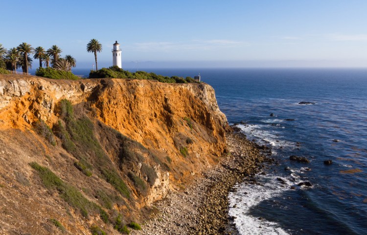
San Francisco
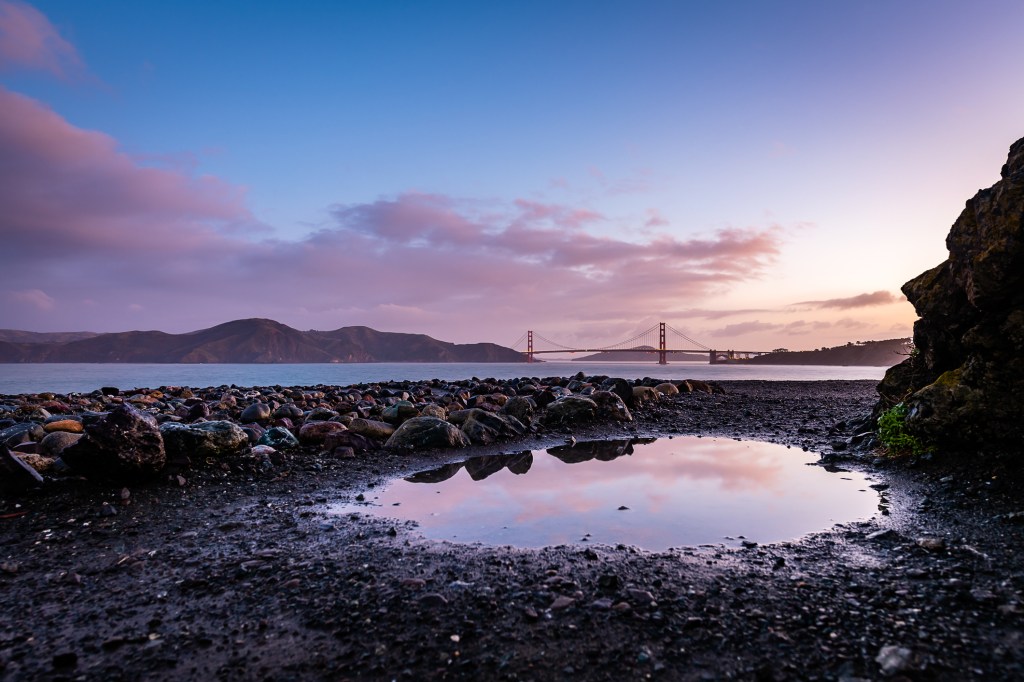
Land’s End Trail
The Lands End Trail is part of the Golden Gate National Recreation Area. Rising above rugged cliffs and beaches, Lands End (3 miles roundtrip, 1.5 hours) feels wild, but the trail from the Lands End Lookout visitors—grab a cup of hot chocolate while you’re there—to Eagle’s Point near the Legion of Honor is perfect for any hiking enthusiast and on a clear day gives great views of the Golden Gate Bridge. For a longer adventure, there are plenty of auxiliary trails to explore that lead down to little beaches. You can also wander down to the ruins of the Sutro Baths, built in the 1890s by a self-made millionaire. Be sure to look out for the remains of three shipwrecks on the rocks of Point Lobos at low tide.
Twin Peaks
Twin Peaks rises up from the center of San Francisco and is the second-highest point in the city. Twin Peaks divides the city between north and south, catching the fog bank that rolls in from the Golden Gate and providing a habitat for lots of wild birds and insects, including the endangered Mission blue butterfly. Be sure to head to Twin Peaks on a sunny day; if the fog is in, as so often happens in the summertime, you won’t see much. While you’ll barely need to get out of your car to enjoy the stunning 360-degree views of the city from the peaks, the best way to enjoy the views is to take a short hike. To scale the less-traveled South Peak, start at the pullout on the road below the parking lot. You’ll climb a steep set of stairs up to the top of the South Peak in less than 0.2 miles. Stop and marvel at human industry: the communications tower that’s the massive eyesore just over the peak. Carefully cross the road to access the red-rock stairway up to the North Peak. It’s only 0.25 miles, but as with the South Peak, those stairs seem to go straight up! It’s worth it when you look out across the Golden Gate to Mount Tamalpais in the north and Mount Diablo in the east.
Ready to go? Grab your guide:

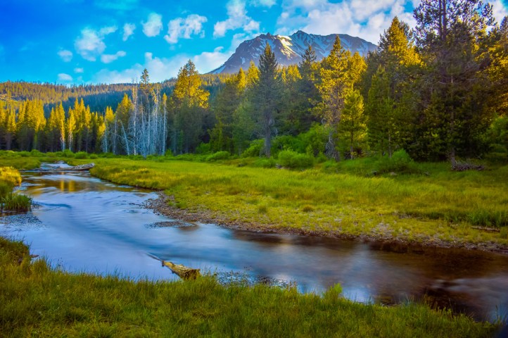
Yosemite
Columbia Rock Trail
To get a commanding view of the valley with a short but steep hike, opt for the Columbia Rock Trail. The trail climbs 1,000 feet via many steep, stone stair switchbacks over the course of 1 mile. Its destination is Columbia Rock, a stone ledge with minimal handrails that offers stunning views of the valley below and Half Dome, which towers in the distance like a giant hooded figure. Continue on another 0.5 miles to Upper Yosemite Fall for more amazing views.
Wapama Falls Trail
The Wapama Falls Trail is an ideal introduction to the Hetch Hetchy area. The hike begins by crossing O’Shaughnessy Dam. After passing through a tunnel blasted into the rock, the trail hugs the rim of the reservoir, offering fine views of Kolana Rock. In spring, expect a profusion of wildflowers along the way. Eventually, the trail gets rockier, with some rock steps, before reaching wooden bridges over Falls Creek and the impressive view of Wapama Falls spilling over a giant rock face. Be careful crossing the four bridges, which can be slippery when the creek is rushing.
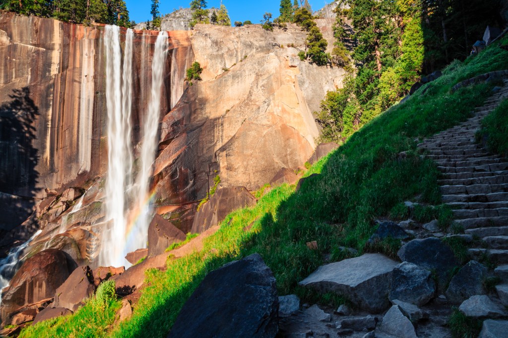
Mist Trail
One of Yosemite’s best day hikes, the Mist Trail, takes in some of the Yosemite Valley’s most stunning scenery, from plunging waterfalls to rounded granite rock faces to sweeping canyon views. Starting at the Happy Isles Nature Center, the trail’s first mile is on a paved path to the Vernal Fall Footbridge. The trail then ascends much steep, slick granite and 600 stairs to the top of Vernal Fall, offering a unique perspective on the 317-foot waterfall. It’s possible to turn around at the top of Vernal Fall for a 2.4-mile out-and-back hike.
If you have the stamina, continue on to the nearly twice-as-tall Nevada Fall. There’s a fairly level section of trail between the top of Vernal Fall and the base of the second waterfall. Then the trail traverses some rocky switchbacks on its way to the top of the 594-foot Nevada Fall. Handrails at the top of the falls allow you to take in the precipitous plunge of the Merced River over the sheer rock face. To make a loop back down to the bottom of the Mist Trail, take the scenic John Muir Trail, which will make your hike 7.3 miles round-trip. You can also simply return via the Mist Trail for a shorter 5.4-mile total hike. Pack a lightweight parka, since this aptly named trail drenches intrepid visitors in the spring and early summer months.
Pacific Coast Highway
Bishop Peak Trail
Just north of San Luis Obispo, the 1,546-foot-high Bishop Peak is the city’s natural treasure. A 4-mile round-trip hike to the rocky crown of Bishop Peak offers commanding views of San Luis Obispo and the surrounding area. Named by Spanish missionaries who thought the mountain resembled a bishop’s hat, Bishop Peak is the tallest of the morros, or “Nine Sisters,” a chain of nine volcanic peaks stretching from San Luis Obispo up to Morro Bay. In addition to the fine views, Bishop Peak teems with wildlife, especially birds that float on the mountain’s thermals. The hour-long hike passes through a forest, past Volkswagen Beetle-size boulders, and into a series of exposed switchbacks. Bring water!
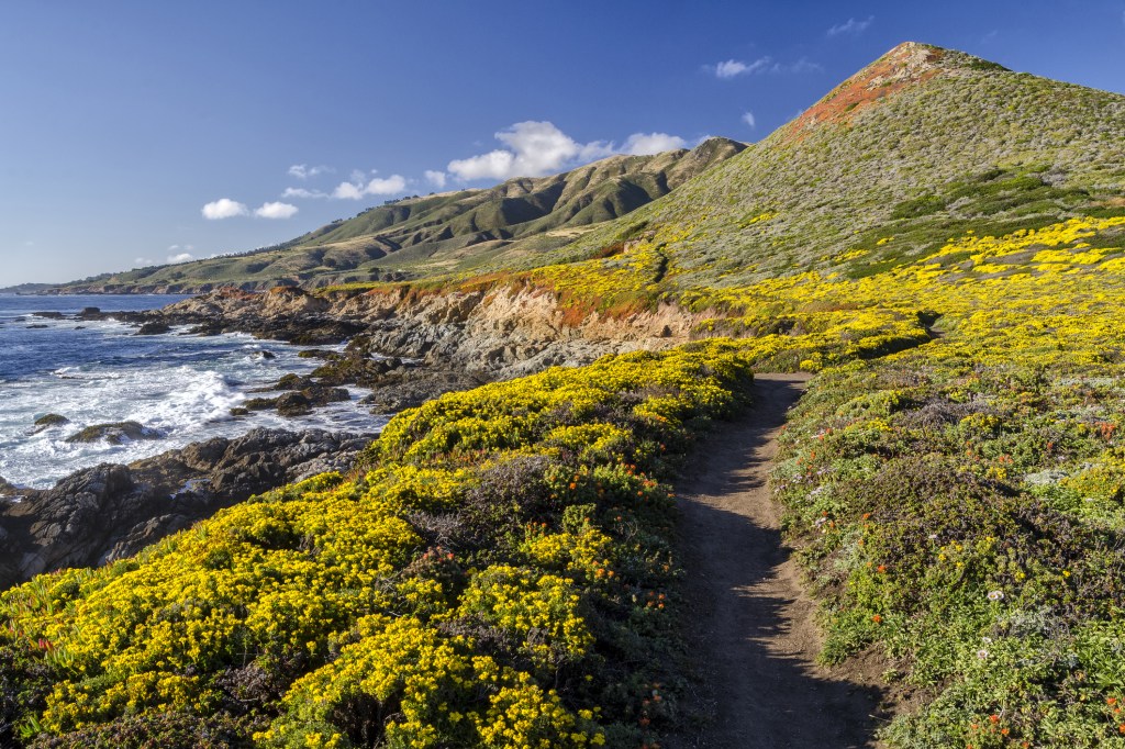
Ridge Trail and Panorama Trail Loop
For a long coastal hike in Big Sur, take the Ridge Trail and Panorama Trail Loop at Andrew Molera State Park. You’ll start at the parking lot on the Creamery Meadow Beach Trail, then make a left onto the long and fairly steep Ridge Trail to get a sense of the local ecosystem. Then turn right onto the Panorama Trail, which runs down to the coastal scrublands. From the Panorama Trail, you can take a short spur called the Spring Trail out to a secluded beach. The Panorama Trail turns into the Bluffs Trail, which takes you back to Creamery Meadow, on the last leg.
Grand Canyon
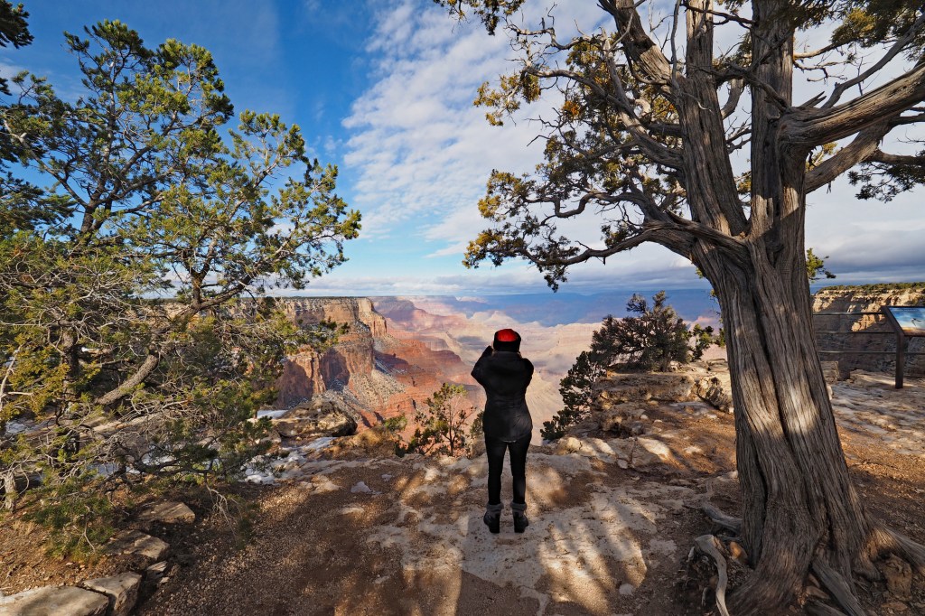
Rim Trail
If you can manage a nearly 13-mile, relatively easy walk at an altitude of around 7,000 feet, the Rim Trail provides the single best way to see all of the South Rim. The trail, paved for most of its length, runs from the South Kaibab Trailhead area on the east, through the village, and all the way west to Hermit’s Rest, hitting every major point of interest and beauty along the way. The path gets a little tough as it rises a bit past the Bright Angel Trailhead just west of the village. Heading farther west, the trail becomes a thin, dirt single-track between Powell Point and Monument Creek Vista, but it never gets too difficult. (You can avoid these sections by walking on the road, which is paved.) It would be considered an easy, scenic walk by just about anybody, kids included. But perhaps the best thing about the Rim Trail is that you don’t have to hike the whole 12.8 miles—far from it. There are at least 16 shuttle stops along the way, and you can hop on and off the trail at your pleasure..
Few will want to hike the entire way, of course. Such an epic walk would in fact require twice the miles (or at least one long ride on the shuttle bus), as the trail is not a loop but a ribbon stretched out flat along the rim from west to east. It’s better to pick out a relatively short stretch and take your time.
Bright Angel Trail
Hiking down the Bright Angel Trail, you quickly leave behind the piney rim and enter a sharp and arid landscape, twisting down and around switchbacks on a path that is sometimes all rock underfoot. Step aside for the many mule trains that use this route, and watch for the droppings, which are everywhere. It doesn’t take long for the rim to look very far away, and you soon feel like you are deep within a chasm and those rim-top people are mere ants scurrying about. The Bright Angel Trail is the most popular trail in the canyon owing in part to its starting just to the west of the Bright Angel Lodge in the village center.
It’s considered by park staff to be the safest trail because it has two resthouses with water. The Bright Angel was once the only easily accessible corridor trail from the South Rim, and for years Grand Canyon pioneer Ralph Cameron charged $1 per person to use it. Many South Rim visitors choose to walk down the (now free) Bright Angel Trail a bit just to get a feeling of what it’s like to be below the rim. If you want to do something a little more structured, the 3-mile round-trip hike to the Mile-and-a-Half Resthouse is a good introduction to the steep, twisting trail. The going gets tougher on the way to Three-Mile Resthouse, a 6-mile round-trip hike. One of the best day hikes from the South Rim is the 9-mile roundtrip to beautiful Indian Garden, a cool and green oasis in the arid inner canyon. This is a rather punishing day hike, not recommended in the summer.
For more California...
By clicking ‘Sign Up,’ I acknowledge that I have read and agree to Hachette Book Group’s Privacy Policy and Terms of Use