The Indigenous History of Panchimalco and the San Andres Ruins
The area surrounding San Salvador is rich with indigenous history and natural beauty. If you are in the area, it is definitely worth making a short drive (or bus ride) to explore Panchimalco and San Andrés Ruins.
Panchimalco
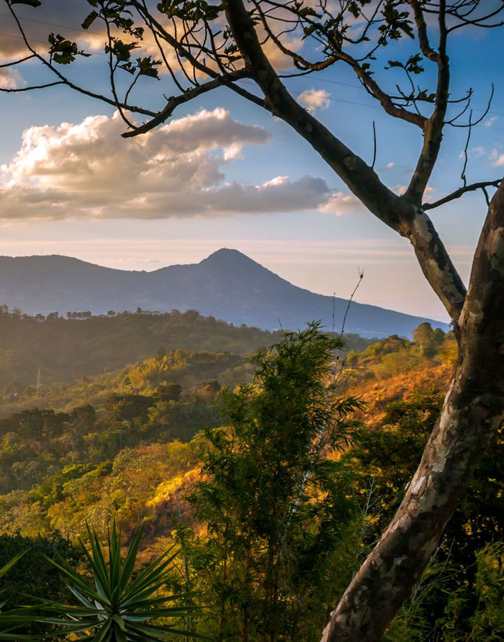
This cool, tiny mountain town, just 15 kilometers southeast of San Salvador, is considered one of the last indigenous strongholds in El Salvador. Panchimalco is where the Pipil people fled during the Spanish takeover of San Salvador during the 16th century. Here they settled with the preexisting Mayan population, and to this day they have preserved much of their indigenous heritage. This is one of the few villages in the country where you will see women wearing traditional clothing and also where you will find the oldest surviving colonial church in El Salvador. The tiny Iglesia Santa Cruz de Panchimalco (town center, 7am-7pm daily), with its classic baroque-style facade, was built in 1725 and retains much of its original materials and design. The inner nave is supported by 16 wooden columns on stone bases that separate the nave from the aisles. The main altar retains its original gold finish, and if you look closely, you will see the image of the Holy Cross of Rome dating back to 1792. The church is considered one of the highlights of Panchimalco.
Although the history, cool climate, and delicious pupusas make Panchimalco a worthwhile day trip any time of year, its real draw is the popular Festival de las Flores y Palmas, which takes place the first Sunday of May. The original meaning of the celebration was to commemorate the beginning of the rainy season, but today the festival honors two Roman Catholic saints, the Virgen del Rosario and the Virgen de la Concepción. If you come early in the day, you will find the women of Panchimalco meticulously stripping palm fronds of their leaves and then skewering them with gorgeous colorful flower blossoms, creating huge flower-laden fronds that they will then carry throughout the town. The procession begins in the afternoon around 2pm and starts with the dance of the Moors and Christians, an unlikely vestige of a tradition brought over by the Spaniards that celebrates a Spanish victory over Muslim invaders during the Middle Ages. After the men perform the dance, women dressed in traditional clothing carry a large altar with the Virgin Mary on top through town. The rest of the day can be spent exploring the town, checking out the artisans and food vendors selling comida típica, and sampling chicha (a fermented drink made of corn and dulce de panela).
Panchimalco is also known for its local art and culture, in particular the portraits you will probably see around the city of children with massive eyes. The Casa Taller Encuentro (Calle Antigua Barrio San Esteban 18-B, tel. 2280-6958 or 7760-3180, 8am-5pm Mon.-Sat., 1pm-5pm Sun., free) is a great place to check out if you are interested in seeing the work of local artists. This lovely home has a small art gallery showcasing local work, a garden with sculptures, and a sitting area. The Casa Taller Encuentro focuses on preserving the heritage of Panchimalco through involving youth in workshops and classes from making art to learning the indigenous Nahuatl language. You could explore Panchimalco on your own, or take a guided tour with Adventures El Salvador (tel. 7844-0858) to visit local artists or take a class in traditional textile weaving.
Newsletter Signup
By clicking ‘Sign Up,’ I acknowledge that I have read and agree to Hachette Book Group’s Privacy Policy and Terms of Use
Getting There
Bus 17, 17A, and 17B all go to Panchimalco from Avenida 29 de Agosto on the south side of Mercado Central in the Centro Histórico. The cost is $0.35, the trip takes about one hour, and buses run every half hour.
If you are driving, take the road toward Planes de Los Renderos until you reach the turnoff for Panchimalco; it is clearly signed. The drive takes about half an hour.
San Andrés Ruins
Head west of the city 32 kilometers to find the San Andrés Ruins (Km. 32, Carretera Panamericana, tel. 2319-3220, 9am-4pm Tues.-Sun., $3 foreigners, $1 Central Americans), originally founded by a community of farmers in 900 BC and but abandoned in AD 250 because of the catastrophic eruption of Volcán Ilopango. It was eventually reoccupied from AD 600 to 900, when it became the powerful Mayan administrative capital that ruled over the Zapotitán Valley and the Valley of the Hammocks. The site is expansive, grassy, and peaceful, with a very good museum that includes some English information as well as ceramic artifacts, a photo exhibit about the history of the region, and galleries with both pre-Hispanic and colonial-era exhibits. So far, only a few of the principal ceremonial areas have been excavated, but aerial photos suggest that the site contains up to 1,200 homes. The main and most impressive structure is the Acropolis pyramid, which is surrounded by smaller neighboring pyramids that were likely used for ceremonial purposes.
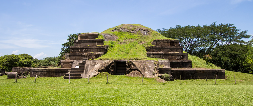
Incense burners and sacrificial tools, such as stingray spines for bloodletting, have been discovered at the site, and excavated ceramics suggest that the city was an important trade center with links to communities in what is now Mexico, Guatemala, Belize, and Honduras. San Andrés was abandoned during the Classic Maya Collapse toward the end of 900 AD, and the settlement remained residential until the Spanish conquest, when it became a center for coffee growing and indigo production. The whole site was buried by volcanic matter during the 1658 eruption of Volcán Playón and not rediscovered until the late 19th century. In addition to the ruins, there is an indigo factory that you can see; it was left nearly perfectly intact from the ashes of the eruption.
Getting There
Take bus 201 to Santa Ana or bus 202 to Ahuachapán and ask to be let off at the San Andrés ruins. The cost is $ 1.50 and should take about one hour. Buses run every 10 minutes.
If you are driving, take Carretera Panamericana (CA1) toward Los Chorros, and continue as if going to Santa Ana. The entrance is on the right at Km. 35 and is clearly signed. The drive takes about 45 minutes.


Newsletter Signup
By clicking ‘Sign Up,’ I acknowledge that I have read and agree to Hachette Book Group’s Privacy Policy and Terms of Use
Pin it for Later
