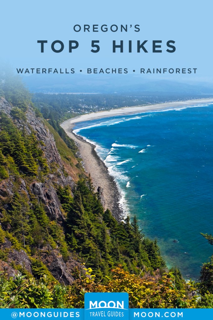
Oregon’s Top Five Hikes
Oregon’s diverse, dramatic landscape lends itself wonderfully to a good hike. Narrowing down the plentiful and varied options to Oregon’s top five hikes isn’t an easy task. Here are our picks.
Wildwood Trail
Who would imagine that one of the state’s top trails is only 10 minutes from downtown Portland? Thanks to 5,000-acre Forest Park, it’s true. The 30-mile Wildwood Trail links various parklands in the West Hills with Forest Park. The southern end of the trail starts just past the Vietnam Veterans of Oregon Memorial near the Oregon Zoo. From here it runs through Washington Park and Hoyt Arboretum and past Pittock Mansion. At Cornell Road, the trail crosses the edge of the Audubon Sanctuary (5151 NW Cornell Rd., 503/292-6855, dawn-dusk daily), where the Audubon Society of Portland administers a 148-acre free-to-the-public nature preserve that is a showcase for native flora and fauna. The sanctuary has over four miles of forested hiking trails in the verdant West Hills.
From the Audubon Sanctuary, the Wildwood Trail enters Forest Park and runs north for another 22 miles. The trail can be accessed at any of the points described above or at several more northerly trailheads. One convenient access point is the western end of NW Upshur Street at Macleay Park; another is the end of NW Thurman Street (the number 15 Thurman Street bus from downtown stops about 0.25 mile downhill from this entrance to the park.
Eagle Creek Trail
Hikes up a spectacular side canyon of the Columbia Gorge are the highlight of the area. The classic Eagle Creek day hike leads up along the face of a cliff to a viewpoint over Metlano Falls. Part of the trail then drops back streamside near Punchbowl Falls, a good spot to break for lunch and splash in pools of cool water. Casual day hikers can return at this point, making for an easy 4.5-mile round-trip stroll.
More ambitious hikers can continue along to High Bridge, a suspension bridge spanning a deep crevice, and Tunnel Falls, so named because of the tunnel blasted into the rock behind the waterfall. Work your way through the tunnel for great views up and down Eagle Creek’s canyon. The round-trip hike from the trailhead to High Bridge is 6.5 miles; to Tunnel Falls and back it is a strenuous 12 miles.
Be warned that the Eagle Creek Trail is very popular. Try to avoid summer weekends, when the trail is thronged with hikers. Some sections of the trail inch along vertical cliffs with cable handrails drilled into the cliff side for safety. Other steep sections lack handrails altogether. This isn’t a good trail for unsupervised children or unleashed pets.

Oswald West State Park
Most of Neahkanie Mountain and the prominent headlands of Cape Falcon are encompassed within the 2,500-acre gem of Oswald West State Park. Several hiking trails weave through the park, including the 13 miles of the Oregon Coast Trail linking Arch Cape to the north with Manzanita. From the main parking lot on the east side of U.S. 101, a 0.5-mile trail follows Short Sands Creek to Short Sands Beach, a relatively sheltered beach that’s popular with surfers year-round. Rainforests of hemlock, cedar, and gigantic Sitka spruce crowd the secluded boulder-strewn shoreline. From Short Sands Beach, hike north on the three-mile old-growth-lined Cape Falcon Trail to spectacular views.
From the trail to the beach, it’s also possible to turn south and hike to Neahkahnie Mountain (4 miles one-way) with some stiff climbing. Shave about 1.3 miles off the hike by starting a mile south of the main Oswald West parking lot, where there’s an access road to the Neahkahnie Mountain Summit Trail on the east side of the highway. It’s not well marked; look for a subdivision on the golf course to the west. Drive up the gravel road 0.25 mile to the trailhead parking lot and begin a moderately difficult 1.5-mile ascent. Allow about 45 minutes to get to the top. The summit view south to Cape Meares and east to the Nehalem Valley ranks as one of the finest on the coast.
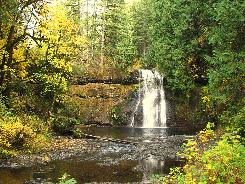
Silver Falls State Park
Ten waterfalls cascade off canyon walls in a forest filled with gargantuan Douglas firs, ferns, and bigleaf and vine maple at Silver Falls State Park. The Trail of Ten Falls is a seven-mile loop linking the falls; the “canyon” half of the loop is more interesting (that’s where the falls are) and has a few steep sections. The highlights are 177-foot South Falls and 136-foot North Falls; in both cases, trails run behind the falls. The “rim” half of the trail is easy but not so scenic; leashed dogs are allowed on this section, but not on the canyon section. Bikers and horseback riders have their own specially designated trails.
If you don’t want to hike the whole loop, a shorter loop starts at the North Falls parking area. North Falls itself is just a short (but steep) hike from the parking area; South Falls is easily reached from the large parking area at South Falls Lodge, a couple of miles south of the North Falls parking lot.
The best time to come is during fall foliage season when there are few visitors, just before icy roads and trail closures inhibit travel. To get there, drive 15 miles southeast of Silverton on Route 214 to get to the park.
Smith Rock State Park
Majestic spires tower above the Crooked River at 623-acre Smith Rock State Park. Seven miles of well-marked trails follow the Crooked River and wend up the canyon walls to emerge on the ridgetops. Because the area is delicate and extremely sensitive to erosion, it’s important not to blaze any trails, because they may leave visible scars for years.
To get there, drive nine miles north from Redmond to NW Crooked River Drive and head north to the park entrance about 100 yards from the Rockhard Store. Begin your hike here, starting a five-mile loop over Misery Ridge.
See More of Oregon


Pin for Later