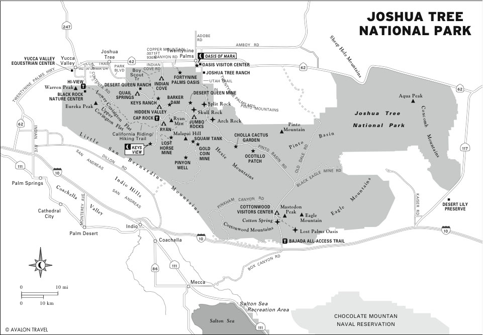
Visiting Joshua Tree National Park
Joshua Tree National Park is one of the most popular rock climbing parks in California. The landscape twists and curves around tan boulders to flatten into seas of the namesake Joshua Tree, which is actually a flowering plant belonging to the agave family.
Getting There
From Amboy and the National Trails Highway (Route 66), turn left (south) on Amboy Road. Drive 40 miles south, passing through the unincorporated town of Wonder Valley, where abandoned homestead cabins are slowly decomposing in the desert. At the junction with Godwin Road, turn left to reach Highway 62 in 2 miles. In Twentynine Palms, turn left (south) onto Utah Trail, which turns into Park Boulevard after crossing SR-62 (Twentynine Palms Hwy.). Park Boulevard continues south to the east entrance of Joshua Tree National Park.
Visitors Centers
At the junction of SR-62 (Twentynine Palms Hwy.) and Utah Trail is the Oasis Visitors Center (74485 National Park Dr., Twentynine Palms, 760/367-5500, 8:30am-5pm daily). A bookstore is on-site and facilities include drinking water, flush toilets, and picnic tables. The larger Joshua Tree Visitors Center (6554 Park Blvd., Joshua Tree, 760/366-1855, 8am-5pm daily) is located farther west in the town of Joshua Tree.
Sights
Oasis of Mara
The best-known oasis in Joshua Tree is the well-developed Oasis of Mara (Hwy. 62 and Utah Trail). A number of small springs well out of the ground along the Pinto Mountain fault here, providing the life-giving water that supports a large and lush (well, lush for the Mojave Desert) ecosystem. Though the Oasis sits outside the park boundaries, it’s still treated as part of the park. A lovely wheelchair-accessible nature trail loops 0.5 miles around the oasis with a variety of informative signs about the natural features of the oasis. You’ll see the palm trees, hardy grasses, and huge light boulders that characterize the region and hint at the beauty you’ll find elsewhere in Joshua Tree.
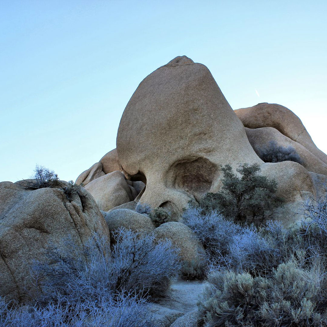
Skull Rock and Cap Rock
Among the wonders of Joshua Tree are the fabulous boulder formations scattered about the landscape. As you drive or hike, you’ll have a hard time missing at least a few of these great light orange-tan rocks. Two rocks that are fairly close together so resemble other objects that they’re named and marked as such on park maps.
Take the east-west connecting road from Pinto Basin Road (the main north-south corridor) to Keys View and Hidden Valley. You’ll first pass Skull Rock (Park Blvd., 7 miles east of Hidden Valley), one of the many giant stones that provide shade at the aptly named Jumbo Rocks campground. Just past the intersection toward Hidden Valley, Cap Rock and its buddies offer interesting geology, a small picnic area, and a good spot for rock climbers to dig in and start scrambling.
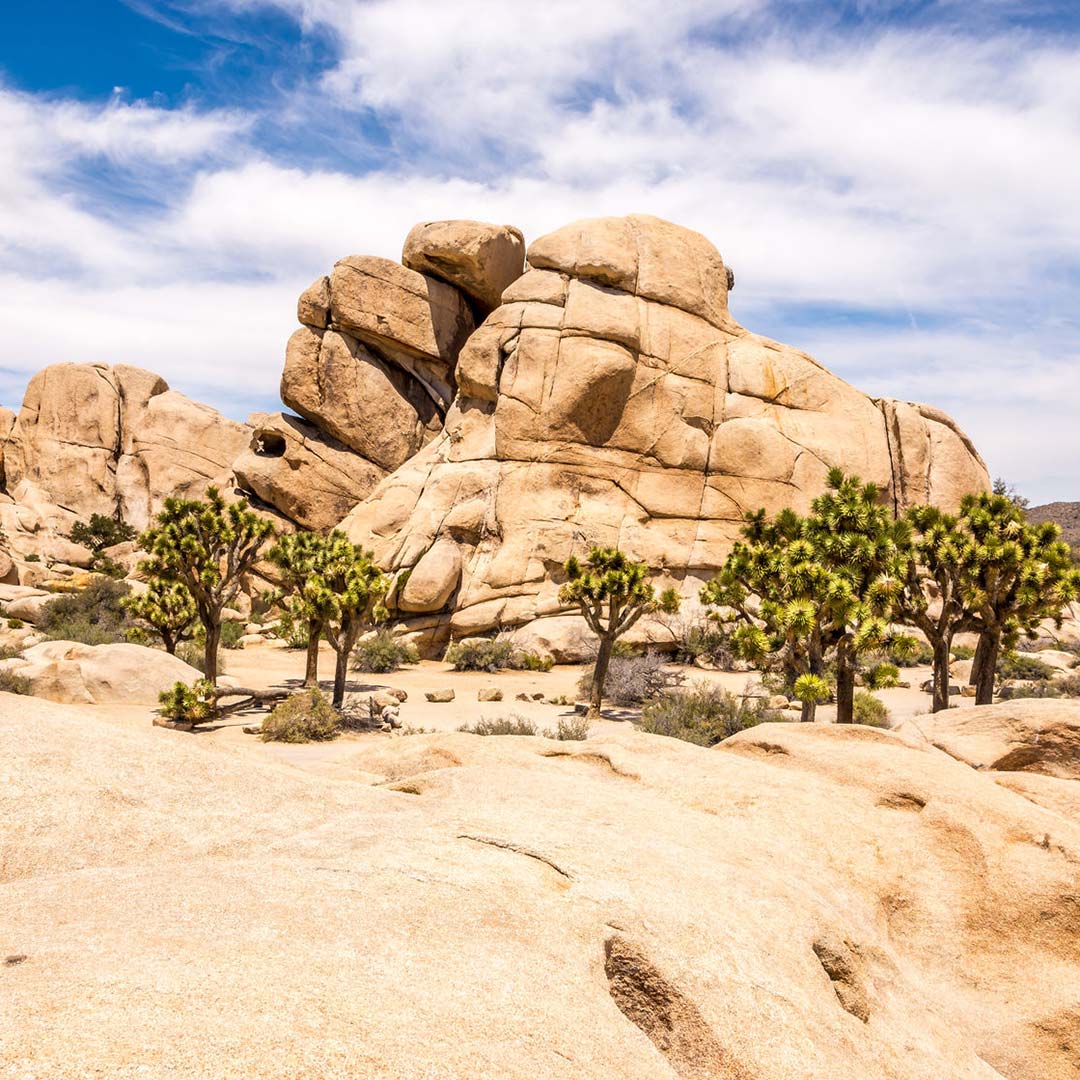
Hidden Valley
One of the centerpieces of Joshua Tree, the Hidden Valley (Park Blvd., 10 miles south of West Entrance) offers hikes, a nature trail, a campground, and a rare view of a tiny desert valley. Park in the day lot and follow the tourists off to the right to the sort-of trail onto and through the big tan boulders. You’ll scramble up, getting a great up-close view of the surprising granite mineral content of the pale boulders on either side of you. Emerge from the rocky trail into a small rocky meadow-like area, which includes small signs describing the natural features.
Keys Ranch
William and Frances Keys were among the rugged settlers of the Mojave Desert. They ranched on the sparse desert grasses and raised five children on this patch that would become part of Joshua Tree National Park. Today, visitors see the weathered pine buildings that housed the original ranch house, the schoolhouse that educated the few local children, the local general store, and a workshop. The orchard and landscaping have been replanted and revived. A collection of mining and farm equipment sits in the dry desert air, and relics like the old well dot the property.
The only way to get a real look at Keys Ranch (760/367-5522, 6pm and 9am Sun. June-Sept., $10) is to take a docent-guided tour of the buildings and land. Reservations are required; call between 9am and 4:30pm or purchase tickets on-site at one of the visitors centers. Tours cover 0.5 miles, last about 1.5 hours, and are limited to groups of 25 people.
Keys View
One of the best views in all of Joshua Tree is from Keys View (end of Keys View Rd., bear right off Park Blvd. past Cap Rock). On a clear day, the view redefines the concept of “panoramic,” letting travelers see the whole of the Palm Springs urban sprawl, the Coachella Valley farmland, the notorious San Andreas Fault, and even the Salton Sea many miles to the southeast. You’ll drive all the way to the end of the road out of the West Ranger Station, up to about 5,000 feet elevation and the sizeable parking lot. Get out of your car and climb a brief paved trail to the vantage point at the top of the ridge. The best time to catch a good view at Keys is the early morning.
Black Rock Canyon
Follow Park Boulevard west to exit the park at the Joshua Tree Visitors Center. West of the main entrance, and just south of the tiny town of Yucca Valley, is Black Rock Canyon (SR-247 at the northwest corner of the park) with a developed campground, nature and ranger center, and hiking trails surrounded by the famed Joshua trees, which begin the spring bloom late each February. Visitors often walk the Hi-View Nature Trail (1.3 miles), a lovely interpretive stroll that points out and describes the plants and other natural features that characterize the northern Mojave Desert region.
Hiking
There are 12 self-guided nature trails in the park. Before you take a hike—even a short two- or three-mile jaunt—be sure you’re properly prepared. Joshua Tree is a harsh and unforgiving desert. Bring lots of water (at least one gallon per person), maps, first-aid, and sun protection.
Five miles from the Oasis Visitors Center, the trail to the 49 Palms Oasis weaves 1.5 miles south to pools of water surrounded by fan palms. Look for the trailhead two miles south of SR-62 off Canyon Road.
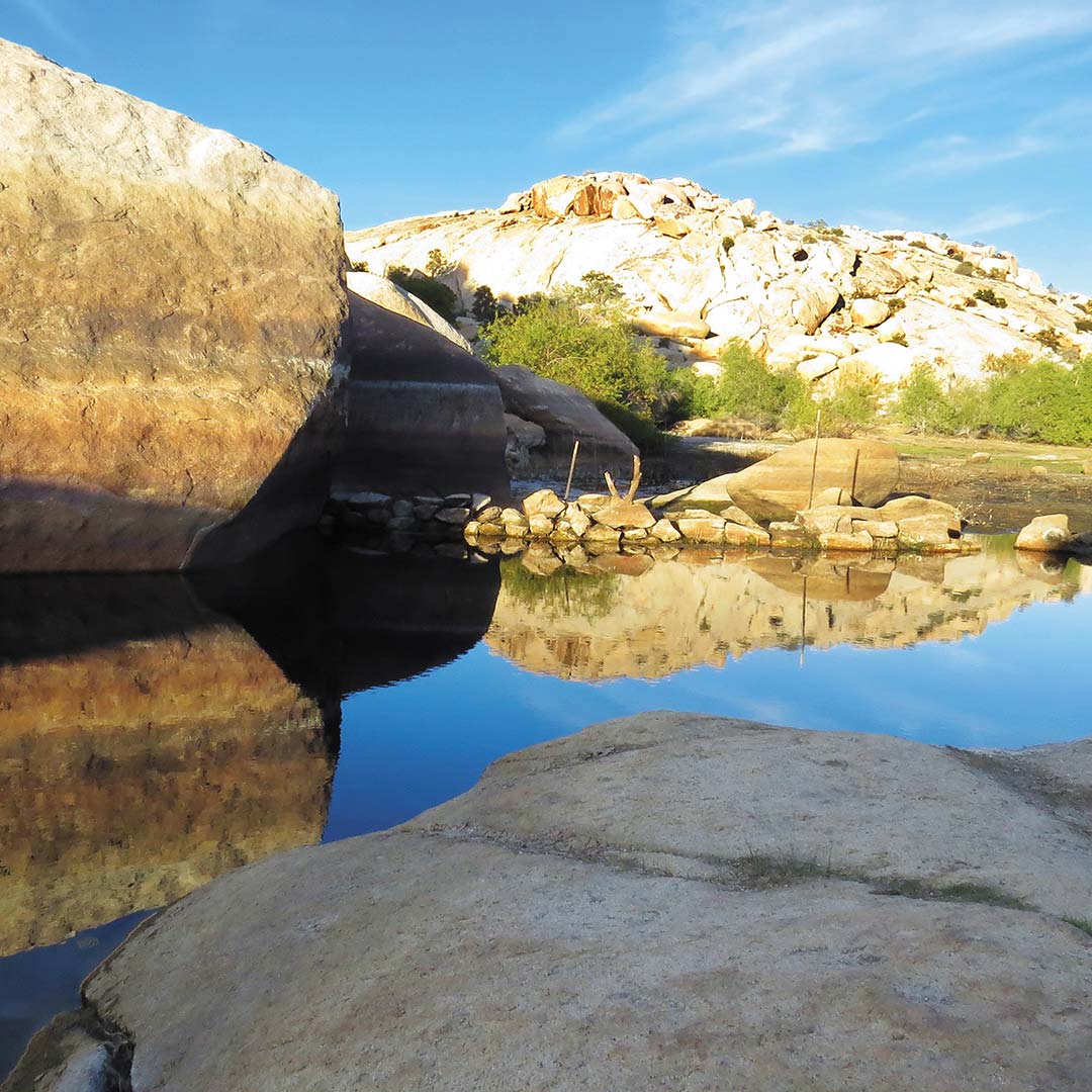
Popular Barker Dam Nature Trail loops 1.3 miles around an early water tank built by cattle ranchers. Note that the tank may be empty in times of drought, but the walk is still an enjoyable entry into the desert environment. The trailhead is located near the parking area for Keys Ranch.
Located on Park Boulevard near Cap Rock, the strenuous trail to Ryan Mountain (2.8 miles round-trip) climbs to the 5,461 summit with views of the surrounding valleys below.
If you’re looking to stretch your legs after the drive to Keys View, consider hiking the Lost Horse Mine Loop (6.2 miles round-trip), which passes by the site of an abandoned ten-stamp mill as the trail climbs above 5,000 feet.
Related Travel Guides
Pin For Later