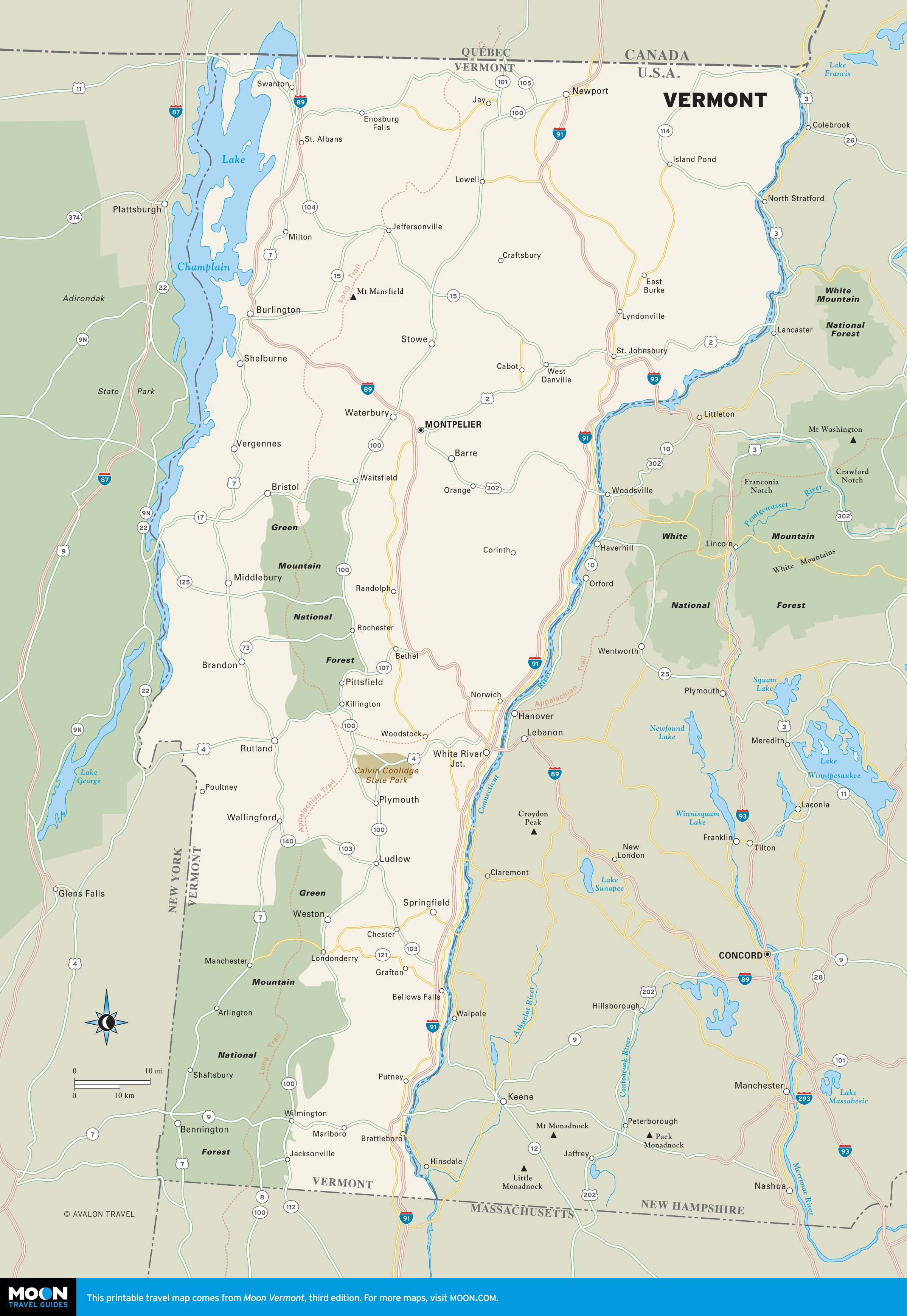
Vermont
These free, printable travel maps of Vermont are divided into five regions:
Explore Vermont with these helpful travel maps. Ensure you have the newest travel maps from Moon by ordering the most recent edition of our travel guides to the Green Mountain State.
Travel Maps of Vermont
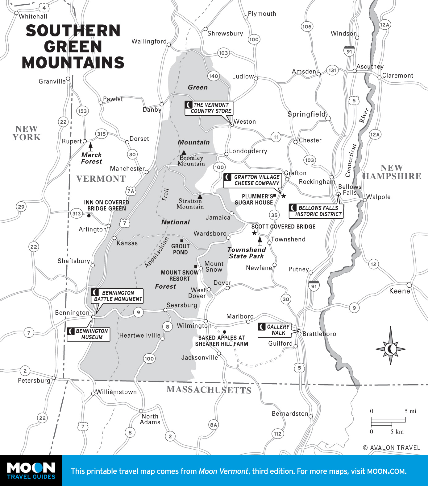
Southern Green Mountains
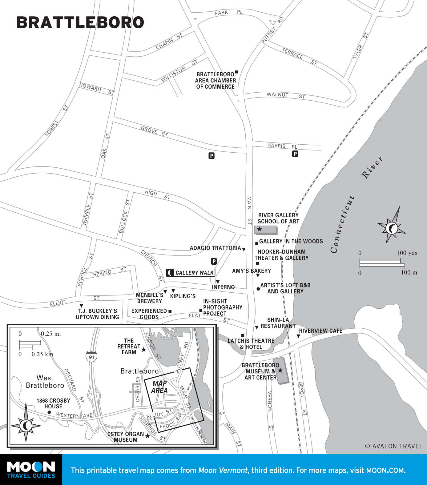
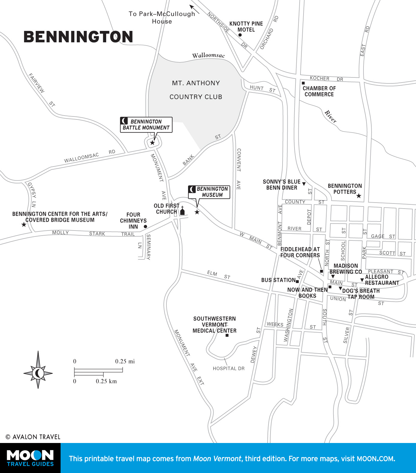
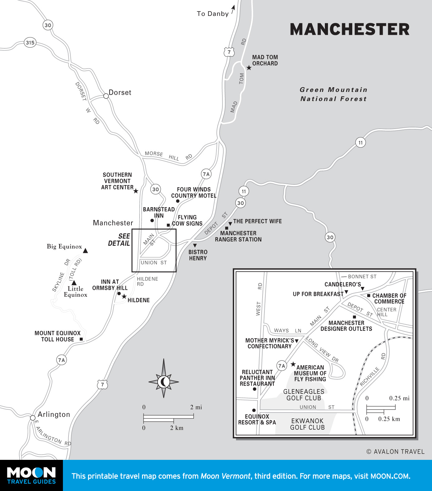
Within southern Vermont is a roller-coaster jumble of forested slopes and hidden valleys that are home to picture-postcard villages and maple farms. Signs for cheese shops and maple syrup are legion on the roadsides. Come shop at the outlet stores in Manchester, see the sights in historic Bennington, or peruse the art galleries in funky Brattleboro.
Along Route 4
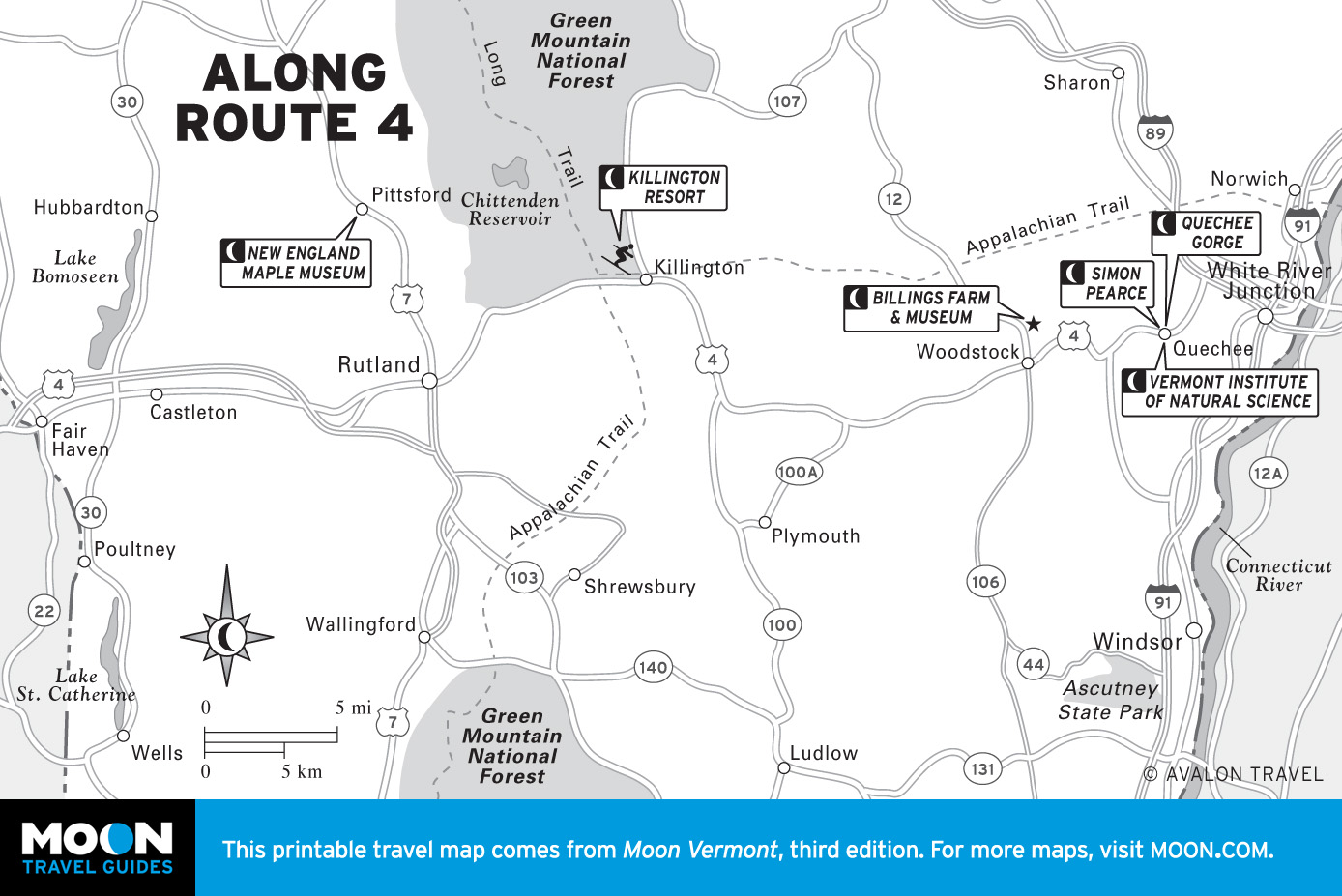
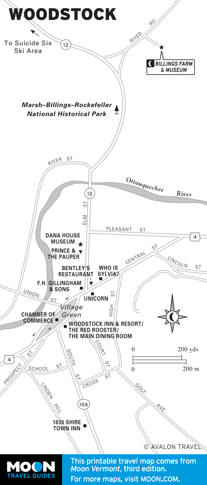
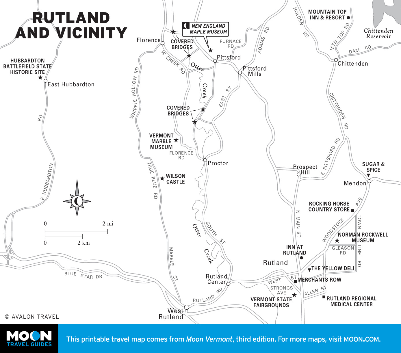
U.S. Highway 4 slices across the middle of the state, separating the two halves of the Green Mountain National Forest. Along this corridor are many of the state’s main centers of civilization: Rutland, once a center for marble production in the country; Woodstock, a quintessential New England town; and in the middle of the route, the “Beast of the East,” the ski resort of Killington.
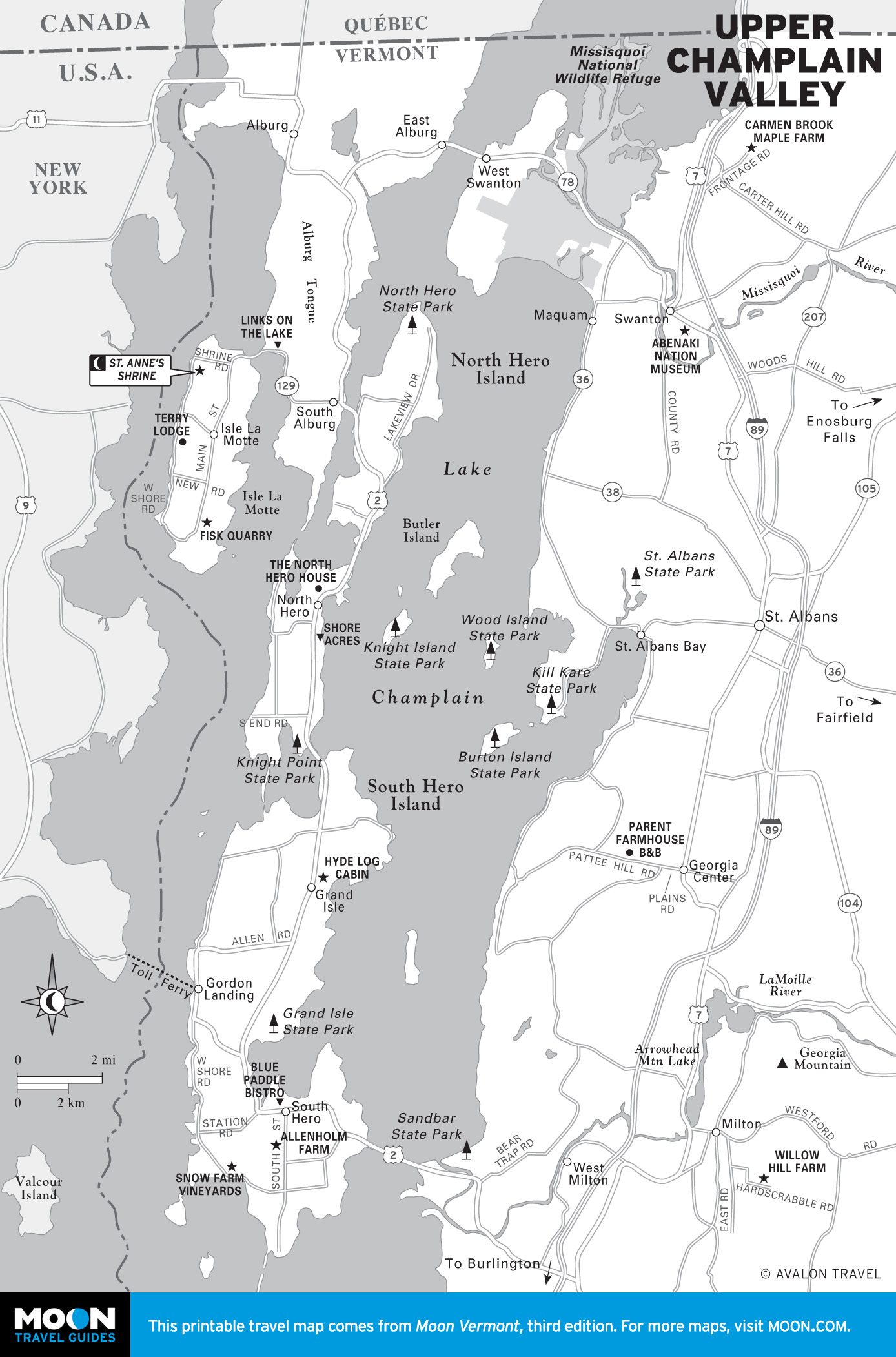
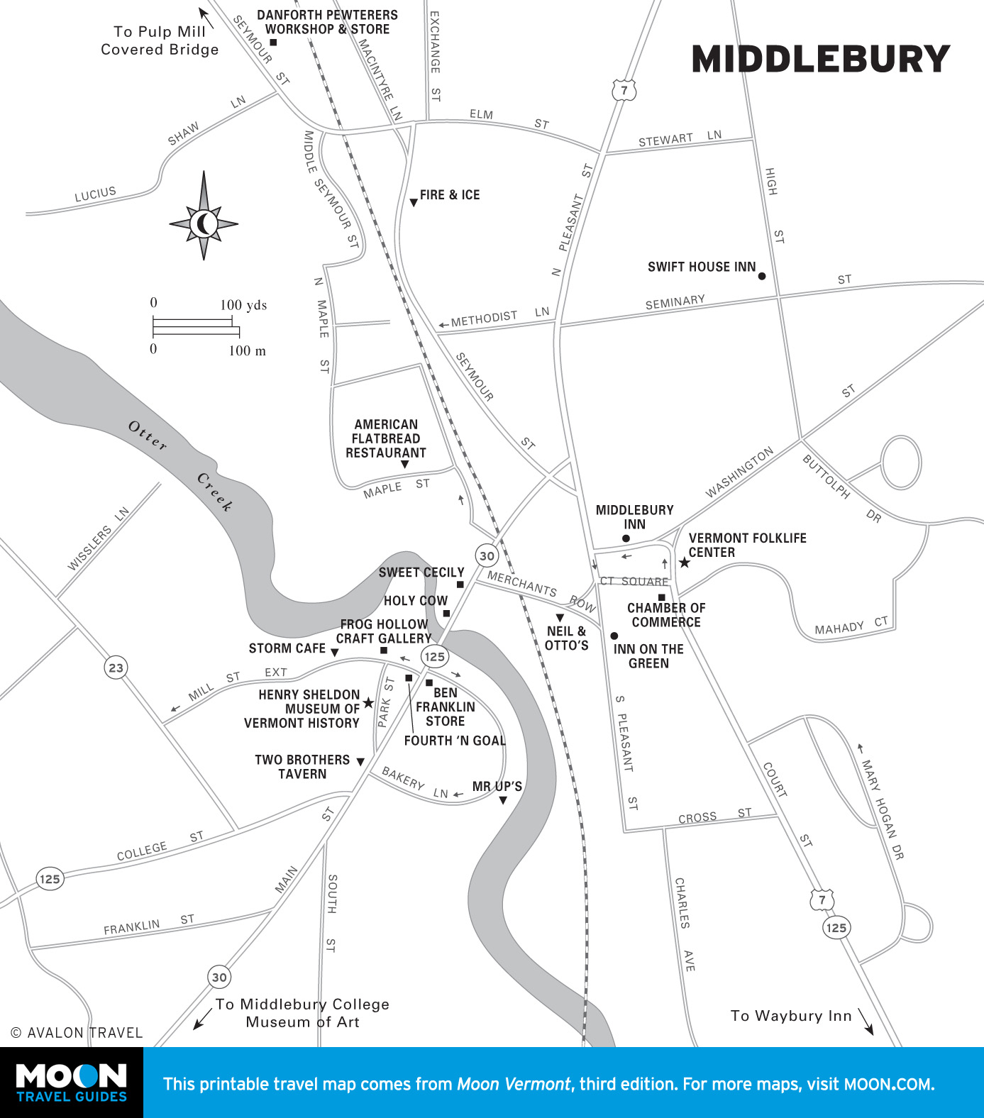
Champlain Valley
Buttressed on one side by mountains and shored up on the other by the coastline of North America’s sixth largest lake, this broad valley, dotted with farms and dairies, holds two of the state’s oldest and most attractive settlements: the delightful college town of Middlebury and the “big city” of Burlington, situated on the shores of Lake Champlain.
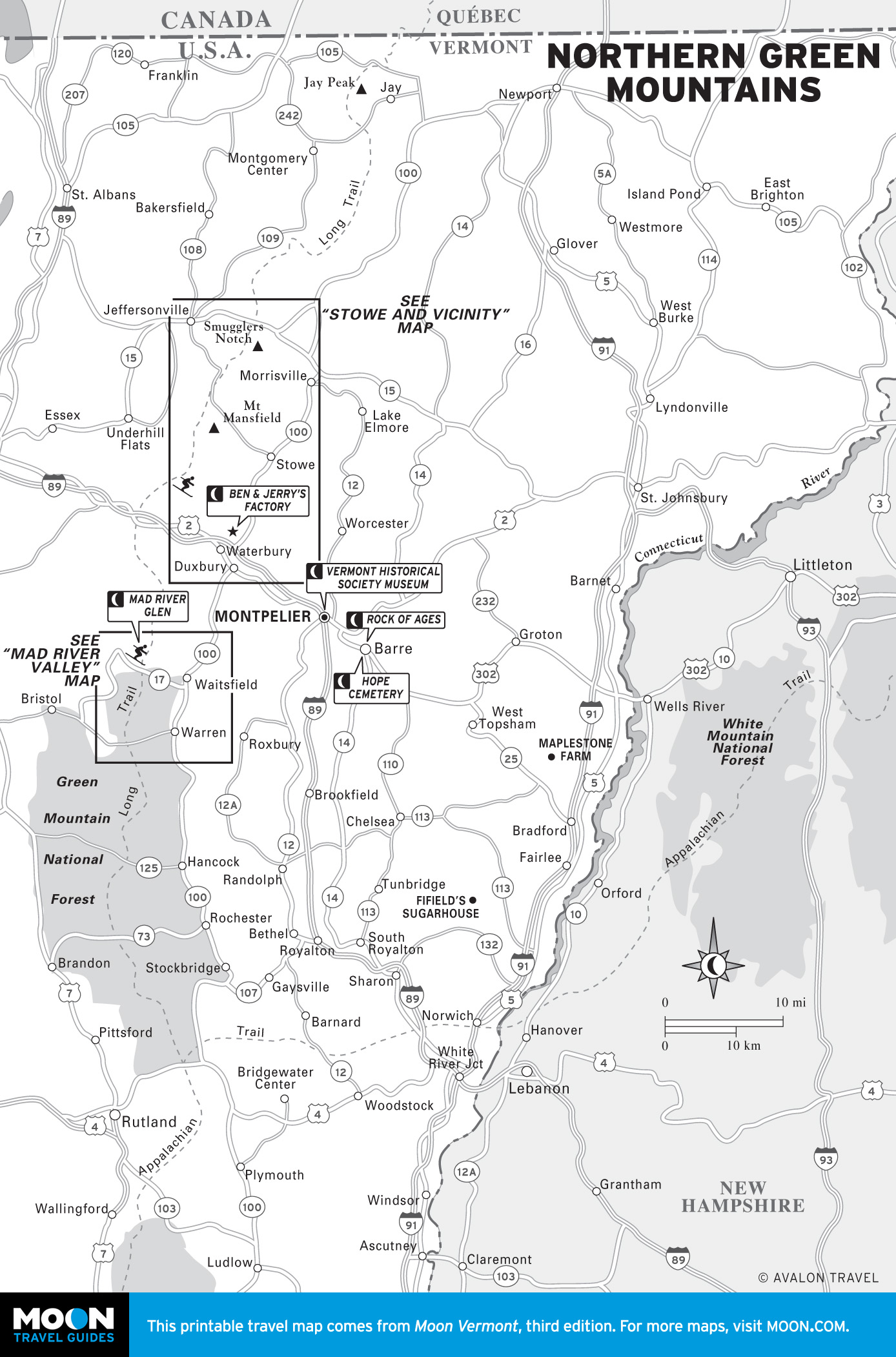
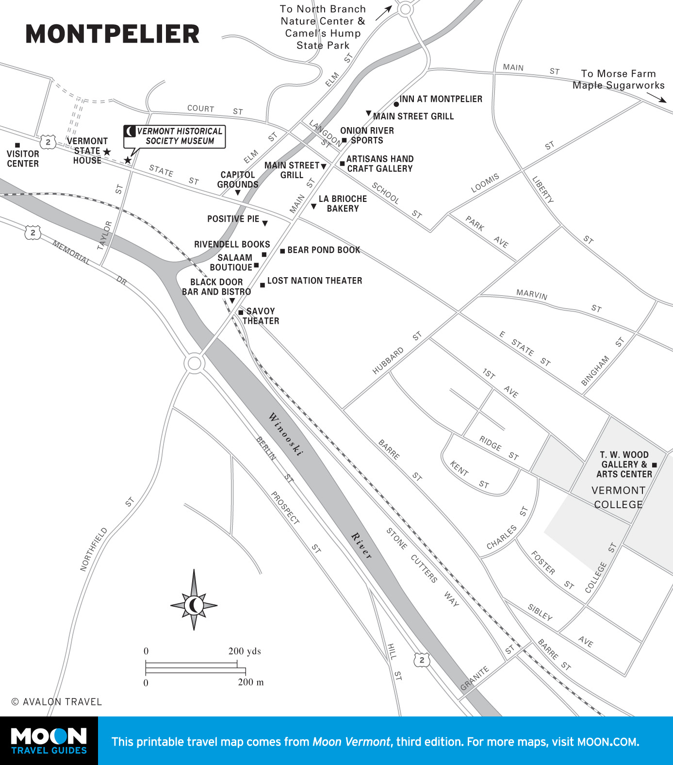
Northern Green Mountains
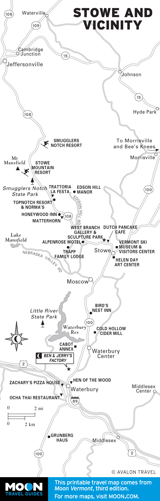
As you travel northward, the mountains get bigger and woollier, culminating with the soaring slopes of Mount Mansfield just outside the alpine village of Stowe. This part of the state is an outdoors-lover’s dream. On the edge of the mountains is the state capital, Montpelier, and Vermont’s number-one tourist attraction—the ice cream factory that made Ben & Jerry’s a household name (and, for some, an addiction).
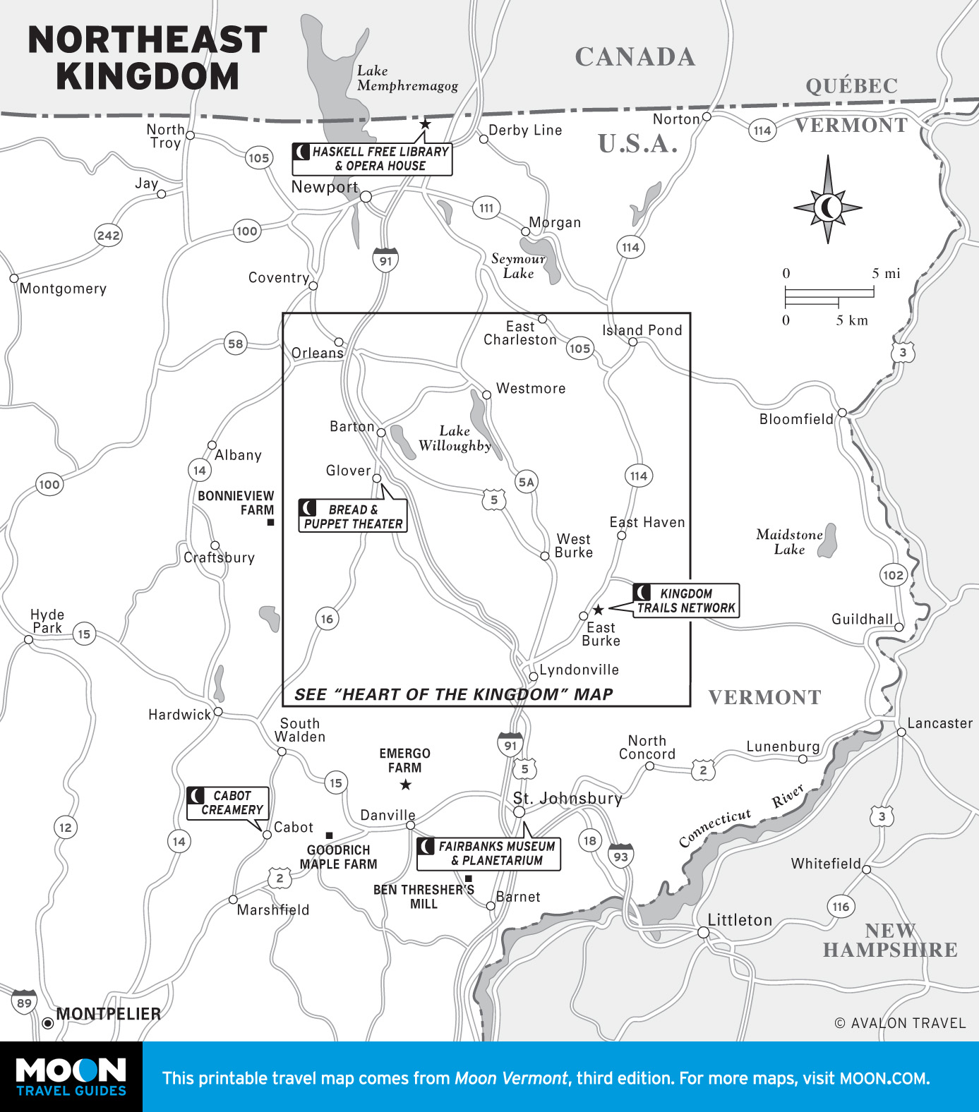
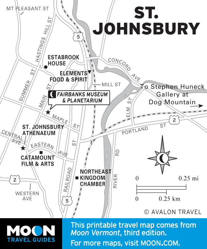
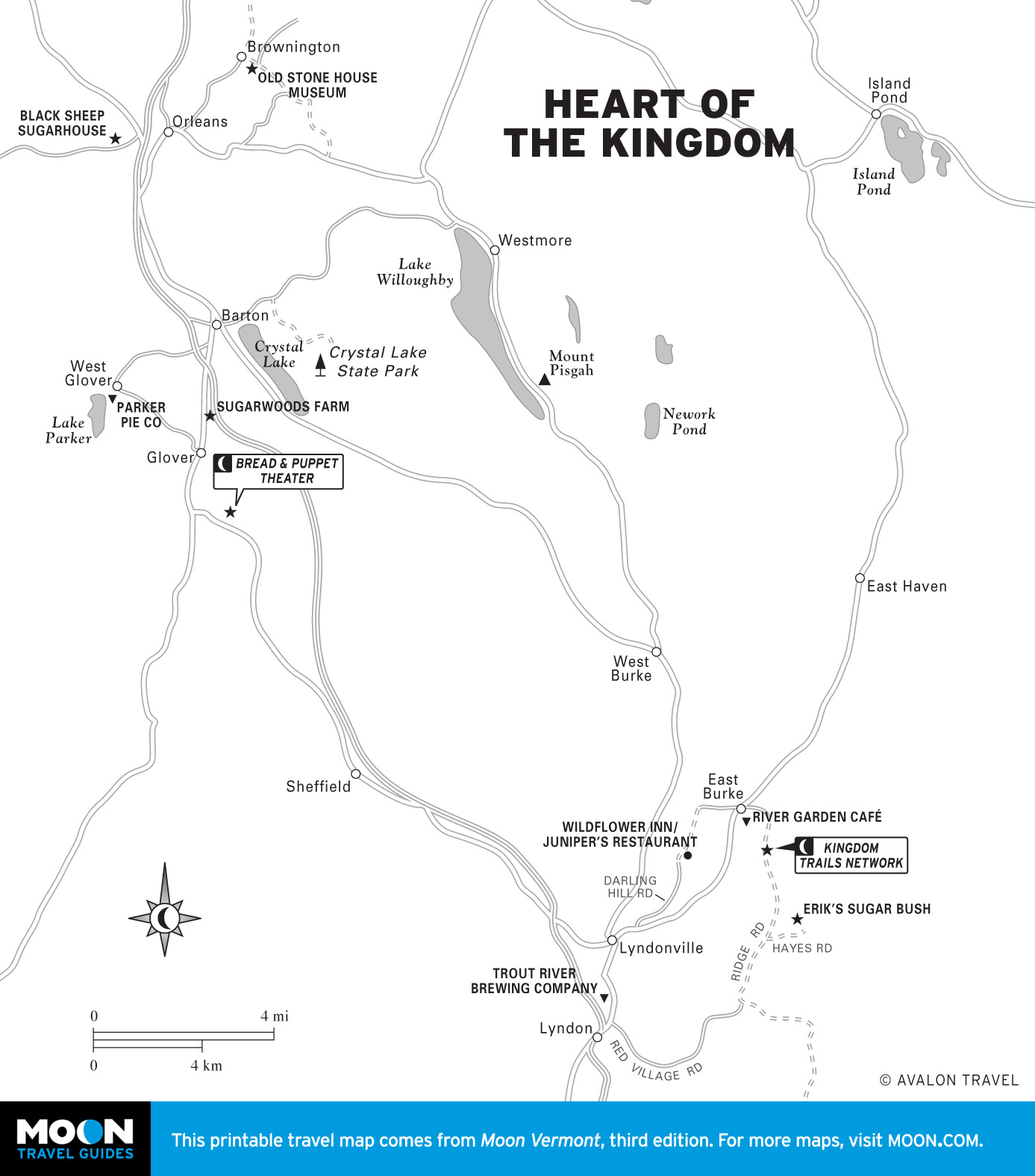
Northeast Kingdom
Those who scratch beneath the surface of this stark landscape often come away proclaiming that this is their favorite part of the state, prizing it for its majestic beauty. This region is also home to some of the state’s most famous gustatory attractions, including Cabot Creamery and Maple Grove Farms, as well as the cherished biking and cross-country skiing terrain of the Kingdom Trails Network.