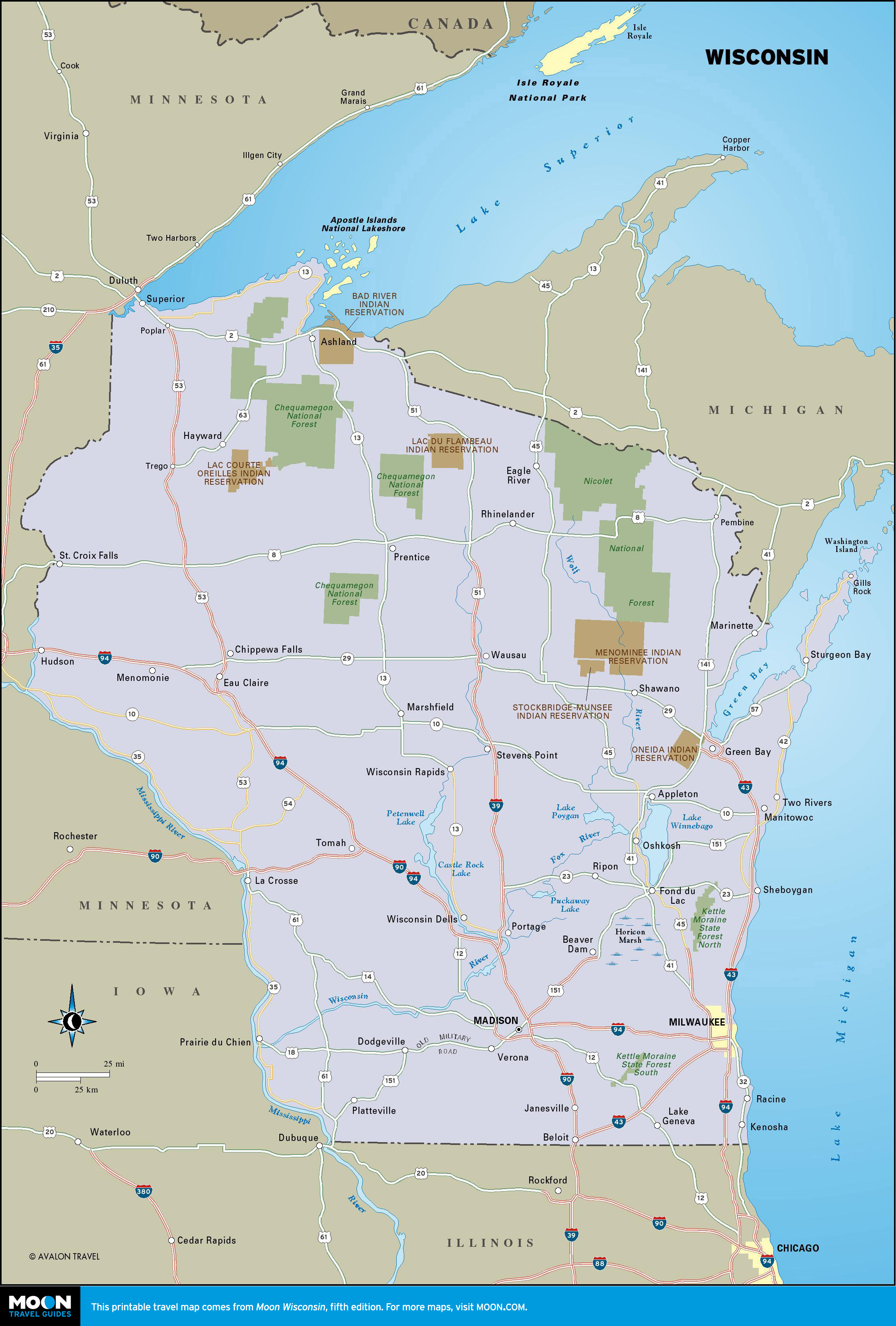
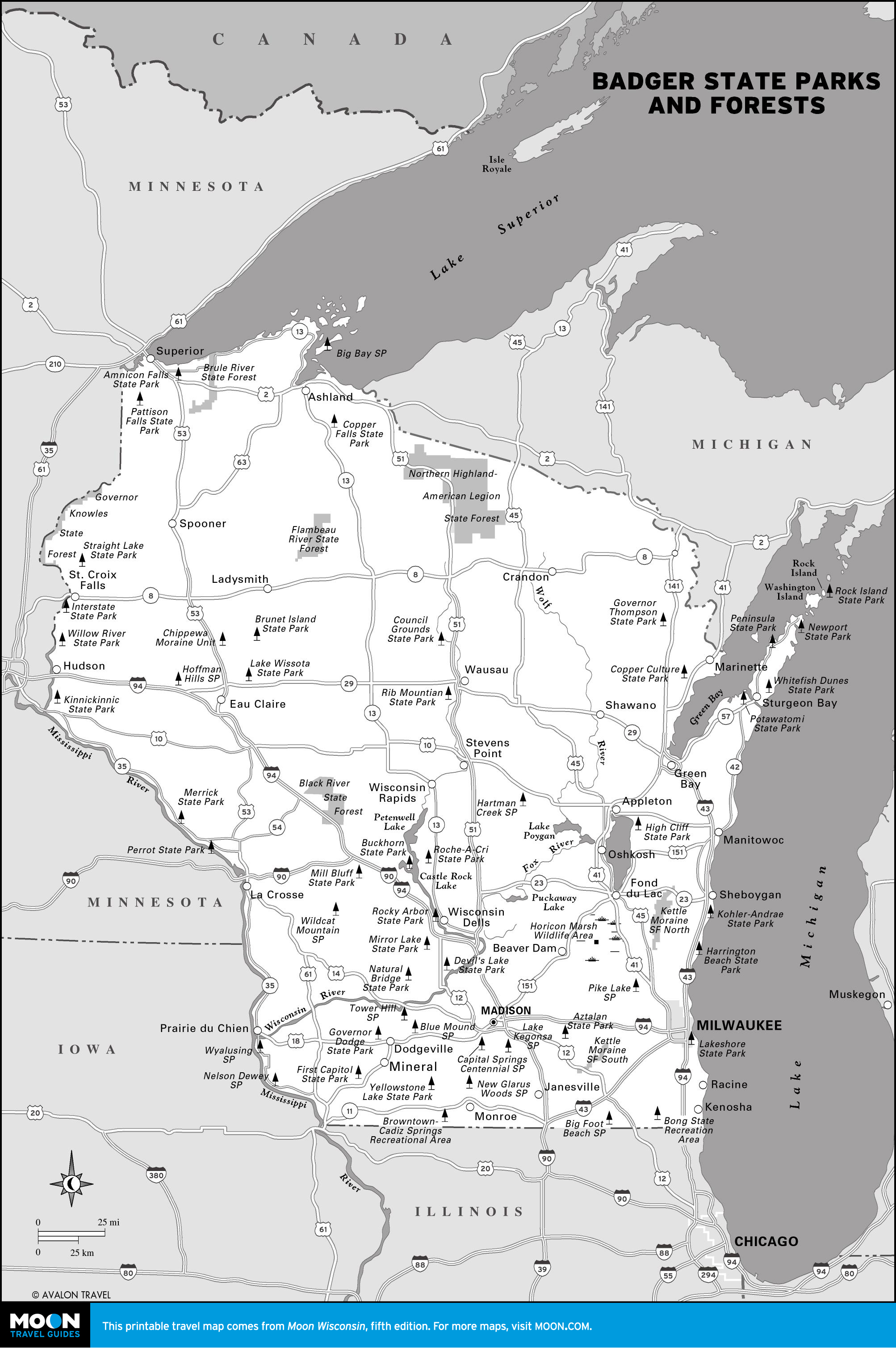
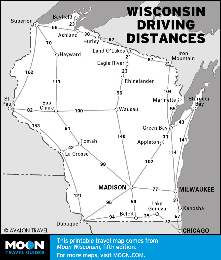
Wisconsin
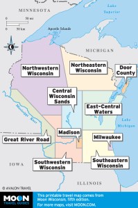
These free, printable travel maps of Wisconsin are divided into nine regions:
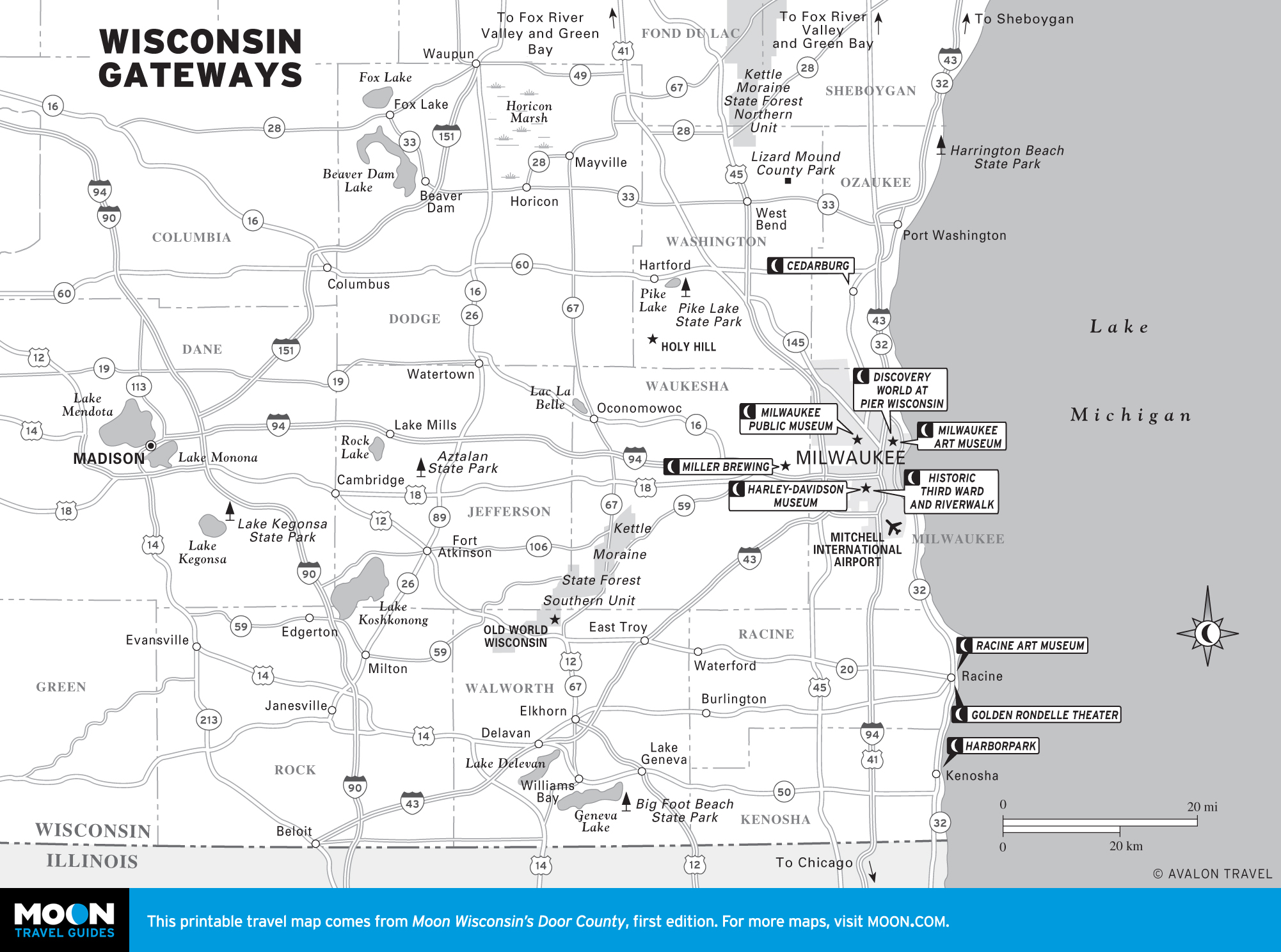
- Milwaukee and Madison
- Southeastern Wisconsin
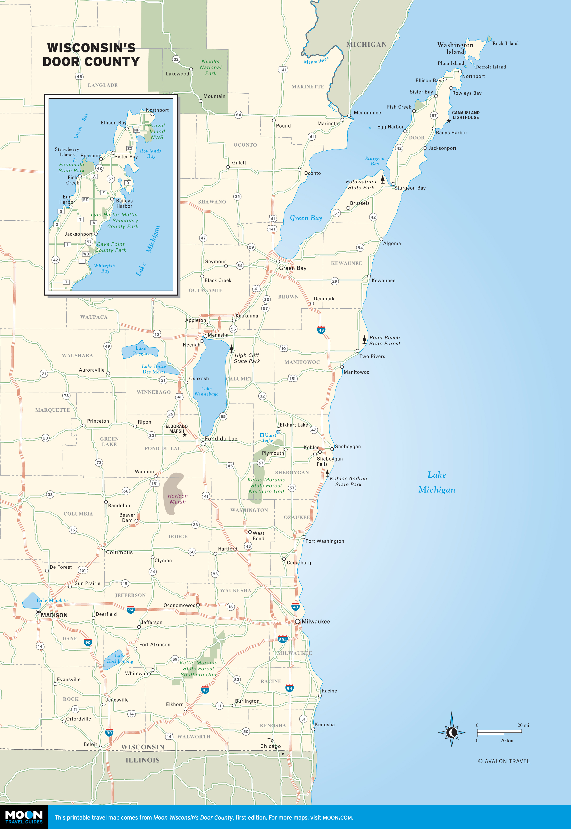
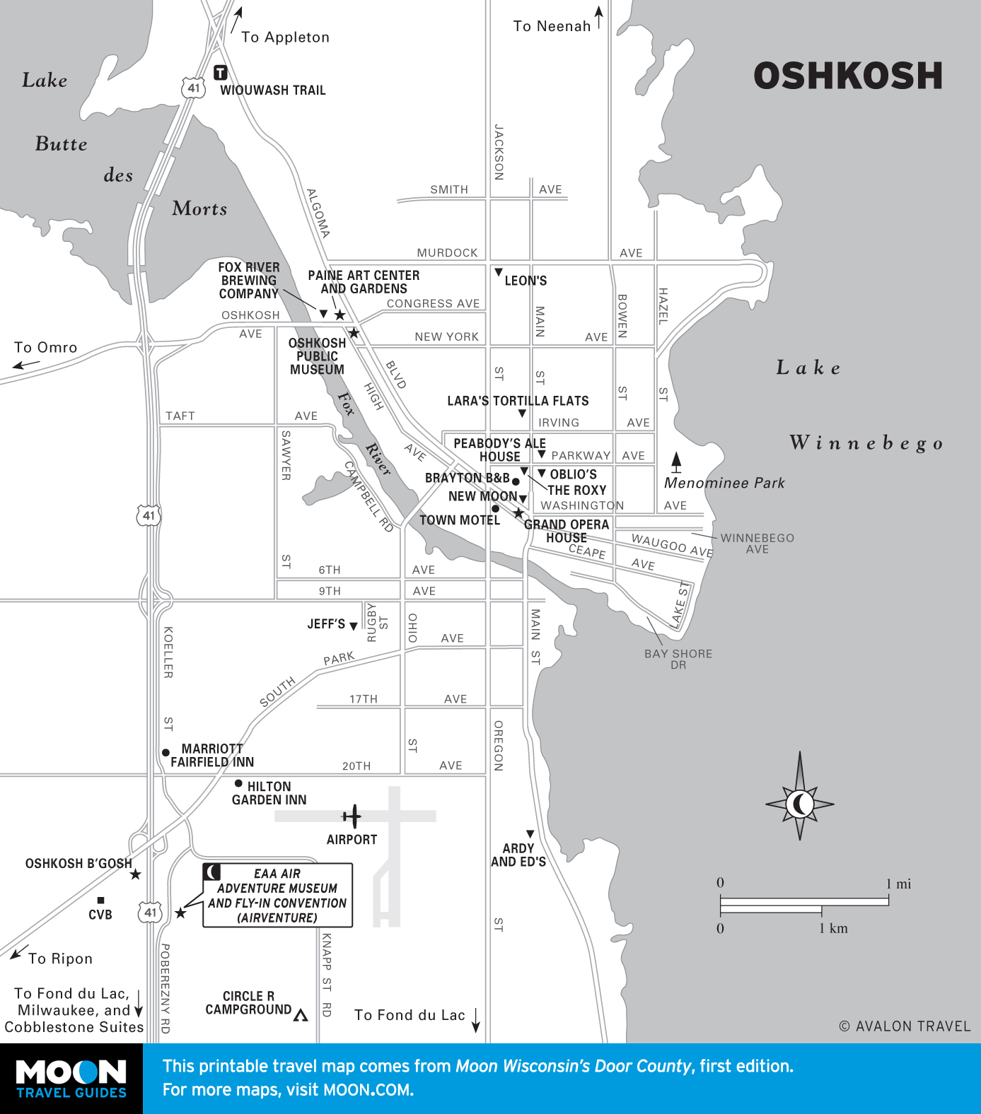
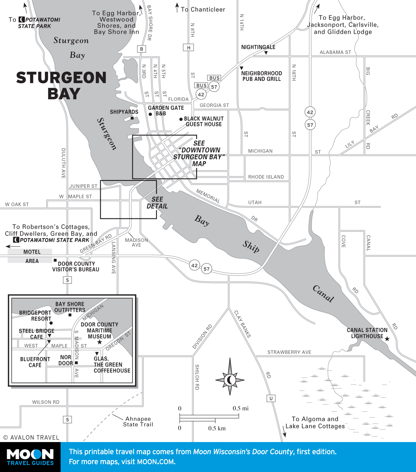
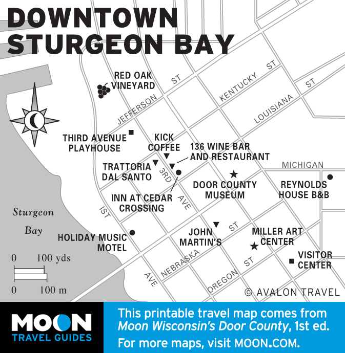
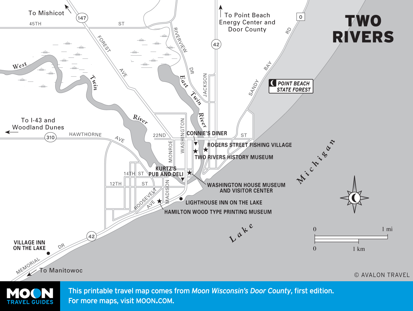
- Door County
- East-Central Waters
- Northeastern Wisconsin
- Indianhead Country
- Great River Road
- The Driftless Region
- Central Wisconsin Sands
Explore Wisconsin with these printable travel maps. Ensure you have the newest travel maps from Moon by ordering the most recent edition of our travel guides to Wisconsin and Door County.
Travel Maps of Wisconsin

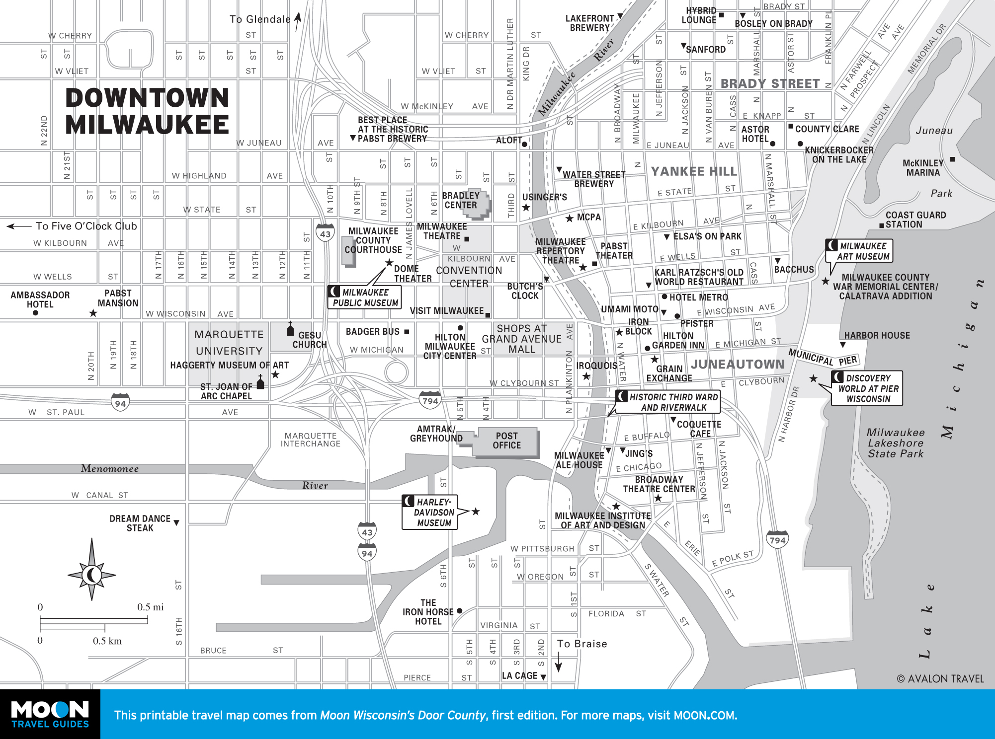
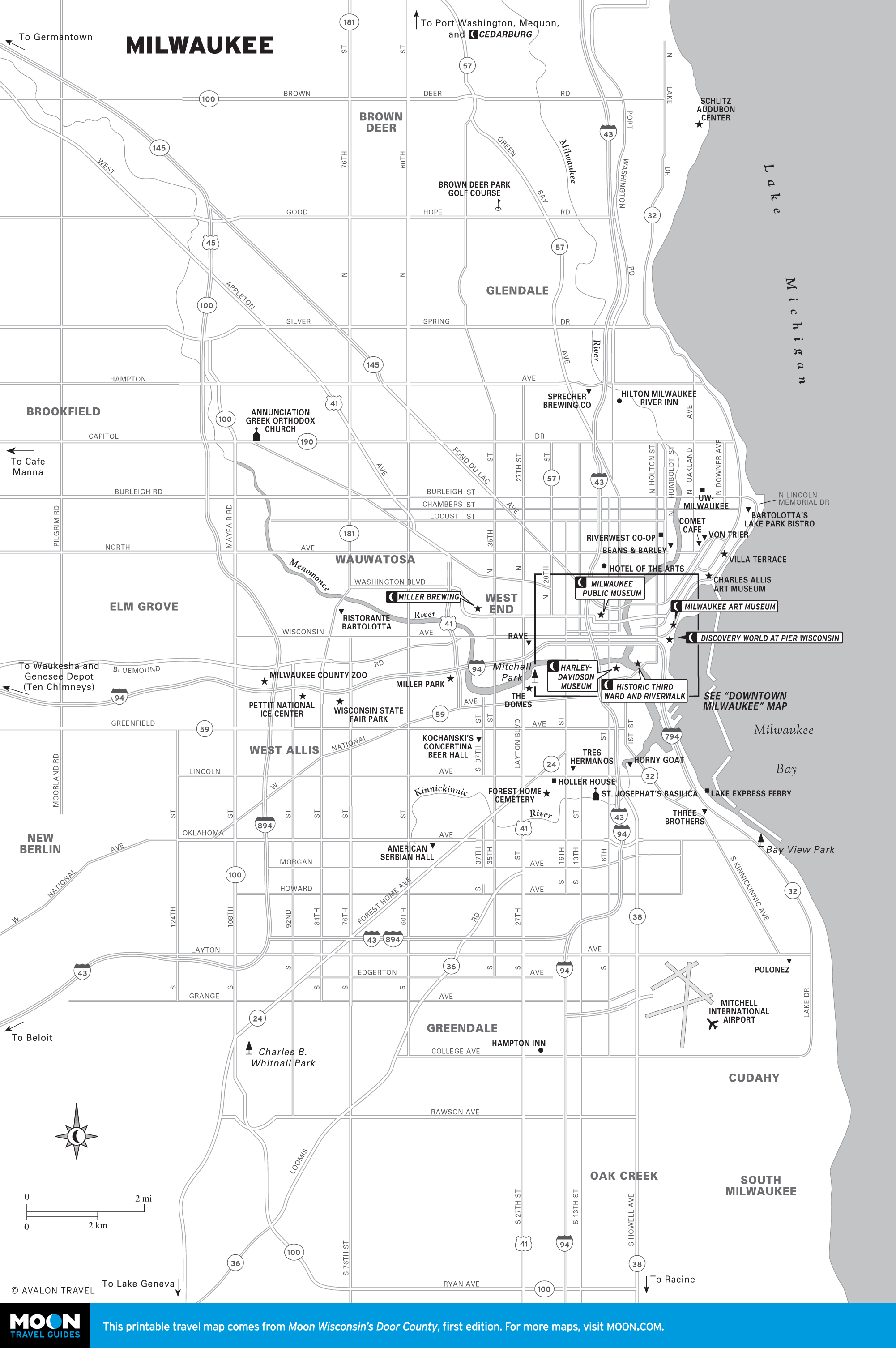
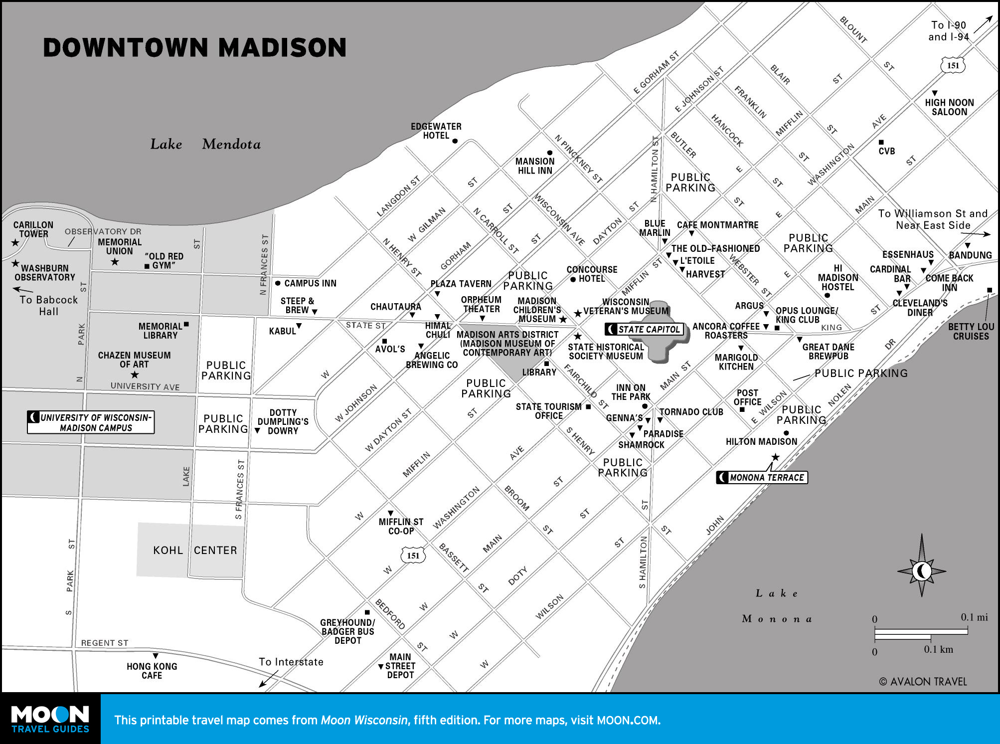
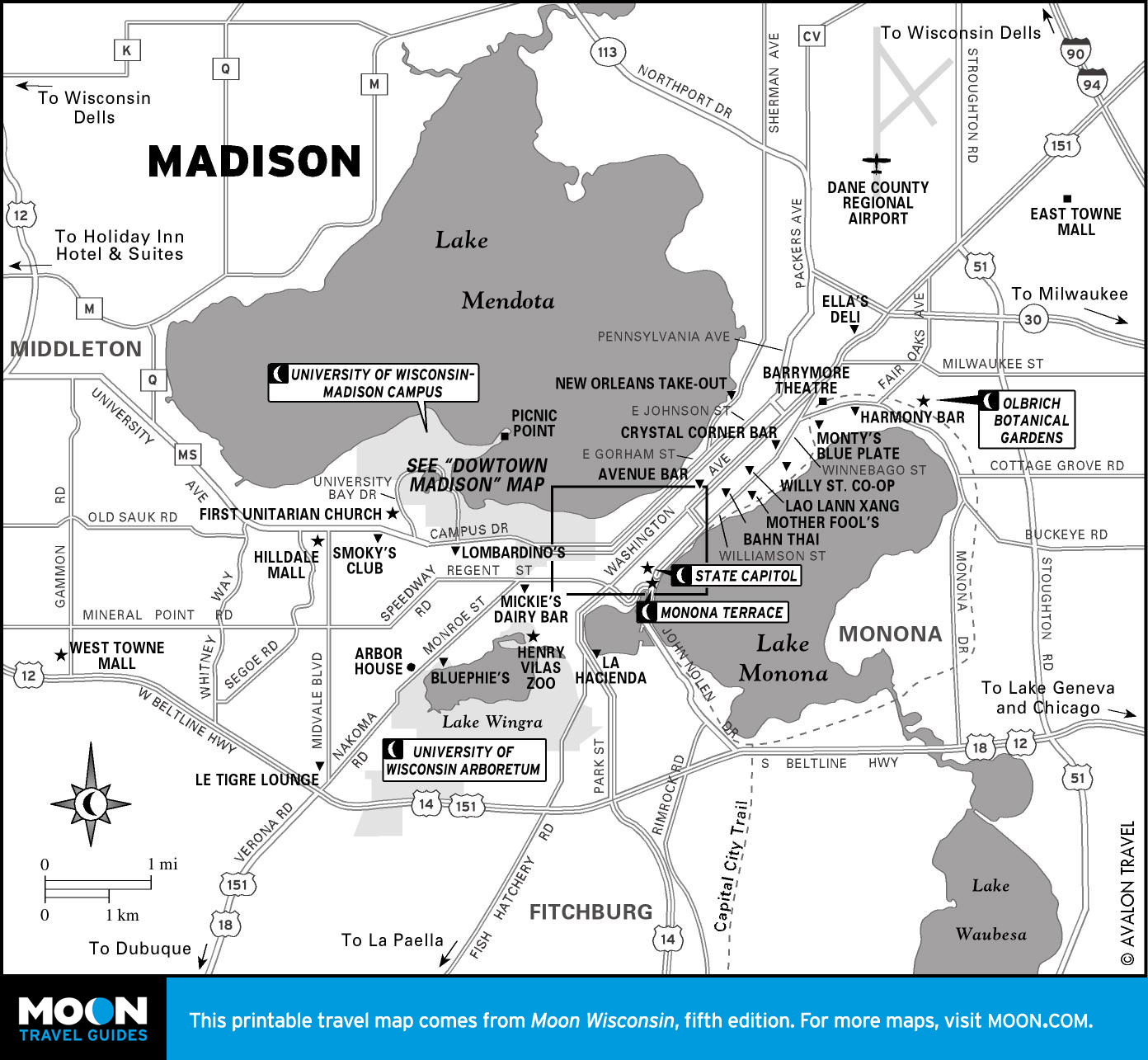
Milwaukee and Madison
Dash the blue-collar images. Milwaukee’s low-key citizenry is darned proud of cultural, educational, and architectural gems along its fabulous lakefront. The wonderfully preserved ethnic neighborhoods and Historic Third Ward offer the state’s best urban trekking tours.
Meanwhile the Mad City, Madtown, the Island Surrounded by Reality, is a vibrant and fetching city plopped among a quartet of jewel-like lakes, upon one of which sits eye-catching Monona Terrace.
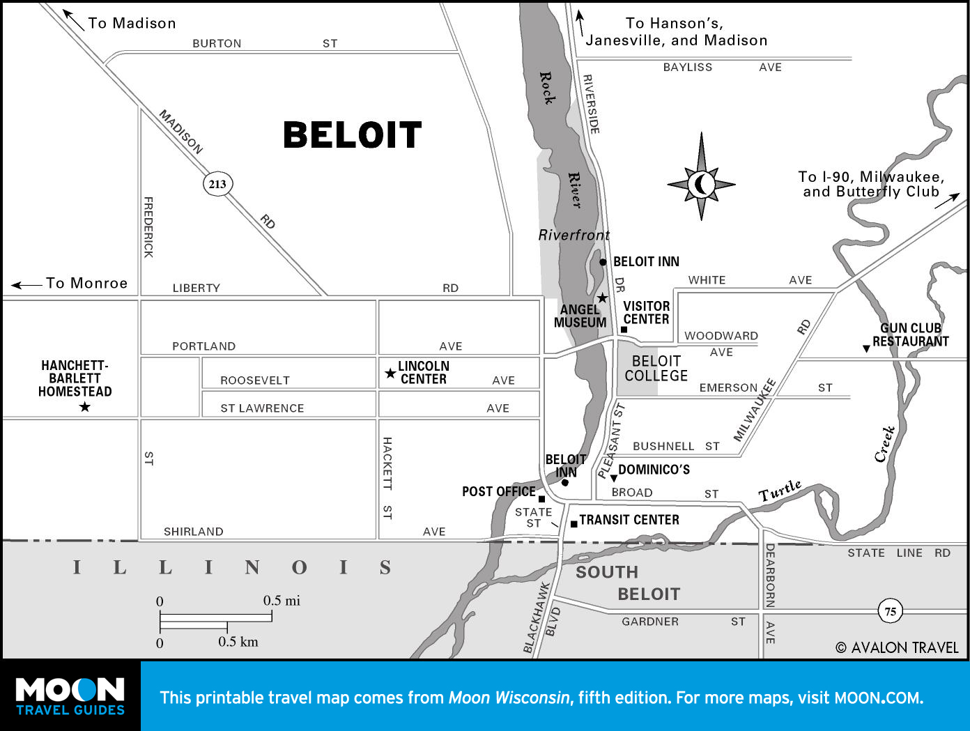
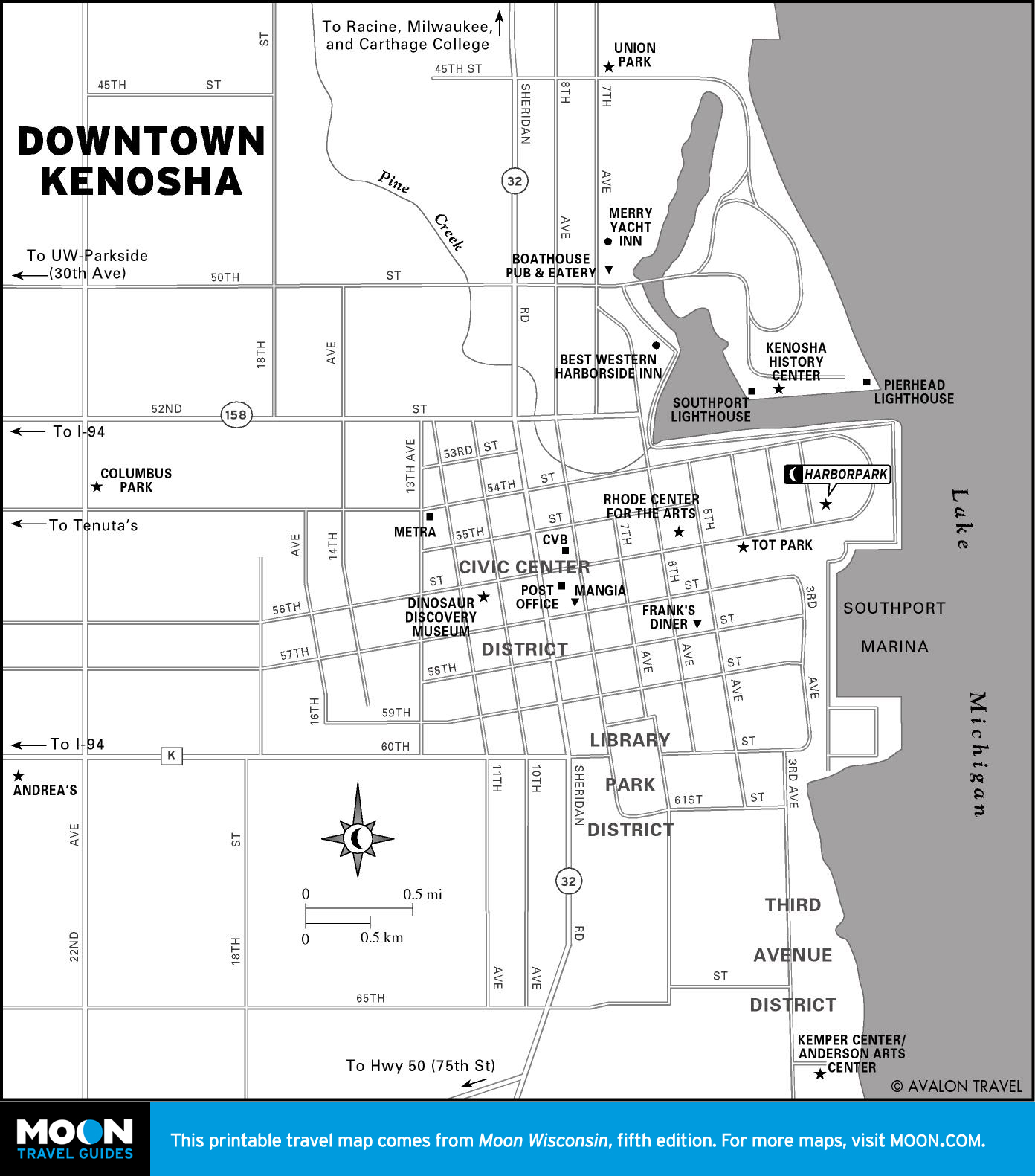
Southeastern Wisconsin
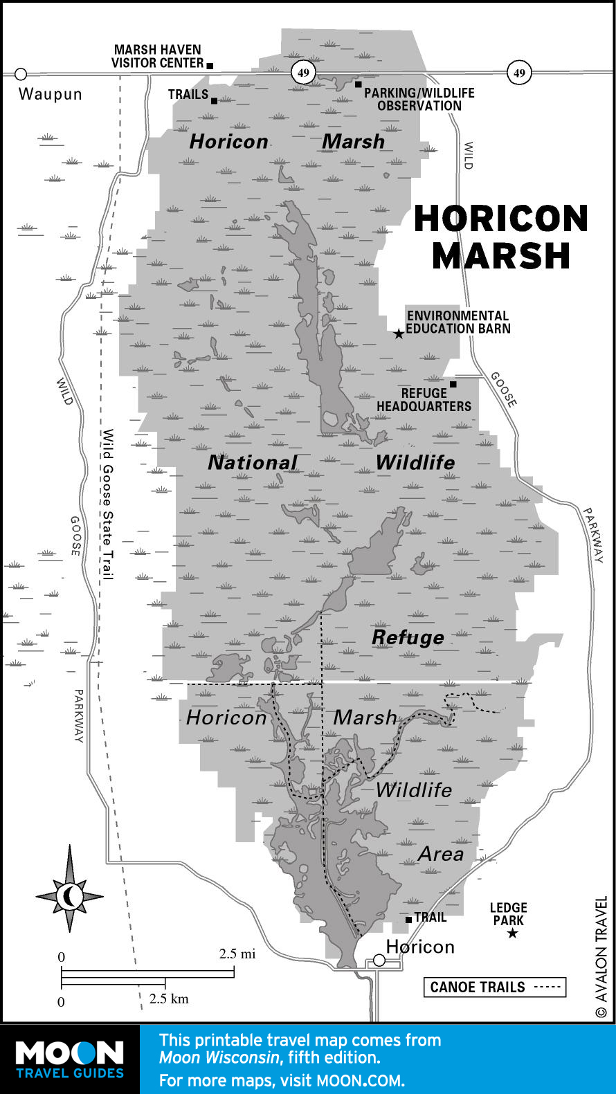
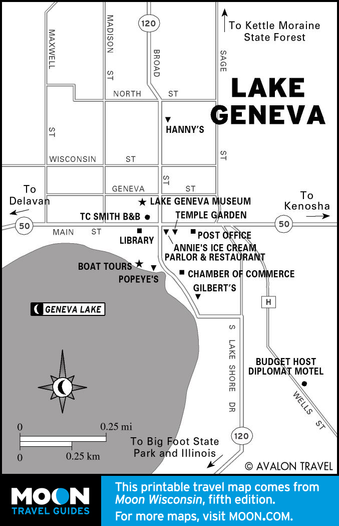
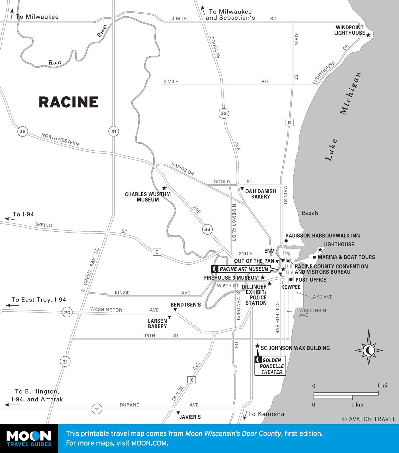
This true gateway region welcomes many a traveler barreling in via the Windy City. Extraordinary museums and parks await in Kenosha and Racine, the latter also sporting Badger native Frank Lloyd Wright architecture. Hop onto the narrower ribbons and discover the Geneva Lake area. A crucial North American migration flyway is Horicon Marsh.

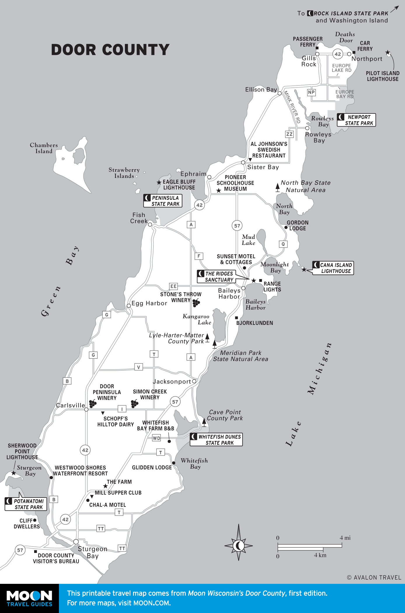
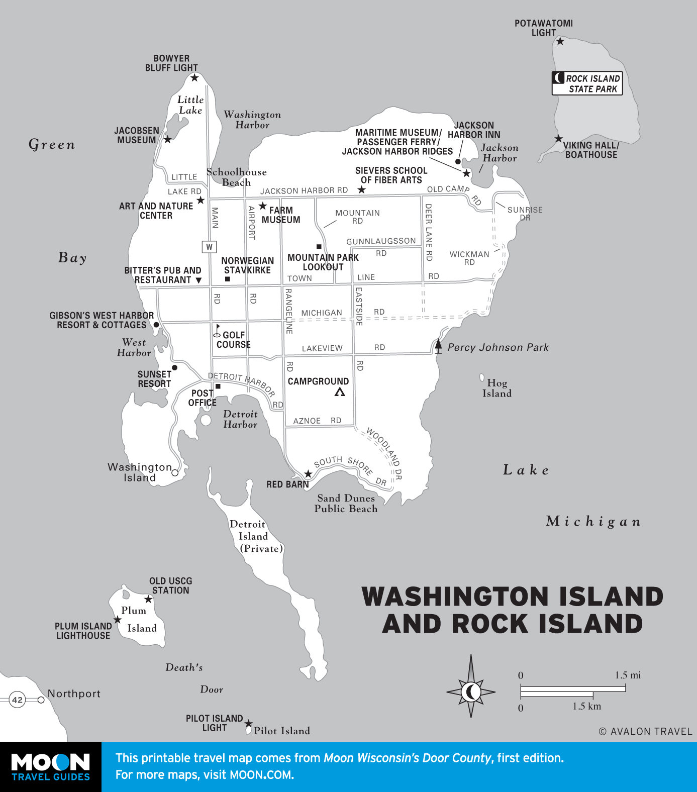
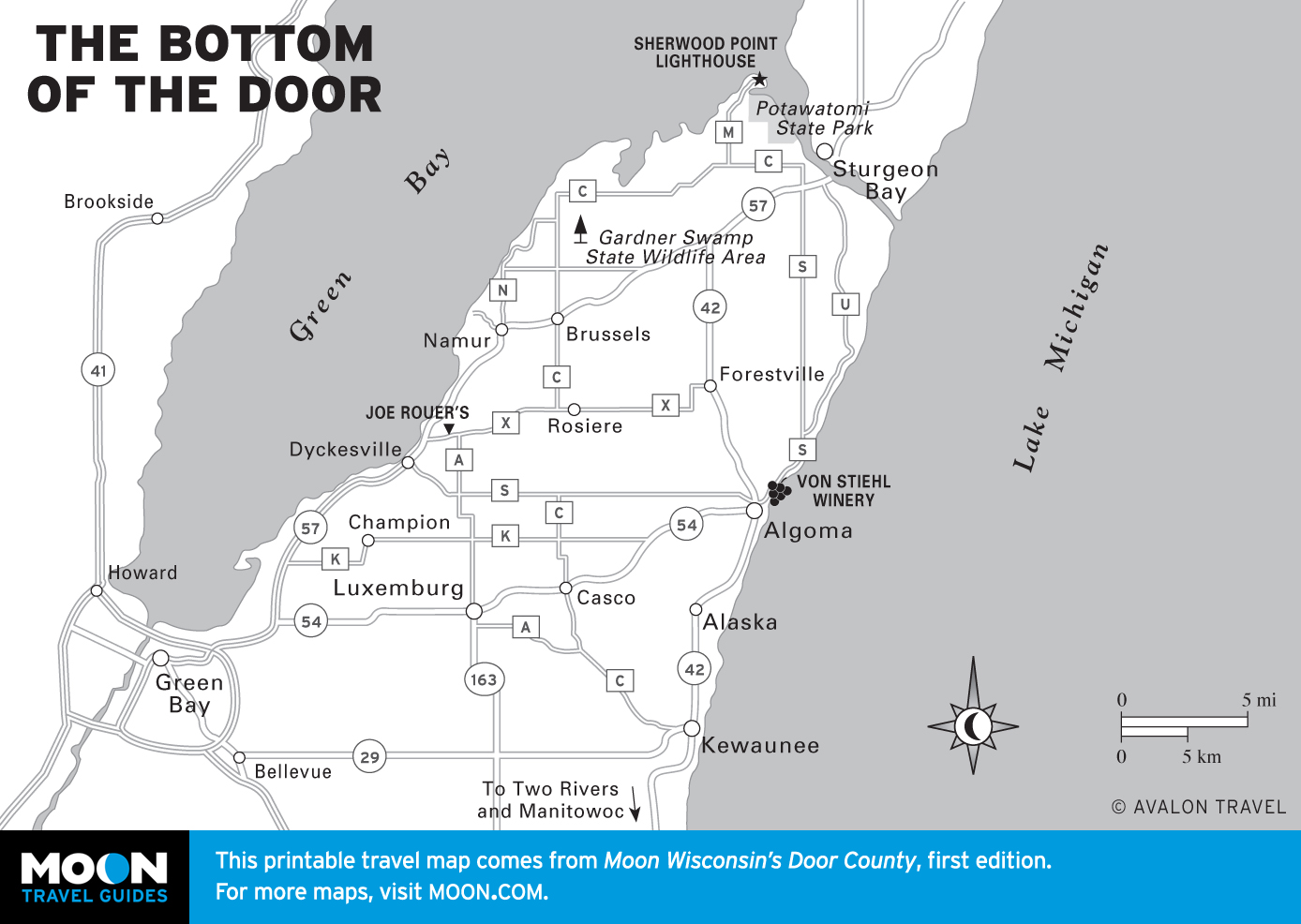
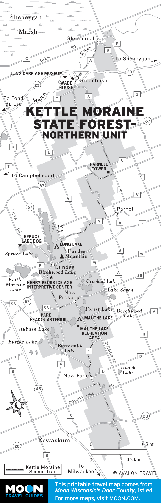
Door County
Jutting into Lake Michigan, the “thumb” of Wisconsin geographically, merely offers, mile for mile, the most sublime collection of state parks in the Midwest and the highest concentration of lighthouses of any U.S. county.
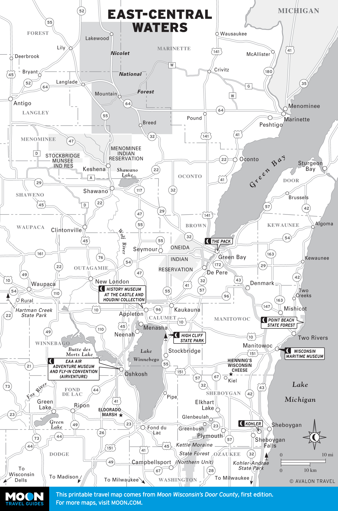
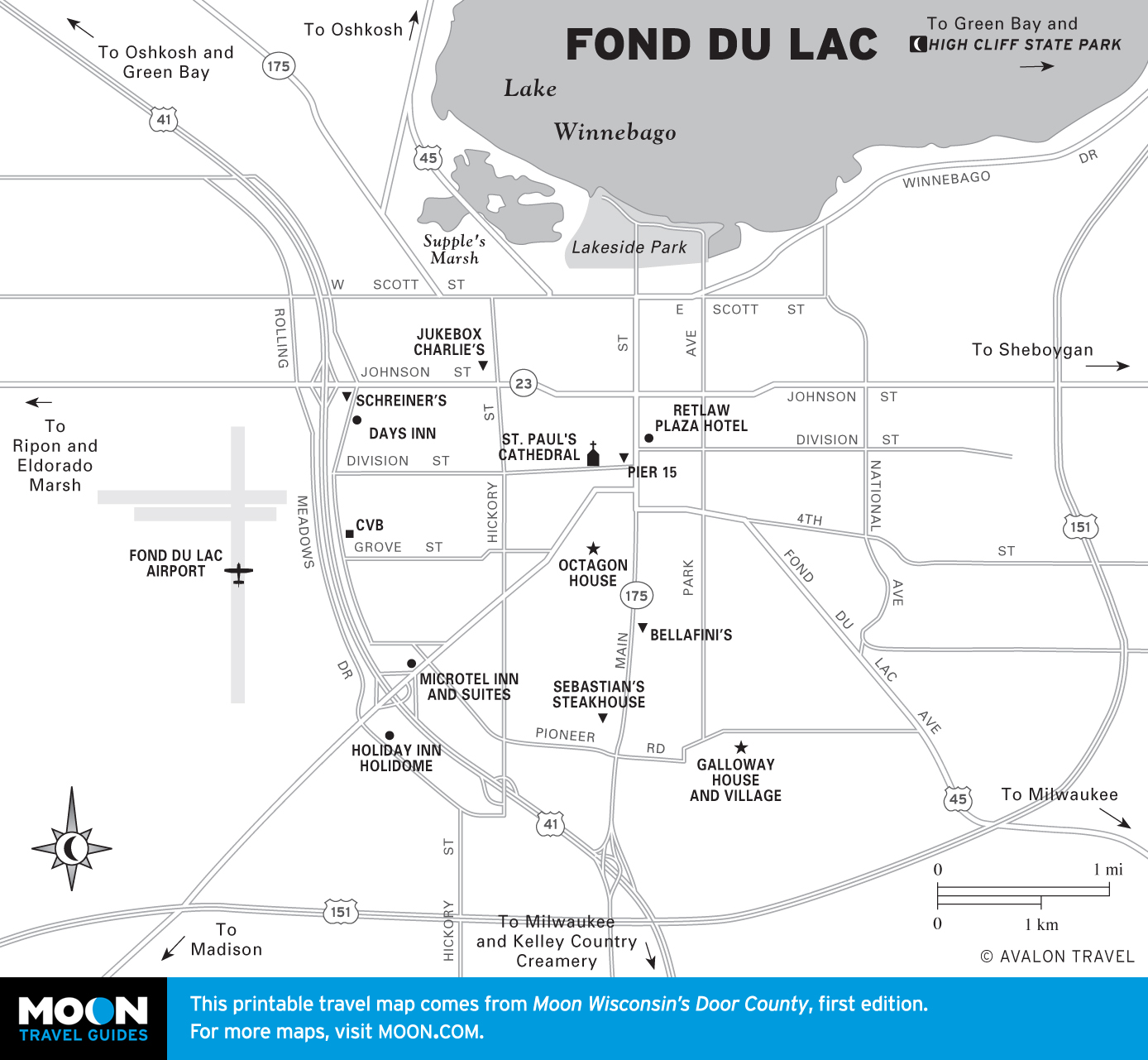
East-Central Waters
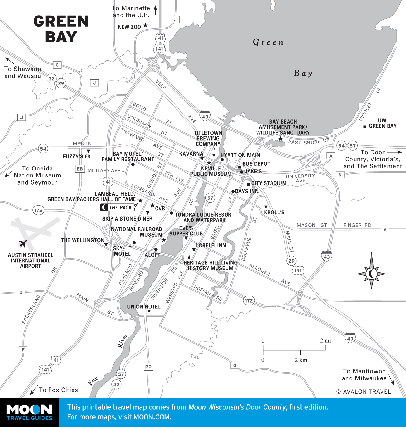
These waters truly made the state, welcoming legions of immigrants and floating timber for paper mills of the Fox Cities, dominated by the enormous Lake Winnebago. To the west are such picturesque resort lands you’ll run out of digital storage, as well as the wild and wonderful Wolf River. No visit to Wisconsin would be complete without a pilgrimage to one of the NFL’s most, well, sacred institutions: Lambeau Field, home of the Green Bay Packers.

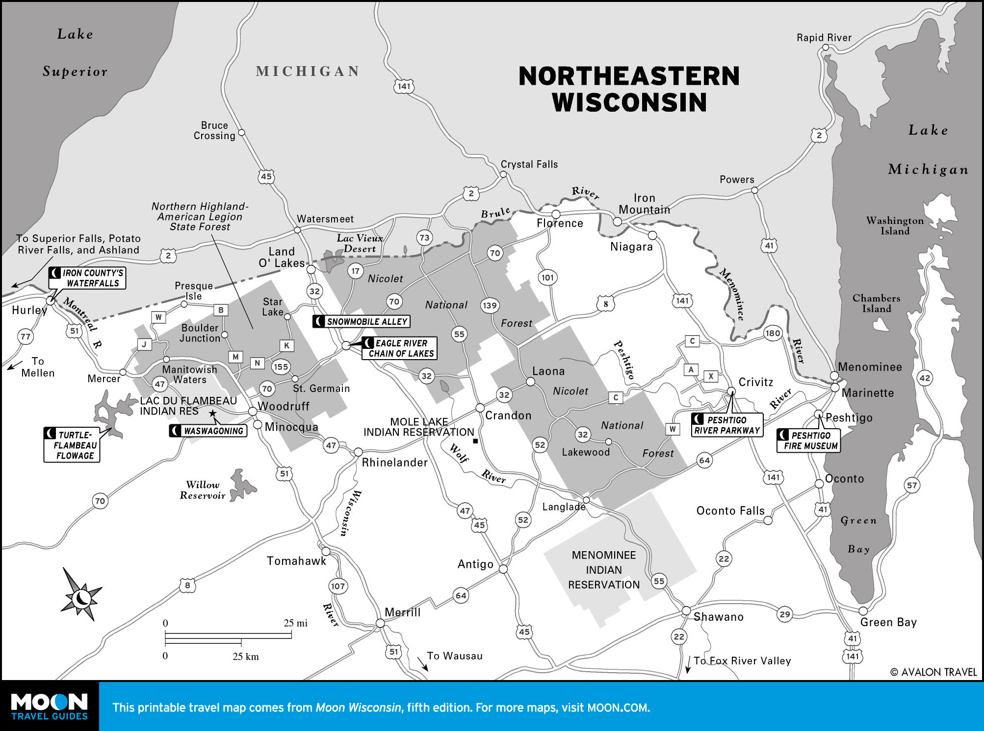
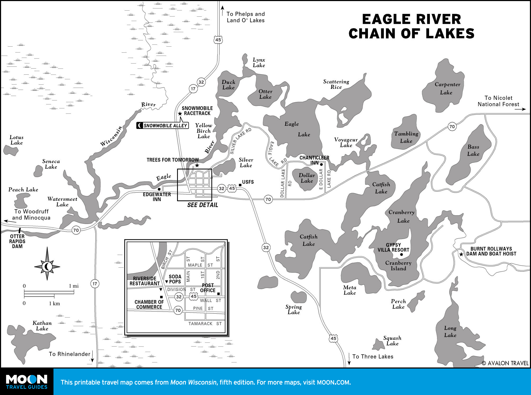
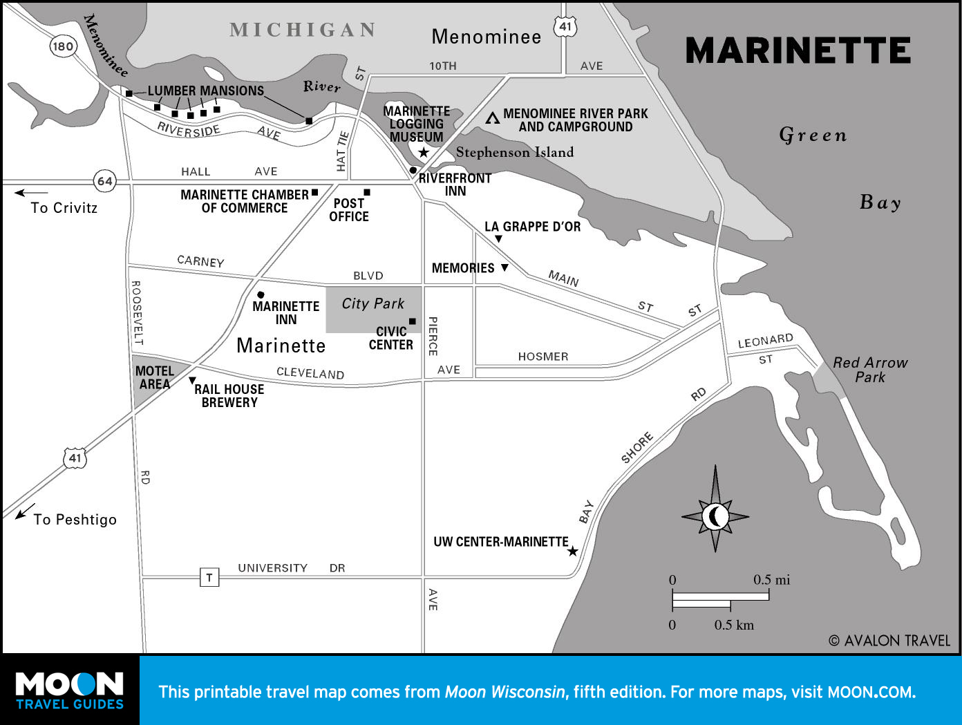
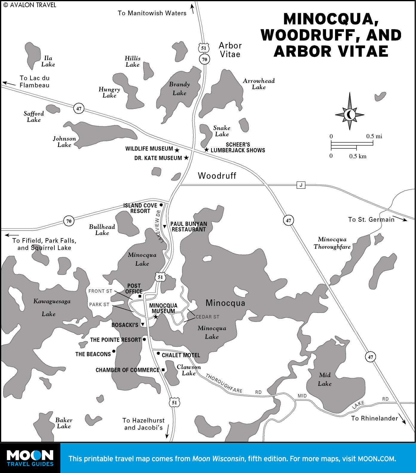
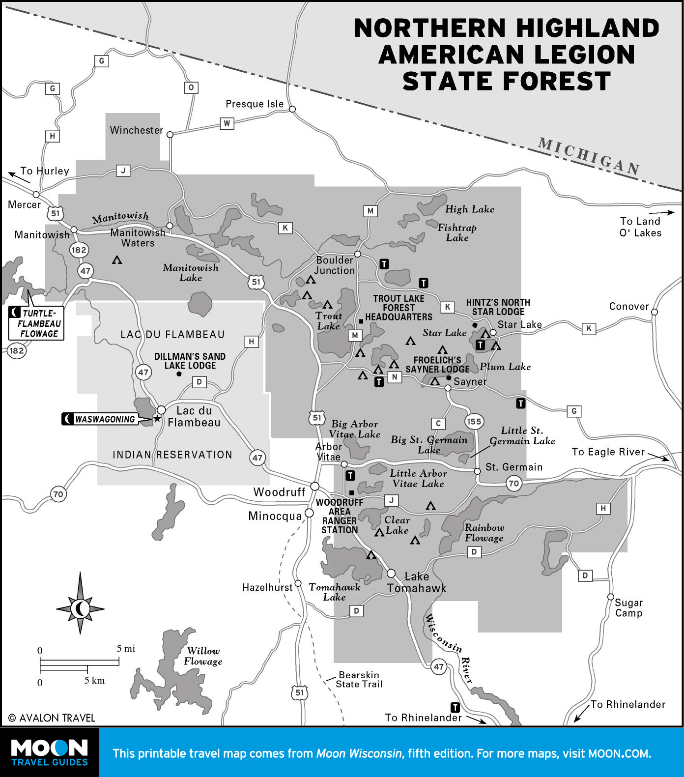
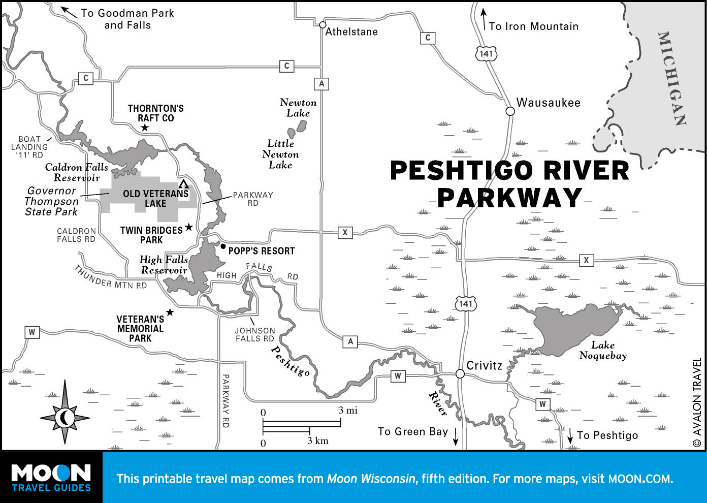
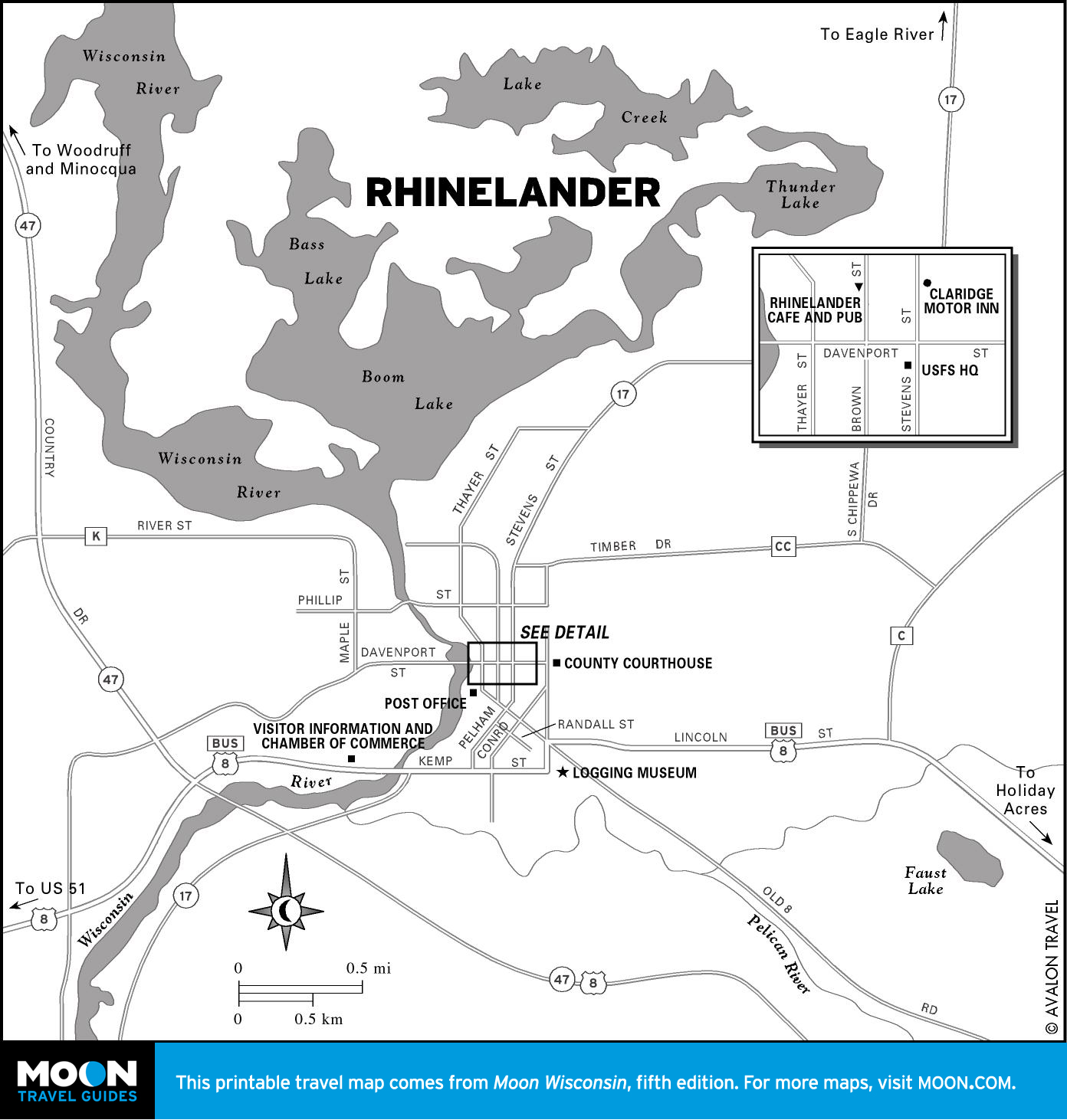
Northeastern Wisconsin
Here find one of the world’s highest concentrations of lakes and two of the Midwest’s grandest rivers, Peshtigo River and the Turtle-Flambeau Flowage. Marinette and Iron County waterfalls offer the most scenic drive in the region. Sleds have always ruled in northern Wisconsin, and the mecca is Snowmobile Alley near the Eagle River Chain of Lakes.
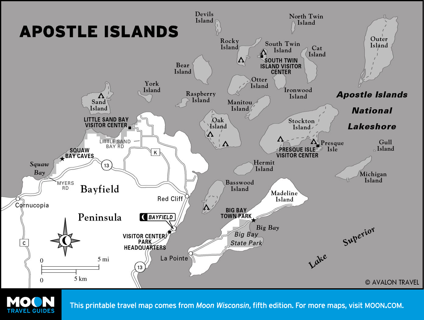
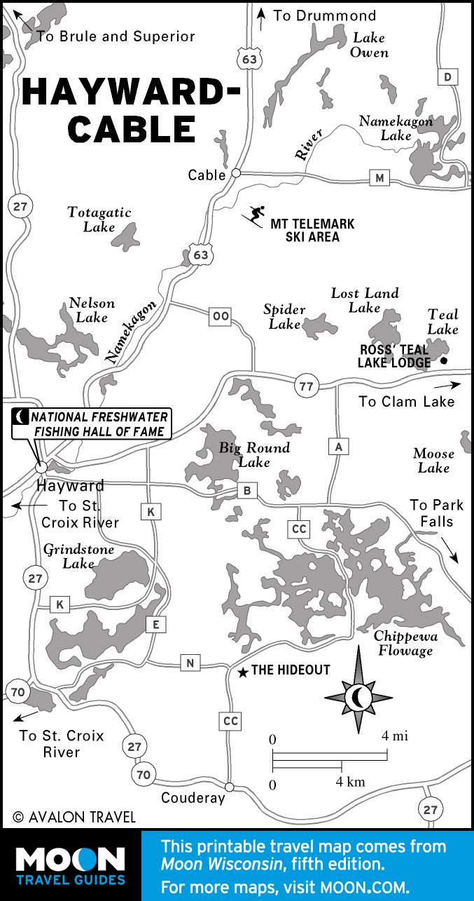
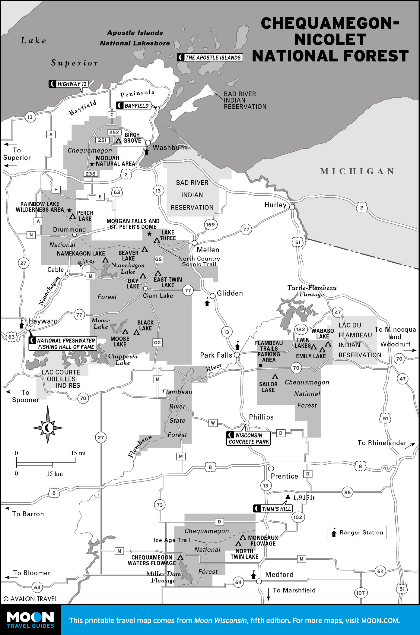
Indianhead Country
Hydrophiles adore the St. Croix National Scenic Riverway. Anglers battle lunker muskies near Hayward. From preciously anachronistic Bayfield, head to the magnificent Apostle Islands National Lakeshore. Everyone should trace the Lake Superior coast along WIS 13—the most scenic drive in the state, bar none.

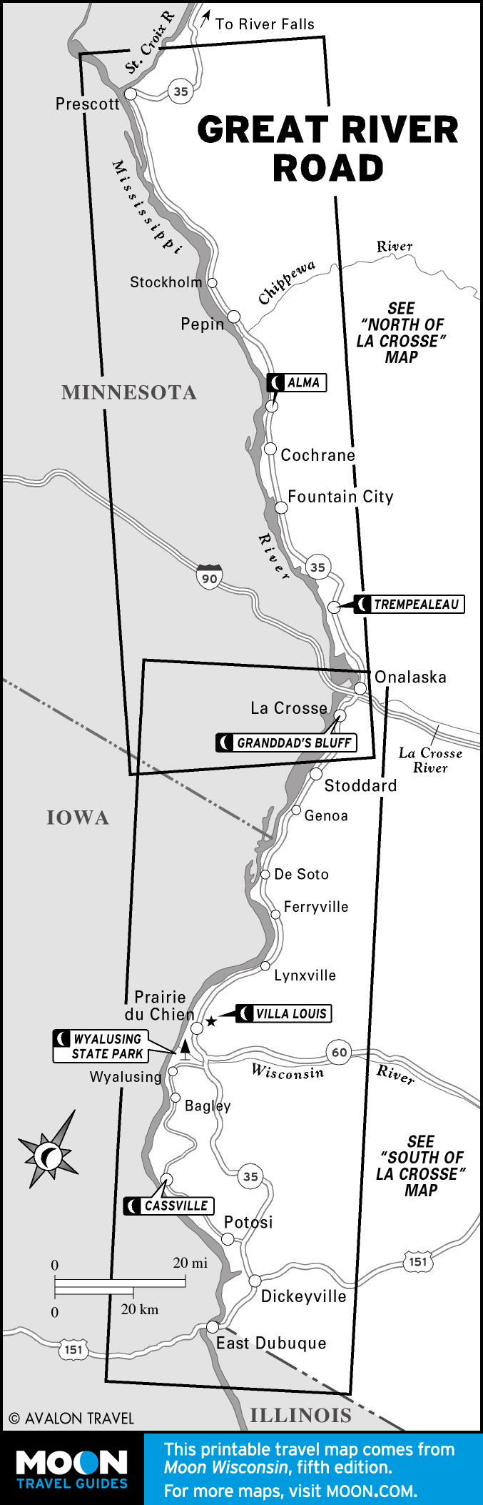
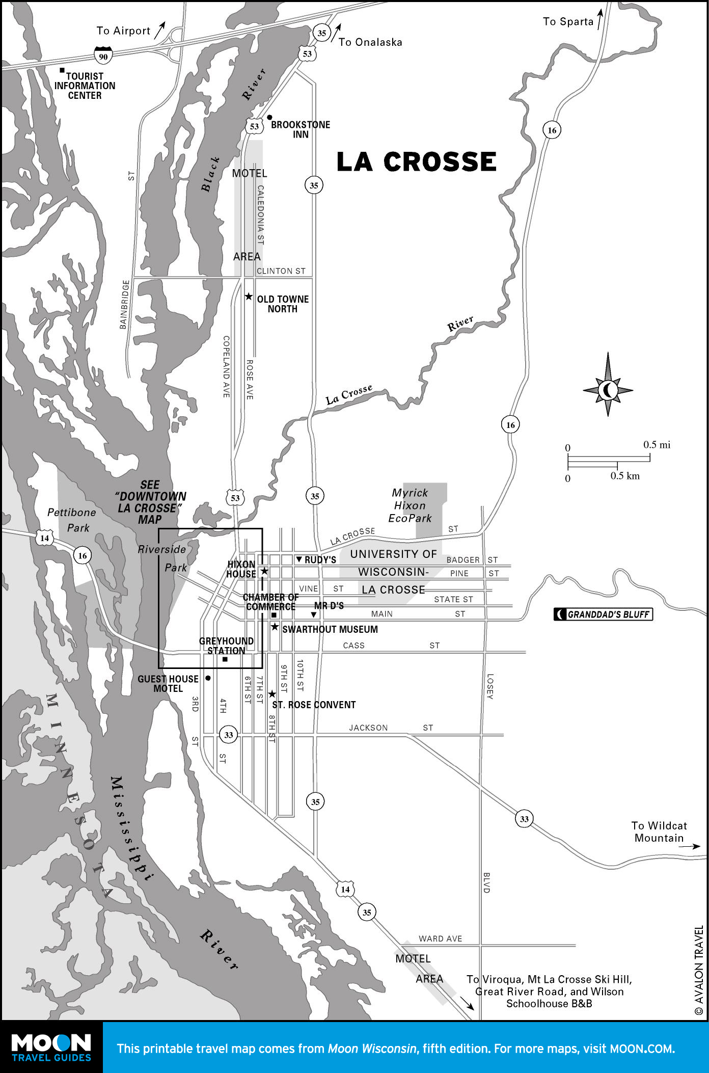
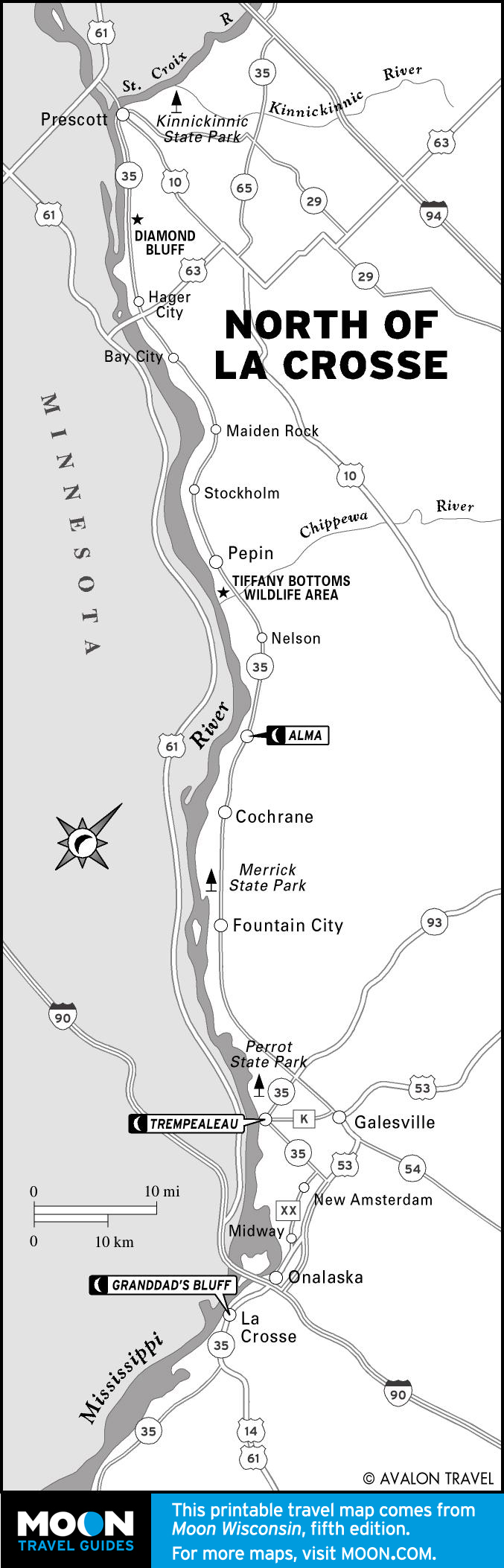
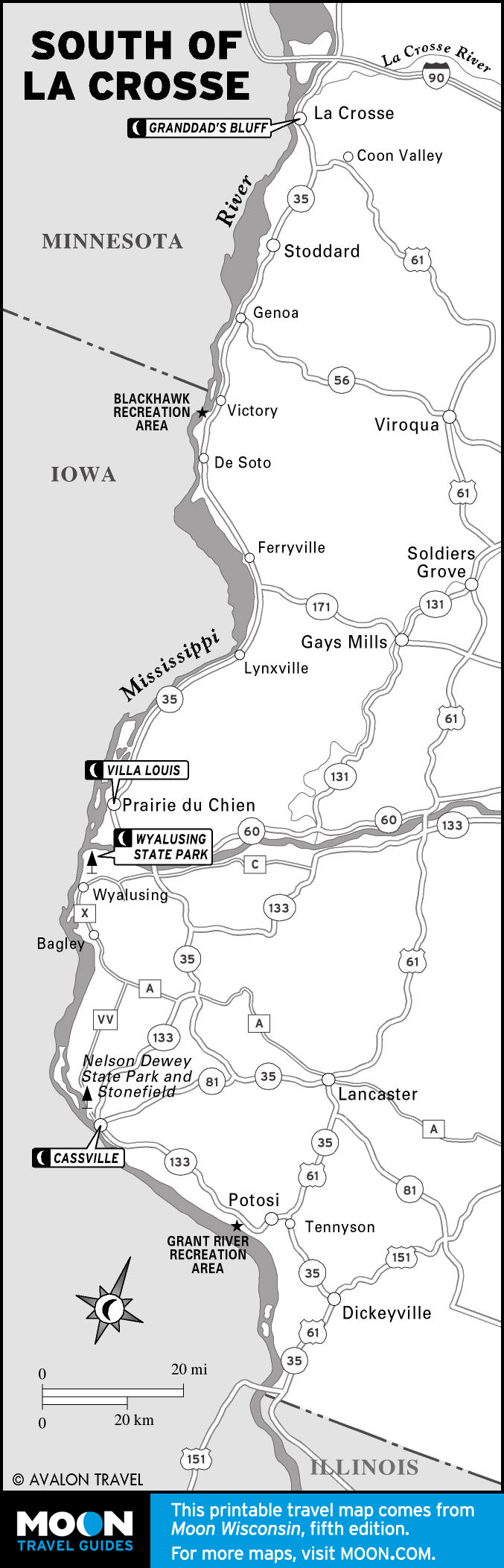
Great River Road
For 200 miles, find river towns that refuse to get sucked into tourist trapdom: Alma, funky Trempealeau, or Cassville, where eagles soar and one of the nation’s last river ferries chugs you across the Ol’ Miss.
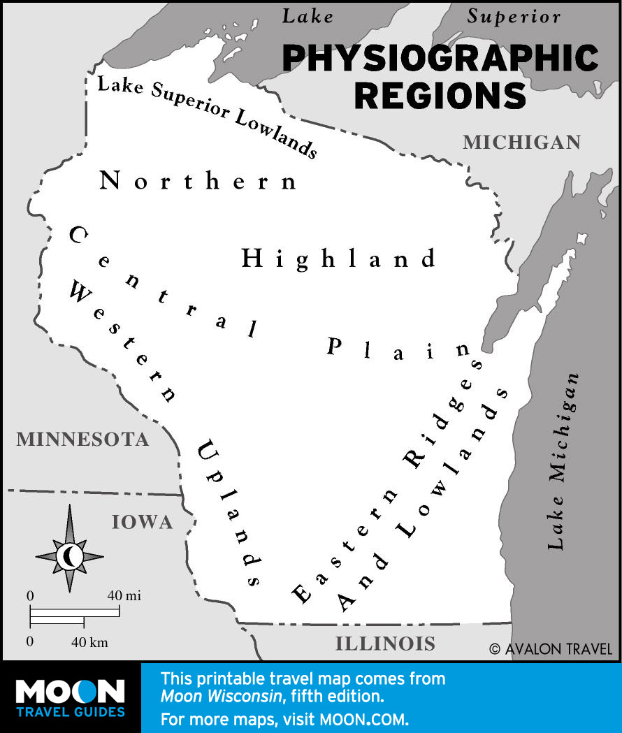
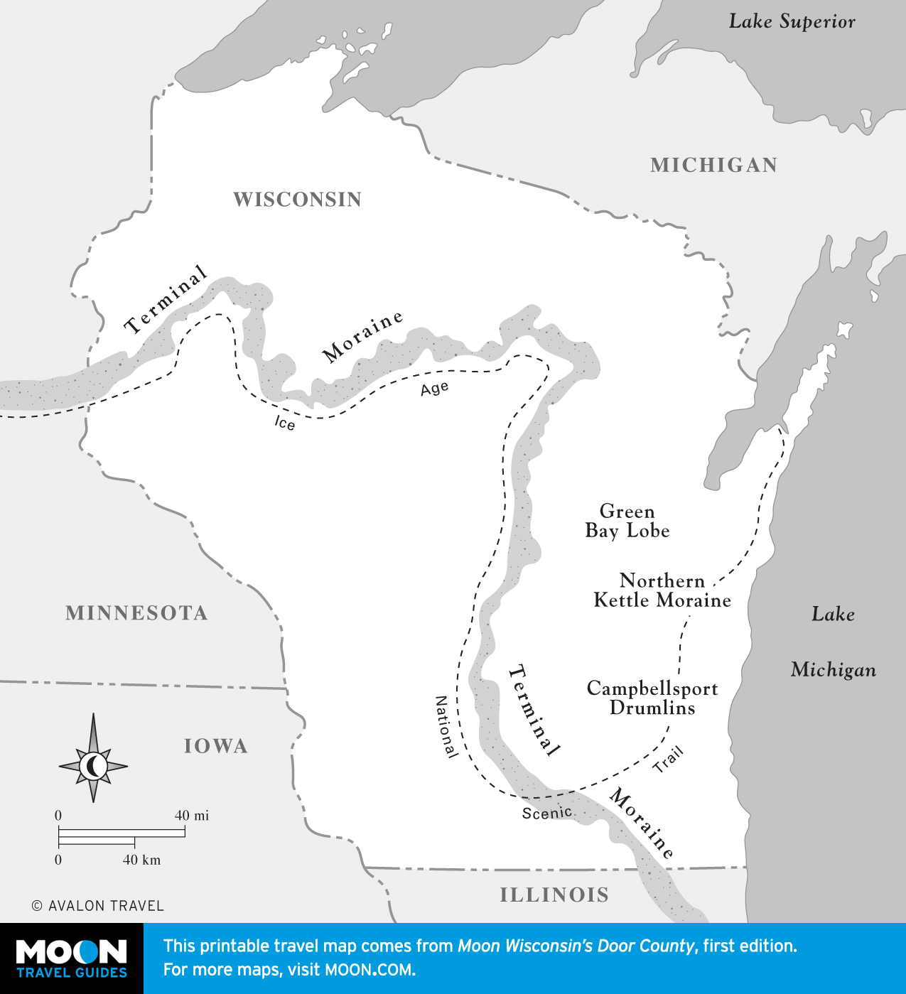
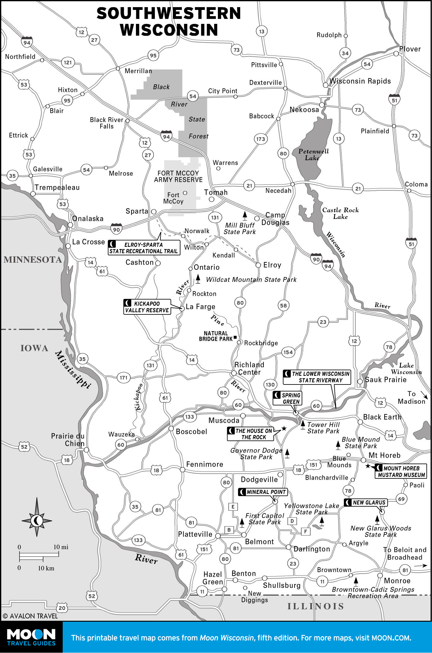
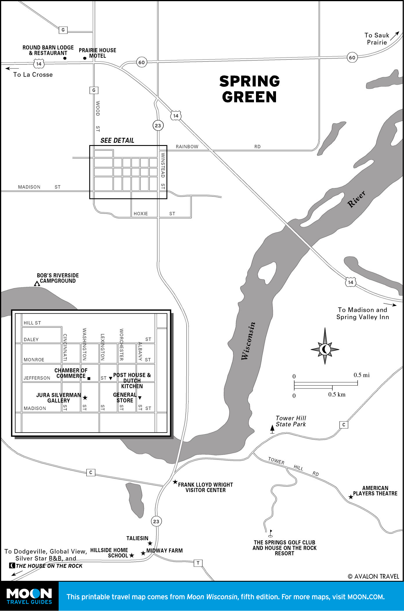
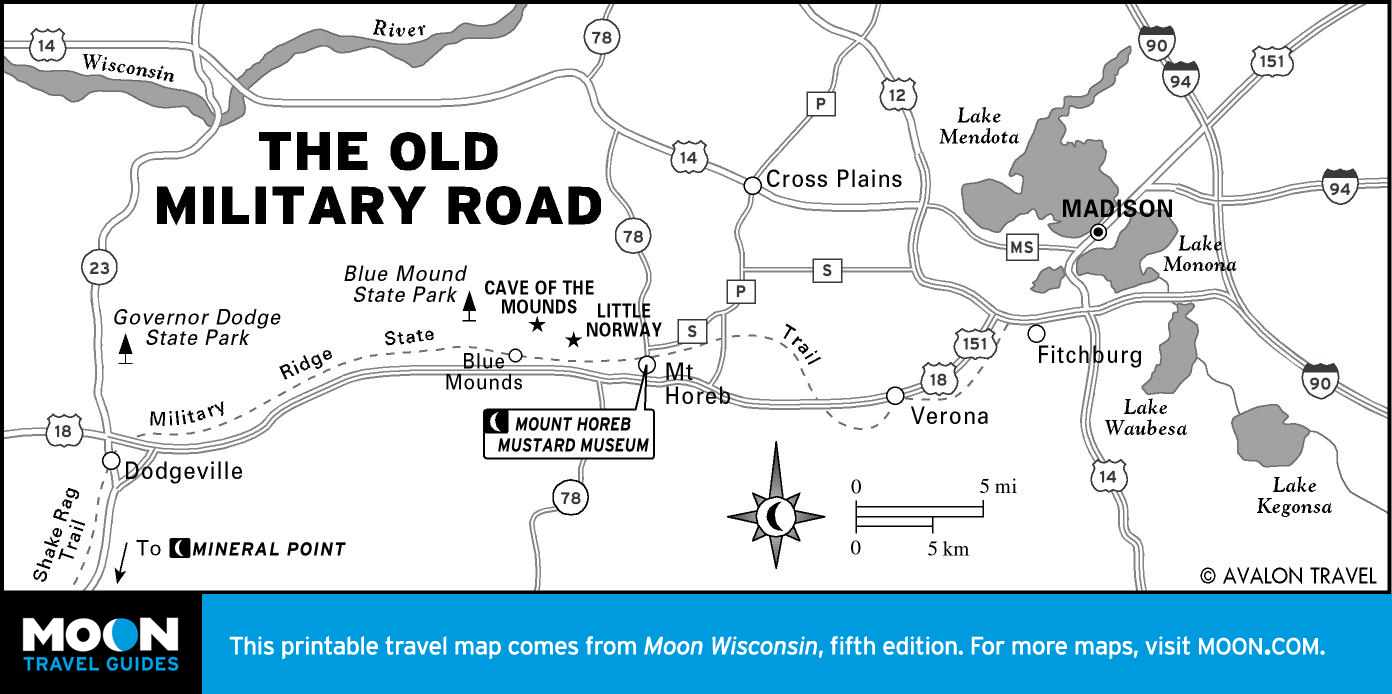
The Driftless Region
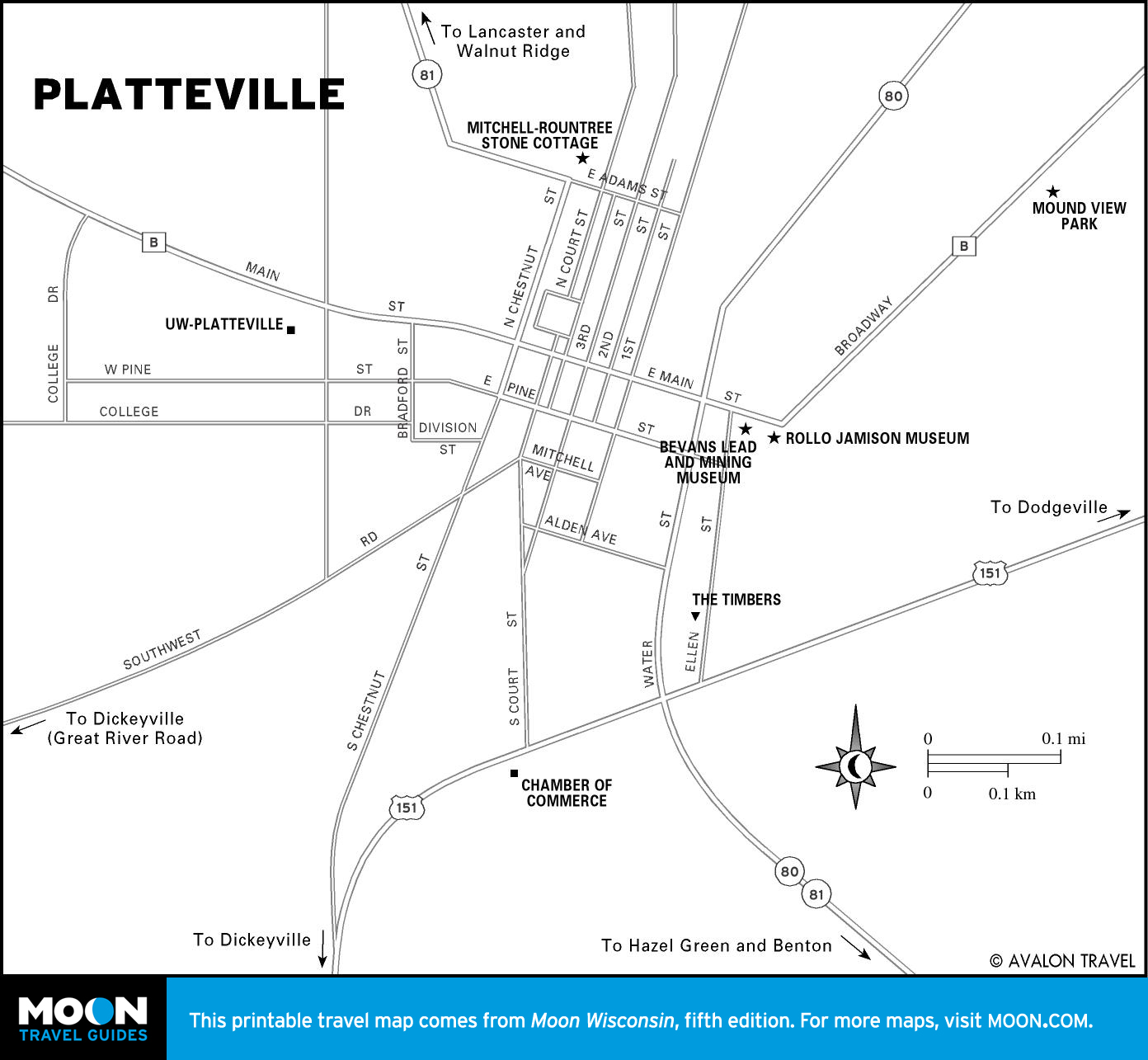
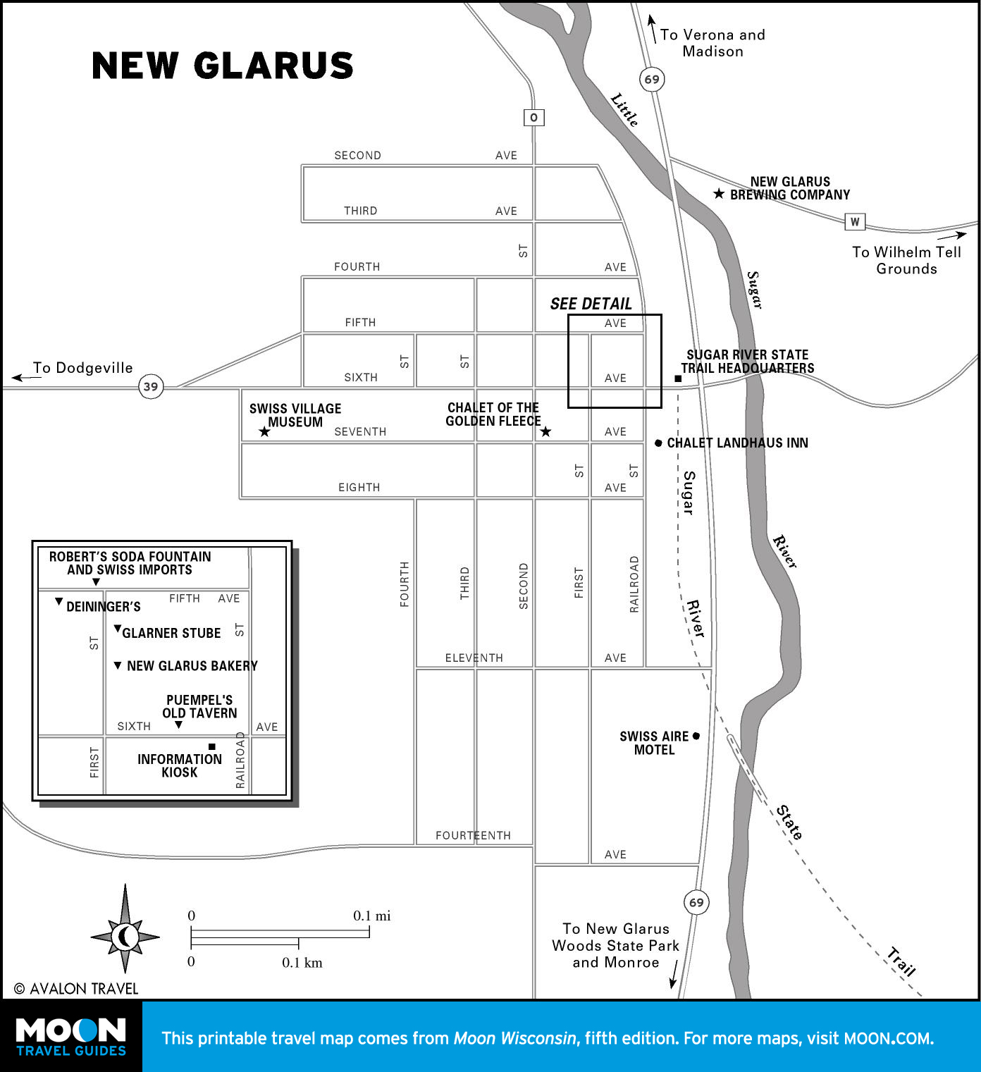
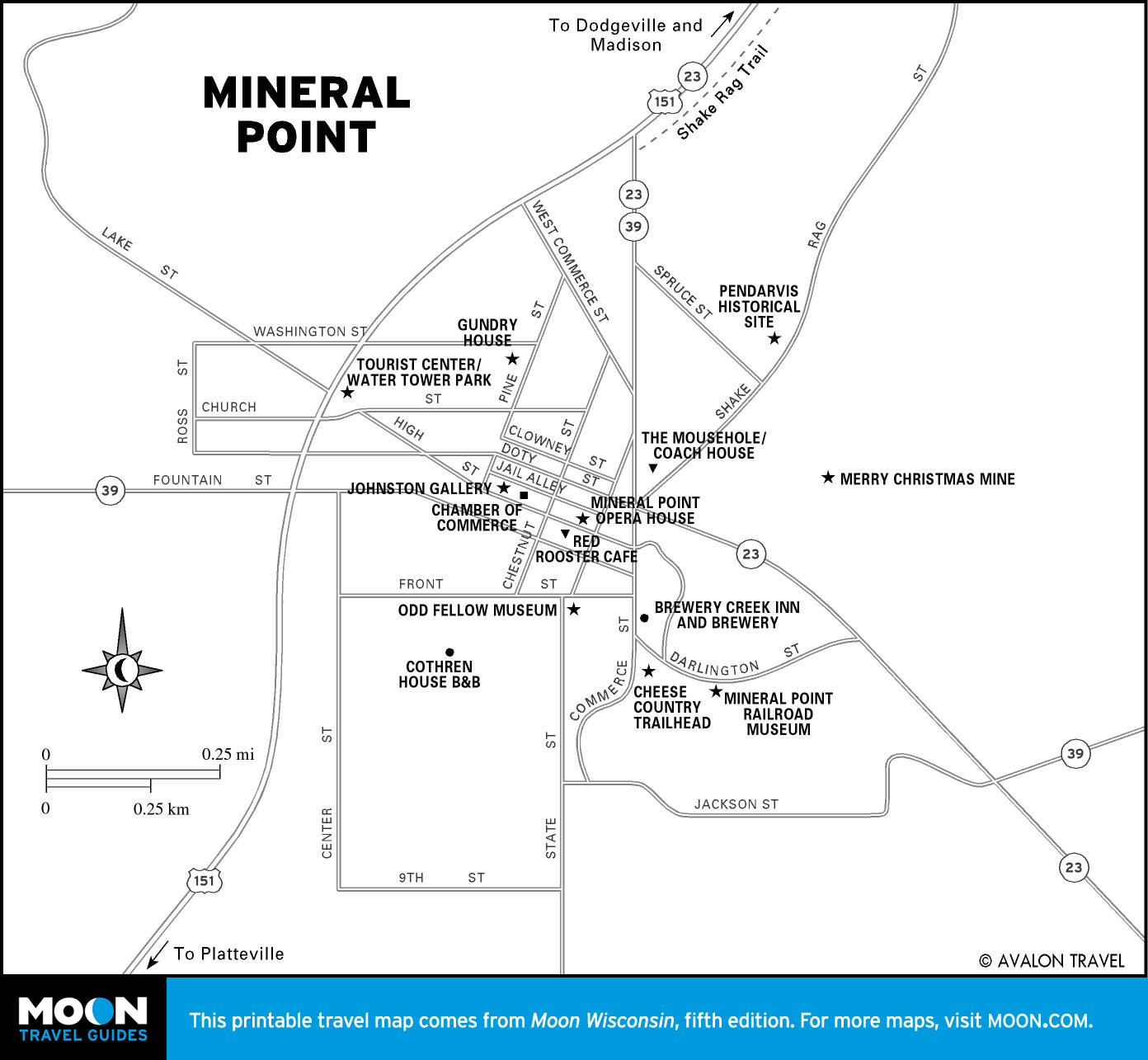
This, the largest unglaciated region in the northern Midwest, is where the land gets ambitious. Spring Green was the home of Frank Lloyd Wright. Nearby, the architectural opposite: House on the Rock. Roll through Mineral Point, very nearly still a 19th-century Cornish village, and New Glarus, a slice of Switzerland.
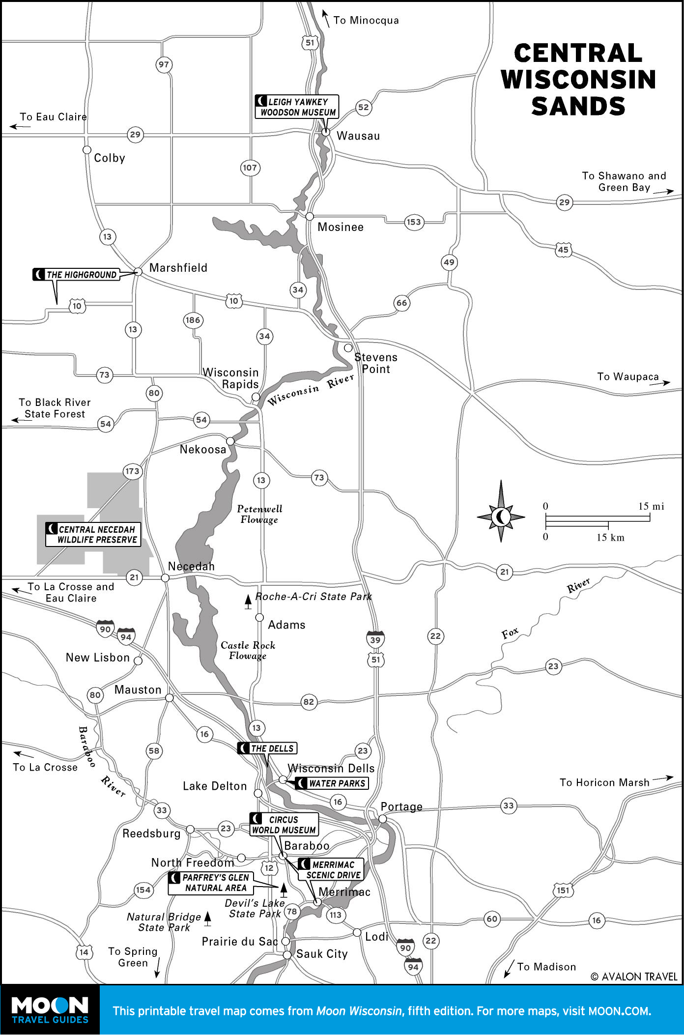
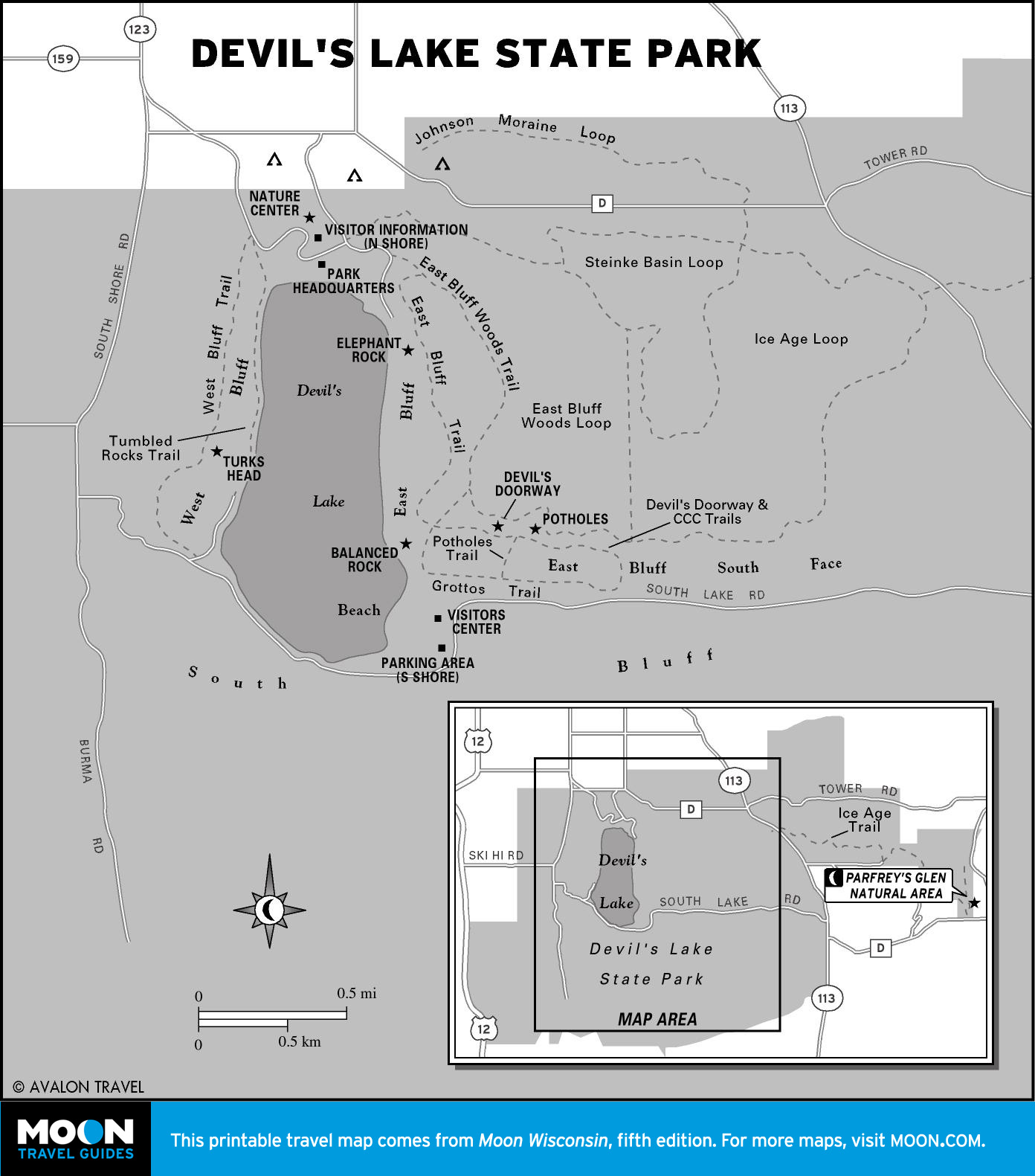
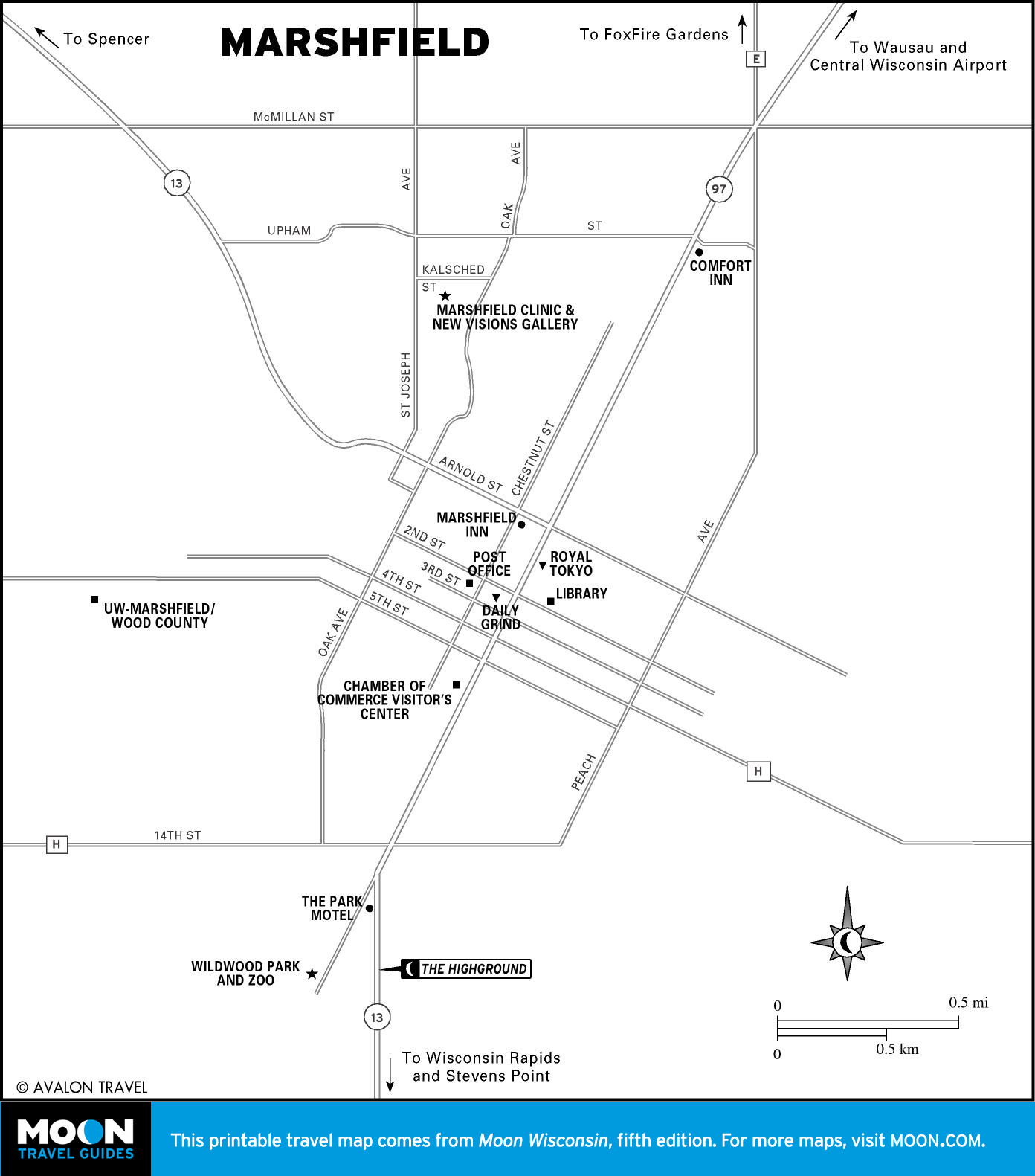
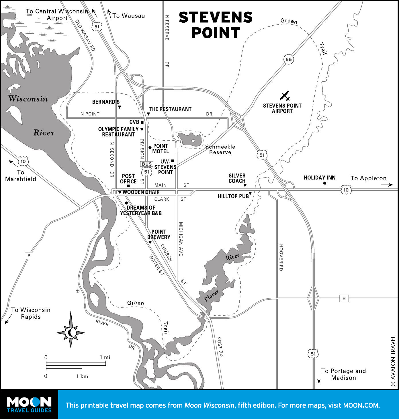
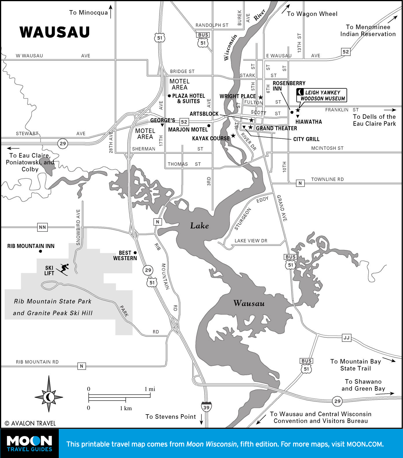
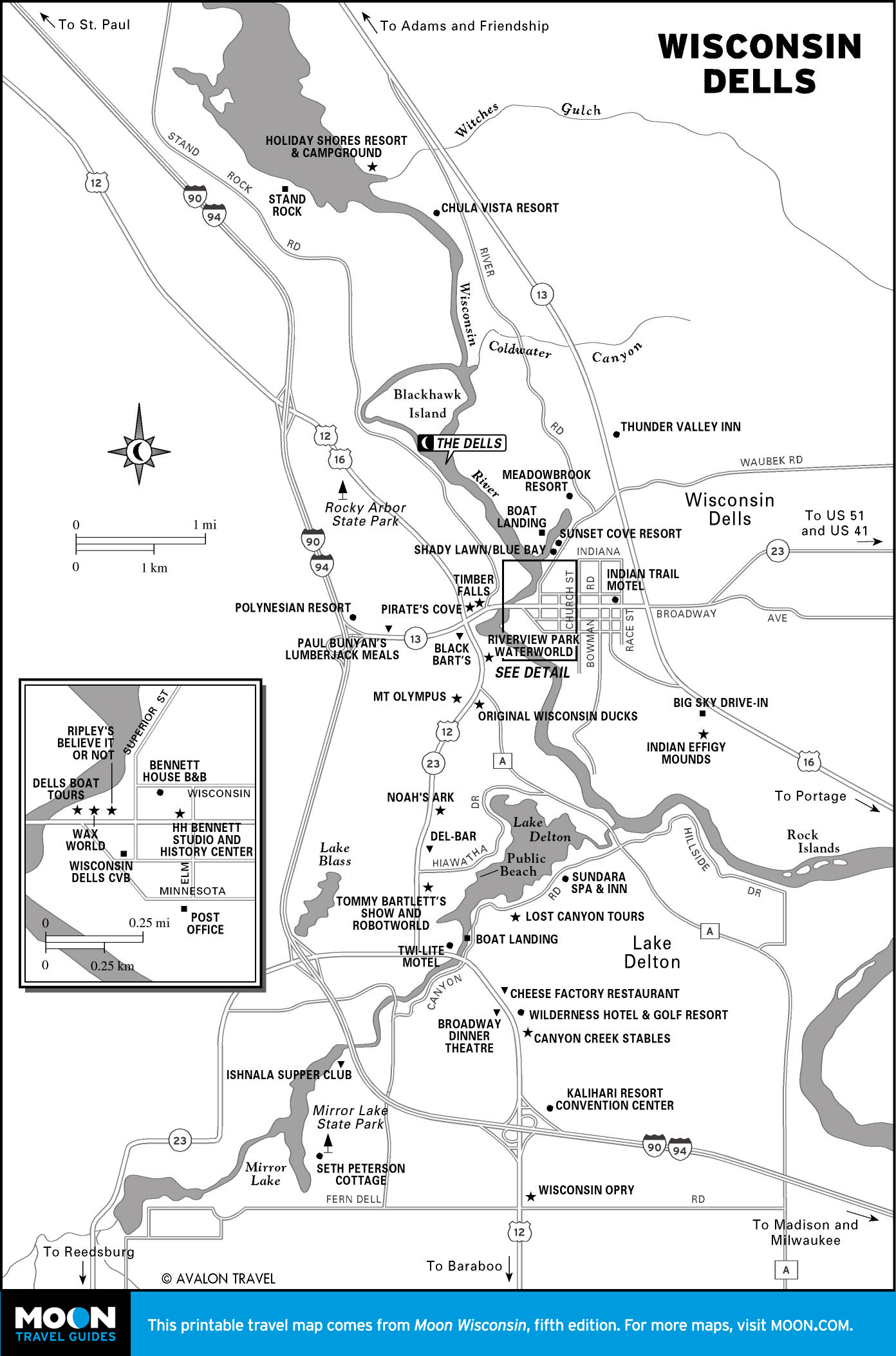
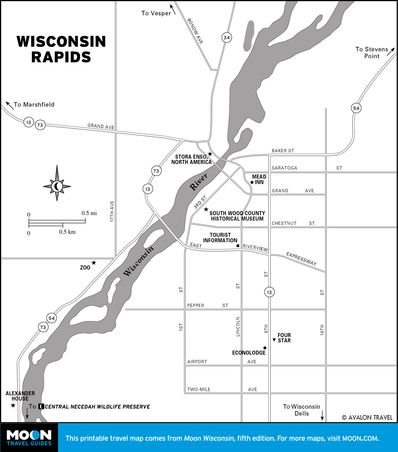
Central Wisconsin Sands
Central Wisconsin sports the state’s number one family attraction—water park-heavy Wisconsin Dells.