Cuba
These free, printable travel maps of Cuba are divided into eleven regions:
- Havana
- Artemisa and Pinar del Río
- Isla de la Juventud
- Mayabeque and Matanzas
- Cienfuegos and Villa Clara
- Sancti Spíritus
- Ciego de Ávila and Camagüey
- Las Tunas and Holguín
- Granma
- Santiago de Cuba
- Guantánamo
Explore Cuba with these helpful travel maps. Ensure you have the newest travel maps from Moon by ordering the most recent edition of our travel guides to Cuba and Havana.
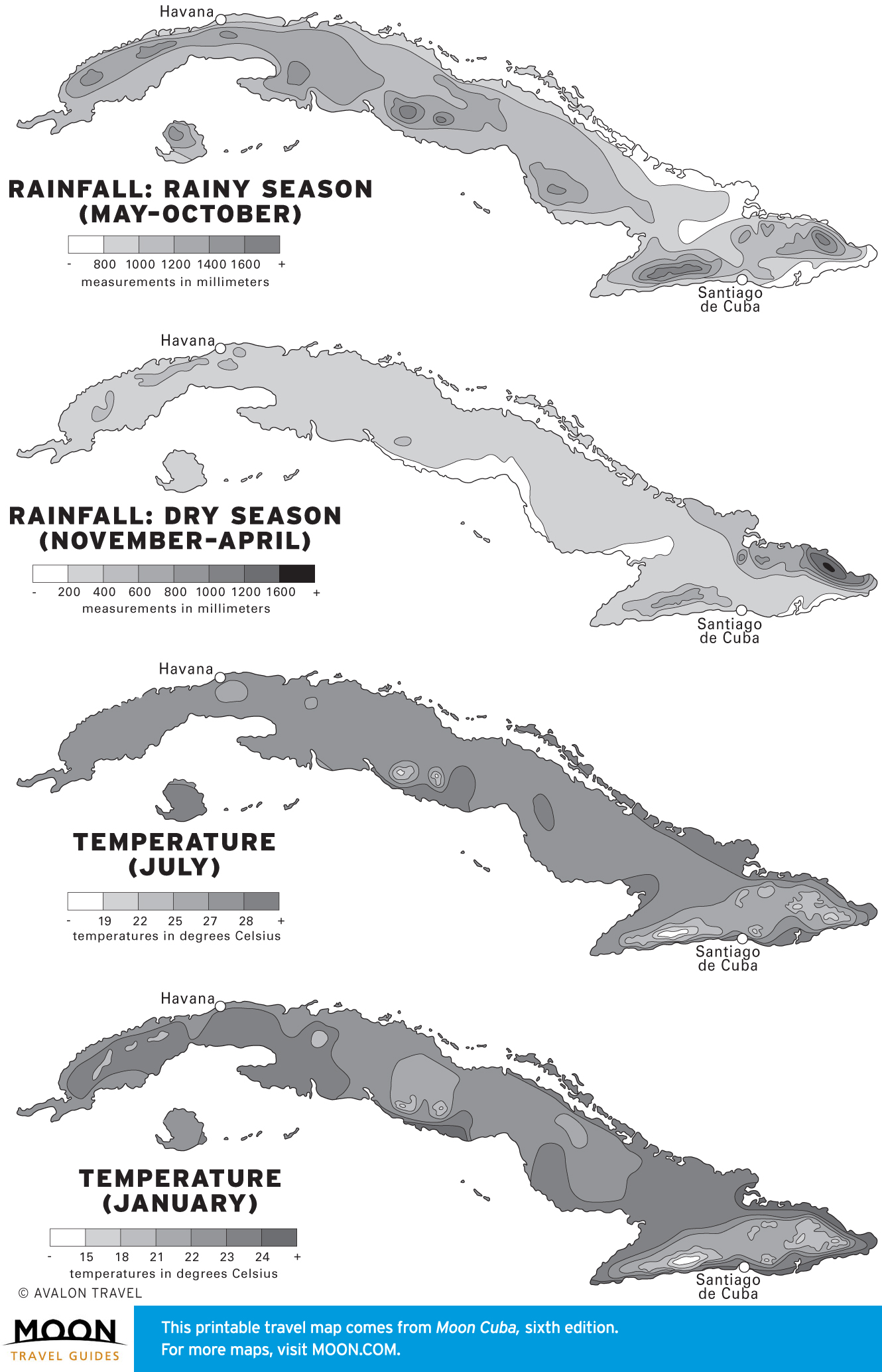
Travel Maps of Cuba
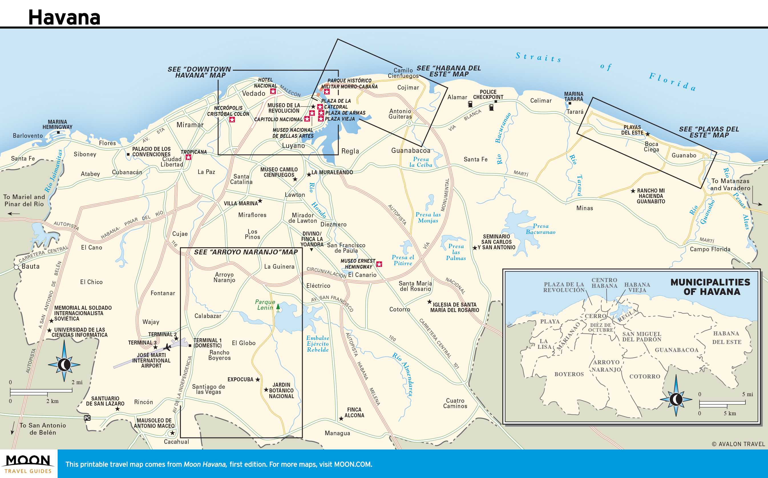
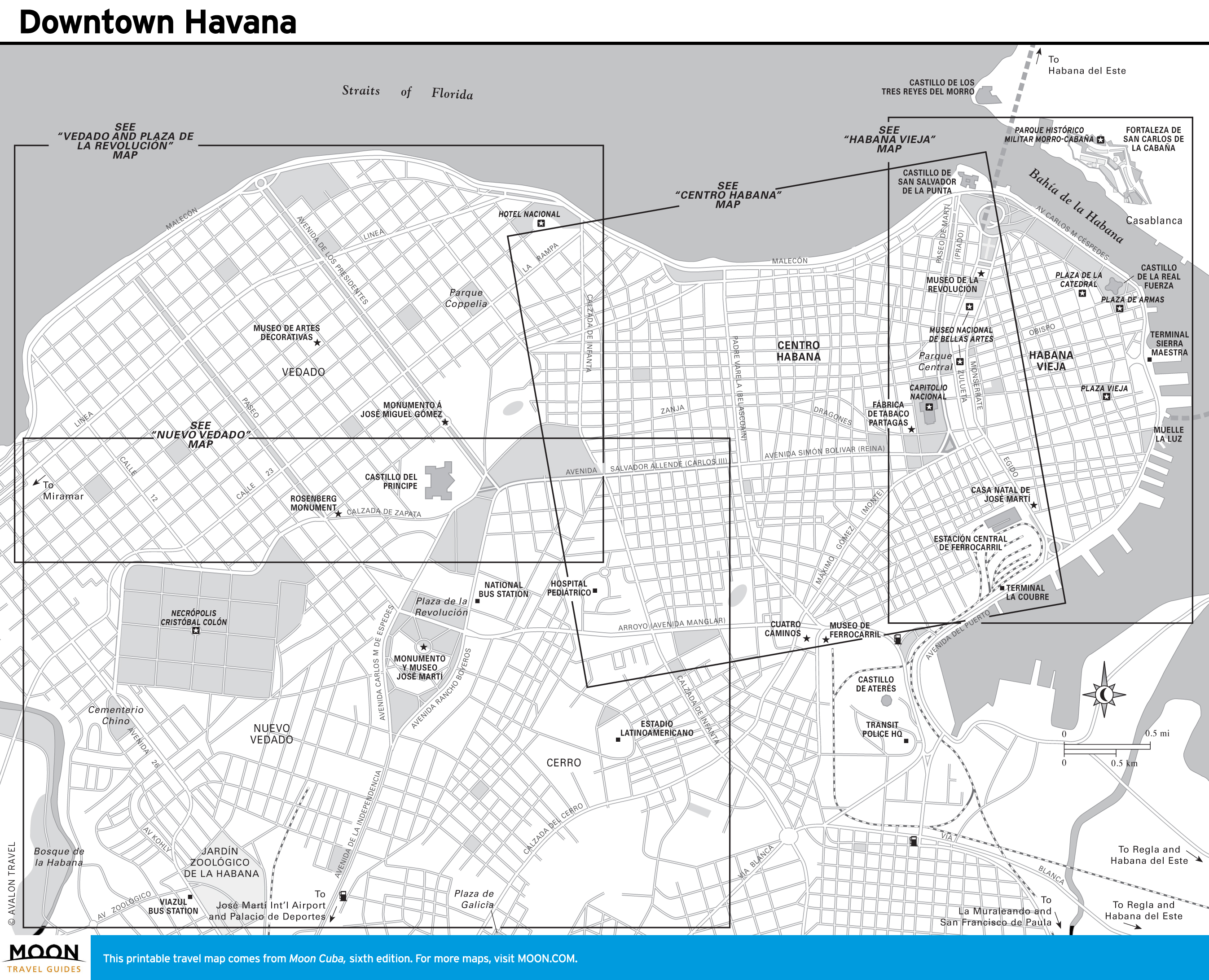
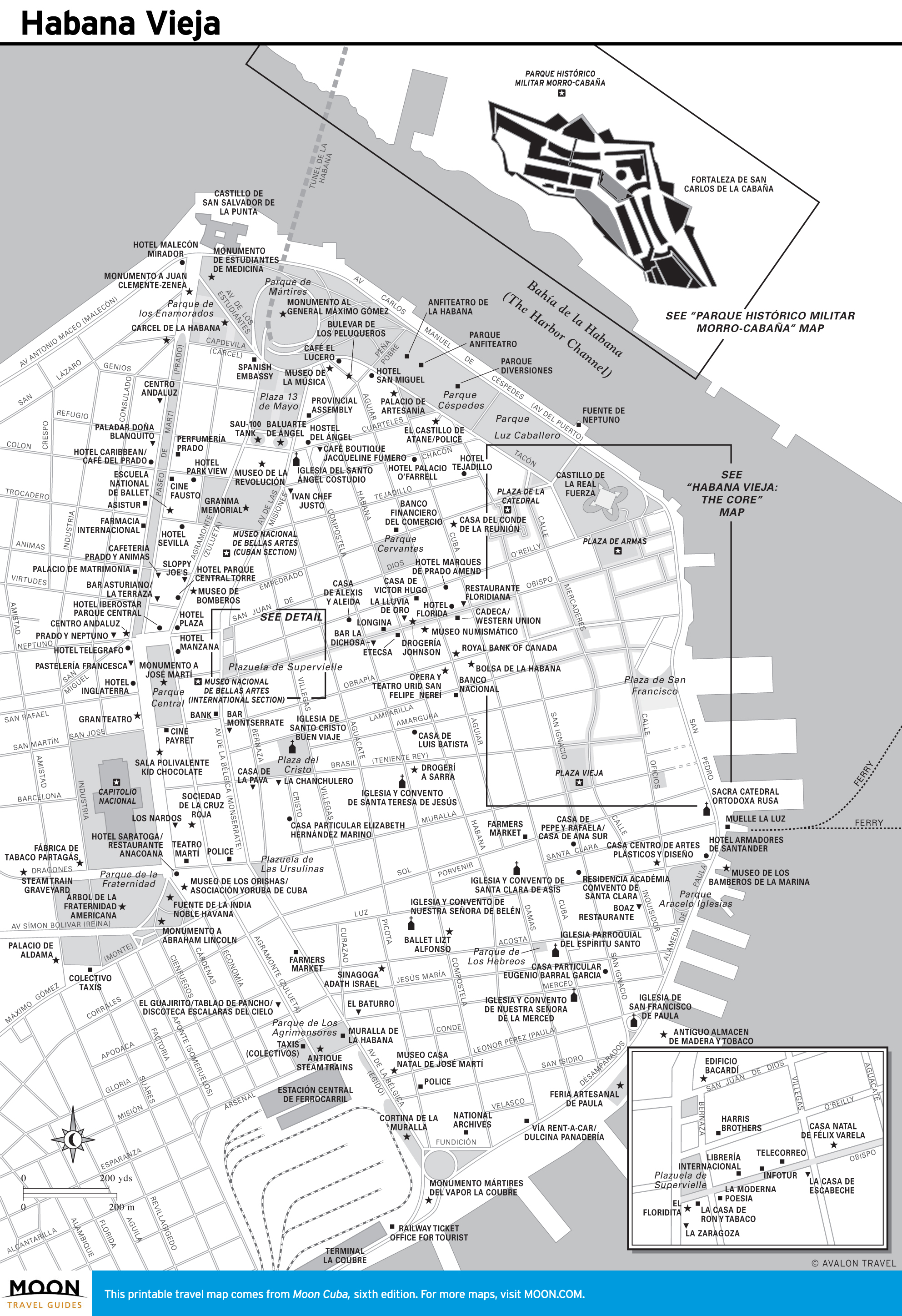
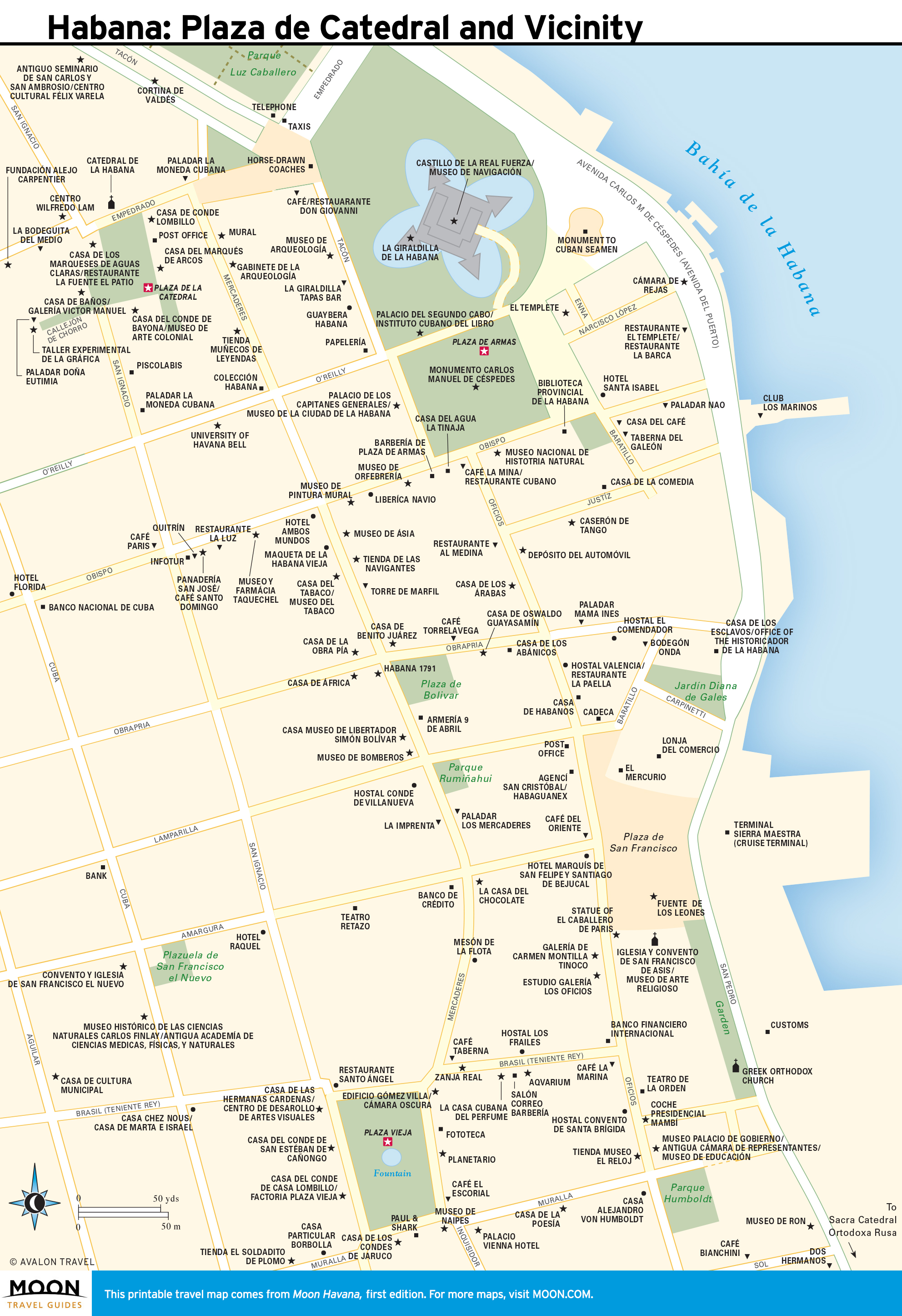
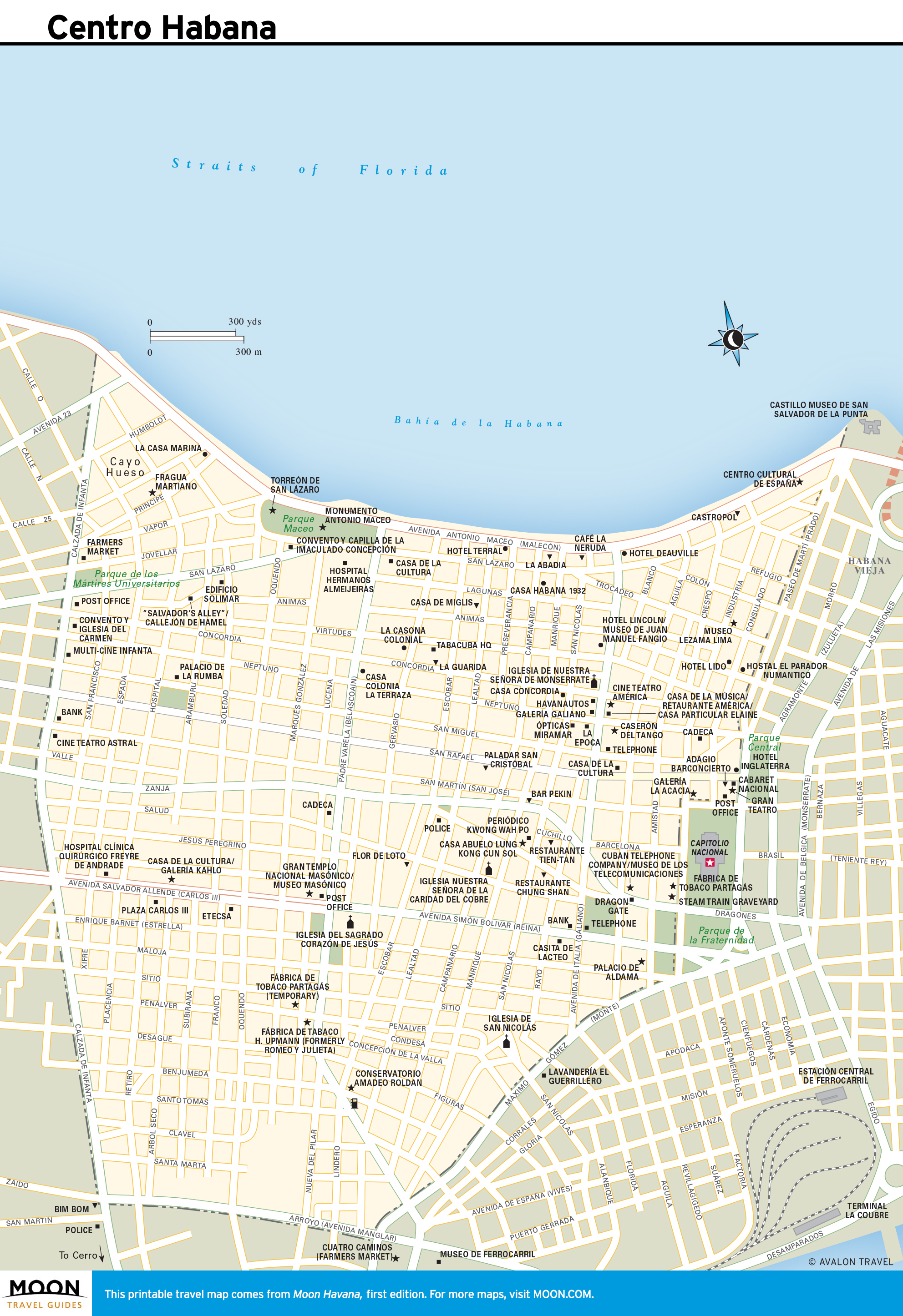
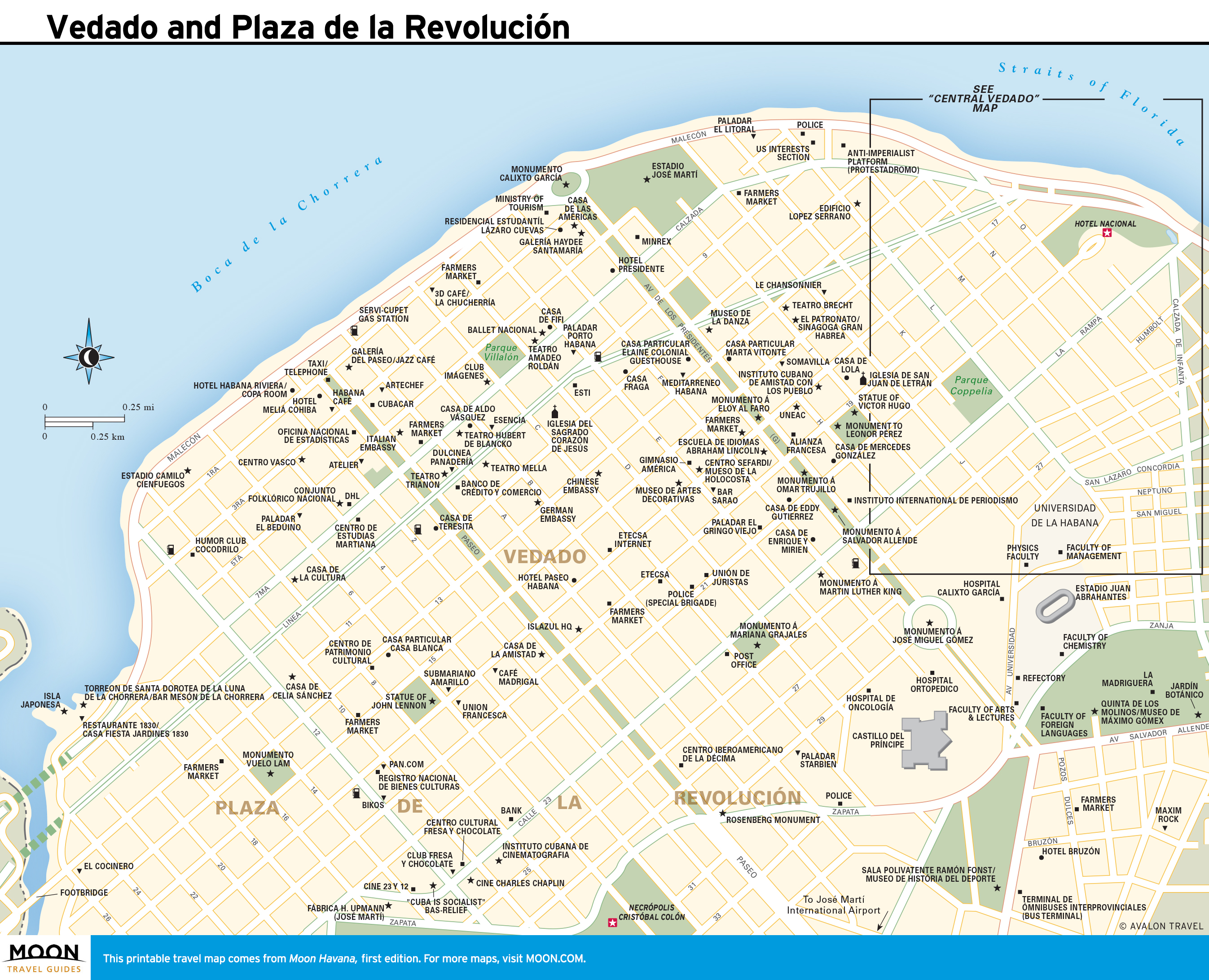
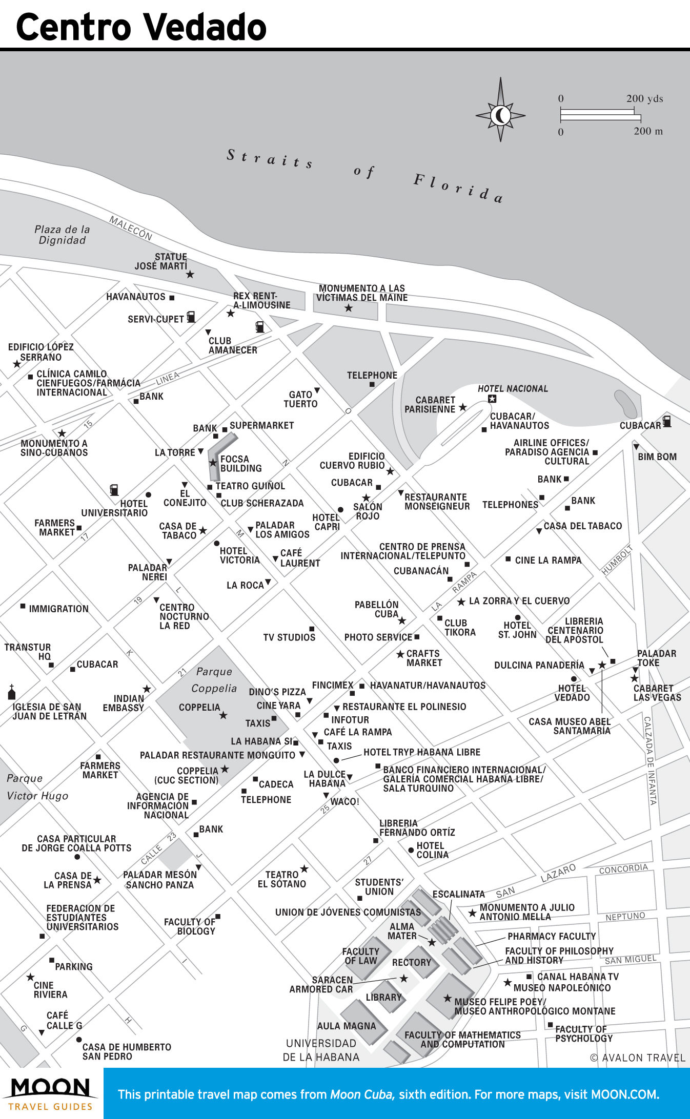
Travel Maps of Havana
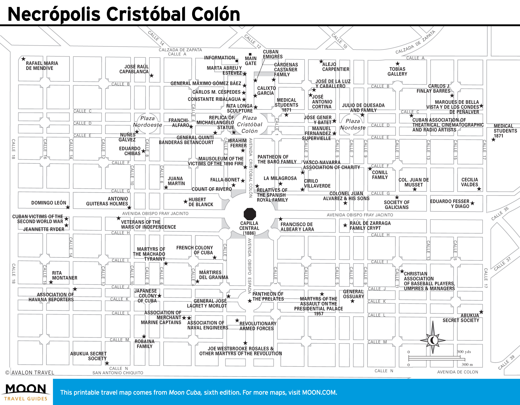
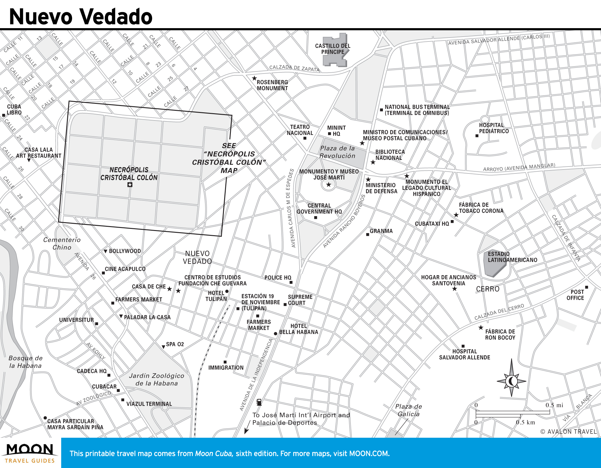
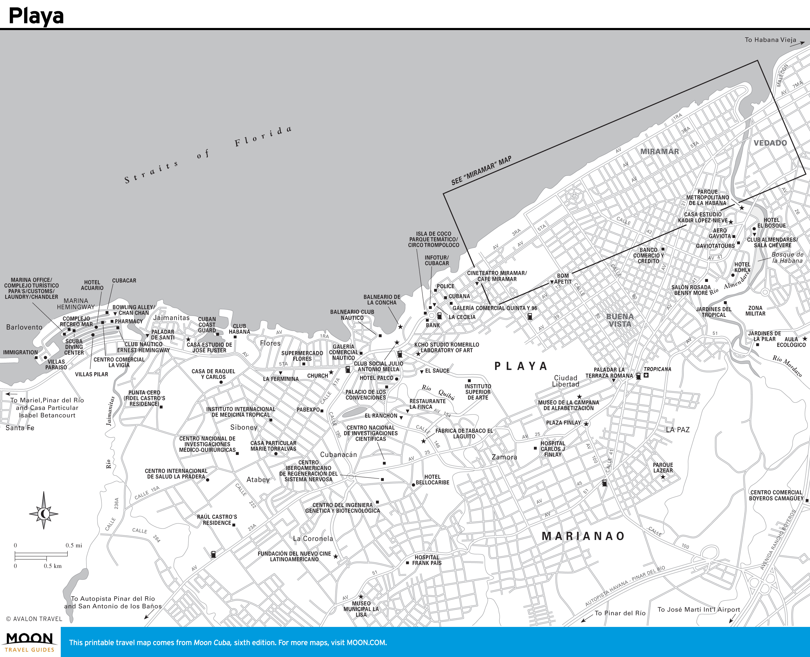
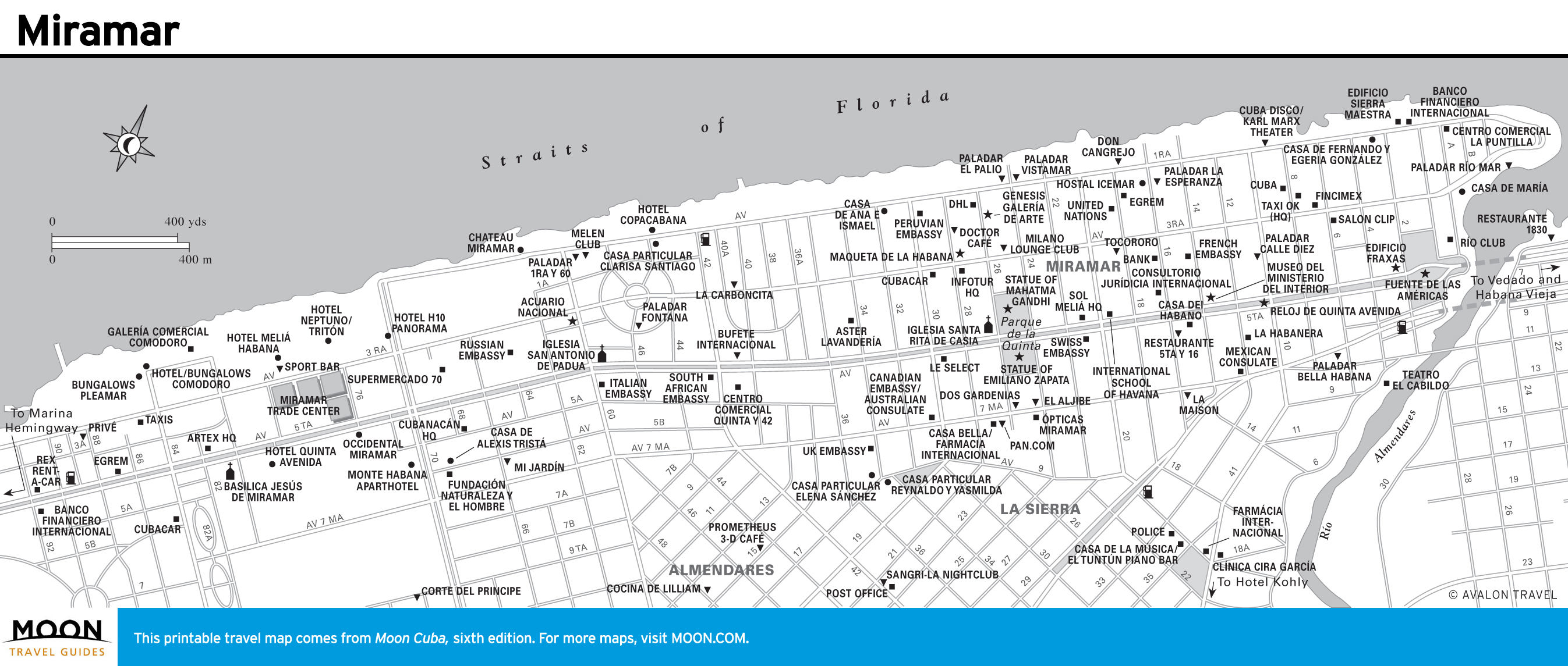
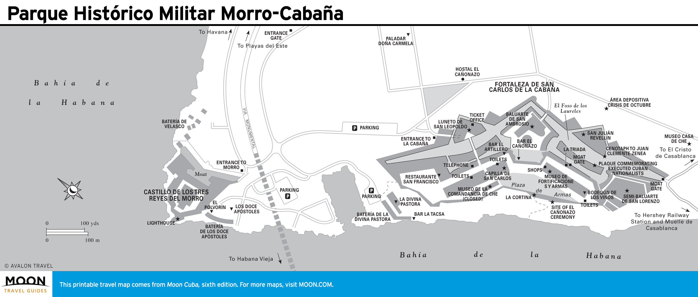
Habana Vieja (Old Havana) is the colonial core, full of plazas, cathedrals, museums, and bars. Parque Histórico Militar Morro-Cabaña preserves the largest castle in the Americas. The Vedado district teems with beaux-arts, art nouveau, and art deco mansions; a magnificent cemetery; and the one-of-a-kind Plaza de la Revolución. There are even gorgeous beaches nearby.

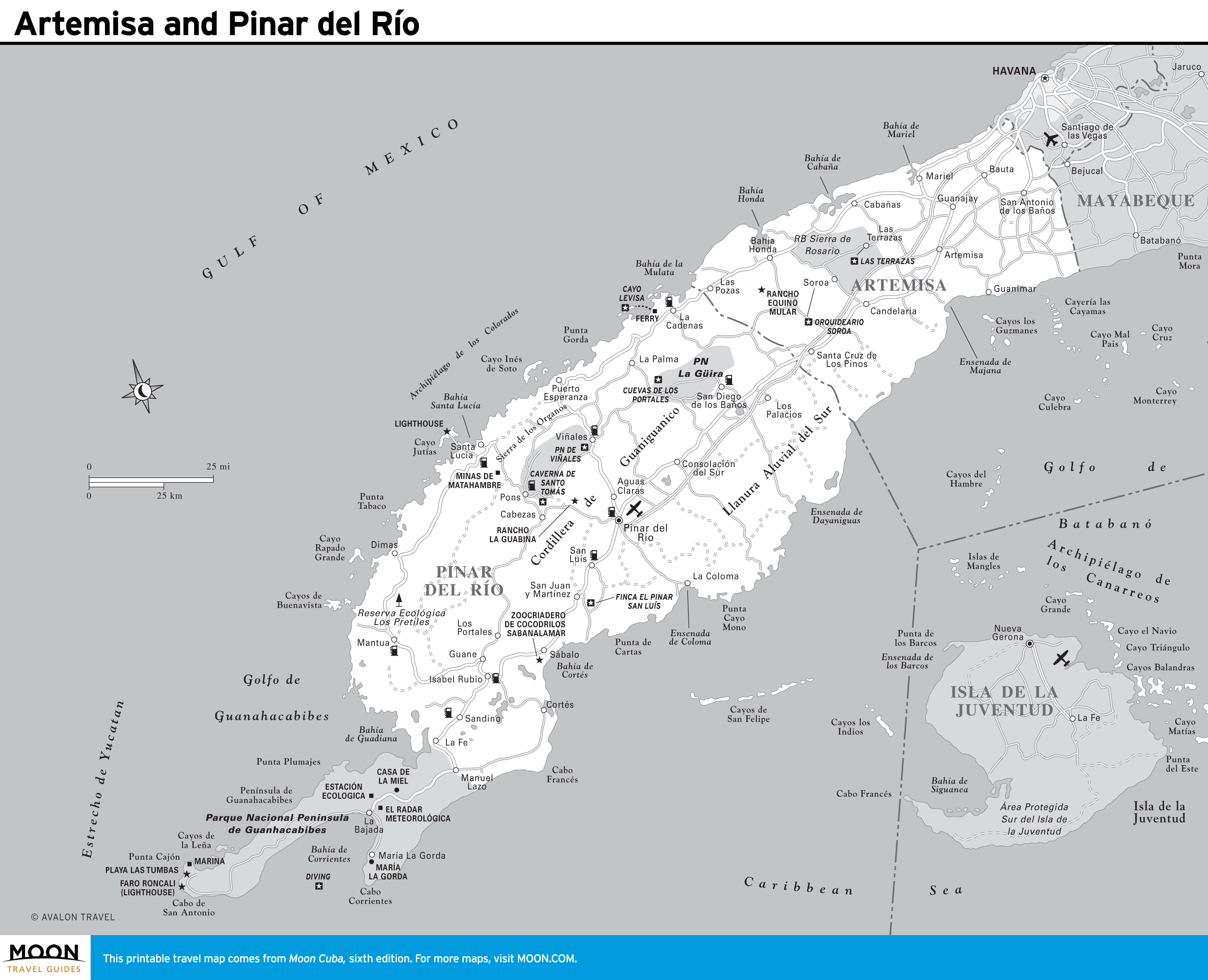
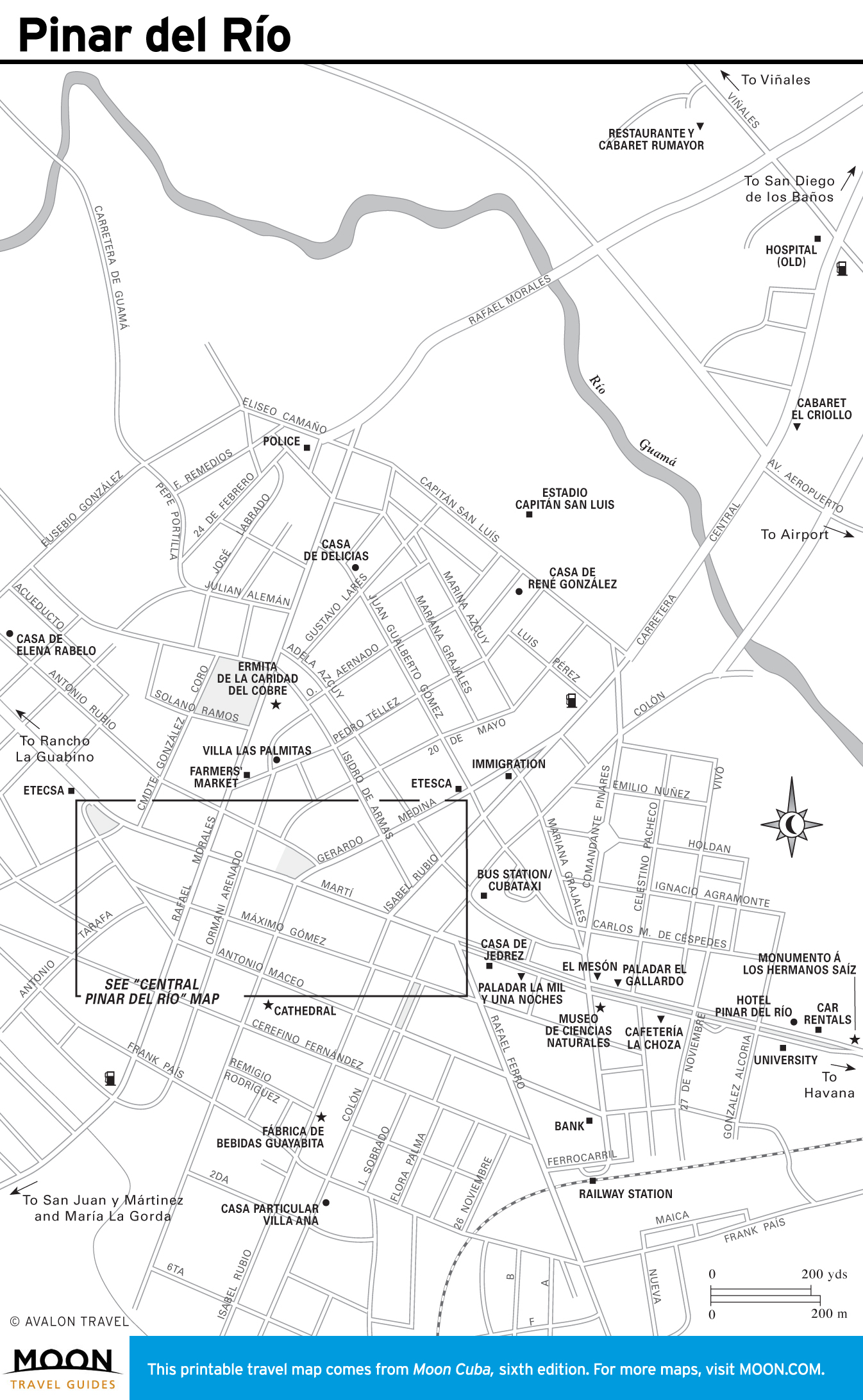
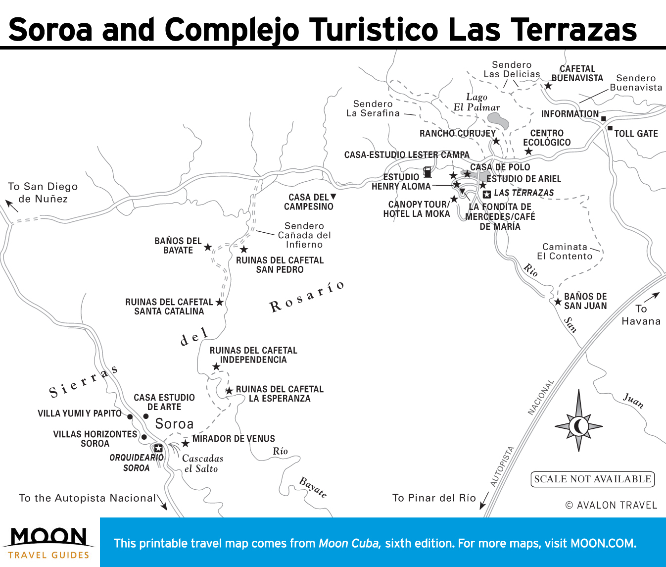
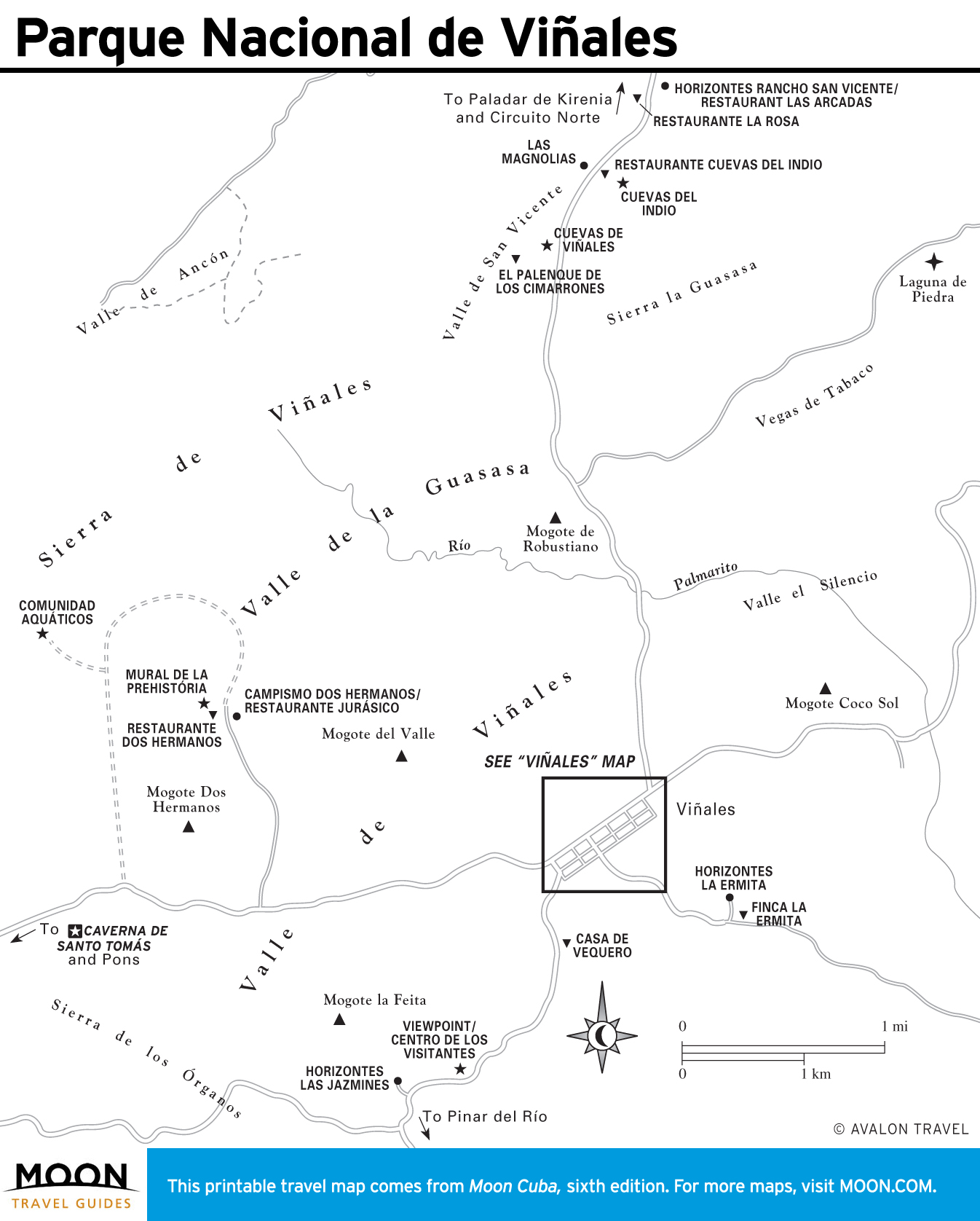
Artemisa and Pinar del Río
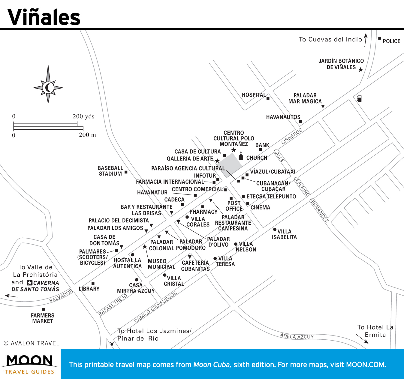
These valleys are where the world’s finest tobacco is grown. Viñales has magnificent scenery, plus preeminent climbing and caving. Scuba divers rave about Cayo Levisa and María la Gorda.

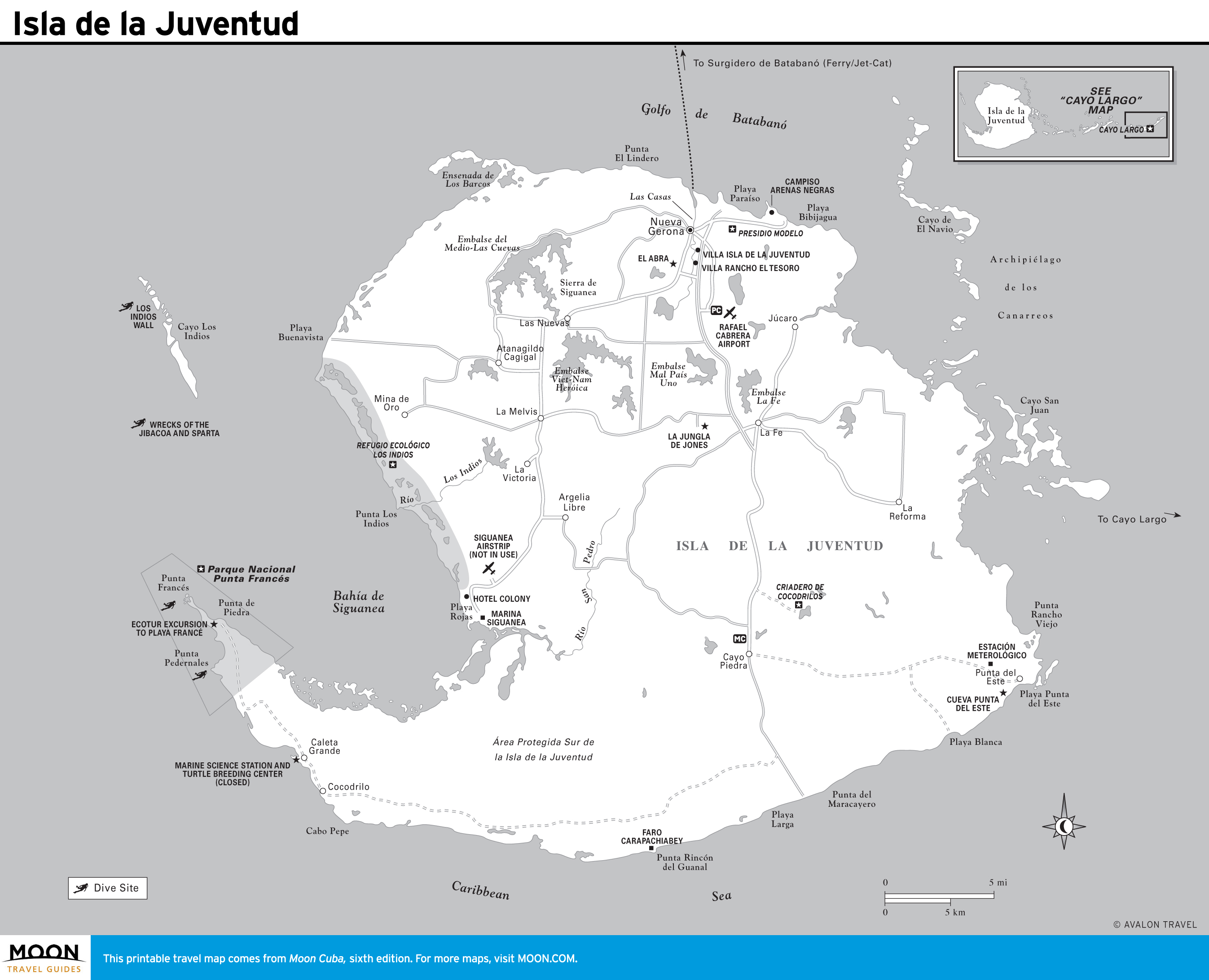
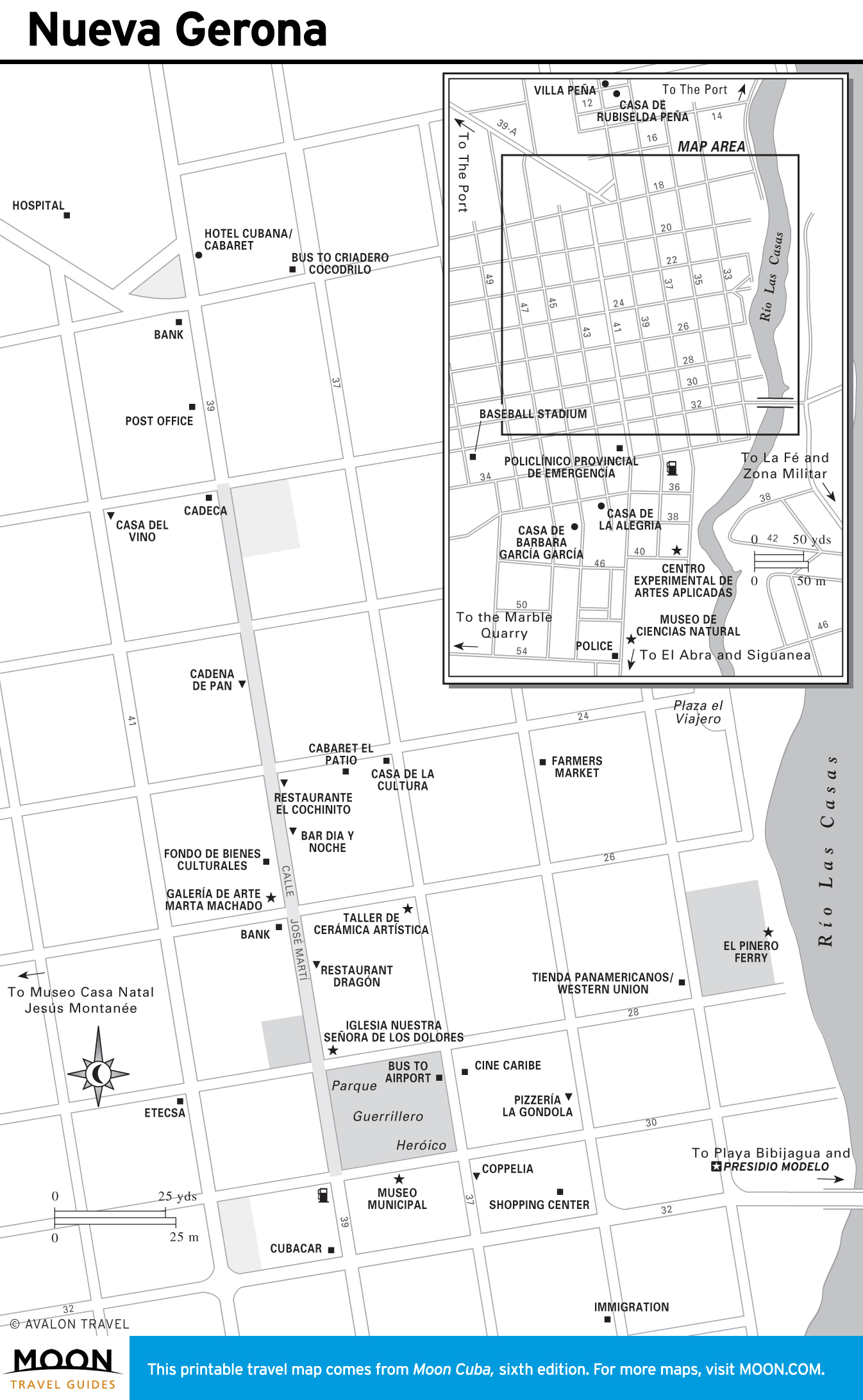
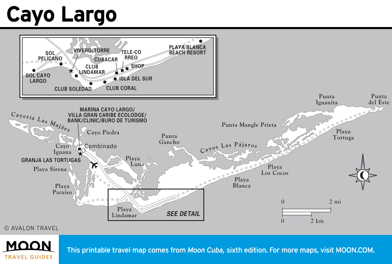
Isla de la Juventud
Slung beneath Cuba, this archipelago draws few visitors. The exception is Cayo Largo, a coral jewel with stupendous beaches.
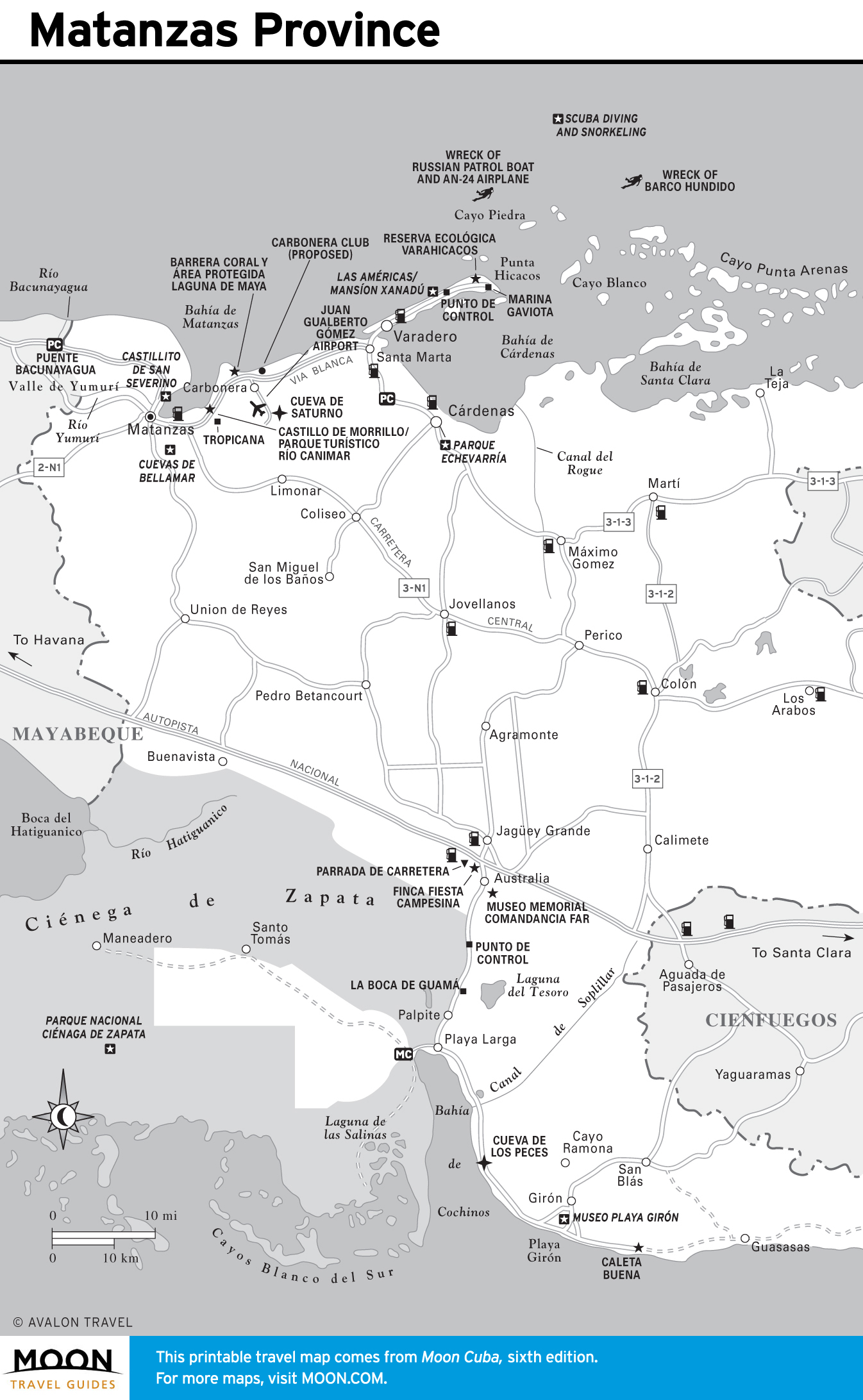
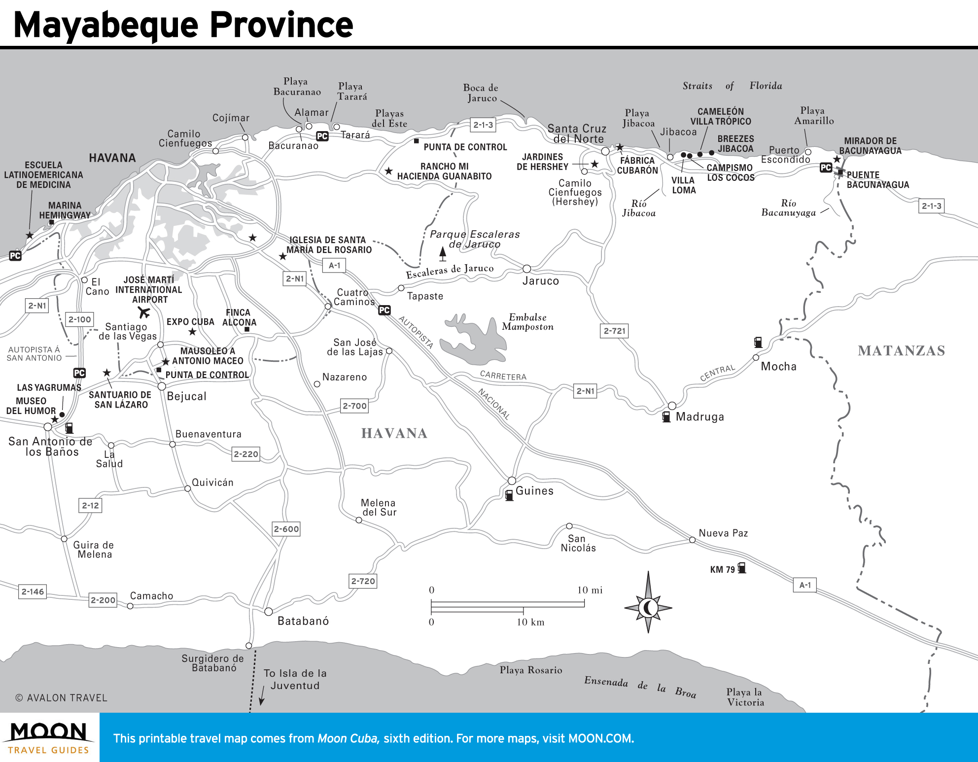
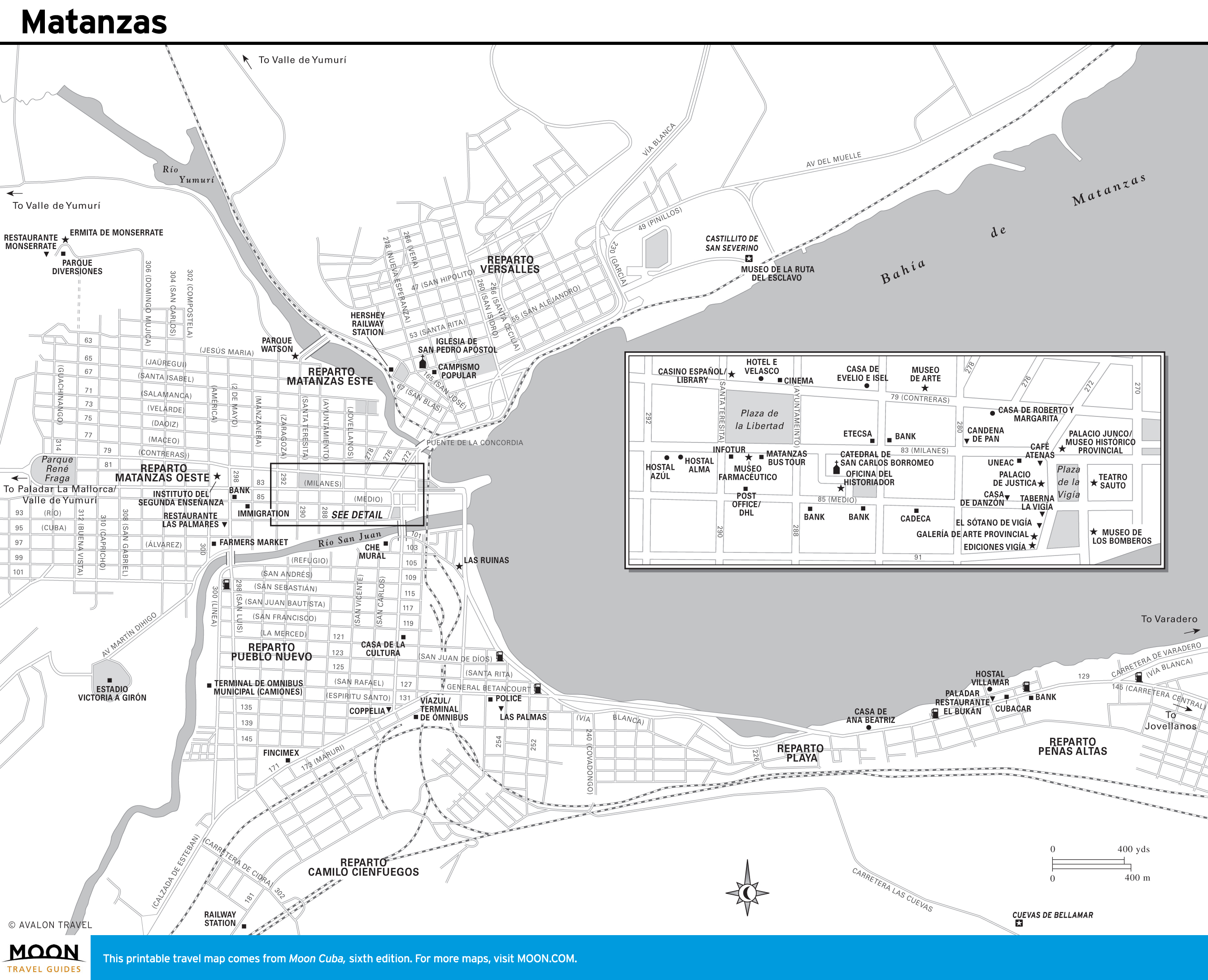
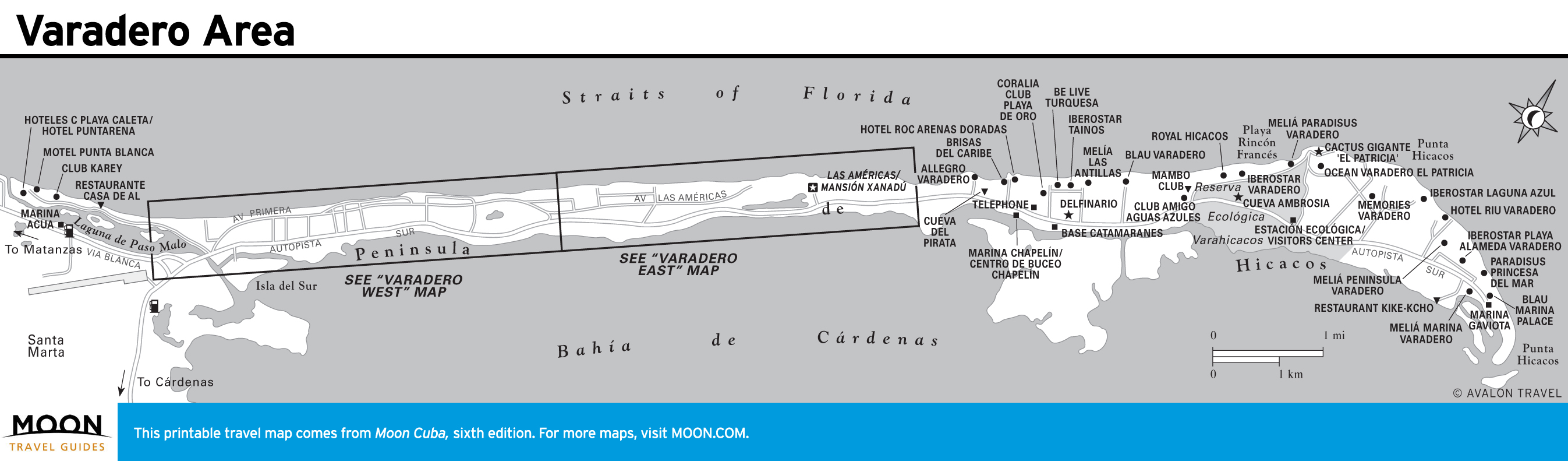
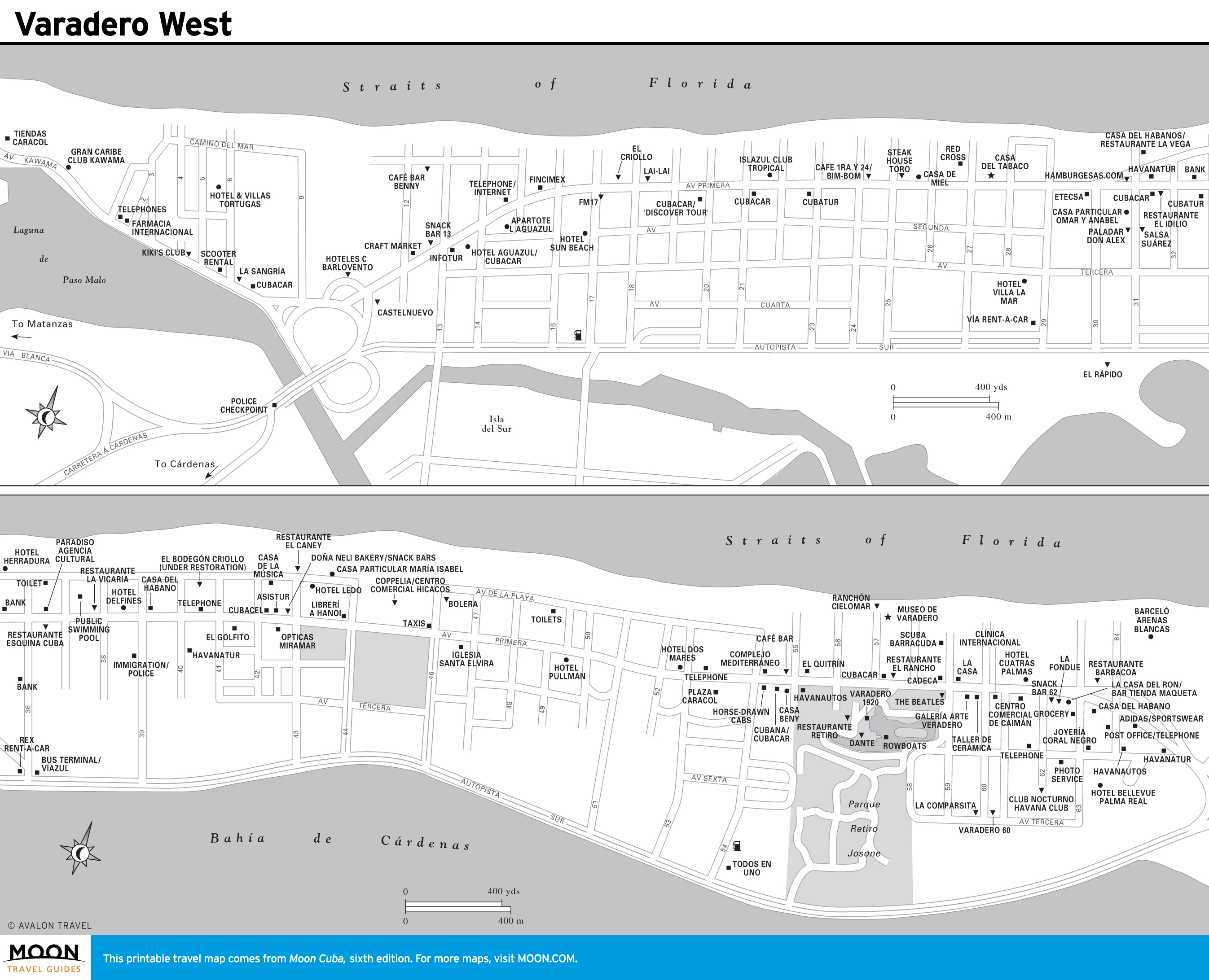
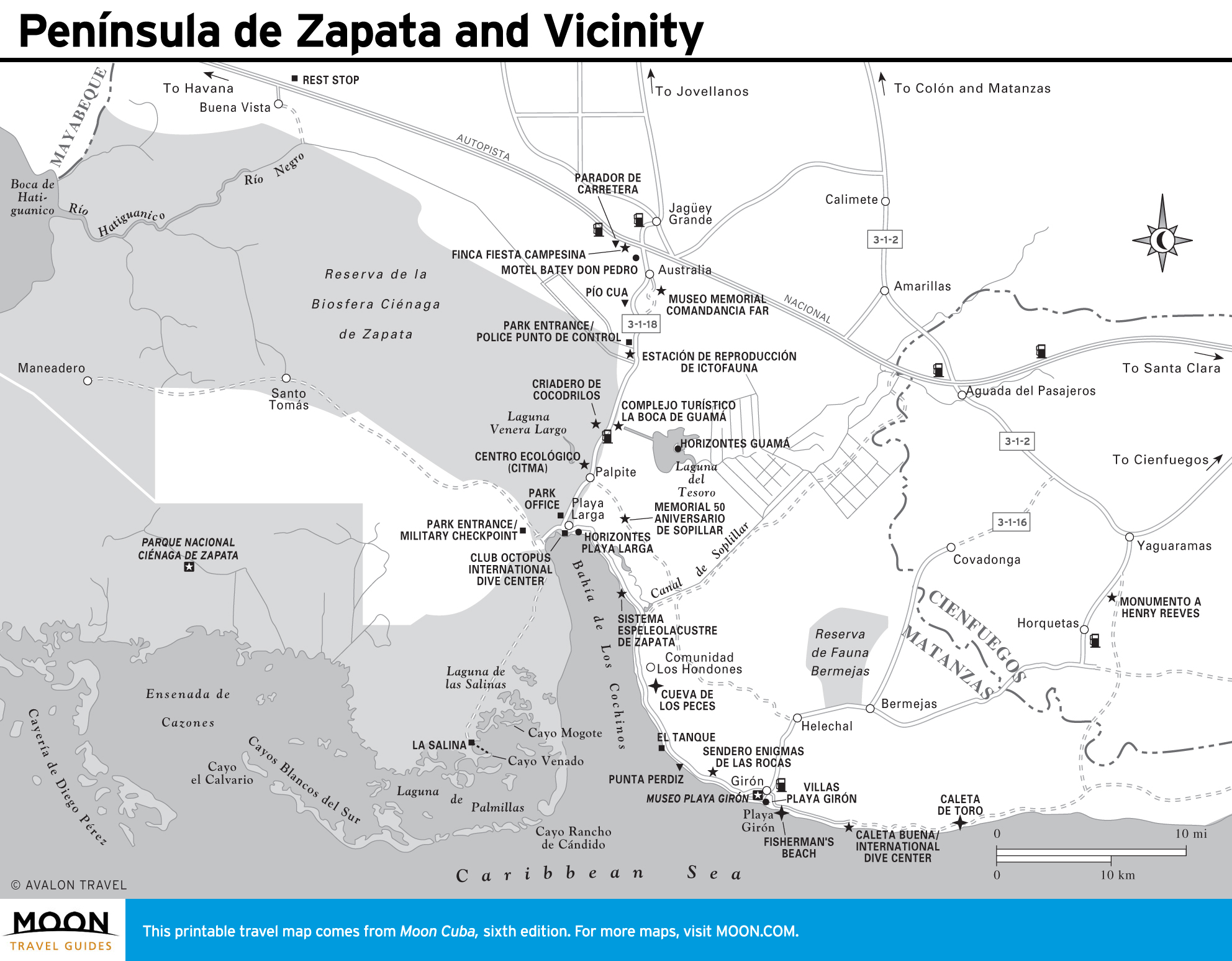
Mayabeque and Matanzas
Cuba’s premier beach resort, Varadero, has the lion’s share of hotels, plus Cuba’s only 18-hole golf course and exceptional diving. Colonial-era Matanzas is a center for Afro-Cuban music and dance. The Caribbean’s largest swamp—the Ciénaga de Zapata—offers fantastic birding and fishing.
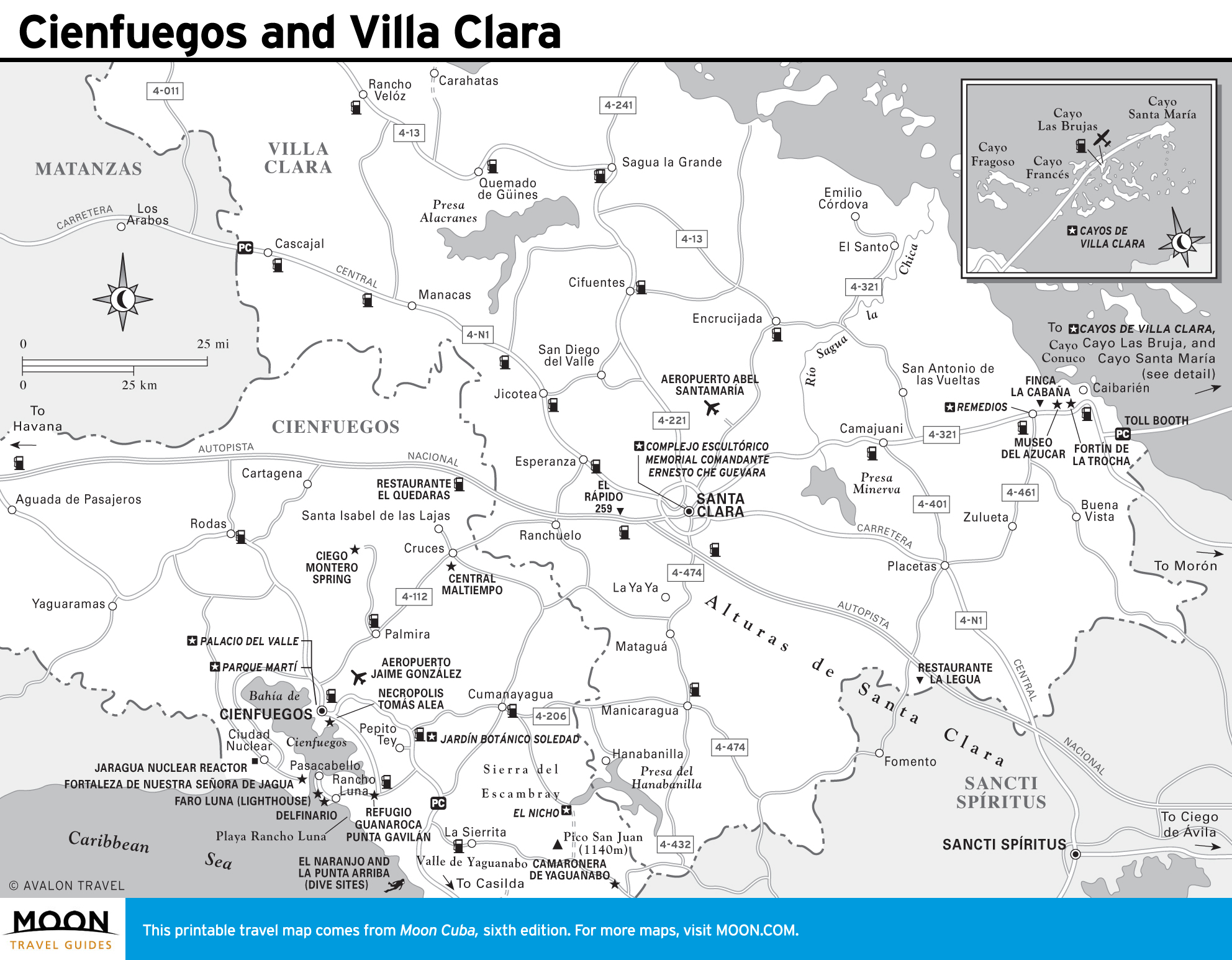
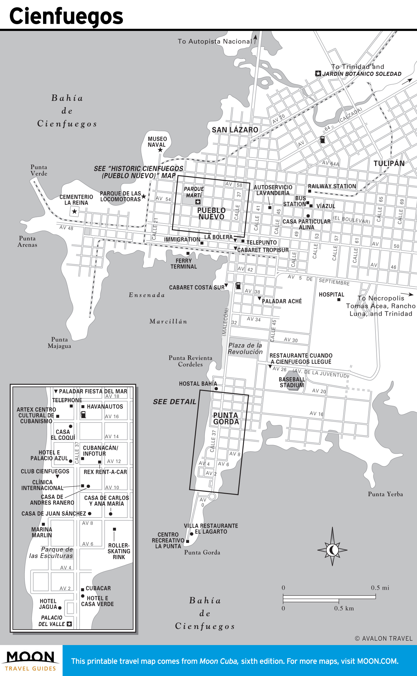
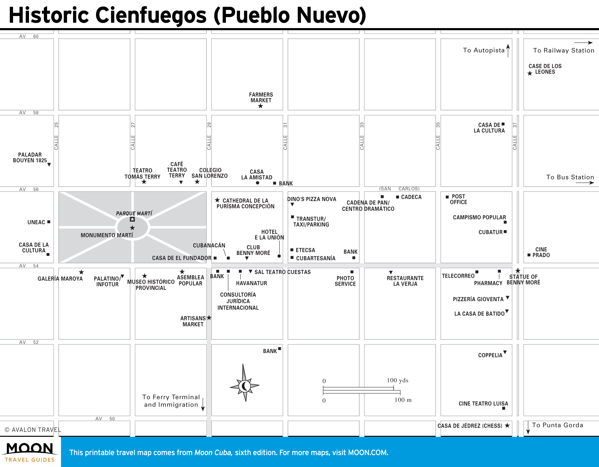
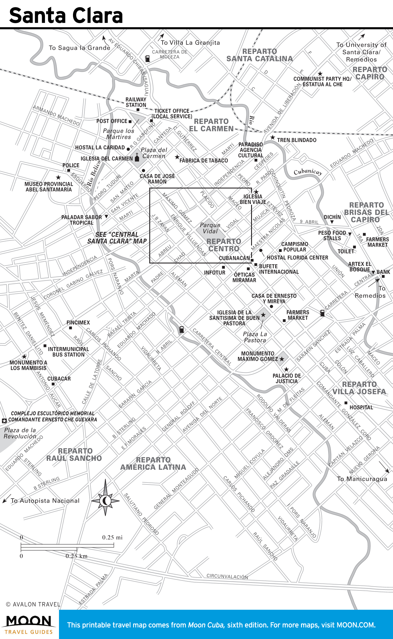
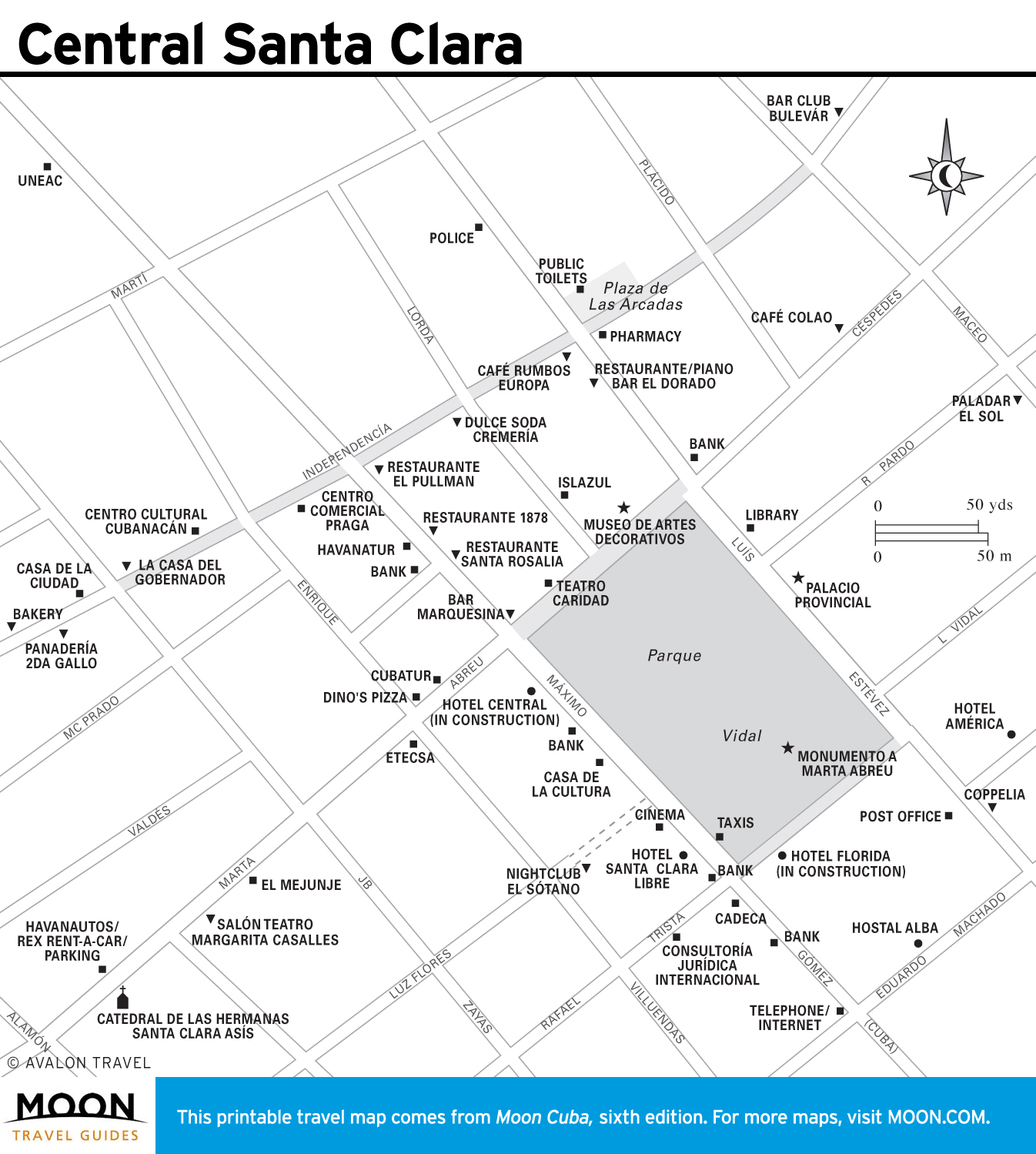
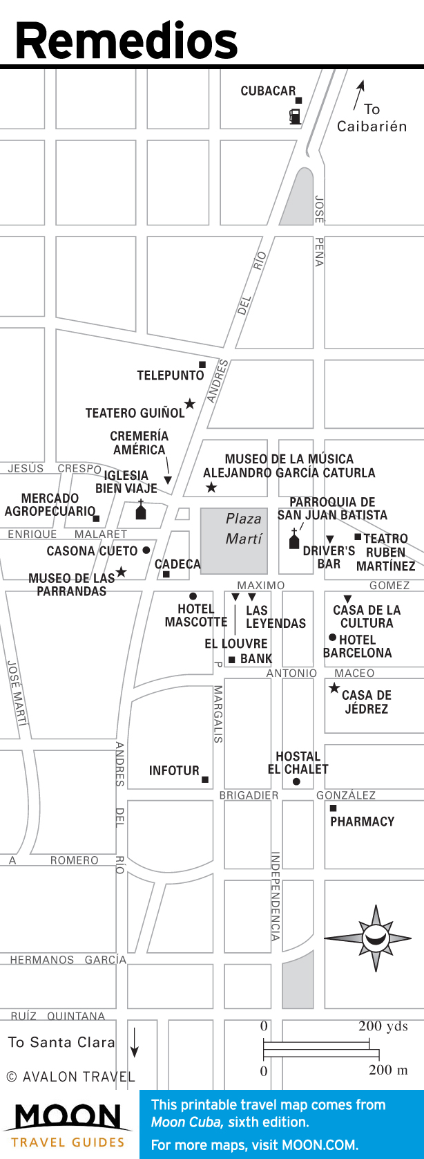
Cienfuegos and Villa Clara
Bird-watchers and hikers are enamored of the Sierra Escambray, where forest trails lead to waterfalls. Santa Clara draws visitors to the mausoleum and museum of Che Guevara.
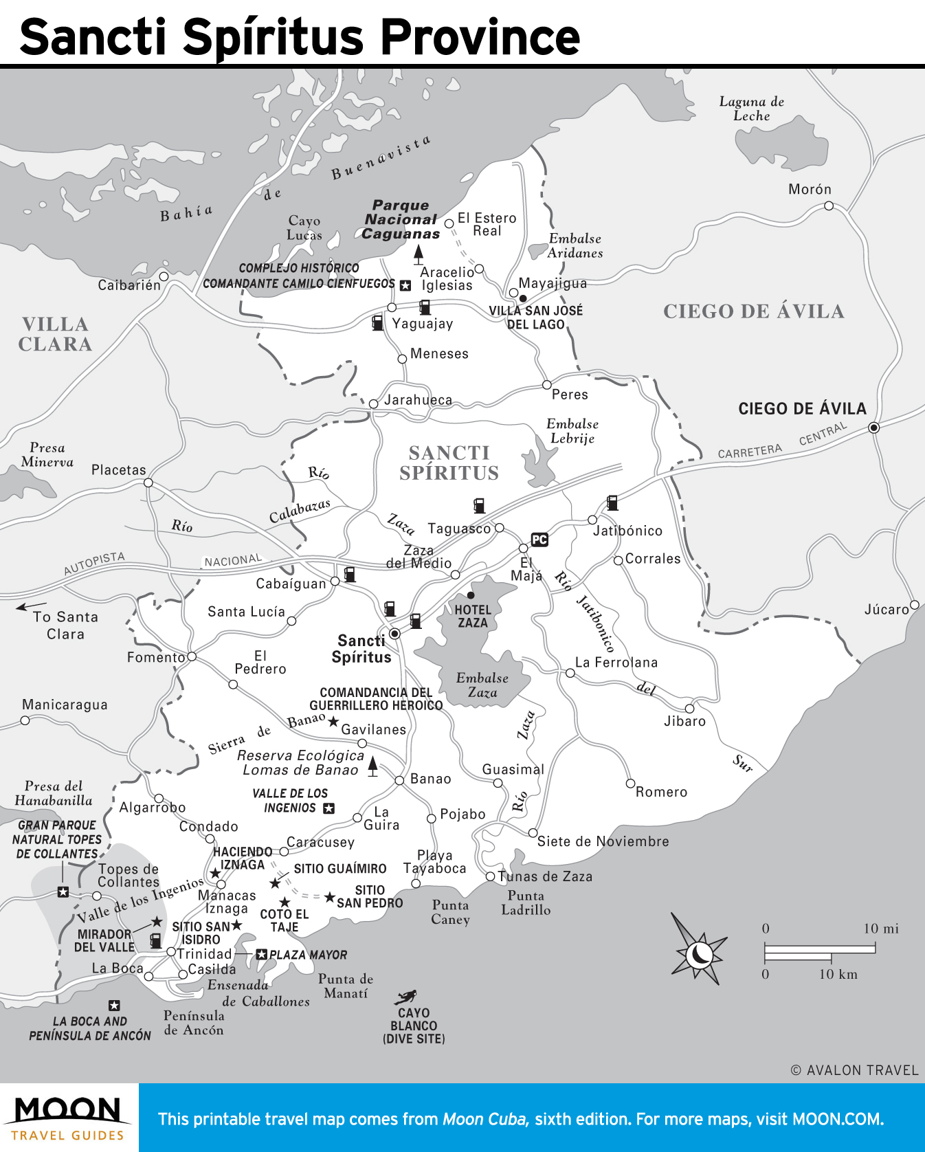
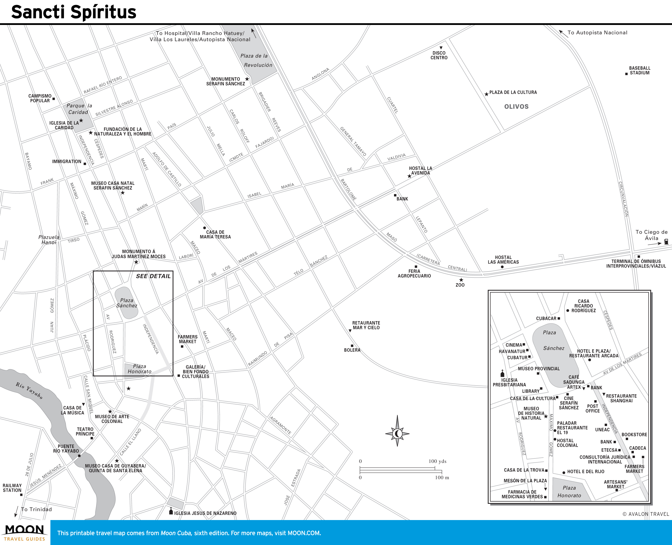
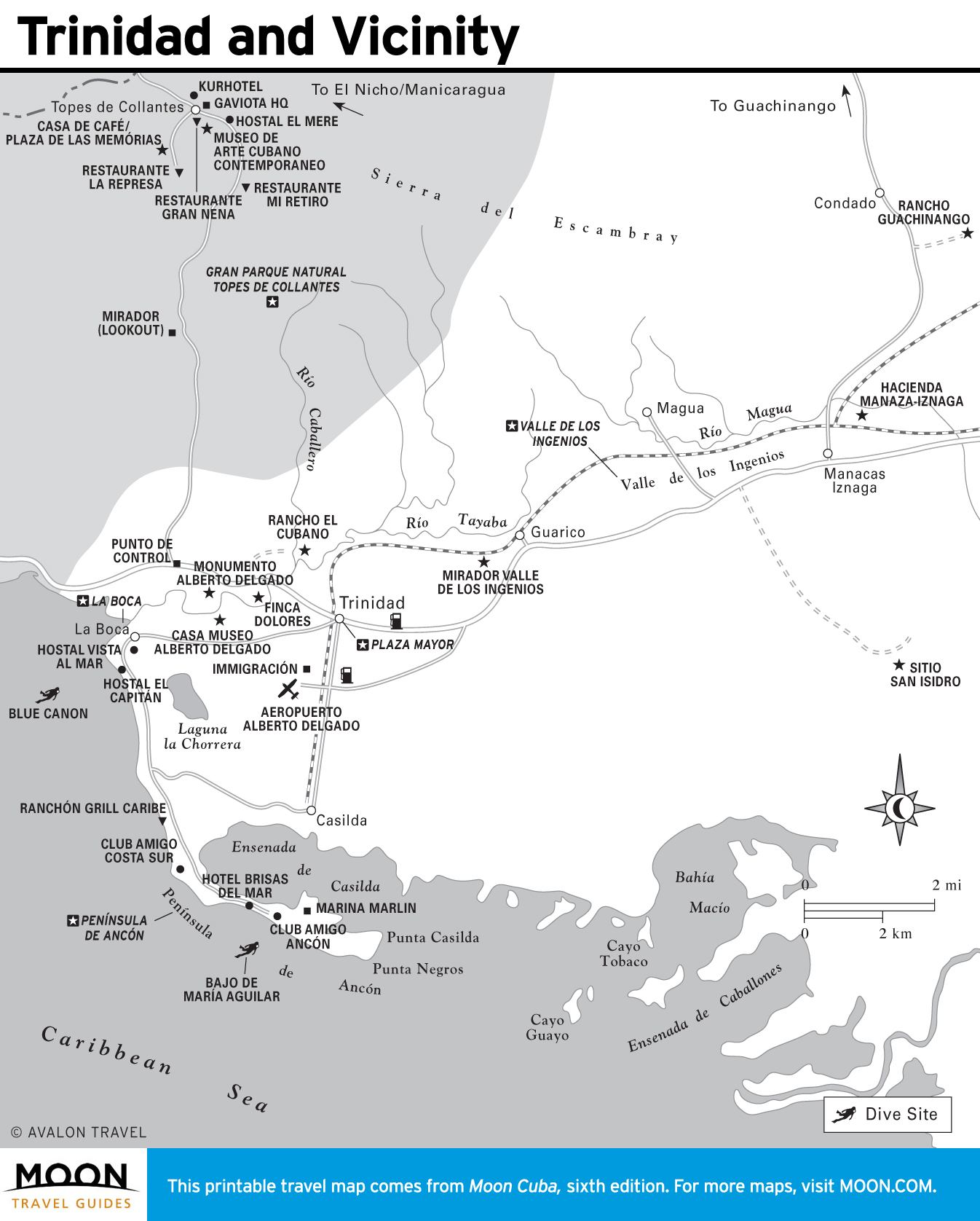
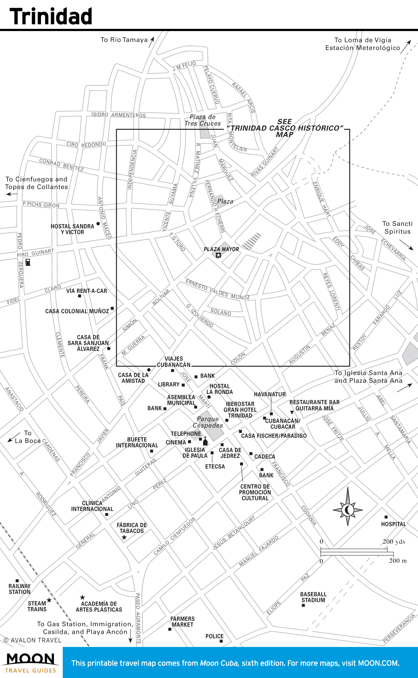
Sancti Spíritus
Sancti Spíritus is a charming hill town that is a crown jewel of colonial architecture. It’s a great base for hiking at Gran Parque Natural Topes de Collantes, lazing at Playa Ancón, or riding a steam train into the Valle de los Ingenios.
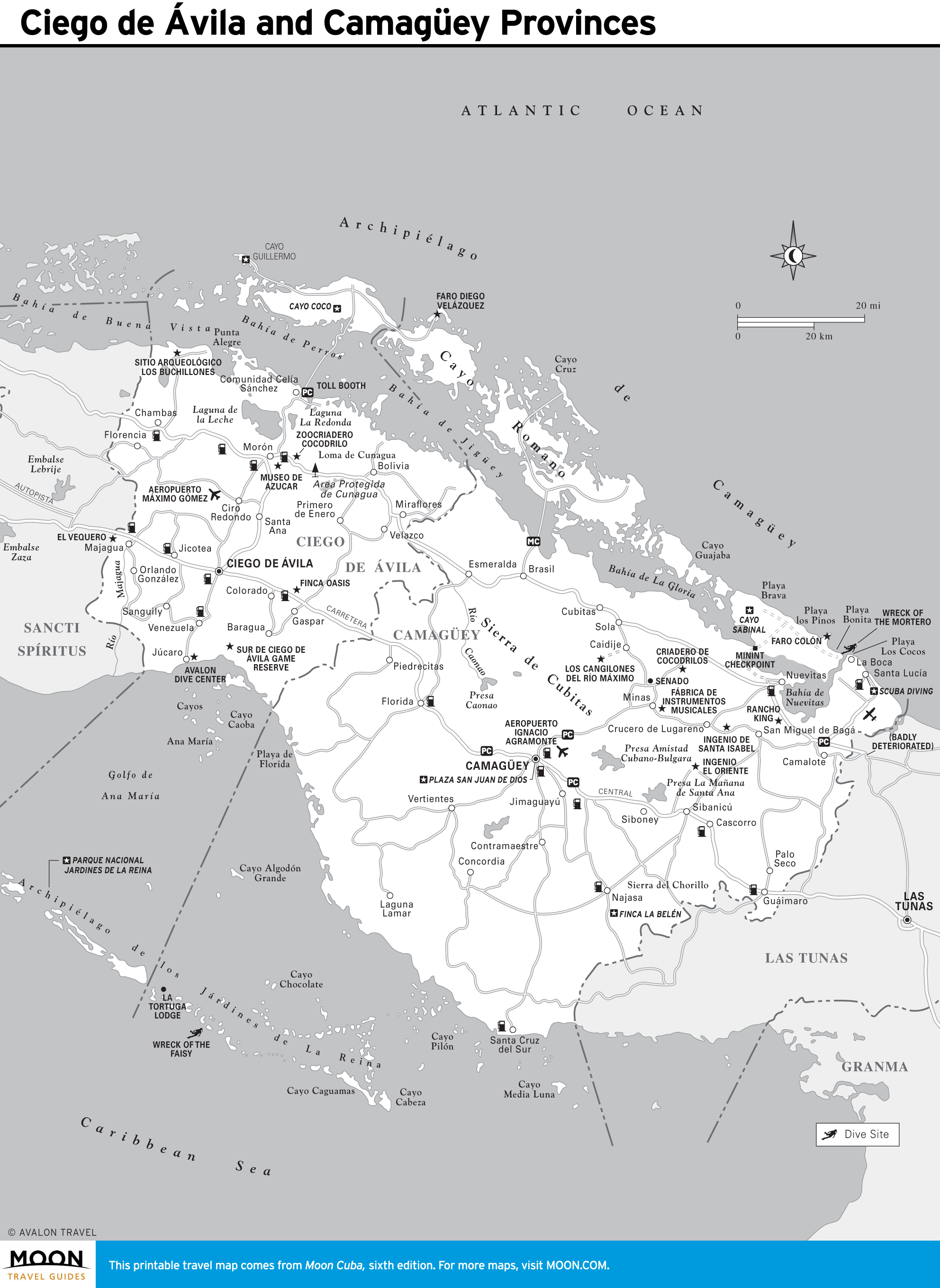
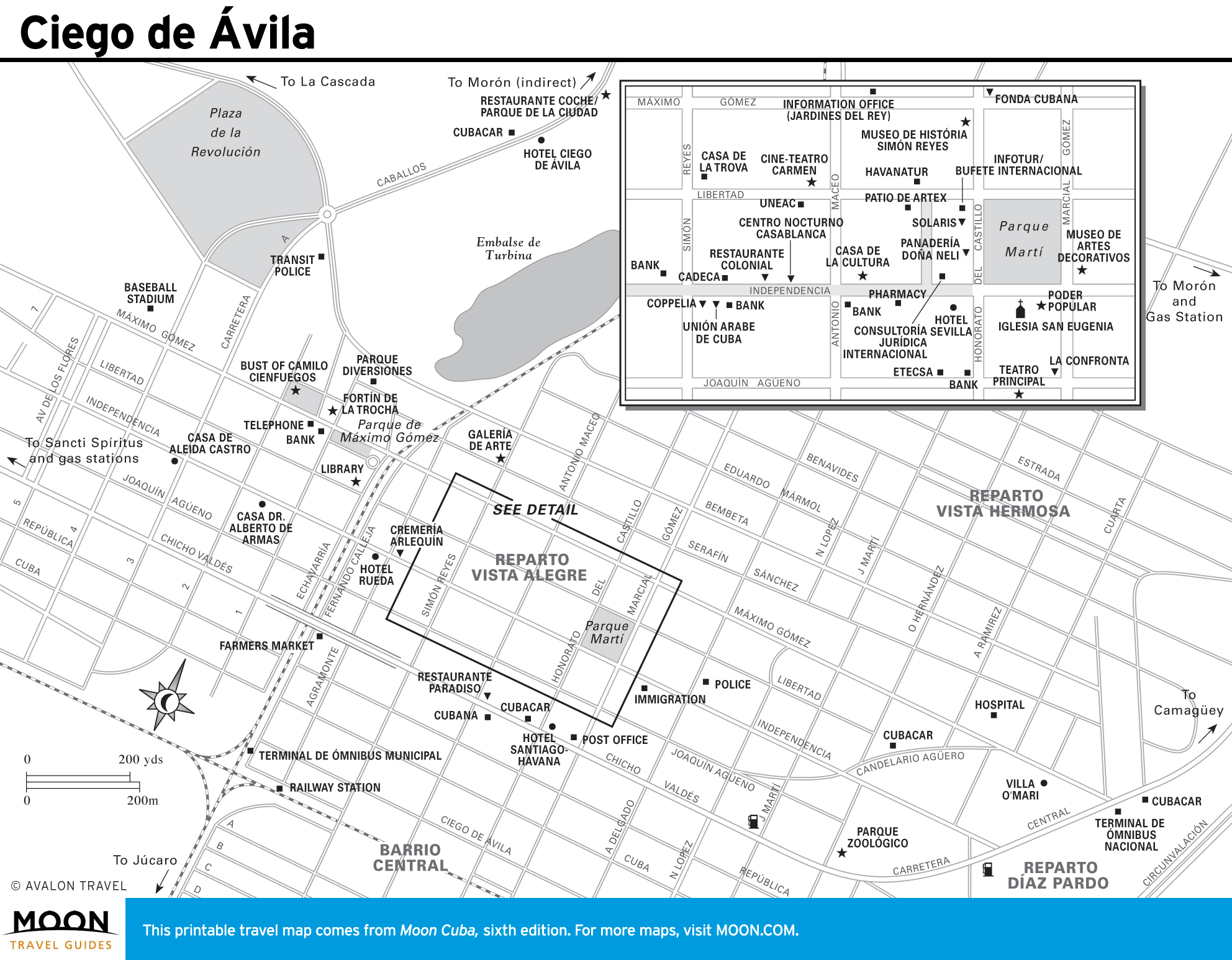
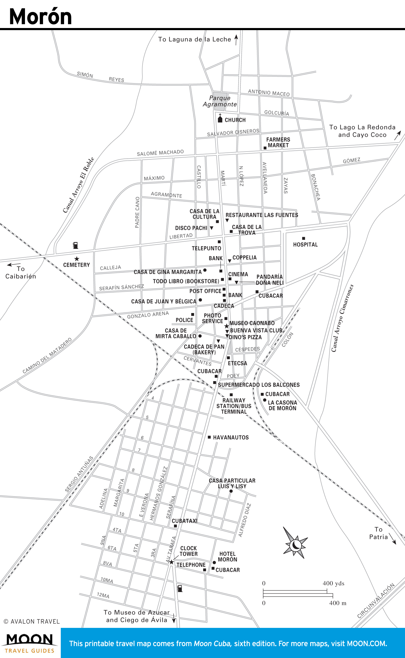
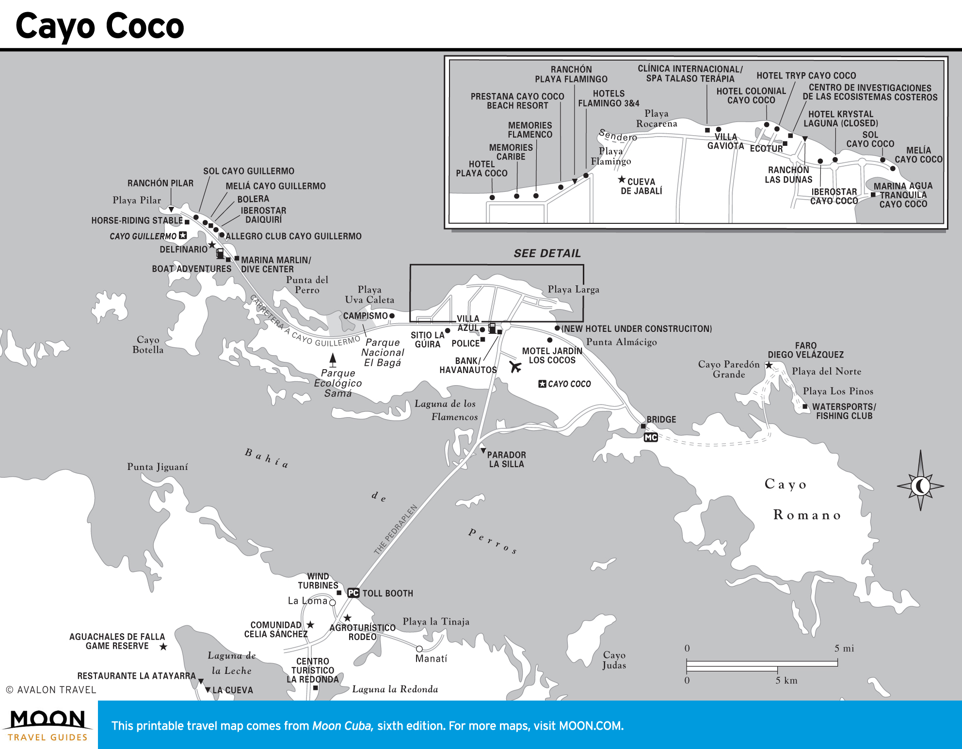
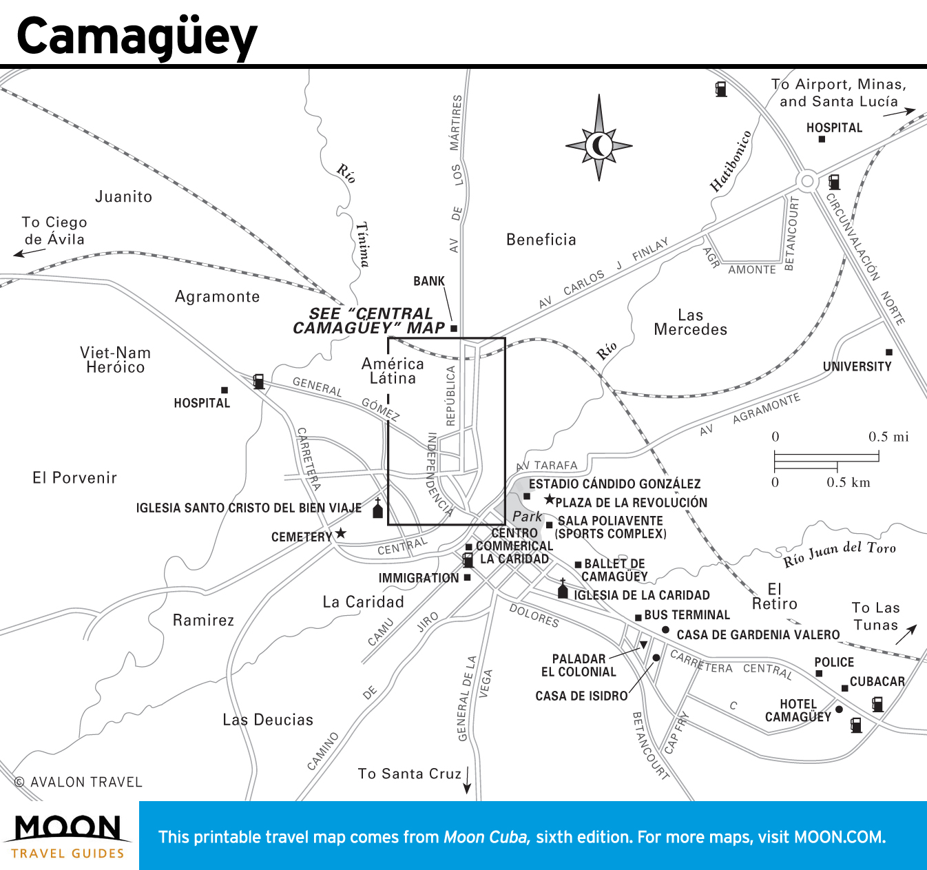
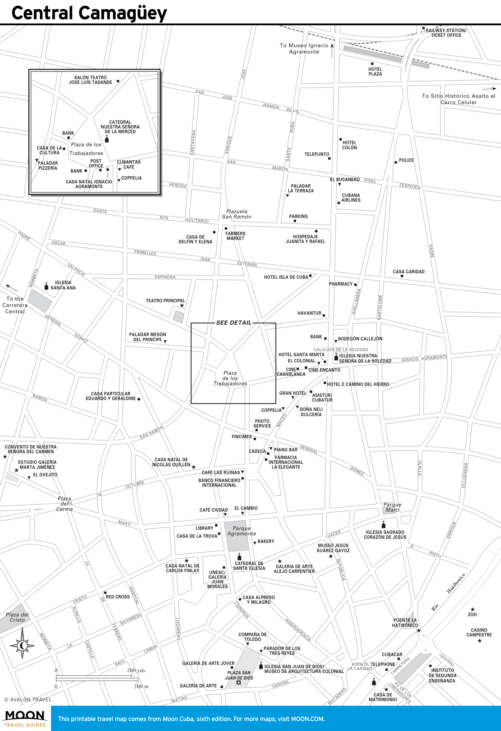
Ciego de Ávila and Camagüey
Tiny Ciego de Ávila Province is the setting for Cayo Coco, the most developed isle of the Jardines del Rey archipelago. Come here for magnificent beaches and to view flamingos. Playa Santa Lucía has some of Cuba’s best diving.
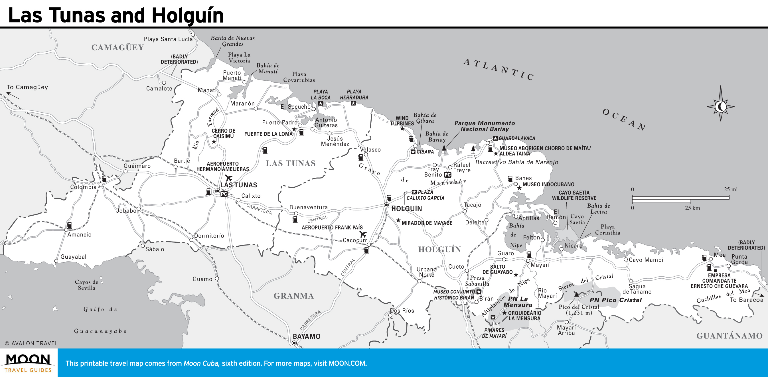
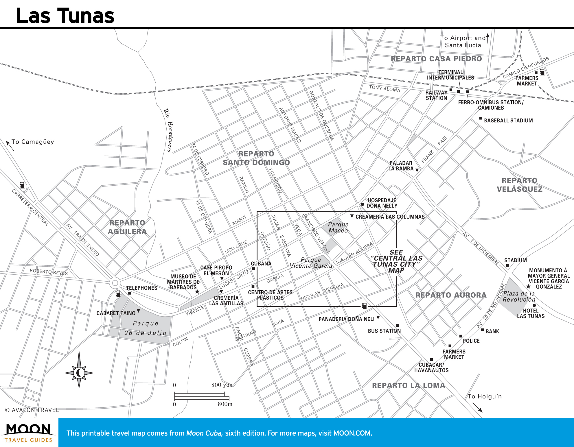
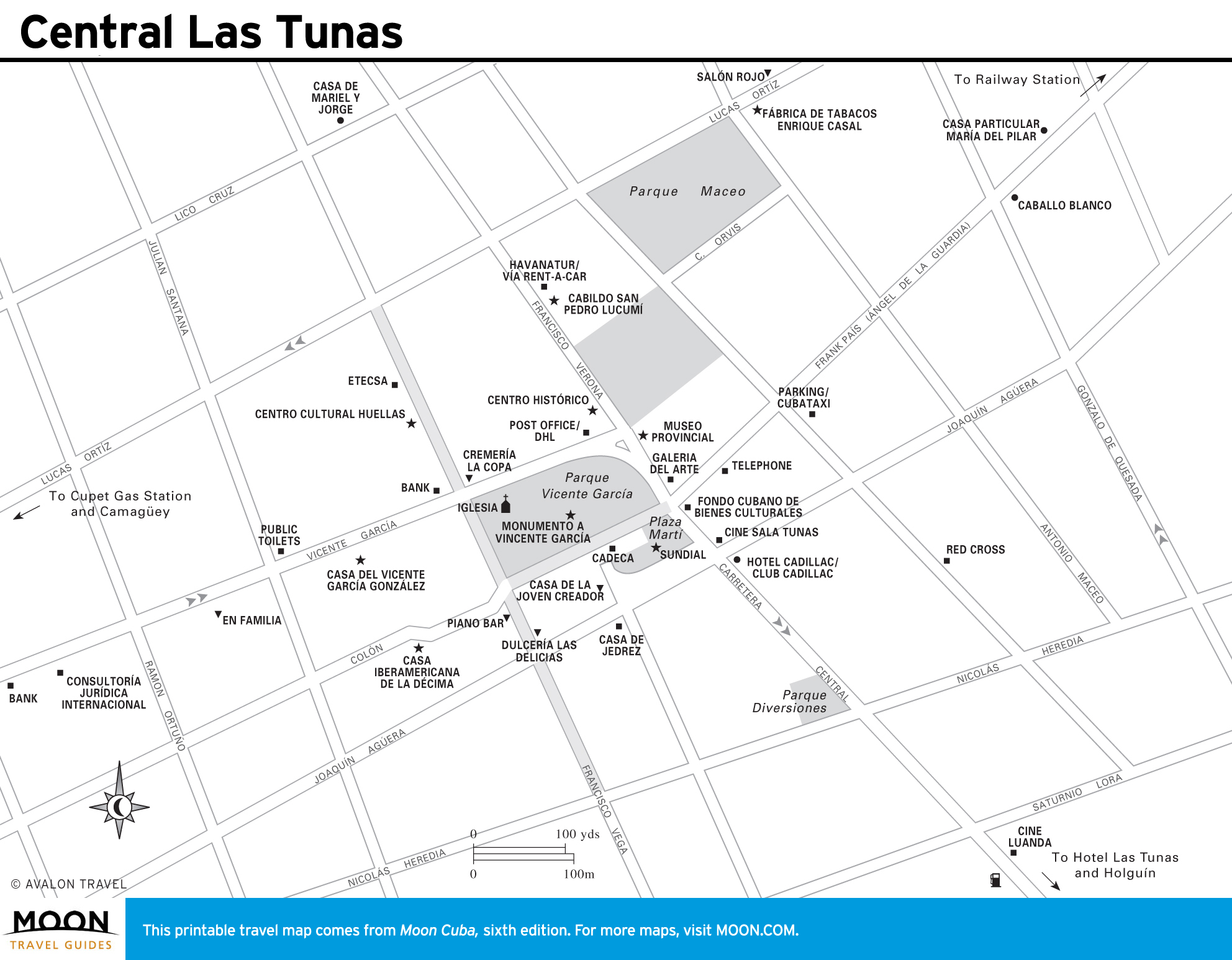
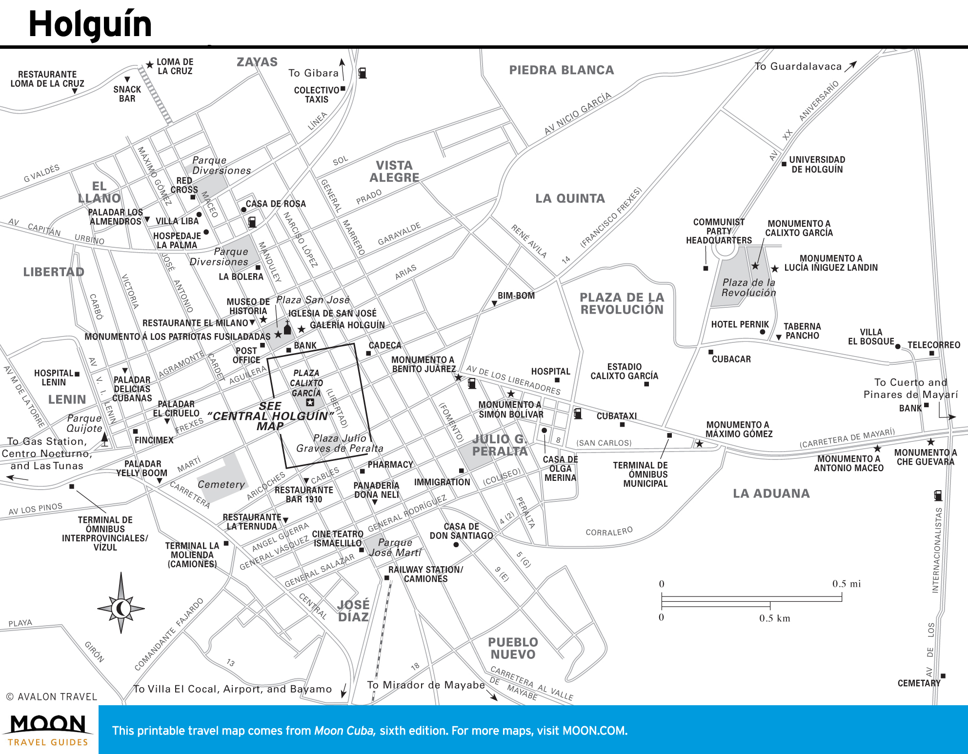
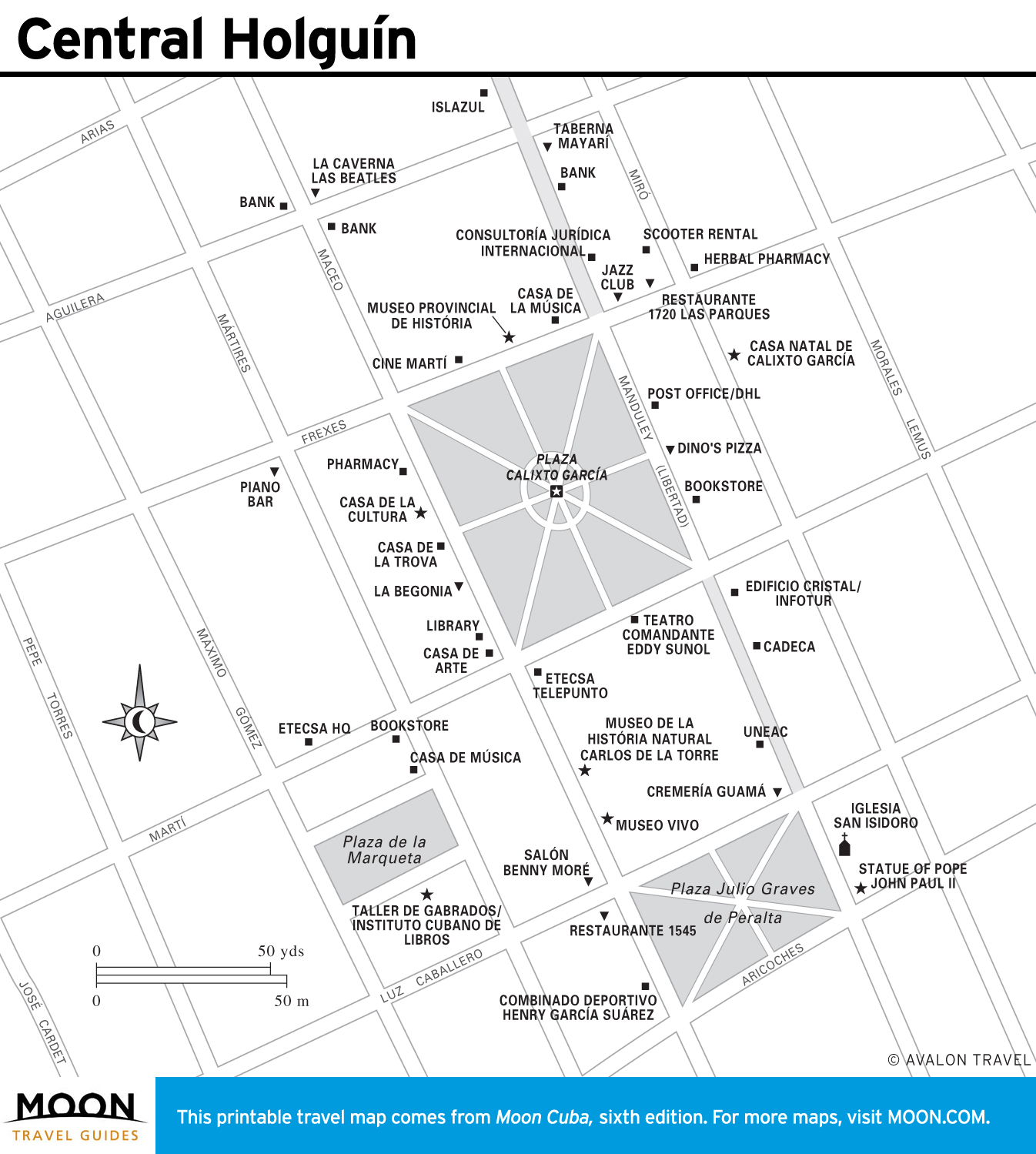
Las Tunas and Holguín
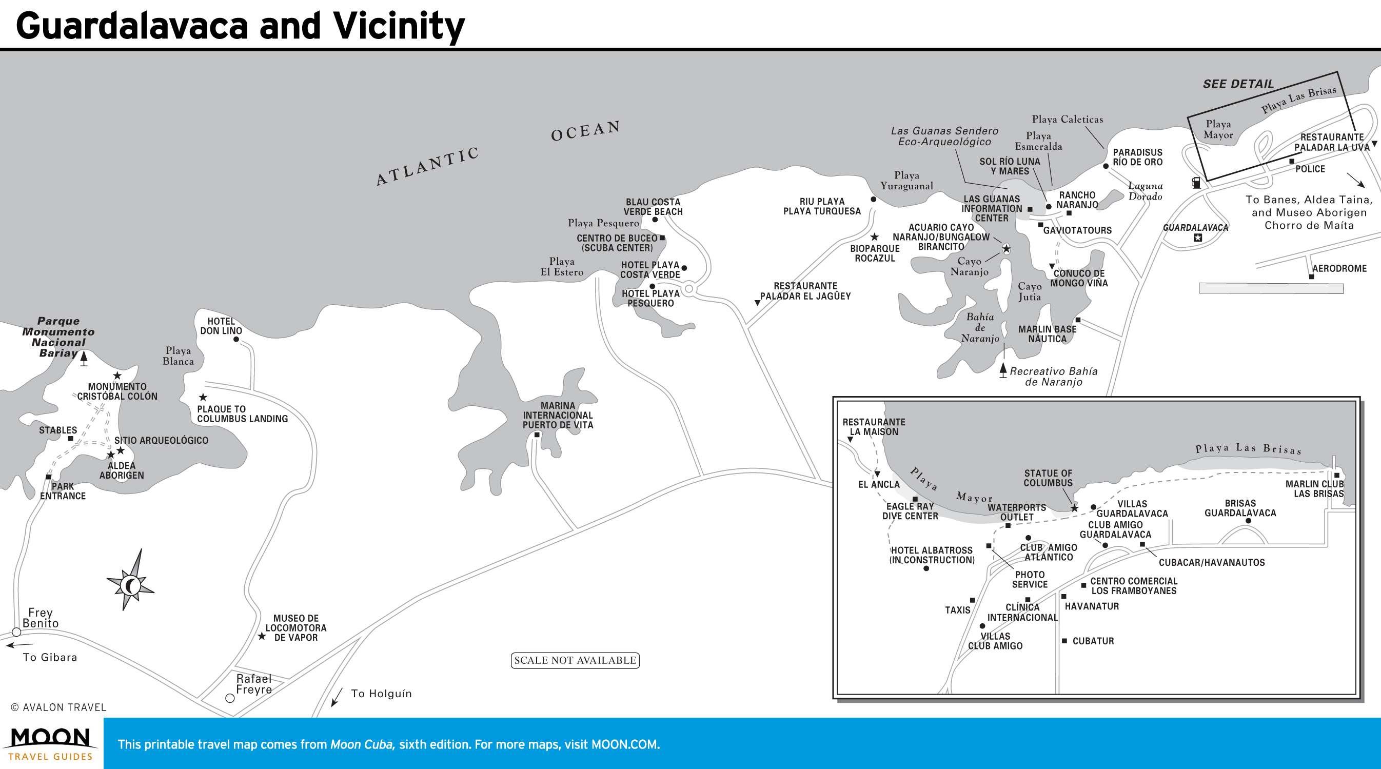
For travelers, Las Tunas Province is a place to pass through en route to history-packed Holguín, with its intriguing plazas and lively artistic culture. Nearby are the beaches of Guardalavaca, an archaeological site at Museo Aborigen Chorro de Maíta, the alpine setting of Pinares de Mayarí, and Fidel Castro’s birthplace at the Museo Conjunto Histórico Birán.
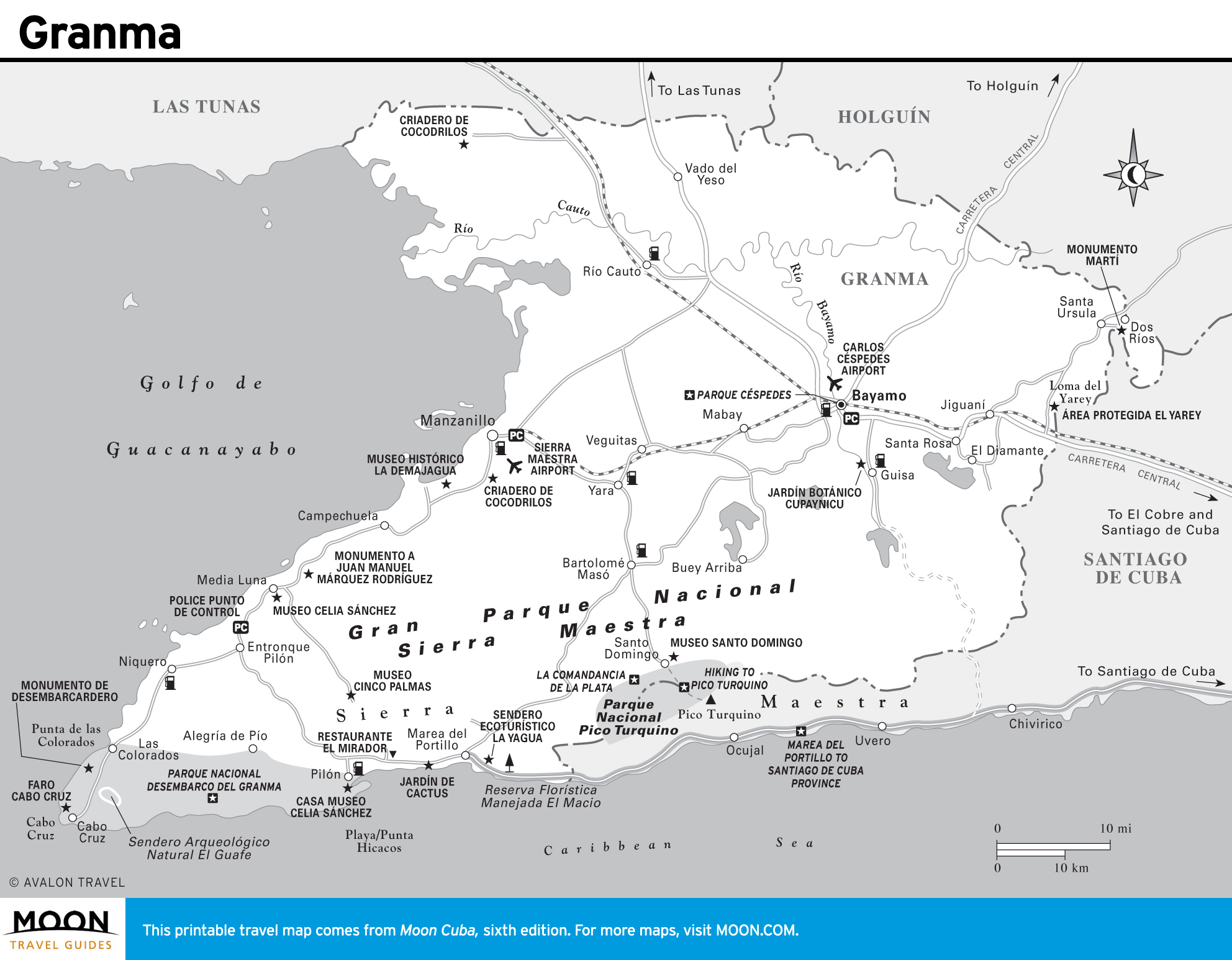
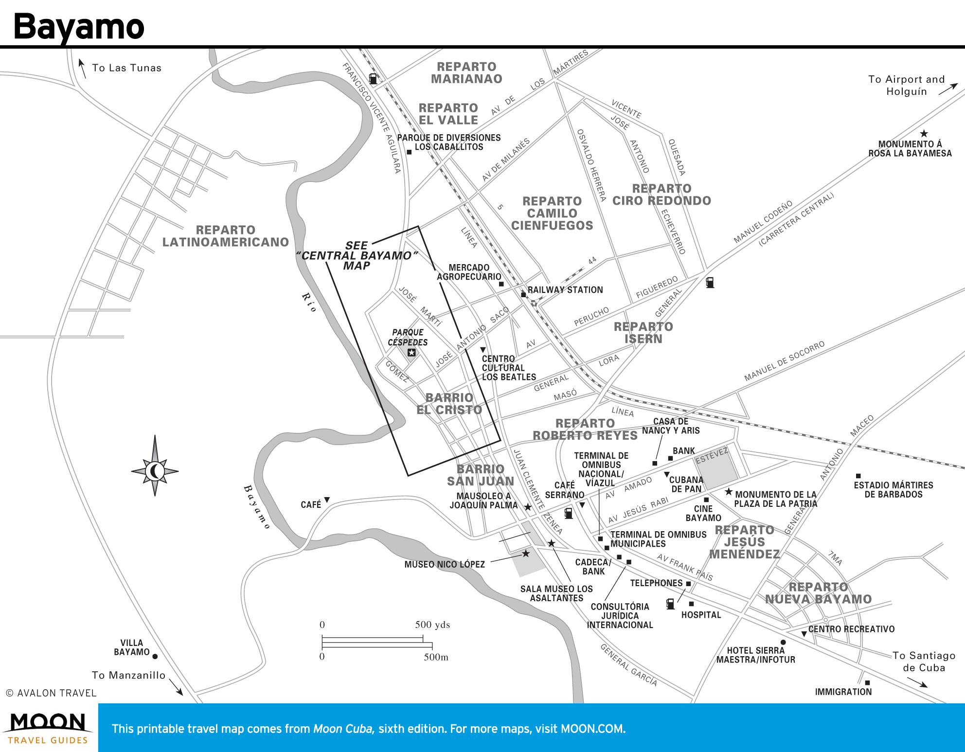
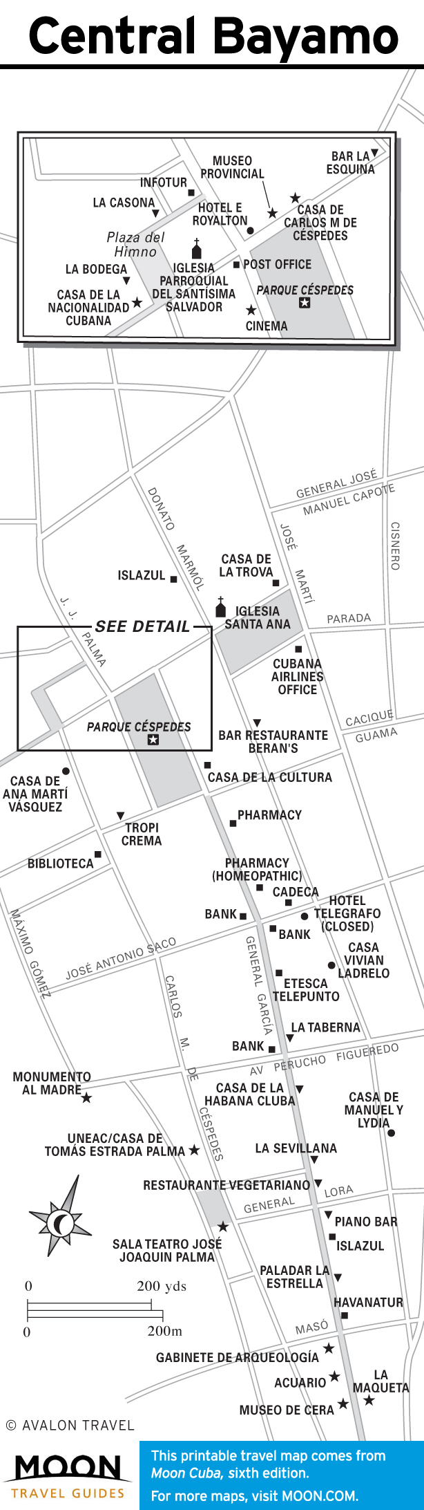
Granma
Off-the-beaten-path Granma Province is dominated by the Sierra Maestra, the mountainous base for Fidel Castro’s guerrilla war. You can hike to his headquarters, La Comandancia de la Plata, and to the summit of Pico Turquino, Cuba’s highest peak. Independence was launched in Bayamo, touting a vibrant colonial plaza.
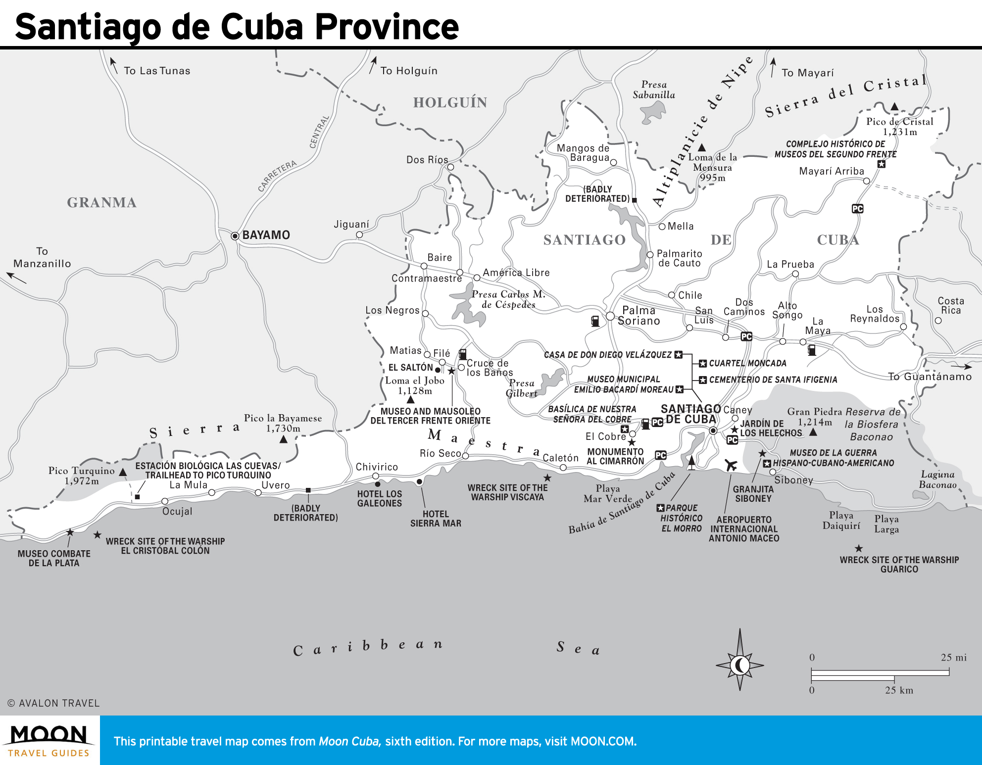
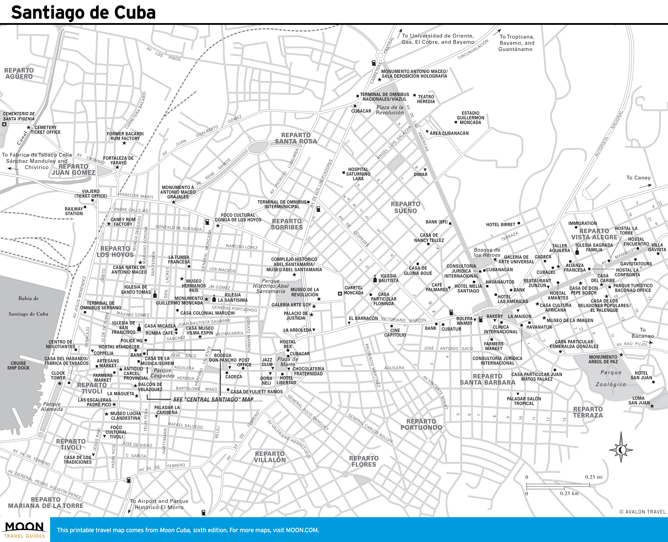
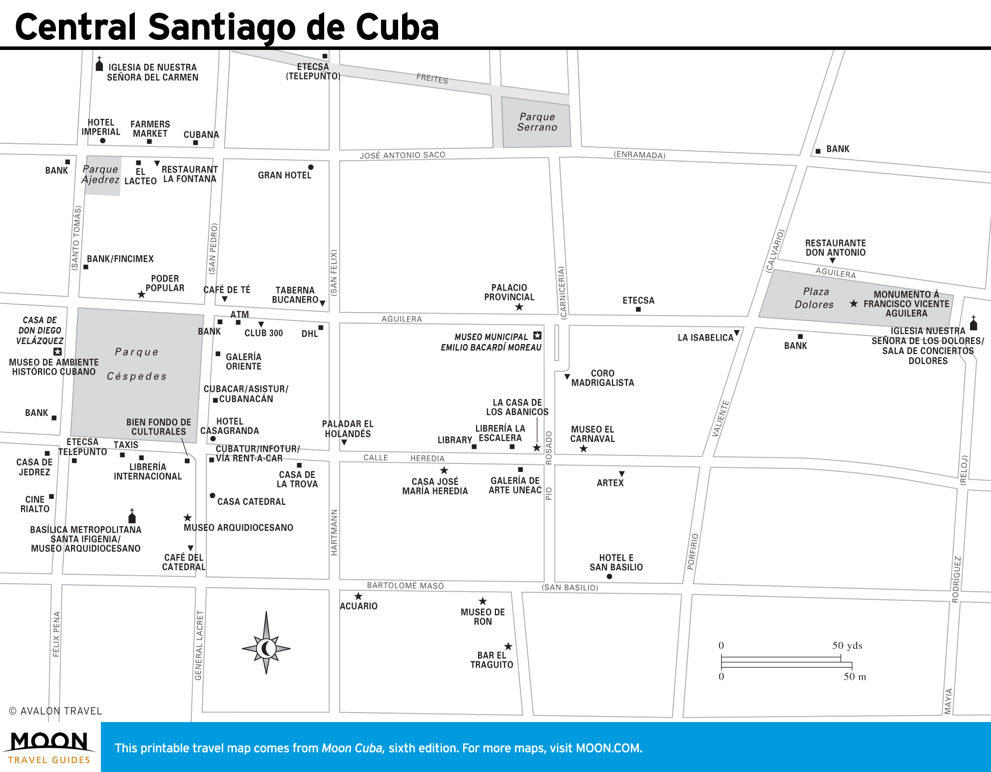
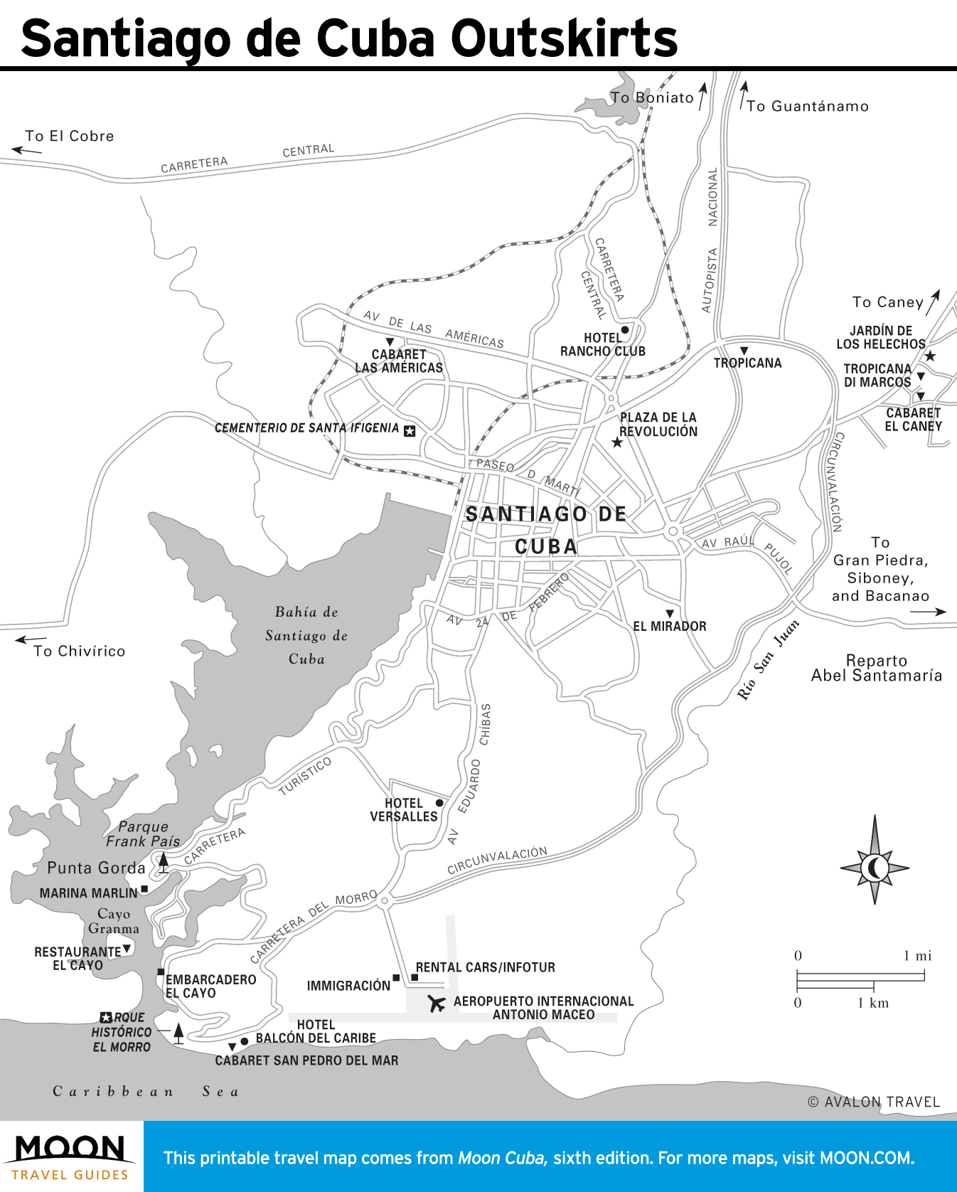
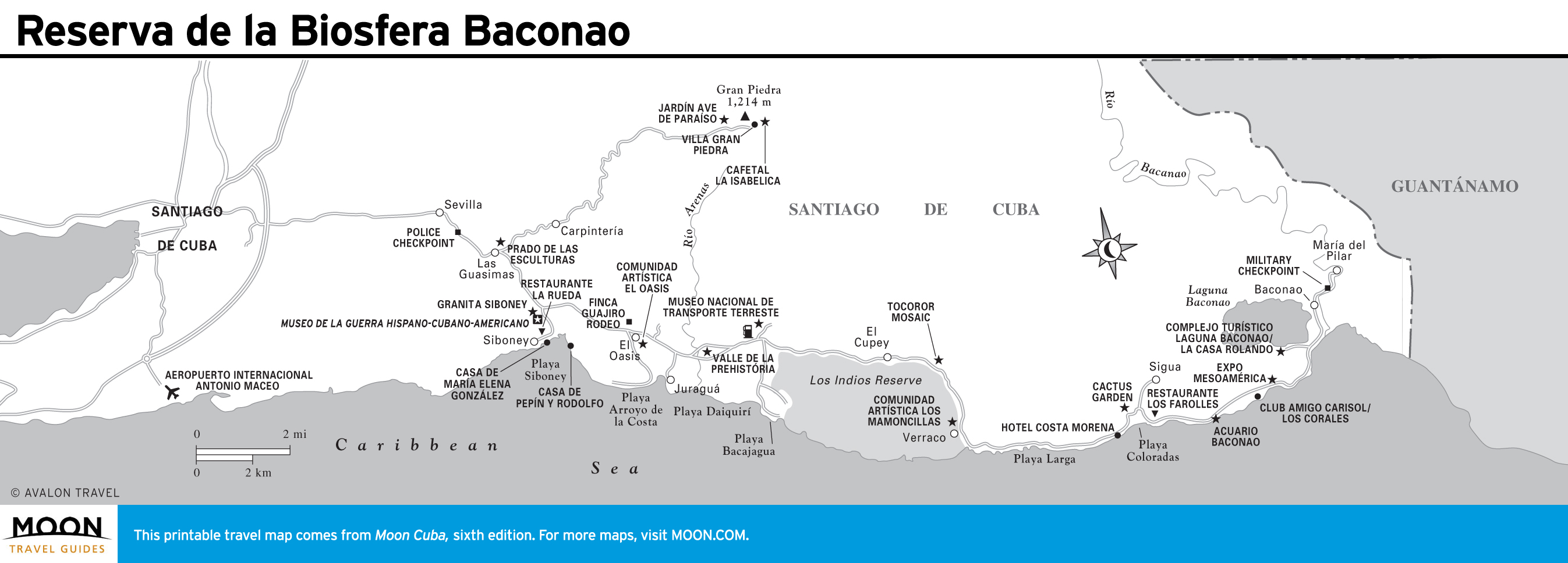
Santiago de Cuba
The city of Santiago de Cuba, founded in 1514, predates Havana and has strong Haitian and Jamaican influences. Much of Cuba’s musical heritage was birthed here. The Moncada barracks, museums, and mausoleums recall the city’s revolutionary fervor.
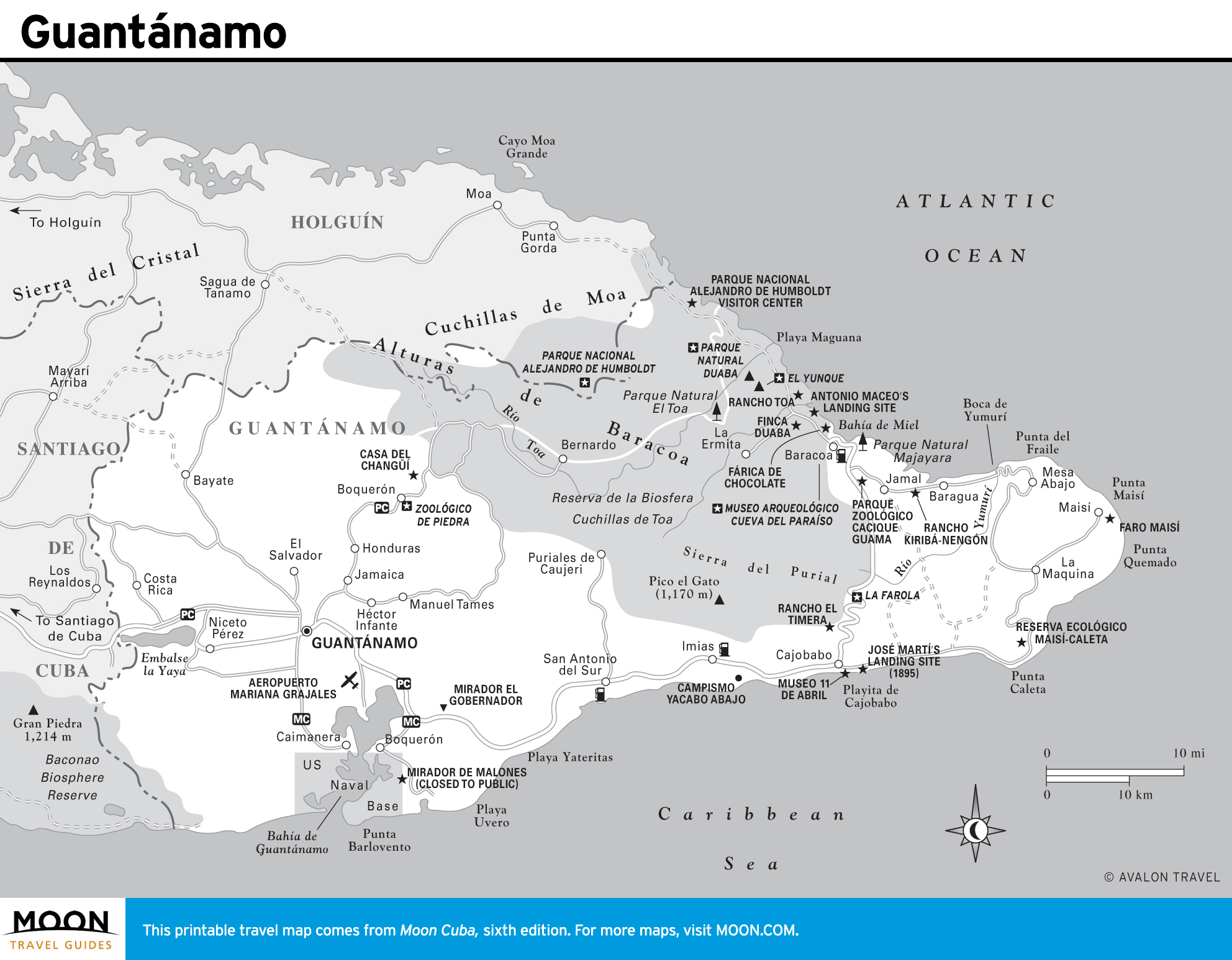
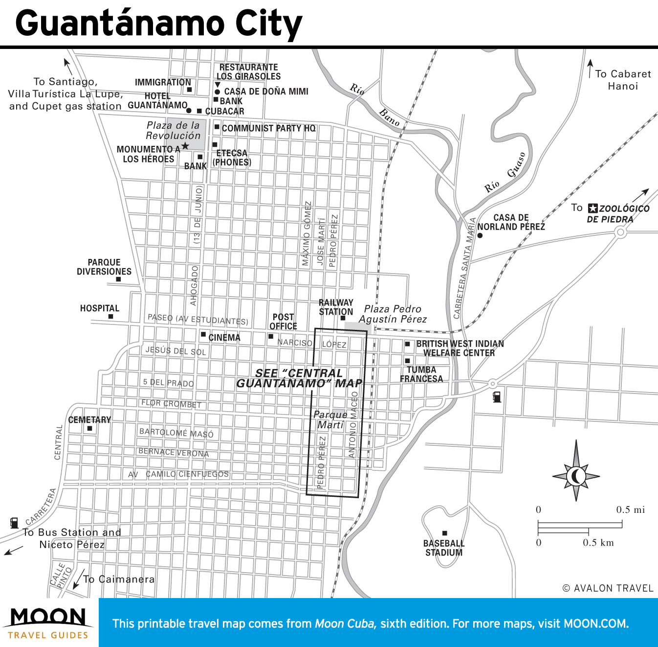
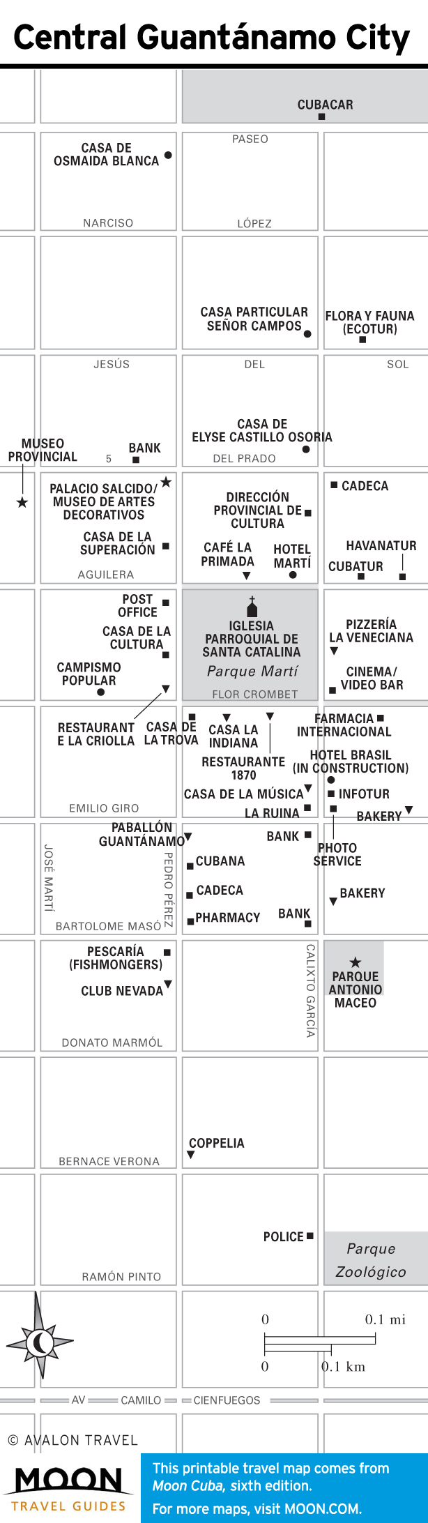
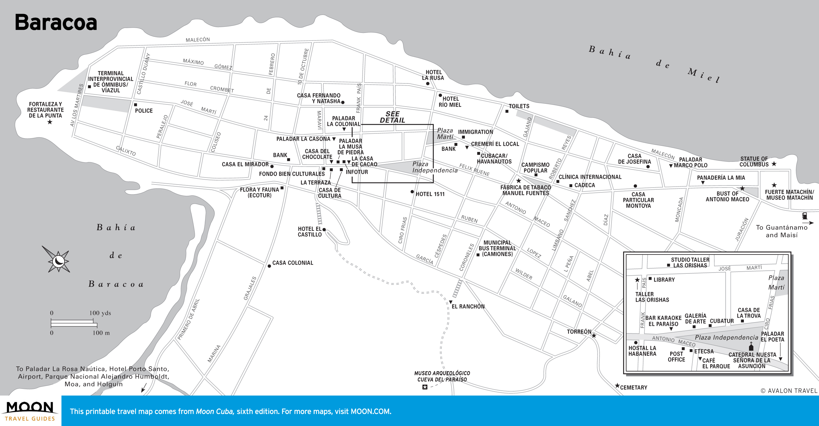
Guantánamo
This mountainous province is synonymous with the U.S. naval base, which can be viewed from a hilltop restaurant at Glorieta. The town of Guantánamo has a lovely colonial plaza and is alive with traditional music. Nearby the Zoológico de Piedra—literally a stone zoo!—fascinates. The La Farola mountain road leads to Baracoa, Cuba’s oldest city, full of vernacular charm and boasting Cuba’s most dramatic physical setting.