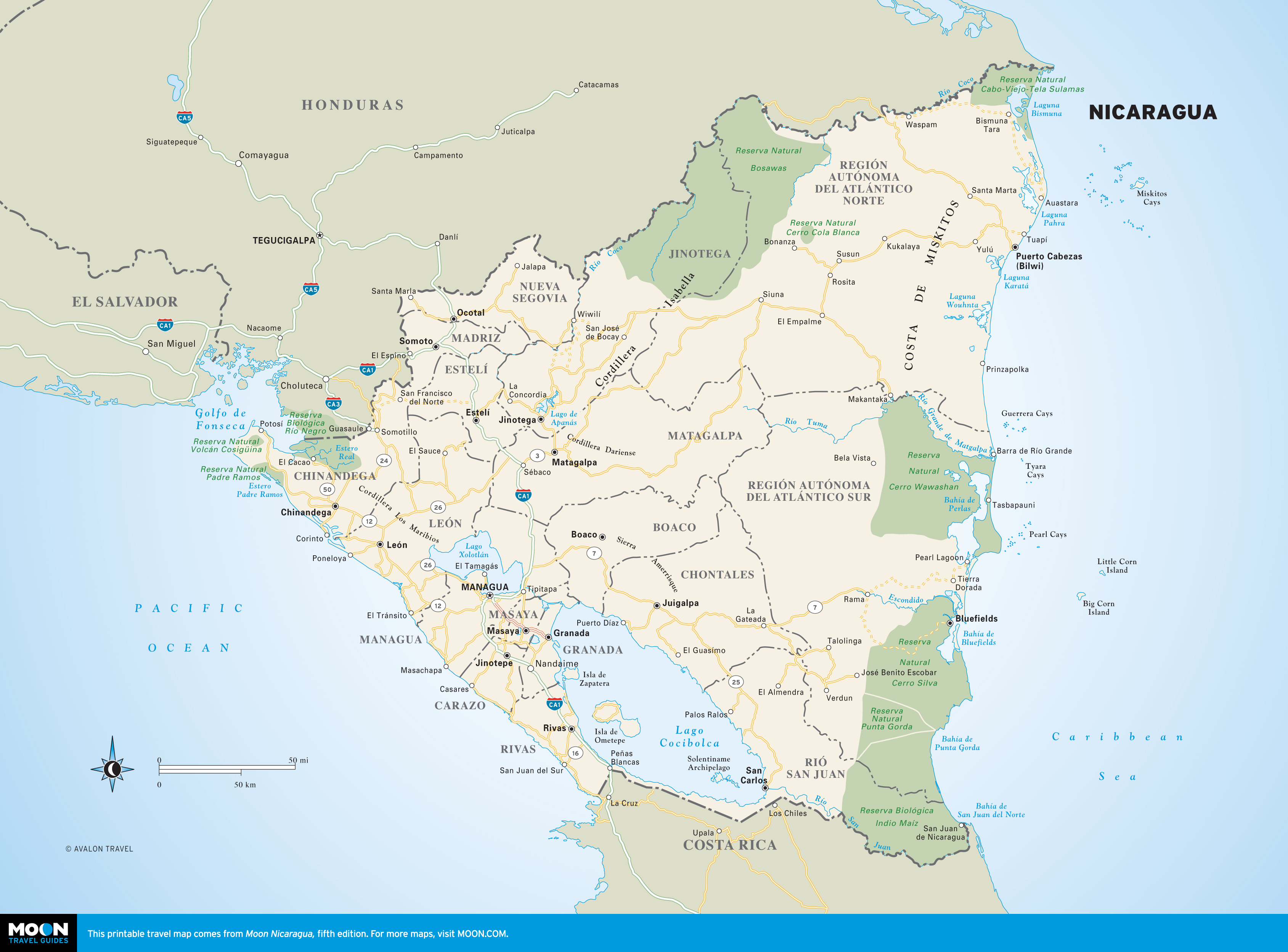
Nicaragua
These free, printable travel maps of Nicaragua are divided into the following regions:
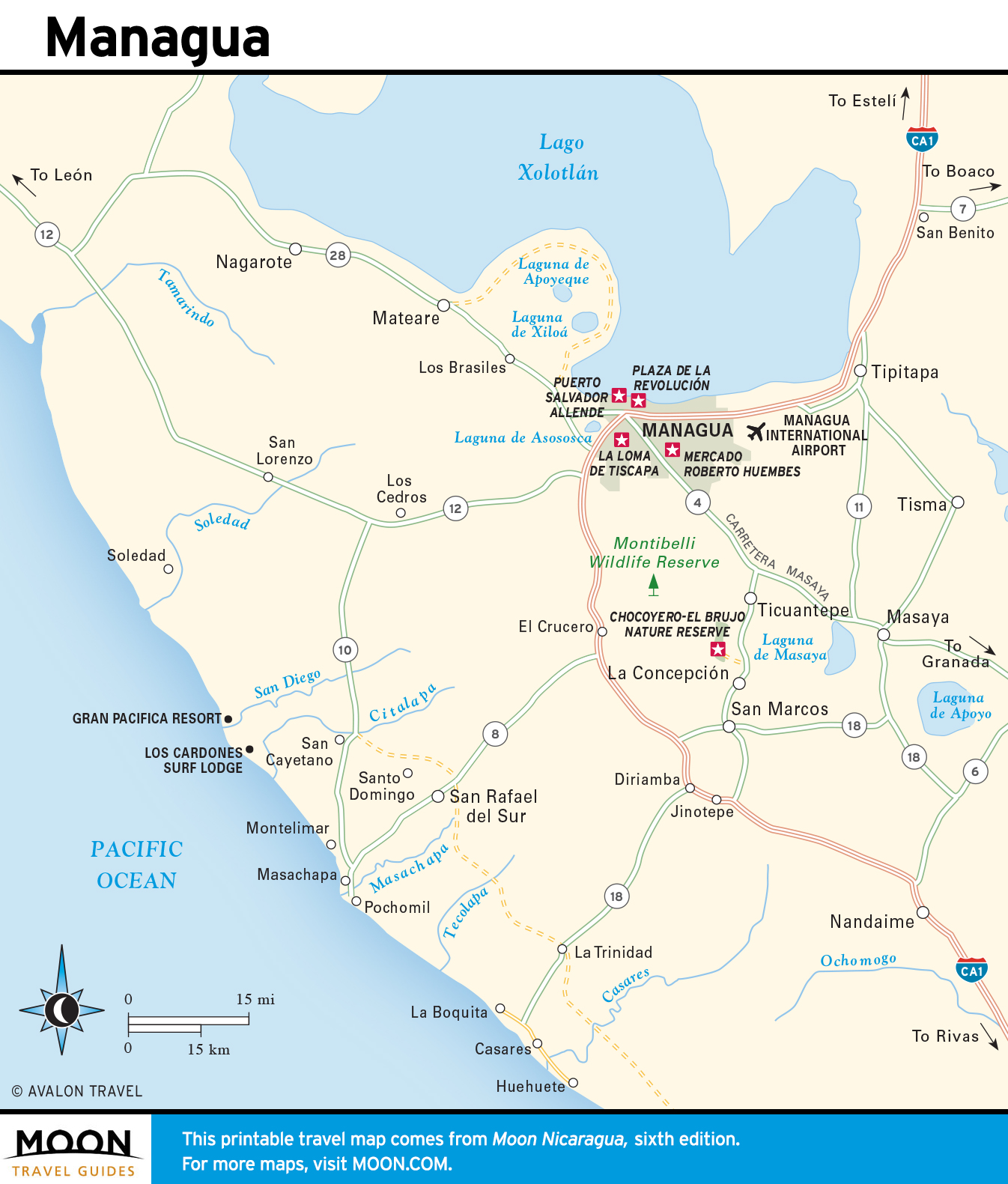
- Managua
- Granada and Masaya
- La Isla de Ometepe and Rivas
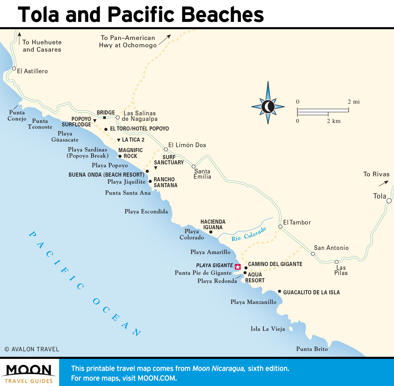
- San Juan del Sur and the Southwest Coast
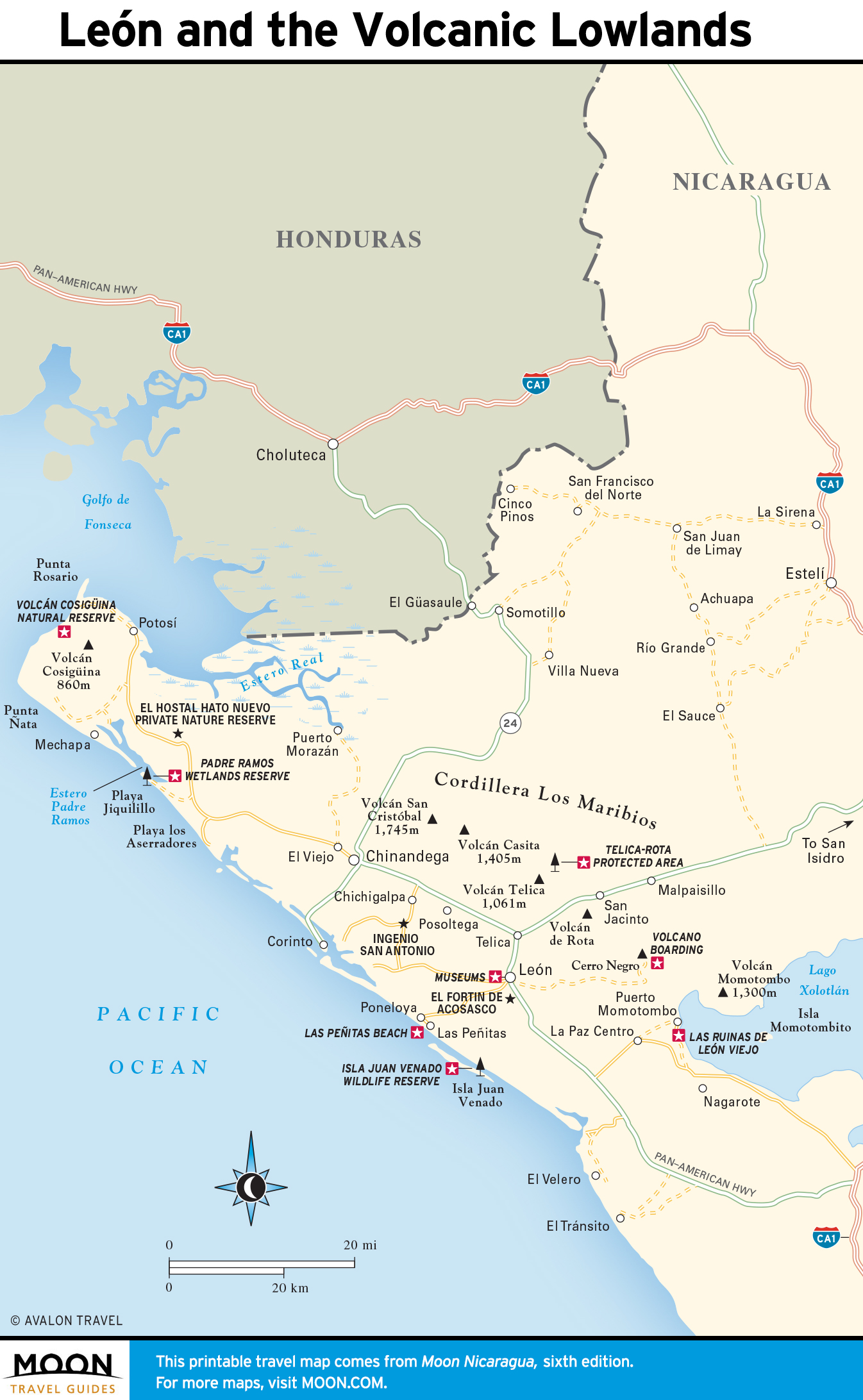
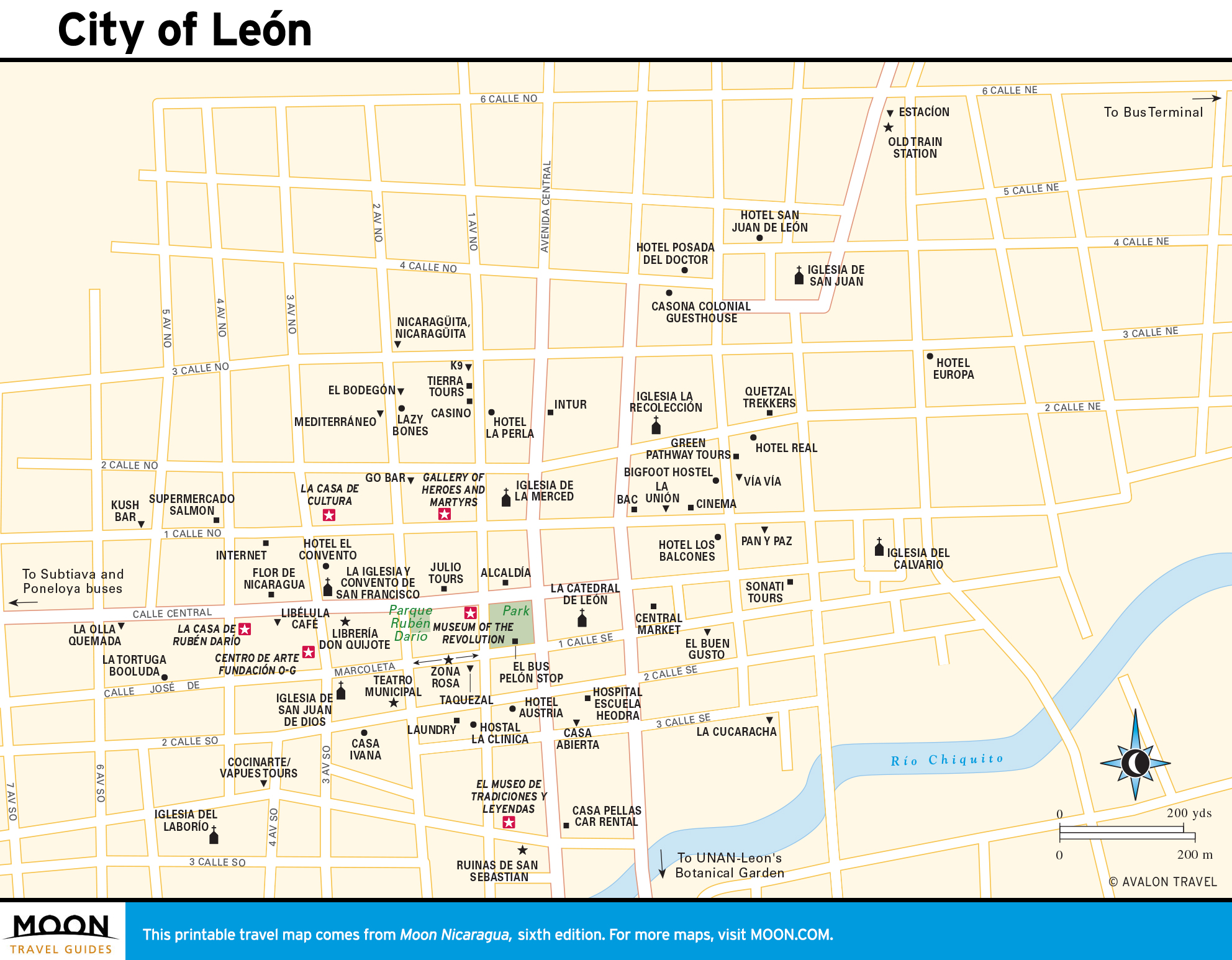
- León and the Volcanic Lowlands
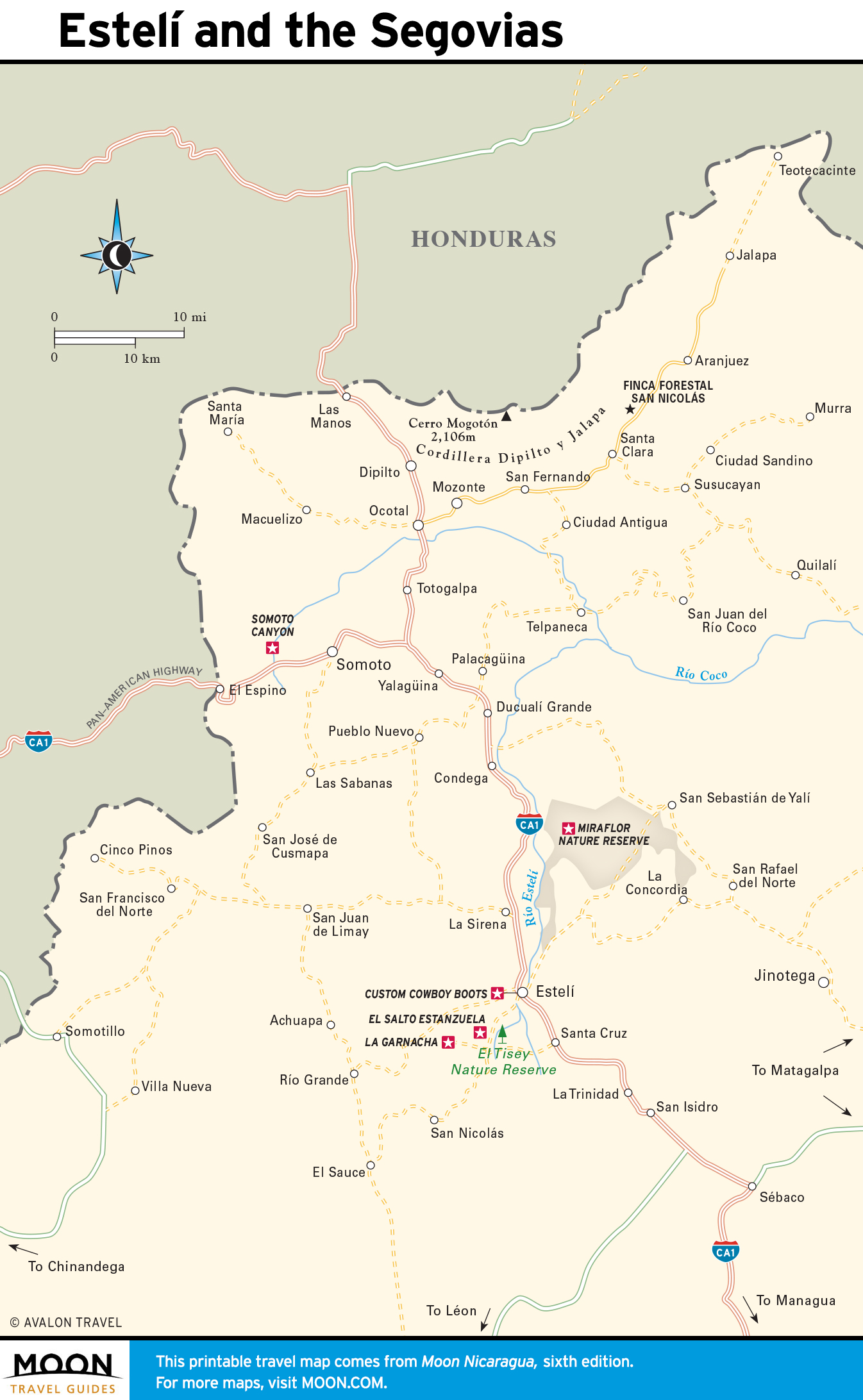
- Estelí and the Segovias
- The Matagalpa and Jinotega Highlands
- Chontales and the Nicaraguan Cattle Country
- Solentiname and the Río San Juan
- Bluefields and the Corn Islands
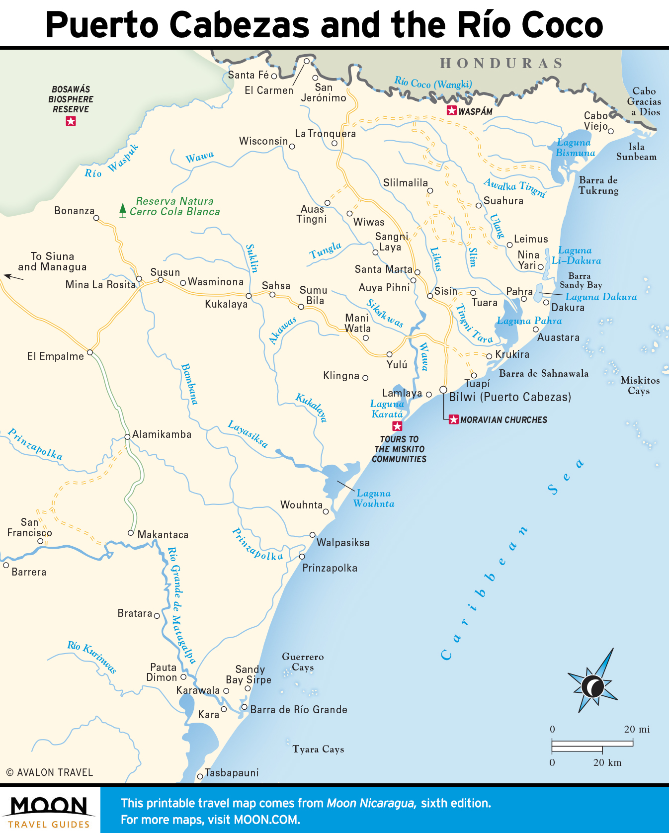
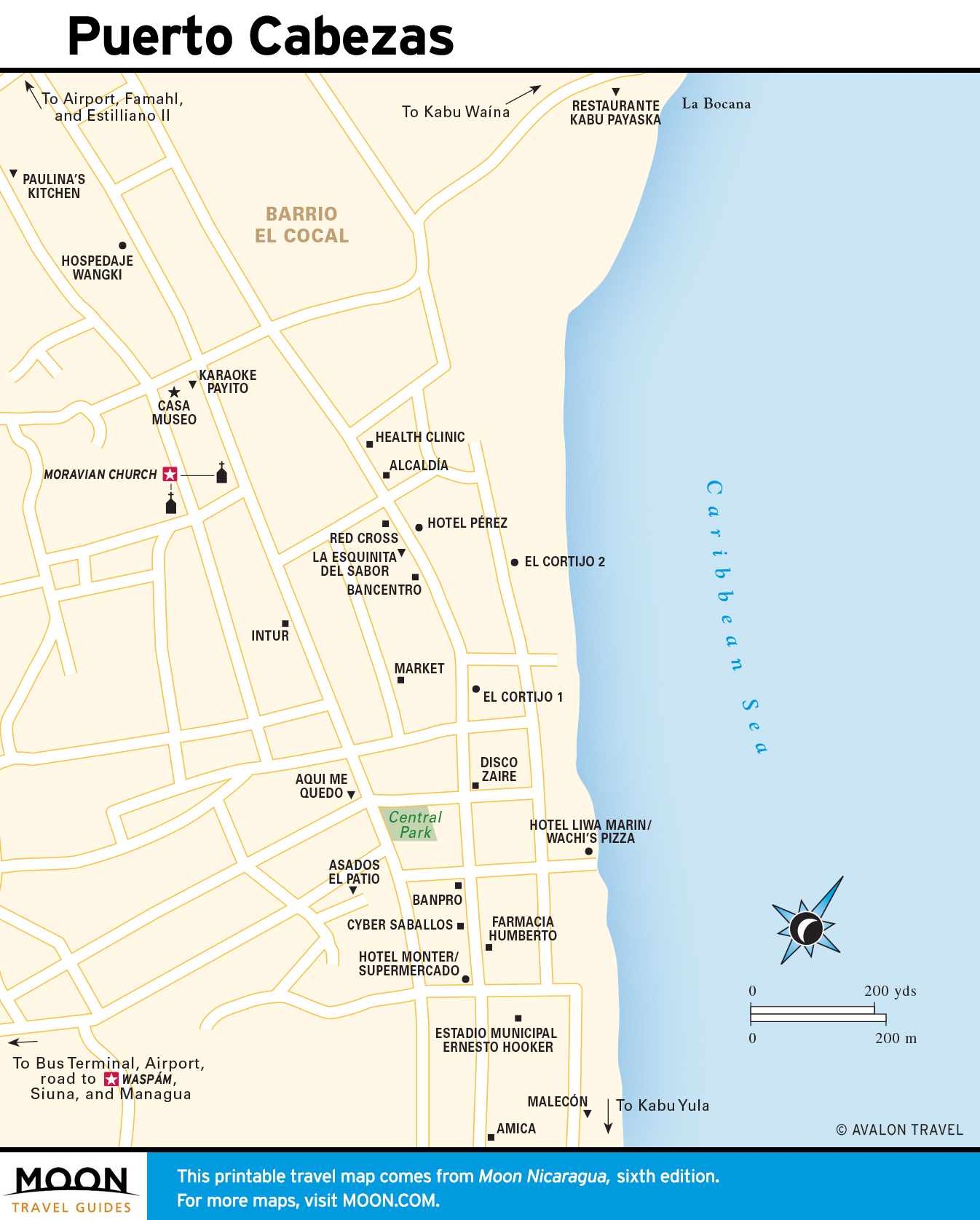
- Puerto Cabezas and the Río Coco
Explore Nicaragua with these helpful travel maps from Moon.
Nicaragua
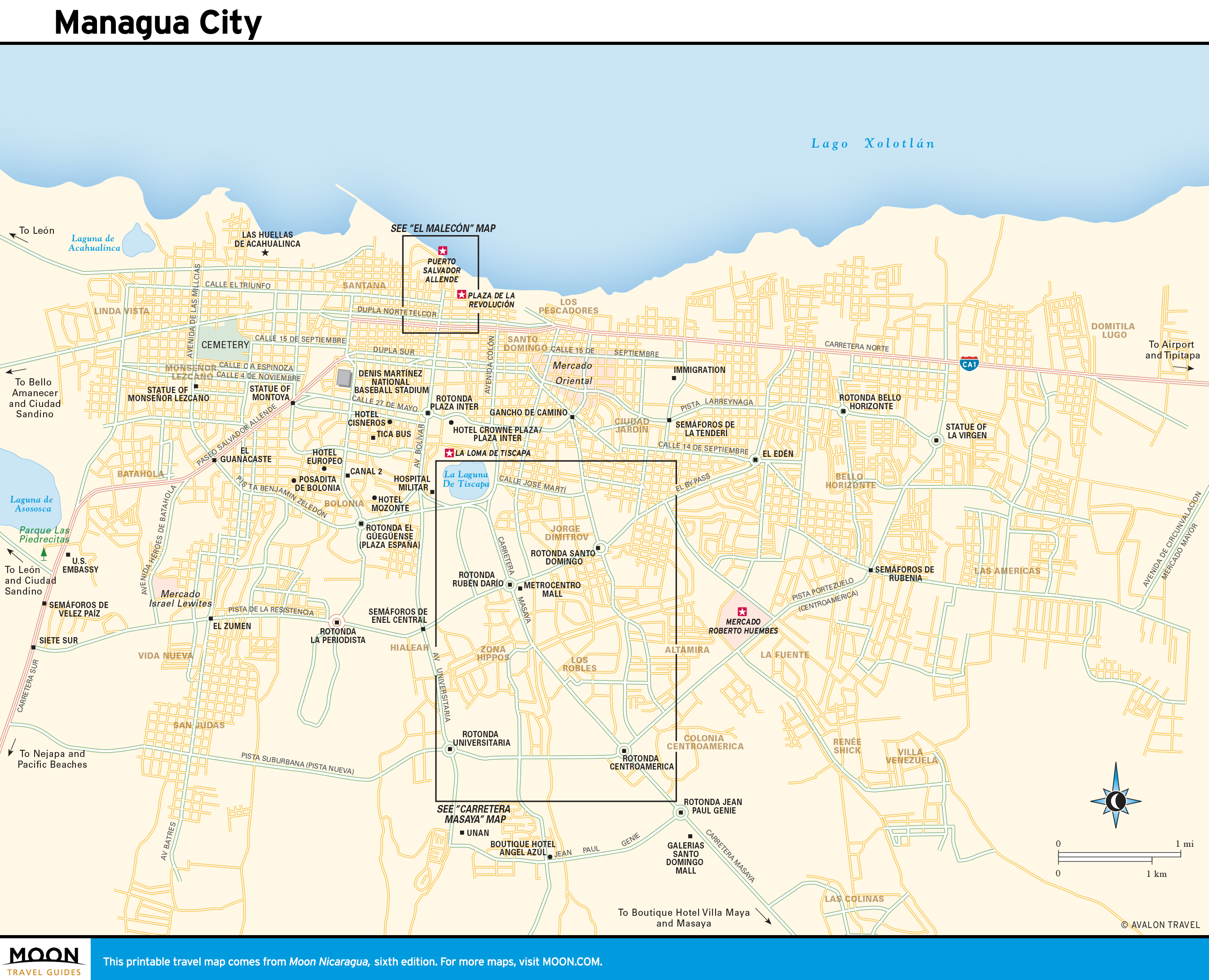
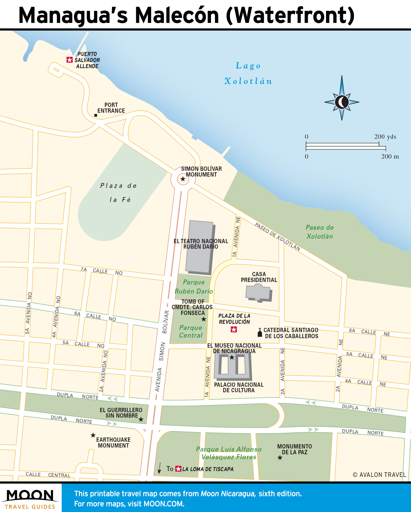
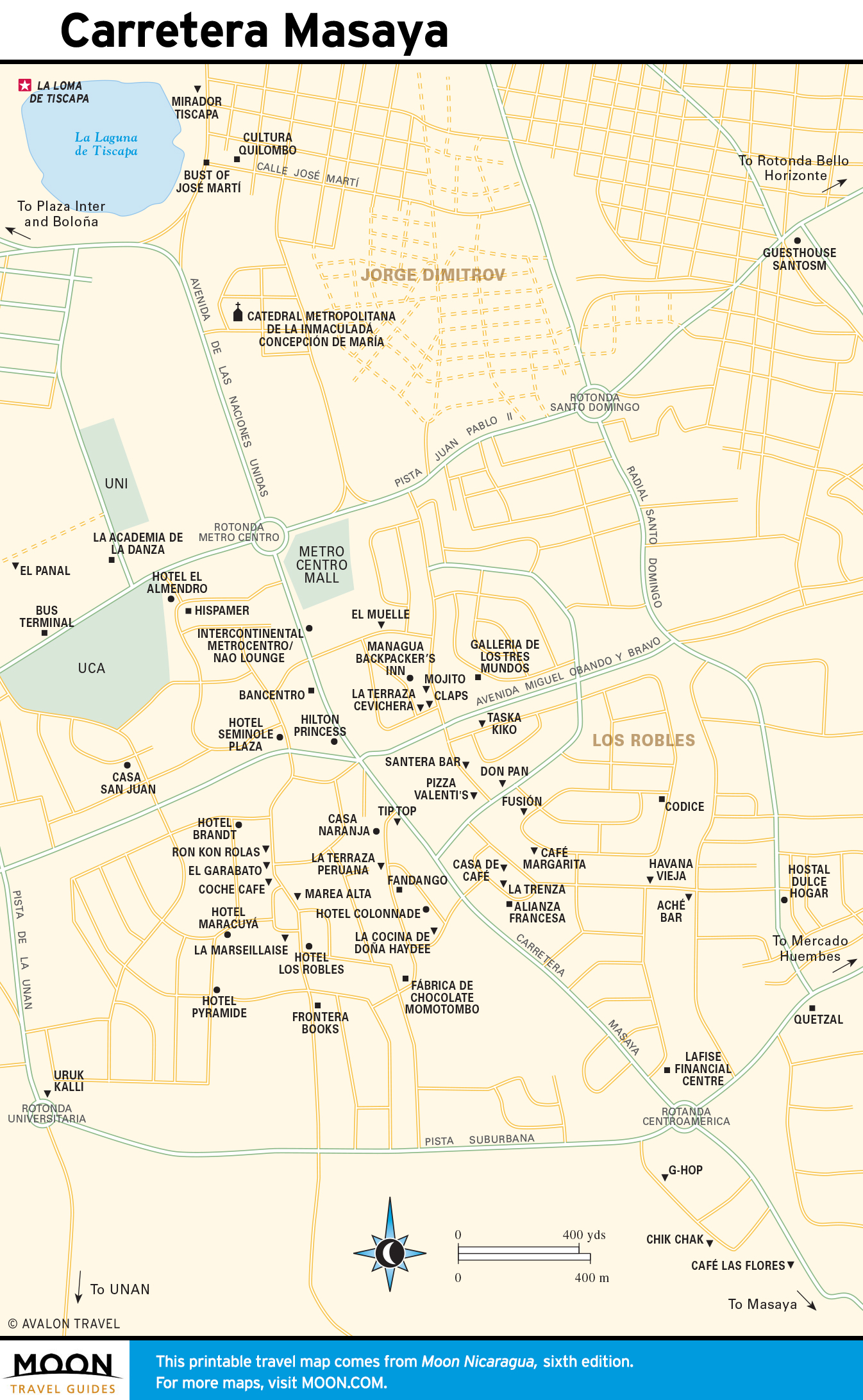
Managua
Though you could conceivably pass through Nicaragua without visiting Managua at all, its central location makes it an important transport hub and the place to go for services not available elsewhere.
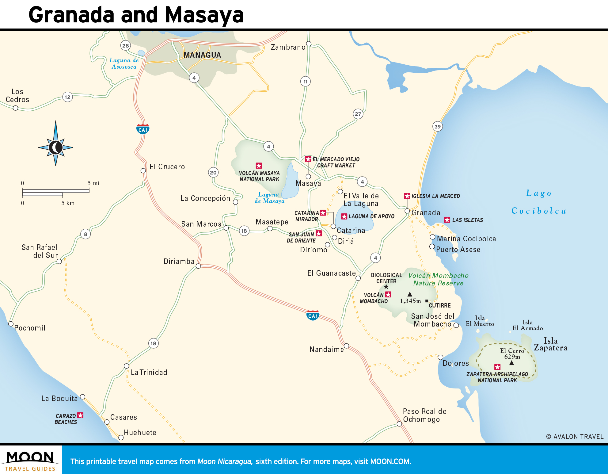
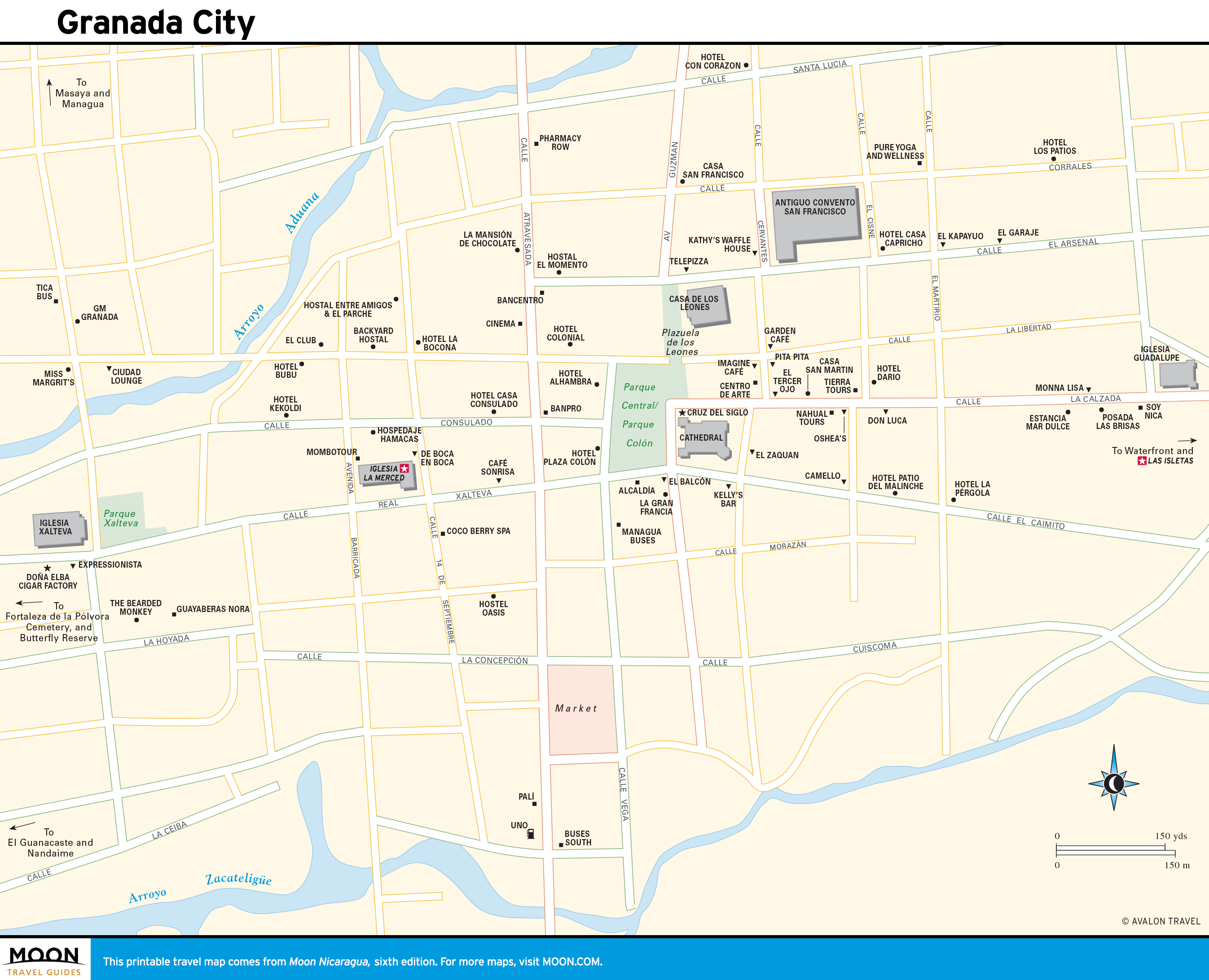
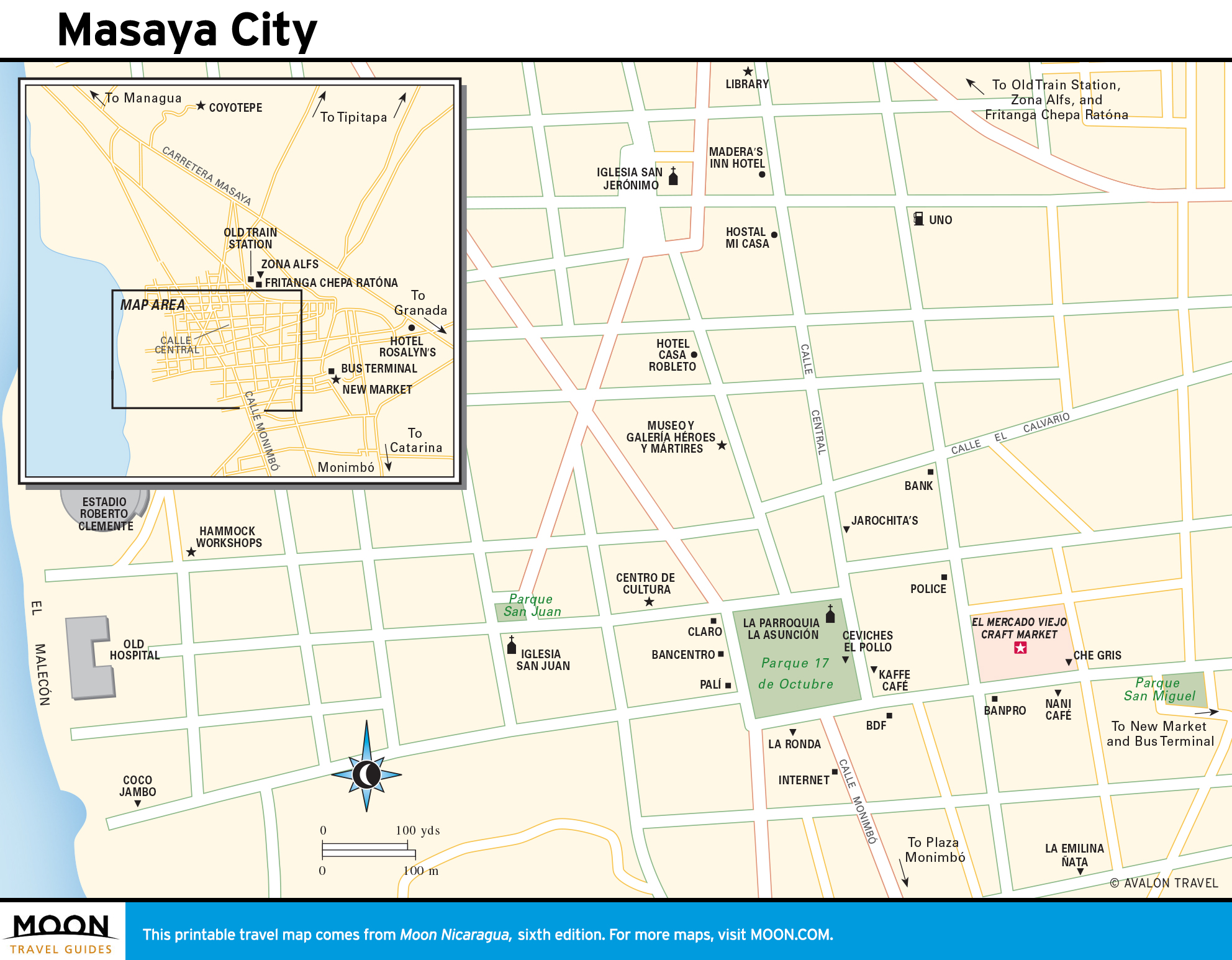
Granada and Masaya
Granada is the undisputed hub of tourism in the country, and it’s got the international cuisine and café culture to prove it. Less than an hour south of the capital, Masaya and the dozens of villages that comprise the Pueblos Blancos are known for their residents’ artistry.
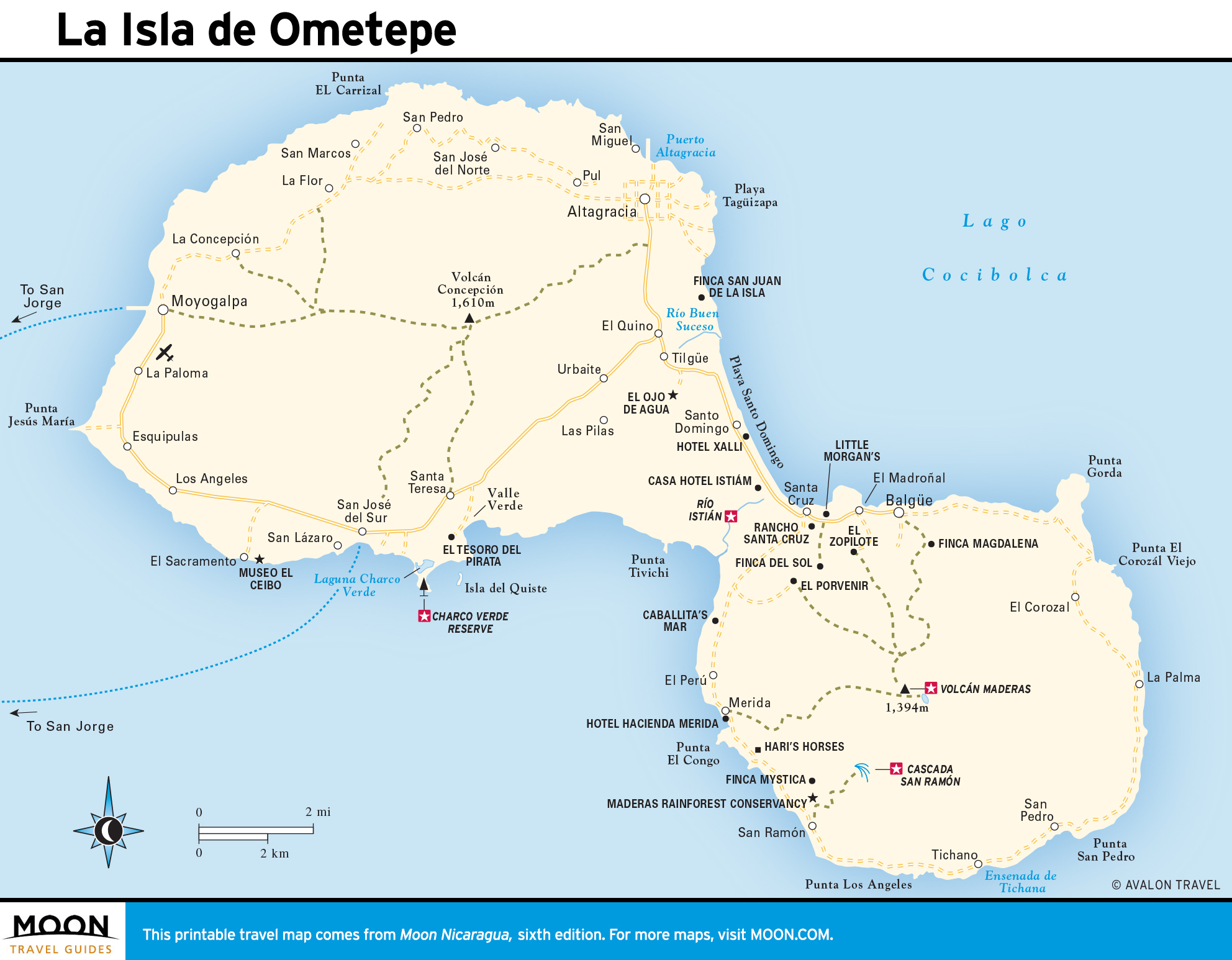
La Isla de Ometepe and Rivas
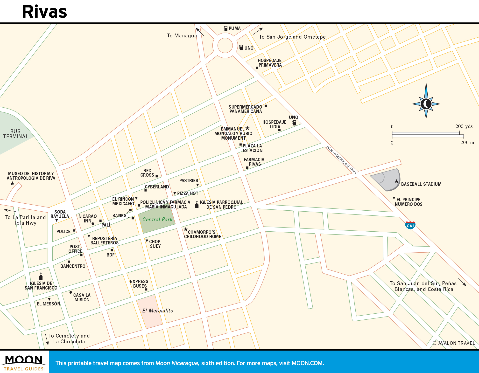
An old administrative city with a colonial history, Rivas may be worth a stop on your way to the beaches of San Juan del Sur or to Nicaragua’s crown jewel: La Isla de Ometepe, a few kilometers across Lake Cocibolca.
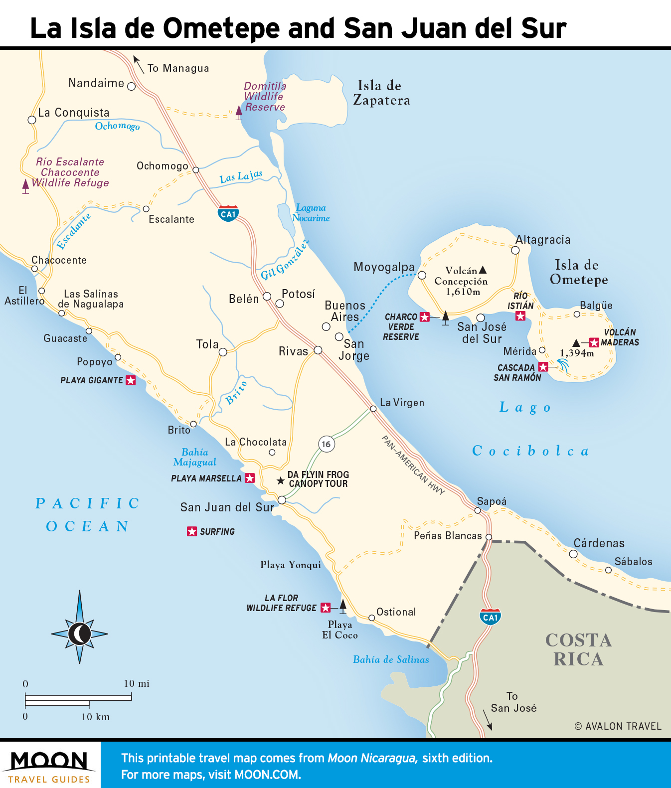
San Juan del Sur and the Southwest Coast
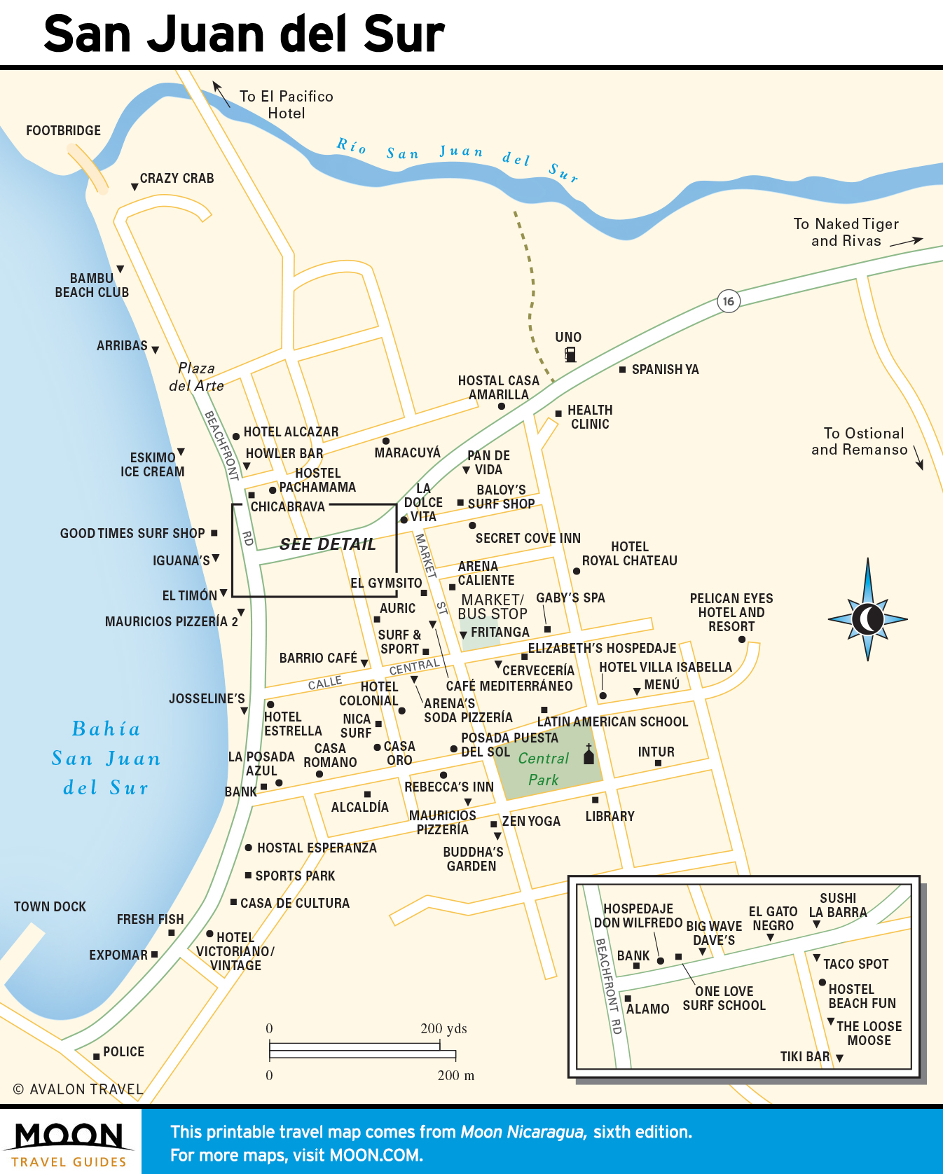
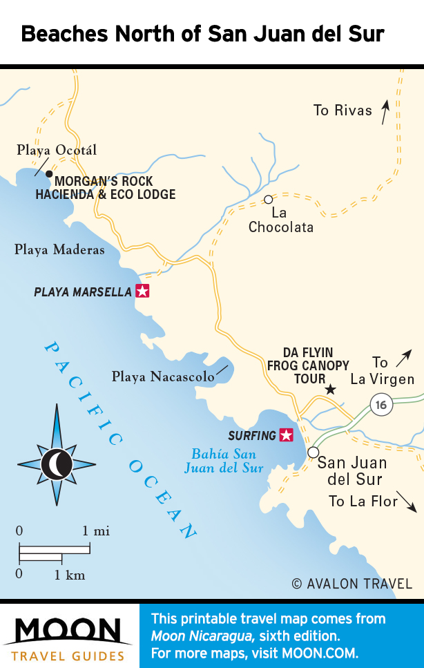
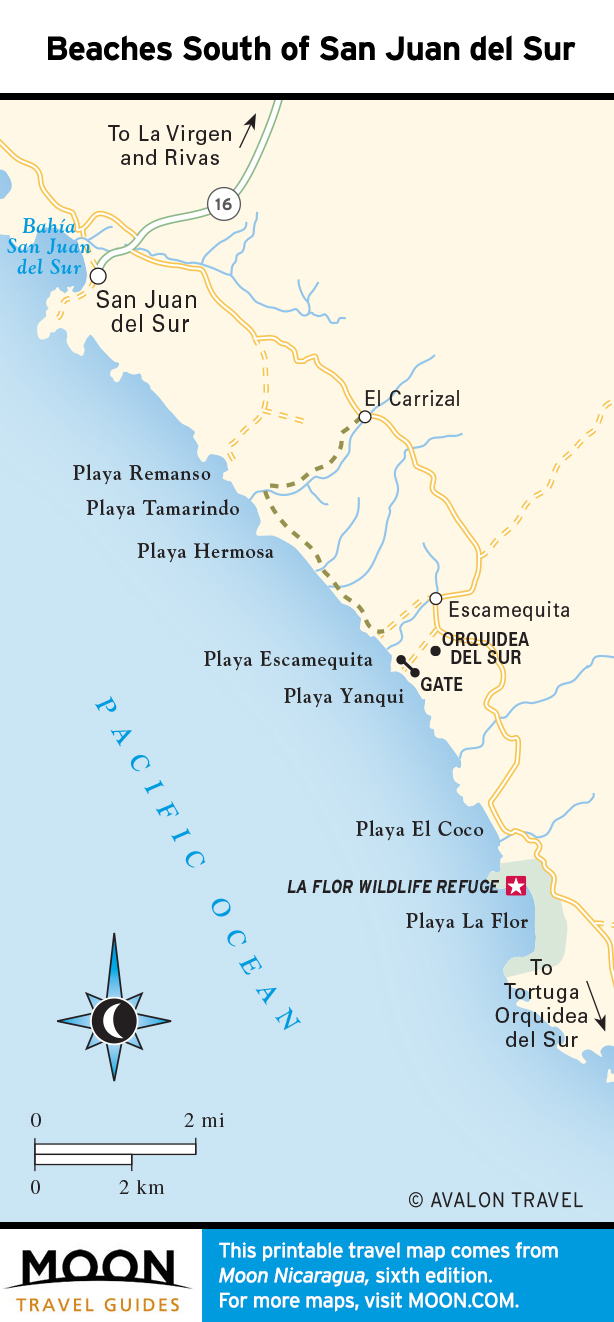
Nicaragua’s favorite beach town is also the most popular with foreign tourists. In addition to a crescent bay lined with barefoot restaurants and sandy bars, San Juan del Sur offers a slow-paced, tranquil setting, fresh seafood, and charming guesthouses.
León and the Volcanic Lowlands
Lying at the feet of the imposing Maribio volcanoes, León and Chinandega are colonial cities in the arid lowlands of Nicaragua’s Pacific northwest.

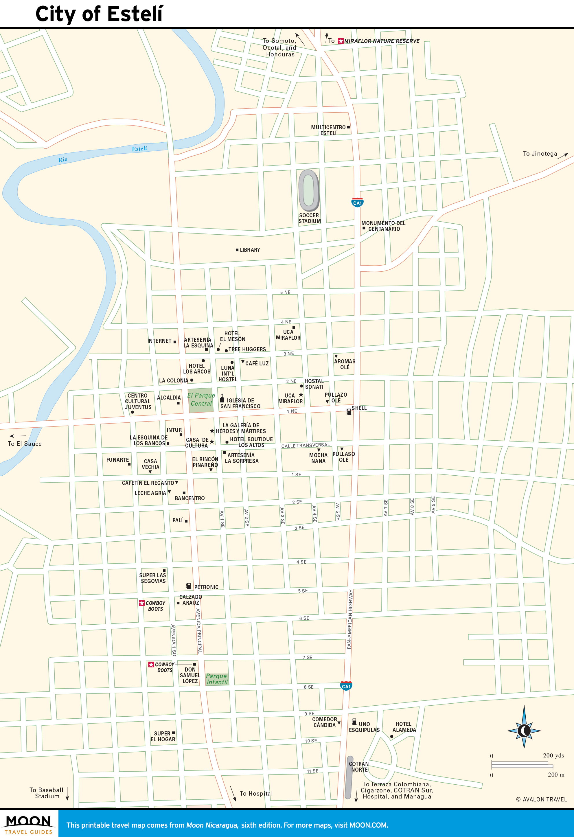
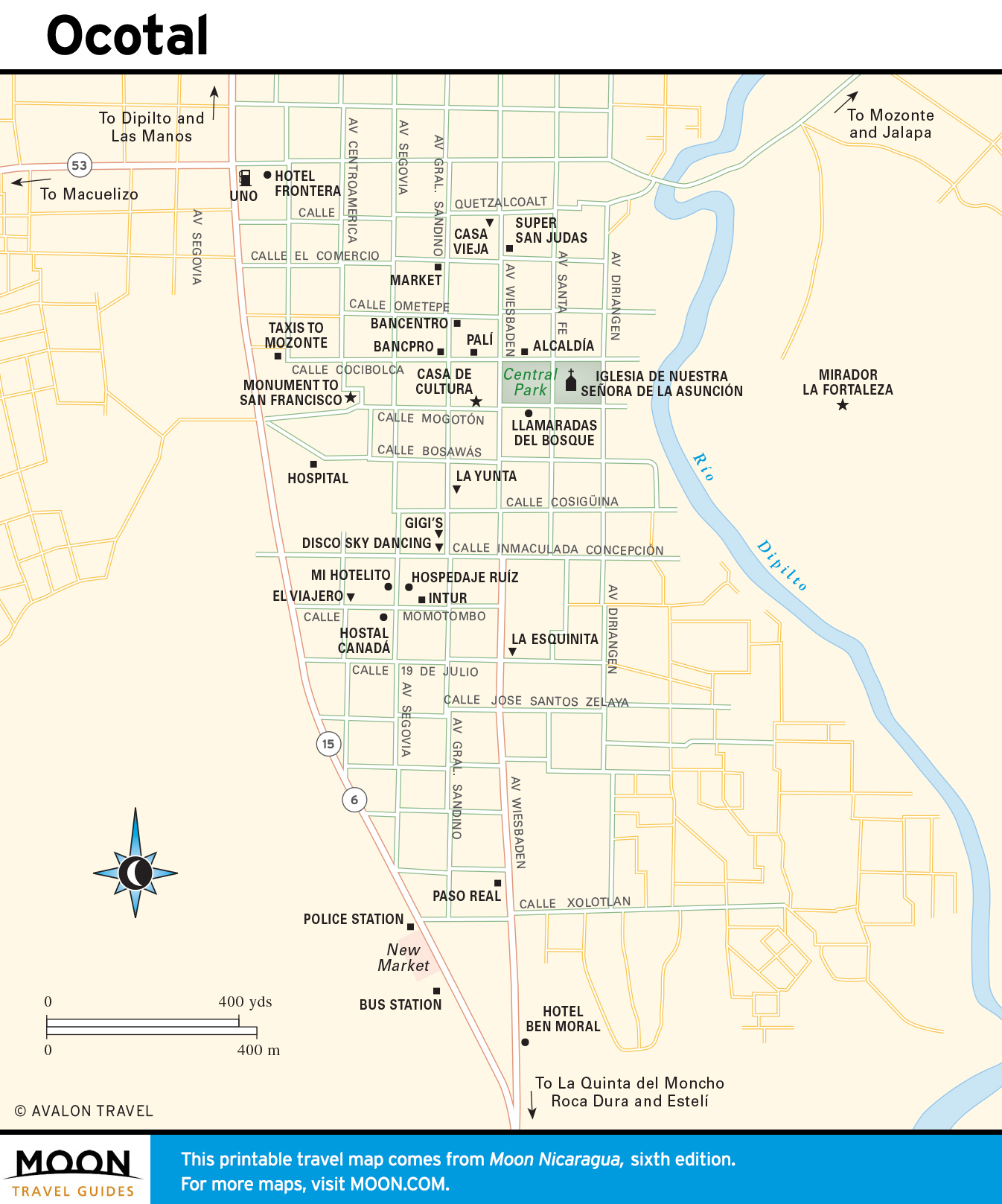
Estelí and the Segovias
Nicaragua’s mountainous north is accessible by comfortable public transportation; its main city, Estelí, is only a few hours from Managua.

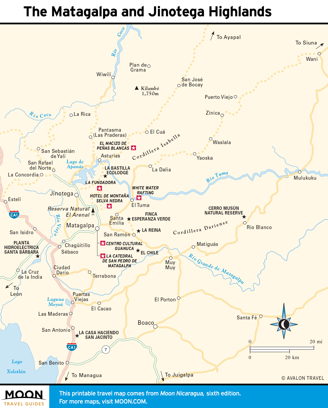
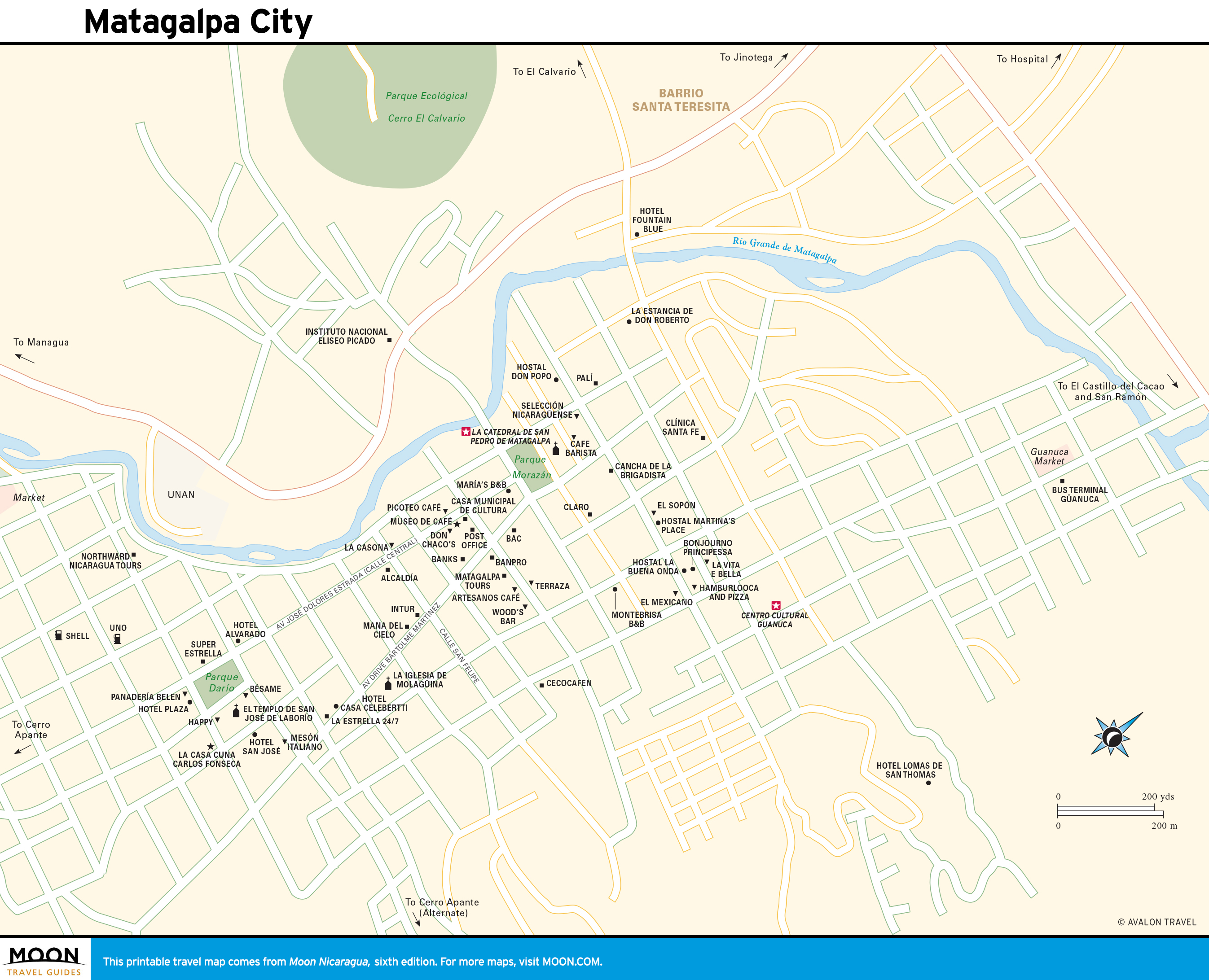
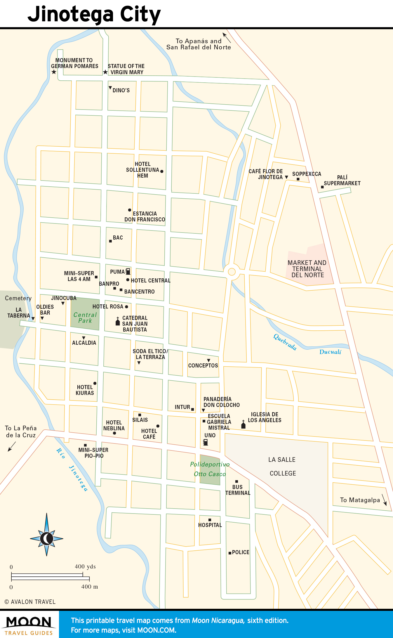
The Matagalpa and Jinotega Highlands
Nicaragua’s rugged interior is coffee country, where the unrushed traveler will find rough, undeveloped adventure.
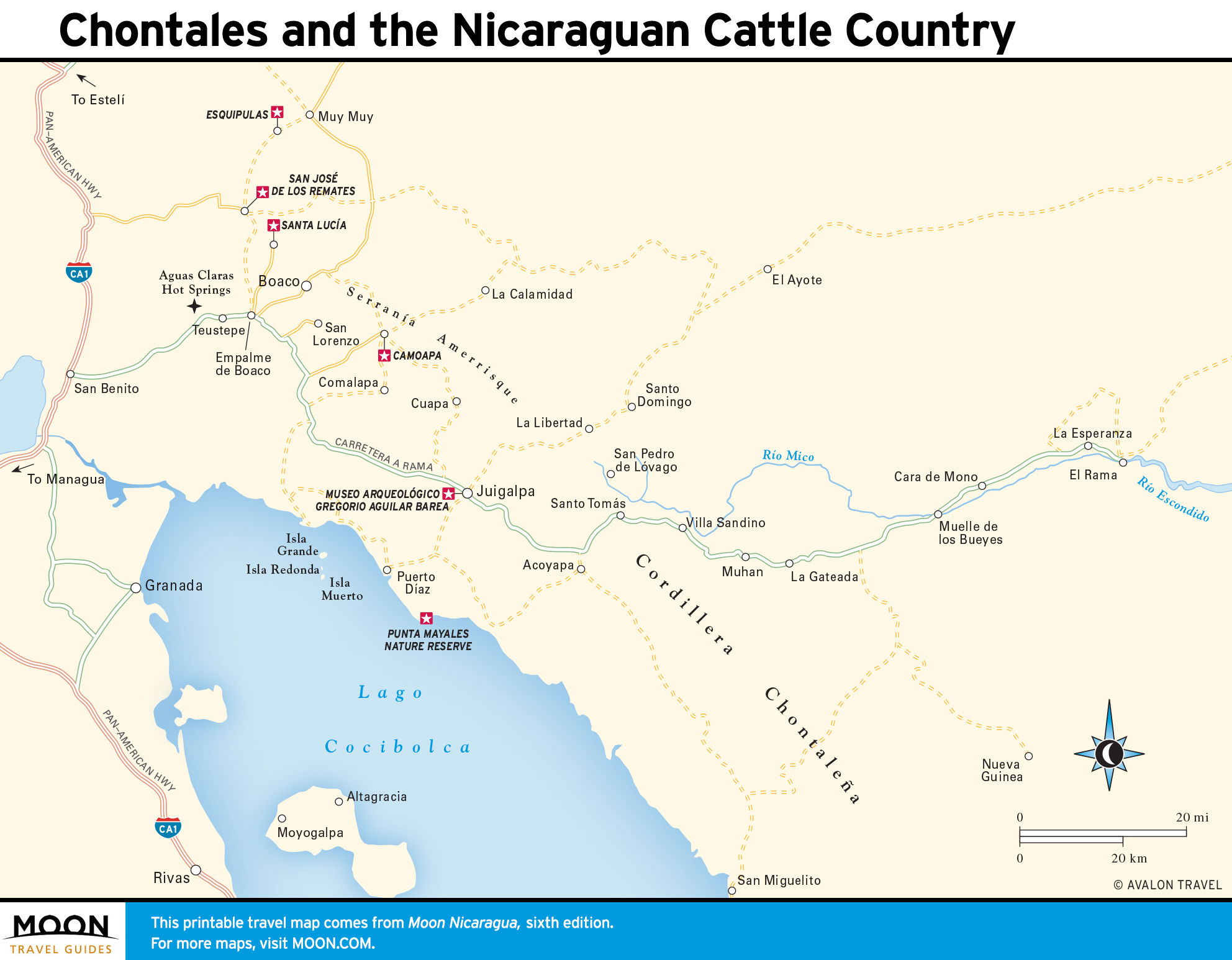
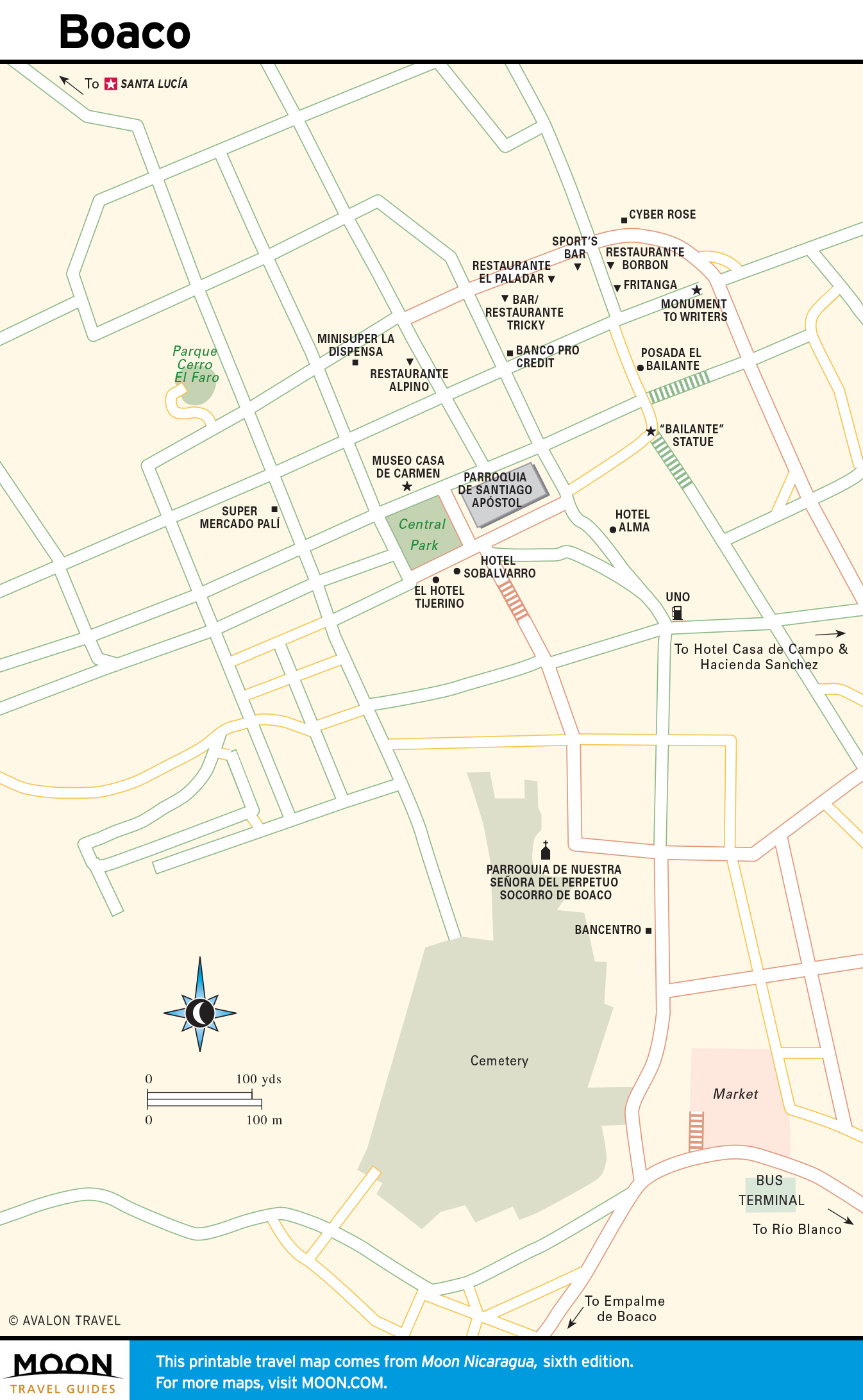
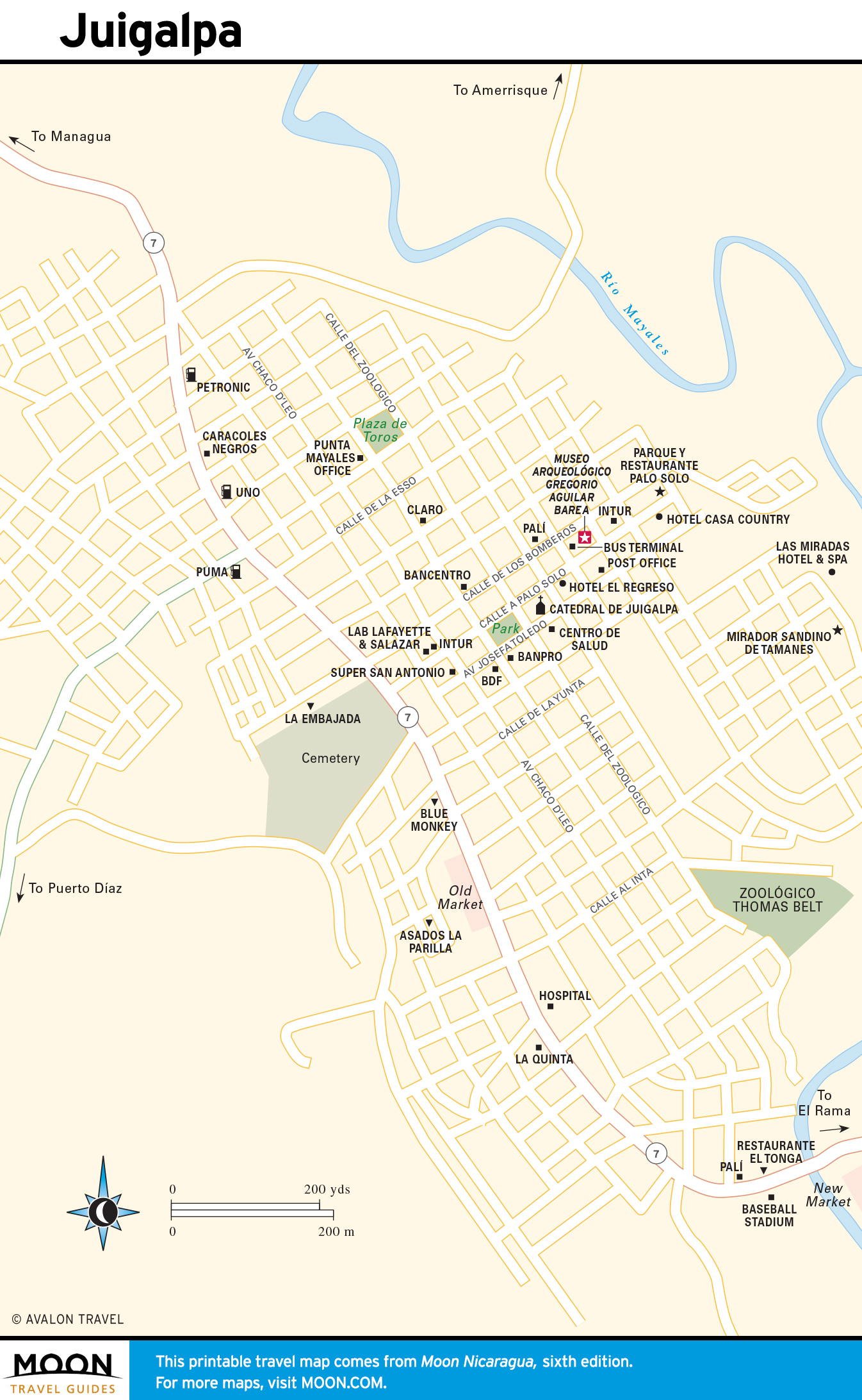
Chontales and the Nicaraguan Cattle Country
Most travelers speed through on buses bound for El Rama and the Atlantic coast, but spending a night in Juigalpa or Boaco, where the wild west vibe hasn’t lost its edge, may lead you on to the area’s hot springs, petroglyphs, horseback treks, and burly hikes.
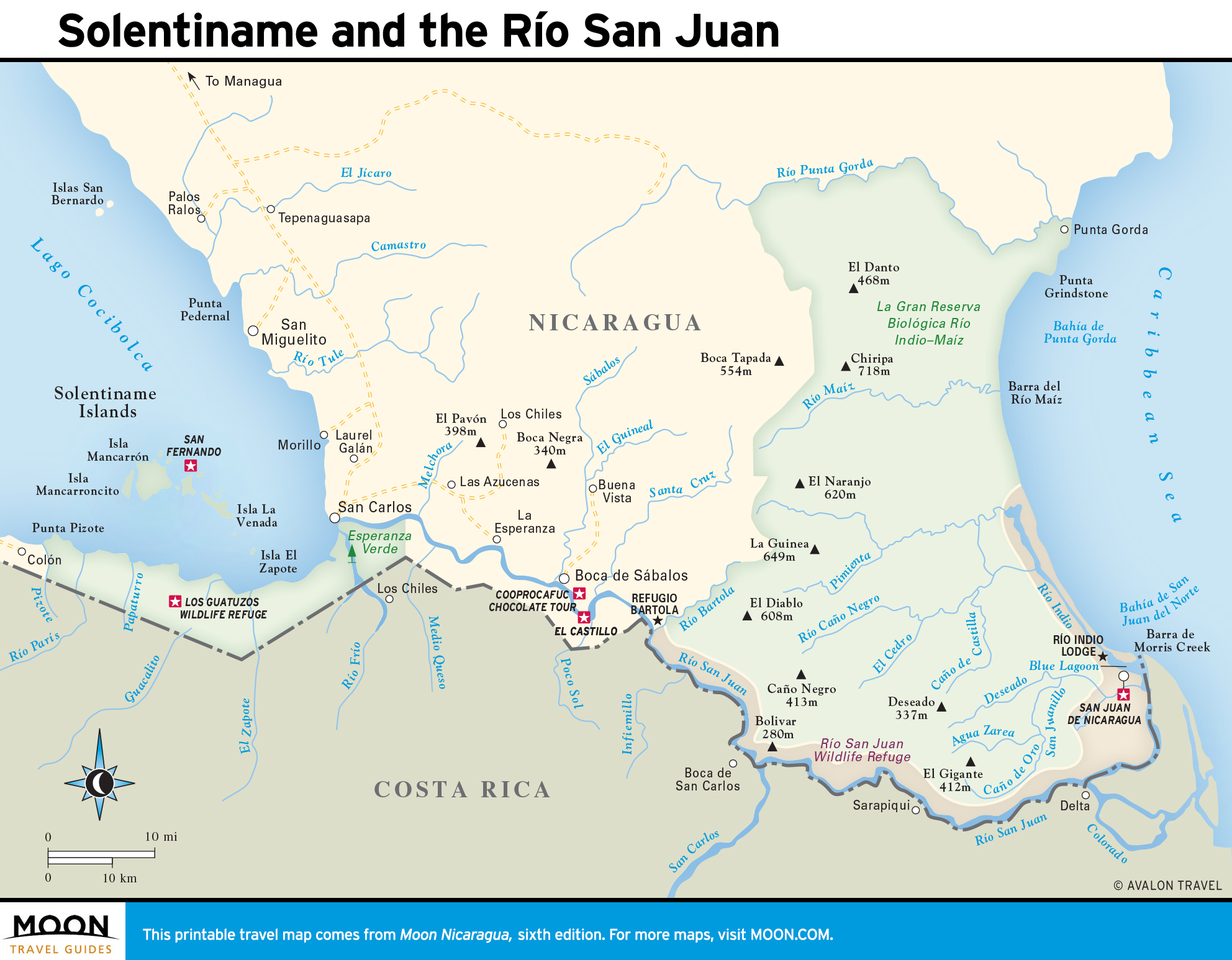
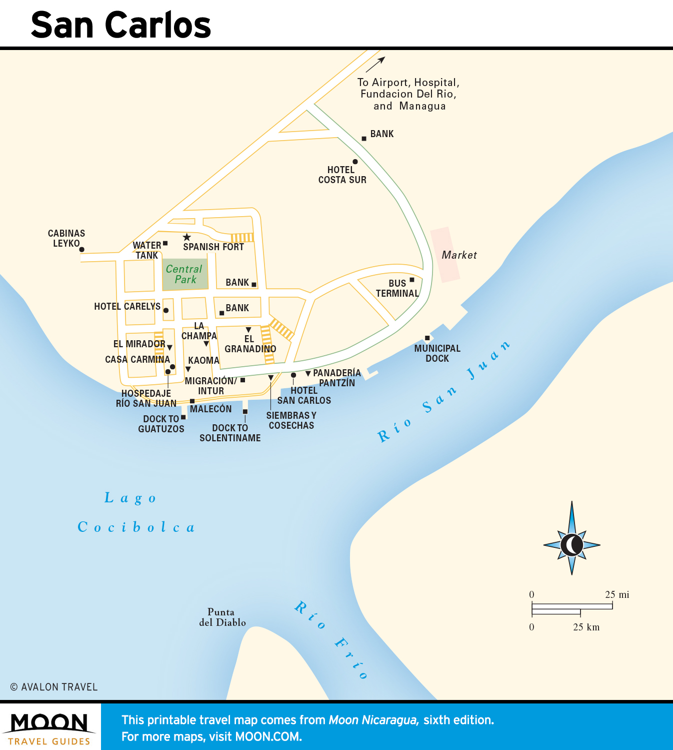
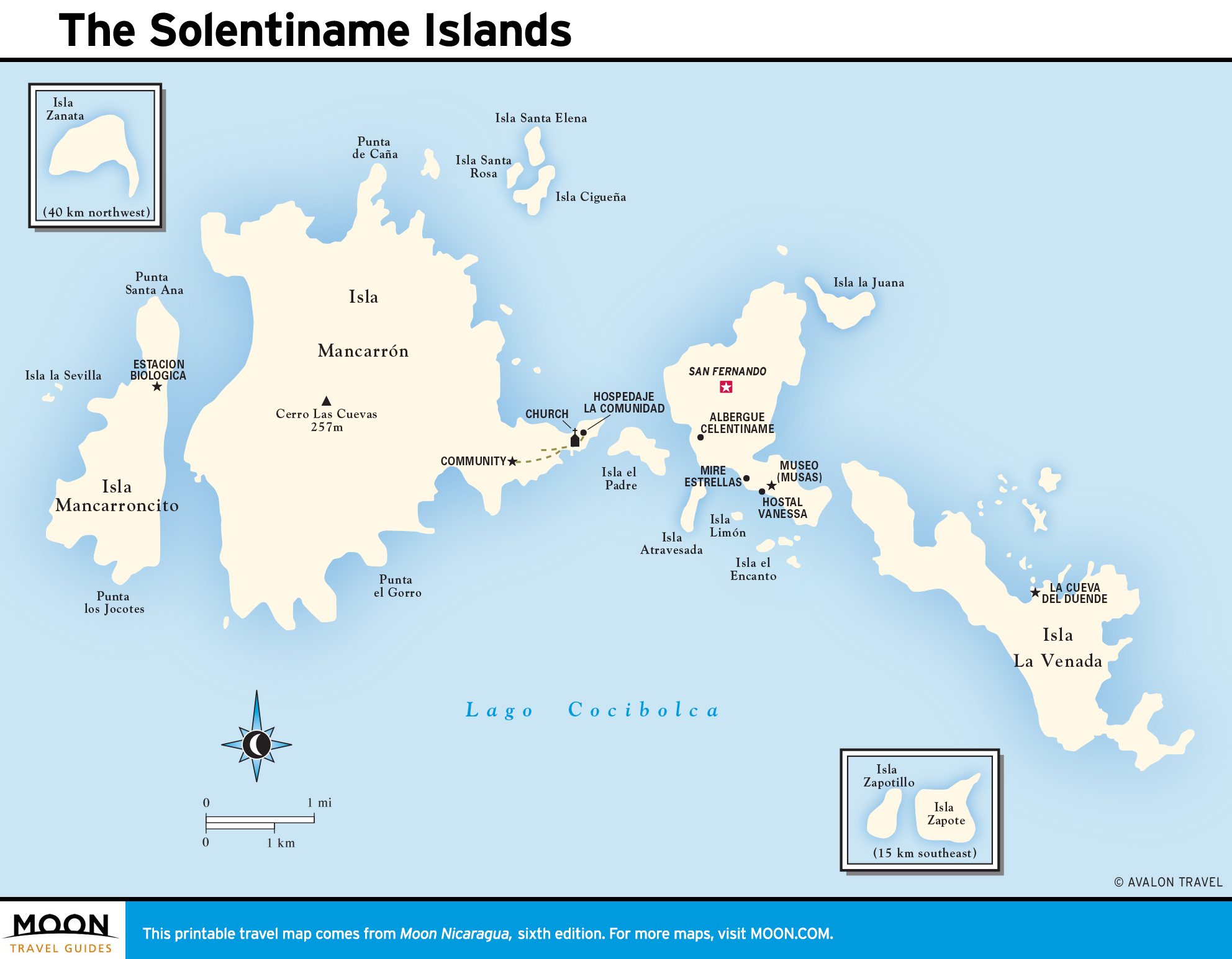
Solentiname and the Río San Juan
Life moves slowly along the broad river that drains Lake Cocibolca to the Caribbean. This gorgeous, verdant lowland is Nicaragua’s wettest, and its remoteness means you’ll spend more time and more money getting around.
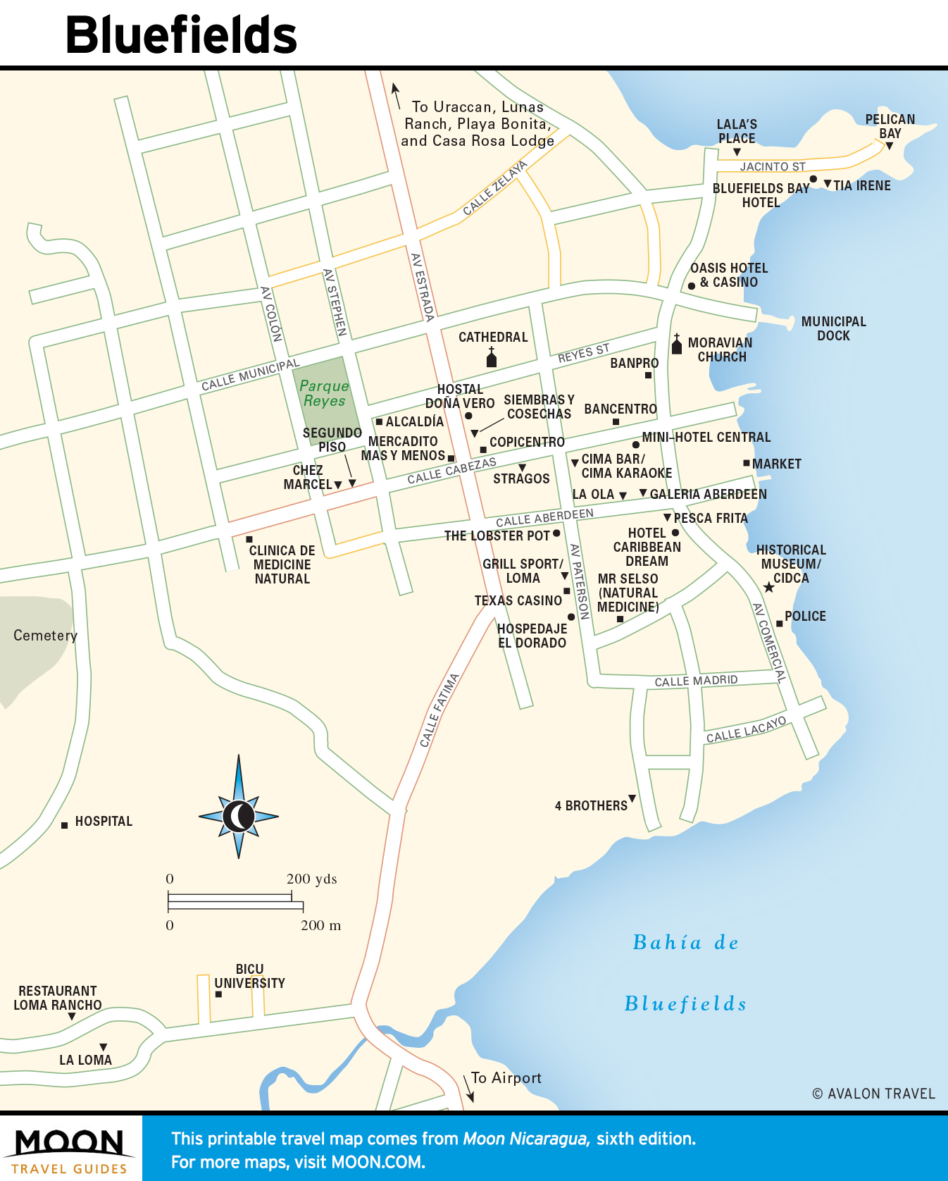
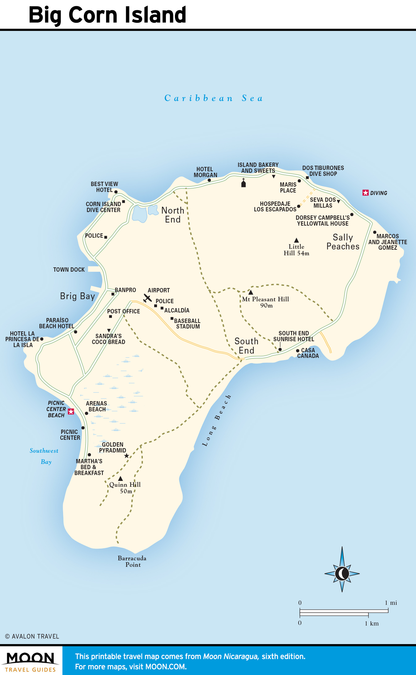
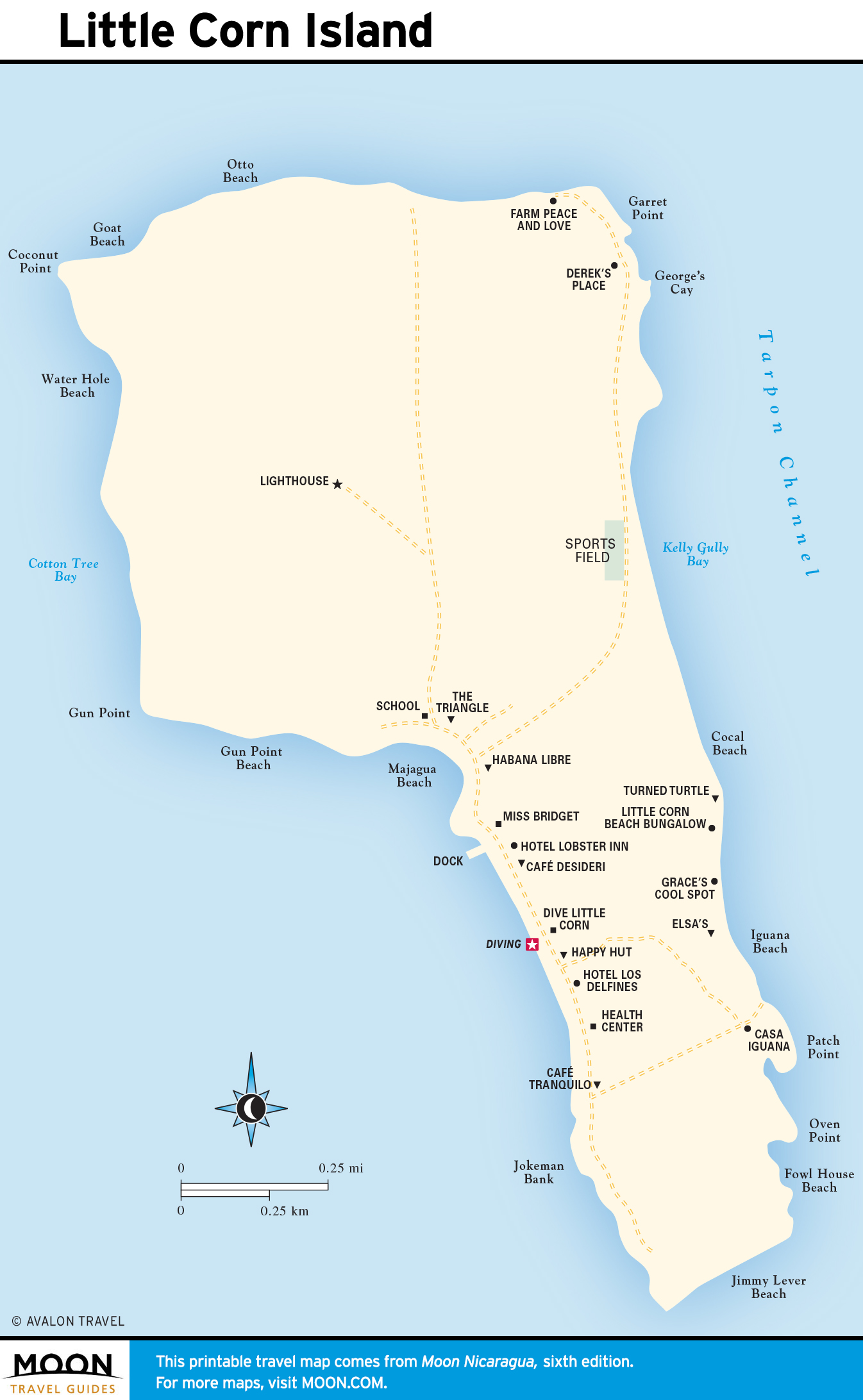
Bluefields and the Corn Islands
Nicaragua’s Caribbean is tough, muddy, and quite unlike any Cancún-tainted visions you may harbor. Most tourists fly straight from Managua to Big Corn, but a few hardy souls still visit Bluefields to experience Creole culture and crab soup.
Puerto Cabezas and the Río Coco
The northeast Miskito communities of Puerto Cabezas (Bilwi), Waspám, and the Río Coco are a far removed, embattled corner of the country, where resources go more toward fighting the drug trade and recovering from natural disasters than developing tourism.