Brazil
These free, printable travel maps of Brazil are divided into nine regions:
- Rio de Janeiro
- São Paulo
- The South
- Minas Gerais
- Brasília, Goiás, and the Pantanal
- Bahia
- Pernambuco and Alagoas
- The Northeast Coast
- The Amazon
Explore Brazil with these helpful travel maps.
Travel Map of Brazil
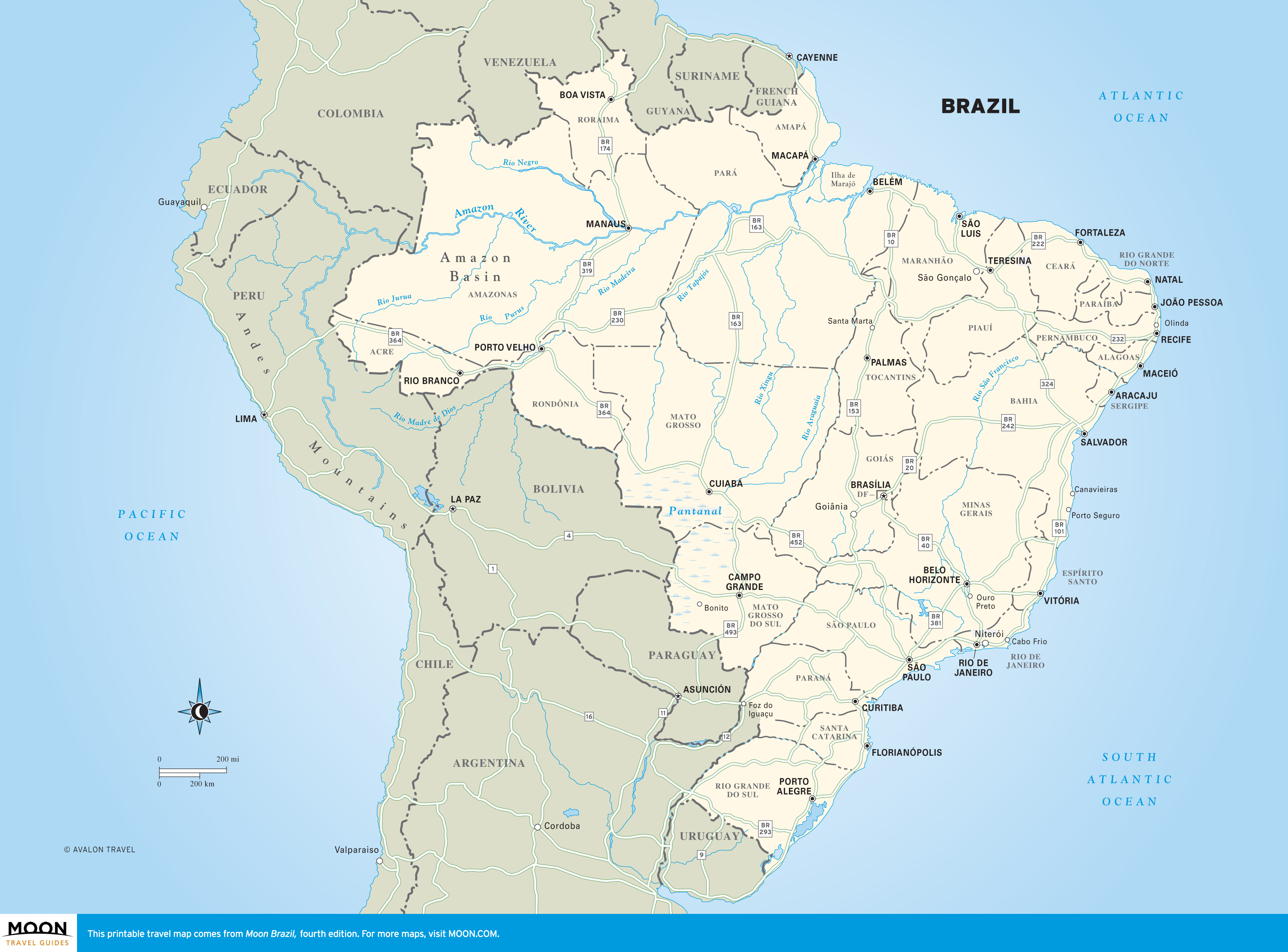
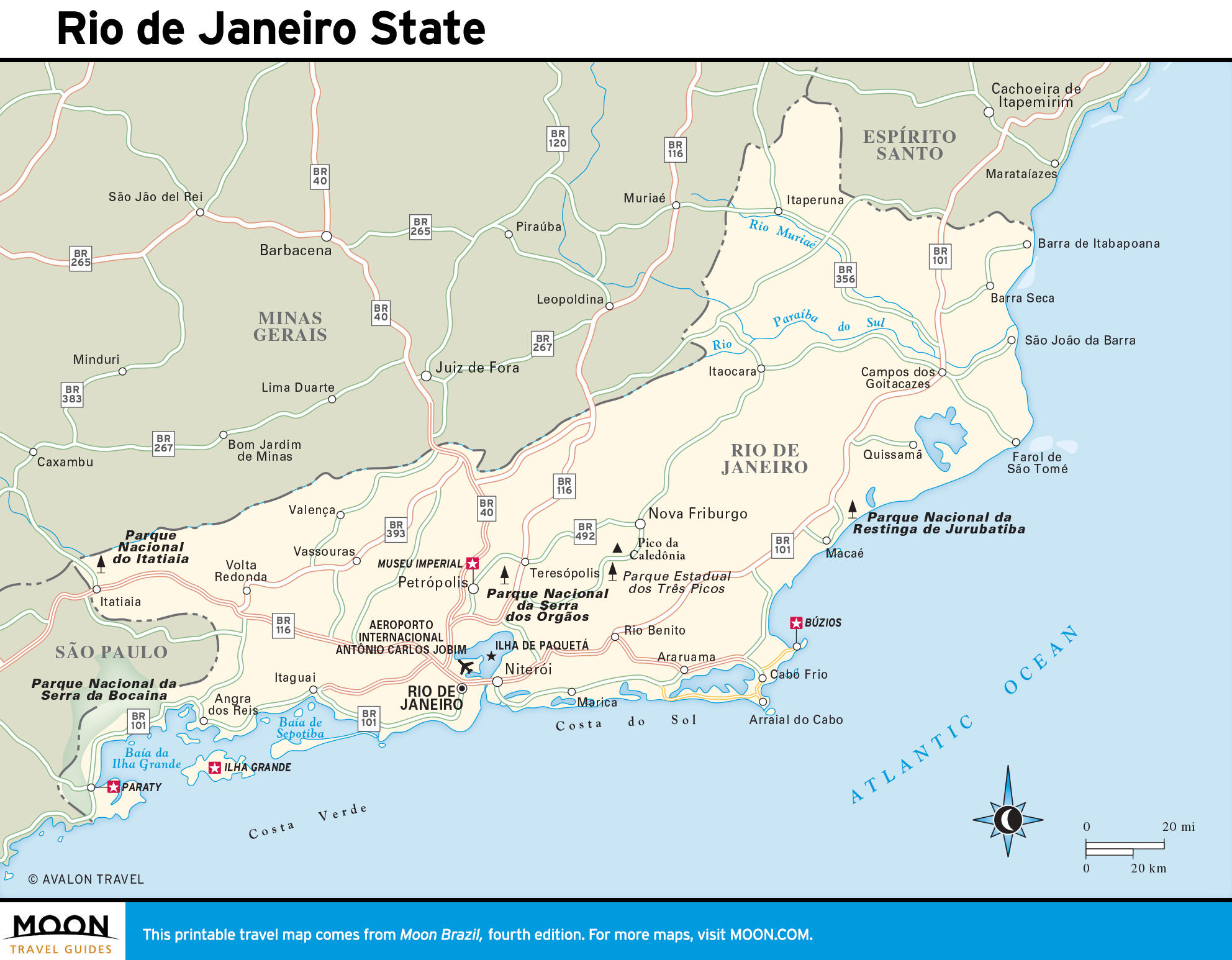
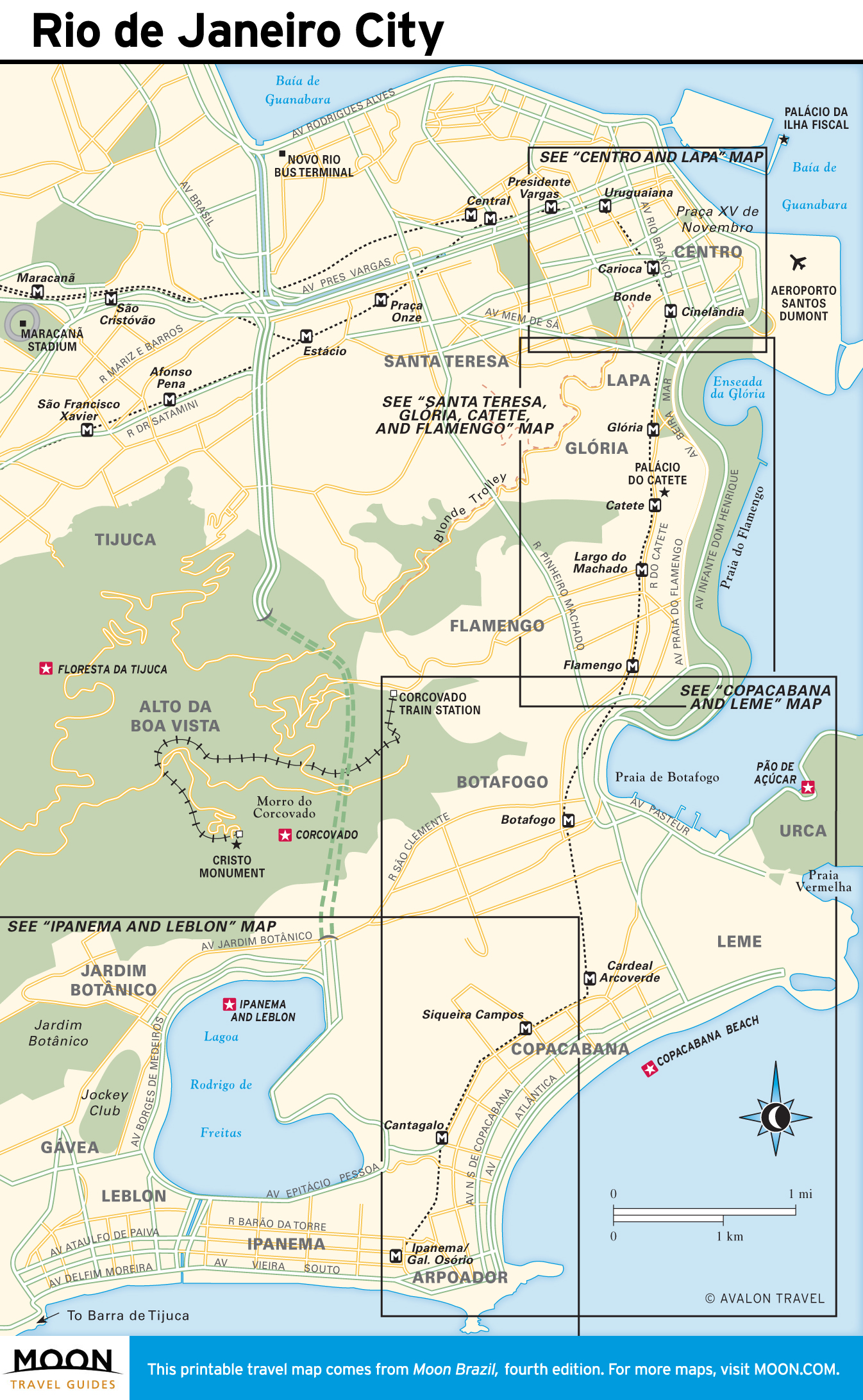
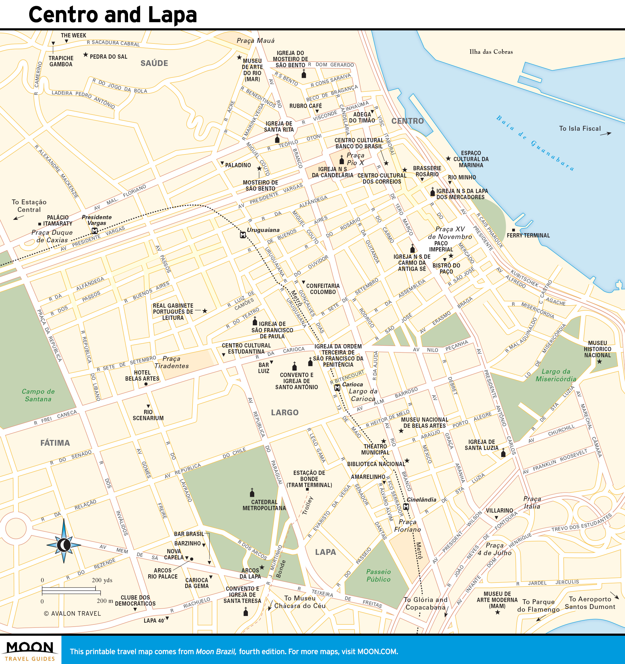
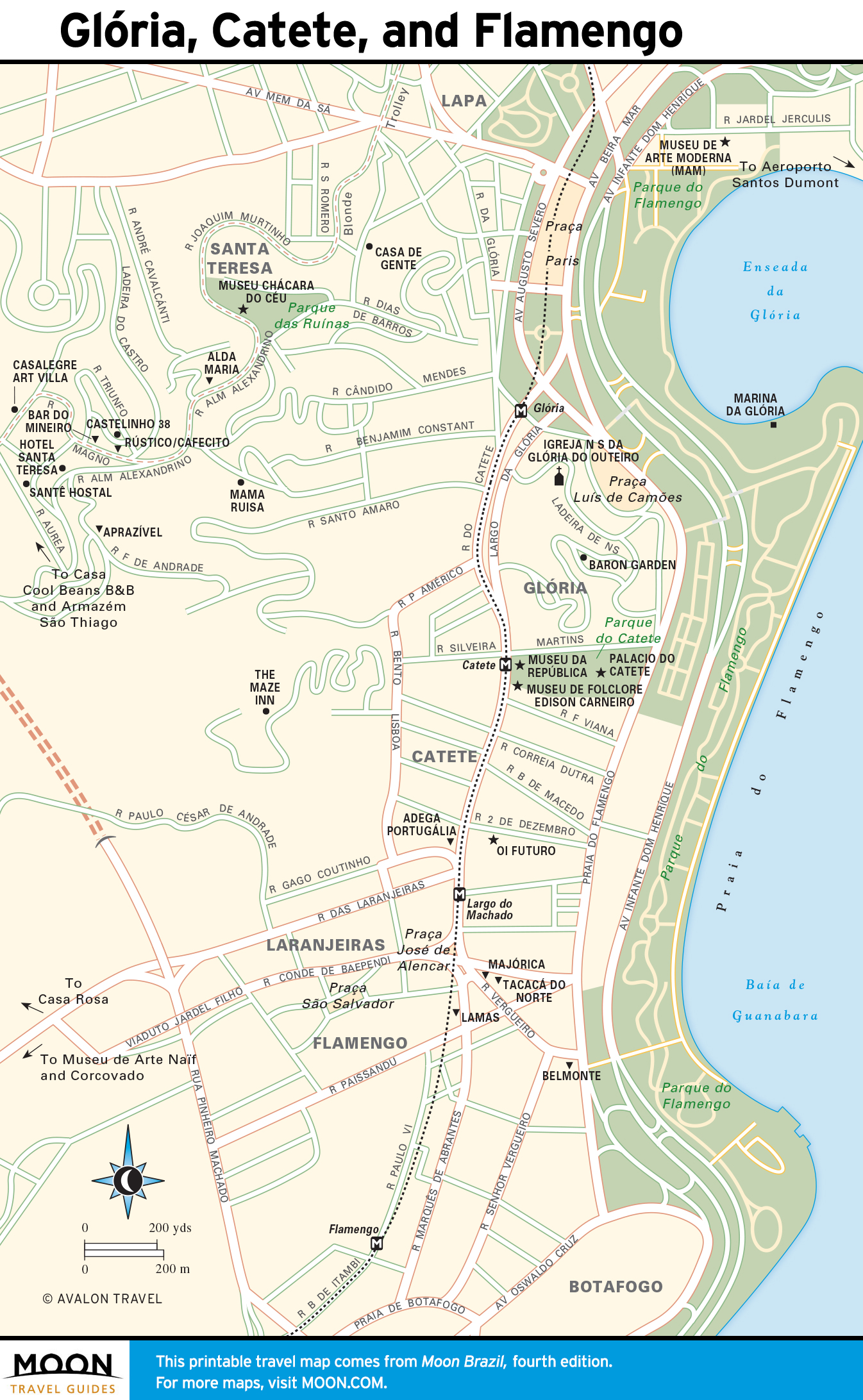
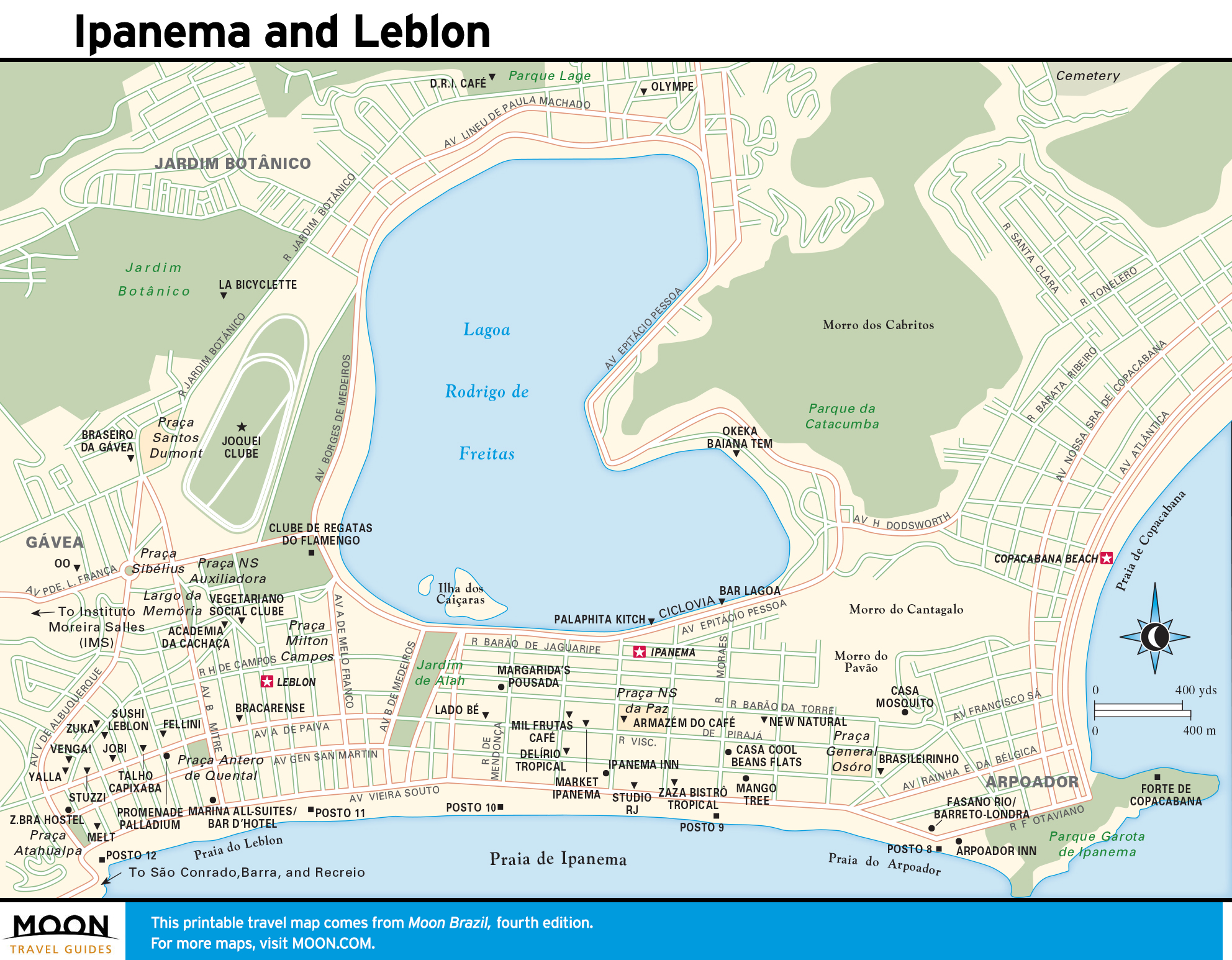
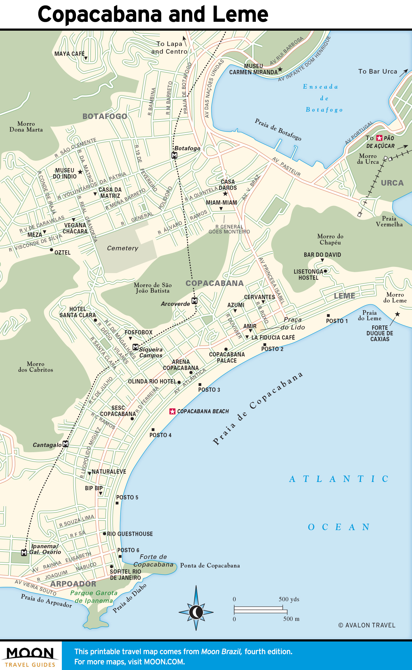
Rio de Janeiro
Squeezed between lush mountains and the Atlantic Ocean, Rio de Janeiro is one of the world’s most visually stunning cities. Historically and culturally rich, its iconic sights include Pão de Açúcar, Corcovado, and the beaches of Copacabana and Ipanema. Its compelling architecture and terrific museums are complemented by a relaxing vibe and pulsing nightlife. The small state of Rio de Janeiro has numerous getaways from the urban bustle, ranging from cool mountain retreats and virgin Atlantic rain forests to beautiful sandy beaches.
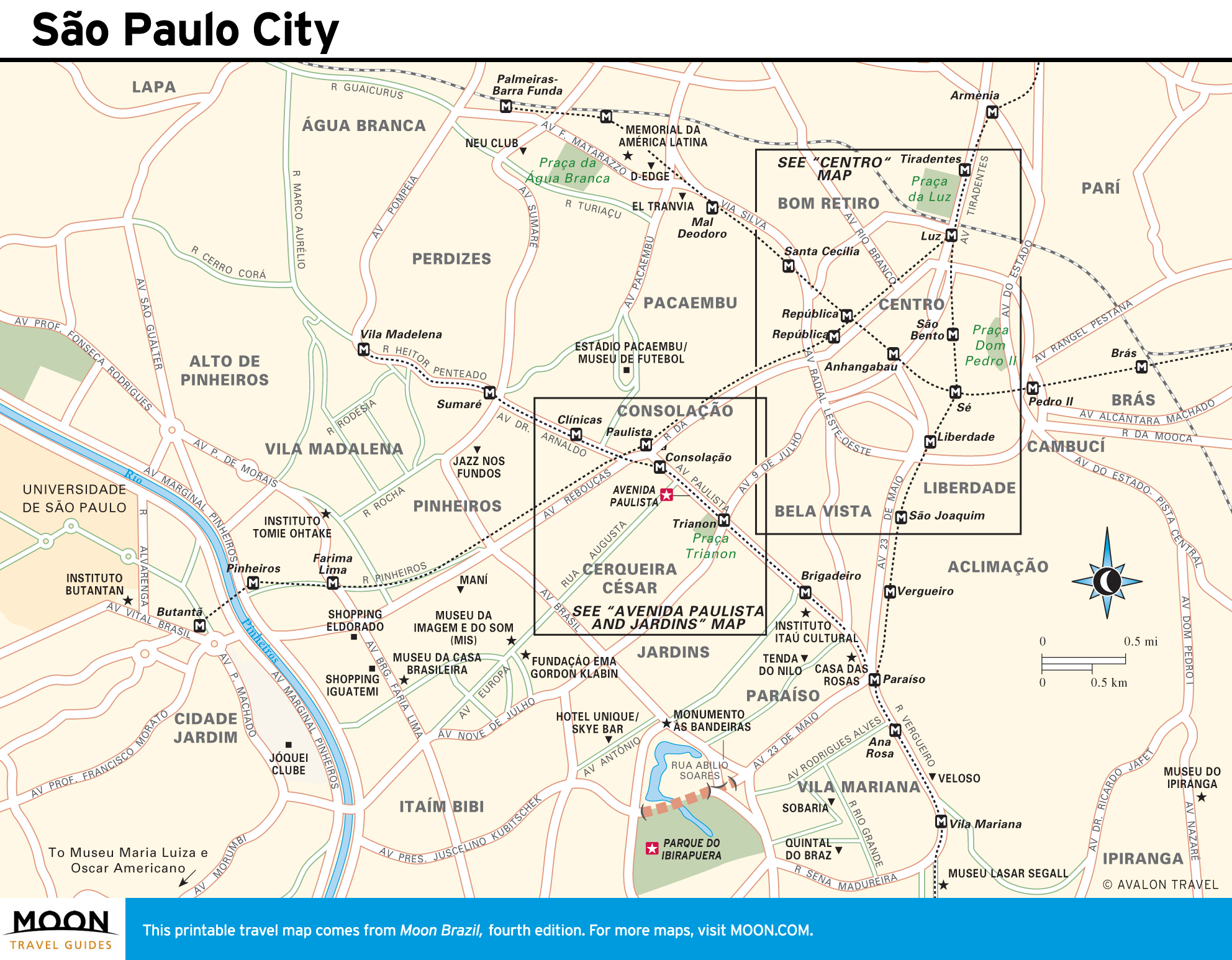
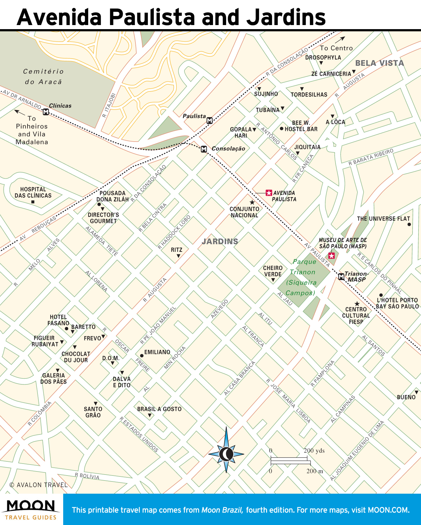
São Paulo
The city of São Paulo, Brazil’s economic and cultural powerhouse, is often overlooked by foreign tourists, but this megametropolis offers a wealth of artistic, gastronomic, nightlife, and shopping options. Its electric hustle can be felt on the main drag of Avenida Paulista, but urban oases, such as Parque do Ibirapuera, also abound. The interior of São Paulo state possesses Alpine-style resorts and unspoiled swaths of forest. The Litoral Norte features a string of trendy beach resort towns whose sugary sands are framed by mountains.

The South
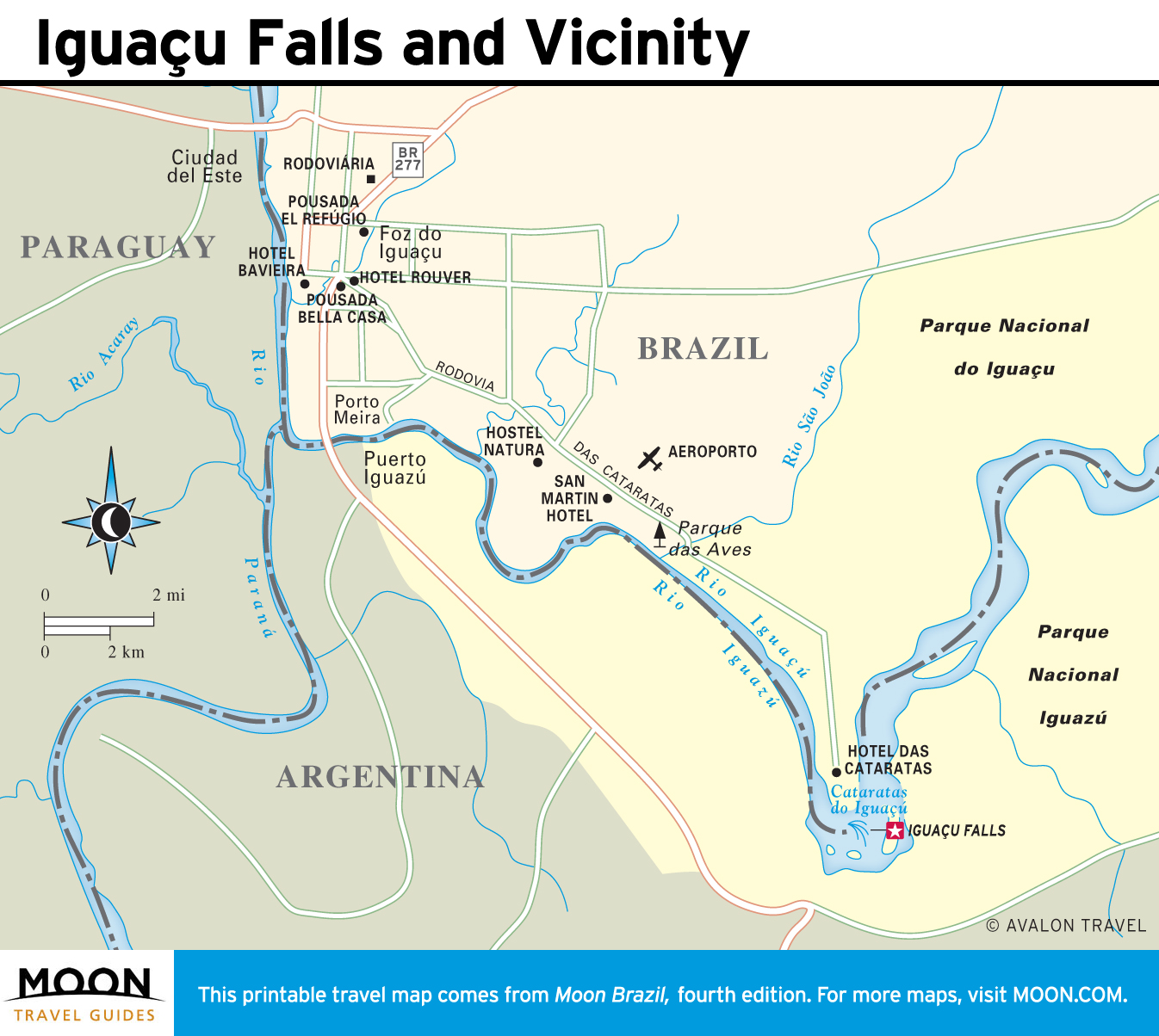
Known as O Sul (The South), the trio of narrow states running south from São Paulo is very different from the rest of Brazil. The area was settled largely by 19th-century immigrants from Germany, Poland, Ukraine, and Italy, and European influence remains strong. Striking natural attractions include the windswept beaches of Santa Catarina, the rugged Serra Gaúcha mountain range of Rio Grande do Sul, and the jaw-dropping, body-drenching spectacle of Iguaçu Falls.


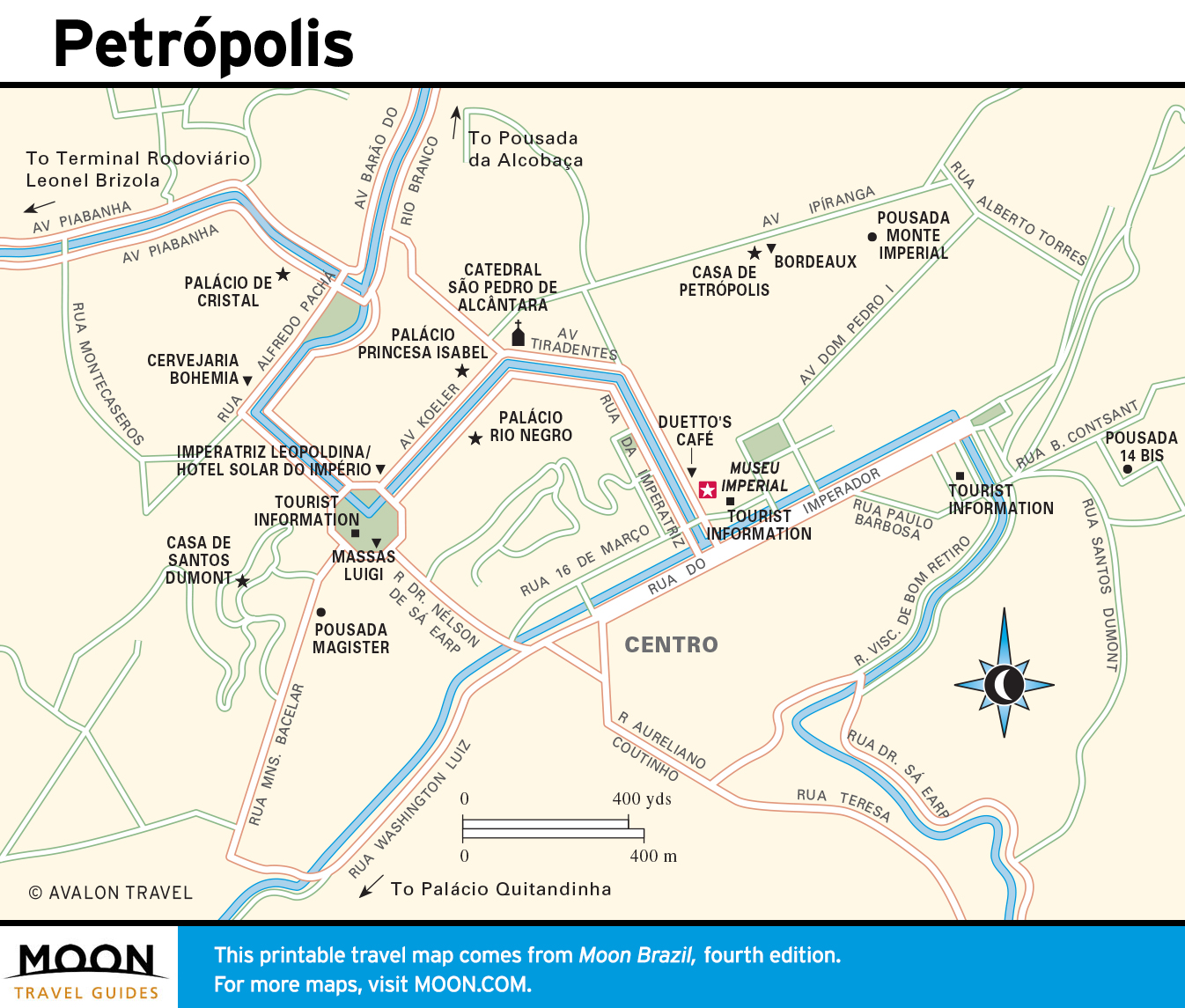
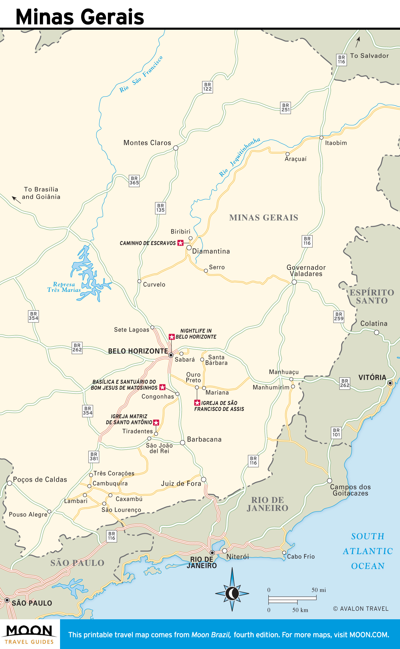
Minas Gerais
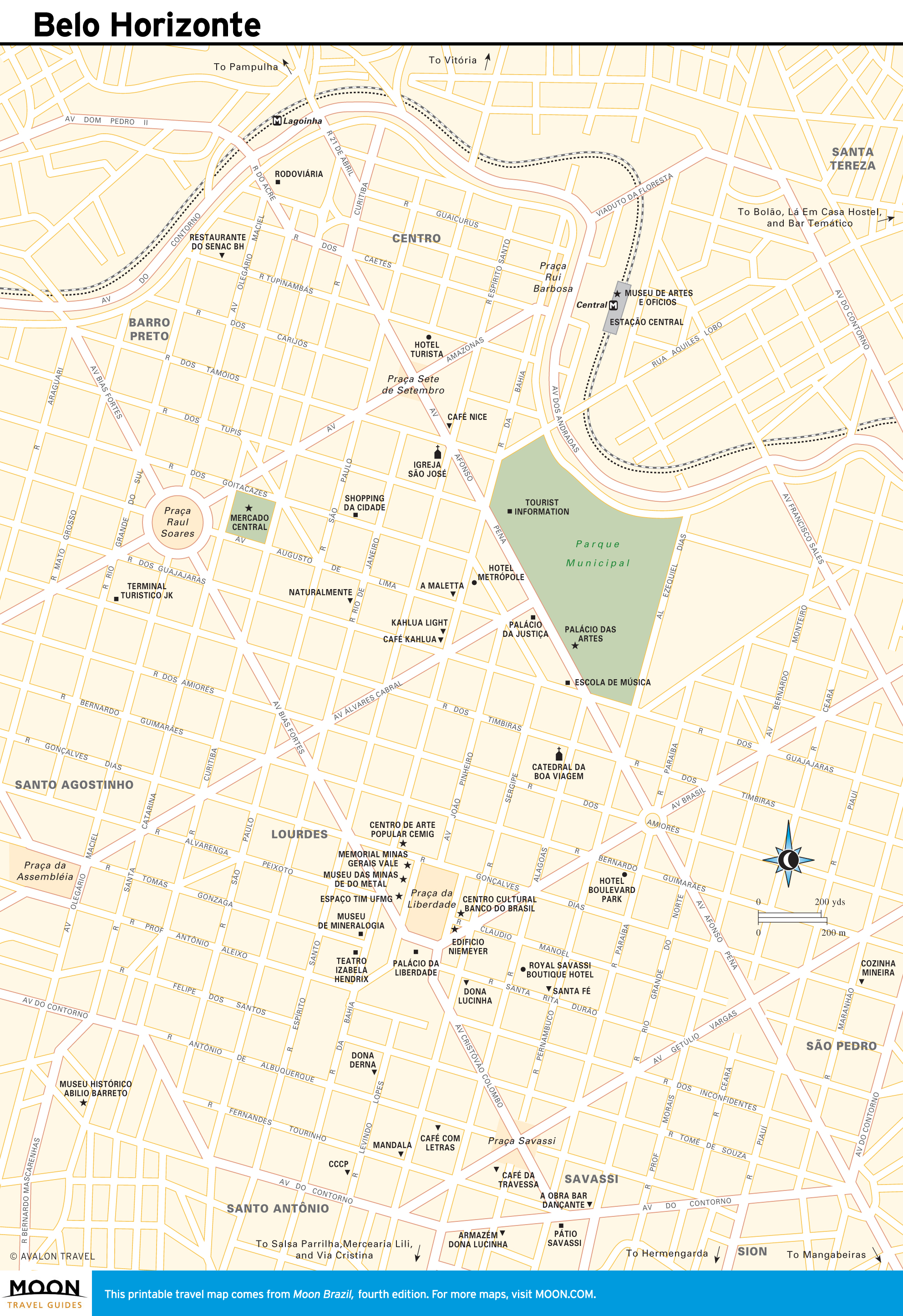
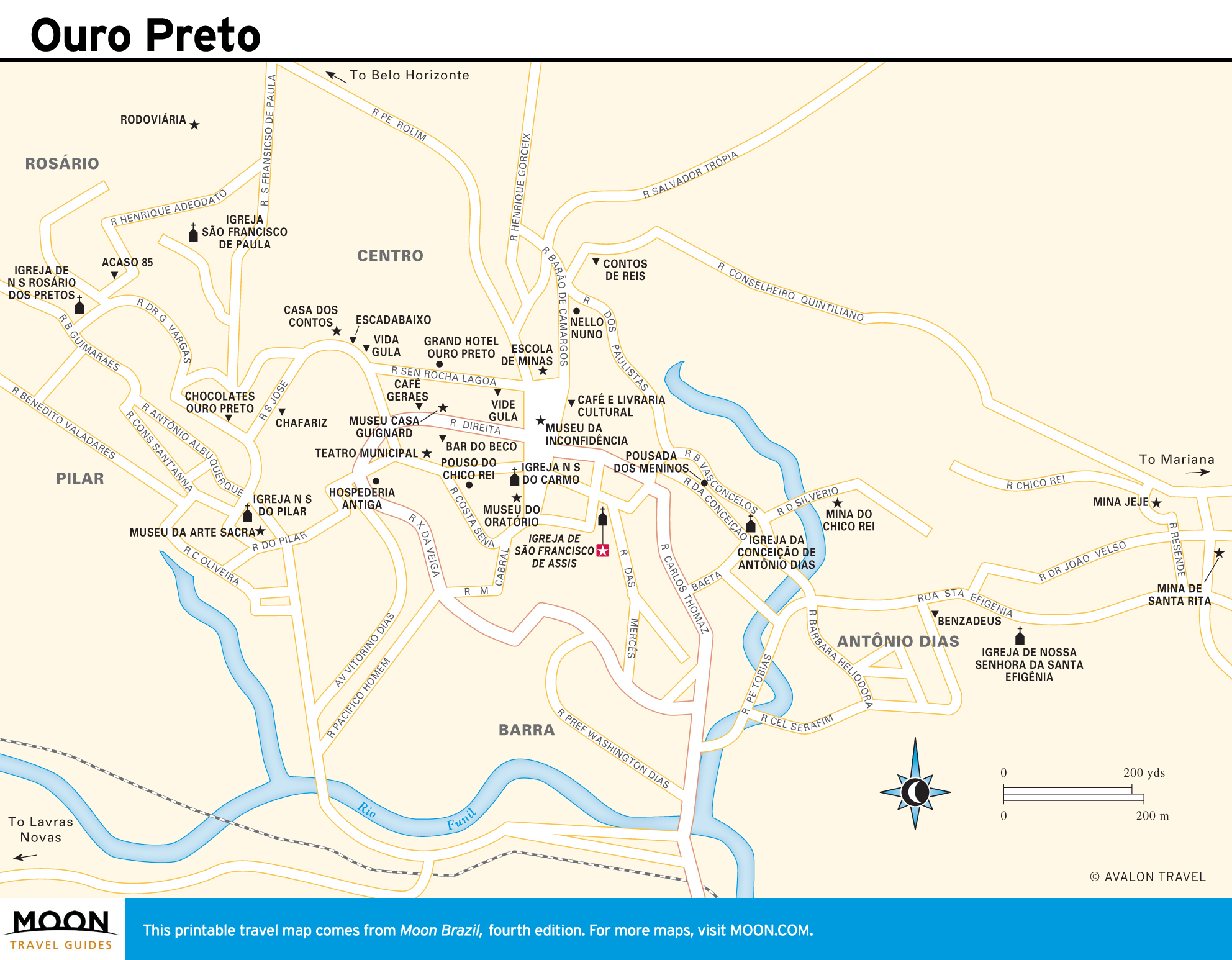
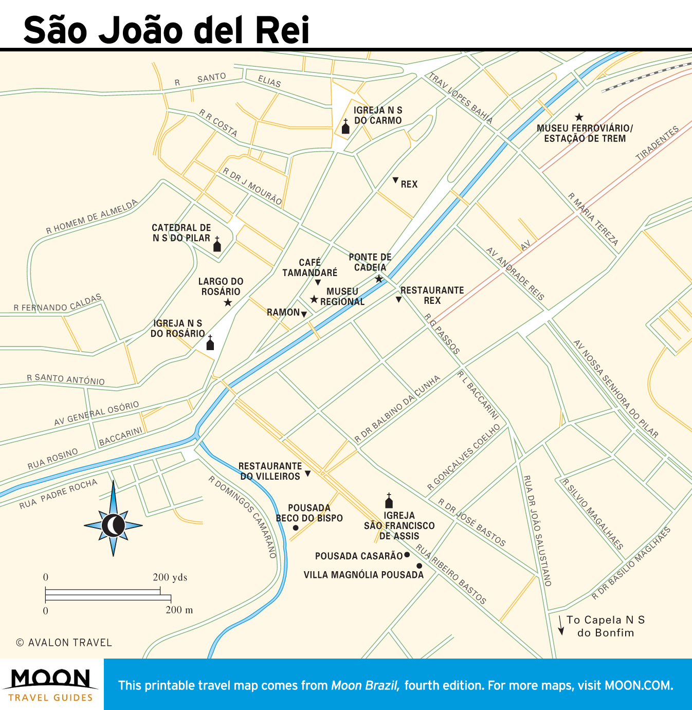
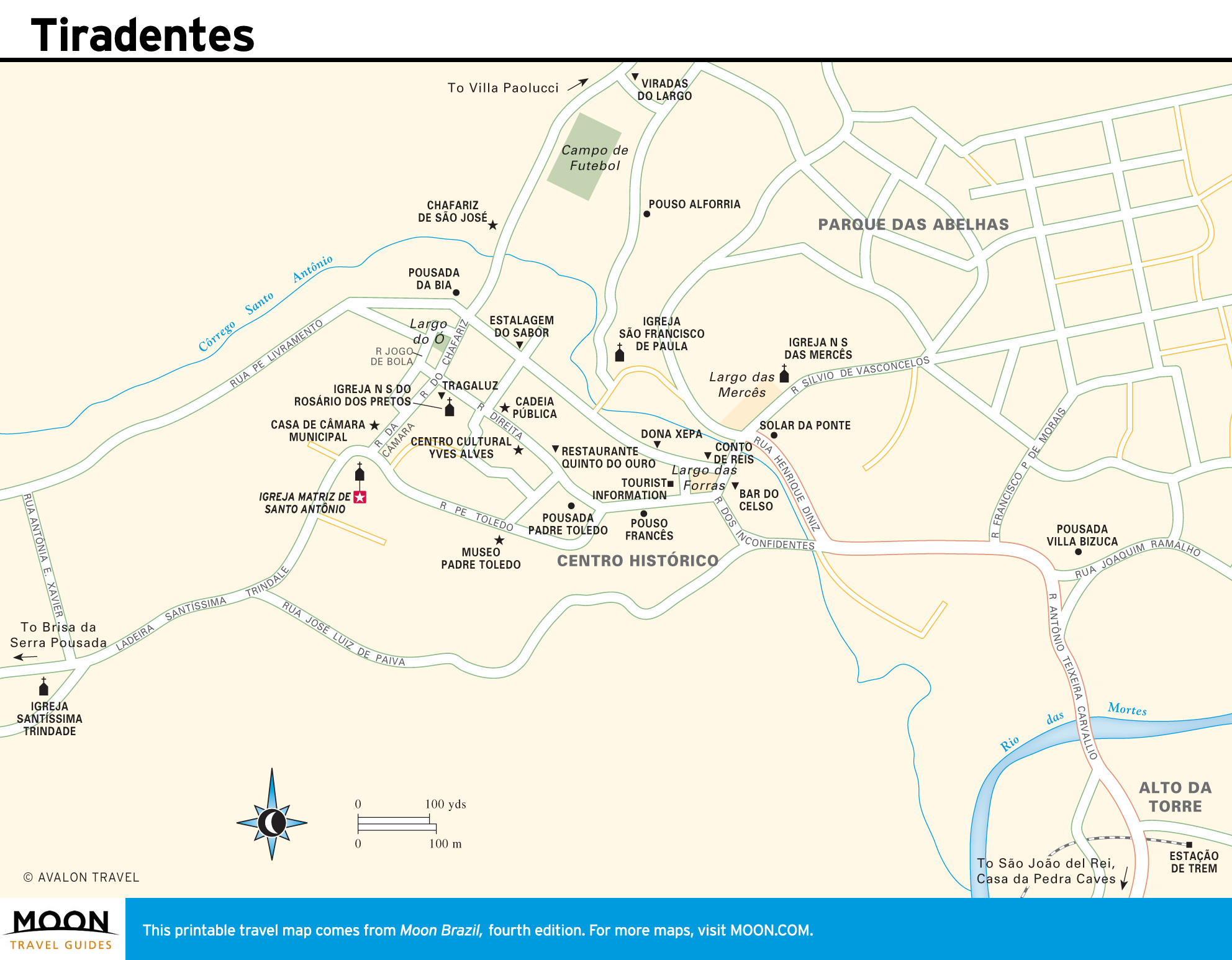
Despite important mining and metal industries and the sophisticated capital, Belo Horizonte, this inland state has a rural character enhanced by its craggy mountains, robust cuisine, and bracing cachaças. Minas Gerais is also steeped in history: You’ll find extravagant baroque churches lined with pure gold along with 17th-century colonial mining towns such as Ouro Preto, Mariana, São João del Rei, Tiradentes, and Diamantina. Collectively known as the cidades históricas, each one has its own flavor, but all showcase splendid Brazilian colonial architecture.
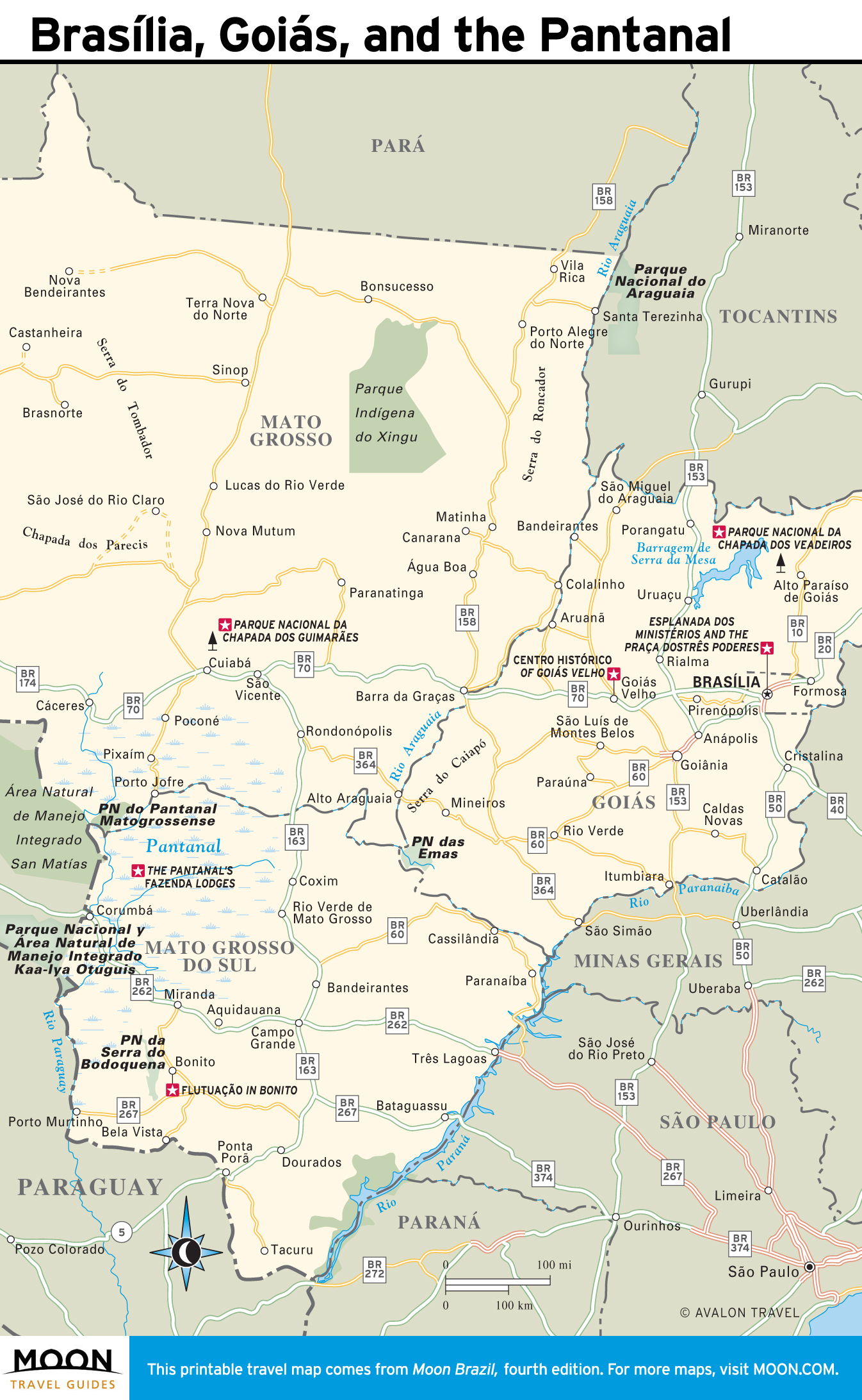
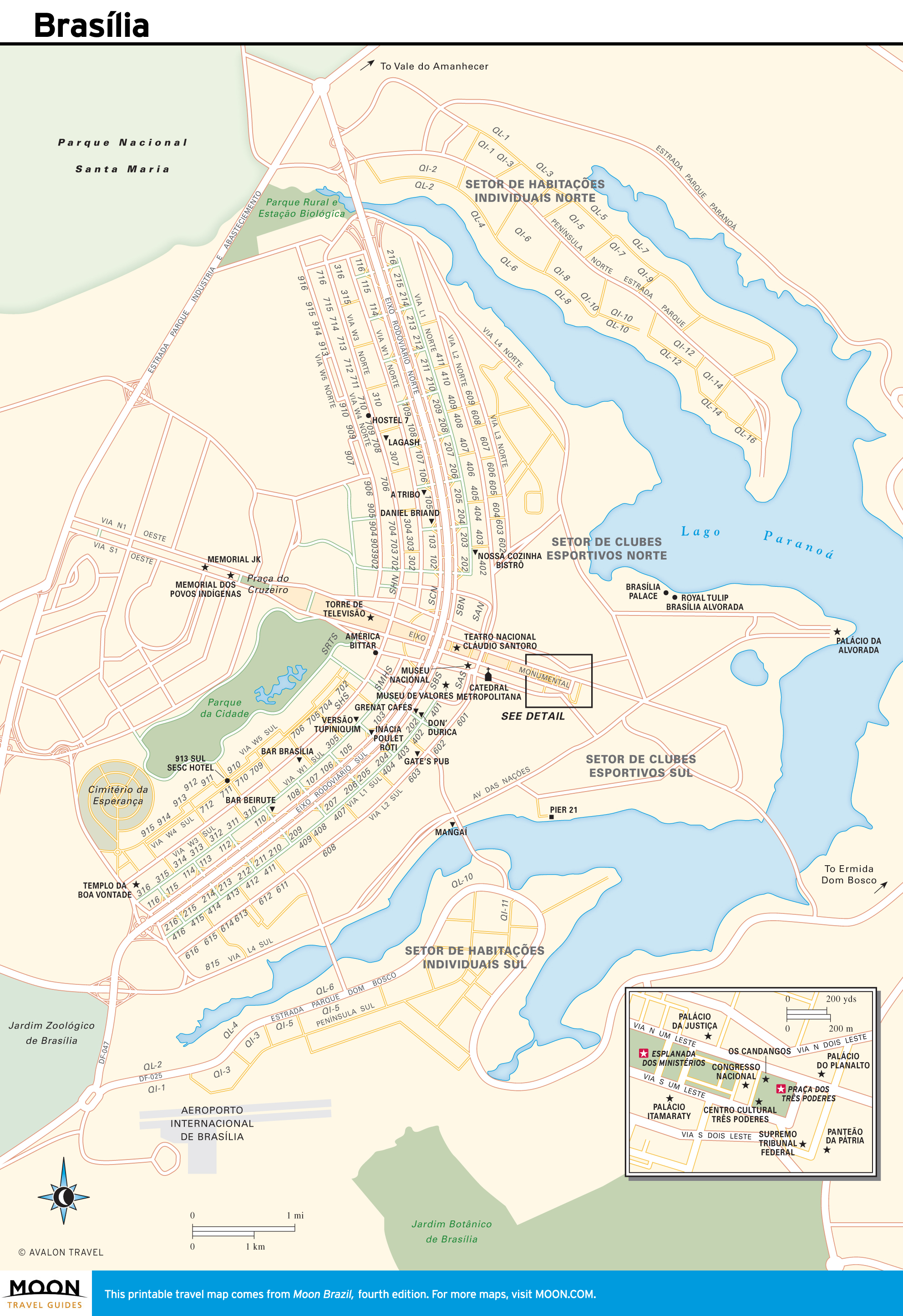
Brasília, Goiás, and the Pantanal
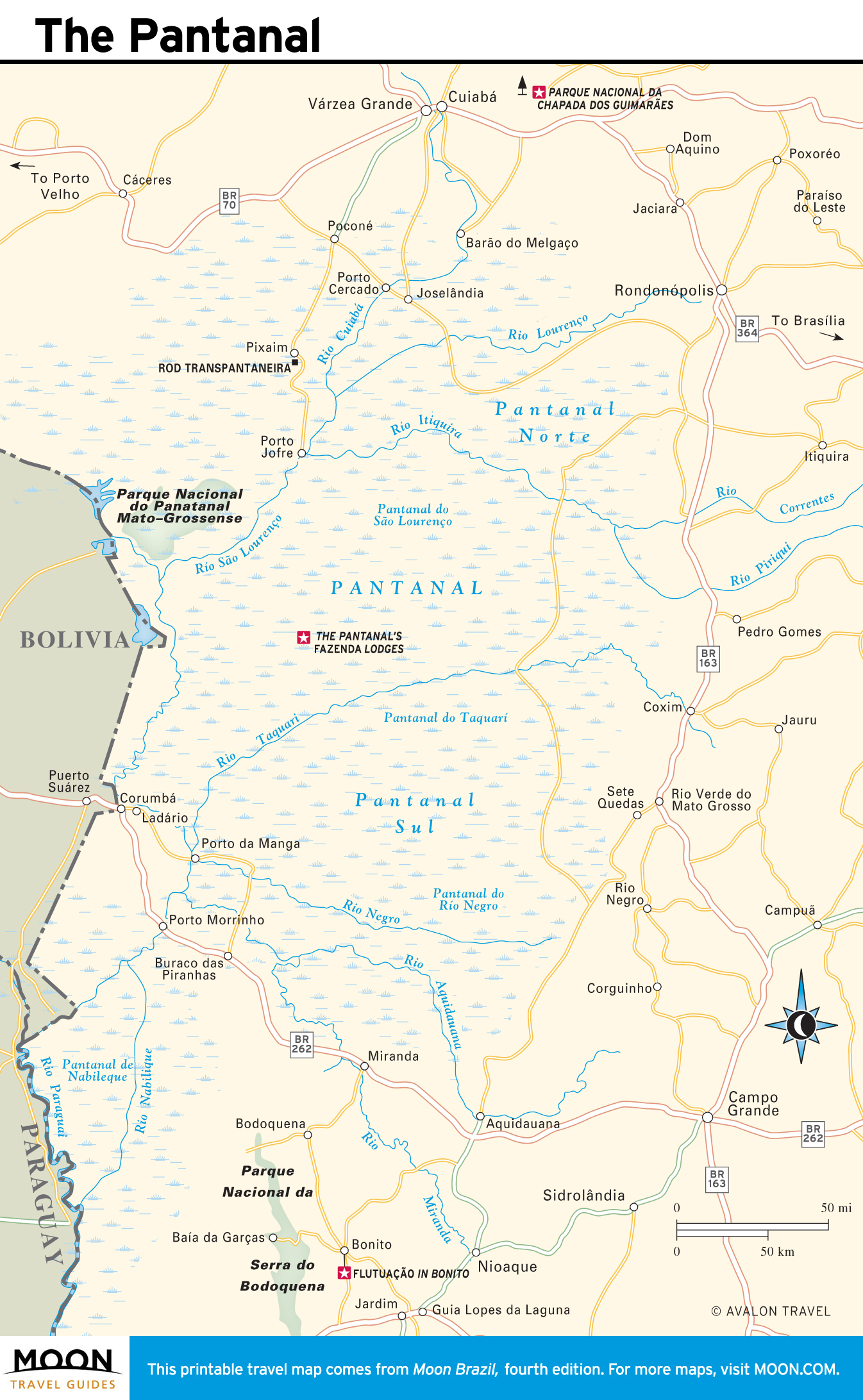
Brazil’s space-age capital, Brasília, sits in a flat plateau region known as the Planalto. The city symbolically marks the heart of Brazil and offers a unique mélange of utopian modernist architecture. Brasília is the gateway to the state of Goiás, which features colonial towns and the savanna-like Cerrado riddled with waterfalls. Farther west, Mato Grosso and Mato Grosso do Sul constitute a vast Wild West region with a frontier feel. Both states share the Pantanal, the world’s largest wetlands, which teems with wildlife.
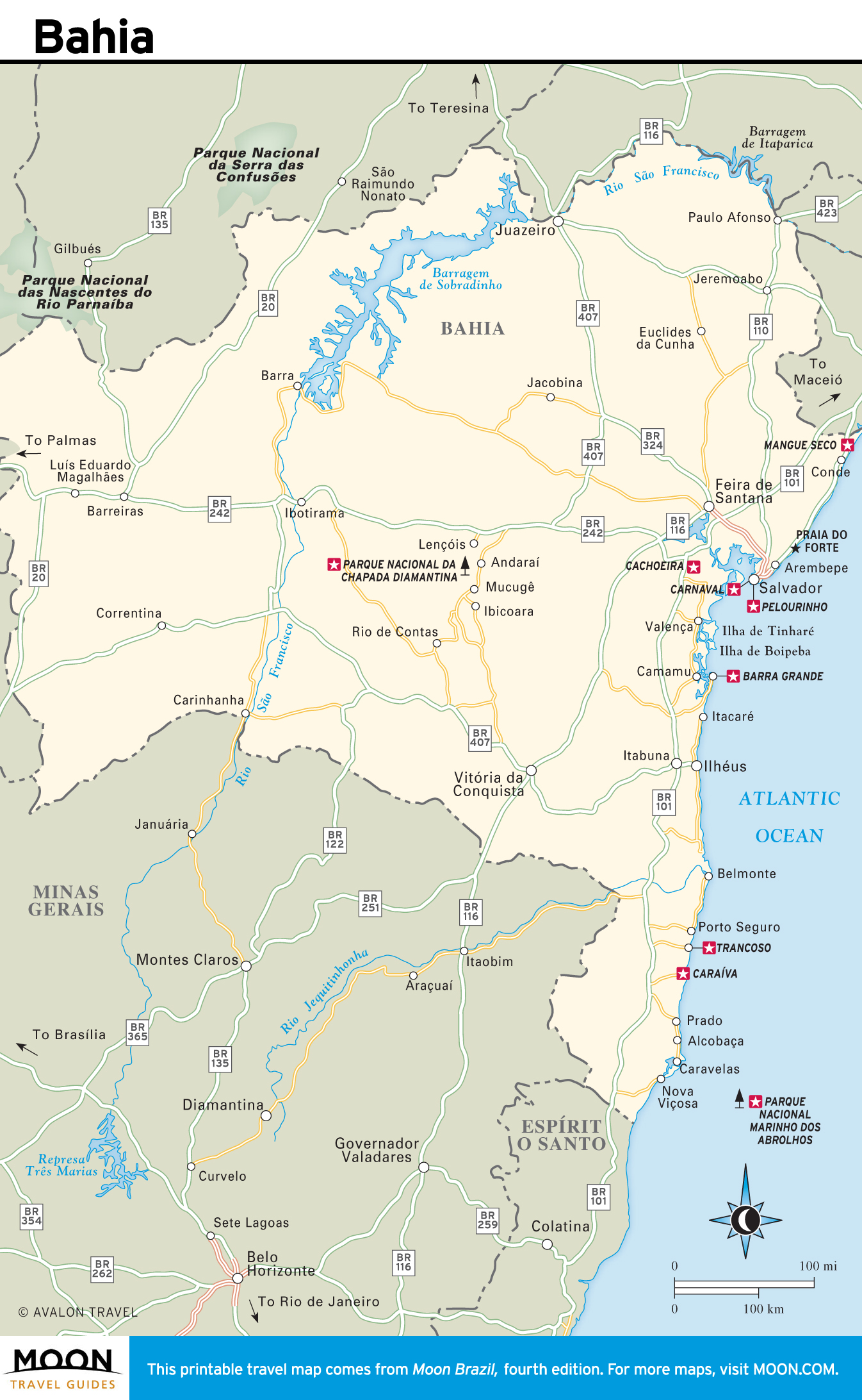
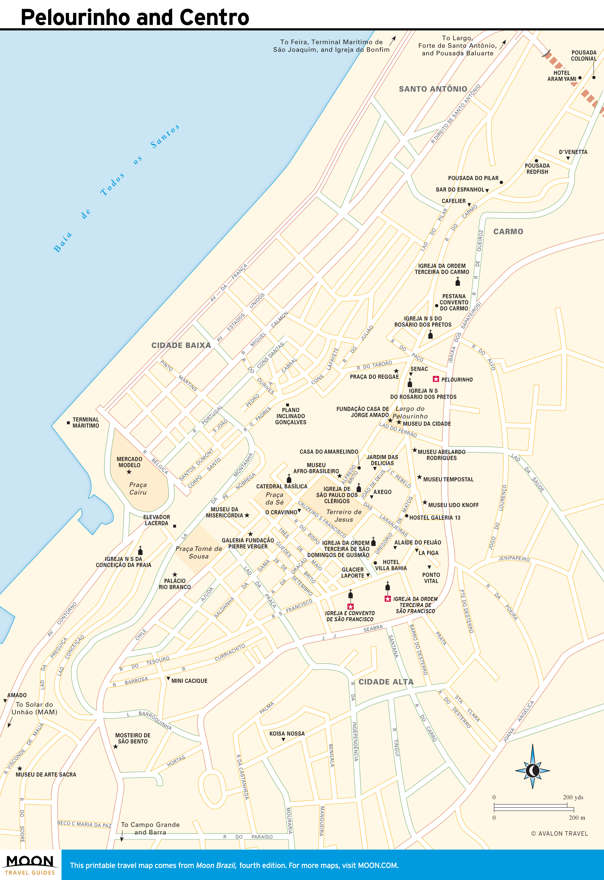
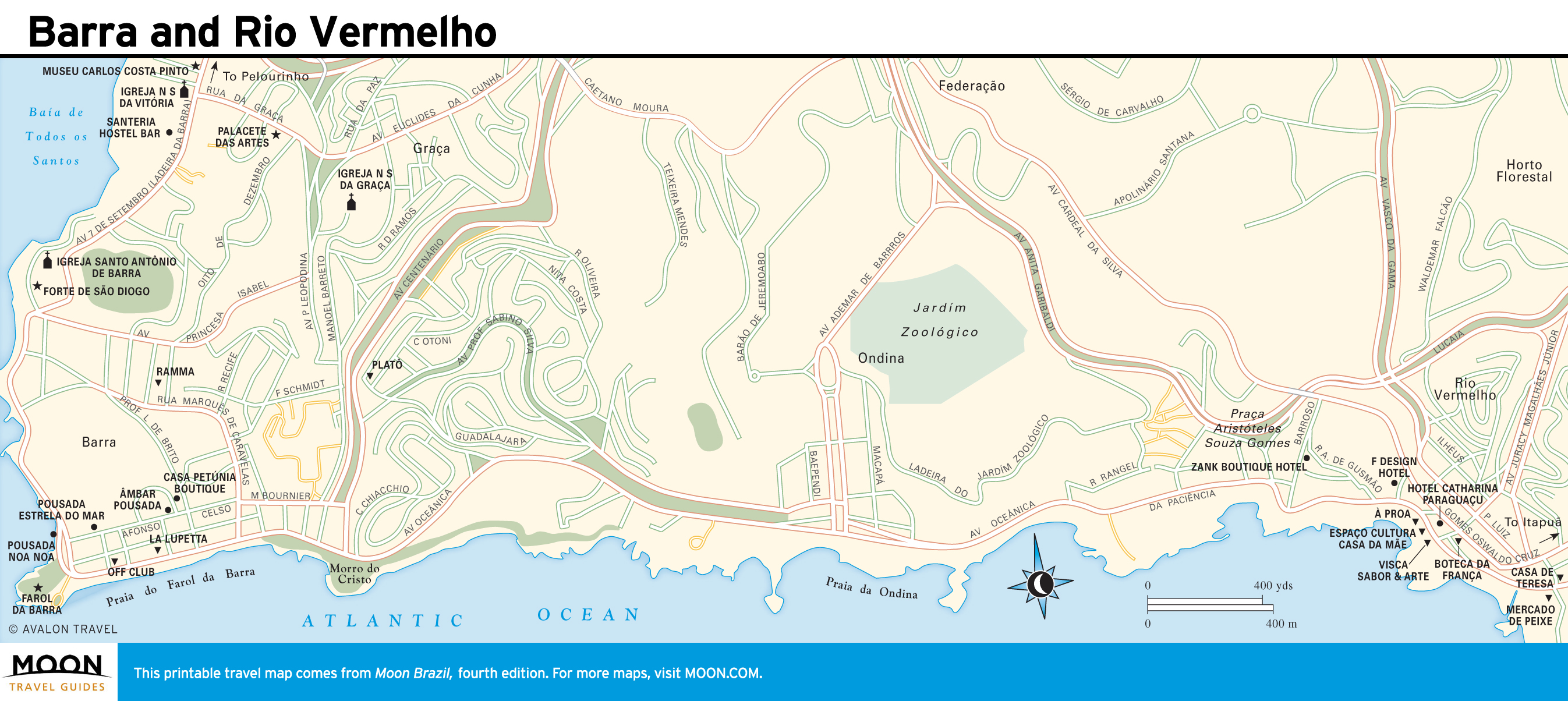
Bahia
Salvador was Brazil’s first capital, a legacy that has left it with a captivating historical center and one of Brazil’s most potent traditional cultures. A strong African influence colors everything from religious celebrations and festas to music, dance, and cuisine. Bahia boasts Brazil’s longest coastline and some of its most captivating tropical beaches. Inland, the Chapada Diamantina is a lush oasis of mountains and waterfalls, speckled with colonial diamond-mining towns.

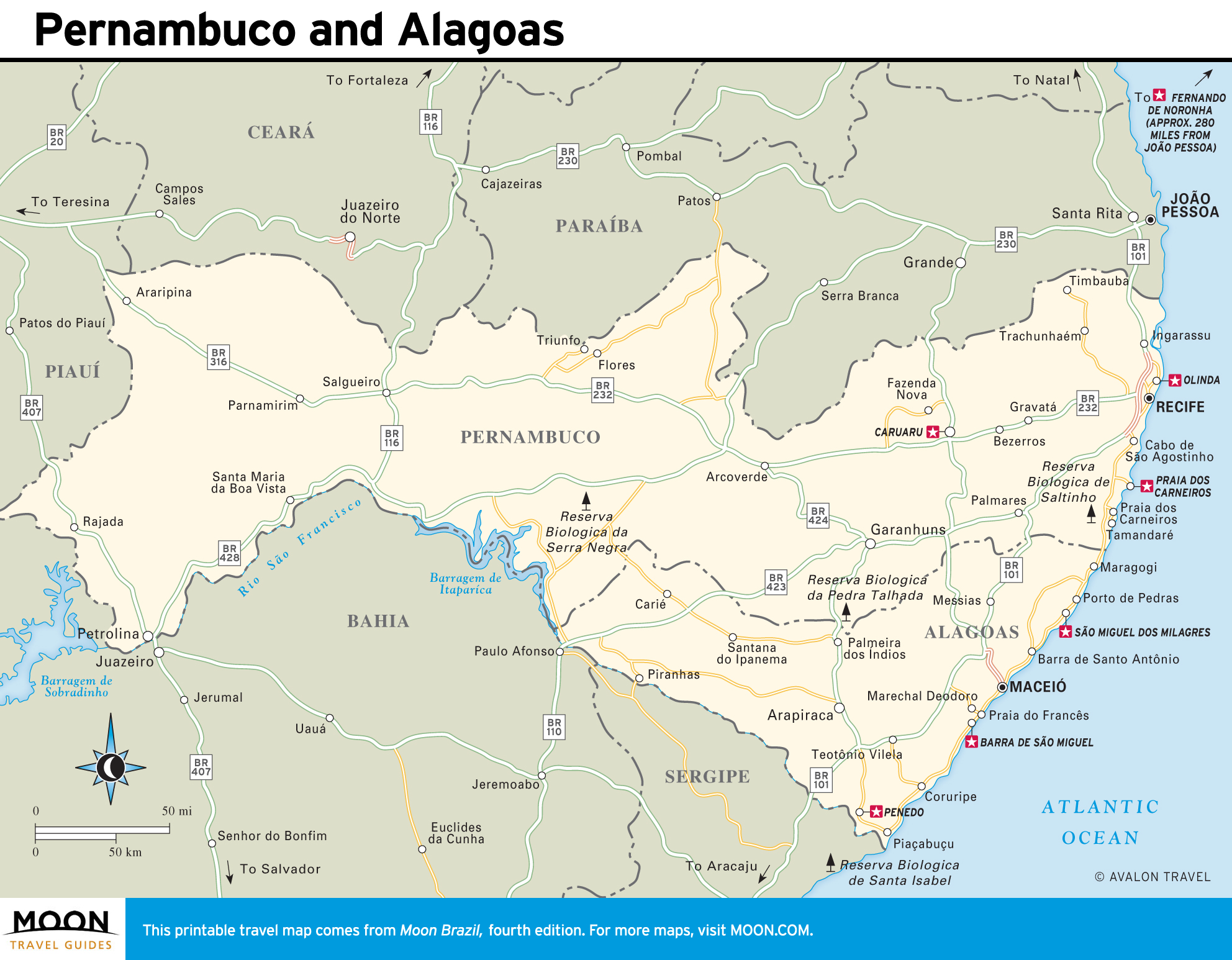
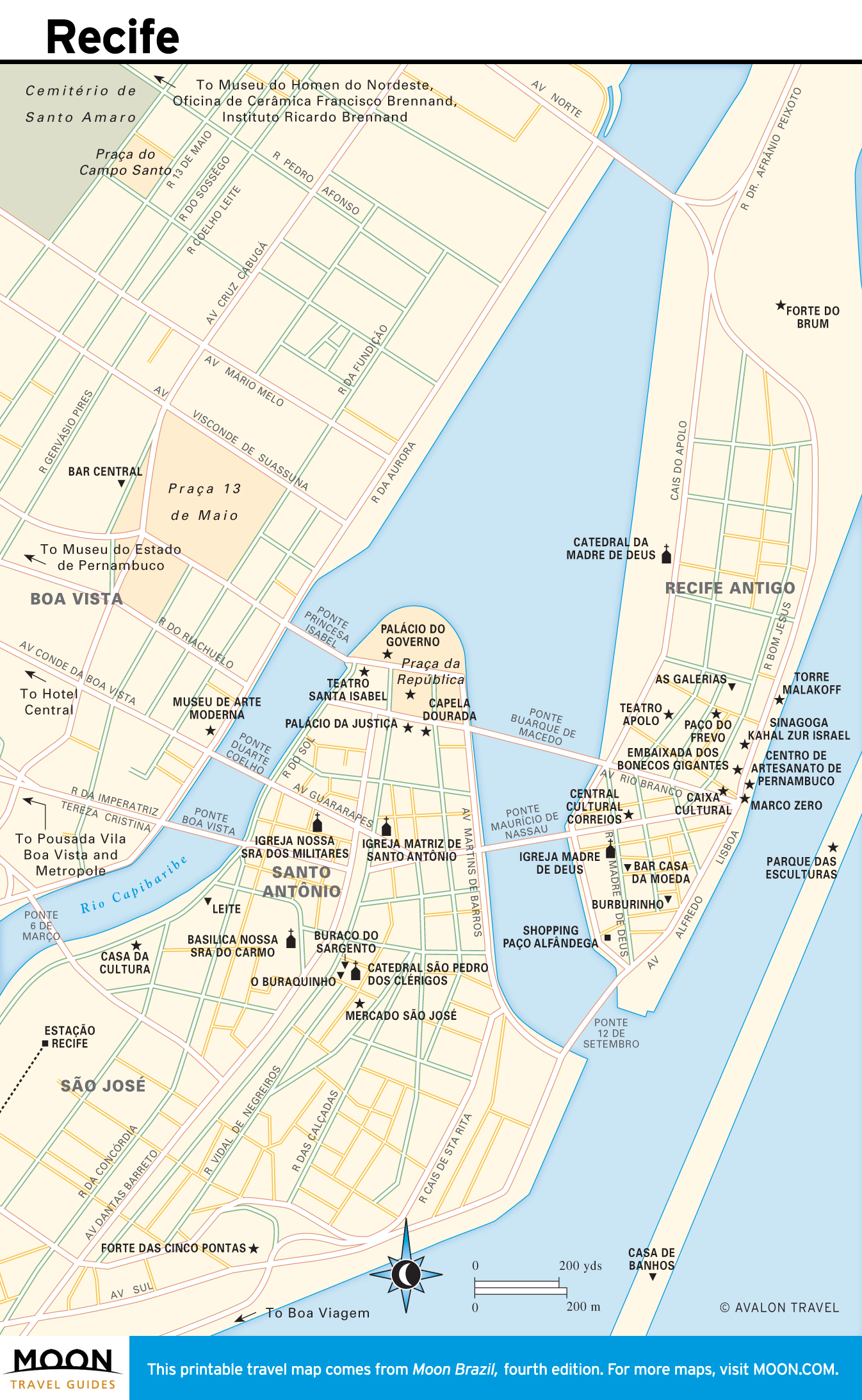
Pernambuco and Alagoas
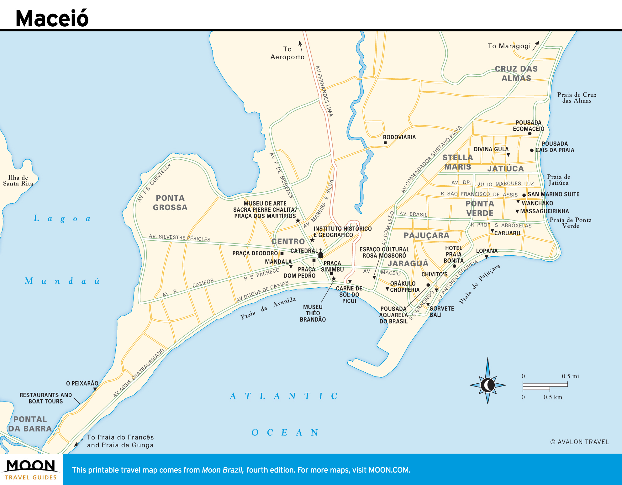
Pernambuco’s coastal capital, Recife, is steeped in a vibrant local culture, while Olinda is one of Brazil’s most seductive colonial towns, with baroque churches perched on palmy hills and a thriving artists’ scene. Inland, the rich culture of the Sertão offers a feast of forró, sun-dried beef, and artisanal traditions. Heading south, the coast is lined with drop-dead gorgeous beaches. The snorkeling is superb along the coast of Alagoas, a tiny state to the south, anchored by its laid-back capital, Maceió.
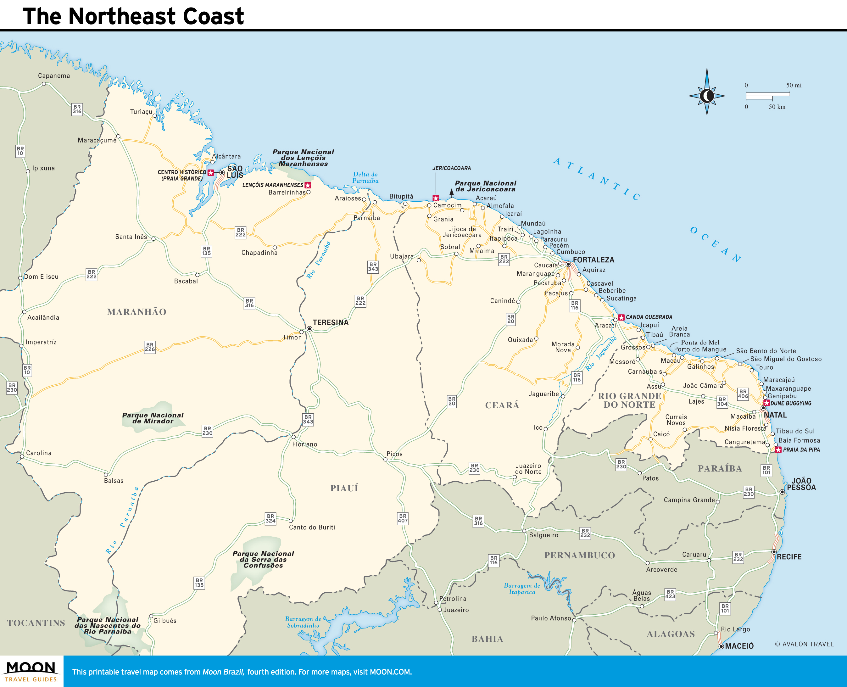
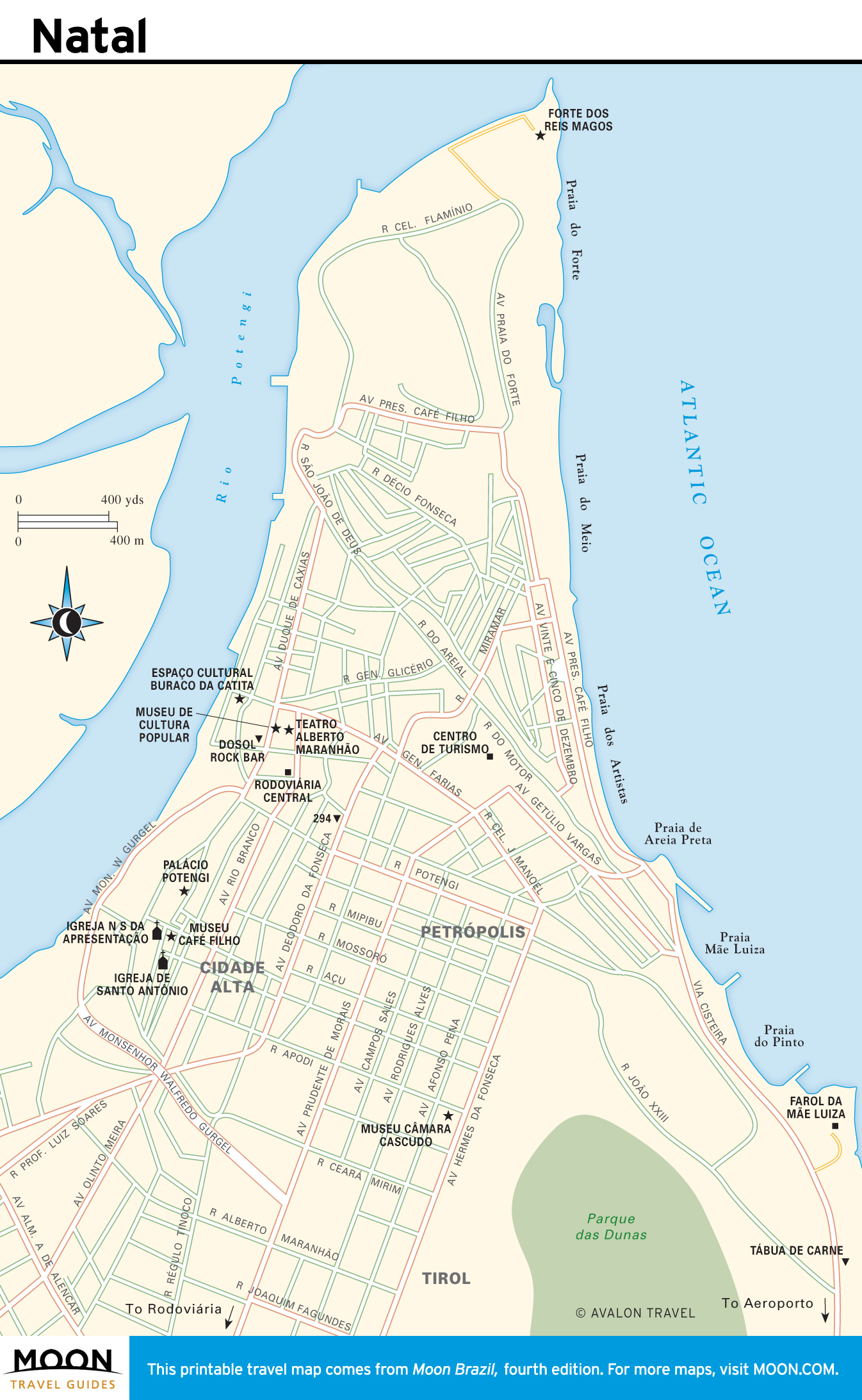
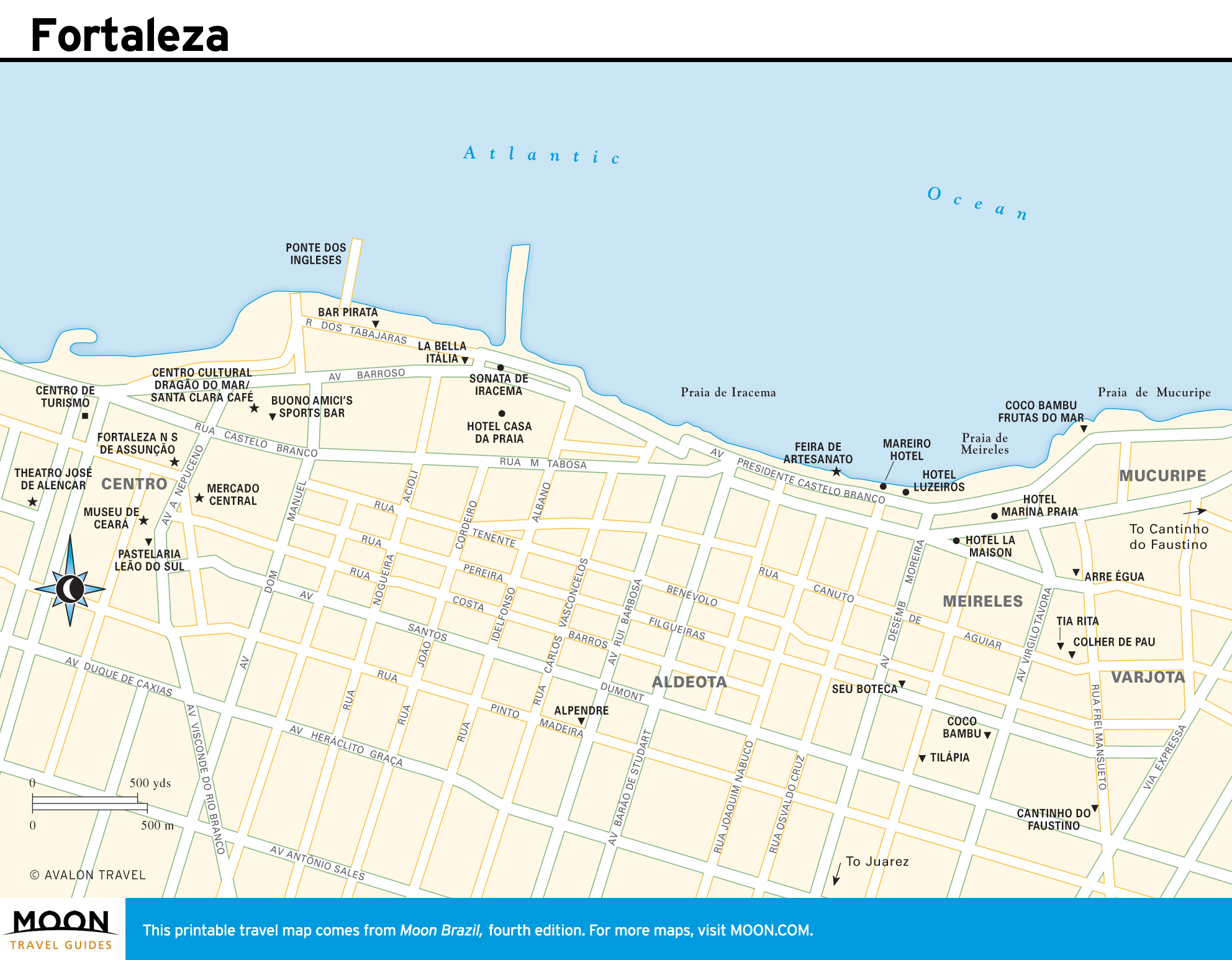
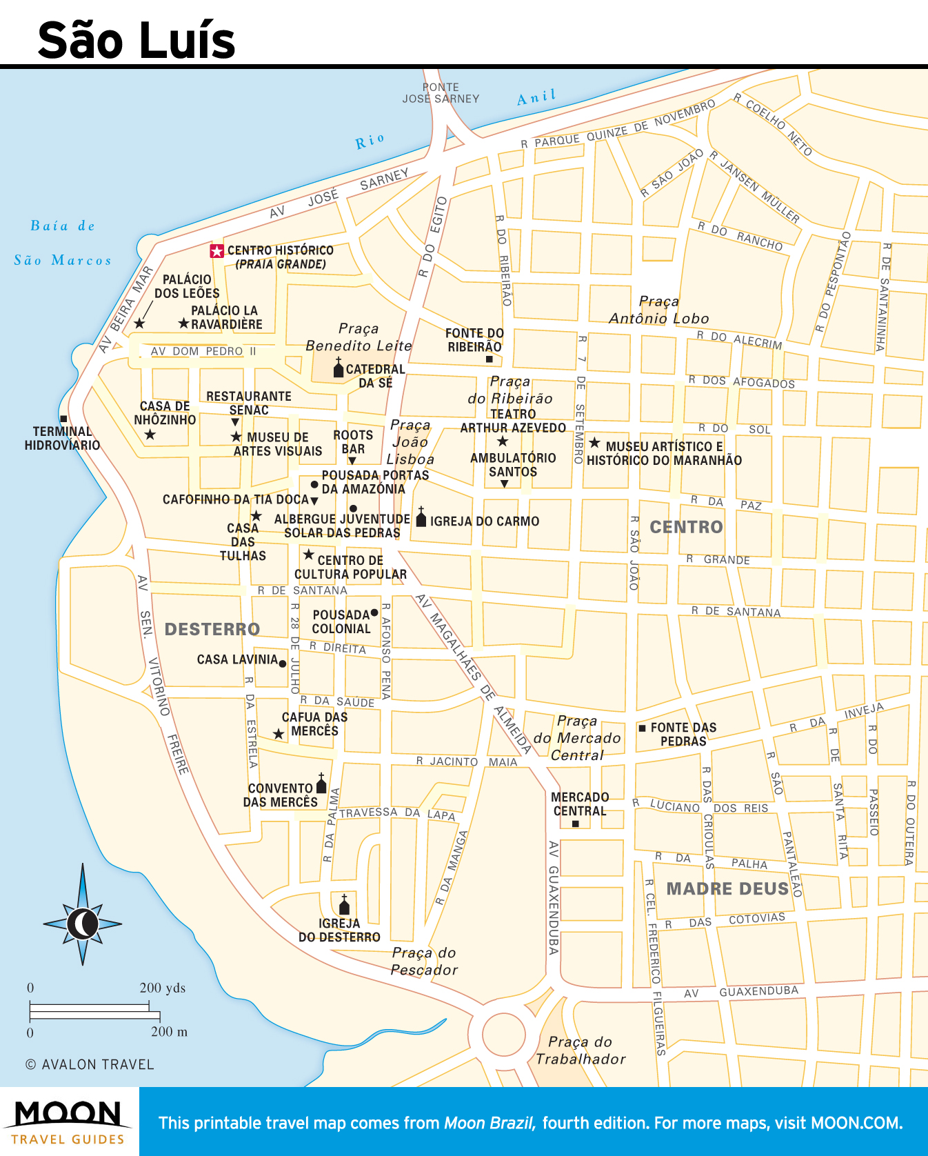
The Northeast Coast
The beachscapes in this region, which extend uninterrupted from Rio Grande do Norte across the state of Ceará and into Maranhão, vary from Saharan dunes navigable by buggy, sand board, or dromedary to sweeping white beaches backed by crumbling red cliffs. The bustling and touristy capital cities of Natal and Fortaleza offer access to rustic resorts, such as the famously secluded Jericoacoara. Maranhão provides a transition between the arid Northeast and the lush, wet Amazon. Its island capital of São Luís possesses an atmospheric colonial center.
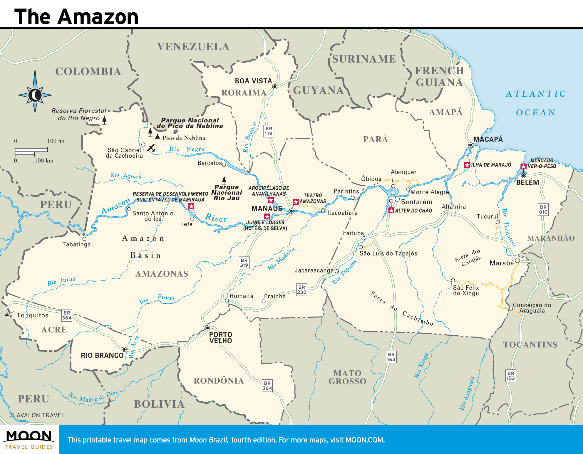
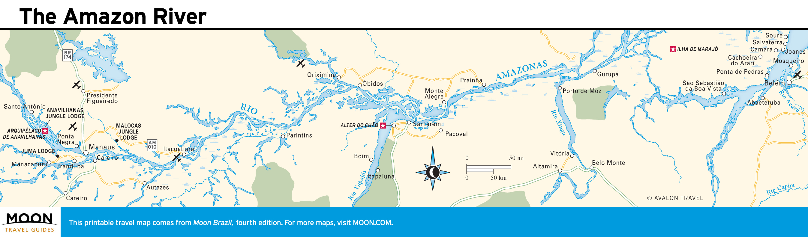
The Amazon
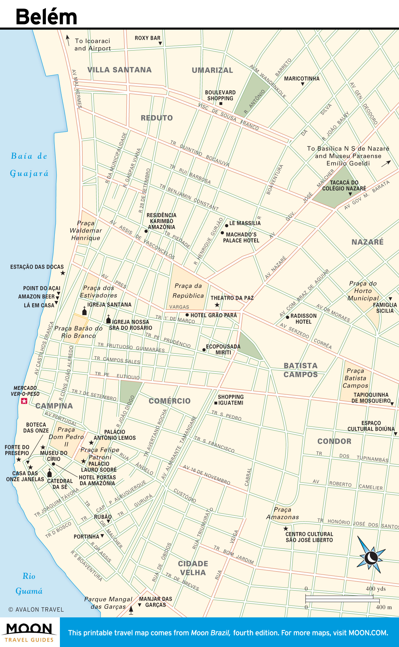
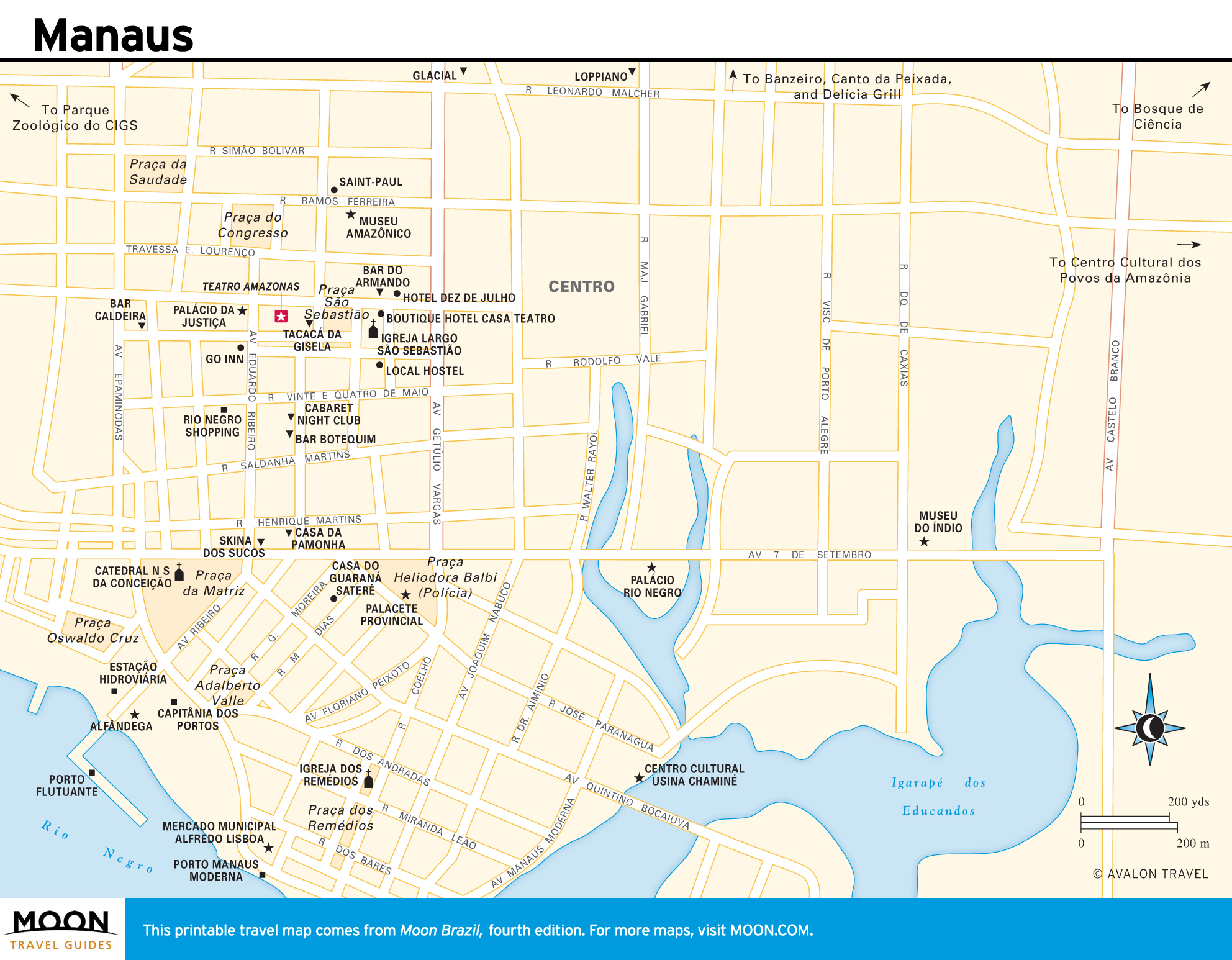
The vast forested region bisected by the Amazon River and its thousands of tributaries is referred to as O Norte (The North). Its two largest states, Amazonas and Pará, are sparsely populated, and the river continues to be the major source of life and transportation. The rain forest is best explored from trips out of Amazonas’s buzzing capital, Manaus, and the town of Santarém, where you can also bask on white-sand river beaches. At the Amazon’s mouth is the alluring colonial city of Belém and the Switzerland-size Ilha de Marajó.