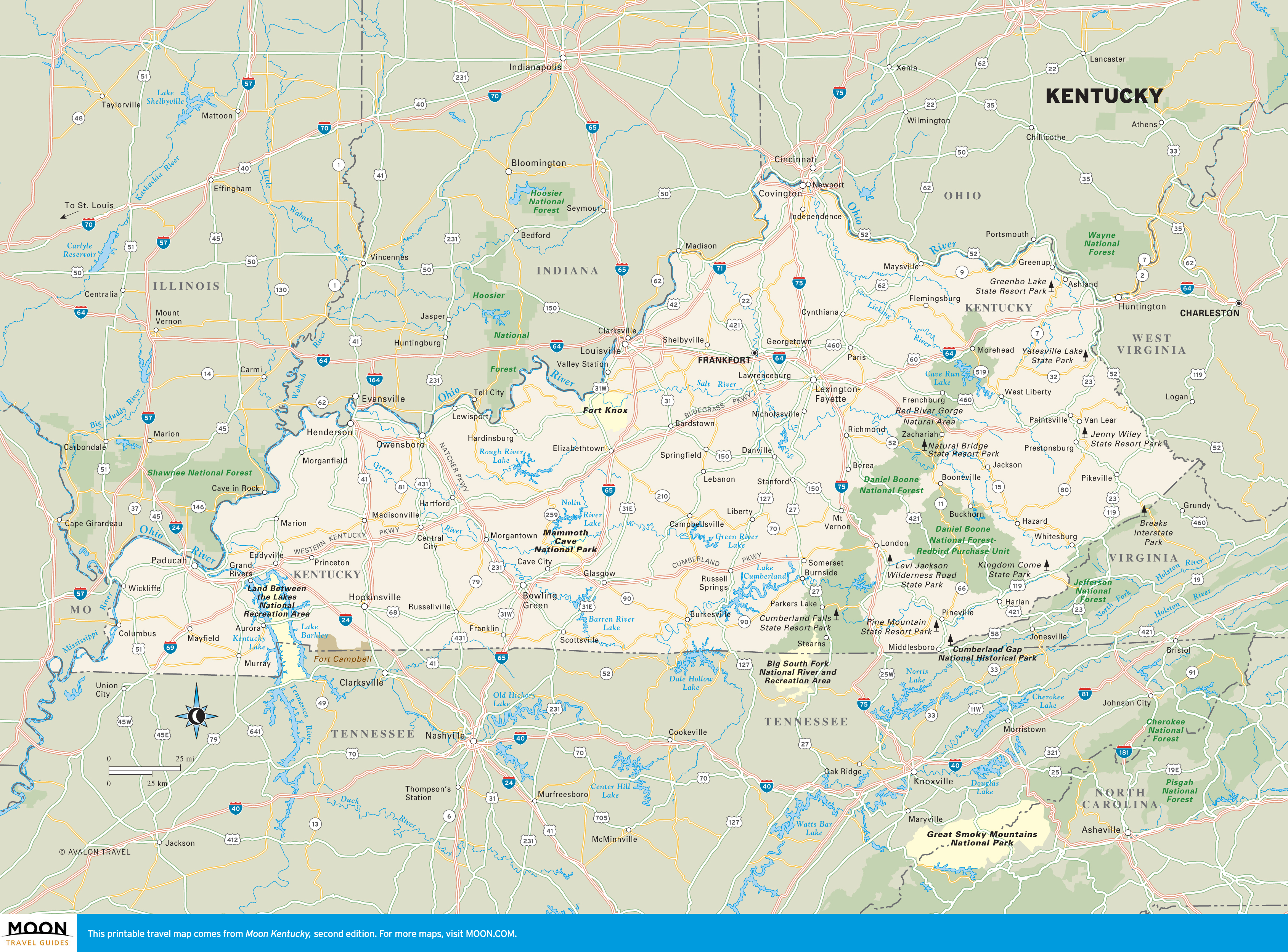
Kentucky
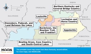 These free, printable travel maps of Kentucky are divided into seven regions:
- Louisville
- Bardstown, the Bourbon Trail, and Frankfort
- Lexington and Horse Country
- Northern Kentucky and Covered Bridge Country
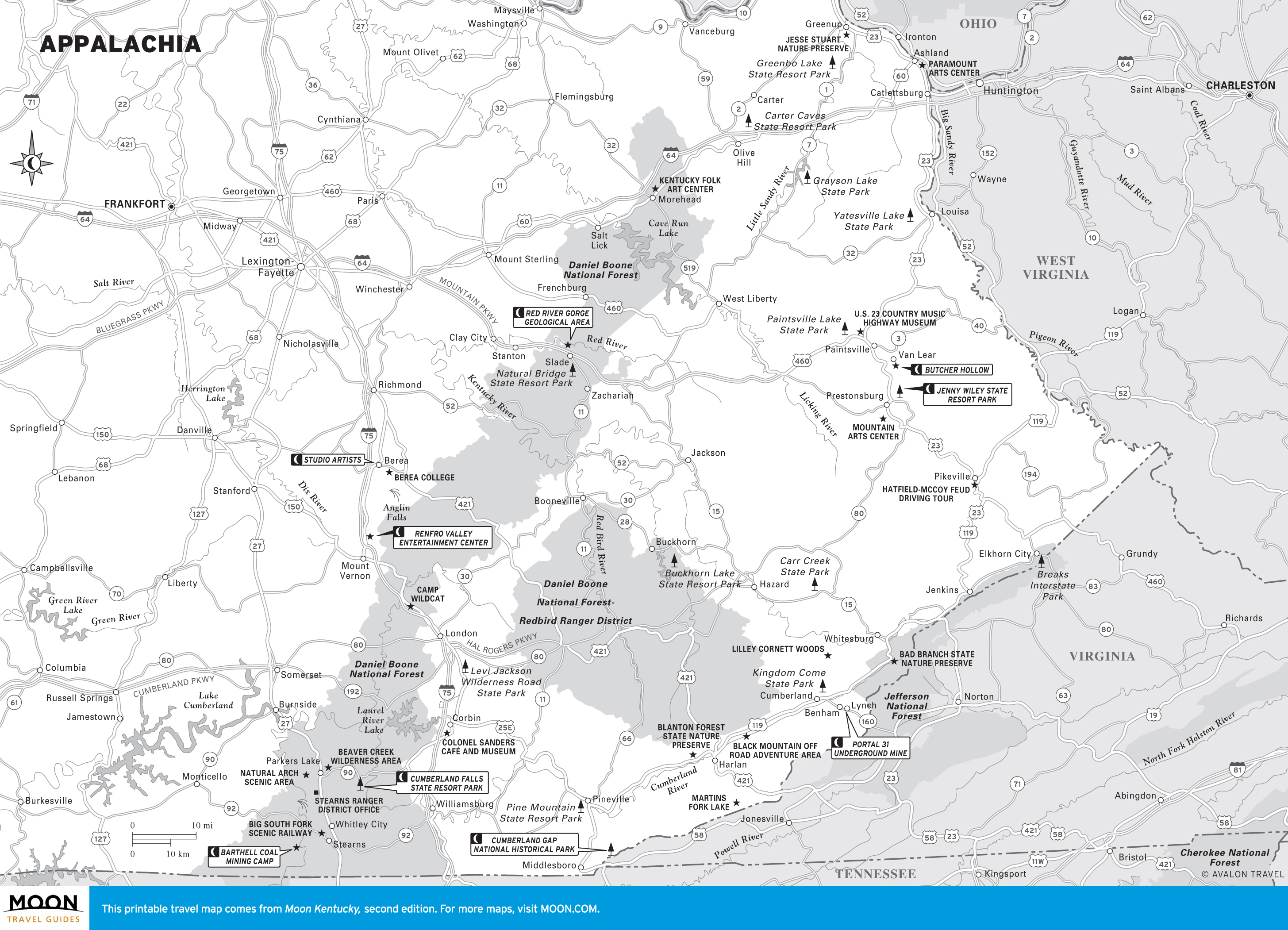
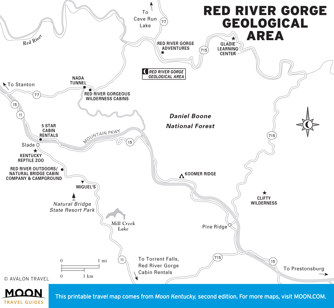
- Appalachia
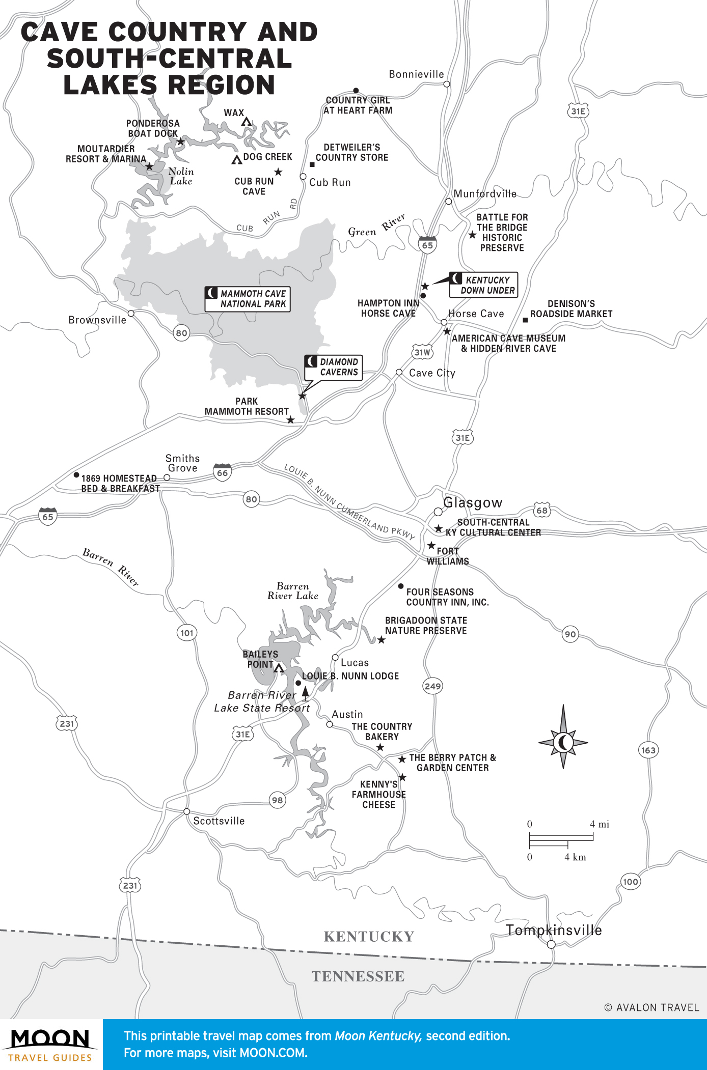
- Bowling Green, Cave Country, and South-Central Lakes
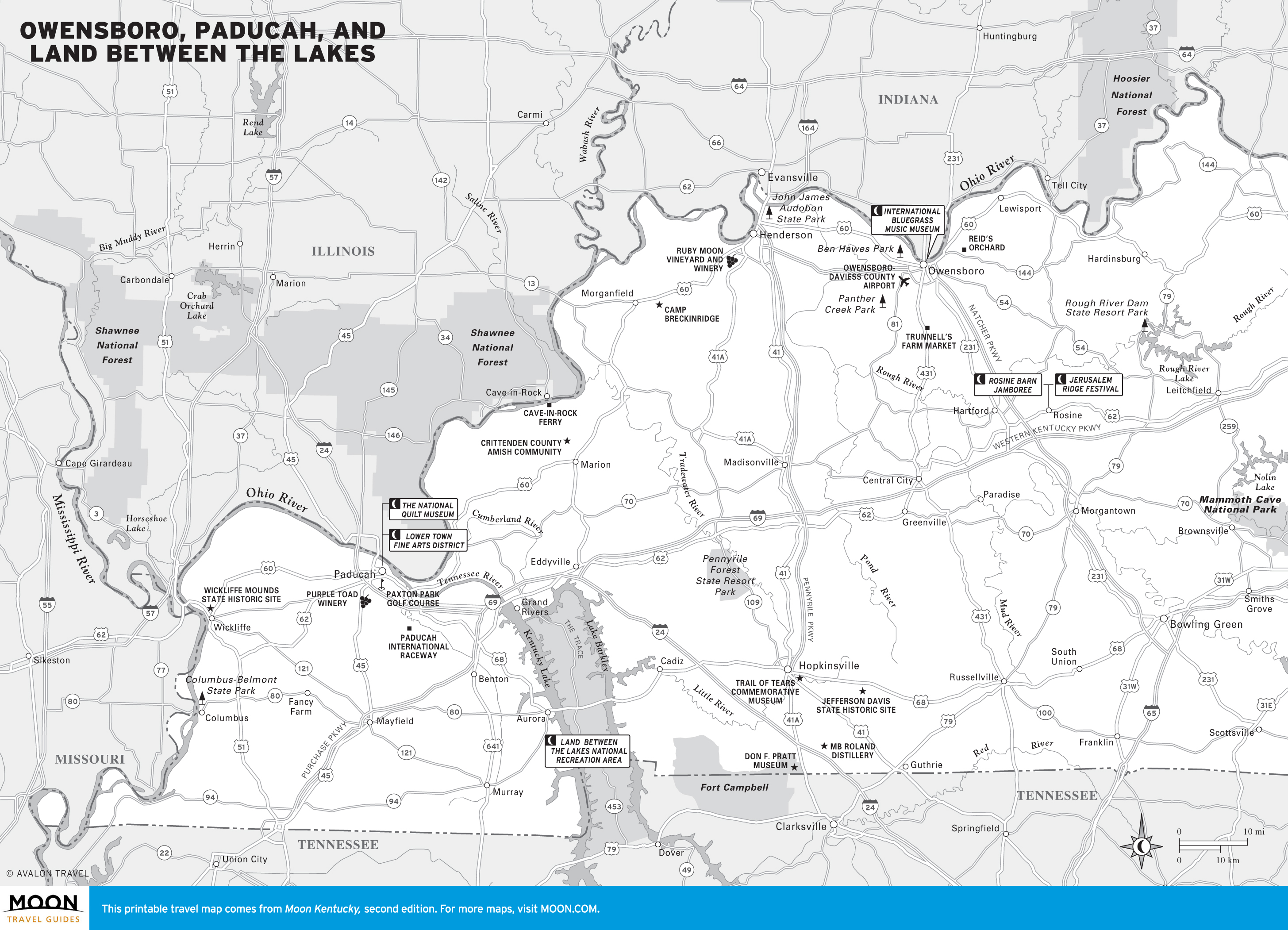
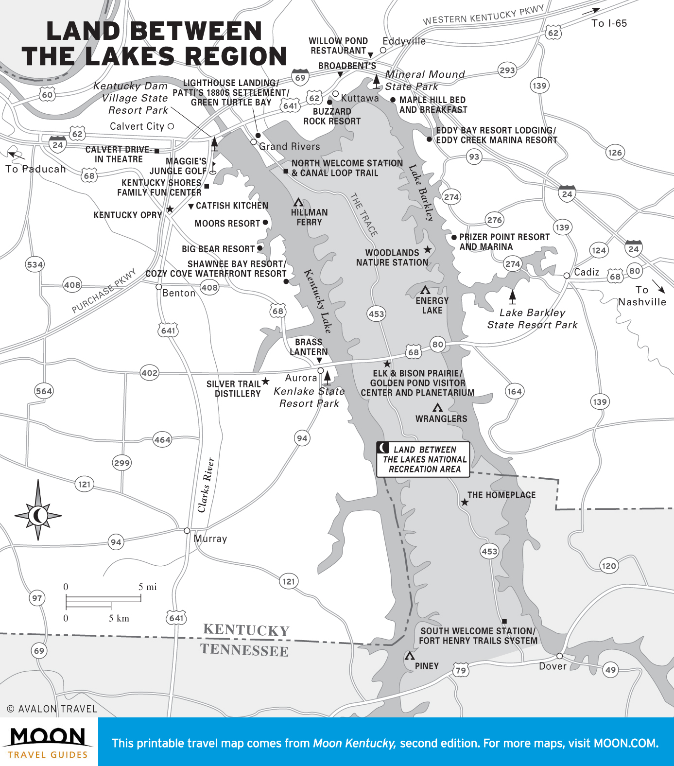
- Owensboro, Paducah, the Land Between the Lakes
Explore Kentucky with these helpful travel maps from Moon.
Kentucky
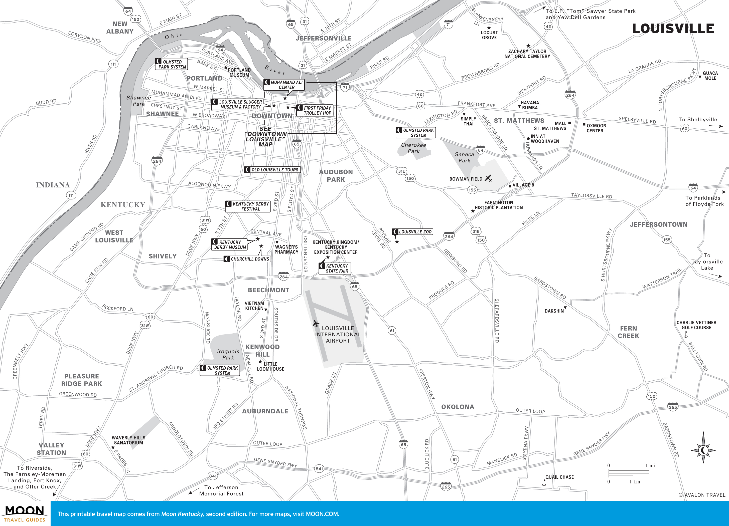
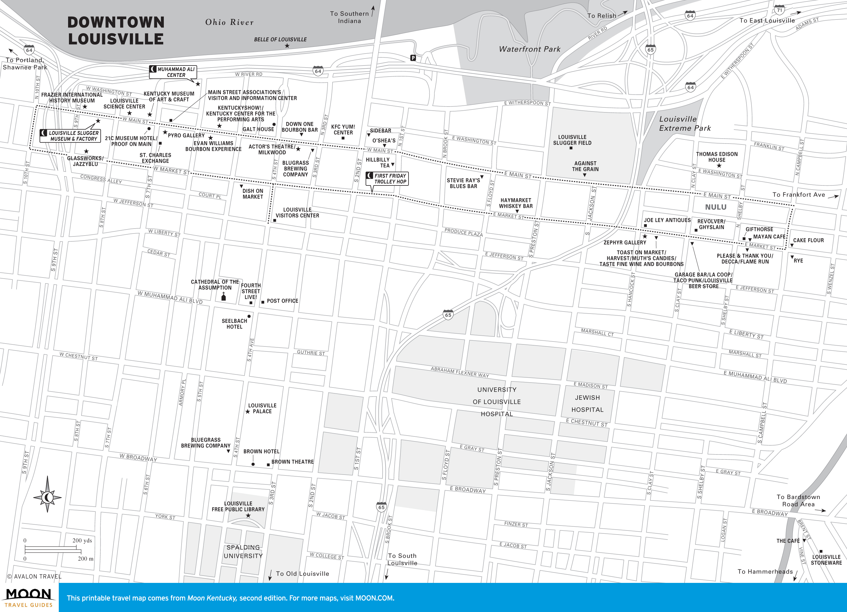
Louisville
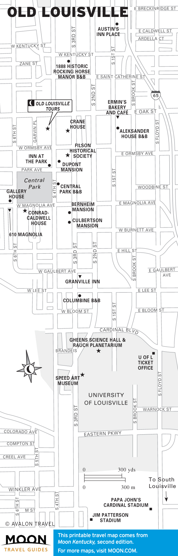
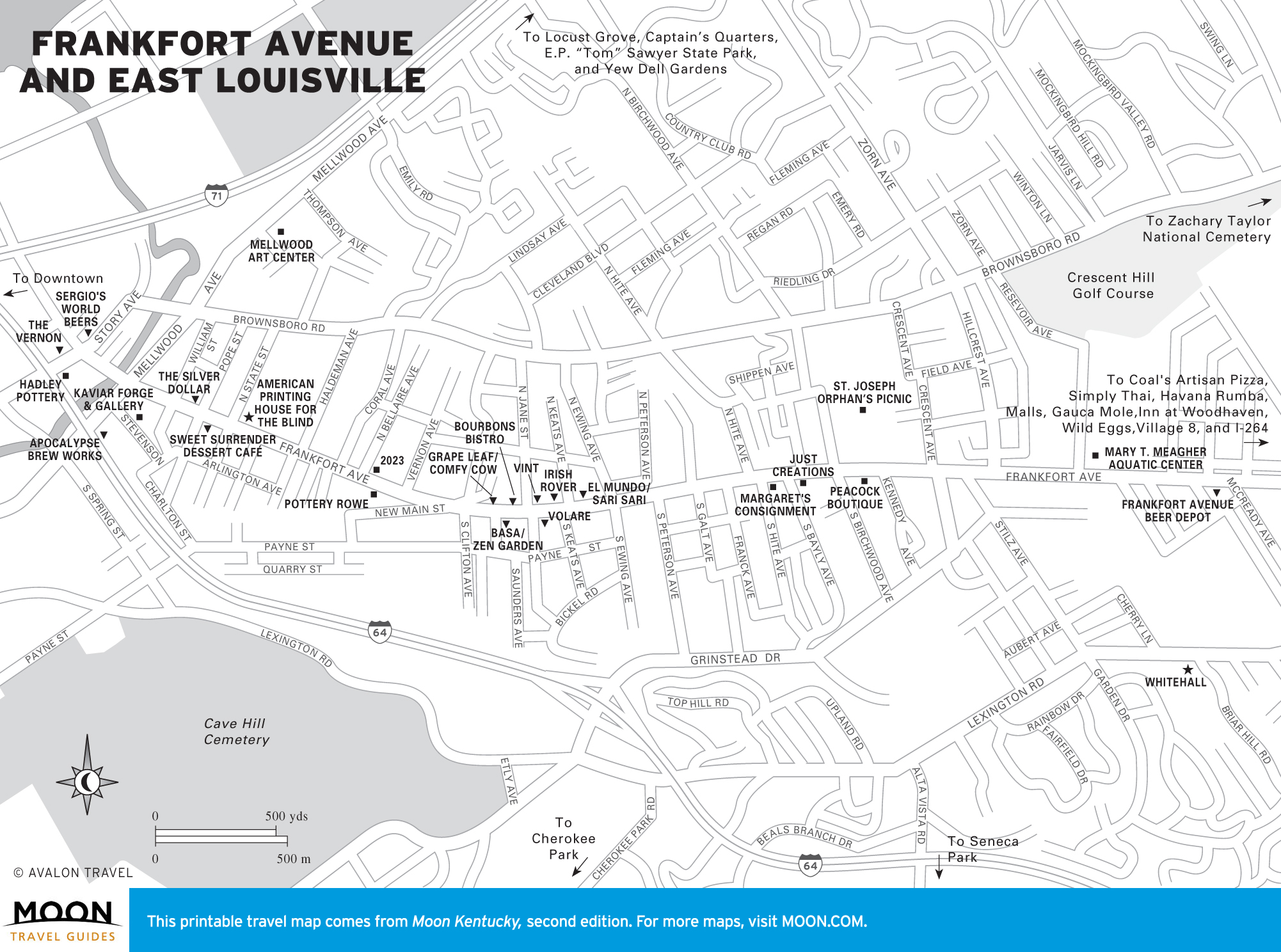
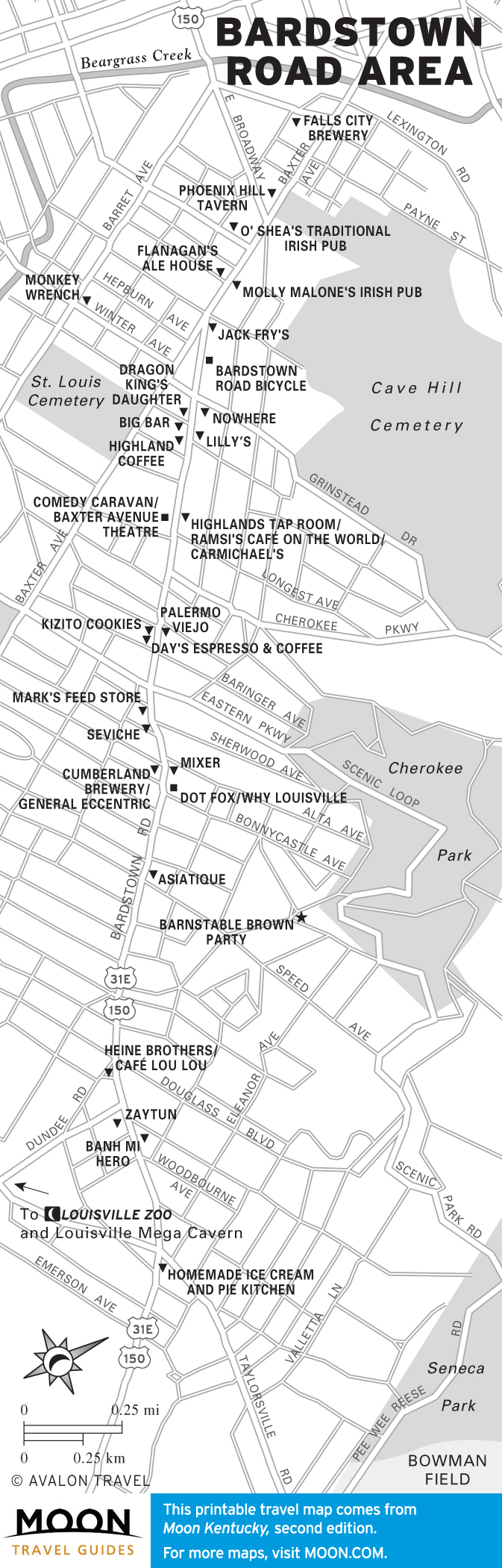
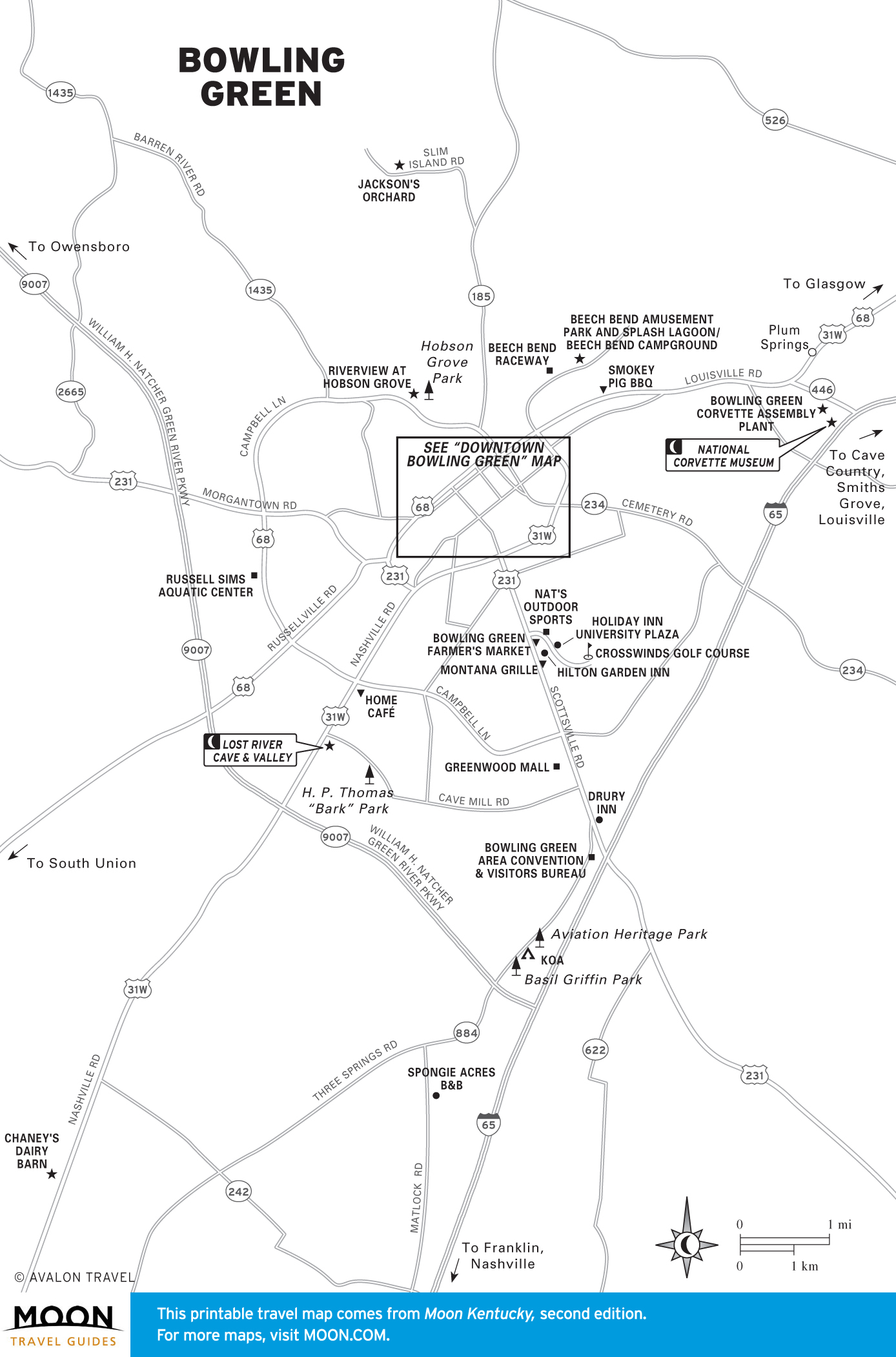
Louisville is Kentucky’s biggest city, offering the most museums, historic sites, and other tourist attractions, as well as hosting the biggest restaurant, nightlife, and art scenes in the state.
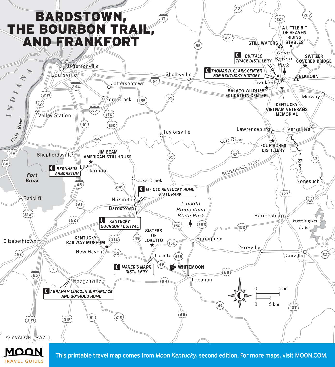
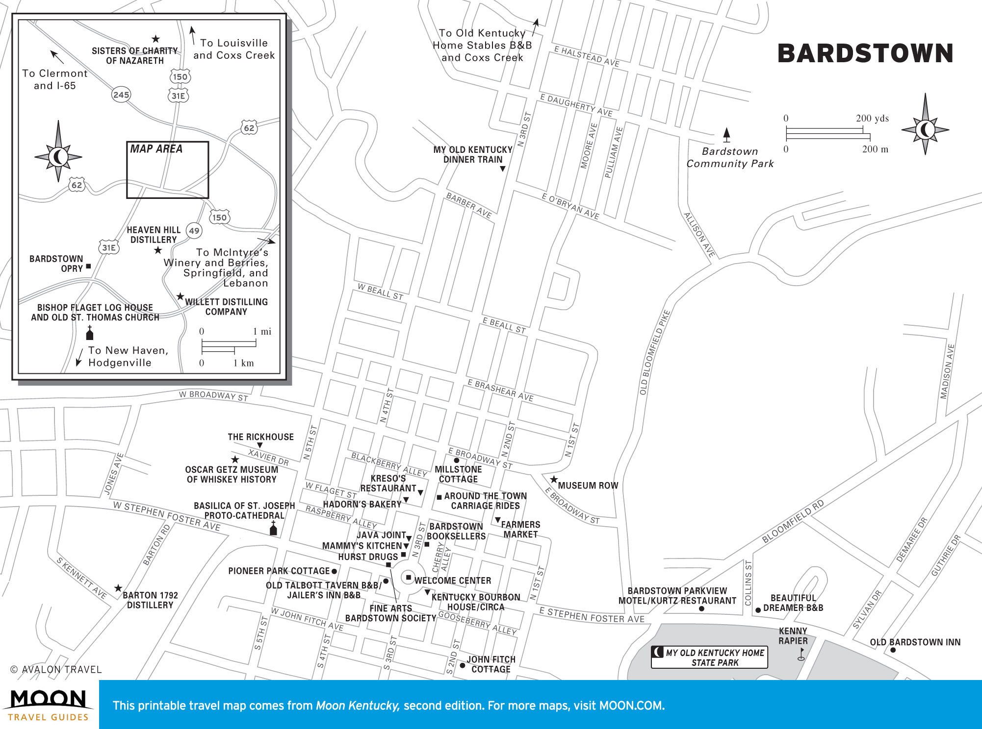
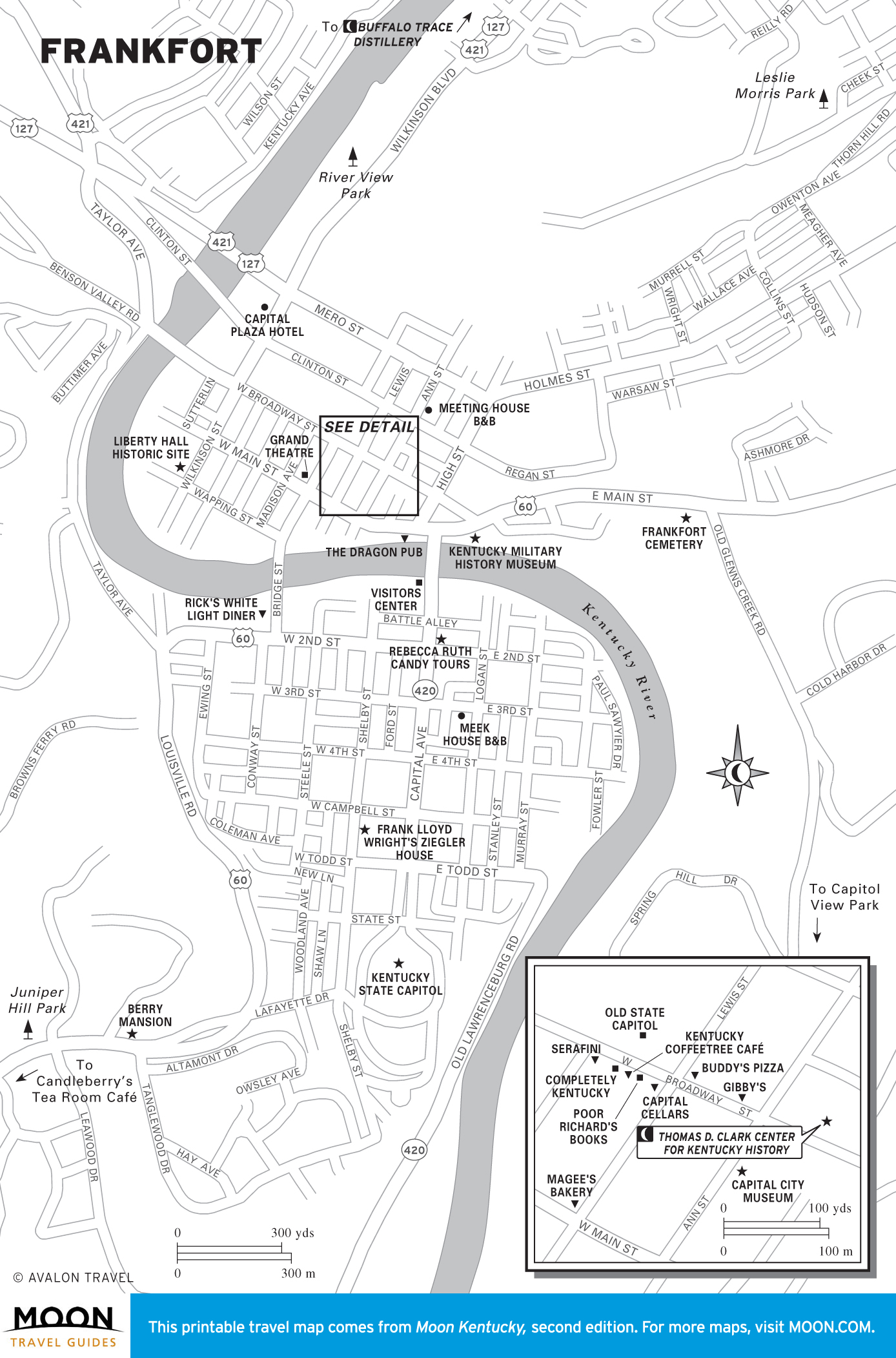
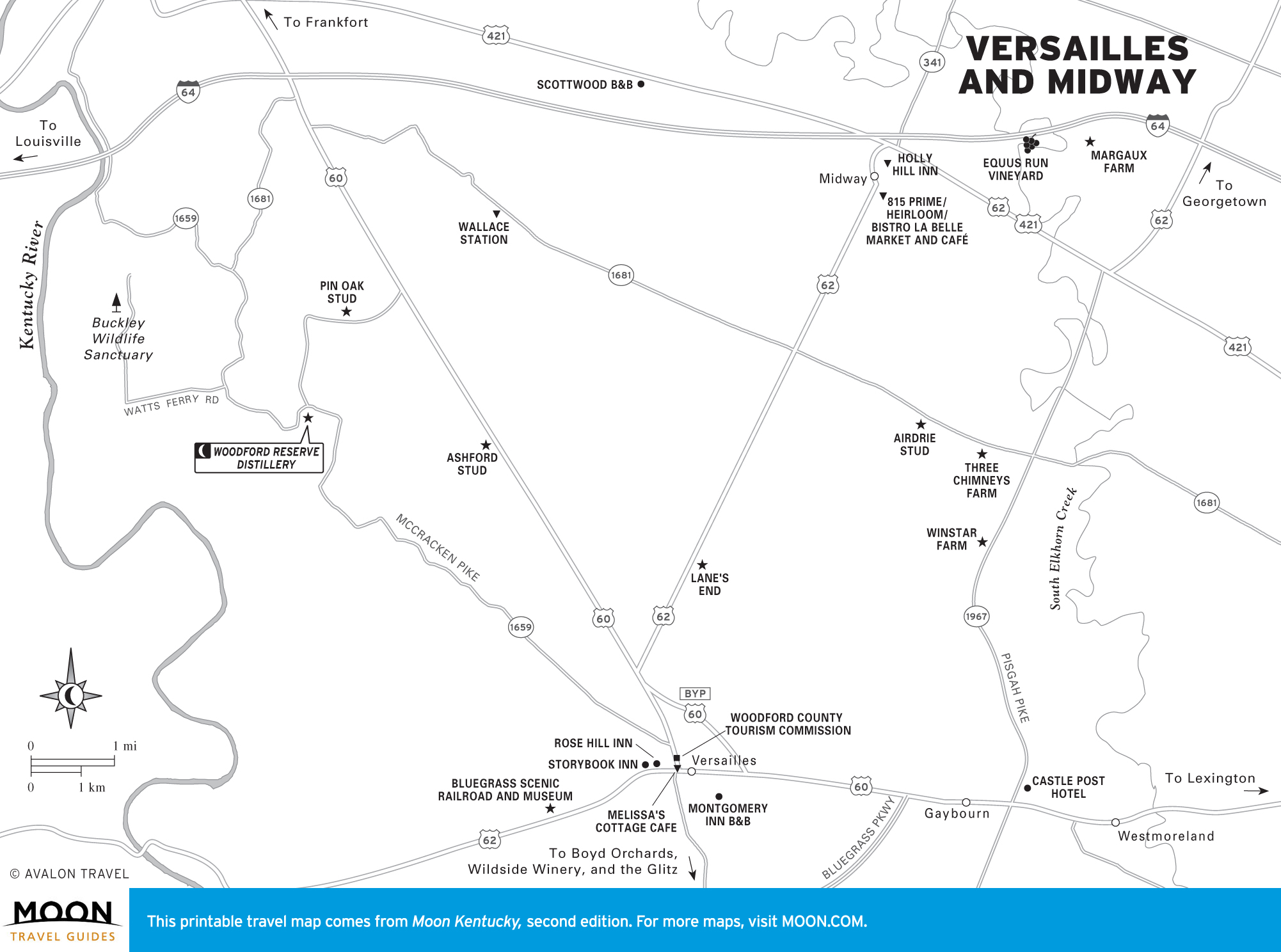
Bardstown, the Bourbon Trail, and Frankfort
Kentucky’s spirit comes to life in this central section of the state. Travel along the famed Bourbon Trail and you’ll get to taste more than the nation’s only native liquor.
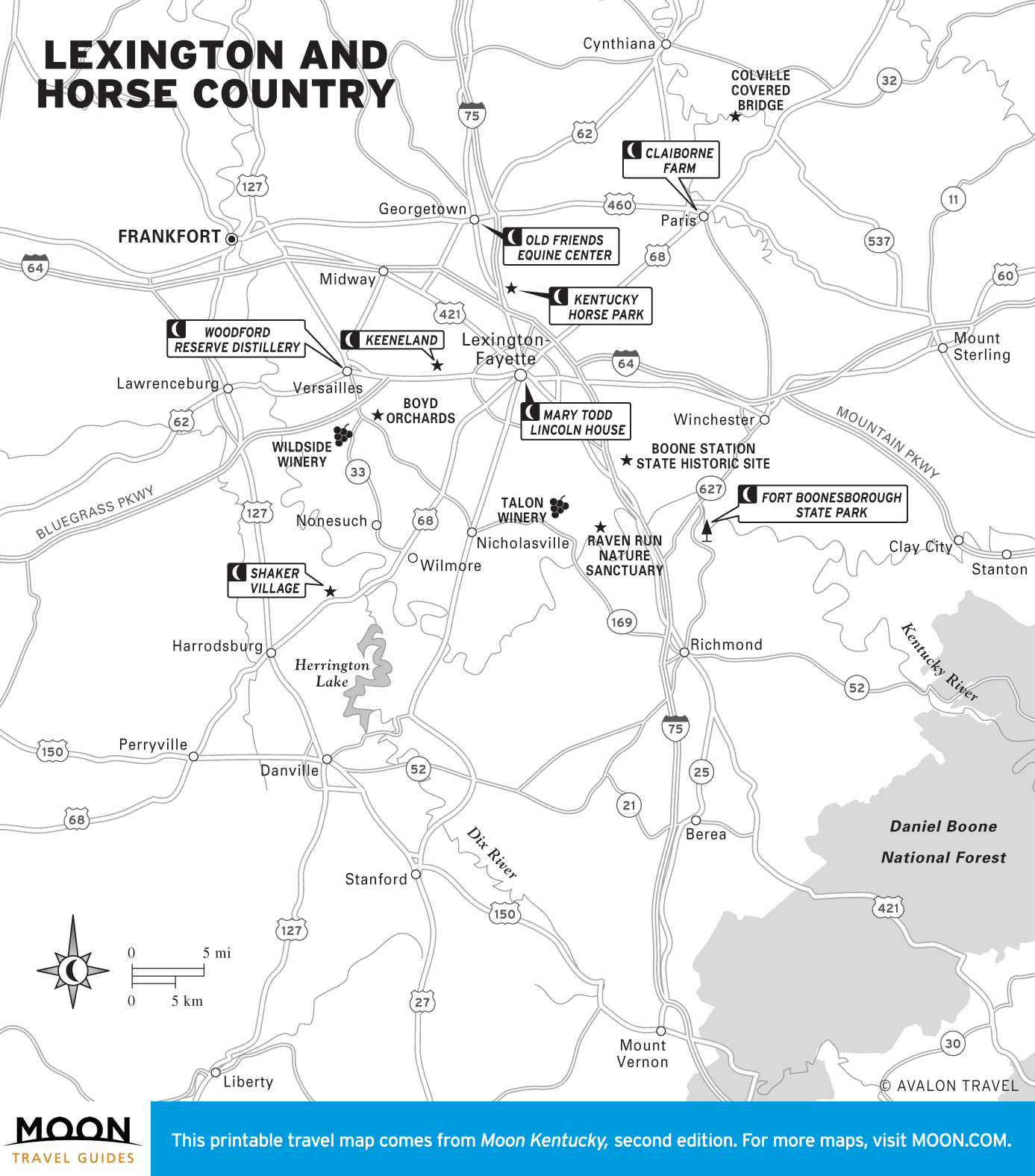
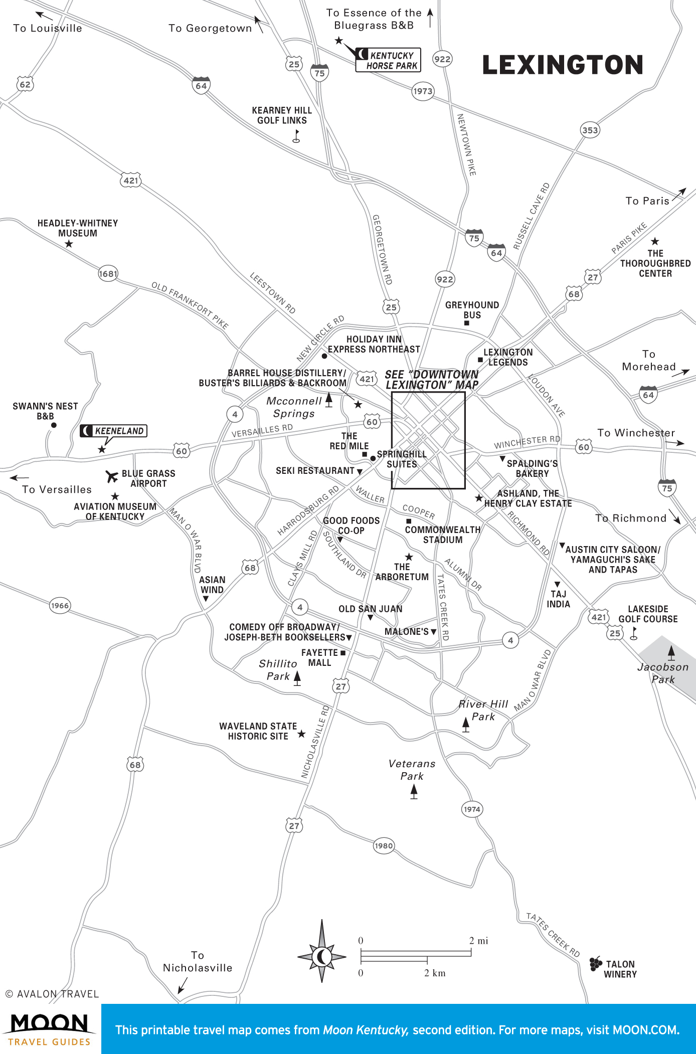
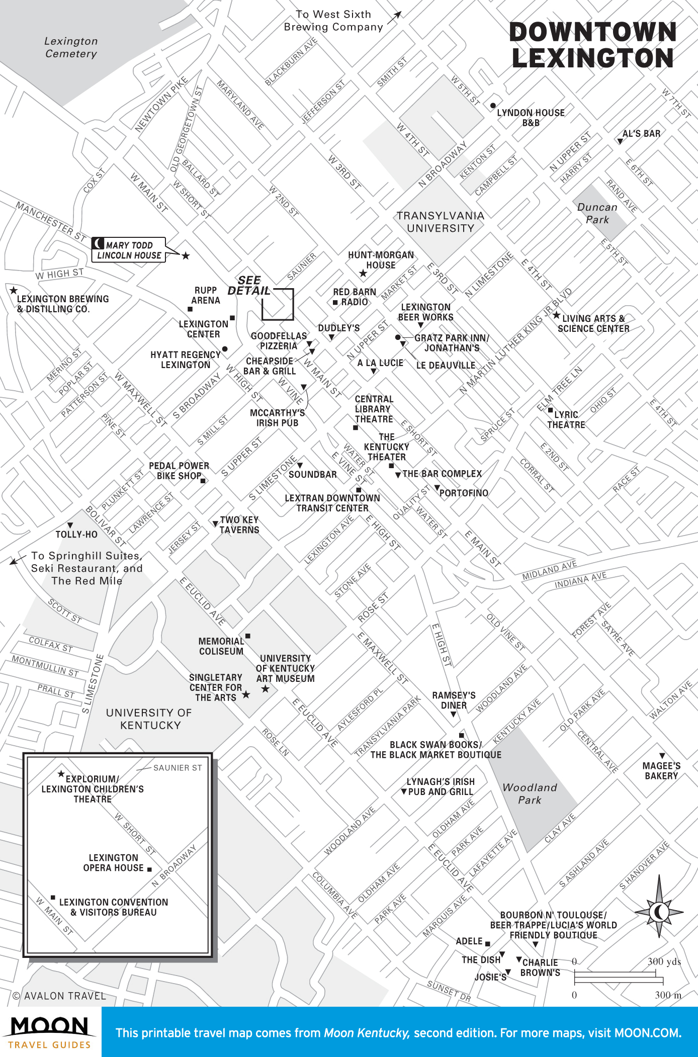
Lexington and Horse Country
Quintessentially Kentucky, Lexington and Horse Country almost seem like a stereotype. On gentle fields enclosed by fences, thoroughbreds are bred into champion racehorses. Visit a horse farm to see just how it’s done.
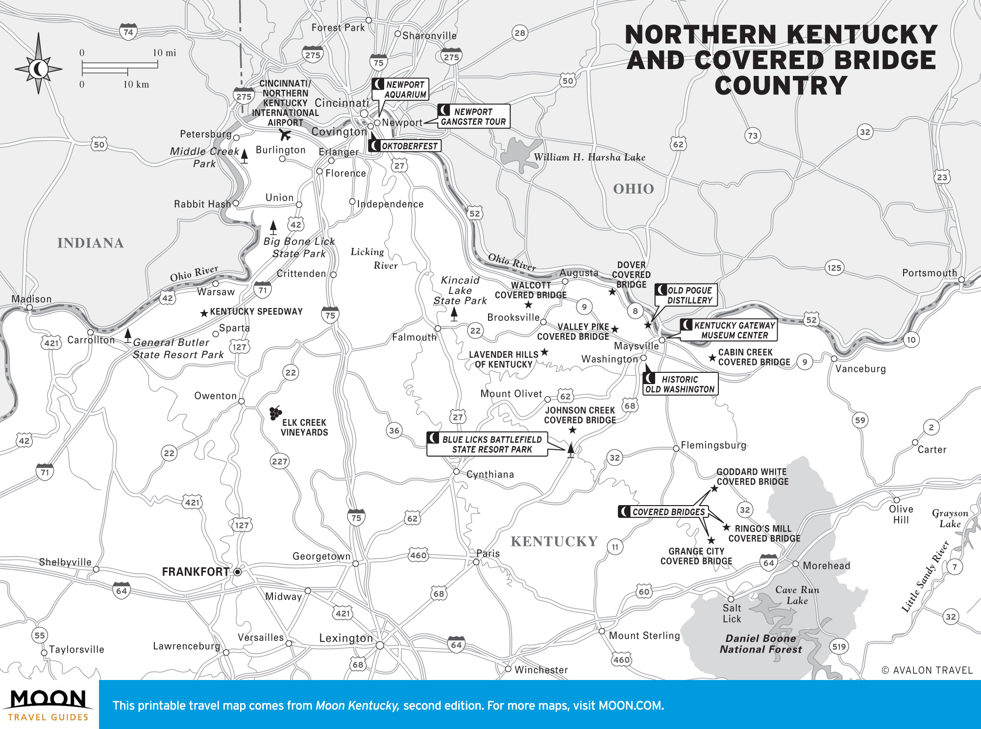
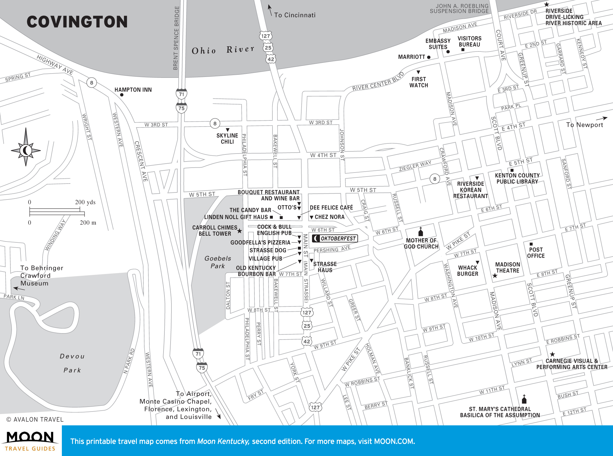
Northern Kentucky and Covered Bridge Country
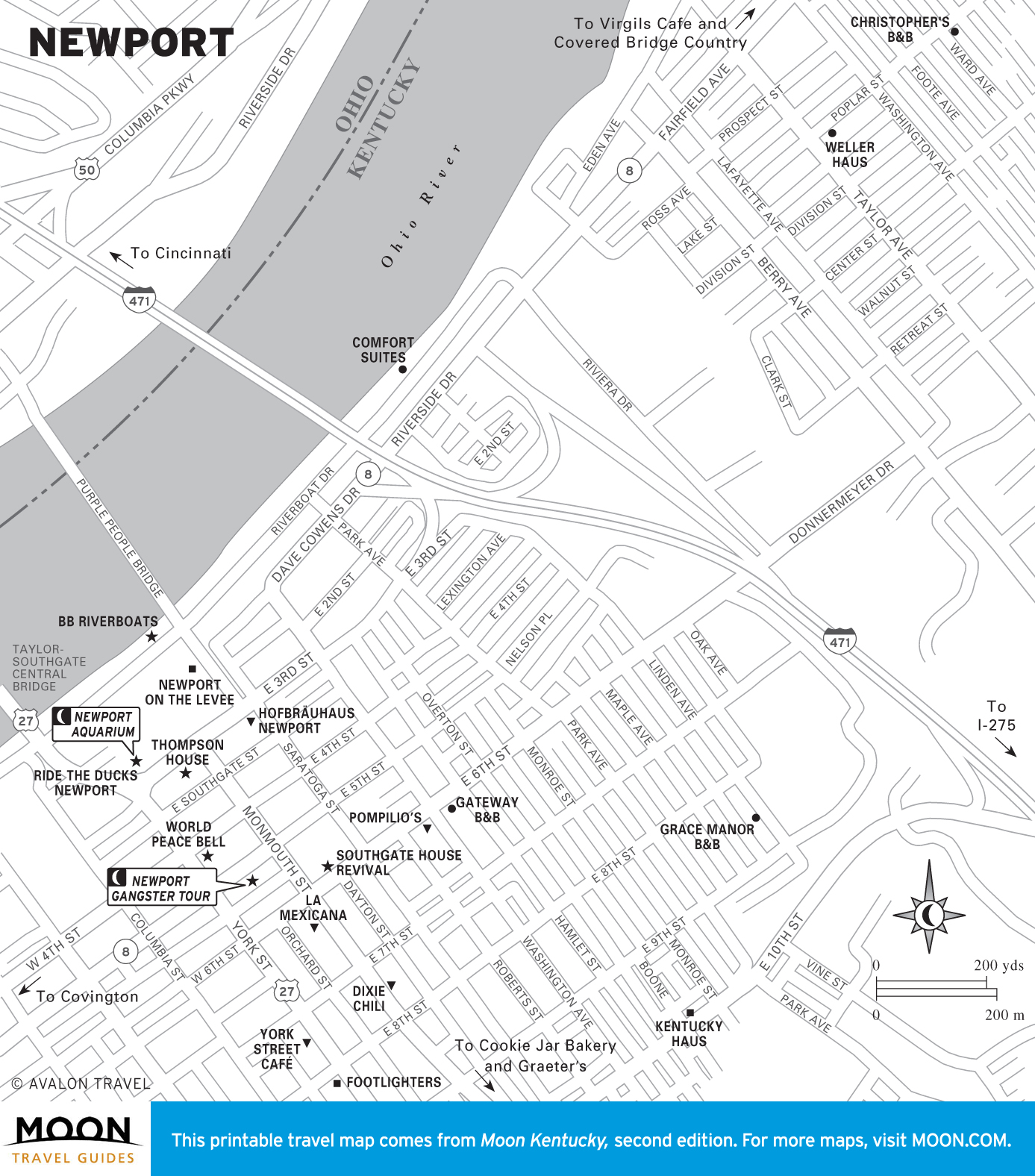
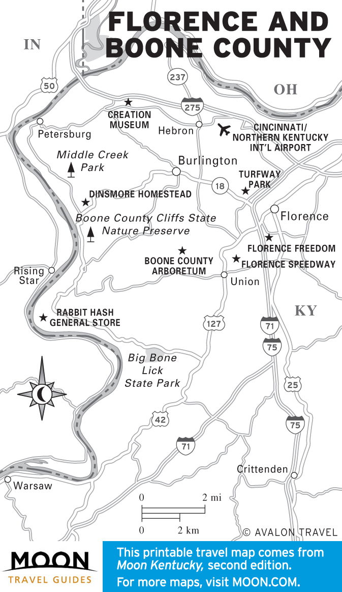
Bordered by the Ohio River, Northern Kentucky bears the influence of its northern neighbors, but retains a distinct Southern sensibility. Covington and Newport are high entertainment destinations, especially with Cincinnati just across the river.
Appalachia
Remarkable natural beauty, a tradition of folk art and music, and a history filled with legendary characters are the earmarks of Appalachia in far eastern Kentucky. Catch a concert along the Country Music Highway.
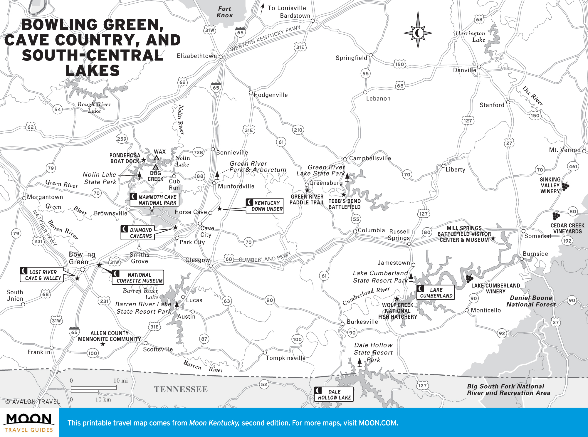
Bowling Green, Cave Country, and South-Central Lakes
Adventure lovers are drawn to south-central Kentucky, where many of the state’s best lakes are concentrated. State parks offer hiking, golfing, and wildlife-watching opportunities.
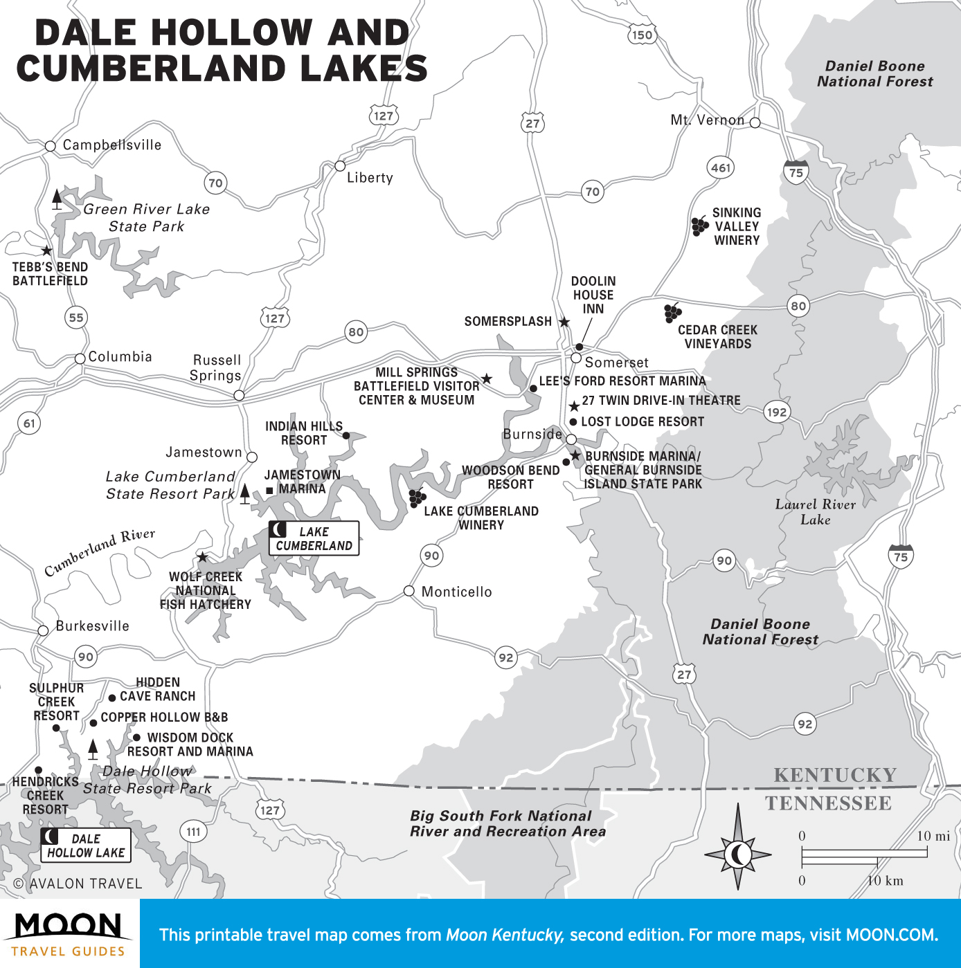
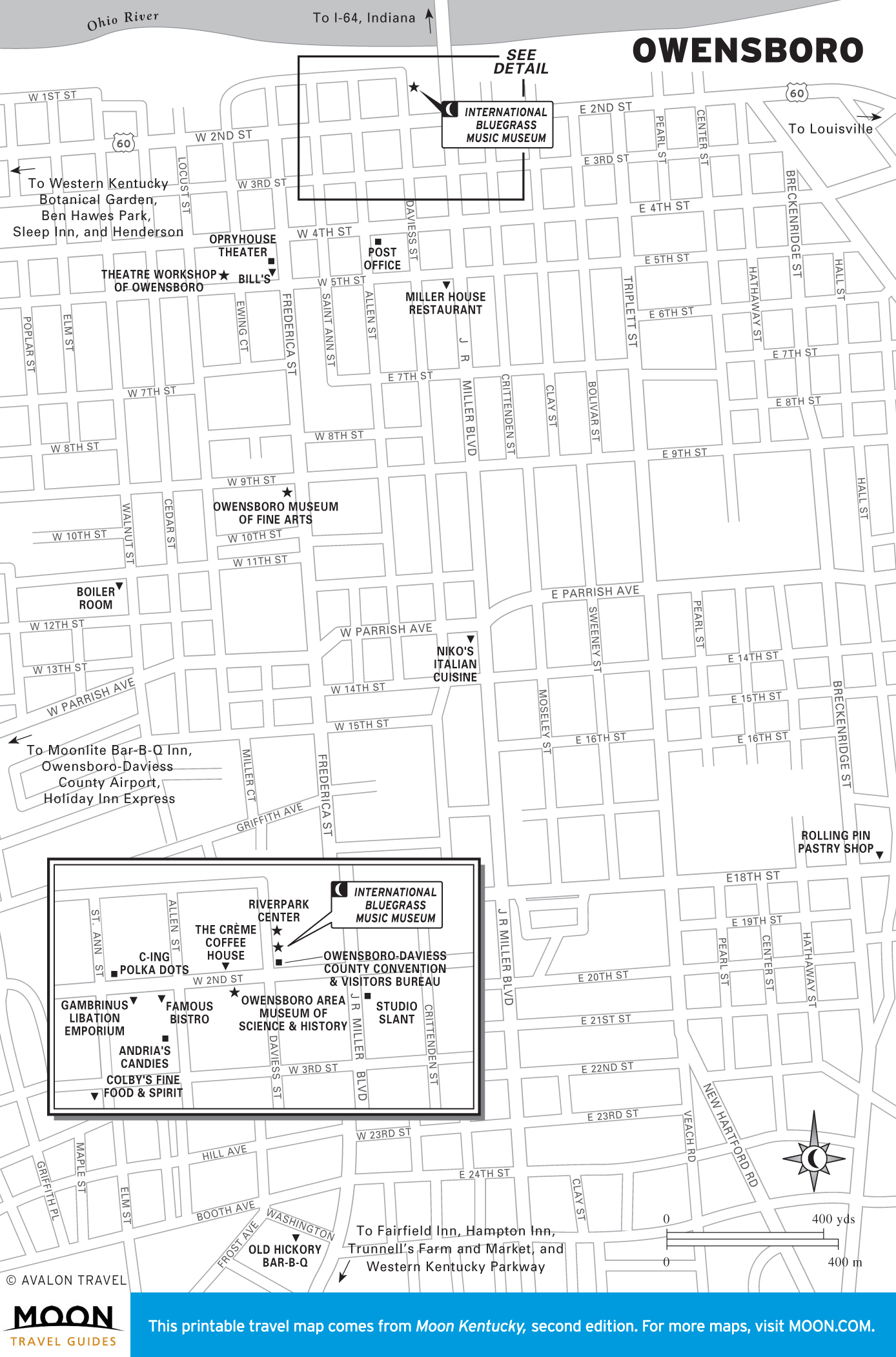
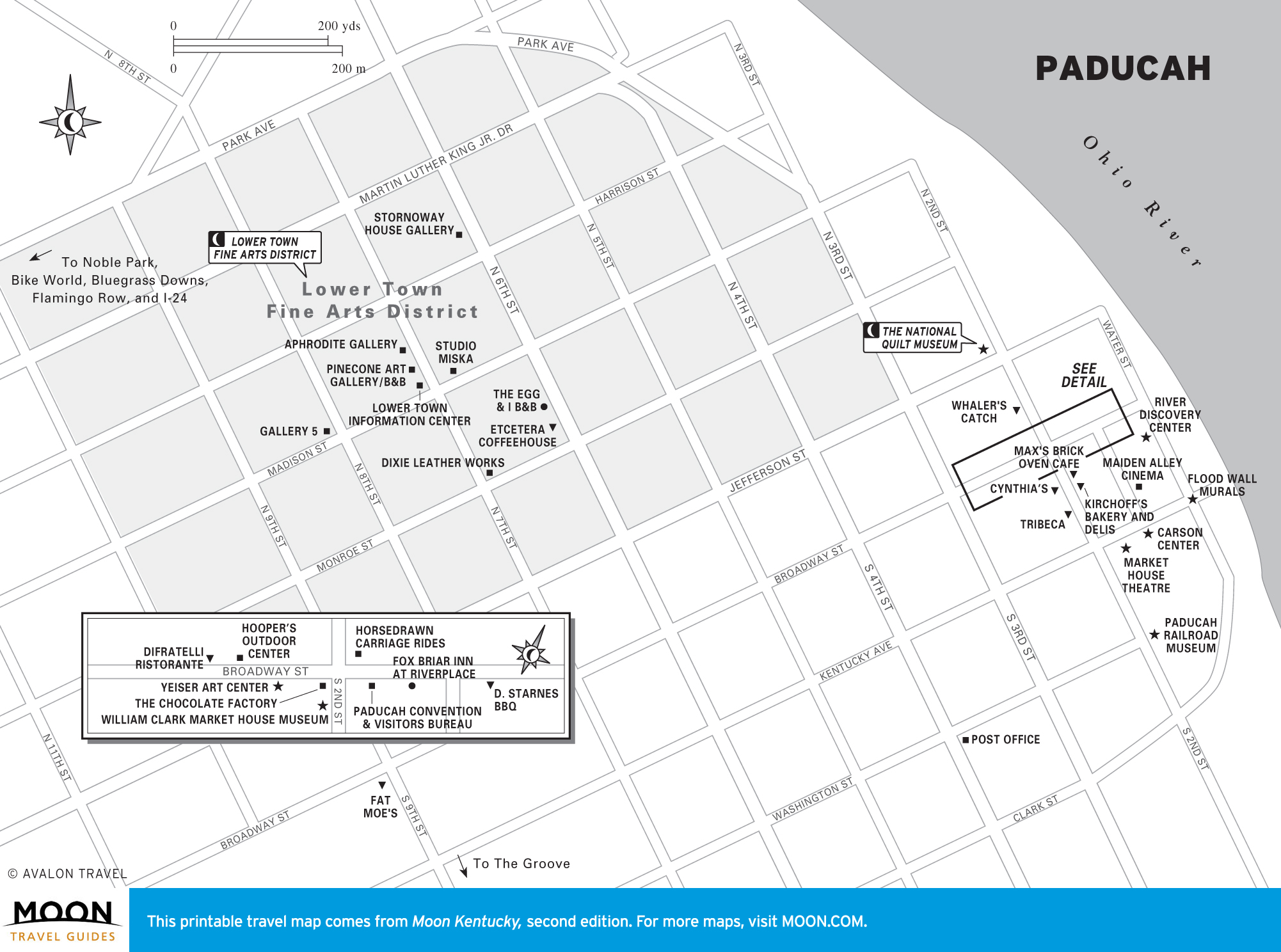
Owensboro, Paducah, the Land Between the Lakes
Western Kentucky is a celebration of Americana. Owensboro, where there’s a festival nearly every weekend, is the home of Kentucky-style barbecue, which is built around burgoo and mutton. Nearby Rosine is home to Bill Monroe, the father of bluegrass music.