Driving to Yosemite: Route Suggestions from SF, LA, or LV
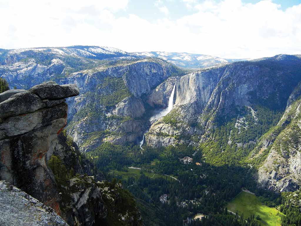
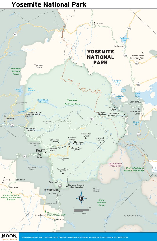
Yosemite’s regions are accessible via five park entrances: Big Oak Flat, Arch Rock, South, Tioga Pass, and Hetch Hetchy. The Arch Rock entrance (Hwy. 140) and the Big Oak Flat entrance (Hwy. 120 west) are usually open year-round. The Tioga Pass (Hwy. 120 east) entrance is just a few miles from Tuolumne Meadows and is the eastern access to Yosemite from U.S. 395. Tioga Road closes in November or December each year and reopens in the spring, usually in May or June. The Hetch Hetchy entrance is to the northwest of the park and also closes in winter. The South entrance is open year-round.
In winter it is always possible that roads can close unexpectedly and chains may be required on any road at any time. Check the park website or call 209/372-0200 for current road conditions.
Driving to Yosemite from San Francisco
The Big Oak Flat park entrance is the closest to San Francisco, accessed via Highway 120 from the west. The drive to Big Oak Flat is about 170 miles from San Francisco and takes at least four hours; however, traffic, especially in summer and on weekends, has the potential to make it much longer. Try to time your drive for weekdays or early mornings to avoid the biggest crowds. From the Big Oak Flat entrance, it’s about another 45 minutes to Yosemite Valley.
For the most efficient route to Yosemite from San Francisco, take I‑580 east to I‑205 east. In Manteca, take I‑5 to Highway 120 and follow it south to Big Oak Flat Road. The Arch Rock entrance is another option. From San Francisco, take I‑580 east to I‑205 east. In Manteca, take Highway 99 south for 56 miles to Merced. In Merced, turn right onto Highway 140 east. Highway 140 will take you right to the Arch Rock entrance.
Newsletter Signup
By clicking ‘Sign Up,’ I acknowledge that I have read and agree to Hachette Book Group’s Privacy Policy and Terms of Use
Driving to Yosemite from Los Angeles
Yosemite is a pretty straightforward drive north from Los Angeles. The South entrance is closest to Los Angeles and is open year-round via Highway 41. This is also the nearest entrance to the Badger Pass Ski Area, Glacier Point, and the Bridalveil Creek campground. You can reach Yosemite Valley from the South entrance in about one hour.
Plan about six hours to drive the 300 miles to the park. From Los Angeles, take U.S. 101 north, then Highway 170 north, and finally I‑5 north, following signs for Sacramento. Once past the Grapevine, merge onto Highway 99 and follow it through Bakersfield and Fresno (about 130 miles). Once in Fresno, take Highway 41 north for 60 miles to the South entrance of the park.
Driving to Yosemite from Las Vegas
If there’s any chance Tioga Pass will be closed (and between October and May there’s a good one), call the National Park Service at 209/372- 0200, then press 1 twice at the prompts for the latest weather and roads report. If the pass is open, you have your choice of a couple fairly direct routes into Las Vegas. Both start by rolling west on SR 120 through the pass to Mono Lake. If the pass is closed, prepare yourself for a tedious 8.5-hour sightseeing trip through central California (SR 41 south to Fresno, then SR 99 south to Bakersfield and SR 58 east to Barstow).
Newsletter Signup
By clicking ‘Sign Up,’ I acknowledge that I have read and agree to Hachette Book Group’s Privacy Policy and Terms of Use
Pin it for Later
