Hiking Hoapili Trail in South Maui
Anyone who heads out on the Hoapili Trail will realize right away that this isn’t your average hike. Hot, barren, and in the middle of nowhere, the Hoapili Trail isn’t as much about hiking as about stepping back in time. Although the 5.5-mile (8.9-km) round-trip trail takes about four hours, even an hour introduces you to a side of the island most visitors never see.
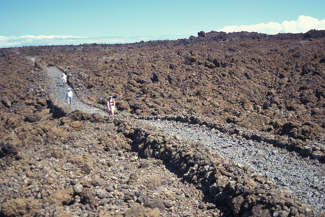
The trail was once an ancient Hawaiian walking path reserved for royalty. In 1824, sections of the trail were reconstructed, and the road took on a structure that remains untouched to this day. The trailhead for Hoapili (also known as the “King’s Highway”) is in the parking lot of La Perouse Bay snorkeling area, 3.1 miles (5 km) past the First Entrance to Big Beach. To find the trail, drive south on Makena Alanui Road until it dead-ends.
From the La Perouse Bay parking lot, you’ll see the trail paralleling the shore and weaving south along the coast. Before you set out, remember that there is no shade and the trail traverses jagged ‘a‘a lava that’s so sharp you’ll want proper hiking boots. Since much of this hike is outside cell phone range, it’s important to be prepared with food and water. Reduce the chance of overheating by starting early in the morning.
Newsletter Signup
By clicking ‘Sign Up,’ I acknowledge that I have read and agree to Hachette Book Group’s Privacy Policy and Terms of Use
After you’ve followed the shoreline for 0.7 mile (1.1 km), passing a couple of pockets of sand and sometimes feral black goats, you’ll see an abandoned lava rock structure off the right side of the trail. This is the popular surfing spot known as Laps (short for La Perouse), and on large south swells you can see death-defying surfers riding waves over jagged sharp lava. After the surf spot, the trail climbs for 10 minutes before arriving at a junction and veering off to the left. There is a sign informing you that you’re entering the King’s Highway and to respect the historic sites. The sign will also indicate that Kanaio Beach is 2 miles (3.2 km) ahead.
On the inland section of trail where the path deviates from the coast, there’s a short spur trail that leads down to the lighthouse at Cape Hanamanioa, although there isn’t much to see except the old weathered light. A better side trip is the short spur trail 20 minutes later that leads down to Keawanaku Beach, where you’re almost guaranteed to have the beach to yourself. To find the beach, look for a short lone palm tree springing from the black lava field surrounded by a grove of kiawe trees, then keep an eye out for the trail down to the shore. Although rocky, the trail is noticeable, and if you find yourself asking “Am I still on the trail?” then you probably aren’t. After Keawanaku, the trail continues for 20 minutes to the coast at Kanaio Beach, a salt- and pepper-colored shore of black lava rock and sun-bleached coral. You’ll notice the remnants of multiple structures, once part of an ancient fishing village.
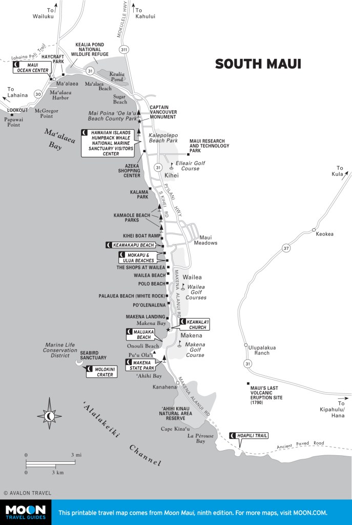
Although Kanaio Beach is the turnaround point for most hikers, the King’s Highway continues to Highway 31 on the “back road to Hana.” To reach the highway, however, requires an overnight stay along the trail; camping is permitted along the shore from points east of Kanaio Beach. To travel just a little farther, however, a sandy road continues from Kanaio Beach and winds along the coast. Another 20 minutes of walking from Kanaio brings you to a shore that’s completely bathed in bleached white coral, and on the southern end of the “white beach” is an ancient Hawaiian heiau set out on the point that looks much the same now as it must have when it was built.
Newsletter Signup
By clicking ‘Sign Up,’ I acknowledge that I have read and agree to Hachette Book Group’s Privacy Policy and Terms of Use

