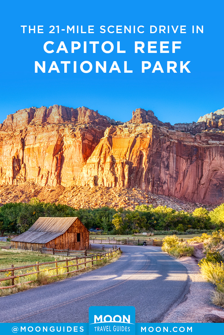
The 21-Mile Capitol Reef Scenic Drive
Turn south from Highway 24 at the visitors center to experience some of the reef’s best scenery and to learn more about its geology. A quick tour of this 21-mile (34-km) out-and-back trip requires about 1.5 hours, but several hiking trails may tempt you to extend your stay. It’s worth picking up a brochure at the visitors center for descriptions of geology along the road. The Scenic Drive is paved, although side roads have gravel surfaces. Note that drivers must pay the $20 park entrance fee to travel this road.
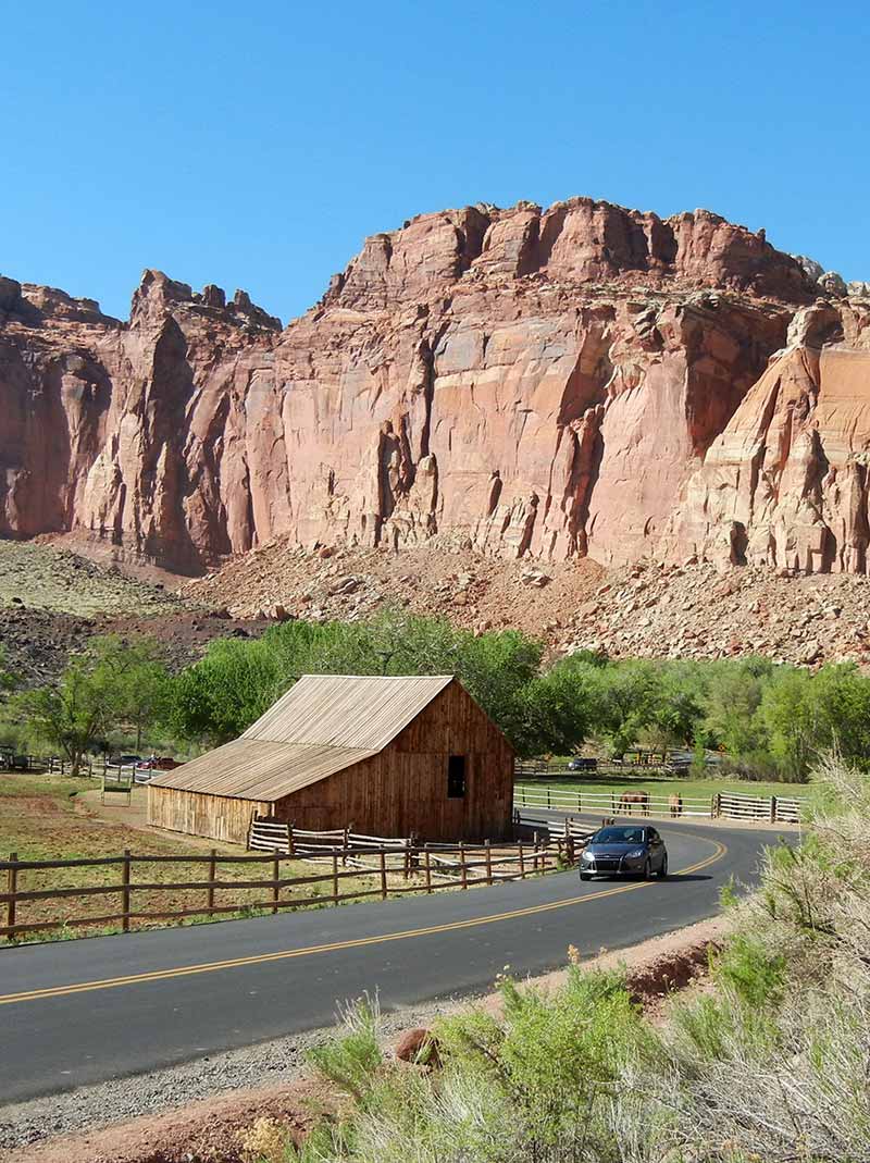
Fruita
In the Fruita Historic District, you’ll first pass orchards and several of Fruita’s buildings. A blacksmith shop (0.7 mi/1.1 km from the visitors center, on the right) displays tools, harnesses, farm machinery, and Fruita’s first tractor. The tractor didn’t arrive until 1940, long after the rest of the country had modernized. In a recording, a rancher tells about living and working in Fruita. The nearby orchards and fields are still maintained using old-time farming techniques.
Ripple Rock Nature Center, just under 1 mile (1.6 km) south of the visitors center, has activities and exhibits for kids, many centering on pioneer life. Kids can also earn certification as Junior Rangers and Junior Geologists.
The Gifford Farmhouse (8am-5pm mid-Mar.-Oct., free), 1 mile (1.6 km) south on the Scenic Drive, is typical of rural Utah farmhouses of the early 1900s. Cultural demonstrations and handmade baked goods (pie!) and gifts are available. A picnic area is just beyond; with fruit trees and grass, this is a pretty spot for lunch. A short trail crosses orchards and the Fremont River to the Historic Fruita School.
Newsletter Signup
By clicking ‘Sign Up,’ I acknowledge that I have read and agree to Hachette Book Group’s Privacy Policy and Terms of Use
Grand Wash
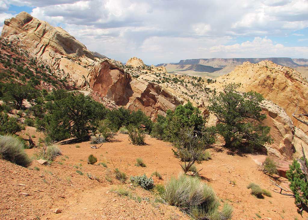
TThe Scenic Drive leaves the Fremont River valley and climbs a desert slope, with the rock walls of the Waterpocket Fold rising to the east. Turn east to explore Grand Wash, a dry channel etched through the sandstone. A dirt road follows the twisting gulch 1 mile (1.6 km), with sheer rock walls rising along the sandy streambed. At the road’s end, an easy hiking trail follows the wash 2.5 miles (4 km) to its mouth along Highway 24.
Back on the paved Scenic Drive, continue south past Slickrock Divide to where the rock lining the reef deepens into a ruby red and forms odd columns and spires that resemble statuary. Called the Egyptian Temple, this is one of the most striking and colorful areas along the road.
Capitol Gorge
Capitol Gorge is at the end of the Scenic Drive, 10.7 miles (17.2 km) from the visitors center. Capitol Gorge is a dry canyon through Capitol Reef, much like Grand Wash. Believe it or not, narrow, twisting Capitol Gorge was the route of the main state highway through south-central Utah for 80 years. Mormon pioneers laboriously cleared a path so wagons could get through, a task they repeated every time flash floods rolled in a new set of boulders. Cars bounced their way down the canyon until 1962, when Highway 24 opened, but few traces of the old road remain today. Walking is easy along the gravel riverbed, but don’t enter if storms threaten. An easy 1-mile (1.6-km) saunter down the gorge will take day hikers past petroglyphs and a “register” rock where pioneers carved their names. If you’re lucky, you may get a glimpse of desert bighorn sheep in this area. Native to the area and often depicted in rock art, the sheep had disappeared from the park but were successfully reintroduced in the 1990s.
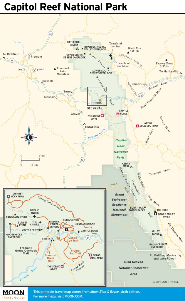
Pleasant Creek Road
The Scenic Drive curves east toward Capitol Gorge and onto Pleasant Creek Road (turn right 8.3 miles from the visitors center), which continues south below the face of the reef. After 3 miles (4.8 km), the sometimes rough dirt road passes Sleeping Rainbow-Floral Ranch (closed to the public) and ends at Pleasant Creek. A rugged road for 4WD vehicles—South Draw Road—continues on the other side, but it is much too rough for cars. Floral Ranch dates back to the early years of settlement at Capitol Reef. In 1939 it became the Sleeping Rainbow Guest Ranch, from the translation of the Native American name for Waterpocket Fold. Now the ranch belongs to the park and is used as a field research station by students and faculty of Utah Valley University. Pleasant Creek’s perennial waters begin high on Boulder Mountain to the west and cut a scenic canyon completely through Capitol Reef. Hikers can head downstream through the 3-mile-long canyon and then return the way they went in, or continue another 3 miles (4.8 km) cross-country to Notom Road.


Newsletter Signup
By clicking ‘Sign Up,’ I acknowledge that I have read and agree to Hachette Book Group’s Privacy Policy and Terms of Use
Pin it for Later