Route 66 Arizona Side Trip: US-89 to Sedona
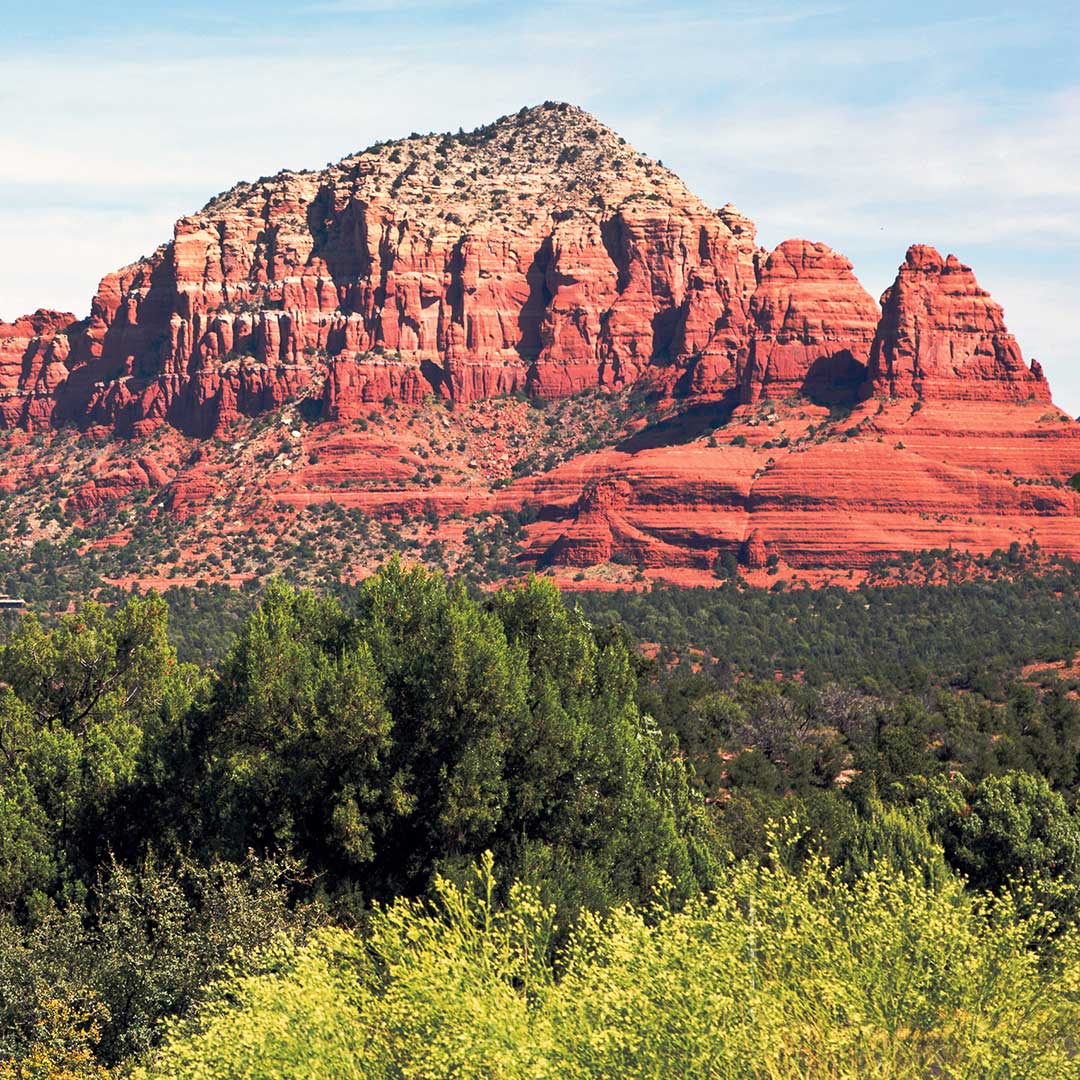
Nourish and heal your soul in the geological wonderland of Sedona. On a quick detour off Route 66 of about 30 miles, south of Flagstaff via US-89, soaring monoliths straddle a town filled with dozens of spas, plentiful art galleries, boutiques, resorts, and wineries. The red-rock monoliths that flank Sedona are regarded as sacred and energy-harnessing vortexes that inspire spiritualists to travel from all over the world to access the mystical power of this area.
But you don’t have to be a crystal-loving hippie to get Sedona; it’s also a hot spot for outdoor enthusiasts with lots of trails for hiking, biking, and off-roading. It’s the perfect place to get in tune with nature, play hard, soak in the desert sun, and relax in the bosom of ultimate luxury.
Getting There
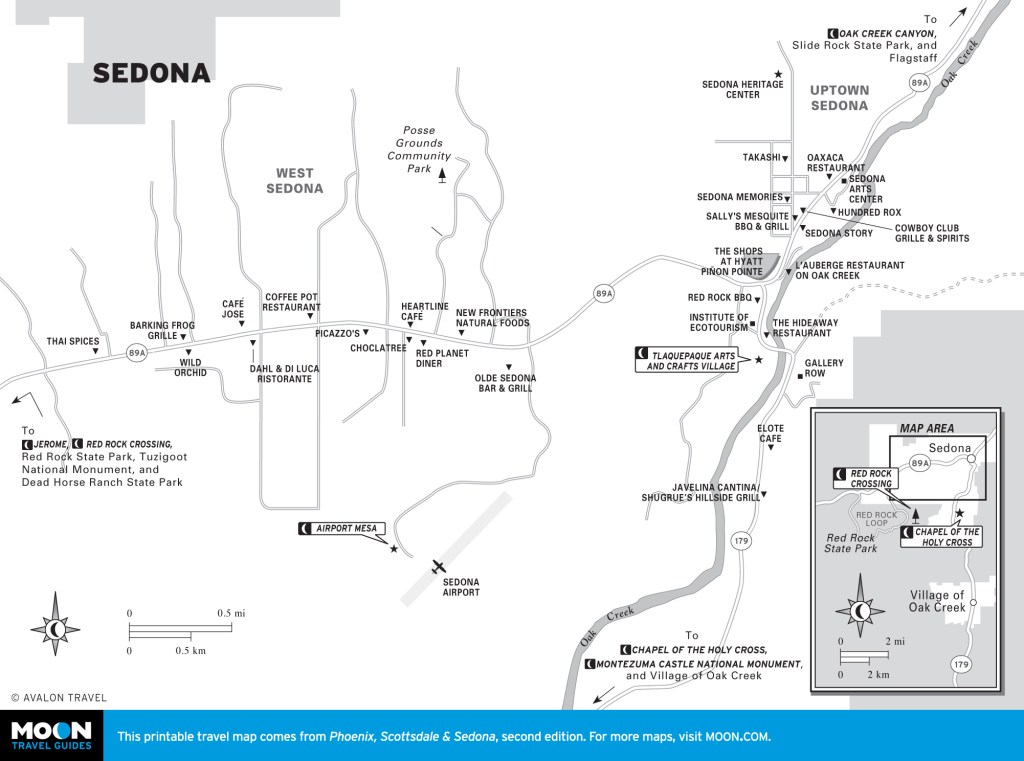
From Flagstaff and Bus-40, head south on S. Milton Road and turn right (west). Take your first left onto US-89A. Follow US-89A south for 25 miles into Sedona.
Scenic Drives
Oak Creek Canyon
Oak Creek Canyon Scenic Drive (Rte. 89A) is a 24-mile drive between Flagstaff and Sedona. From Flagstaff, take I-17 South to Highway 89A. The breathtaking road descends 4,500 feet from the top of the Mogollon Rim, winding through sandstone canyons and rock formations around every curve.
Along the way, visit one of the state’s most beautiful swimming holes. Slide Rock State Park (1300 W. Washington, 928/282-3034, hours vary seasonally, $10) is a natural water park in Oak Creek Canyon. A cool creek with a natural red-sandstone waterslide sits surrounded by huge rock formations. Three short hiking trails are available, but there is no camping. The rocks are slippery, so water-resistant shoes are recommended; if you are wearing light-colored clothing, the sediment from the rocks can cause stains.
The best seasons to enjoy this drive are late spring, summer, and early fall; however, the creek water is usually too cold in fall and winter. It gets extremely busy during the summer months, and there may be a long wait to enter the park. If the parking lot is full, enter via the southbound turn lane. If that lane reaches the highway, the park will be inaccessible until the road clears.
Newsletter Signup
By clicking ‘Sign Up,’ I acknowledge that I have read and agree to Hachette Book Group’s Privacy Policy and Terms of Use
State Route 179
In Sedona, US-89A splits to head west. Stay south on State Route 179 to revel in the area’s spectacular scenery. From Sedona, State Route 179 winds 7.5 miles south through the Coconino National Forest along some of the most gorgeous red-rock sandstone and geological formations in the country. There are several places to pull off the road and stare at the grand and vibrant otherworldly landscape.
In about 3 miles, look for Cathedral Rock (6246 SR-179), the Empire State Building of Sedona’s skyline. Back on State Route 179, continue south and in less than 1 mile, turn east (left) onto Chapel Road and drive 1 mile to view the Chapel of the Holy Cross. Built in 1956, the pyramidal structure juts dramatically from the surrounding red rocks.
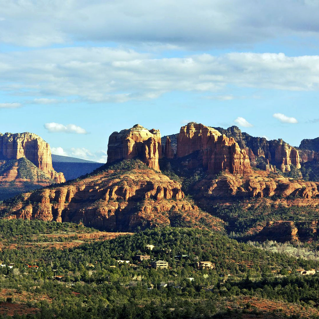
Return to State Route 179 and drive 3 miles south to the parking lot for Bell Rock (6246 SR-179). This distinctive, bell-shaped monolith sits surrounded by one of the four major vortexes in the area. (It’s reported to have the strongest and most electrifying energy field, enough to strengthen one’s psychic abilities.) There are two parking lots; the lot for Courthouse Vista is the closest to the base of the rock.
Sights
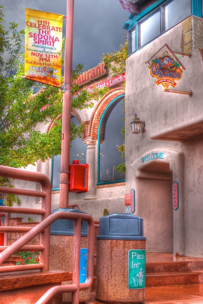
As you drive into Sedona, the majority of the restaurants and hotels are either on the route or within 0.25 mile of the highway. The town of Sedona is divided into four sections: The Village of Oak Creek (SR-179) has restaurants and hiking trails; Upton is full of tourist shops; Oak Creek Canyon has B&Bs and mountain biking trails; and West Sedona is more residential.
Sedona is the center for spirituality and peace. For a beautiful spot to rest, meditate, or just contemplate life’s mysteries, visit Amitabha Stupa and Peace Park (2650 Pueblo Dr., 877/788-7229, dusk-dawn daily, free). The rare 36-foot stupa is a five-minute walk from Pueblo Drive along a well-marked trail.
Tlaquepaque (336 SR-179, 928/282-5820, 10am-5pm daily)—pronounced Tla-keh-pah-keh—has been a Sedona landmark since the 1970s. This distinctive shopping experience is fashioned after a quaint Mexican village, complete with cobblestone walkways, vine-covered walls, and arched entryways situated on the banks of Oak Creek. There are more than 40 specialty shops, 19 galleries, and 5 restaurants.
A Spa For You (30 Kayenta Ct. Ste 1, 928/282-3895, call for appointment, $60-310) offers signature massages, body wraps, and Japanese facial massages that restore and rejuvenate the spirit. To get there, drive west on US-89A and turn right (north) on Navajo Drive. Continue two blocks and turn left (west) on Hopi Drive. Take your first right into the parking lot; the spa is straight ahead on the right.
Sedona is also a good place to realign your chakras. Try a Reiki session at International I AM (3190 W. State Route 89A, Suite 150, 928/451-6368, $50-200), where all types of psychic and spiritual healing services are available.
Hiking
Brins Mesa Trail (5 miles round-trip) is a diverse trek that travels through Sedona’s stunning red-rock formations. From the trailhead, you’ll pass by Devil’s Sinkhole, a 100-foot wide and 50-foot deep active sinkhole that formed in the 1880s. The trail winds through canyon arches and up to Soldier Pass.
To access the trailhead from downtown Sedona, drive west on US-89A and turn right (north) on Soldiers Pass Road. Continue 1.5 miles before turning right (east) on Rim Shadows for 0.2 mile. Parking is available to the left.
The Palatki Heritage Site (10290 Forest Service Rd. 795, 928/282-3854, 9:30am-3pm daily, $5), in the Coconino National Forest, was built by the Sinagua people. The site is nestled among ancient, red sandstone cliffs with rock art and pictographs. It is reachable via a short and easy 1-mile round-trip hike, but tour reservations are required.
From Sedona, take US-89A west for 5 miles and turn right onto Forest Road 525. Continue north for 5 miles, then stay straight to continue north onto Forest Road 795. Drive 2 miles to the parking lot for the Palatki ruins.


Newsletter Signup
By clicking ‘Sign Up,’ I acknowledge that I have read and agree to Hachette Book Group’s Privacy Policy and Terms of Use
Pin it for Later
