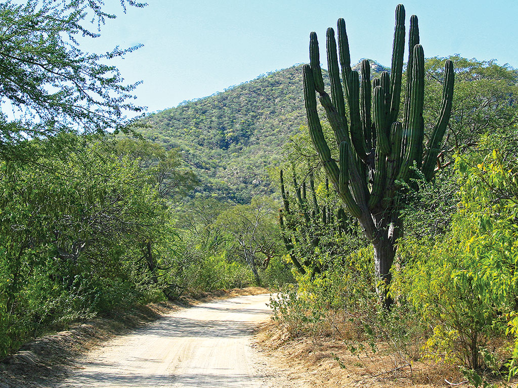
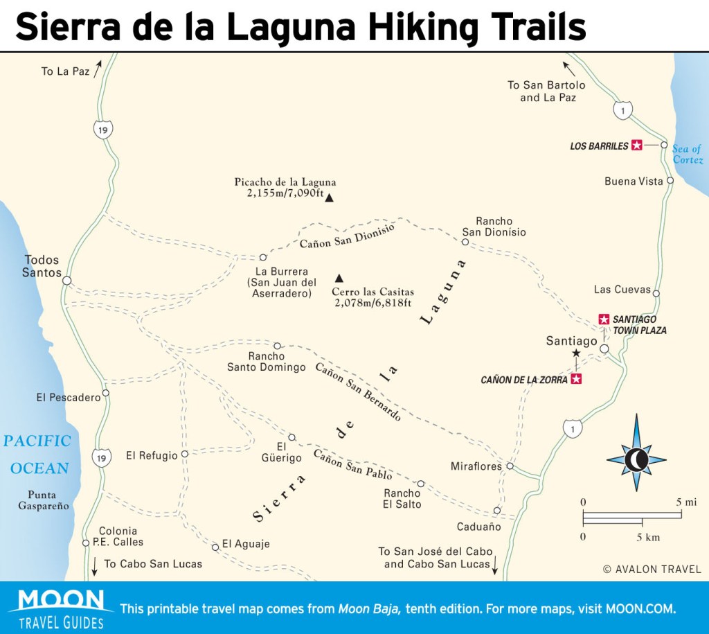
Hiking Sierra de la Laguna, Mexico
The Sierra de la Laguna is one of the most beautiful and least-explored areas of the peninsula. UNESCO designated the 11,600 hectares of this mountain range a biosphere reserve in 1994. There are more than 900 plant species in the sierra, ranging from cacti to palms. Over 20 percent of them are endemic to the peninsula. As a microclimate, the Sierra de la Laguna receives far more rainfall than any other part of the peninsula, providing a drastic change in scenery from the desert below. The highest peak in the range, Picacho de la Laguna (elev. 2,161 m), is also the highest peak in all of Baja California Sur.
The Sierra de la Laguna is approached either from the East Cape or from the West Cape, depending on the final destination. All sierra access from the East Cape is self-guided, while most tours and guided hikes depart from the West Cape.
The mountains experience heavy rains July-October. November through early spring is the most popular time for hiking. Temperatures can drop below freezing at night during the winter.
There are three access points into the sierra from the eastern side: Cañon San Dionísio from Santiago, Cañon San Bernardo from Miraflores, and Cañon San Pablo from Caduaño. Most hikes use an assortment of trails, canyons, and cow paths that wind through the sierra.
Sierra de la Laguna Hiking Trails
The Cañon San Dionísio trail begins at Rancho San Dionísio, in the mouth of the canyon, 23 kilometers from Santiago. Inquire in town about how to get out to the ranch. Cañon San Bernardo is the easiest cross-sierra hike, beginning in Boca de la Sierra on the east side of the range and ending with Santo Domingo on the west side. There are permanent water pools that provide drinking water throughout the 22.5-kilometer hike that takes three days to complete.
The most popular overnight hike is to Picacho de la Laguna; the lake in the name is now a meadow instead of a pool. This hike is best approached from the western side of the sierras from La Burrera ranch near Todos Santos. This is the only trail in the Sierra de la Laguna that is shown on topo maps. Allow three days for the full round-trip hike.
Trails in the Sierra de la Laguna can be difficult to find and follow. If you aren’t an expert or a local who knows your way around, it’s better to go with a guide. Baja Sierra Adventures (tel. 624/166-8706) leads guided treks through the sierra with a range of day trips and overnight trips.


Newsletter Signup
By clicking ‘Sign Up,’ I acknowledge that I have read and agree to Hachette Book Group’s Privacy Policy and Terms of Use