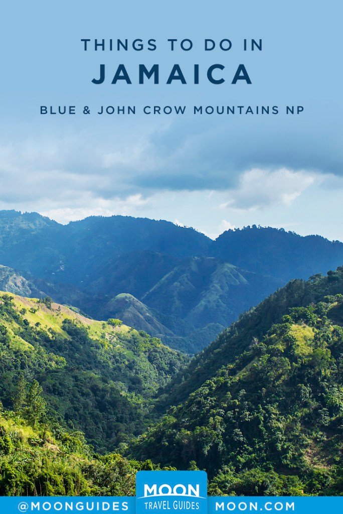
Jamaica’s Blue and John Crow Mountains National Park
Consisting of nearly 81,000 hectares (200,000 acres) in the parishes of St. Andrew, St. Mary, St. Thomas, and Portland, the Blue and John Crow Mountains National Park (BJCMNP, tel. 876/920-8278) covers the highest and steepest terrain in Jamaica. This alpine terrain is the last known habitat for the endangered giant swallowtail butterfly, the second-largest butterfly in the world, which makes its home especially on the northern flanks of the range.
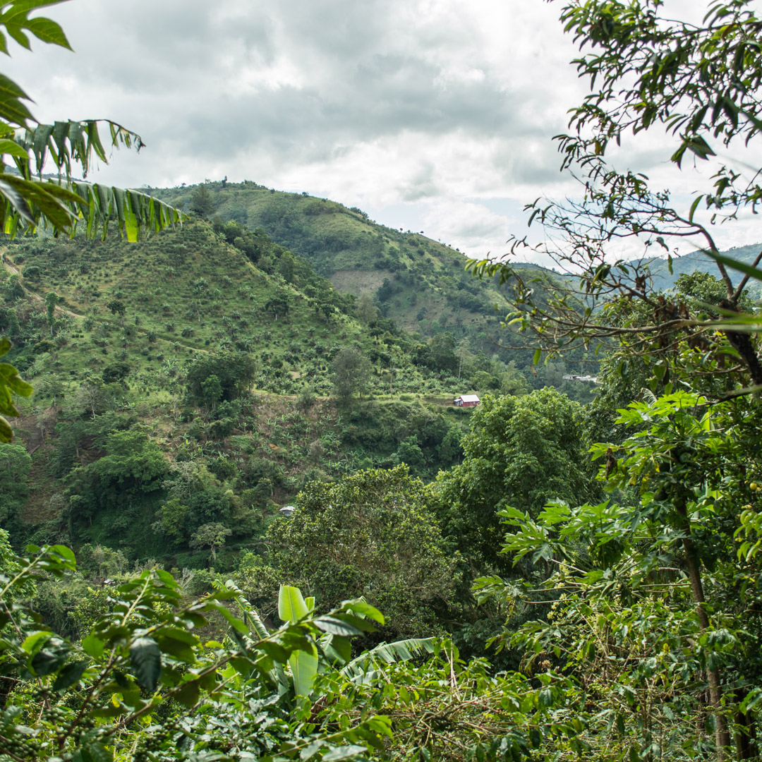
Several endemic plant and bird species reside in the park as well, and many migratory birds from northern regions winter there. Among the most impressive of the native birds are the streamertail hummingbirds—known locally as doctor birds—and the Jamaican tody, the Jamaican blackbird, and the yellow-billed parrot. The Blue Mountains generally are the source of water for the Kingston area, one of many reasons it is important to disturb the environment as little as possible. The BJCMNP has the largest unaltered swath of natural forest in Jamaica, with upper montane rainforest and elfin woodland at its upper reaches.
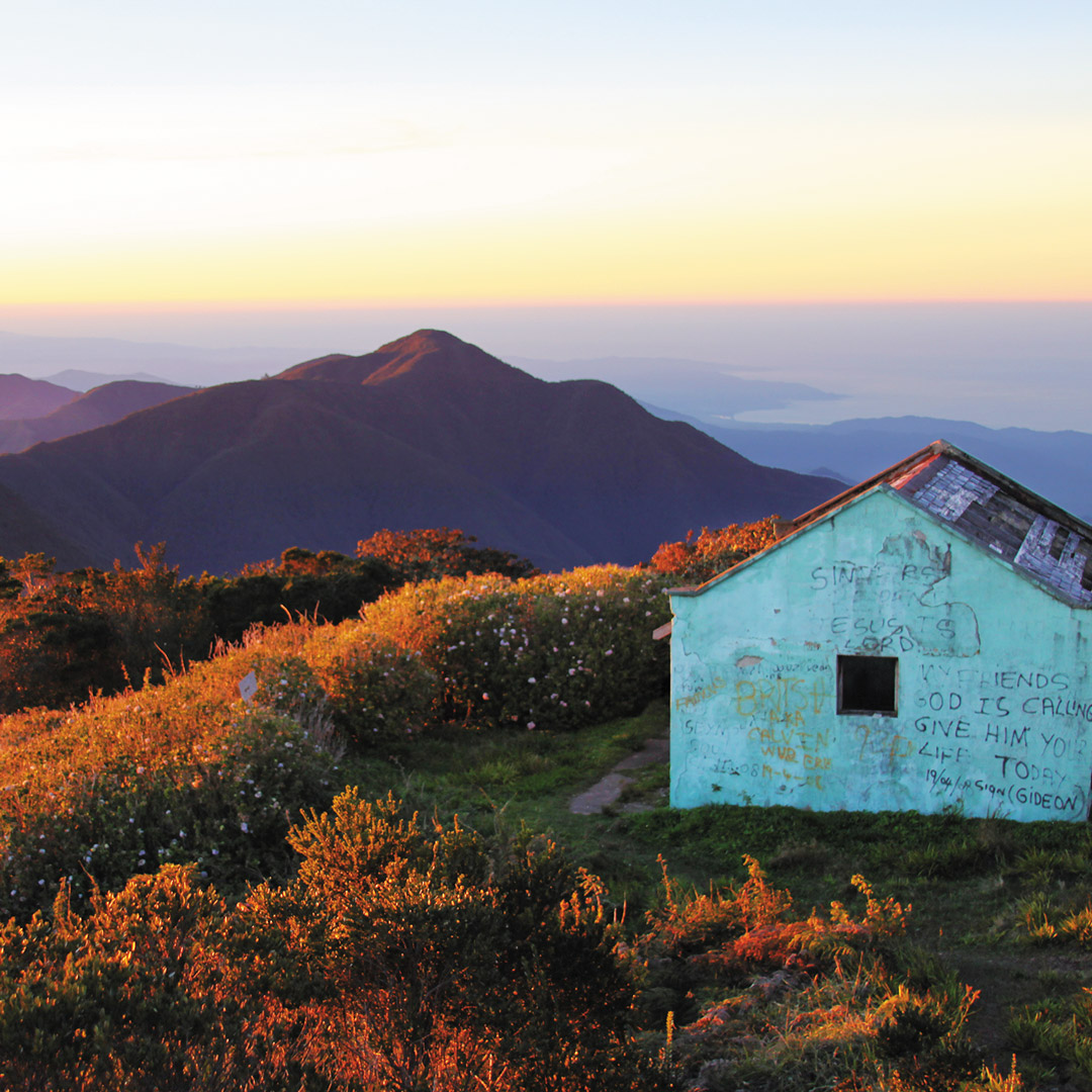
Blue Mountain Peak
The pinnacle of the Blue and John Crow Mountains National Park, Blue Mountain Peak can be reached by a variety of means, depending on the level of exhaustion you are willing to endure. Generally, hikers leave before first light from Whitfield Hall at Penlyne, St. Thomas, after having arrived the previous day.
For ambitious hikers, there’s a 4.5-kilometer (2.8-mile) trail from Mavis Bank to Penlyne Castle, which is pleasant and covers several farms and streams. This option also obviates the need to send for a 4WD vehicle. From Penlyne Castle, follow the road to Abbey Green (3.2 kilometers/2 miles), and from there to Portland Gap (3.7 kilometers/2.3 miles). At Portland Gap a ranger station, sometimes staffed, has bunks, toilets, showers, and campsites. These facilities can be used for US$5 by contacting the JCDT, which asks that visitors register at the ranger station. From Portland Gap to the peak is the most arduous leg, covering 5.6 kilometers (3.5 miles). Warm clothes, rain gear, and comfortable, supportive footwear are essential. Blue Mountain Peak is also a mildly challenging three- to four-hour hike from Whitfield Hall, a rustic farmhouse with a great stone fireplace.
From Portland Gap westward along the Blue Mountain range, there are several other lofty peaks along the ridge with far less traffic. These include Sir John’s Peak, John Crow Peak, and Catherine’s Peak. Guide to the Blue and John Crow Mountains by Margaret Hodges has the most thorough coverage of hiking trails throughout the national park. Otherwise, local people are the best resource.
Getting There and Around
The Blue Mountains are accessible from three points: from Kingston via Papine; from Yallahs, St. Thomas, via Cedar Valley; and from Buff Bay, St. Mary, on the North Coast, via the B1, which runs alongside the Buff Bay River. The B1 route is a very narrow road barely wide enough for one vehicle in many places.
There are two main routes to access the south-facing slopes of the Blue Mountain range. The first, accessed by taking a left onto the B1 at the Cooperage, leads through Maryland to Irish Town, Redlight, Newcastle, and Hardwar Gap before the Buff Bay River Valley opens up overlooking Portland and St. Mary on the other side of the range. The second route, straight ahead at the Cooperage along Gordon Town Road, leads to Gordon Town, and then taking a right at the town square over the bridge, to Mavis Bank. Continuing beyond Mavis Bank requires a 4WD vehicle, and you can either take a left at Hagley Gap to Penlyne, or straight down to Cedar Valley and along the Yallahs River to the town of Yallahs.
Getting to and around the Blue Mountains can be a challenge, even if keeping lunch down on the way isn’t. Only for the upper reaches, namely beyond Mavis Bank, is it really necessary to have a 4WD vehicle; otherwise the abundant potholes and washed-out road is only mildly more challenging to navigate than any other part of Jamaica due to the sharp turns.
A hired taxi into the Blue Mountains will cost upward of US$30 for a drop-off at Strawberry Hill, and at least US$100 for the day to be chauffeured around. Route taxis travel between Papine and Gordon Town (US$3) throughout the day, as well as to Irish Town (US$4); you’ll have to wait for the car to fill up with passengers before it departs.
To reach Whitfield Hall, the most common starting point for hiking up Blue Mountain Peak, 4WD taxis can be arranged by calling Whitfield Hall.
Many travelers find letting a tour operator take care of the driving is the easiest, most hassle-free way to get around the island. One of the most dependable and versatile tour companies on the island is Barrett Adventures (contact Carolyn Barrett, cell tel. 876/382-6384). Barrett can pick you up from any point on the island and specializes in off-the-beaten-path tours.
Related Travel Guide

Pin For Later