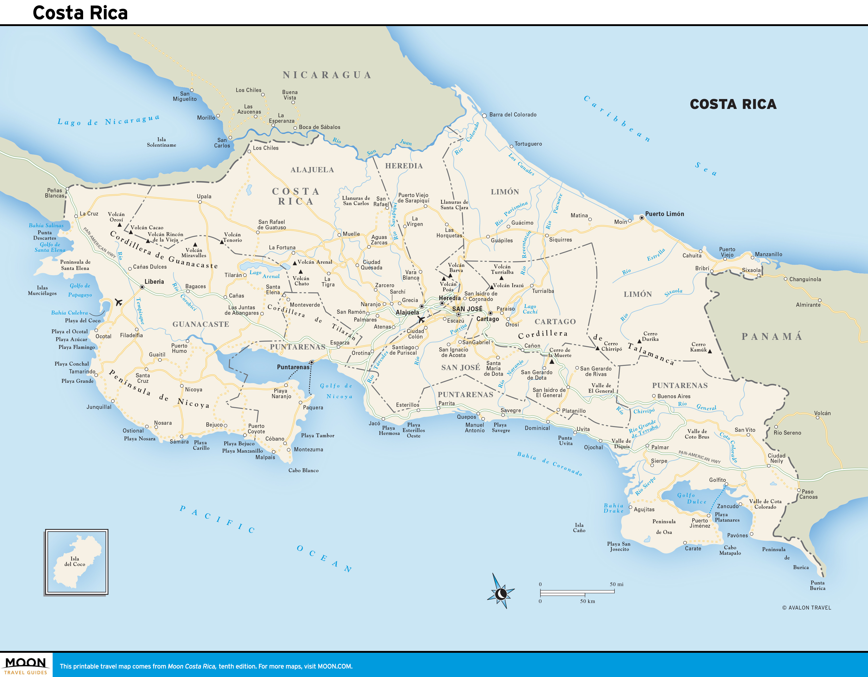
Costa Rica
These free, printable travel maps of Costa Rica are divided into nine regions:
- San José
- The Central Highlands
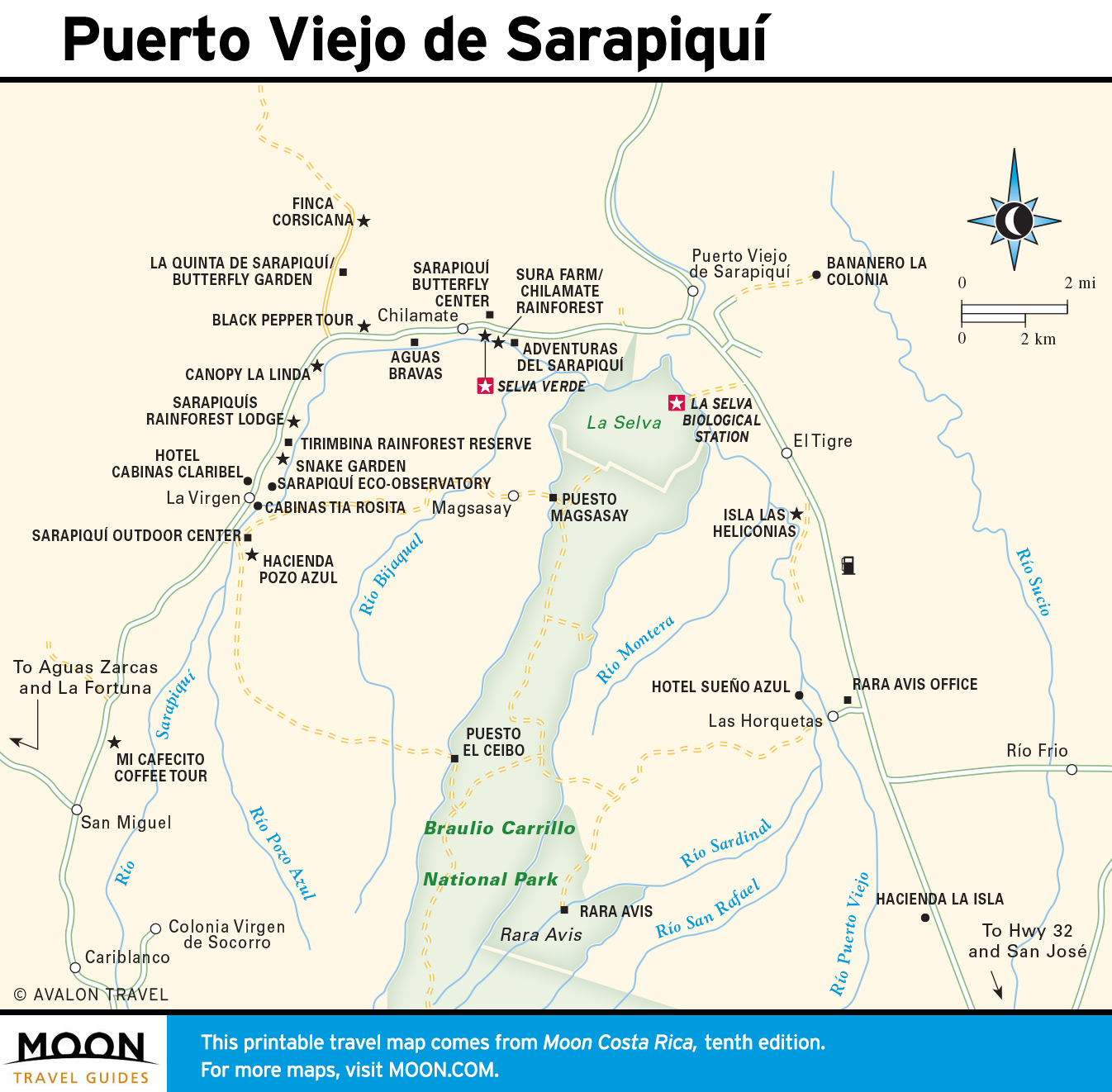
- The Caribbean Coast
- The Northern Zone
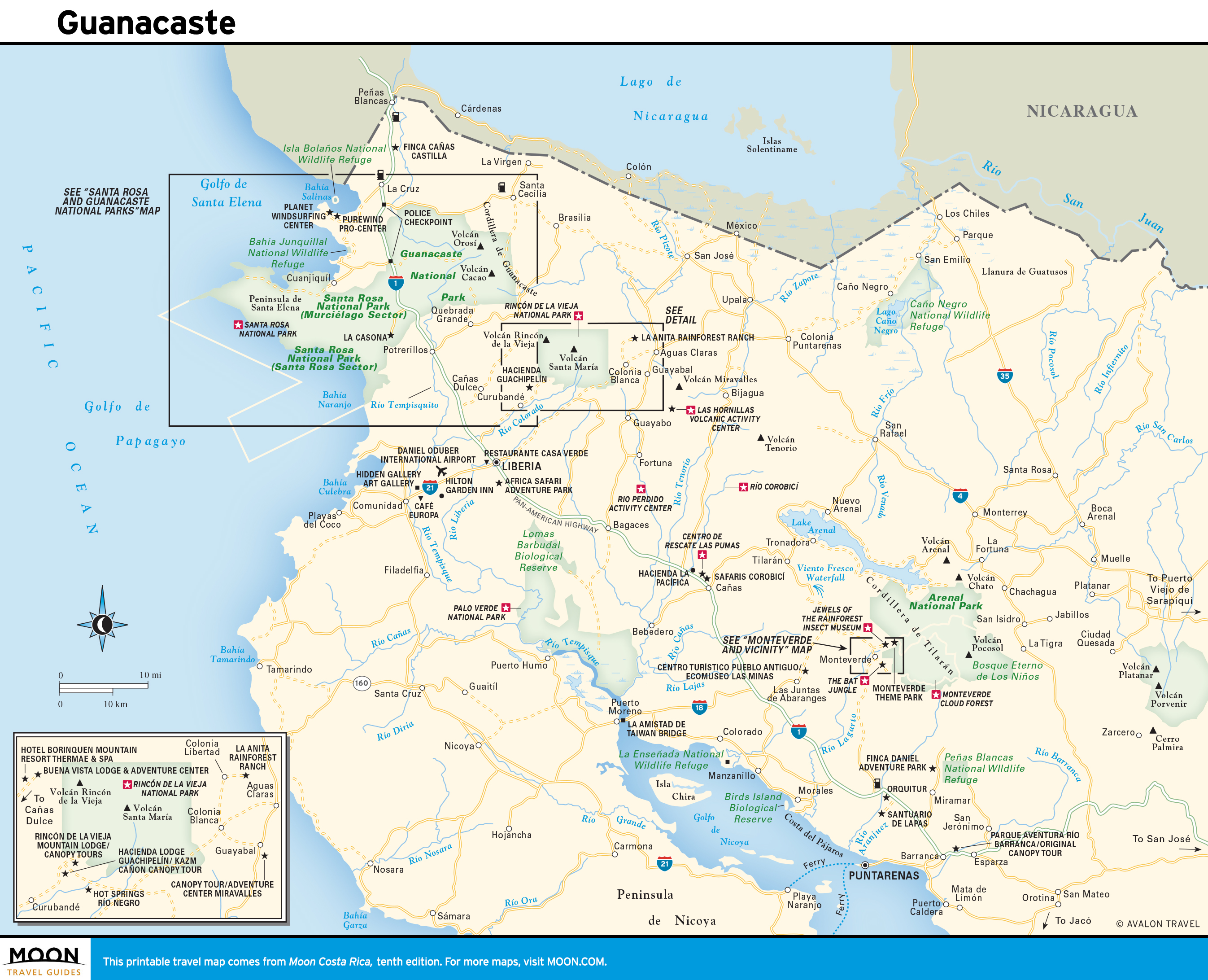
- Guanacaste and the Northwest
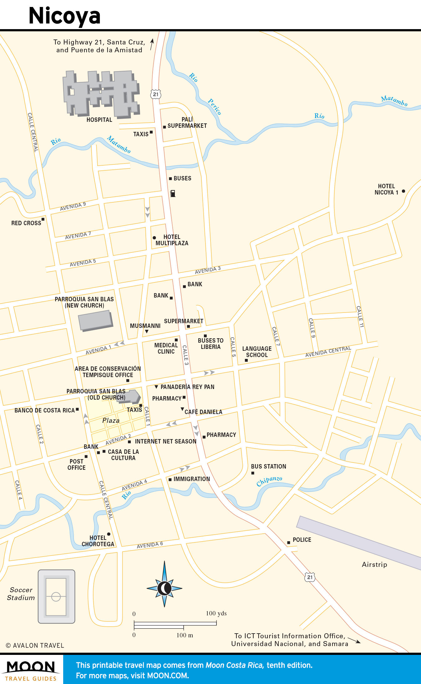
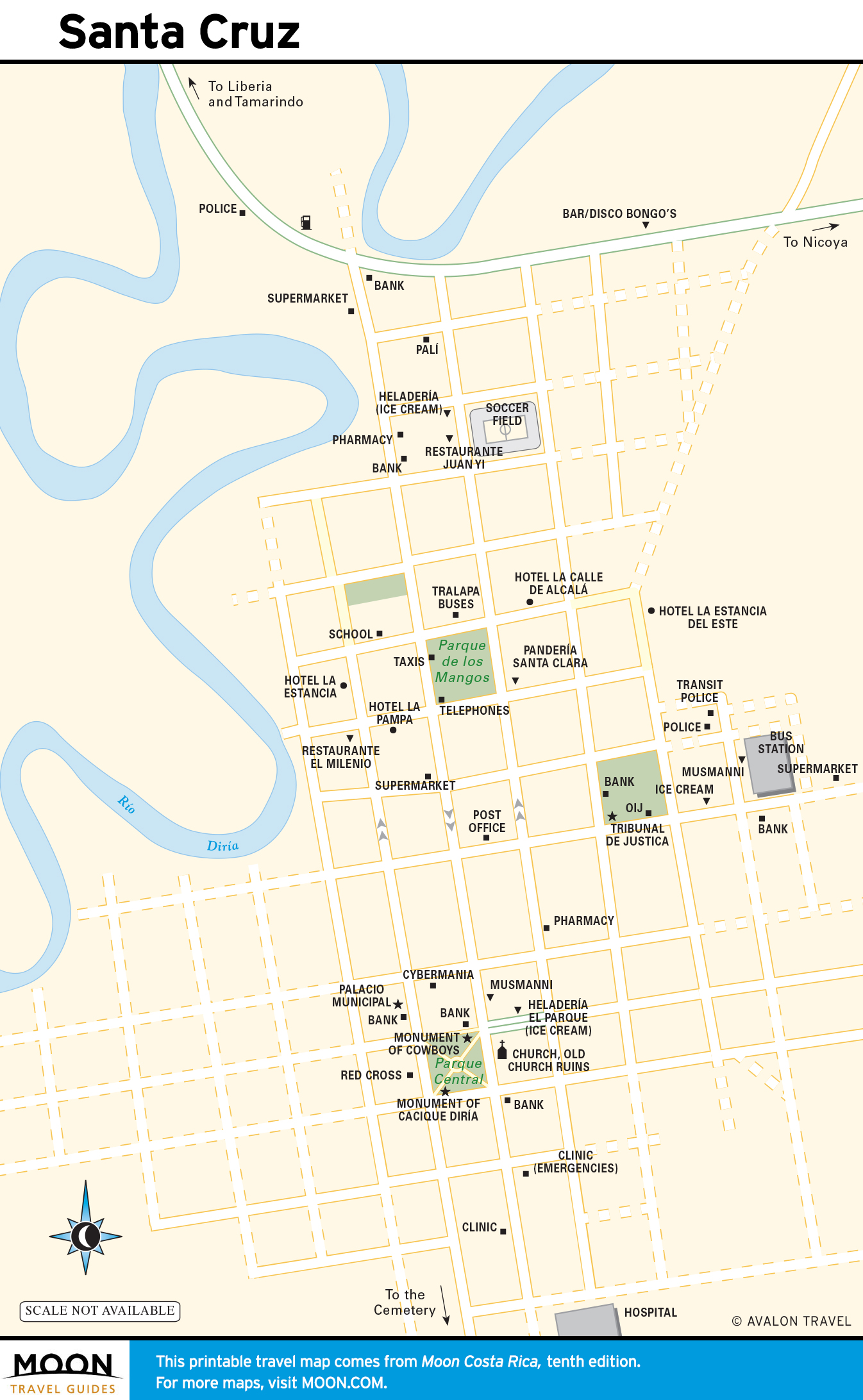
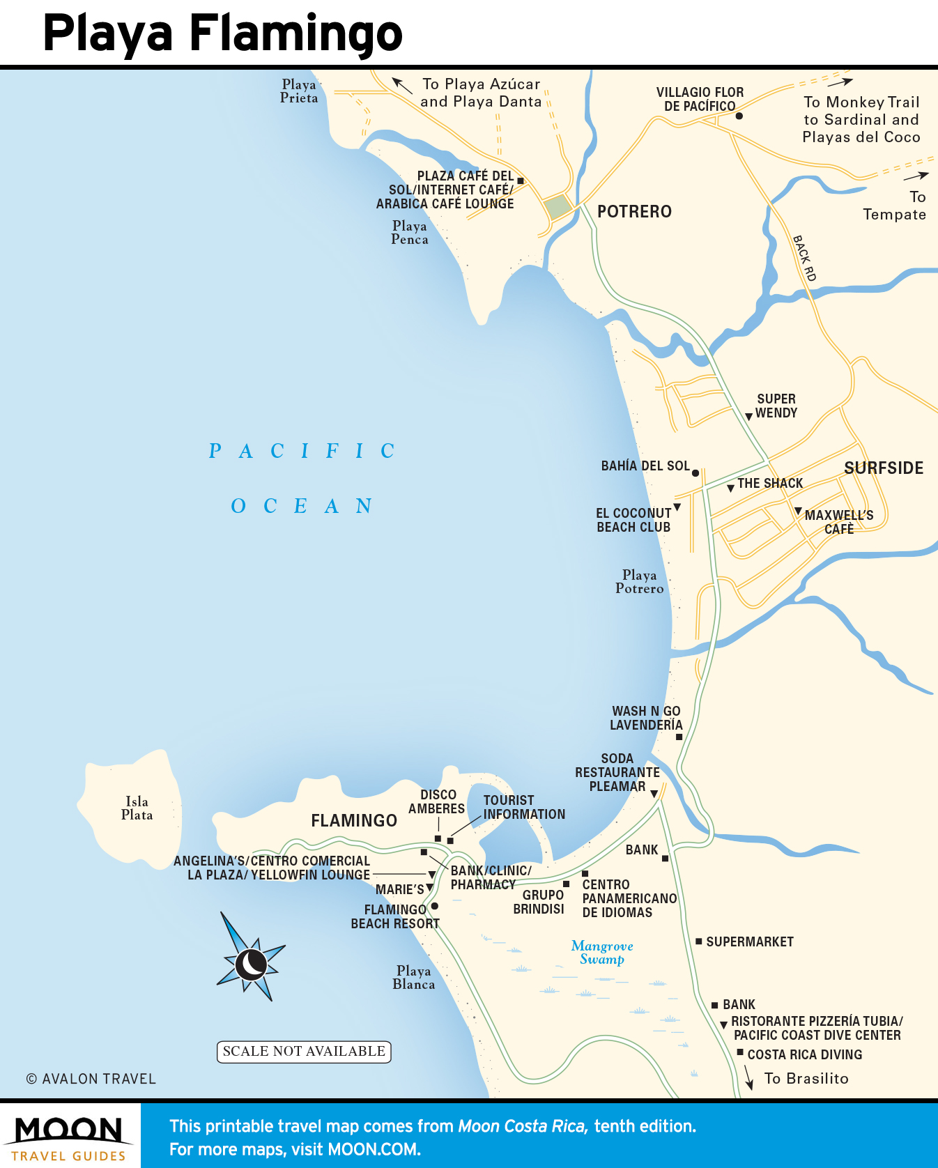
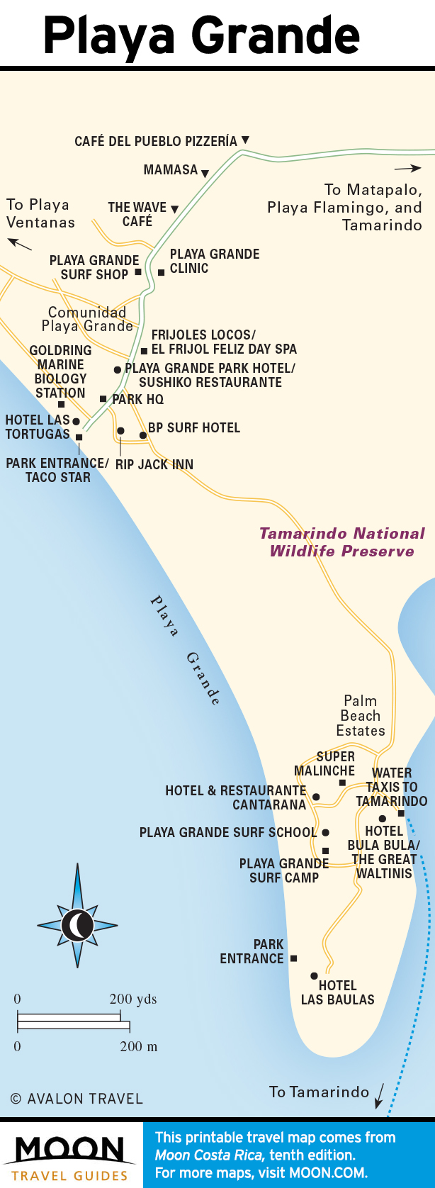
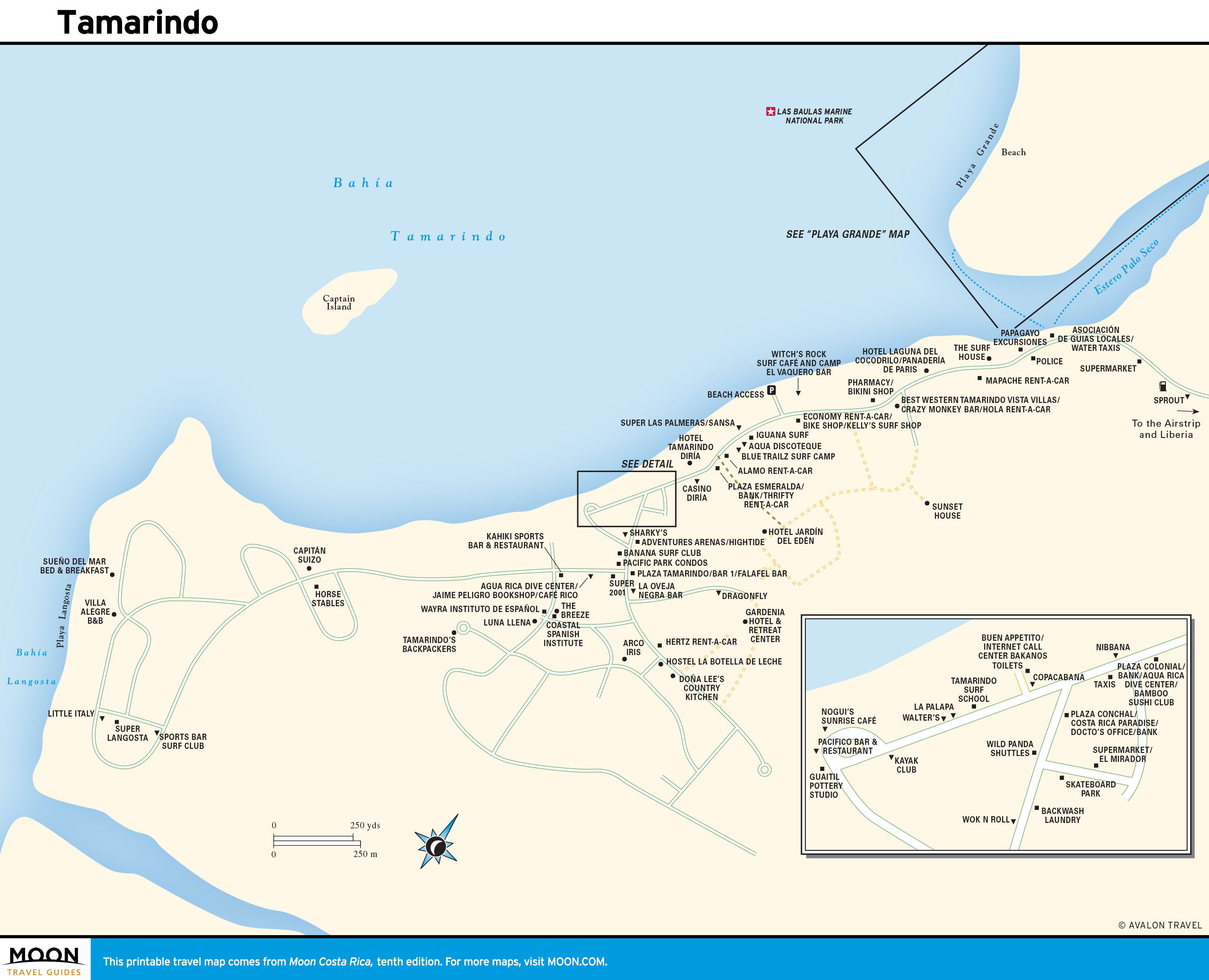
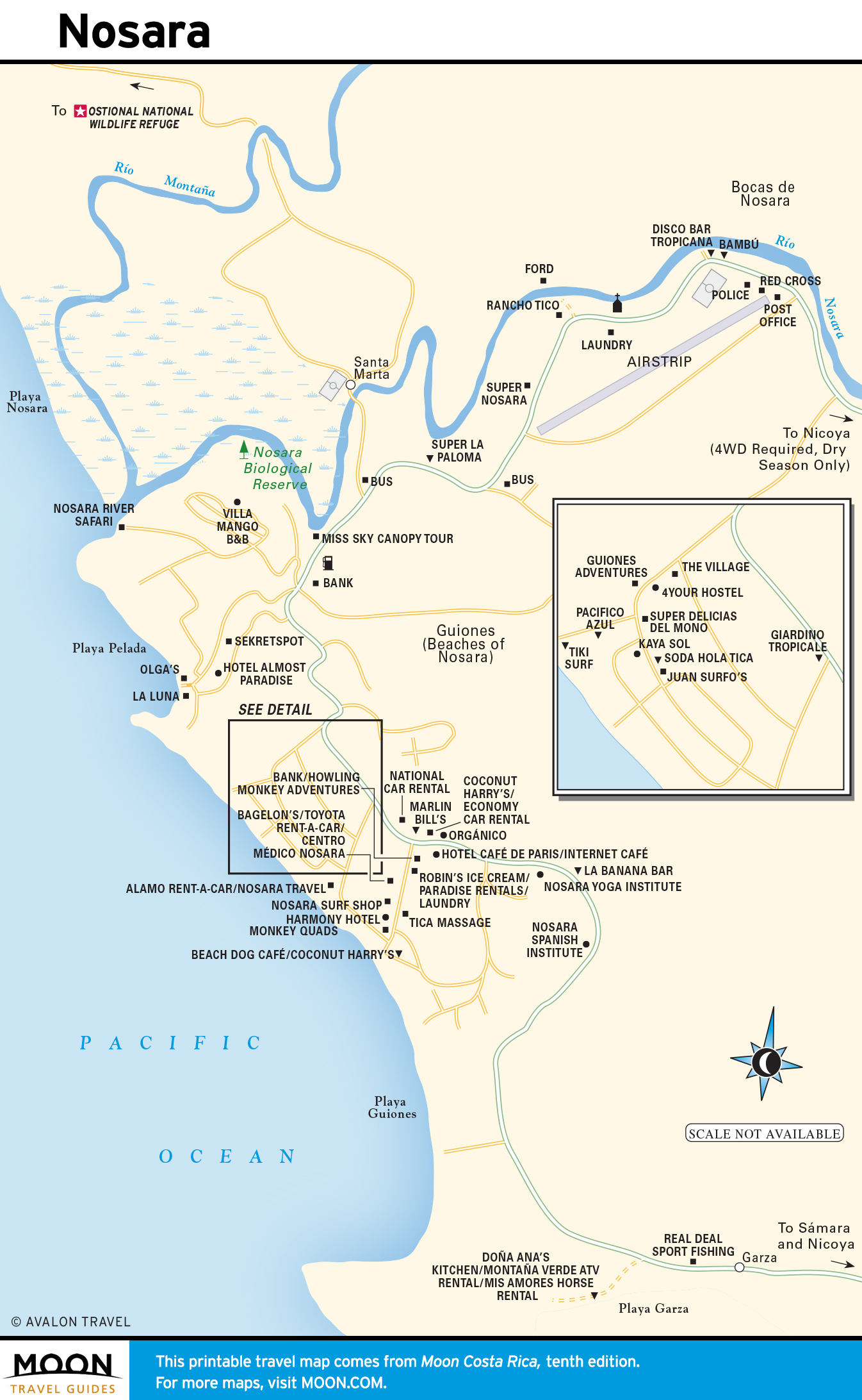
- The Nicoya Peninsula
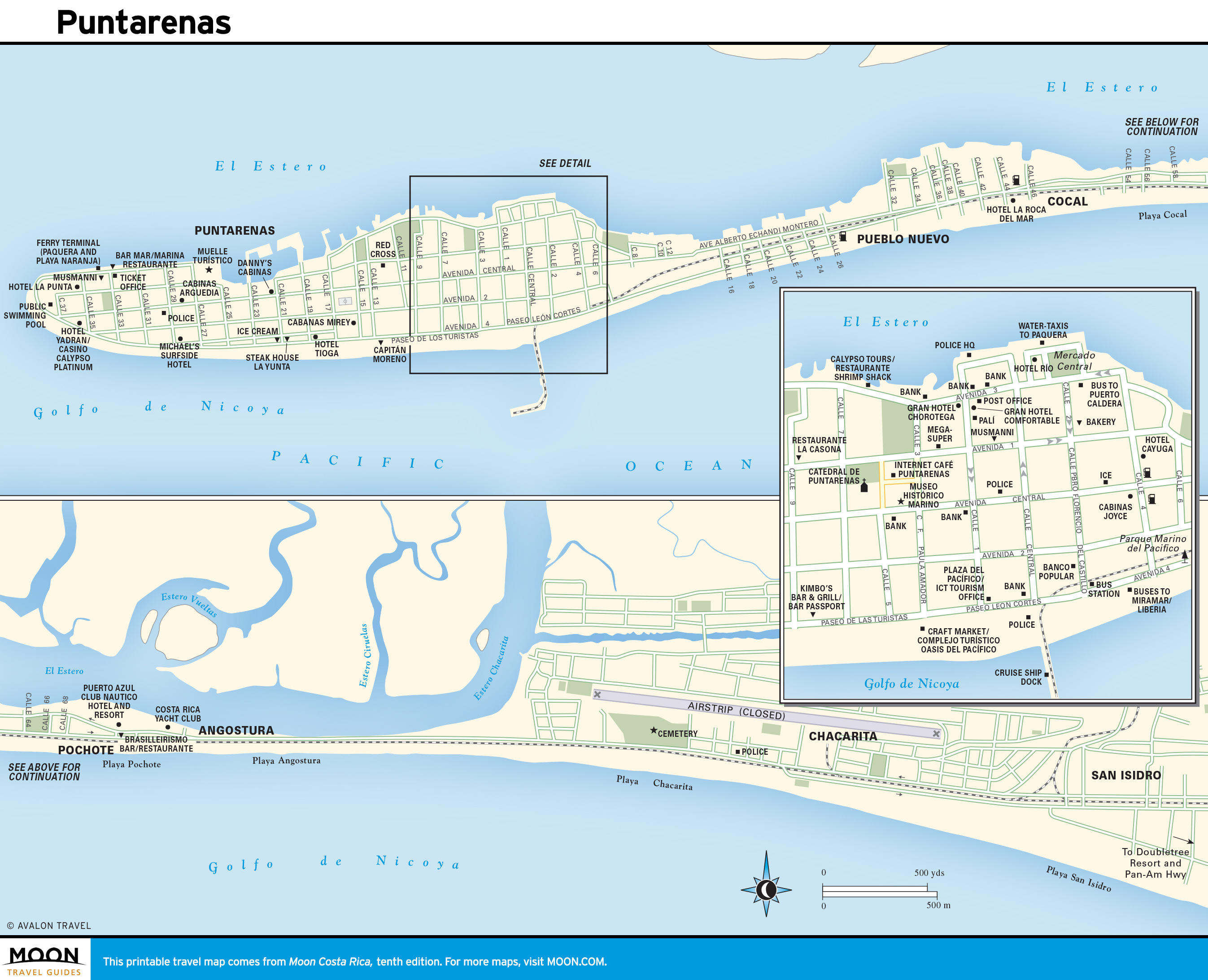
- Central Pacific
- Golfo Dulce and the Osa Peninsula
- South-Central Costa Rica
Explore Costa Rica with these helpful travel maps. Ensure you have the newest travel maps from Moon by ordering the most recent edition of our travel guides to Costa Rica.
Costa Rica
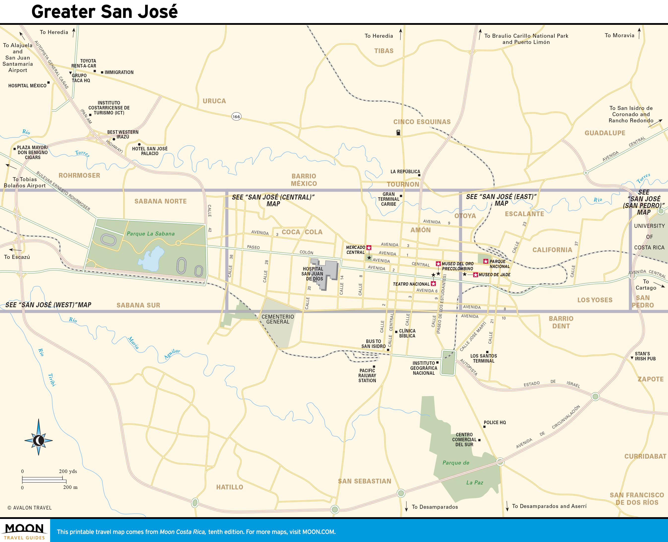
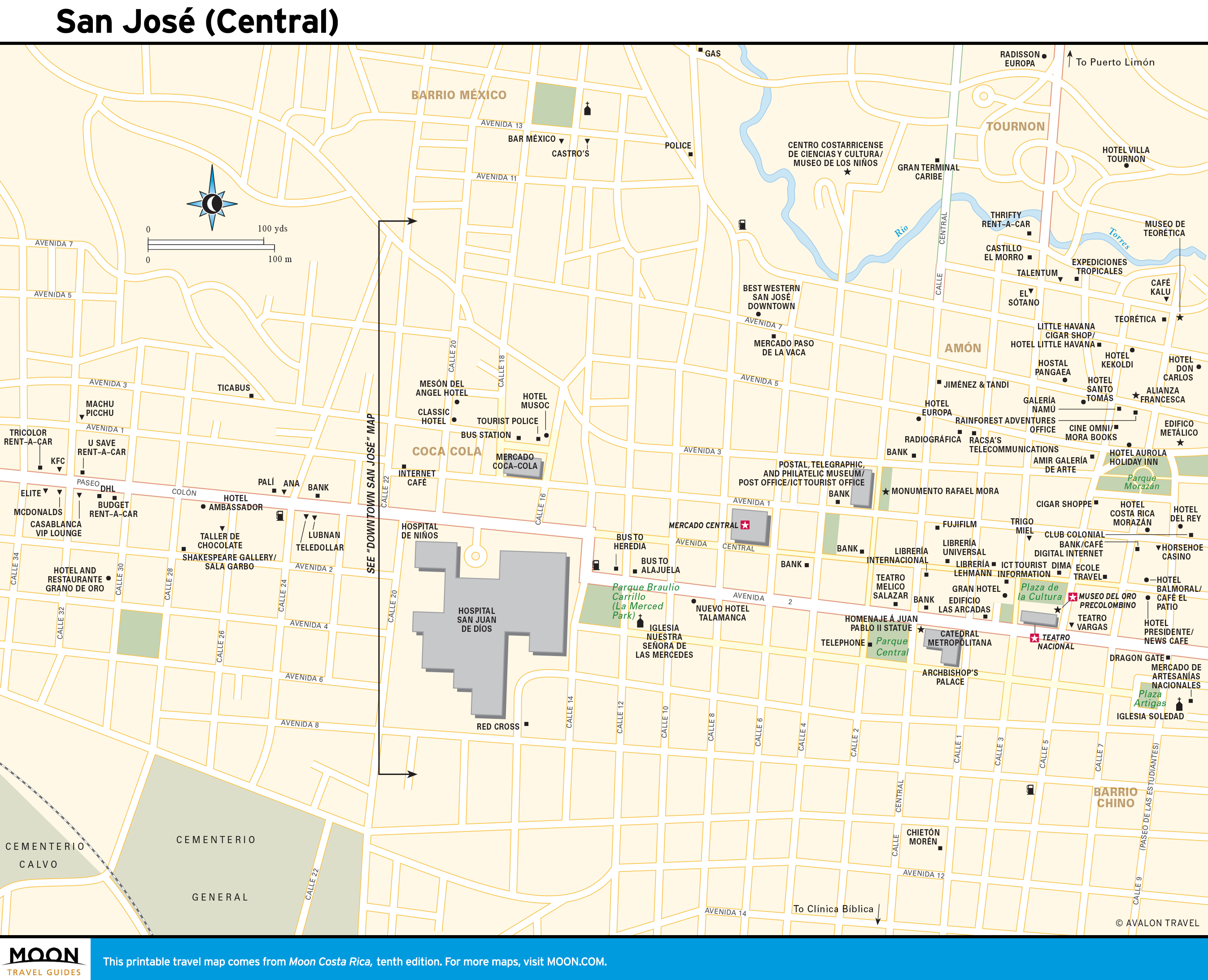
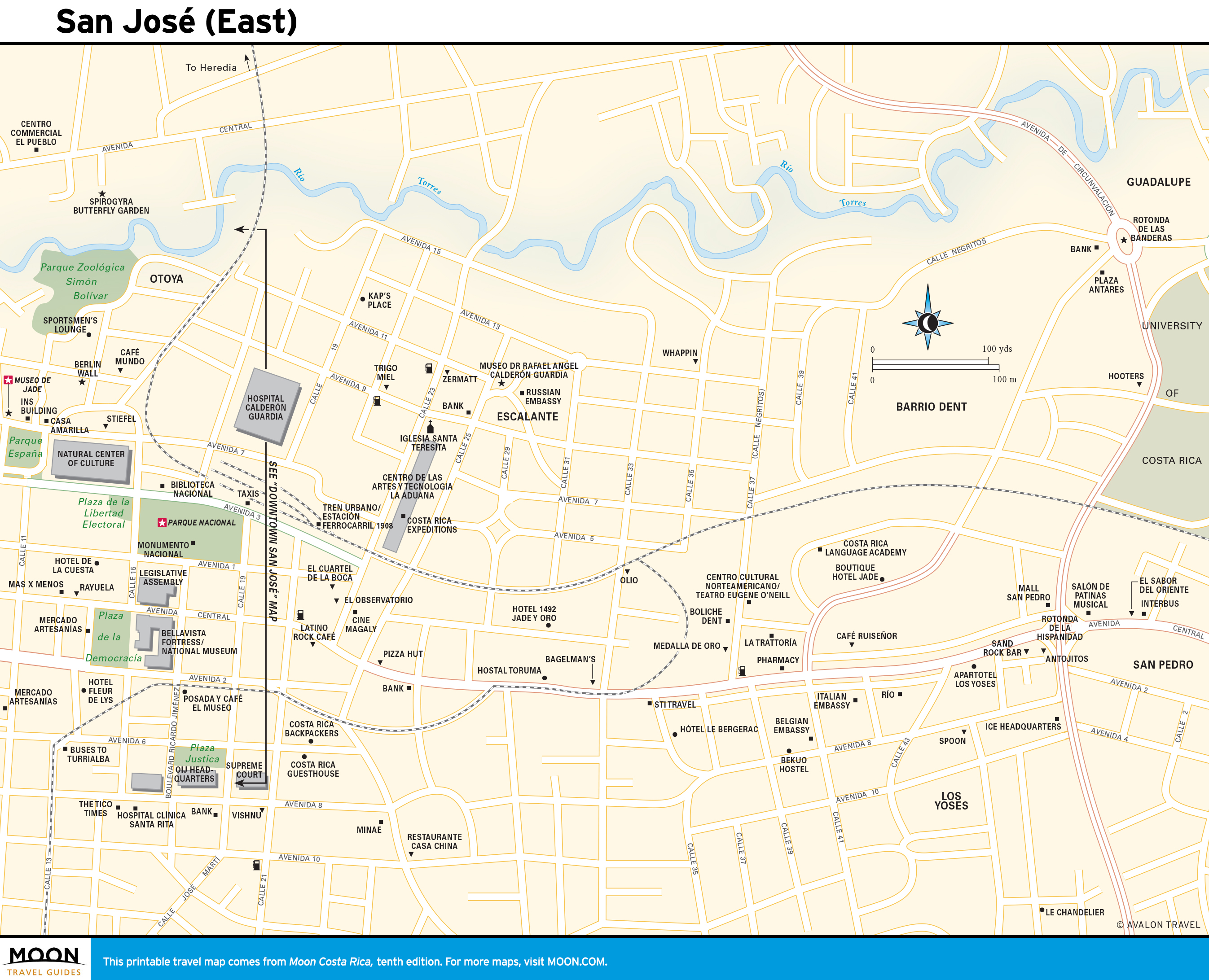
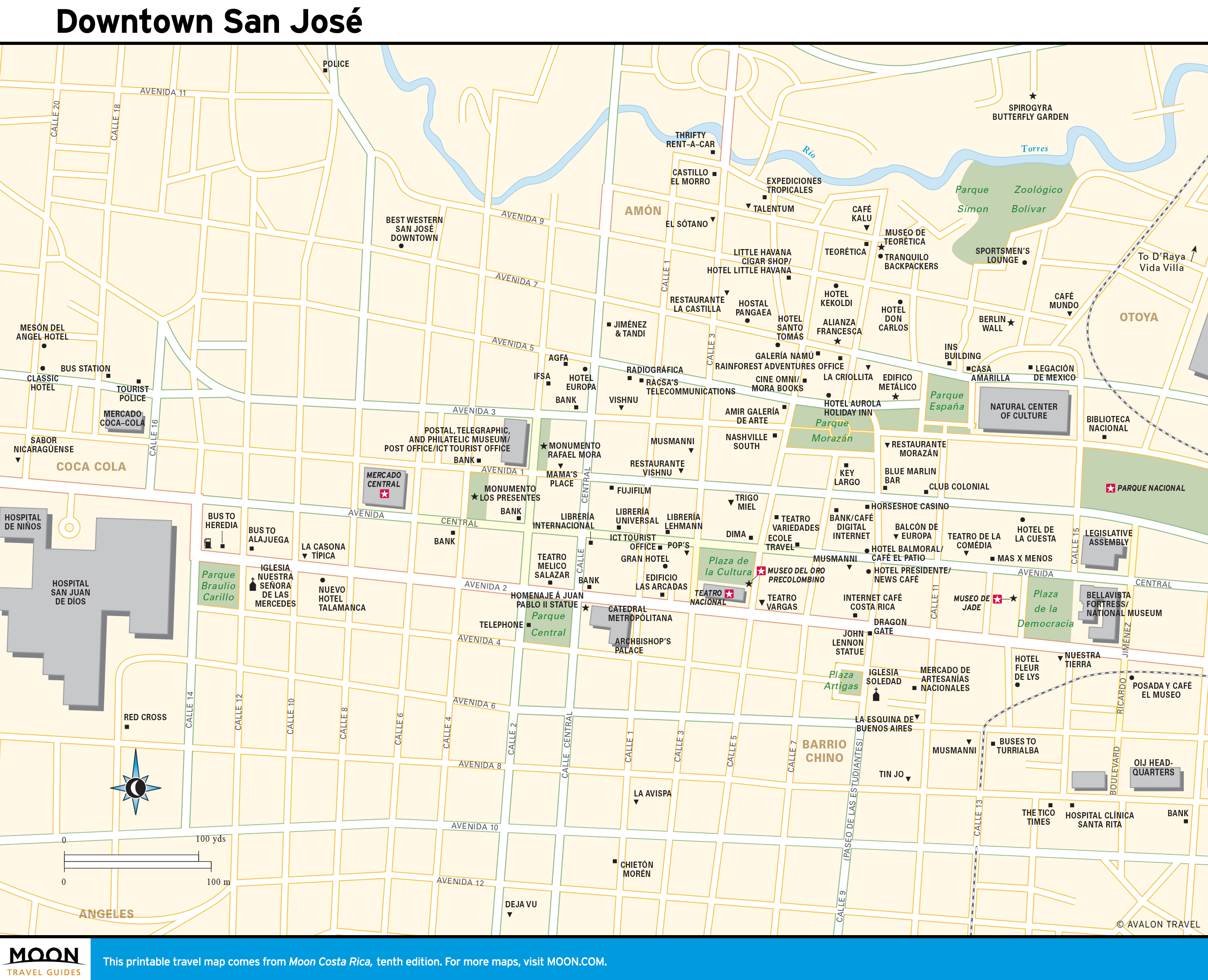
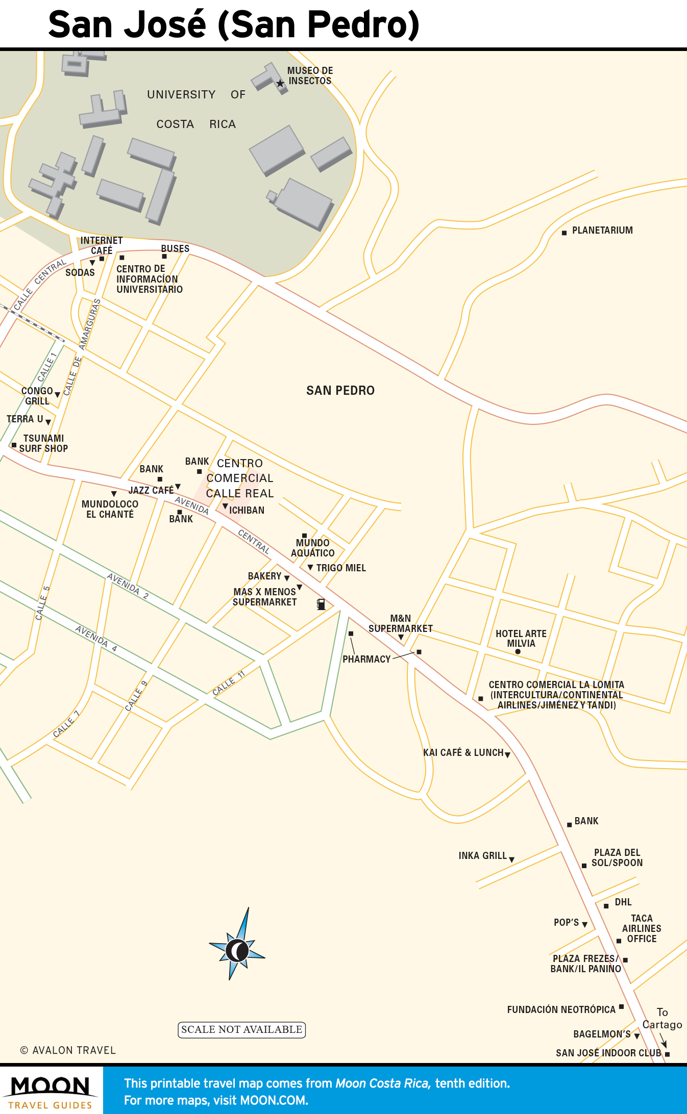
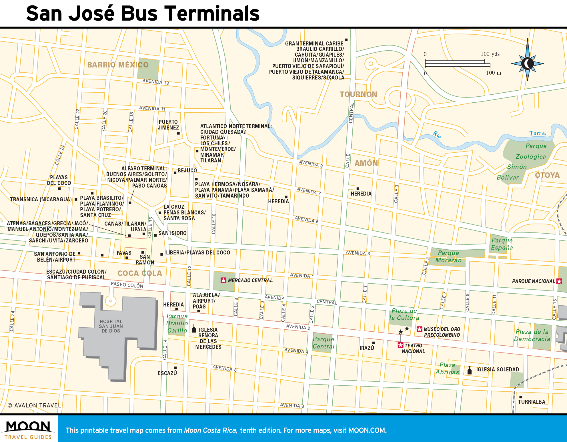
San José
The bustling capital city is a handy hub for forays farther afield. The city boasts superb restaurants, thriving nightlife, and great hotels.
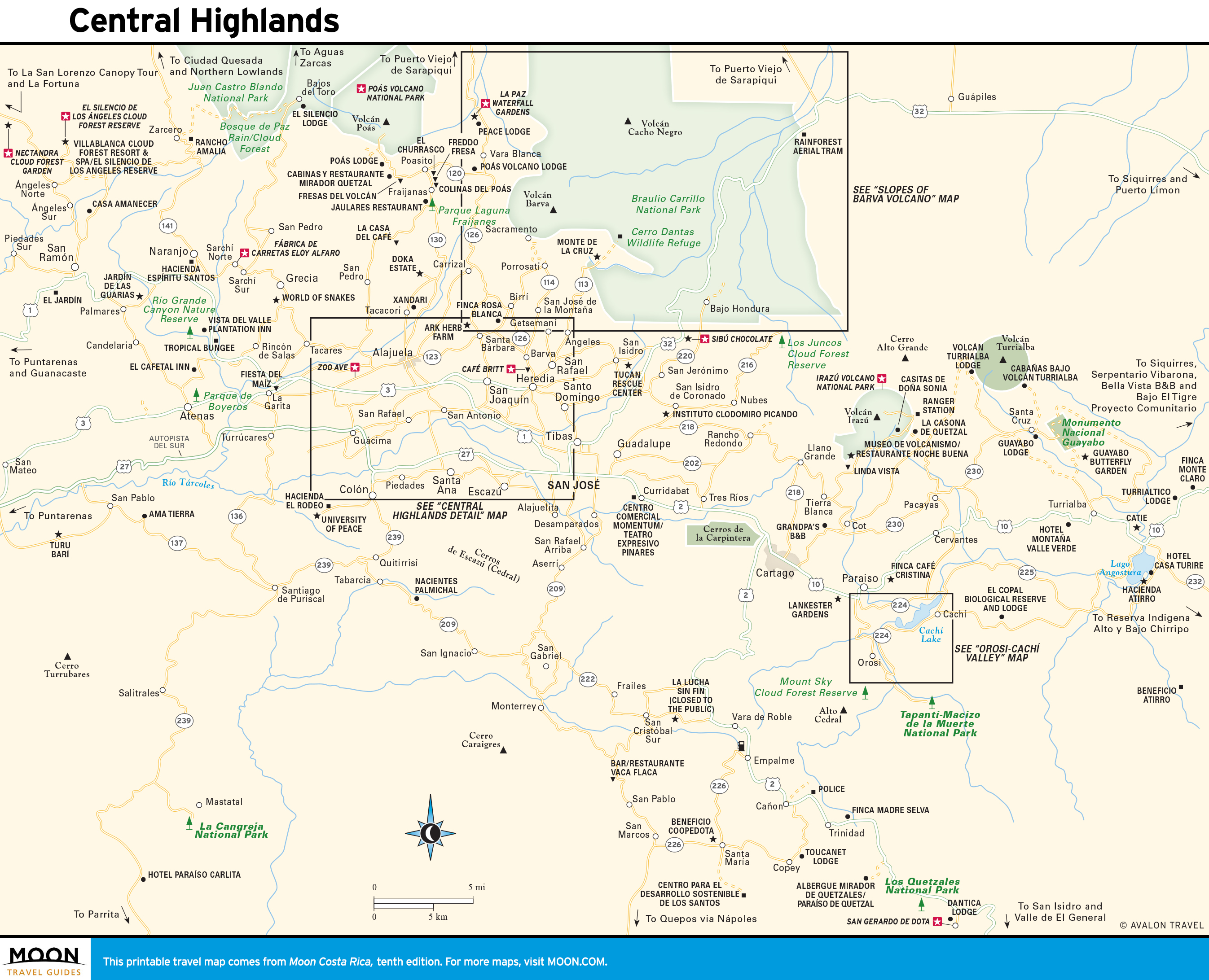
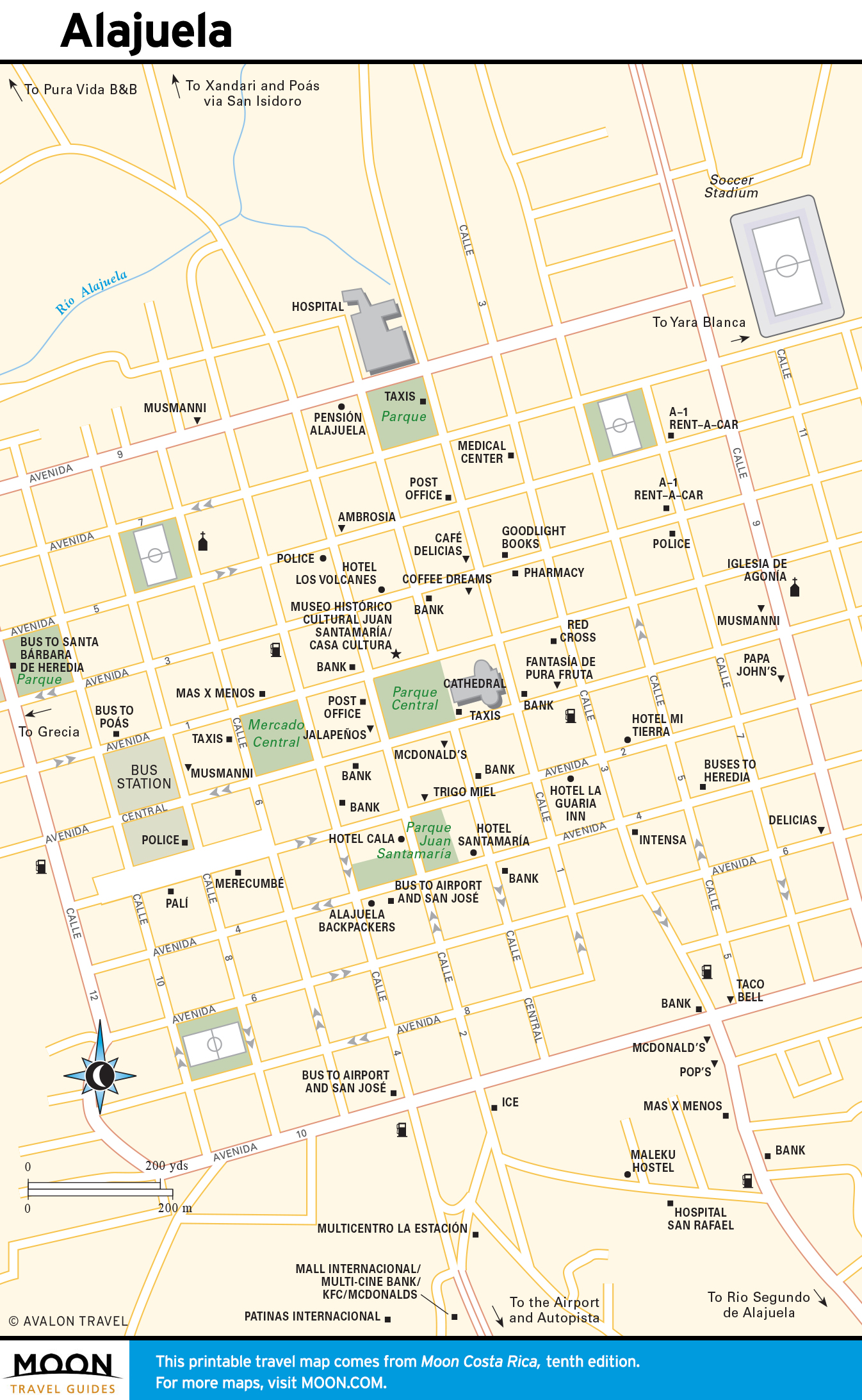
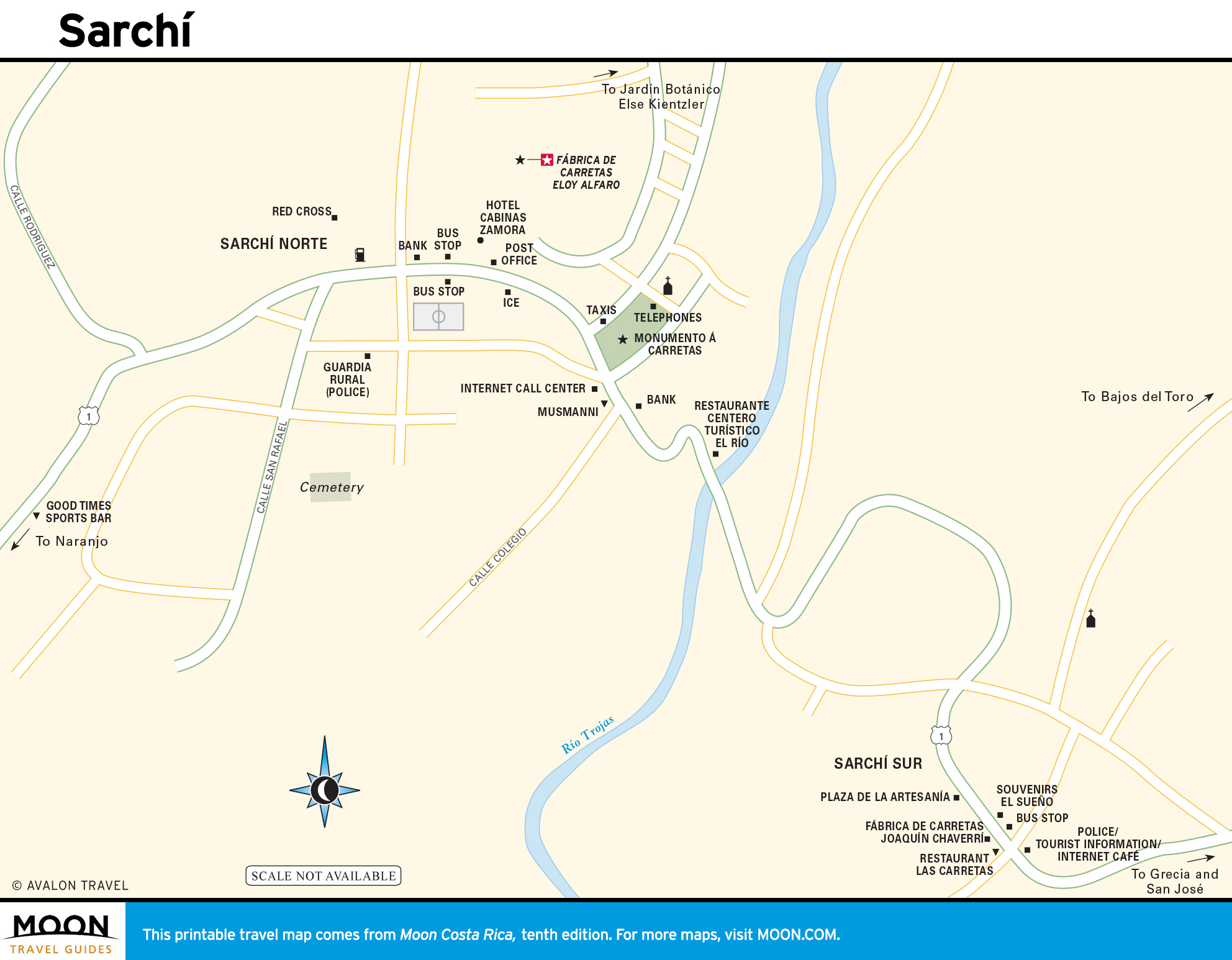
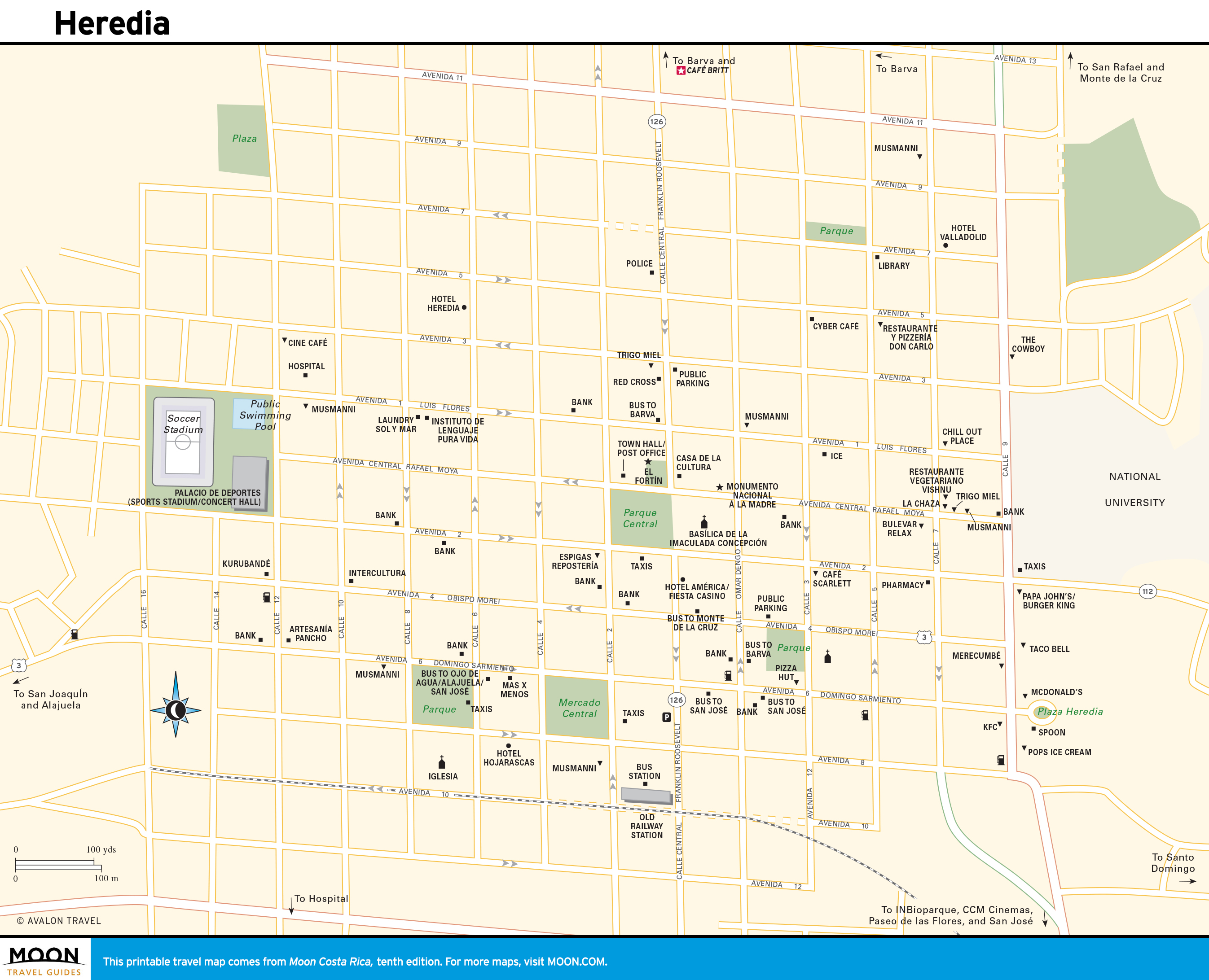
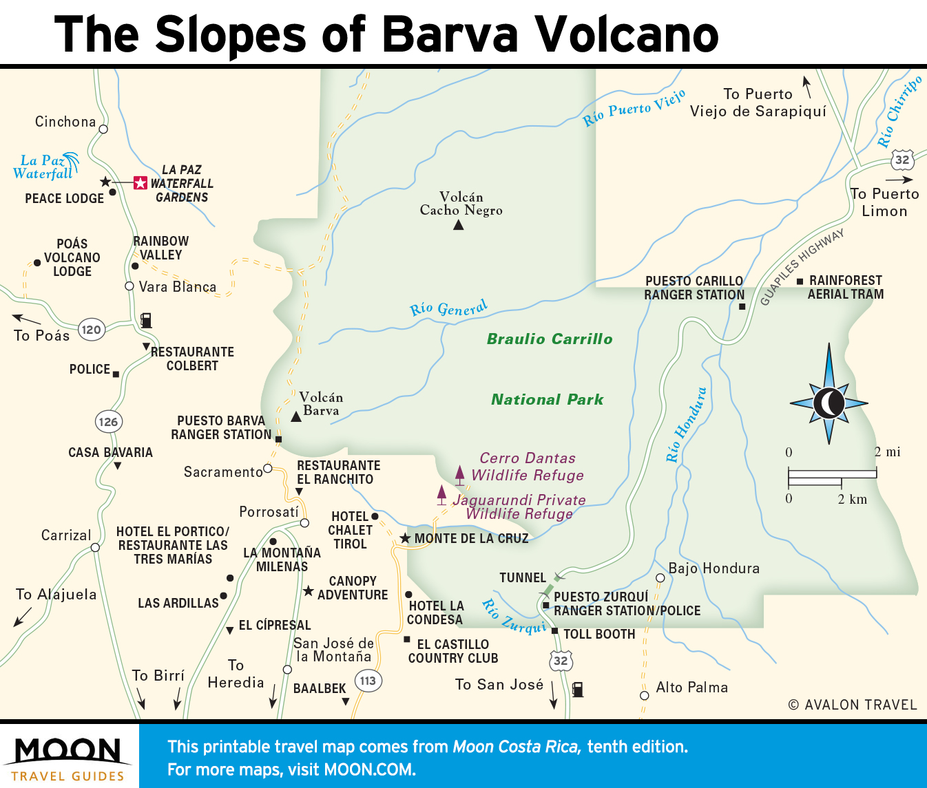
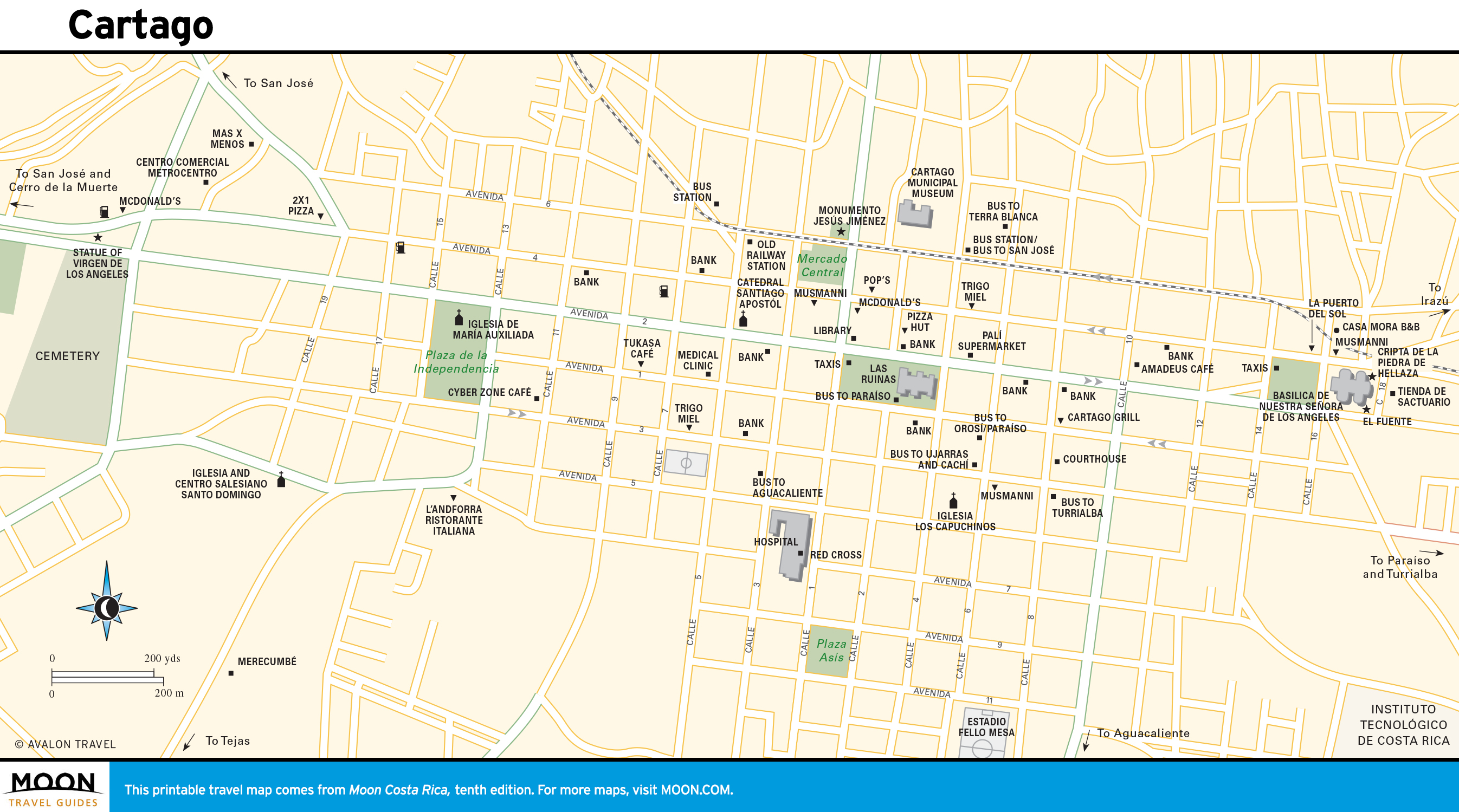
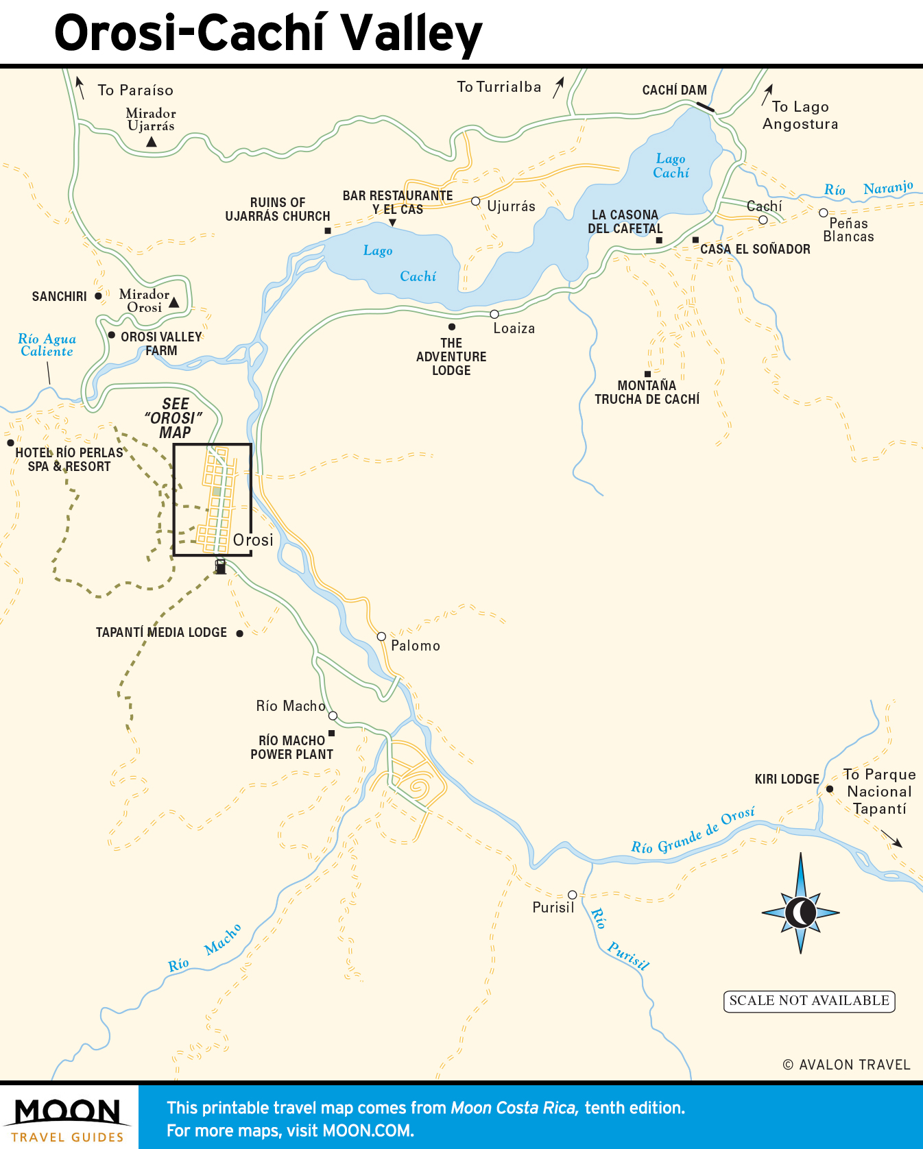
The Central Highlands
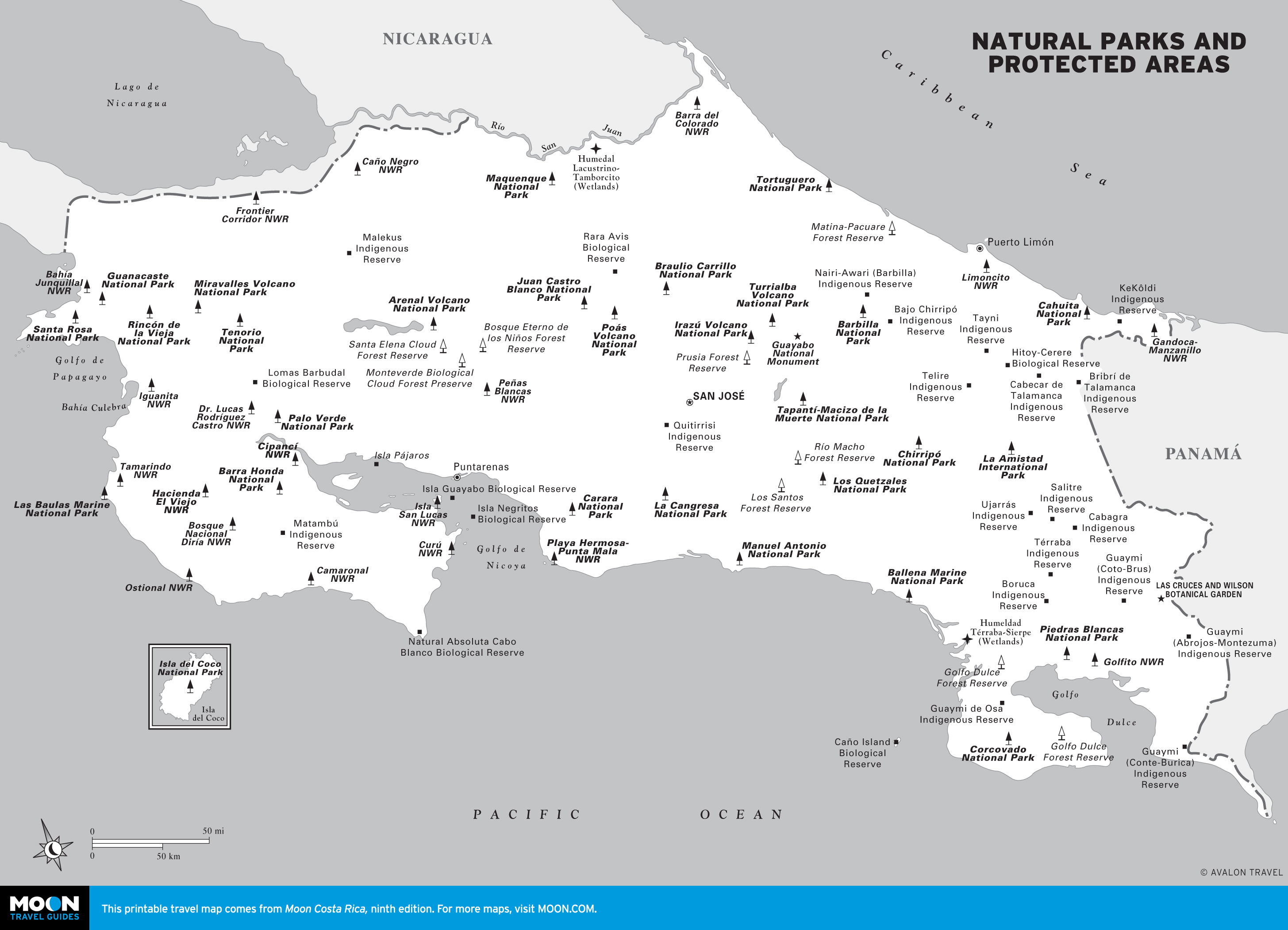
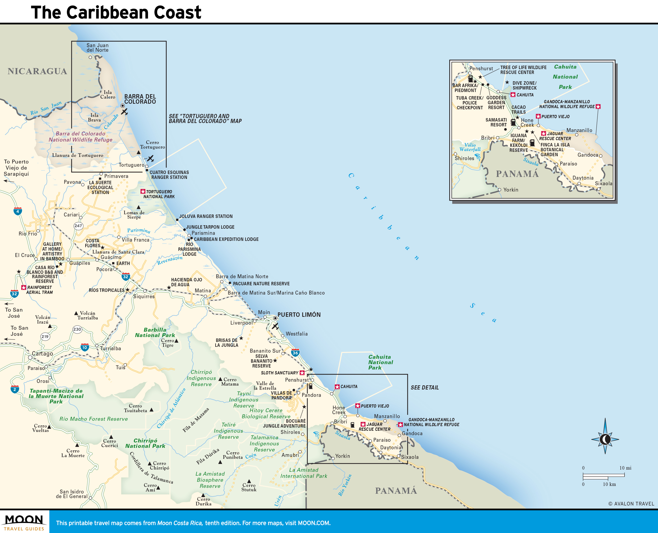
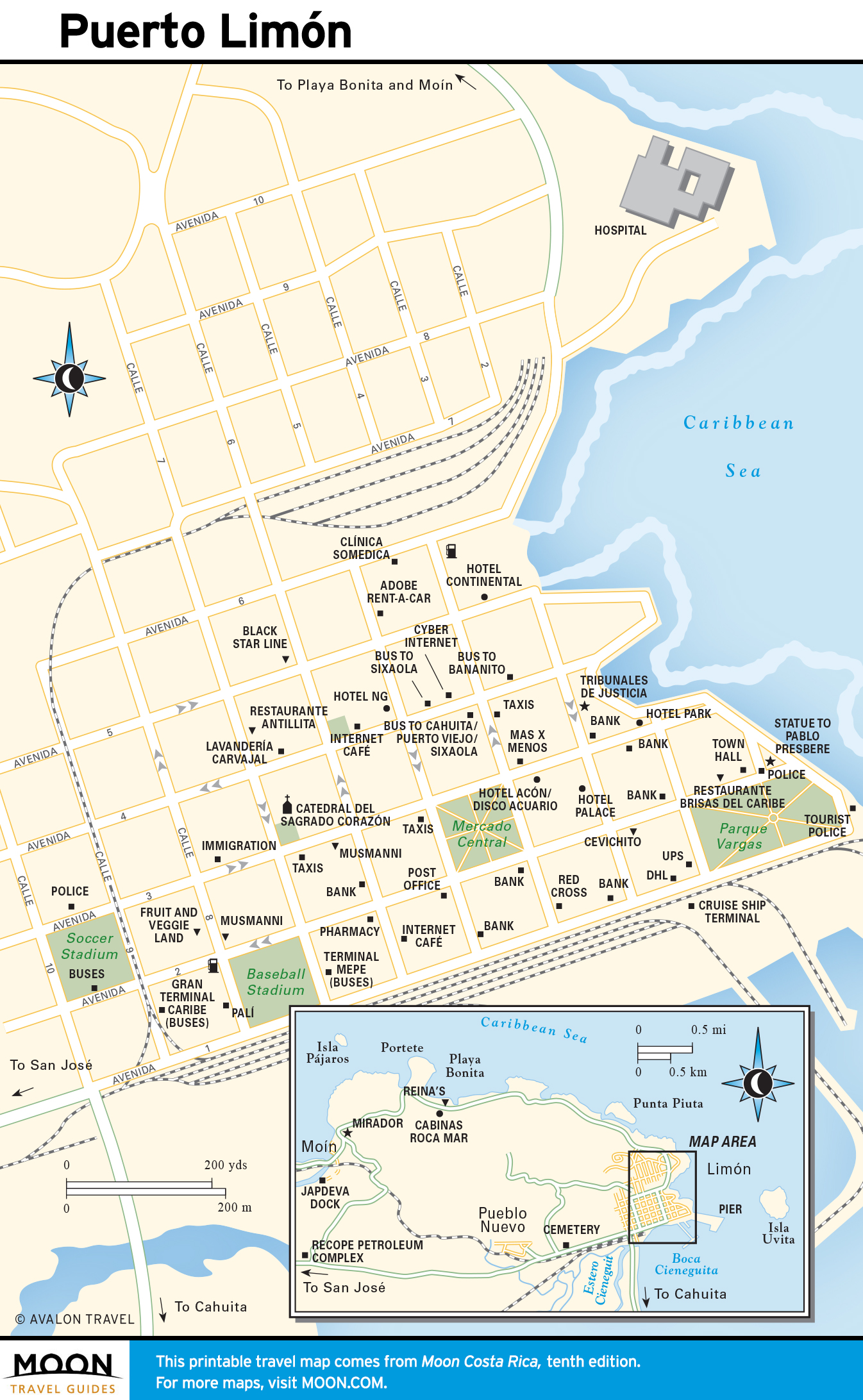
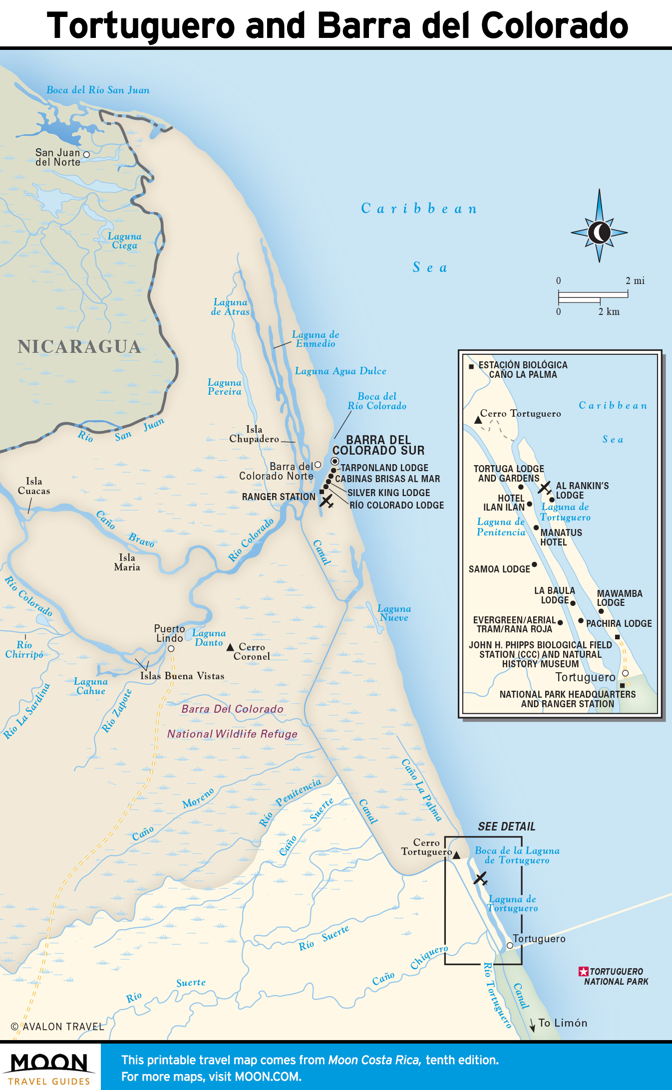
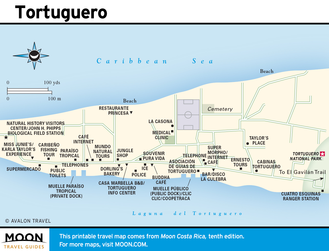
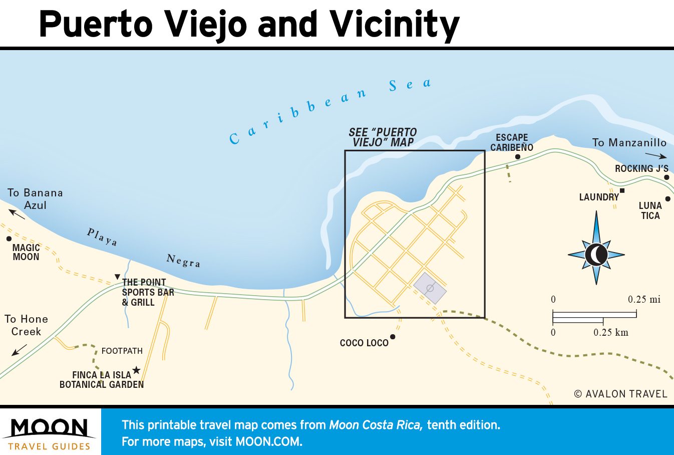
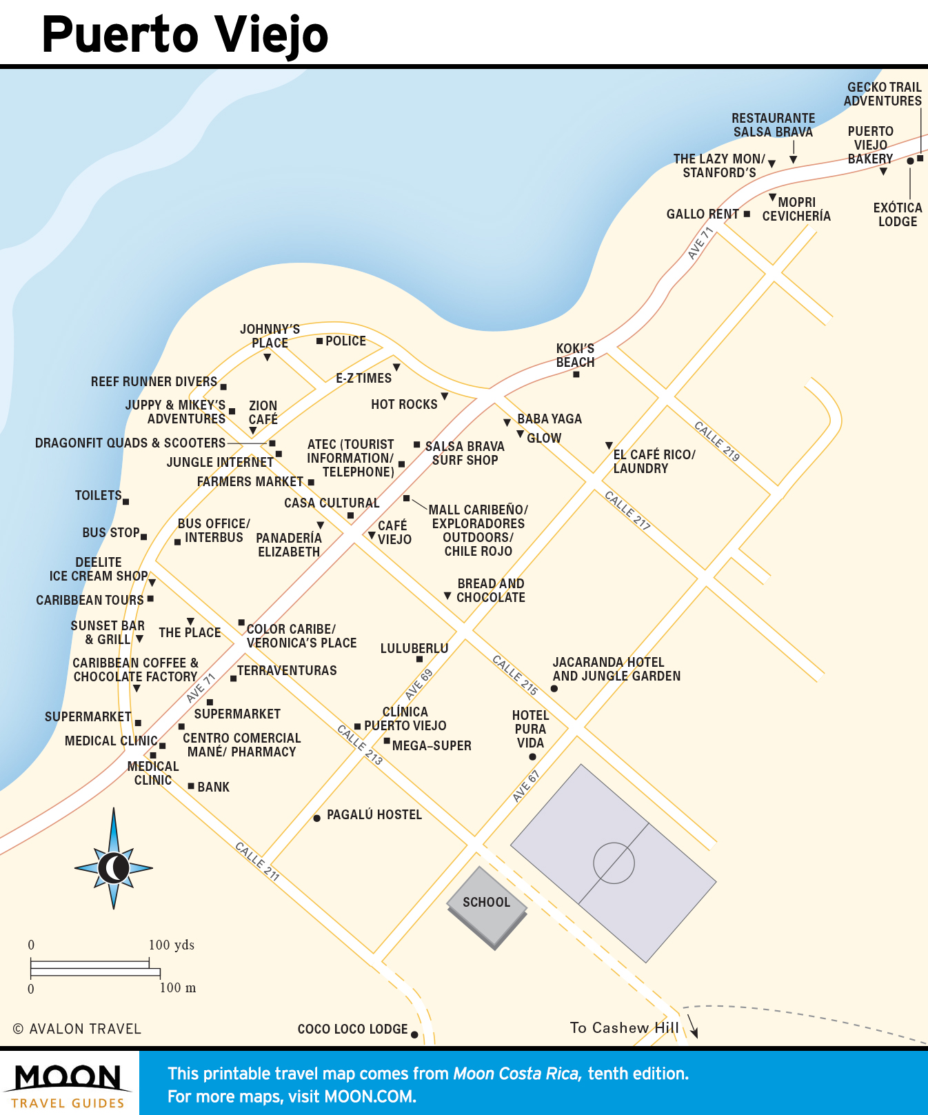
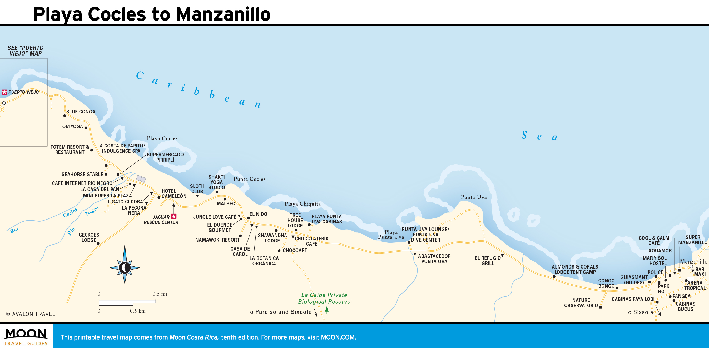
The Caribbean Coast
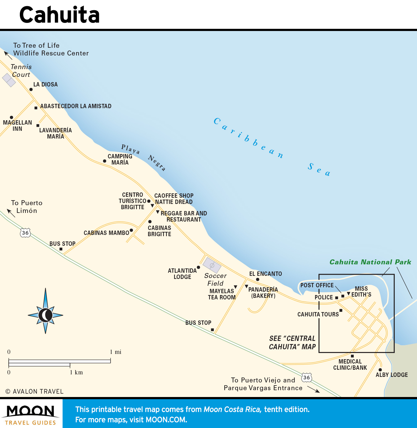
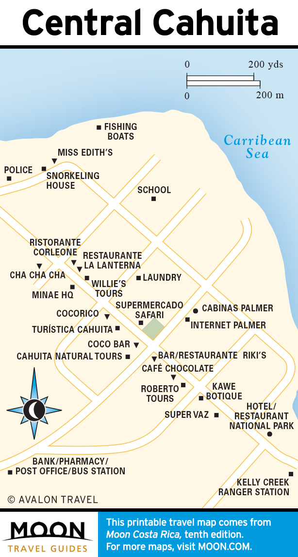
This humid zone is notable for its Afro-Caribbean culture. Offbeat Cahuita and Puerto Viejo draw surfers and backpackers and serve as departure points for treks into indigenous reserves.
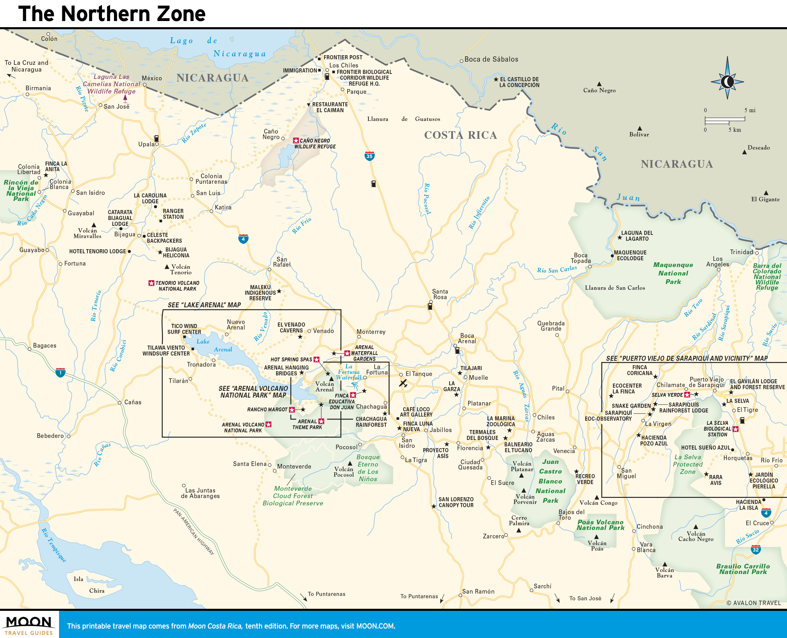
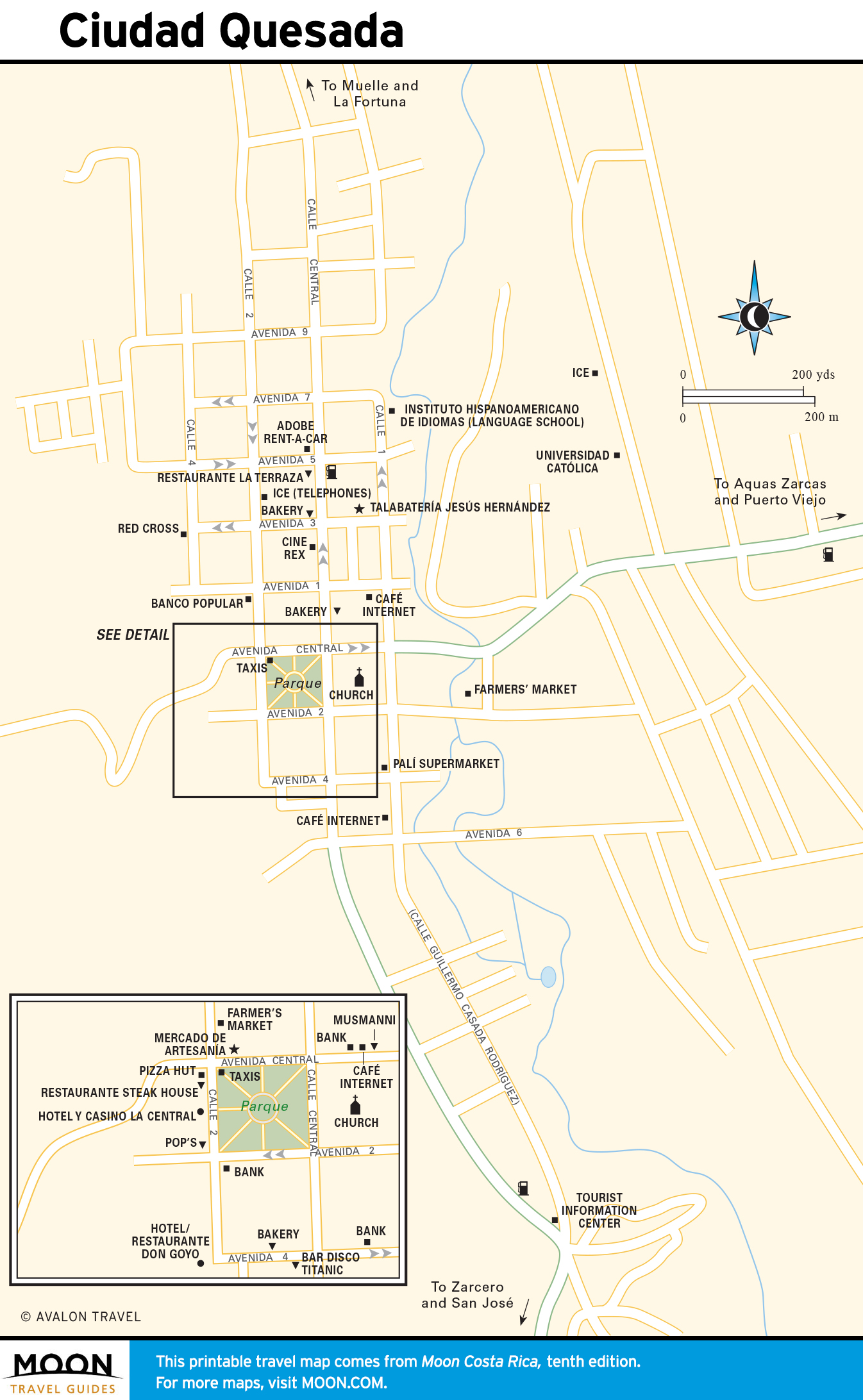
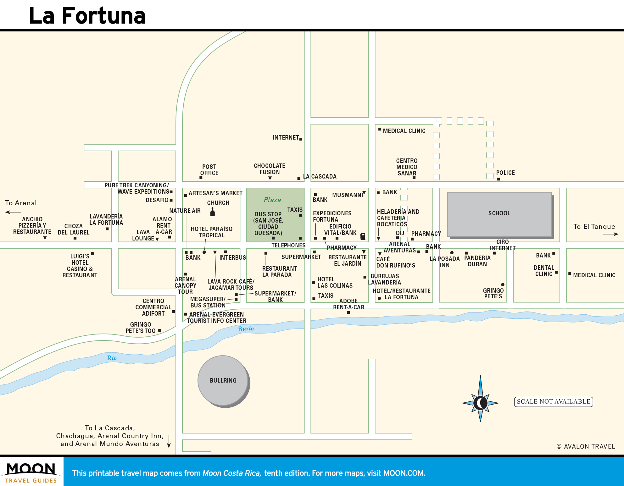
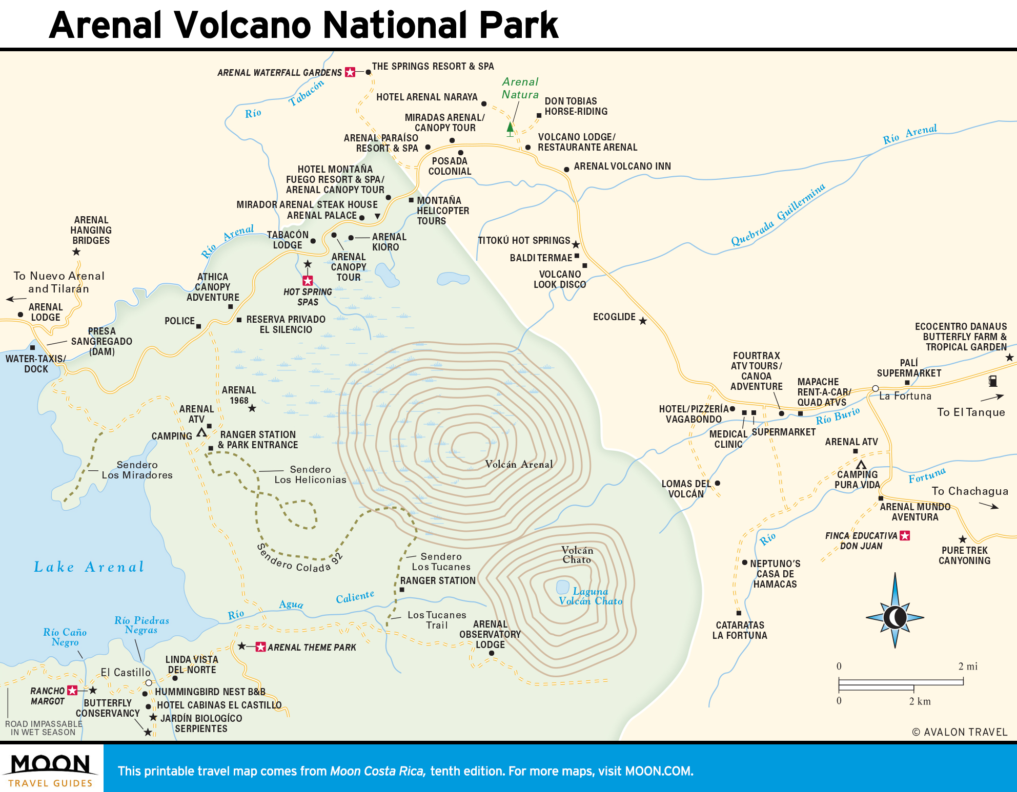
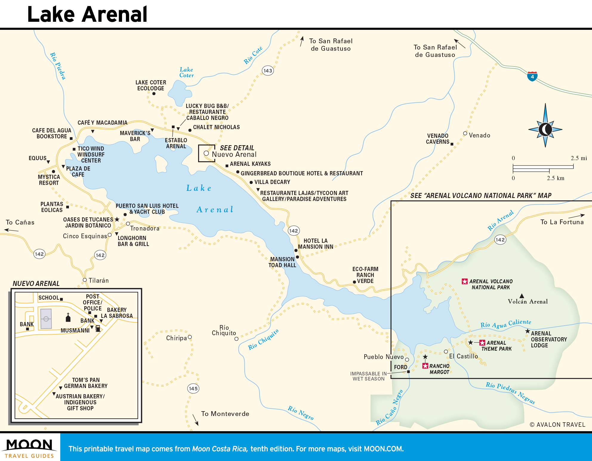
The Northern Zone
The northern lowland is a center for active adventures focused around Parque Nacional Volcán Arenal. Hiking, hot springs, horseback riding, and zip-line adventures are popular.
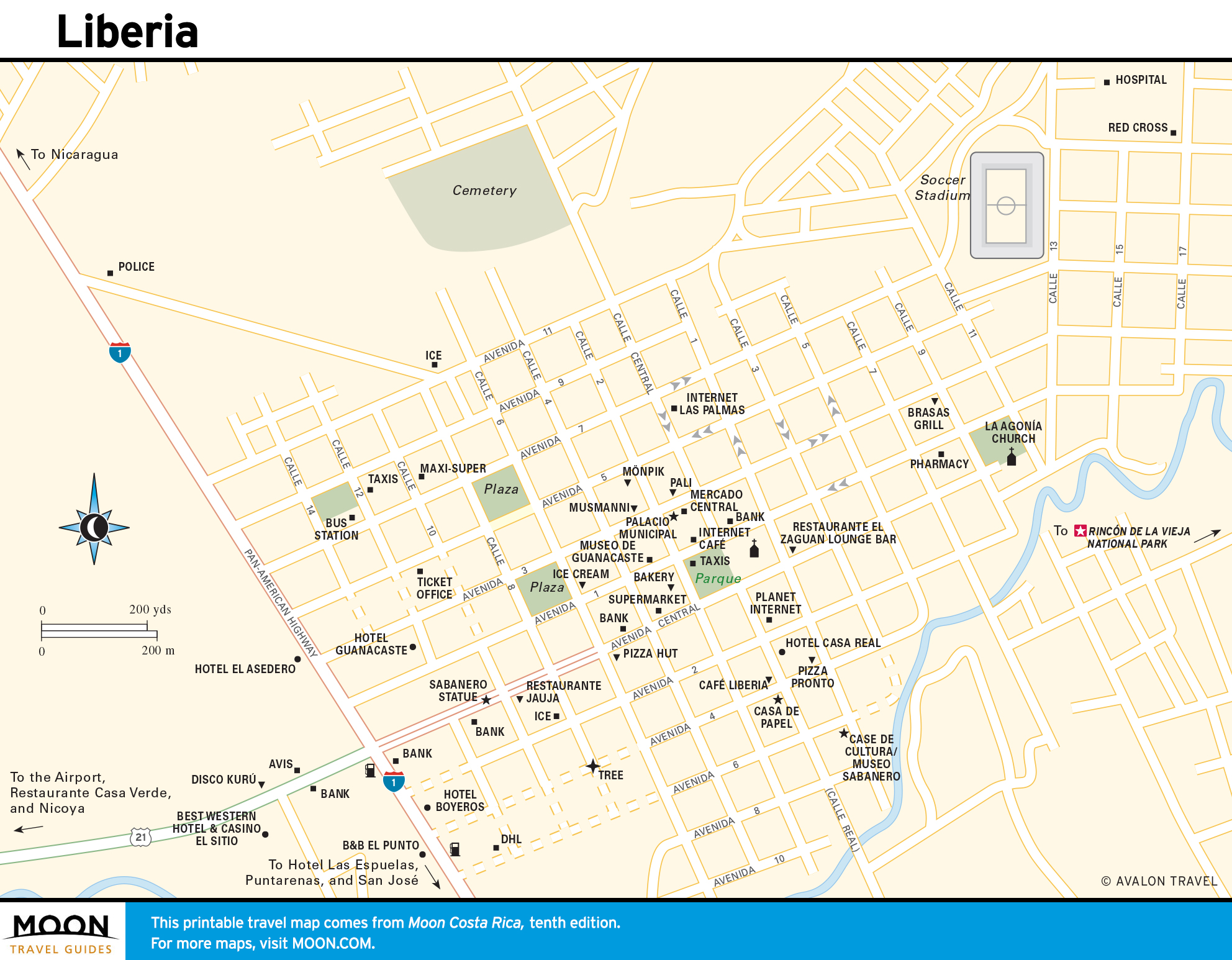
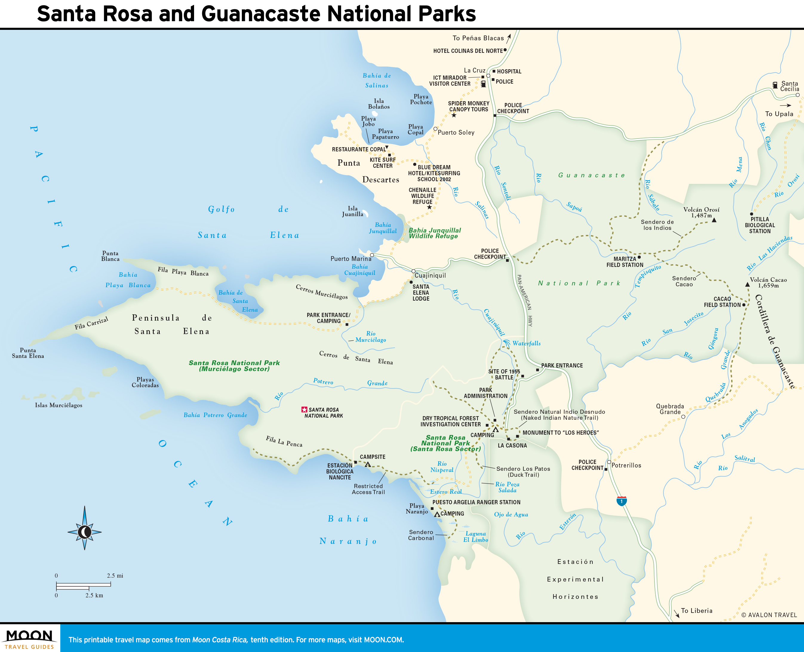
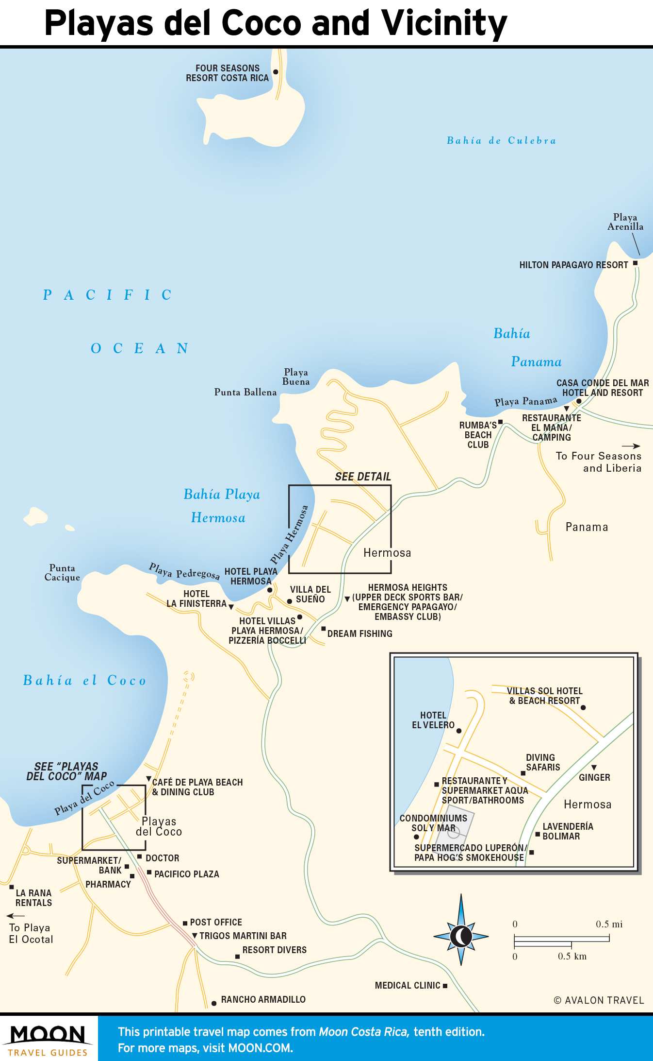
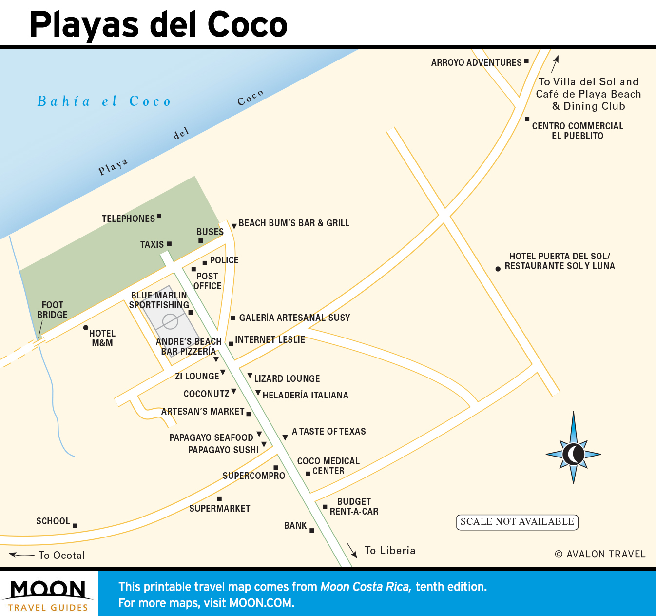
Guanacaste and the Northwest
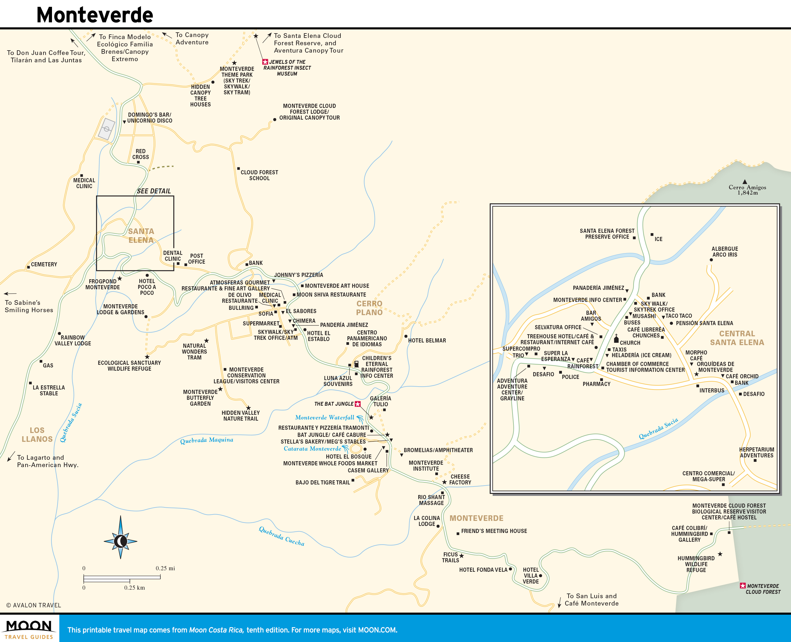
The northwest is distinct for its climate and dry tropical forests. This is also cowboy country; numerous ranches double as eco-centers at the base of volcanoes. The big draw is Monteverde, a mountain idyll boasting attractions and activities that will hold your attention for days.
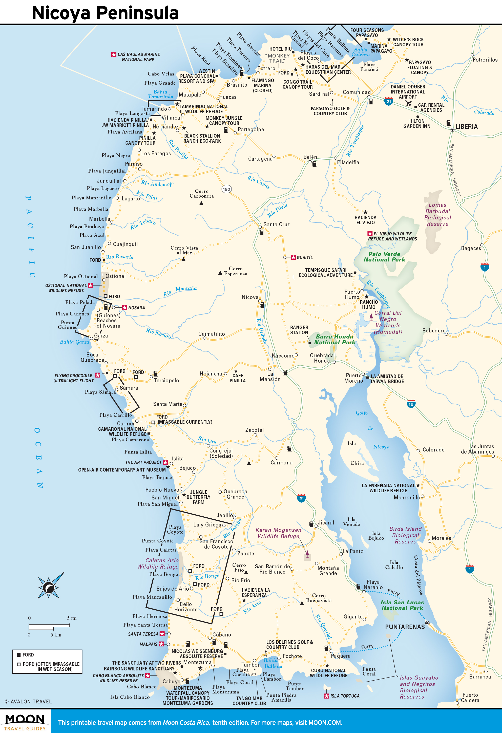
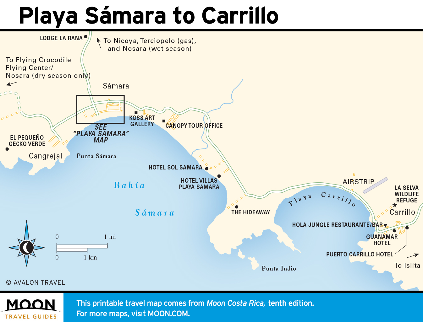
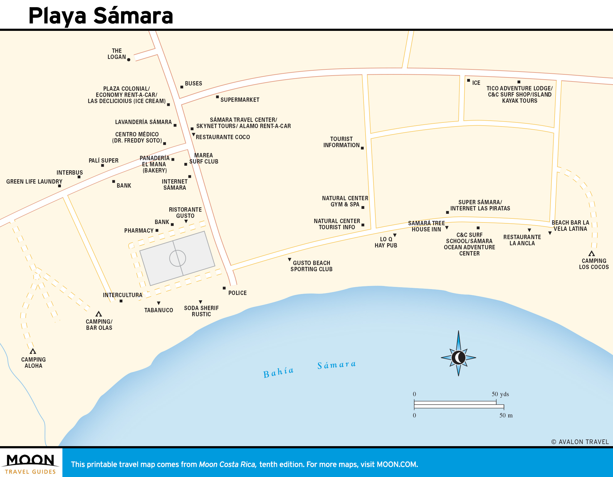
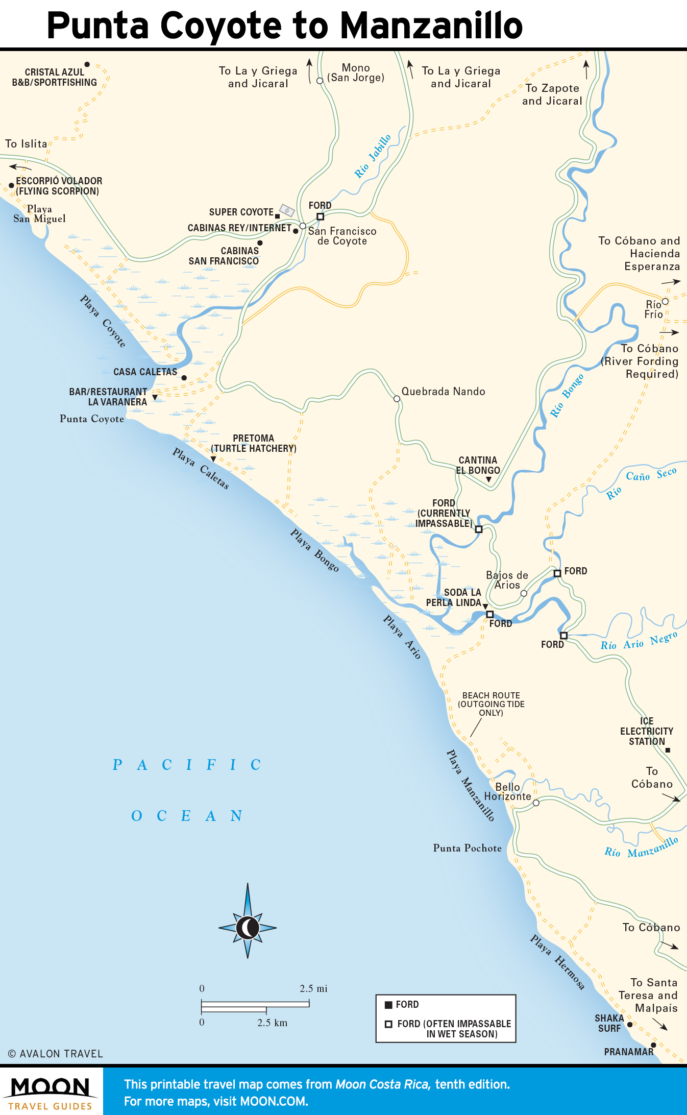
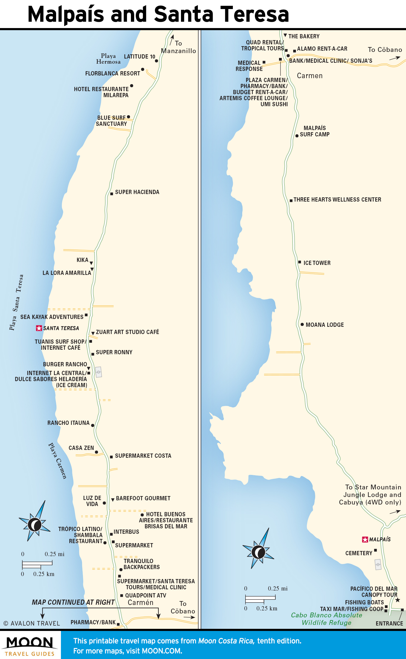
The Nicoya Peninsula
This region is known for its white-sand beaches linked by an unpaved coastal road that may require fording rivers. Scuba diving, surfing, and sportfishing are key draws. Playa Grande and Ostional are important nesting sites for marine turtles.
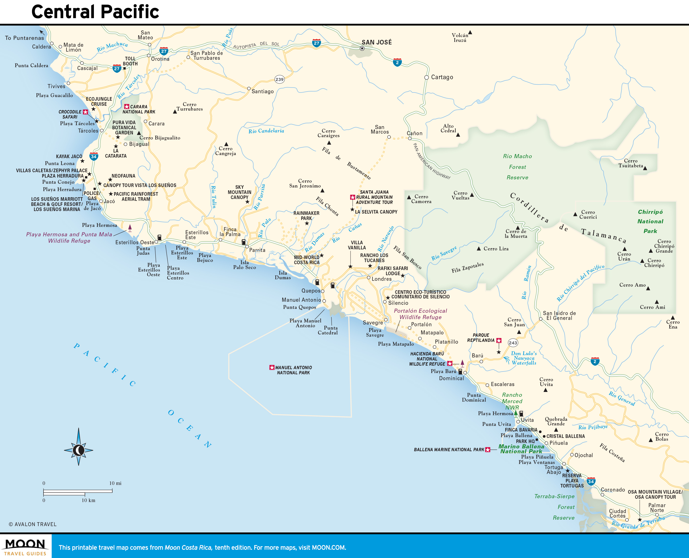
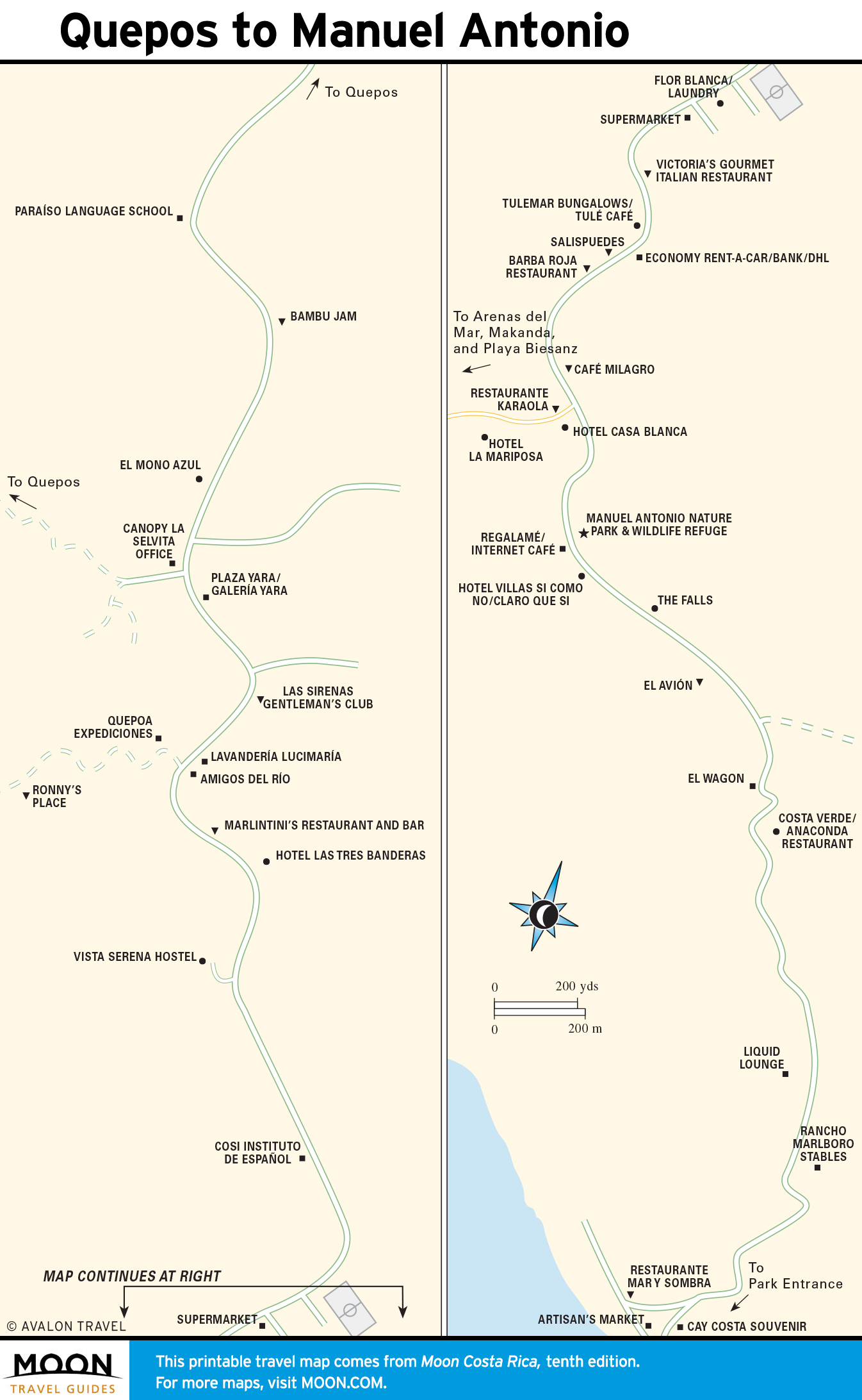
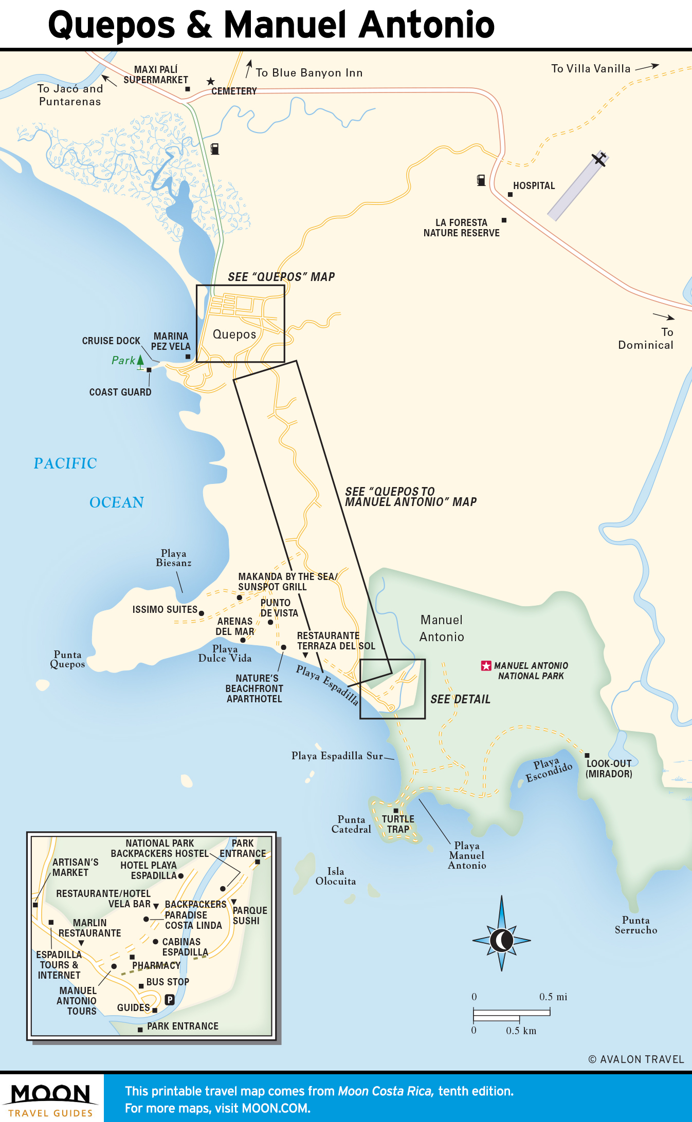
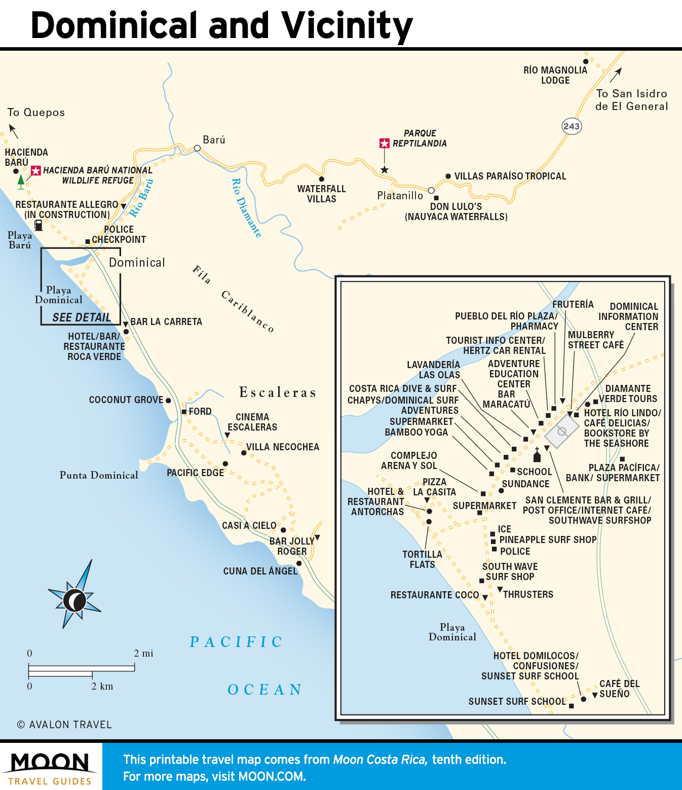
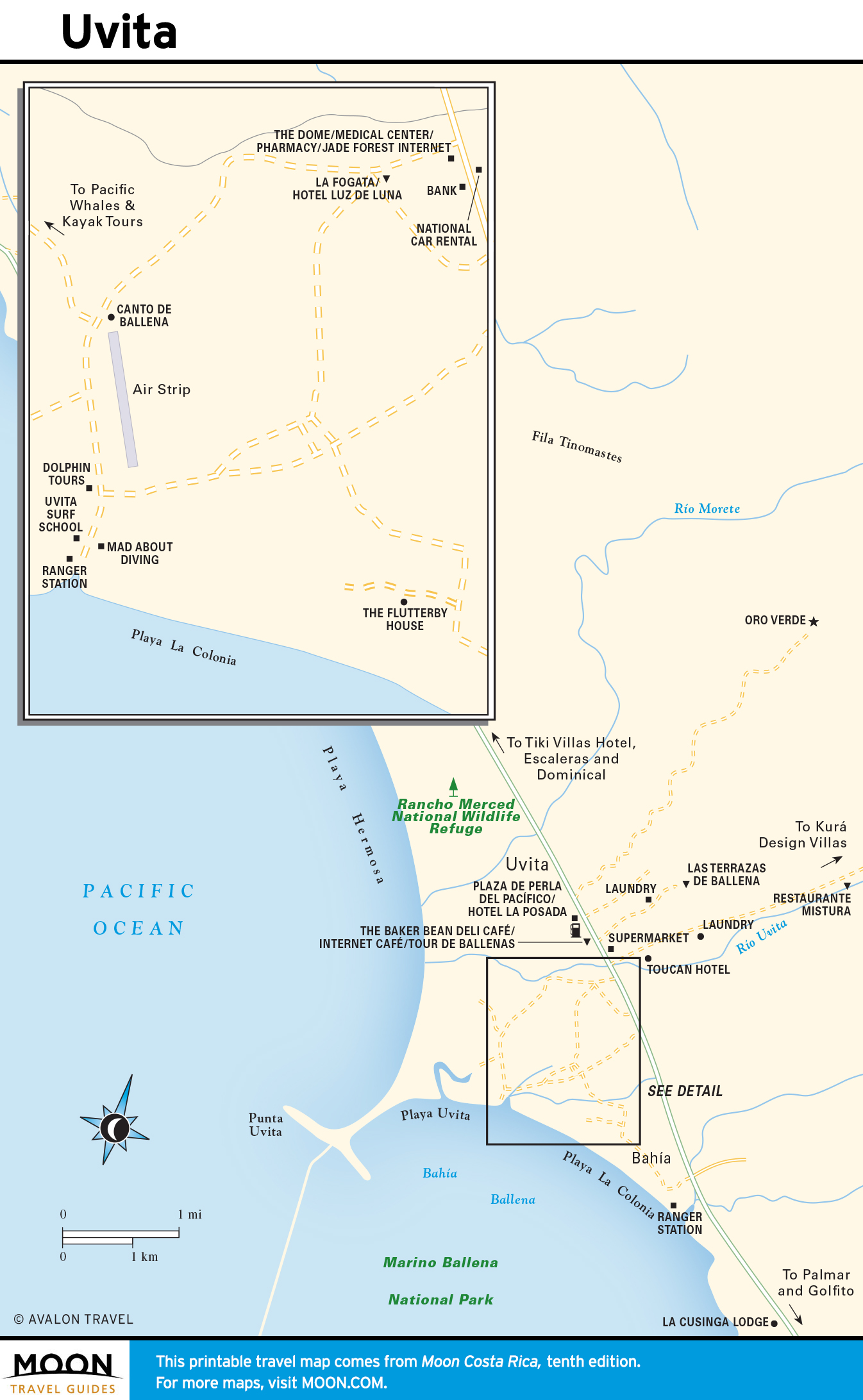
Central Pacific
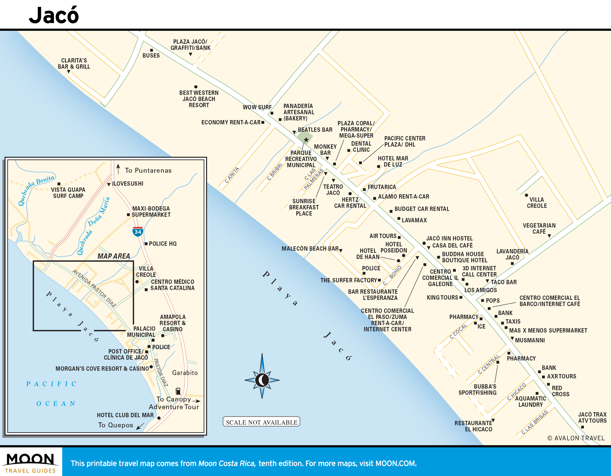
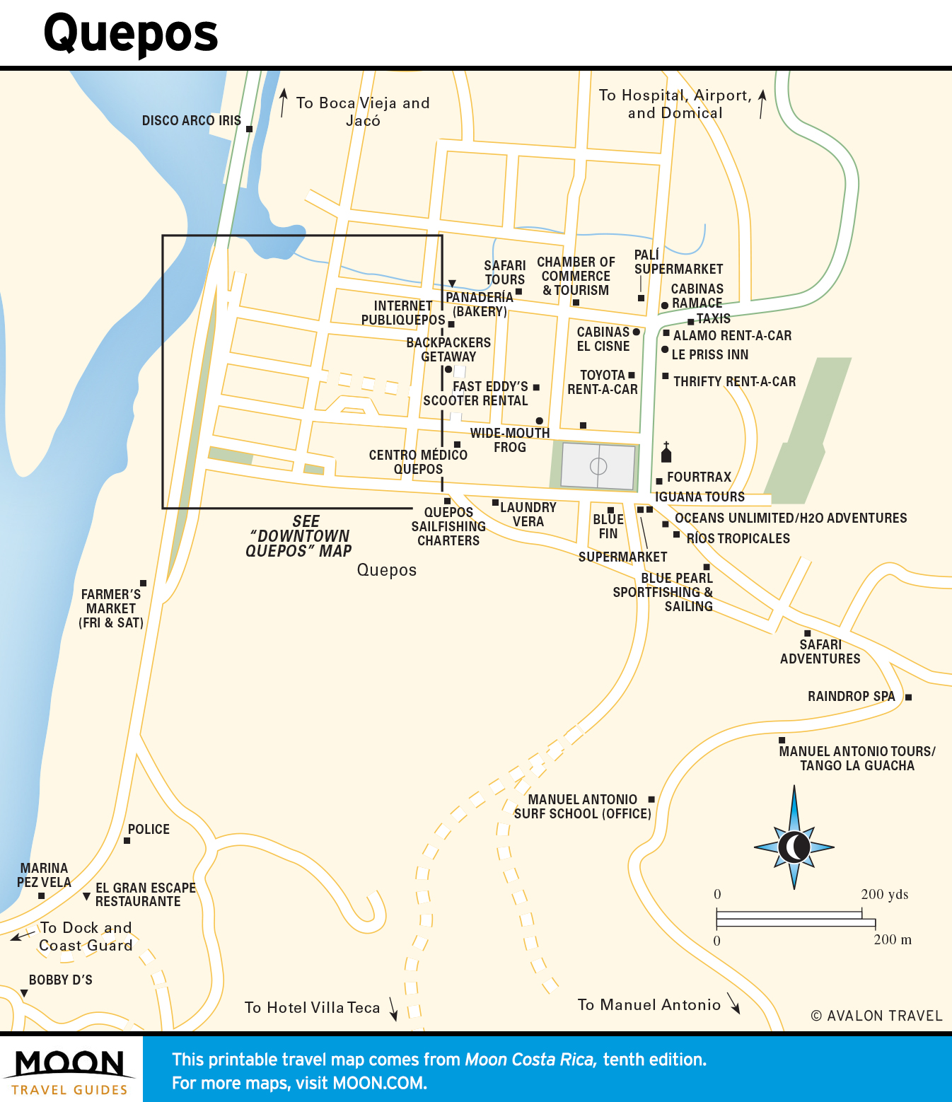
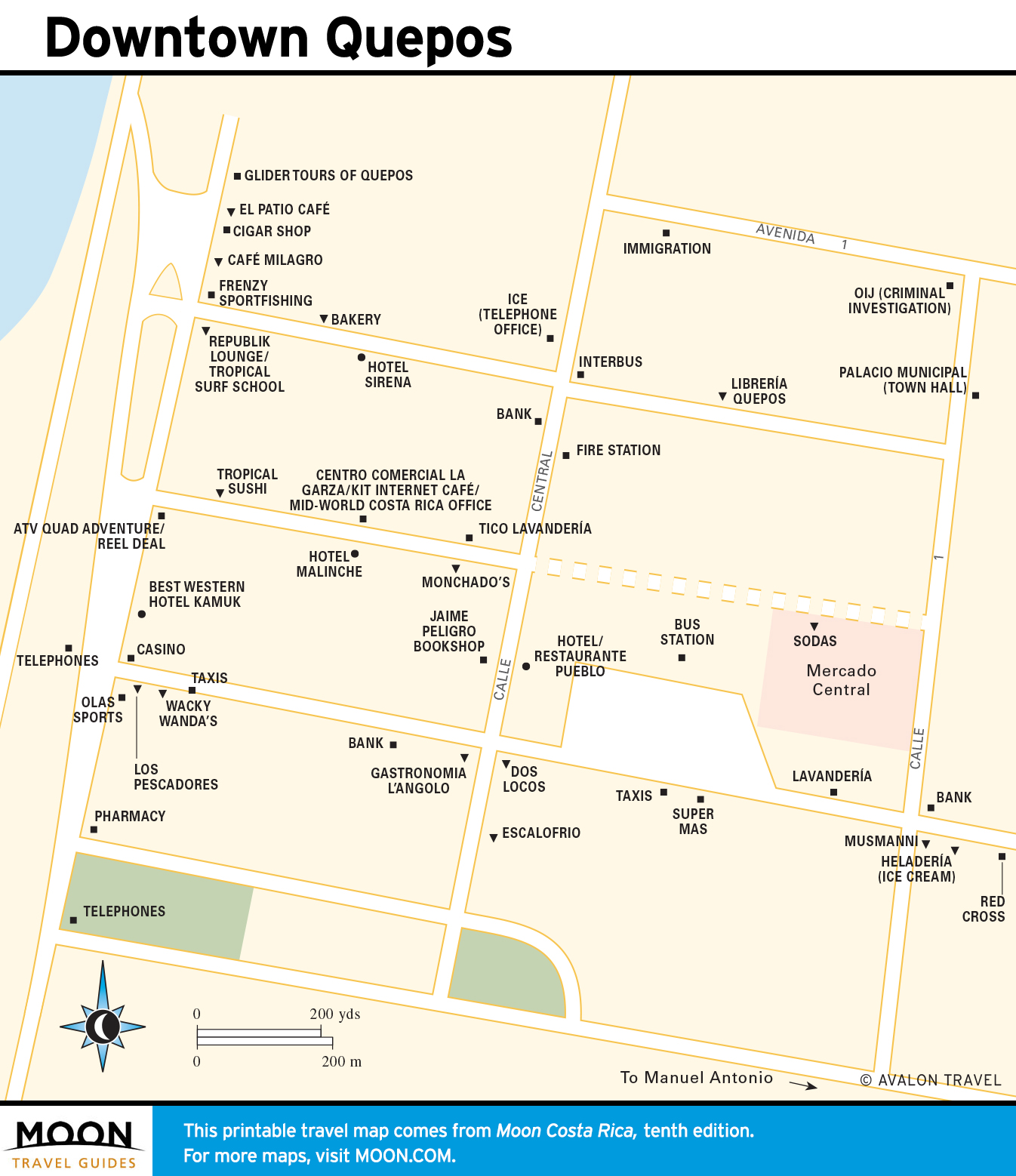
Forest-clad mountains hem a narrow coastal plain fringed by beaches. Jacó, Costa Rica’s most developed resort, is popular with the party crowd. Tárcoles is great for crocodile safaris; Parque Nacional Carara offers worldclass bird-watching; and Manuel Antonio combines all manner of wildlife encounters with a huge selection of fine lodging and dining.
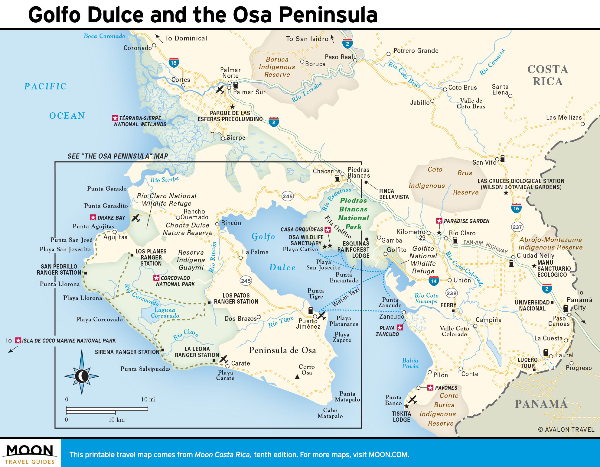
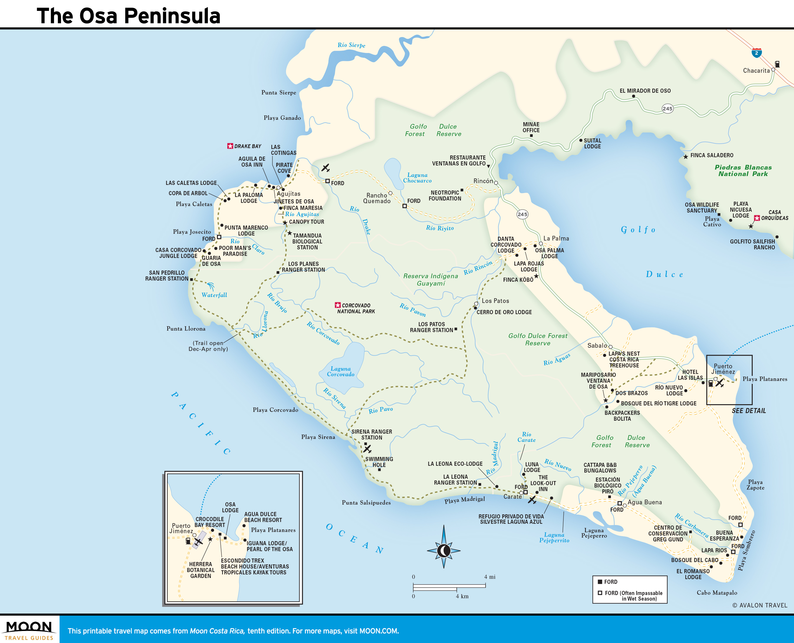
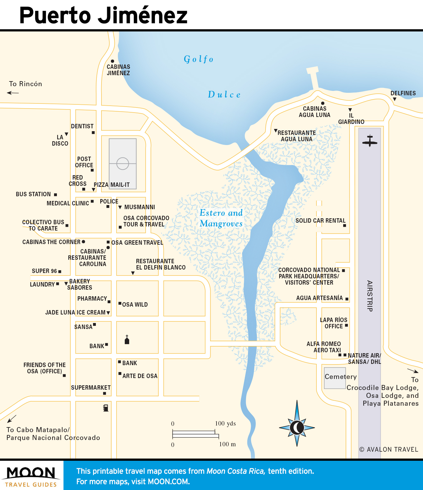
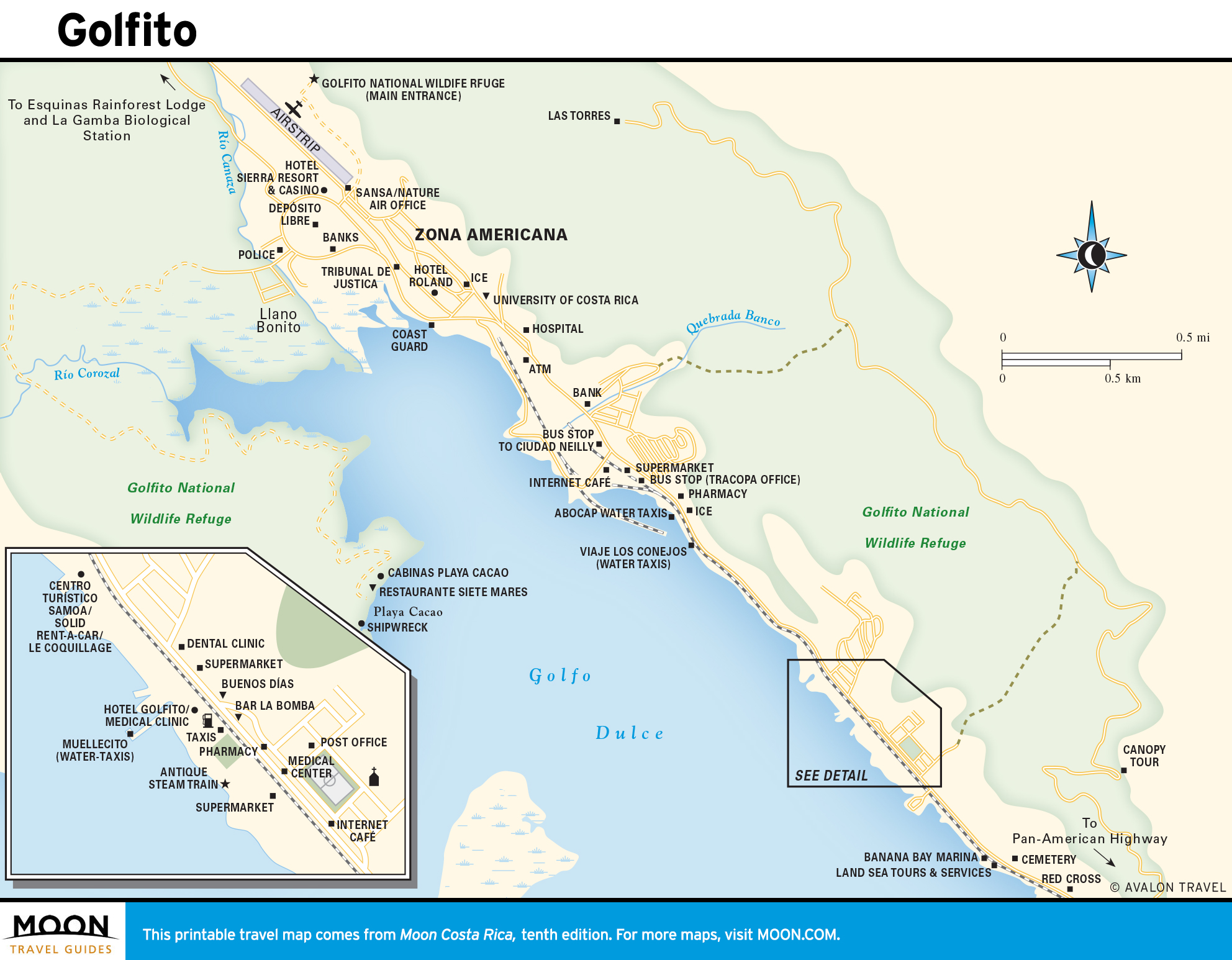
Golfo Dulce and the Osa Peninsula
Soaking rains nurture the forests of Parque Nacional Corcovado. The humble port of Golfito is a base for sportfishing and forays to remote rainforest lodges. Kilometerlong waves wash up at surf capital Pavones. Tucked-away Drake Bay is good for diving and whale-watching excursions and trips to Isla del Caño, an erstwhile indigenous ceremonial site.
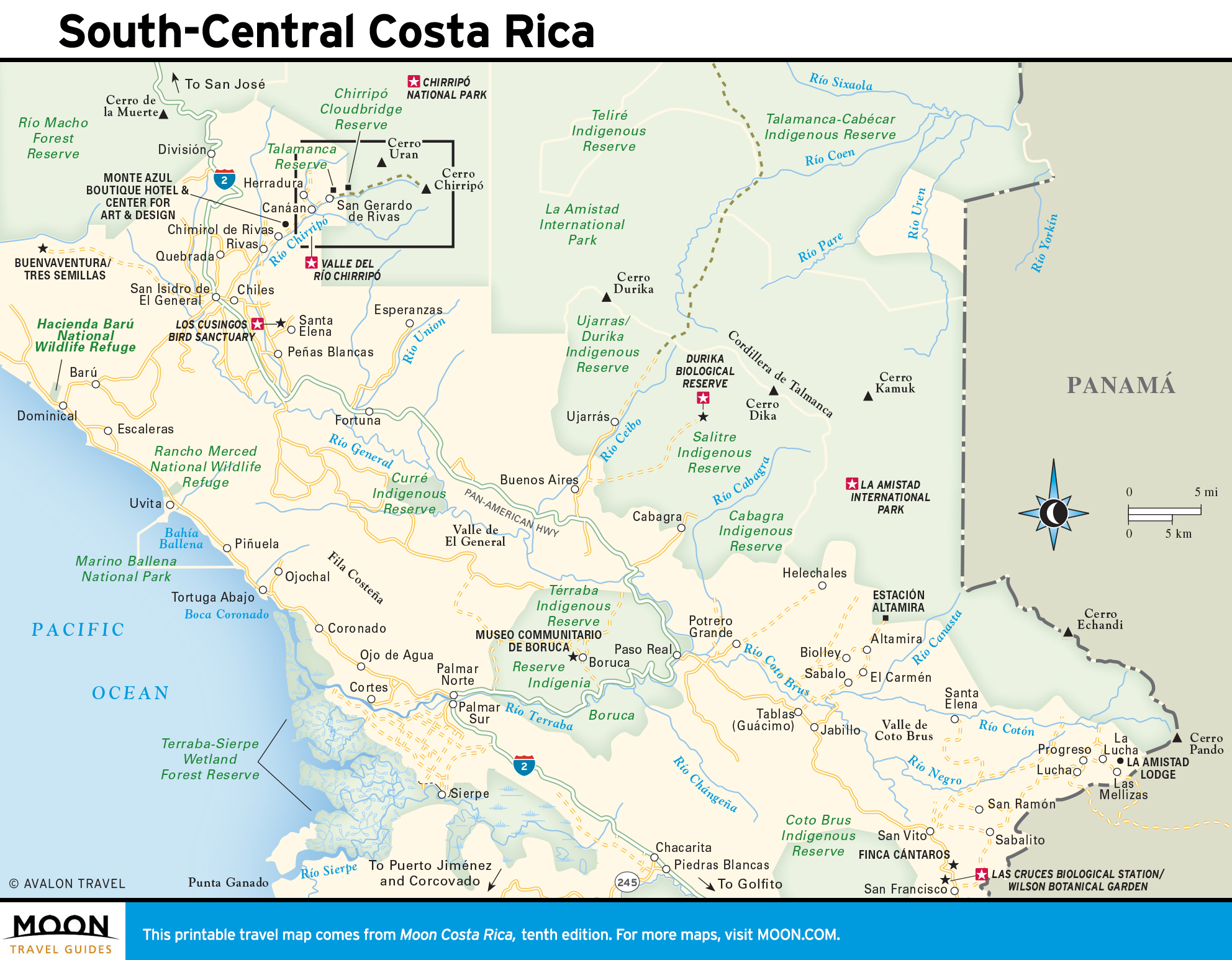
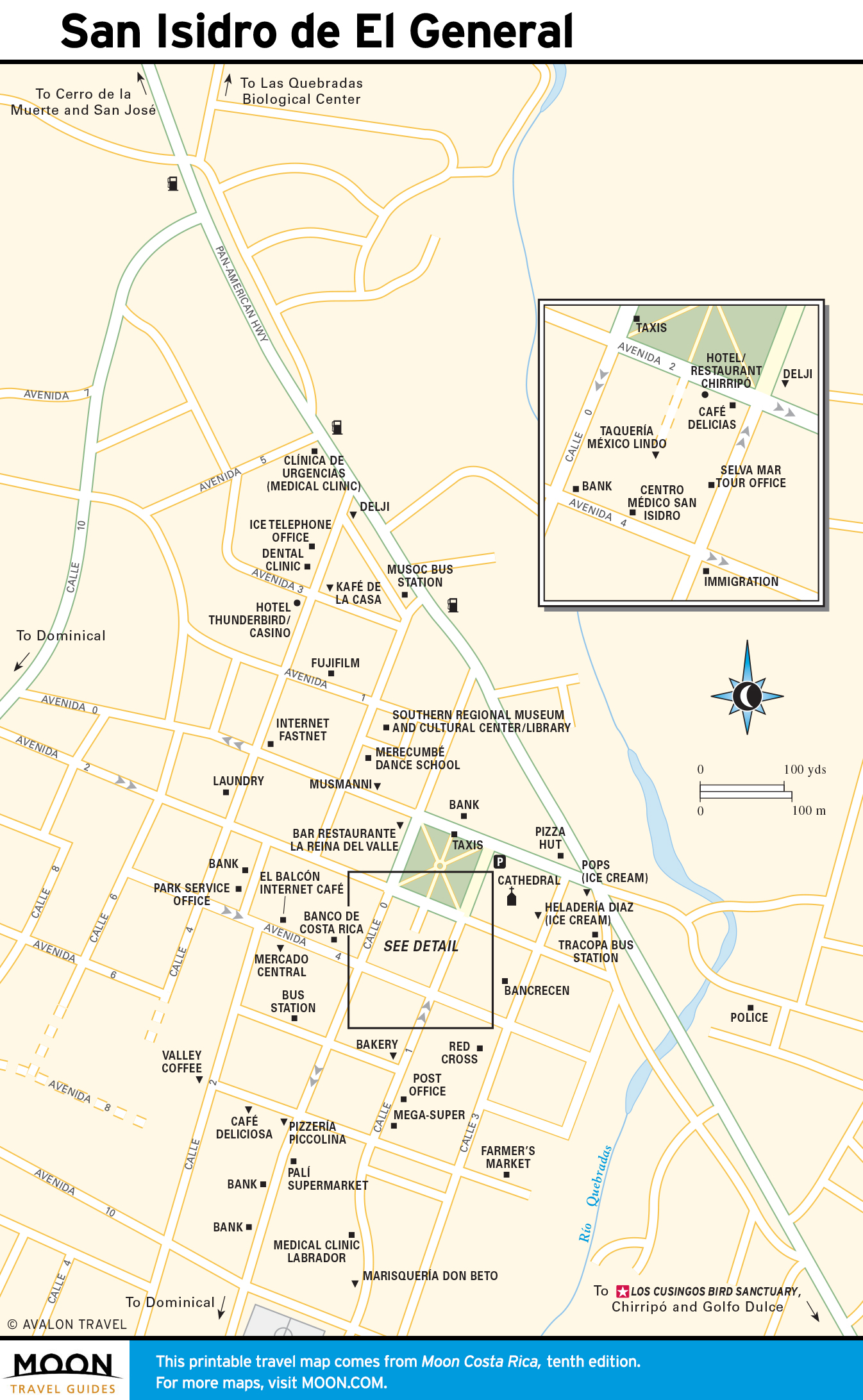
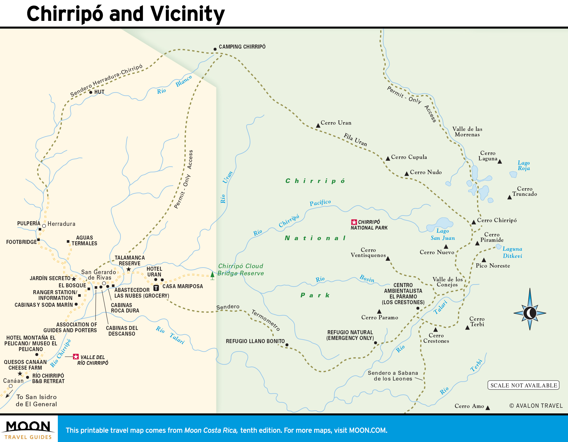
South-Central Costa Rica
The nation’s Cinderella region draws birders and nature lovers to Los Cusingos and Wilson Botanical Garden. Hale and hearty adventure seekers follow the trail up Chirripó, the nation’s highest mountain; the trailhead is accessed by one of several Shangri-la valleys that lead into the rugged Parque Internacional La Amistad. Indigenous communities exist in isolation, but the easy-to-reach village of Boruca offers an initiation.