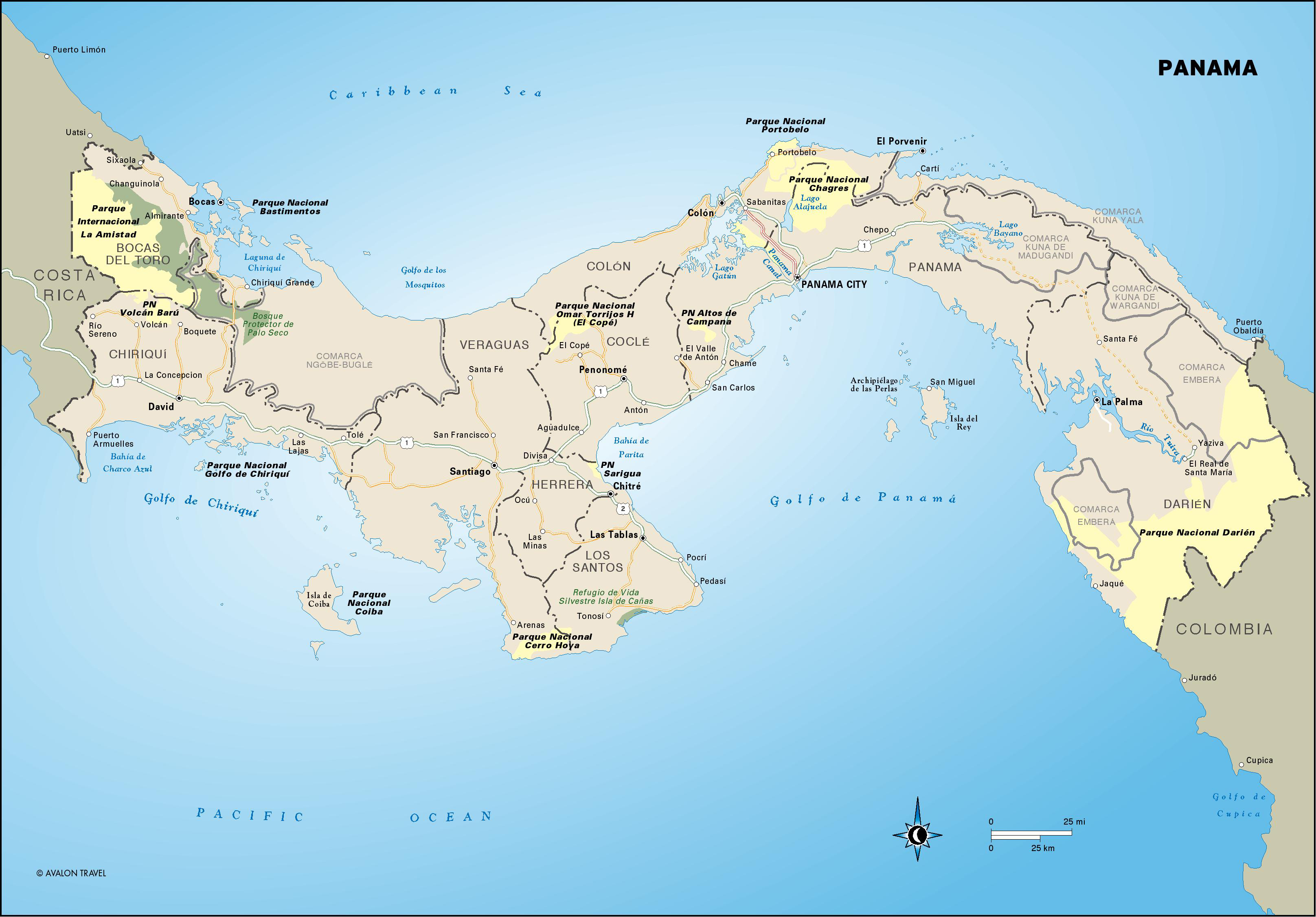
Panama
These free, printable travel maps of Panama are divided into eight regions:
- Panama City
- The Panama Canal and Central Isthmus
- Bocas del Toro
- Central Panama
- Western Highlands and Beaches
- The Azuero Peninsula
- Kuna Yala
- The Darién
Explore Panama with these helpful travel maps from Moon.
Travel Maps of Panama
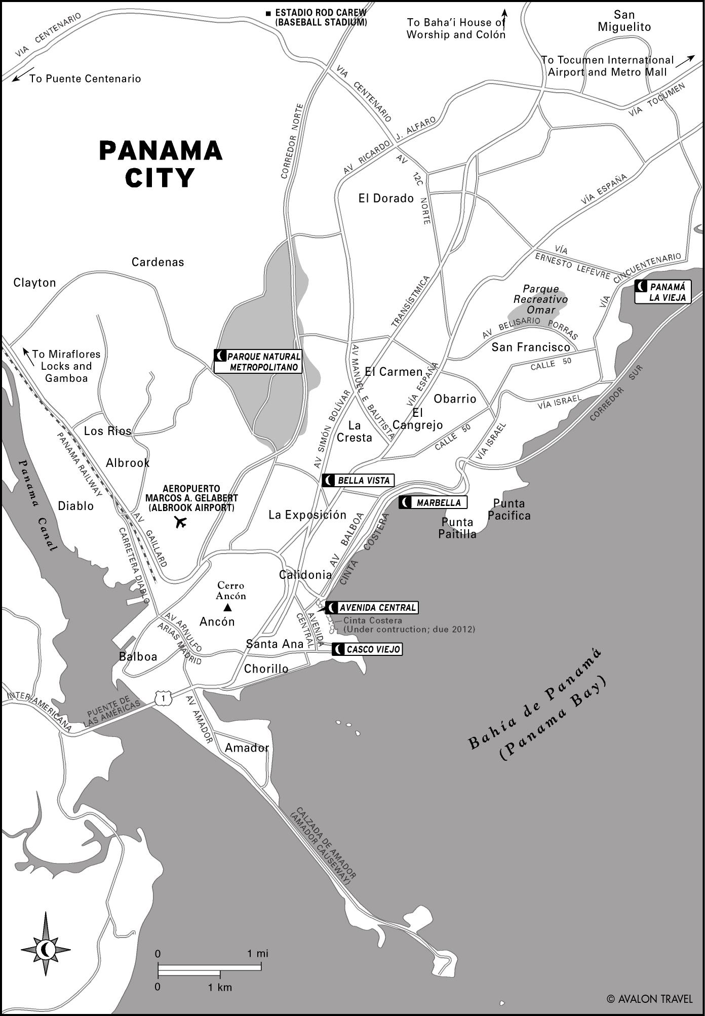
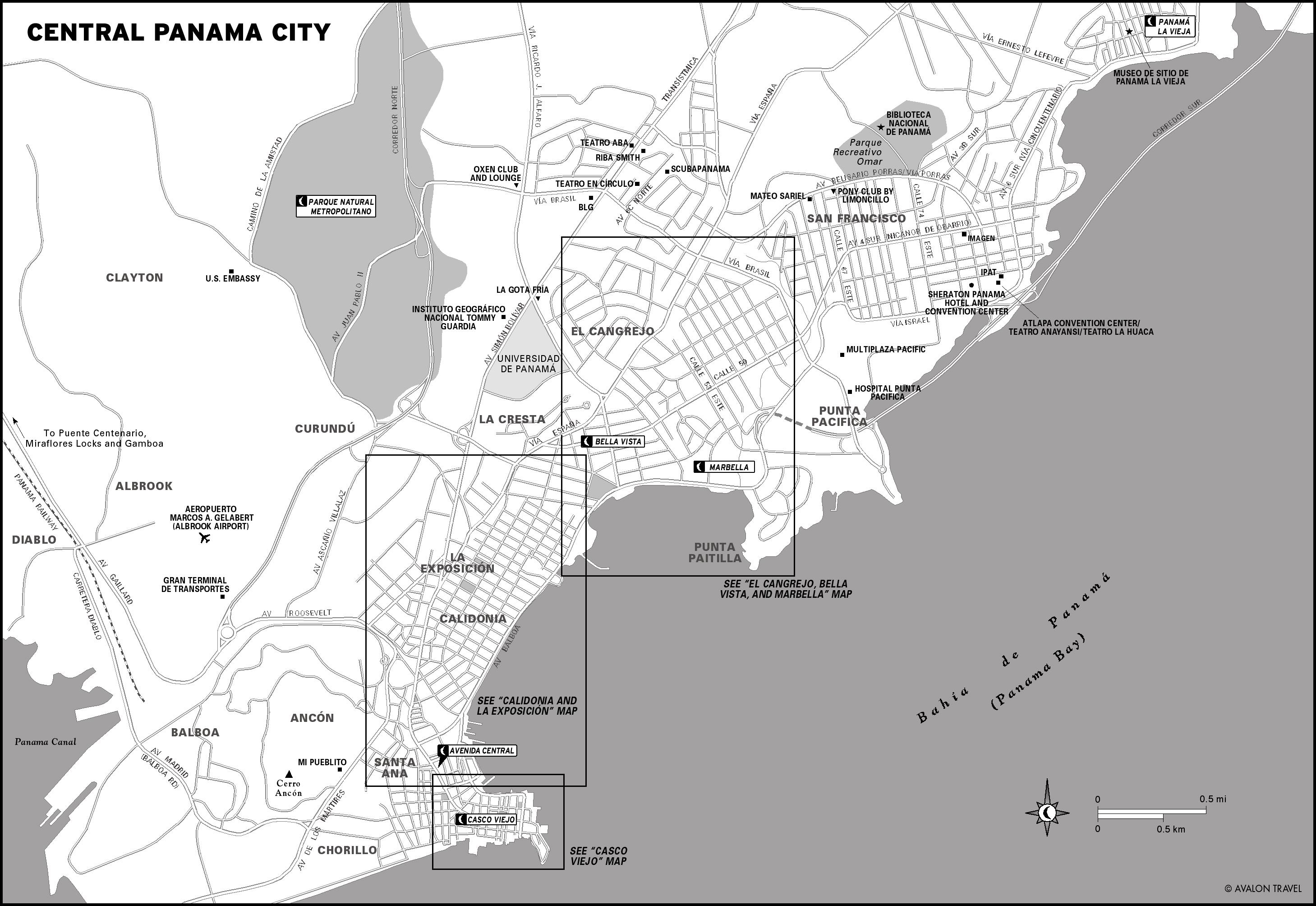
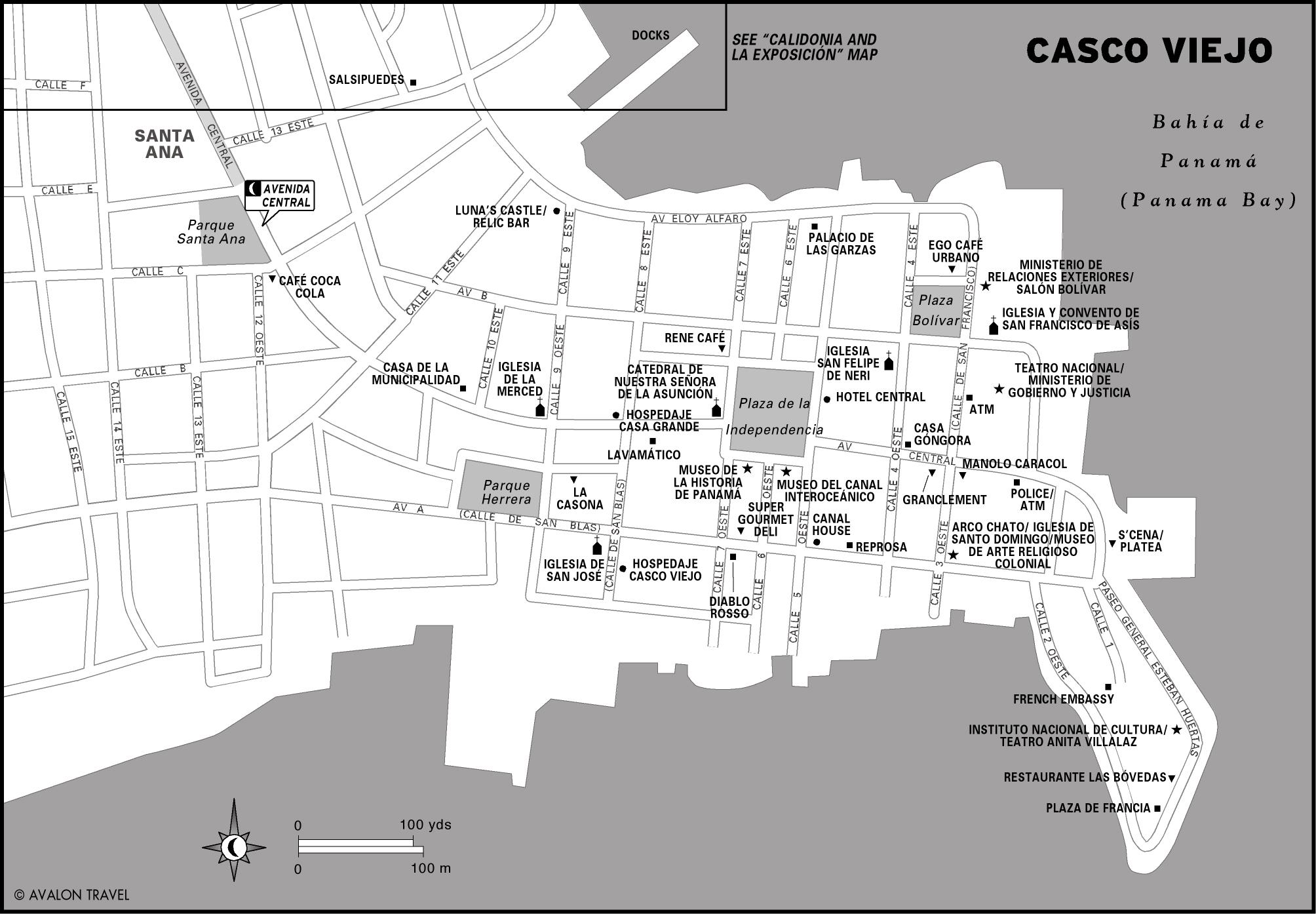
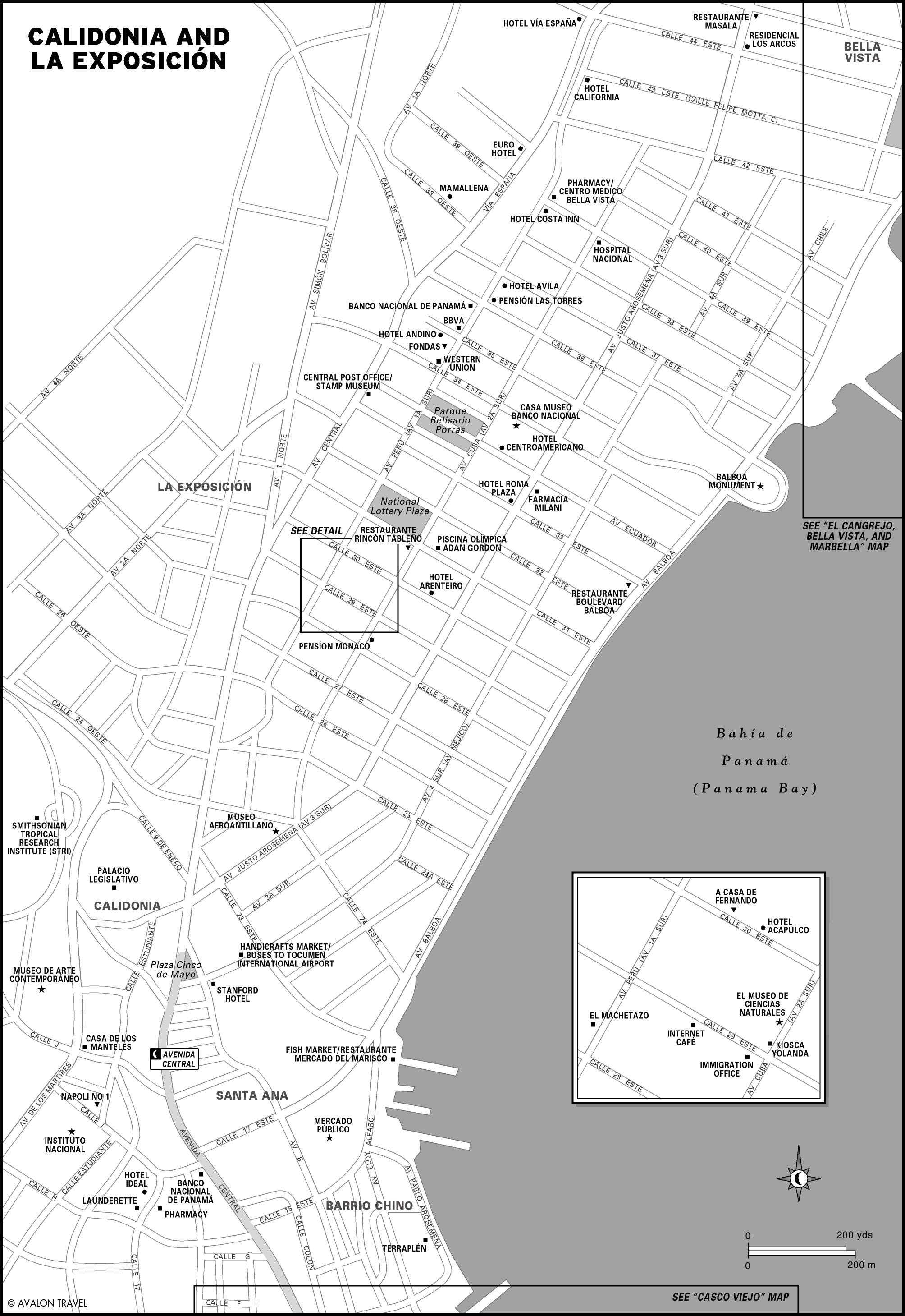
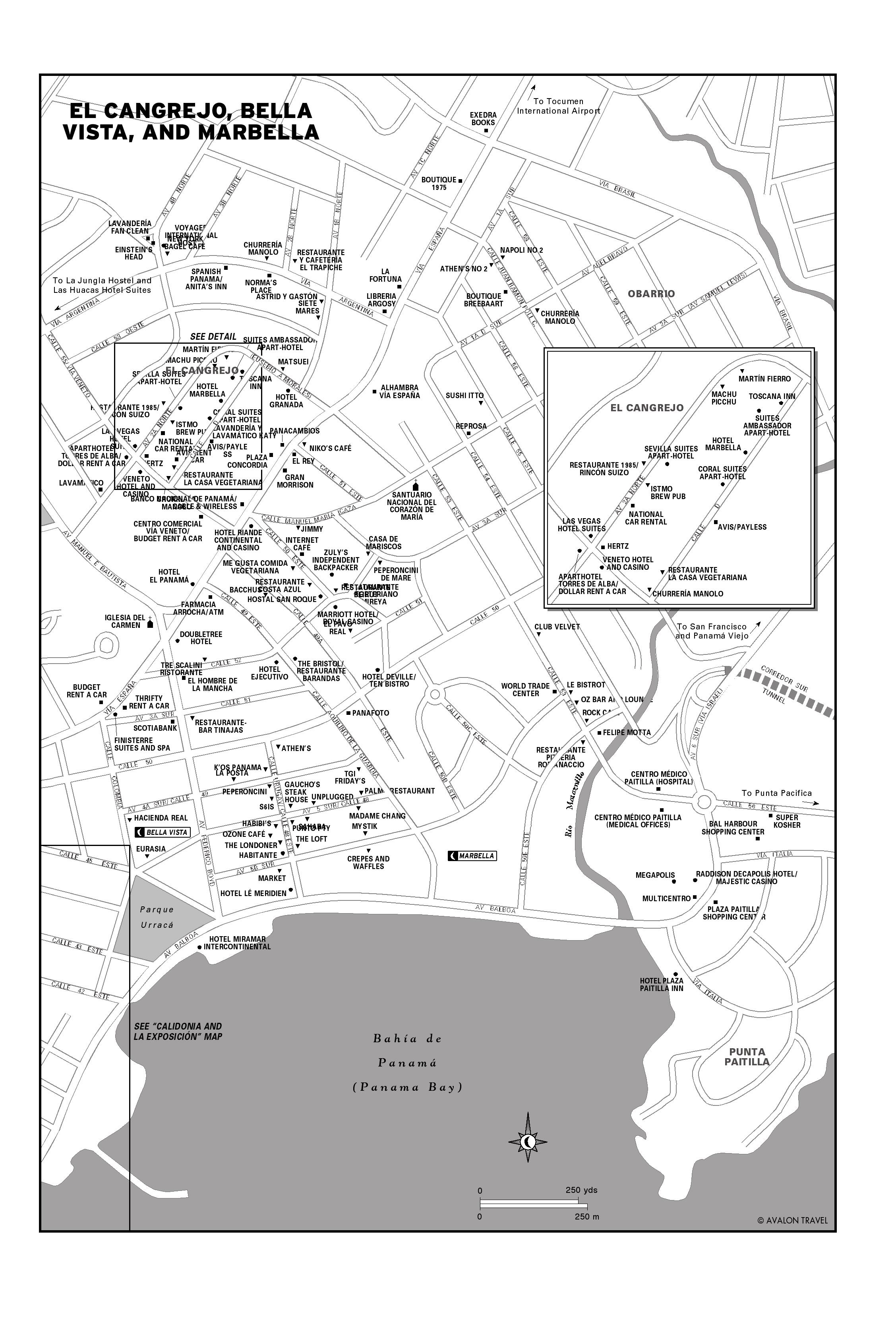
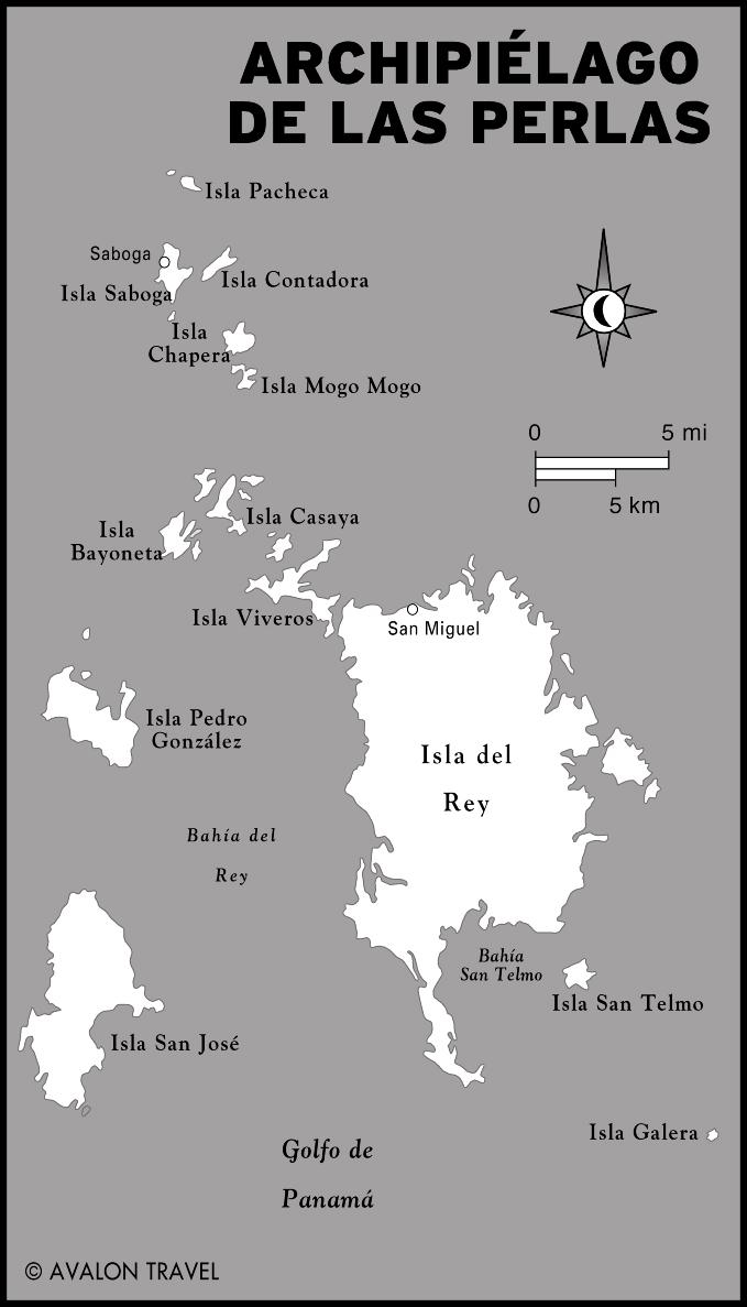
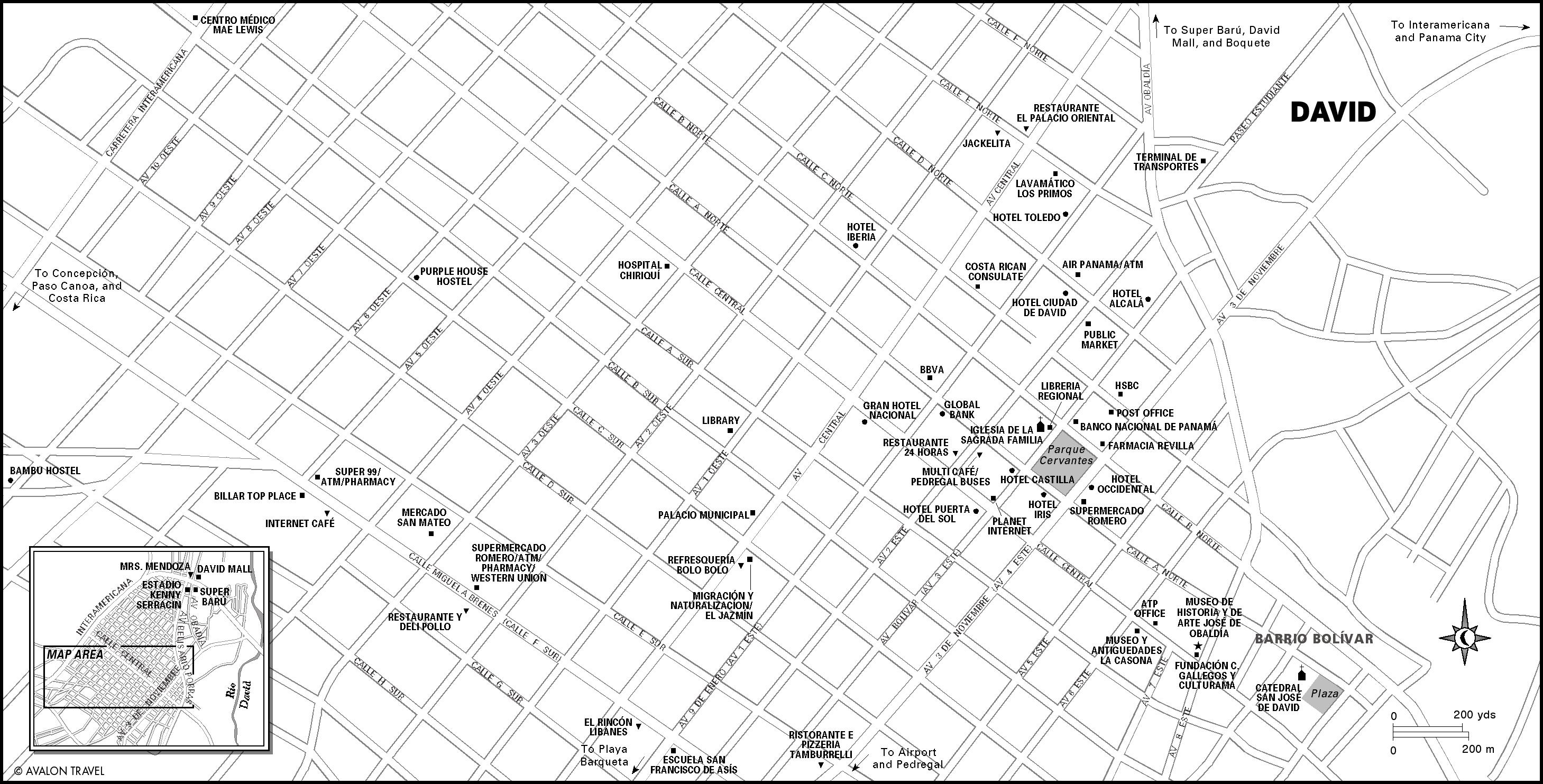
Panama City
Panama City is by far the most cosmopolitan city in Central America, yet it is rich in history. The heart of this burgeoning metropolis of soaring skyscrapers, sophisticated restaurants, and international banks and businesses is Casco Viejo, a charming and well-preserved neighborhood that dates from the 16th century.
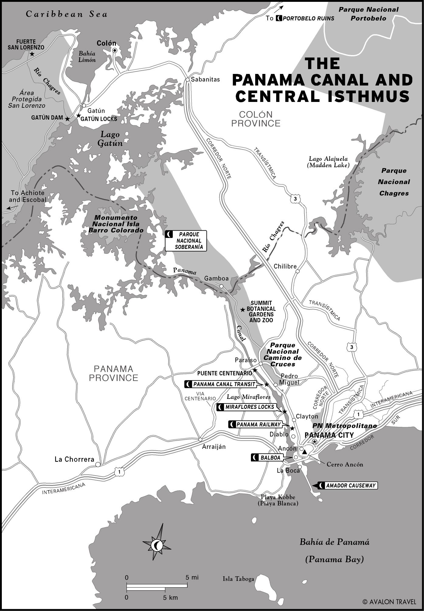
The Panama Canal and Central Isthmus
In addition to seeing and transiting the Panama Canal, visitors can explore the historic townsites and tropical forests of the Pacific side of the canal, as well as the Spanish ruins and tranquil waters of the Caribbean side.
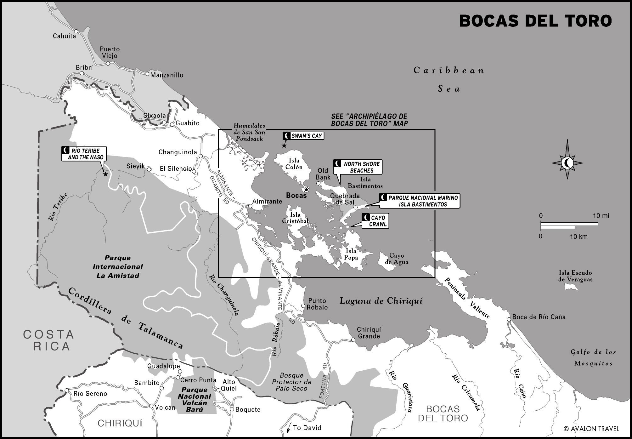
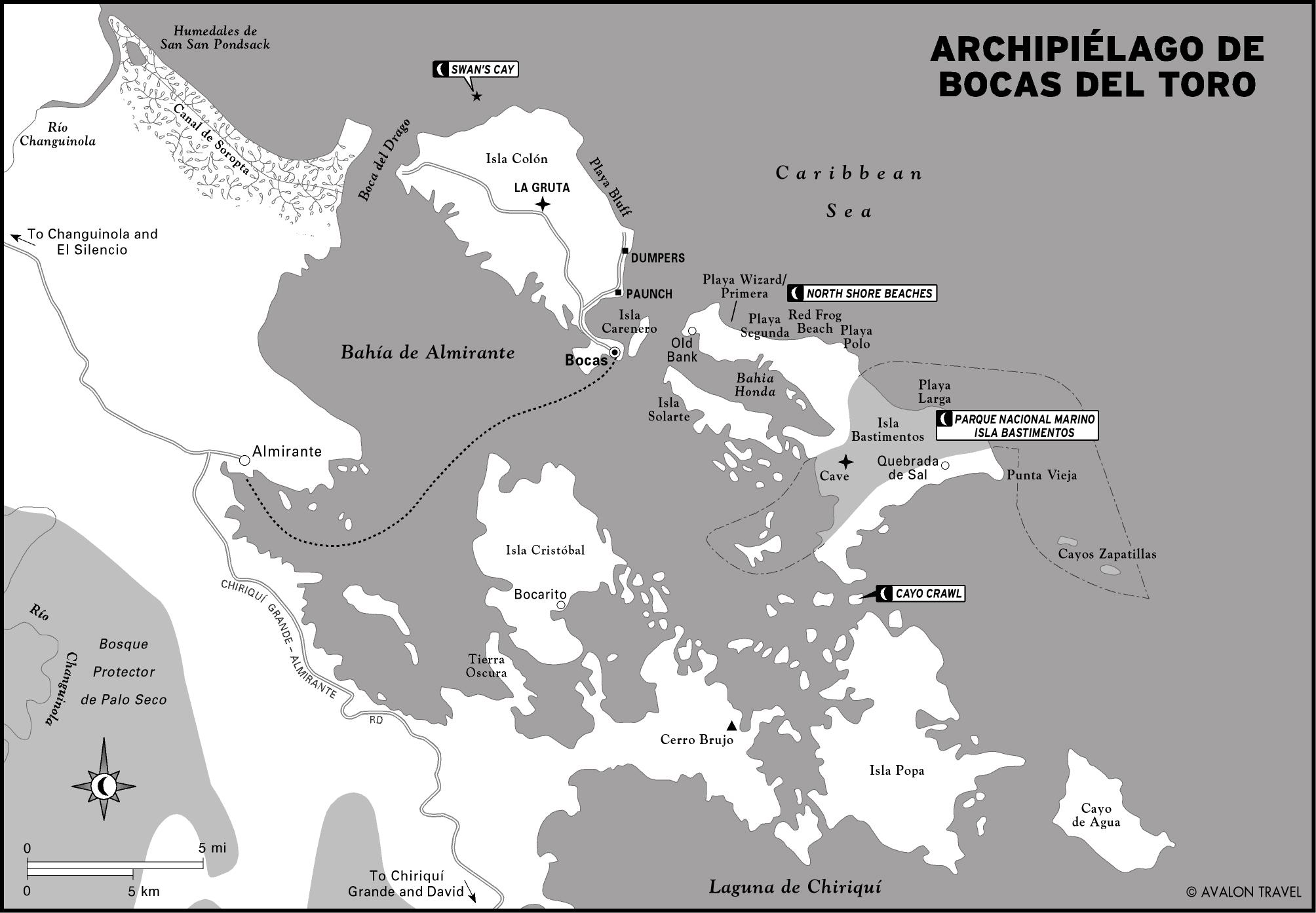
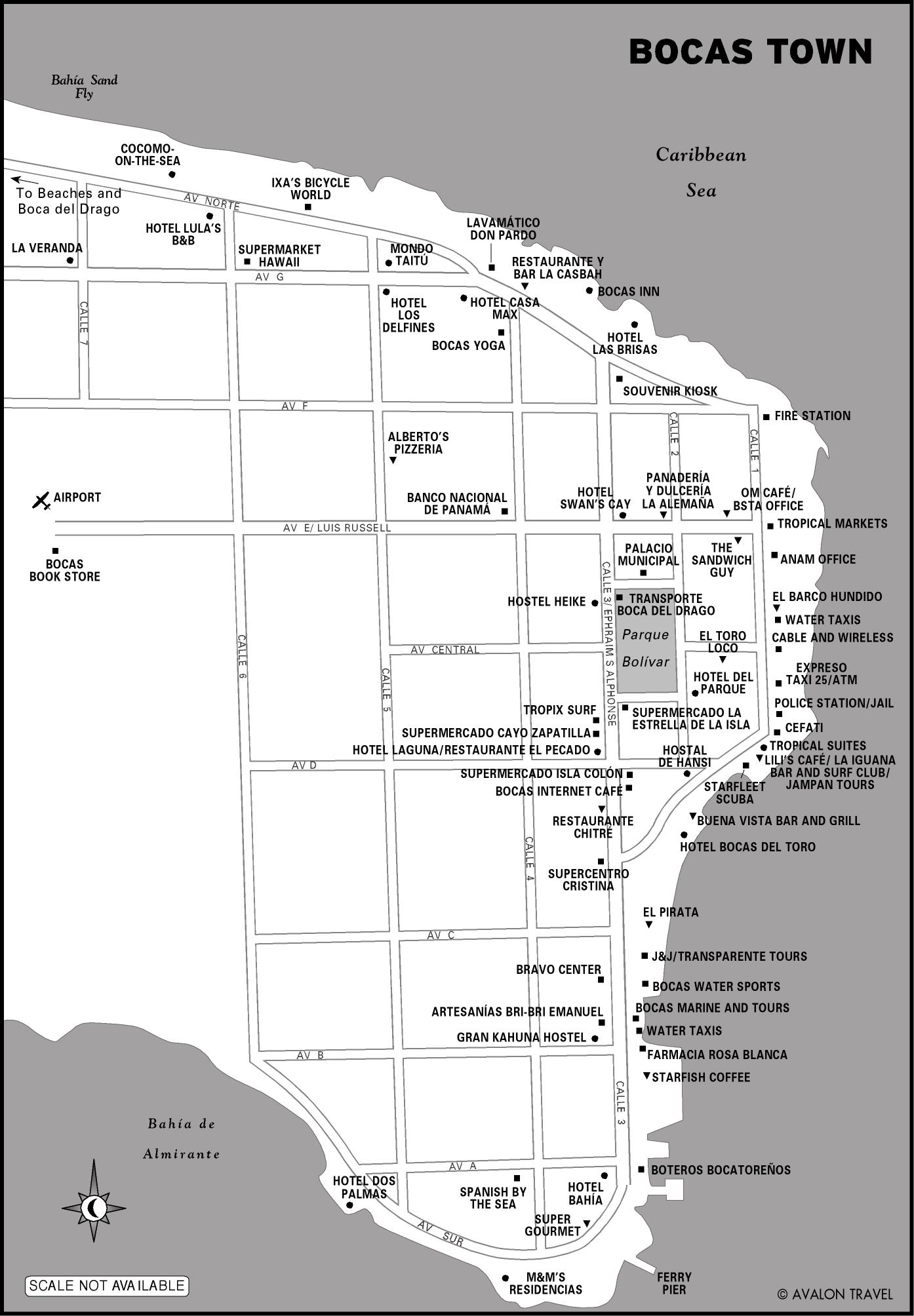
Bocas del Toro
The Bocas archipelago is a bohemian playground of white-sand beaches, big surf, pristine coral reefs, and interesting creatures. The humans are pretty fascinating, too, with a rich mix of diverse peoples that includes indigenous and Afro-Caribbean inhabitants who’ve called Bocas home for hundreds of years.
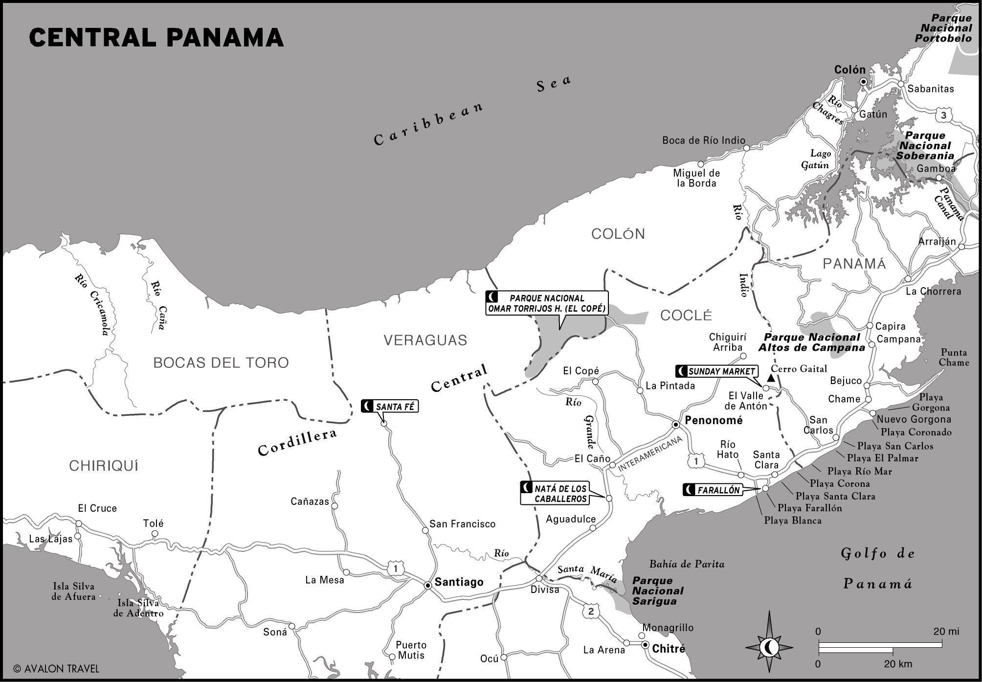
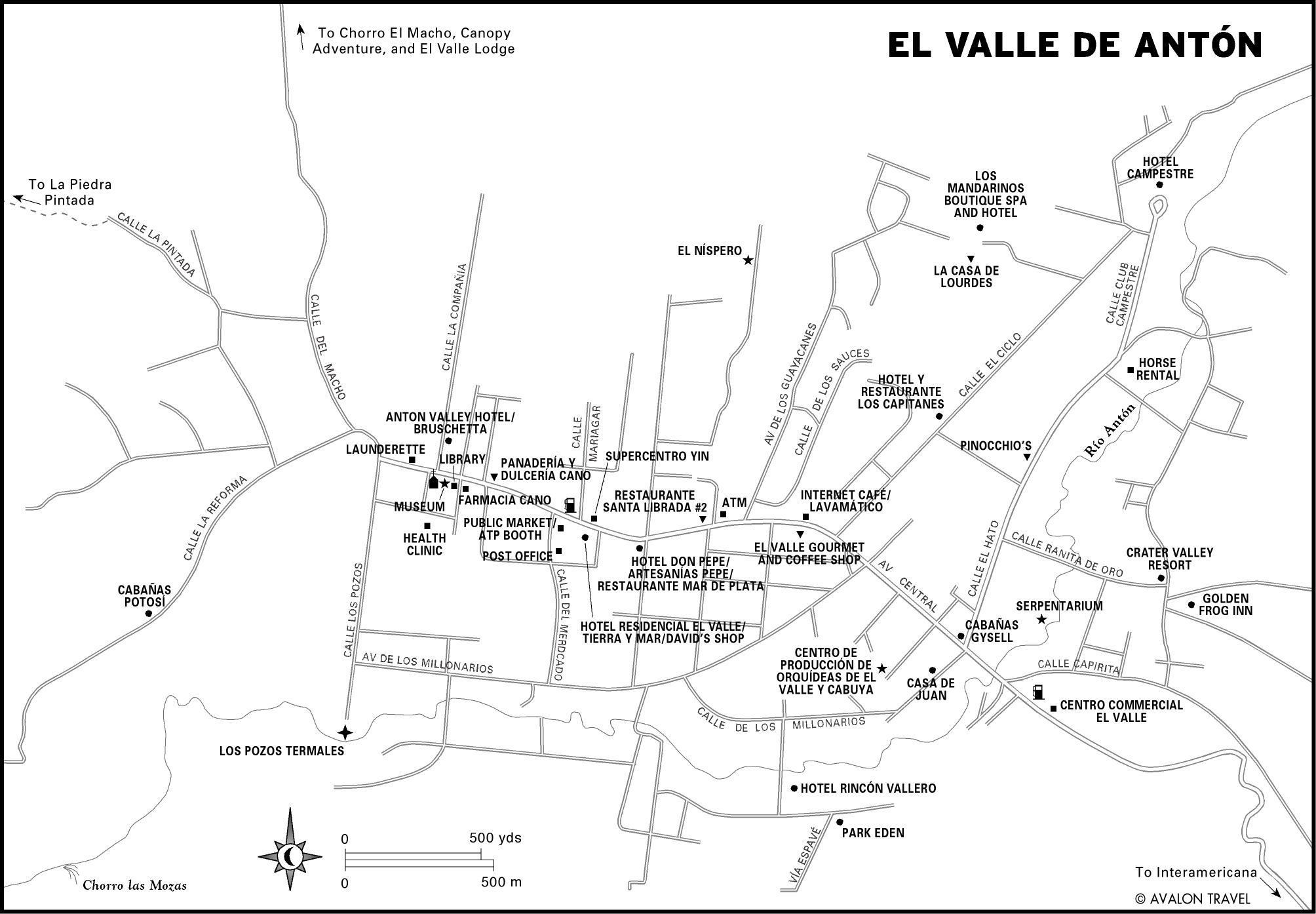
Central Panama
The central provinces contain Panama’s most accessible highlands and popular beaches. From any of the beaches it’s easy to head for the hills and escape the heat in the town of El Valle de Antón, nestled at the bottom of an extinct volcano and known for its waterfalls, square trees, golden frogs, and a popular Sunday crafts market.
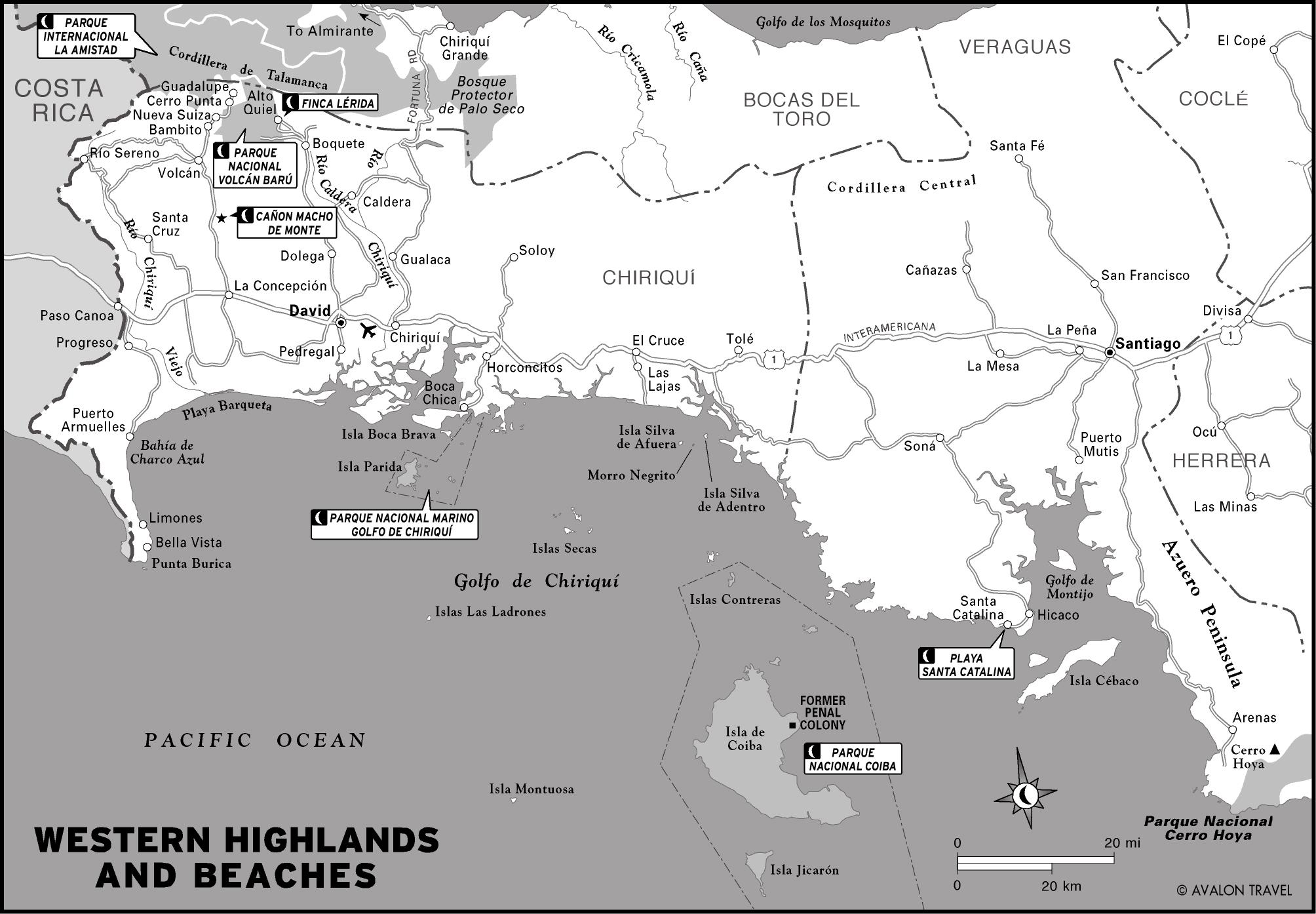
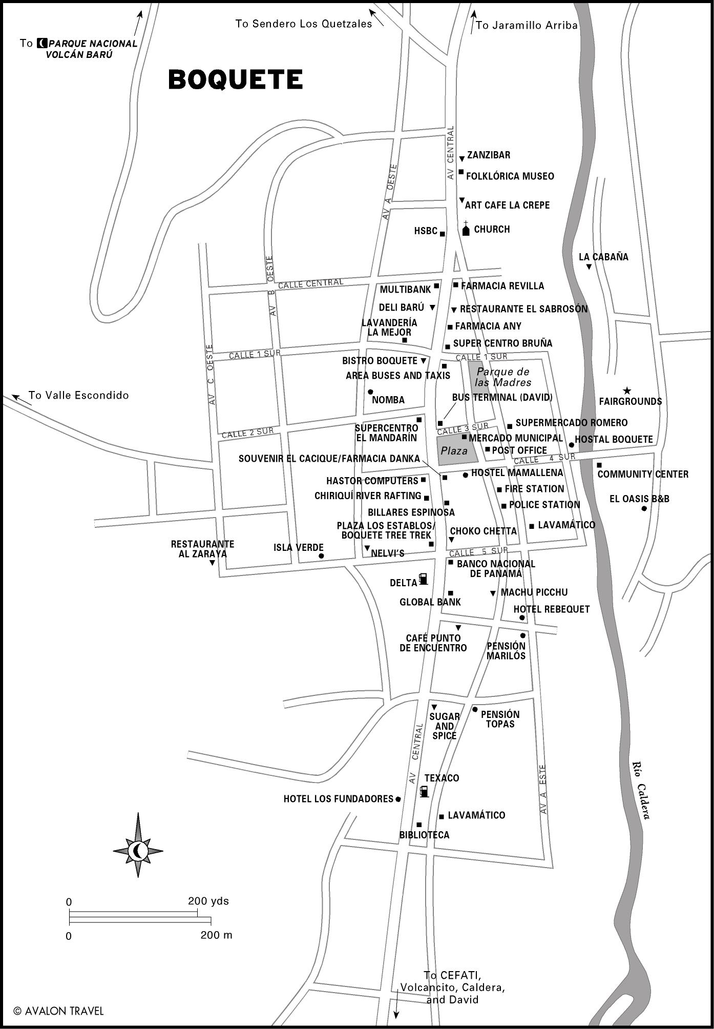
Western Highlands and Beaches
The cool highlands of western Panama are home to the country’s highest mountain, Volcán Barú. The dormant volcano’s fertile volcanic soil produces gourmet coffee, gorgeous flowers, and delicious oranges and strawberries. But its sprawling protected areas, most notably the gigantic Parque Internacional la Amistad, are what really set the region apart.
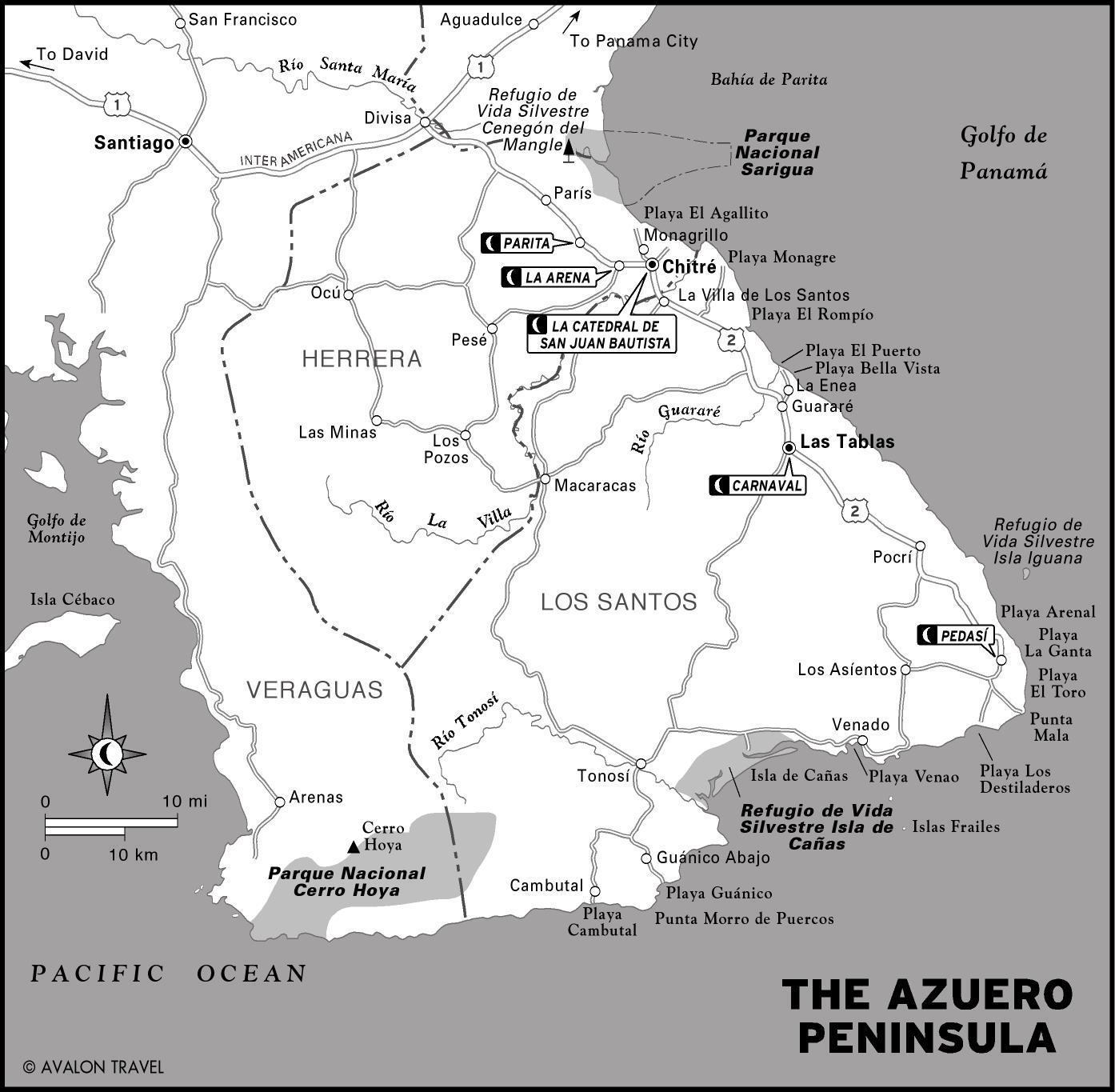
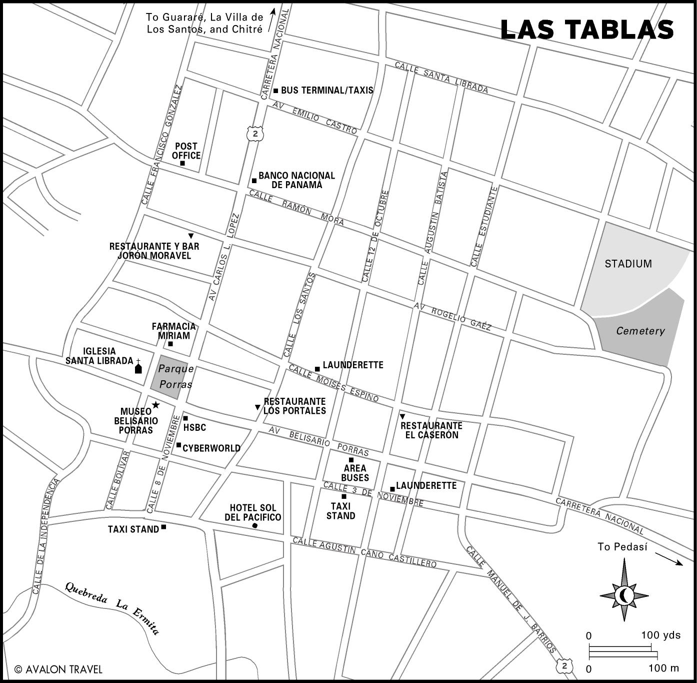
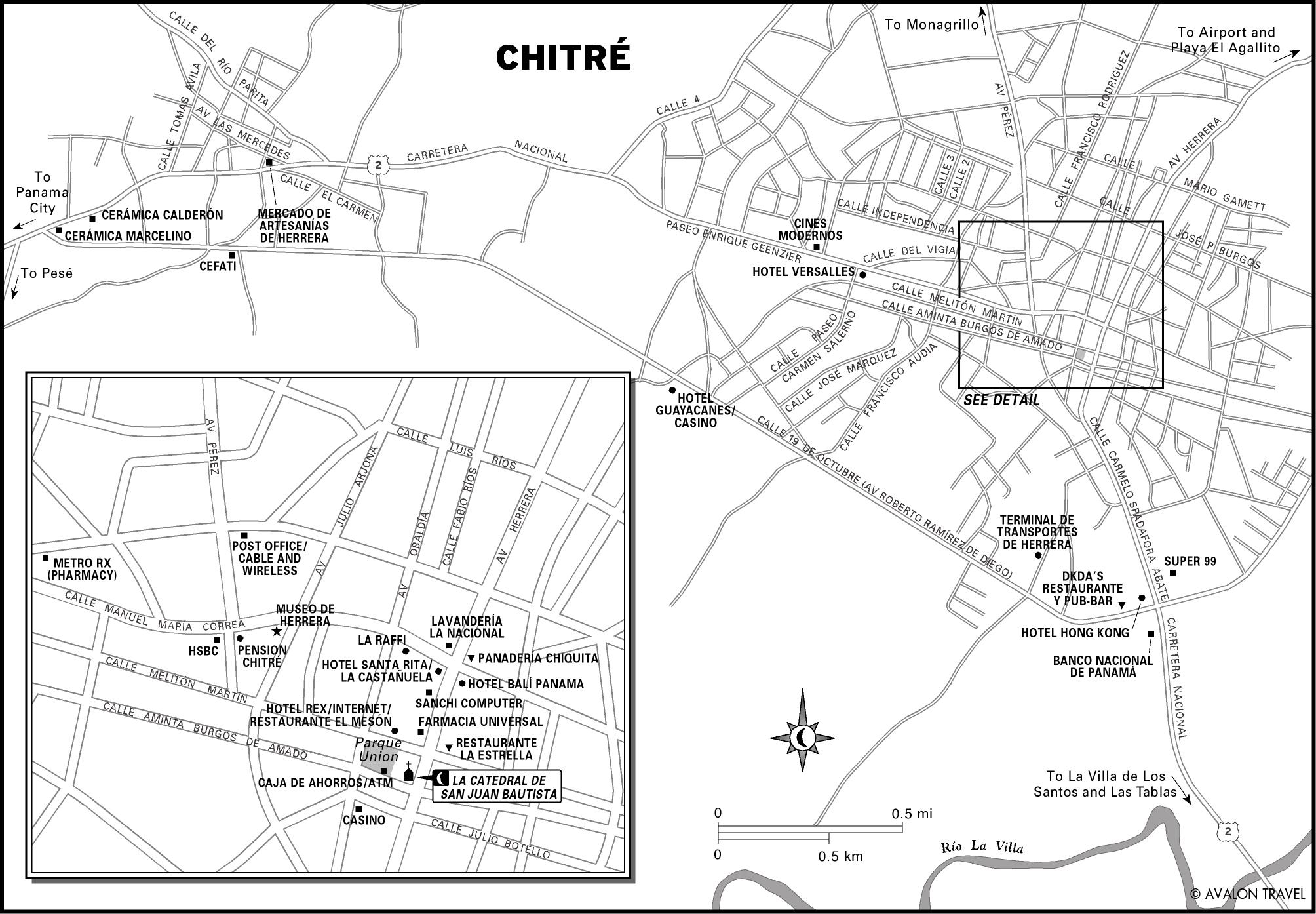
The Azuero Peninsula
The Azuero Peninsula, Panama’s heartland, is the most culturally rich region of the country, with Spanish colonial towns that time has forgotten. The Azuero, known for its festivals, hosts the country’s most important Carnaval celebration. The peninsula also has a ribbon of barely visited beaches that offer good surfing, snorkeling, and fishing.
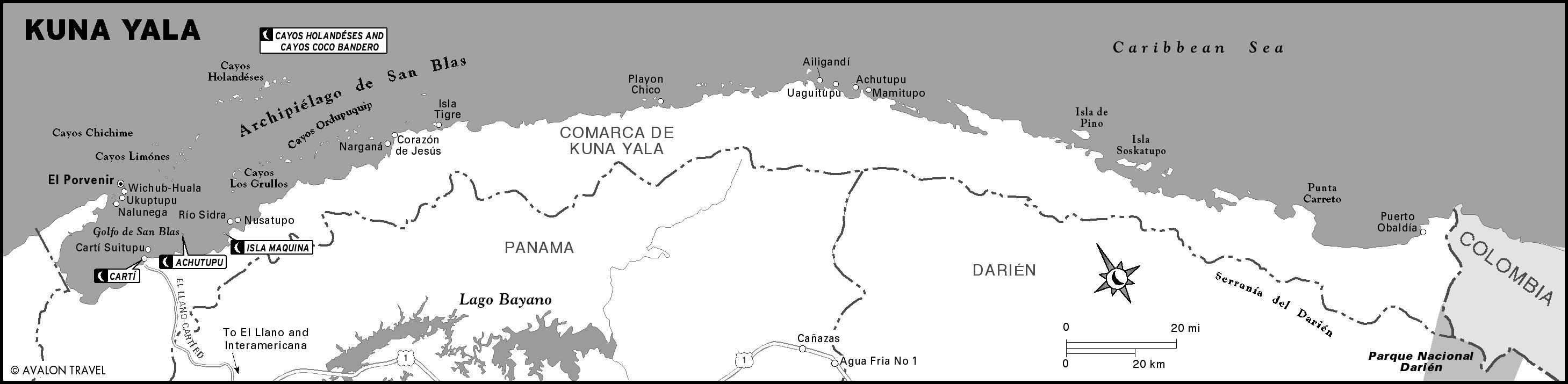
Kuna Yala
Only about 40 of the nearly 400 islands in Kuna Yala, commonly known as the San Blas Archipelago, are inhabited. On these live the Kuna, the most fascinating and intact indigenous culture in the Americas. The uninhabited islands are palm-covered paradises of white sand and clear blue water straight out of Robinson Crusoe.
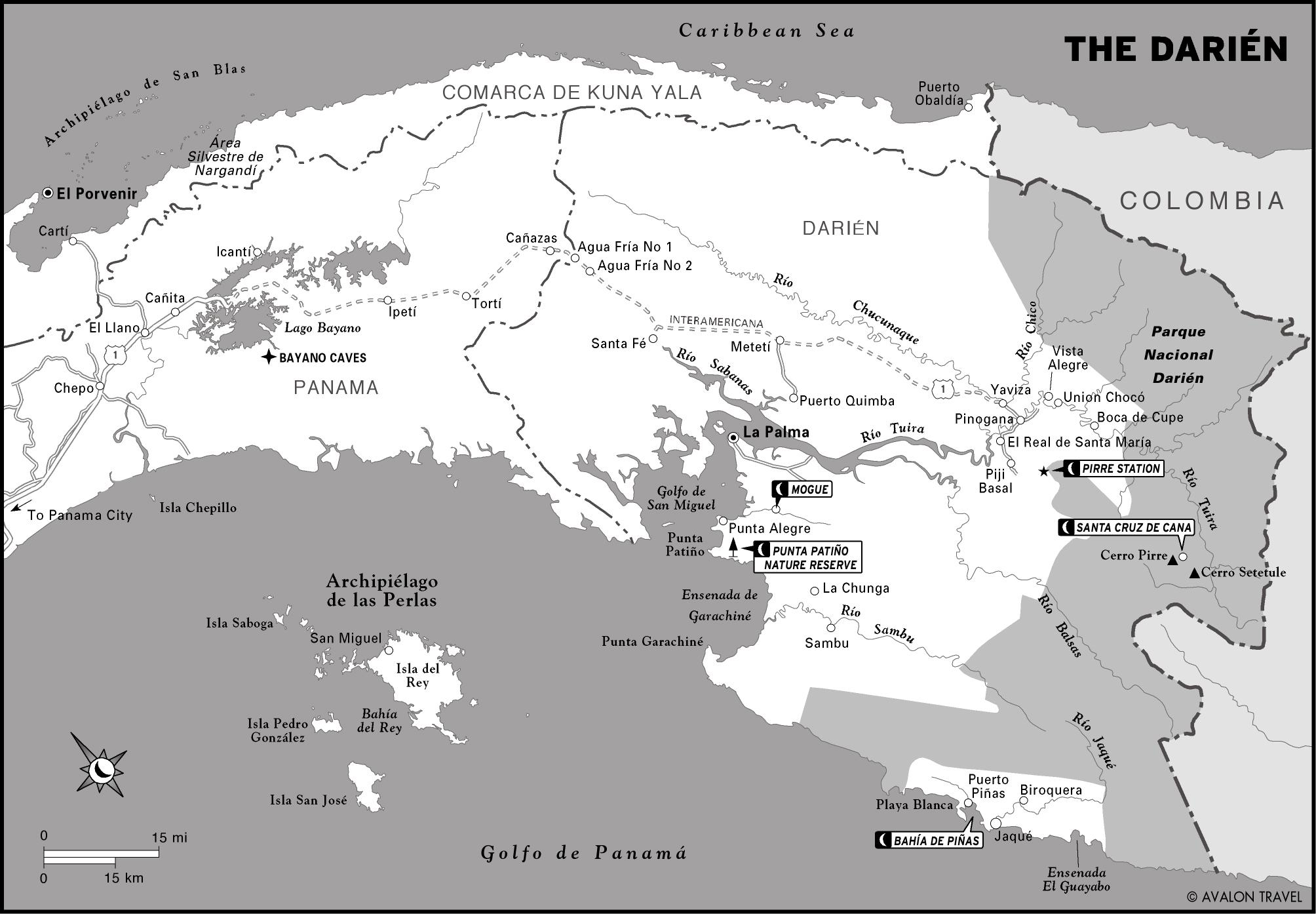
The Darién
The legendary Darién jungle has long attracted adventurers. Parque Nacional Darién is one of the largest and most vital tropical forests in the western hemisphere. The forested coast offers a completely different experience, including astonishingly abundant sea life just offshore. The Darién is also home to three nations of indigenous people who cling to the rugged ways of life they’ve sustained for centuries.