Baja
These free, printable travel maps of Baja are divided into ten regions:
- Tijuana, Rosarito, and Tecate
- Ensenada to El Rosario
- Mexicali to San Felipe
- Desierto Central to Bahía de los Angeles
- Guerrero Negro to Bahía Concepción
- Loreto and Bahía Magdalena
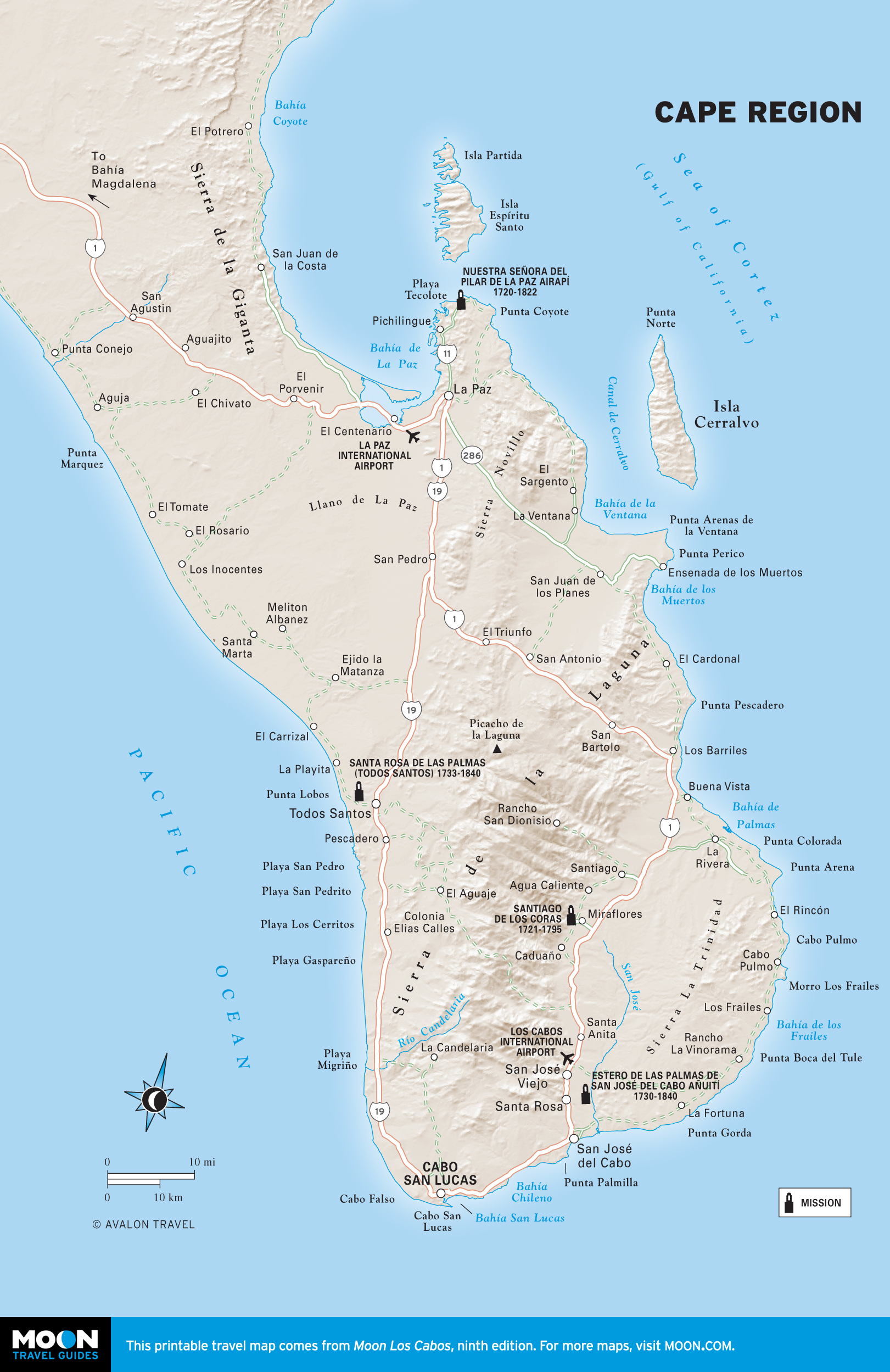
- La Paz and Vicinity
- The East Cape and The Sierra de la Laguna
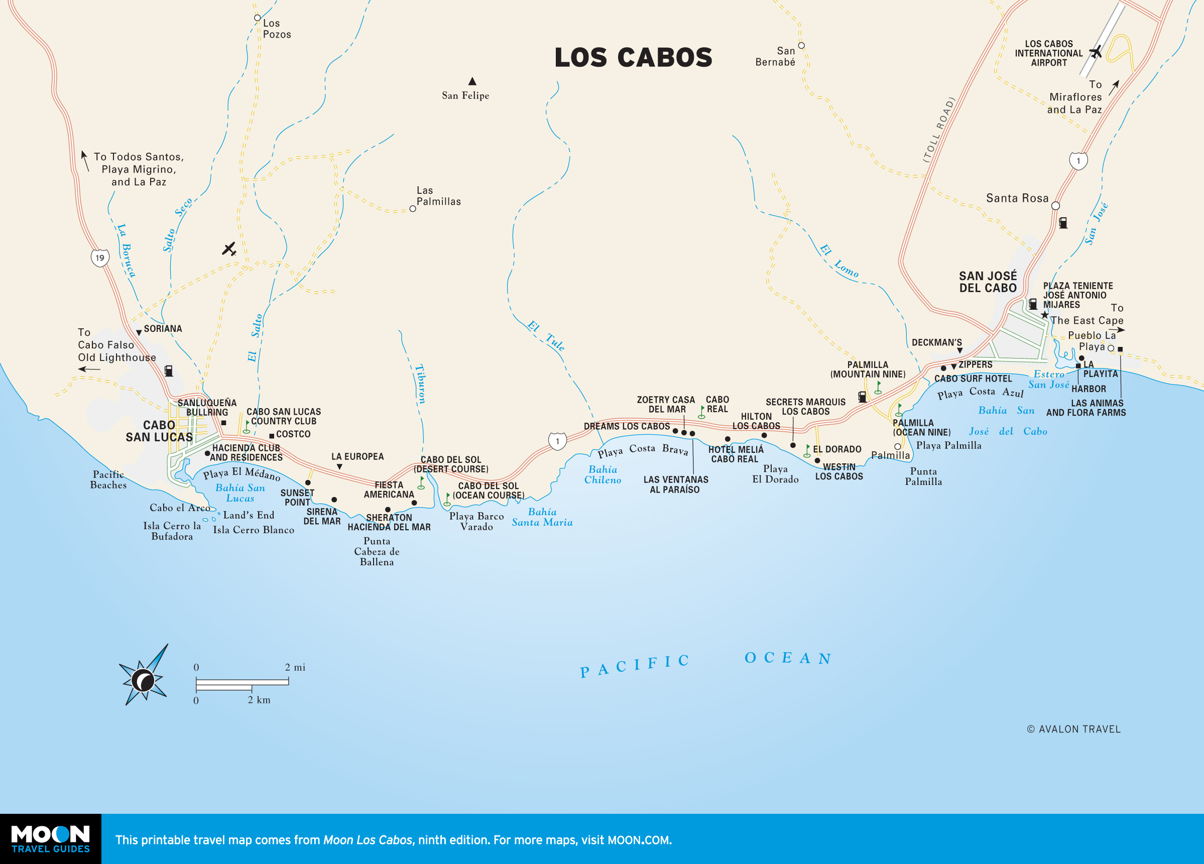
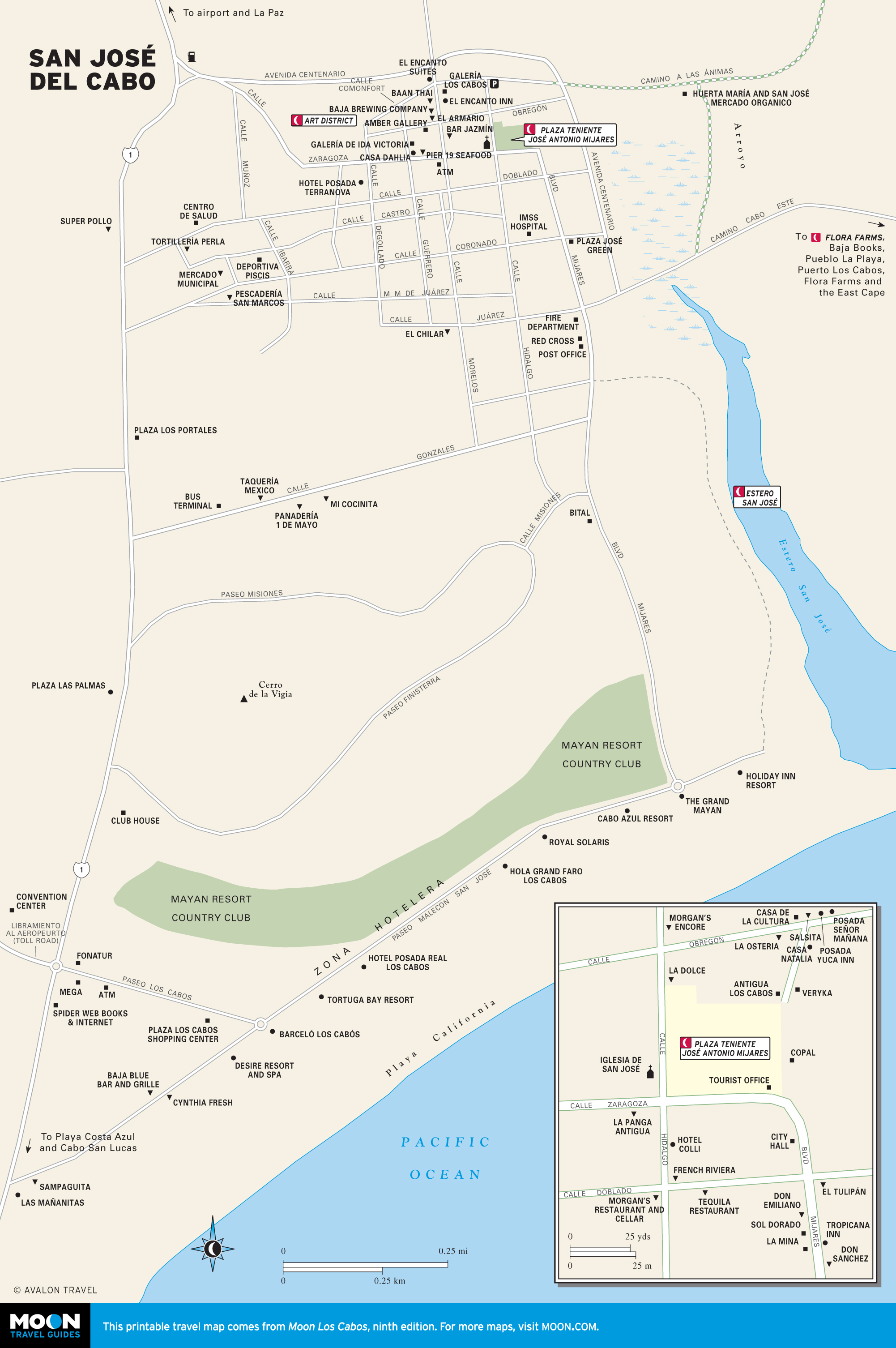
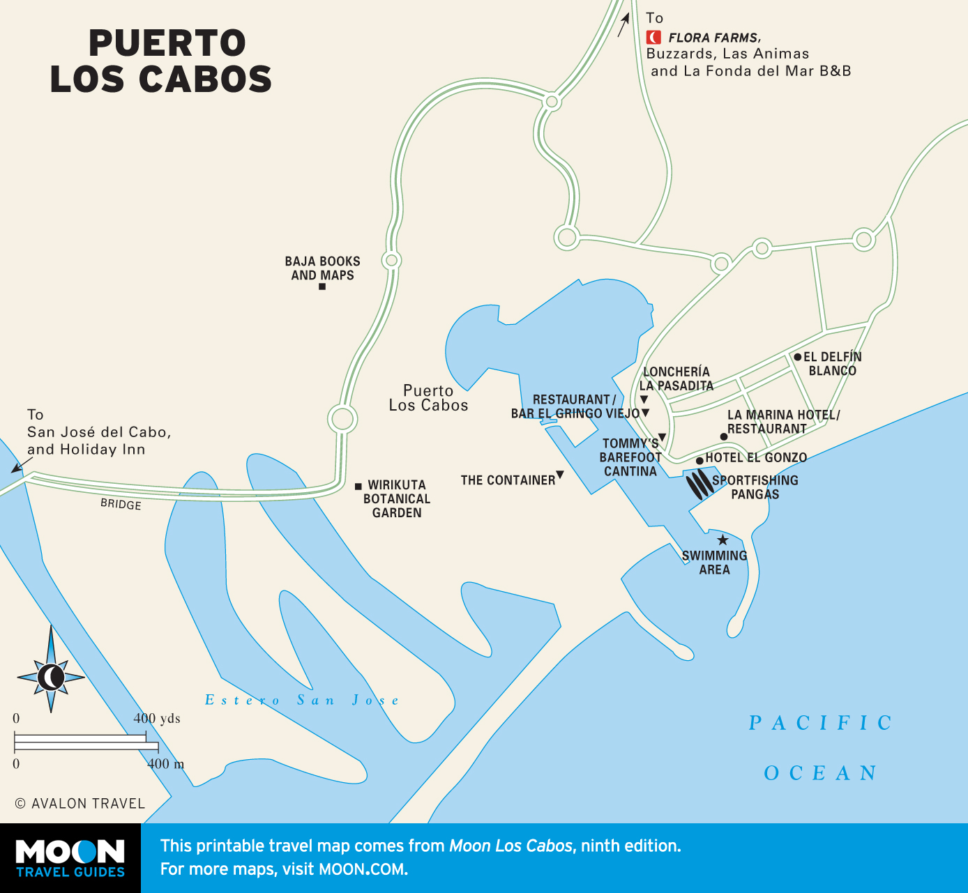
- Los Cabos
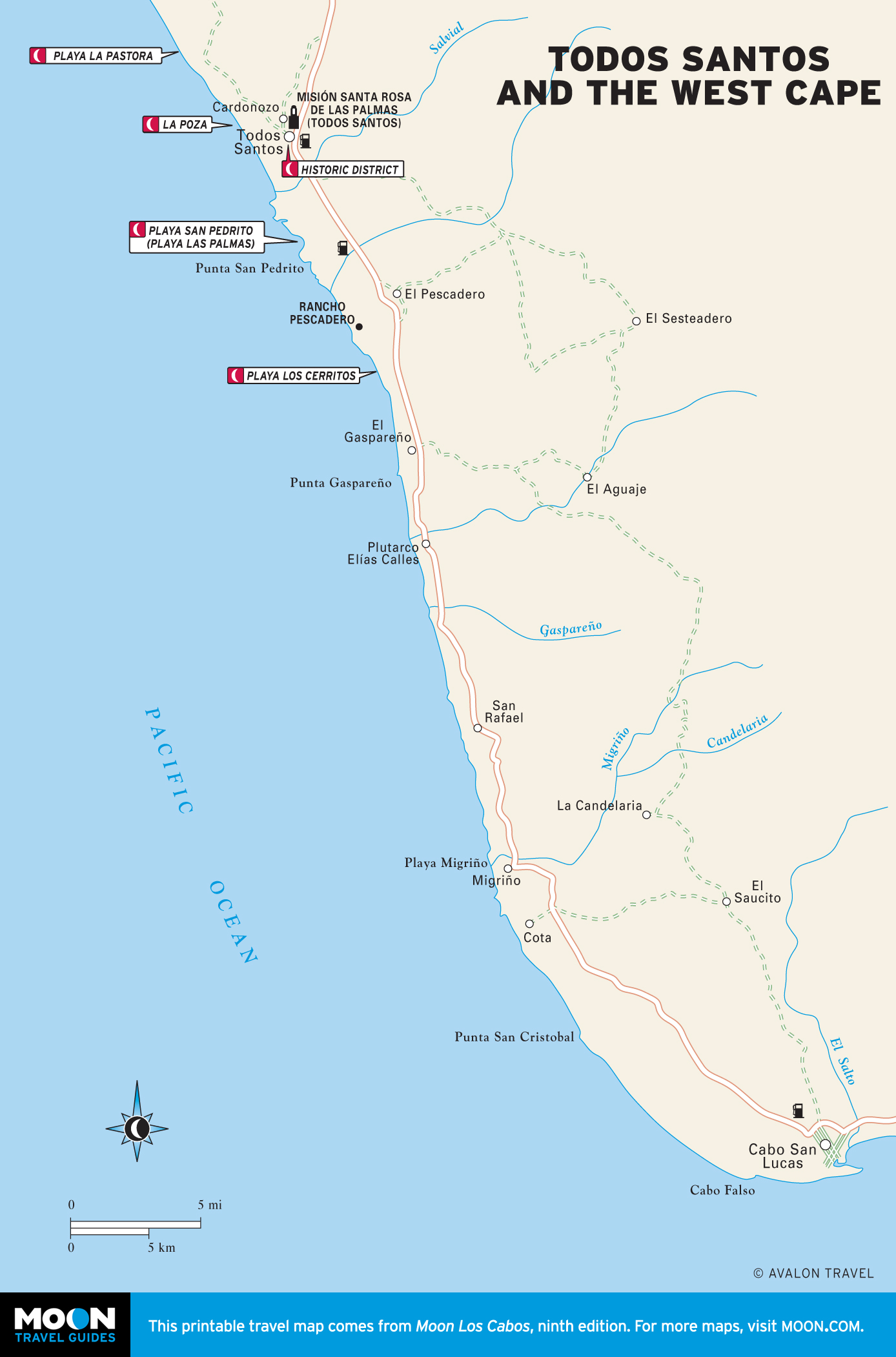
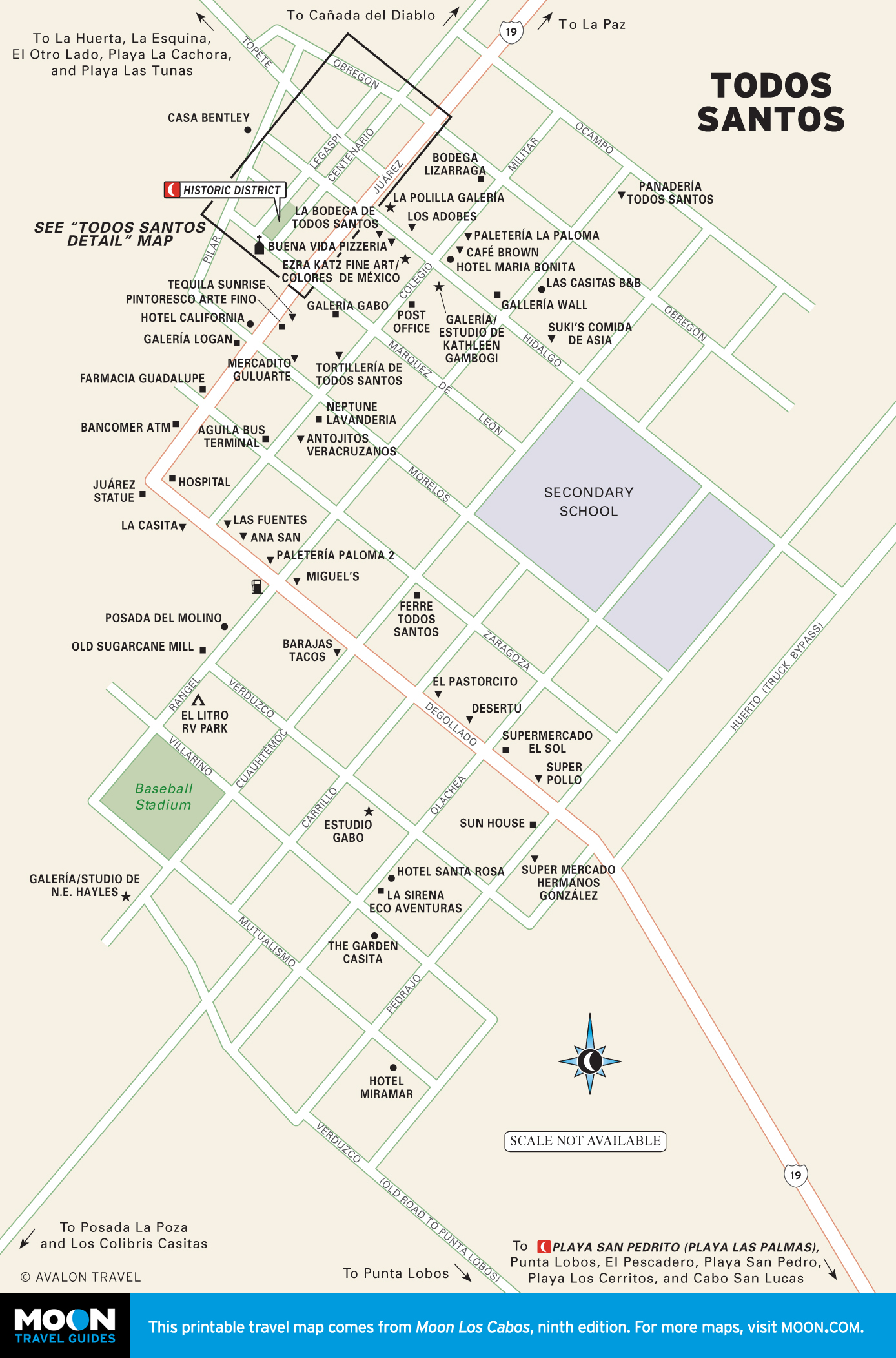
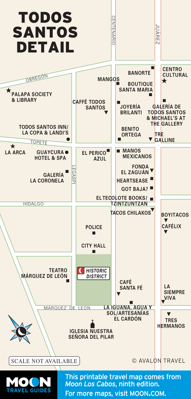
- The West Cape and Todos Santos
Explore Baja with these helpful travel maps from Moon. Ensure you have the newest travel maps from Moon by ordering the most recent edition of our travel guides to Baja and Los Cabos.
Maps of Baja
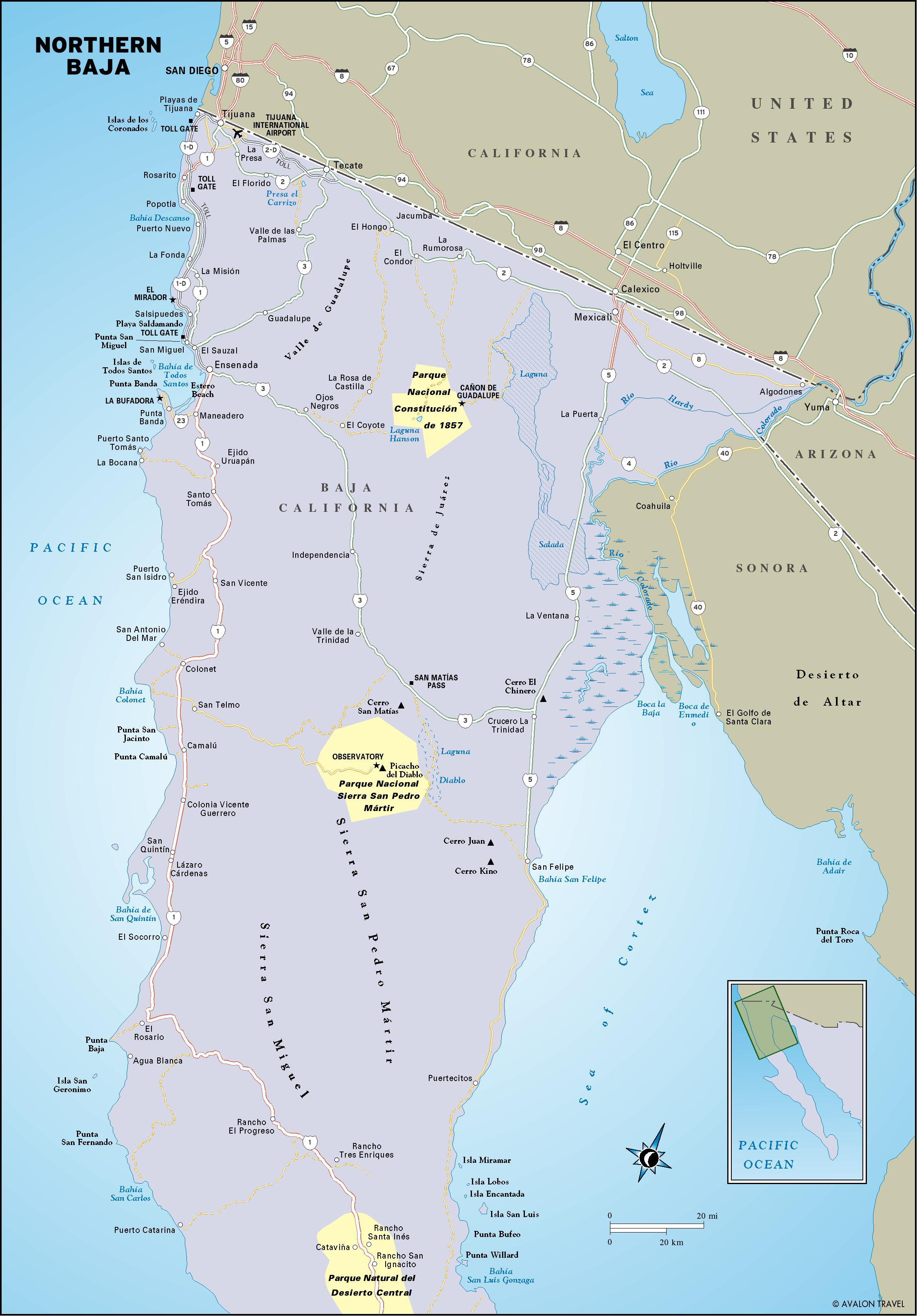
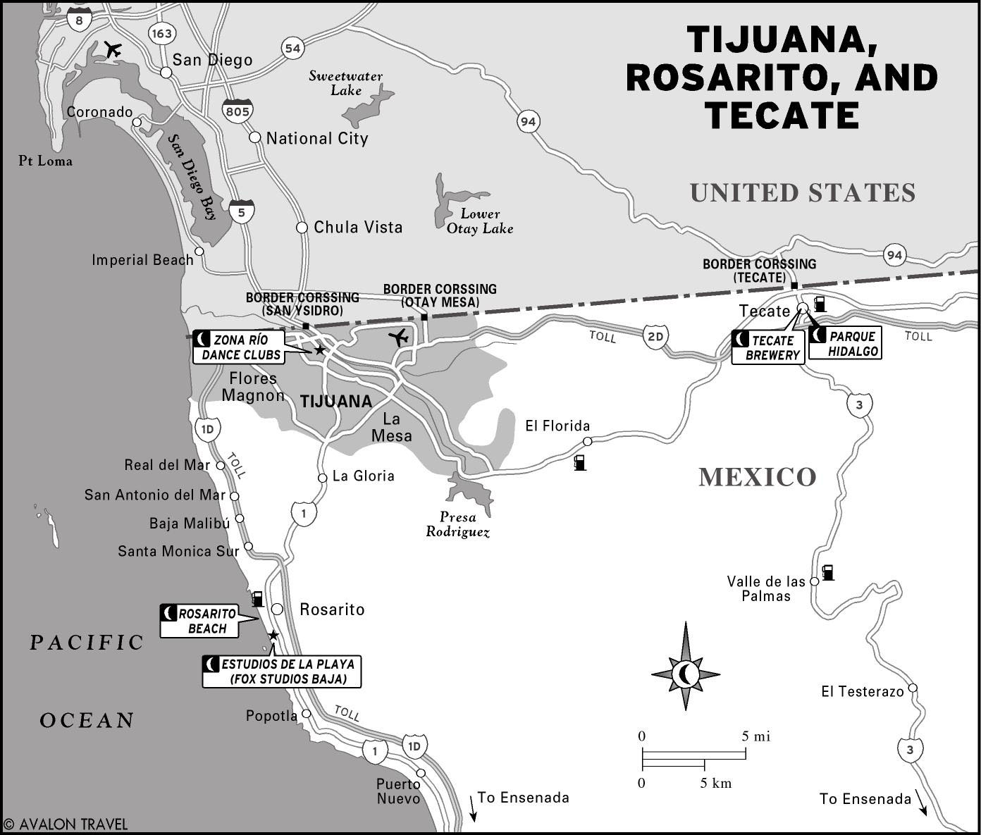
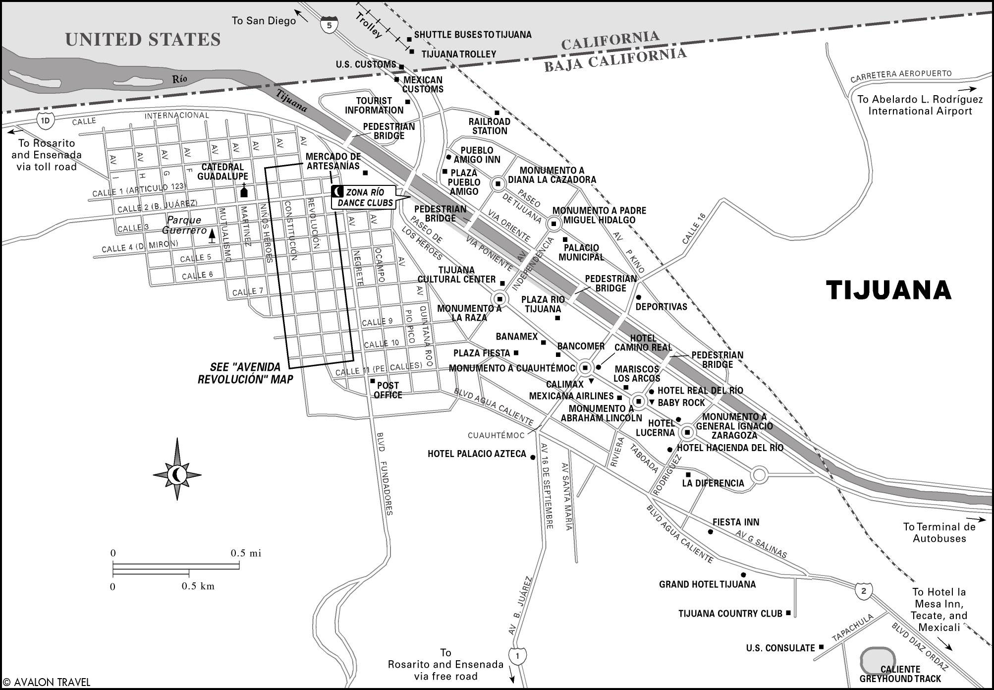
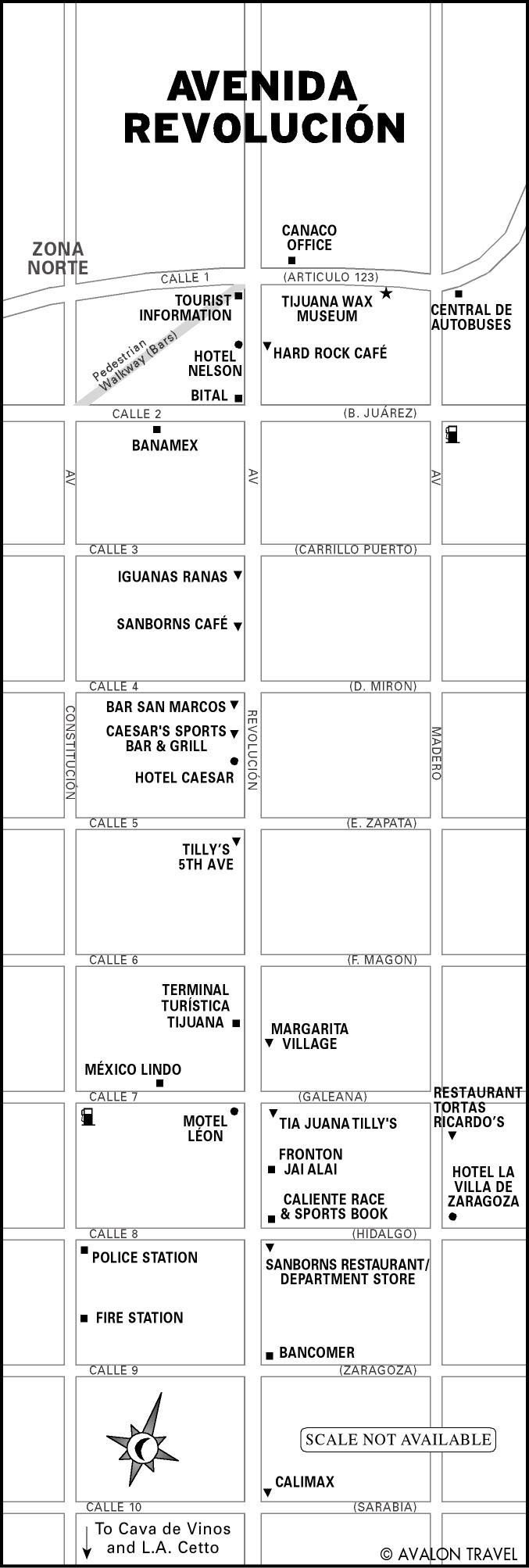
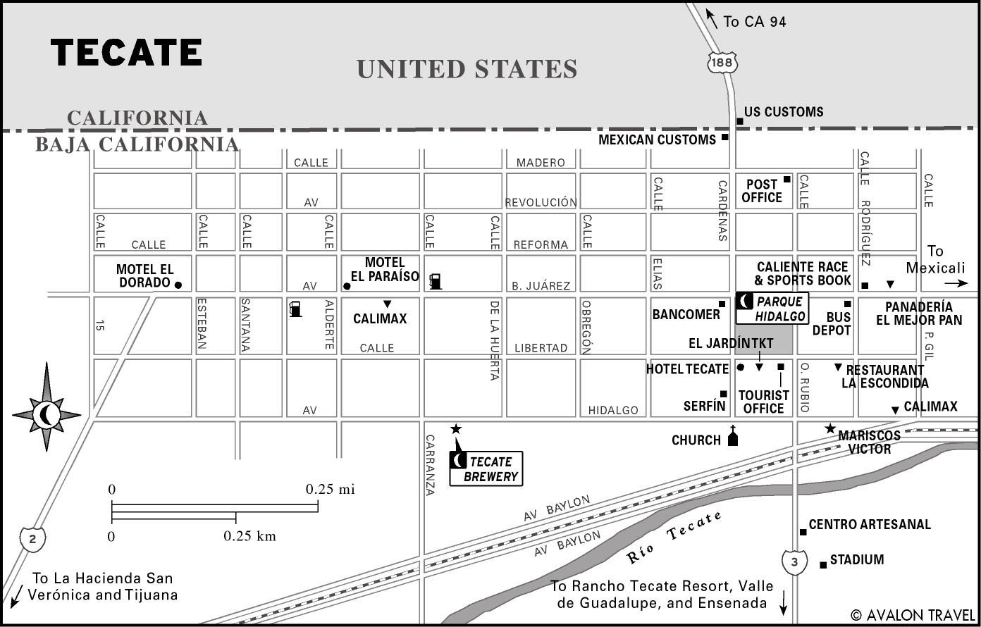
Tijuana, Rosarito, and Tecate
As the peninsula’s largest city, Tijuana is a high-risk, high-reward place. outstanding cuisine, trendsetting nightclubs, and bargain shopping attract loyal weekenders from Southern California. But the stories you hear of drug and sex trafficking, corrupt cops, rip-off artists, and predatory cab drivers are not urban legend. On the Pacific coast to the south, Rosarito draws surfers and college students on spring break. East of Tijuana, tecate offers a more relaxed border crossing and pleasant town plaza, and serves as a gateway to the Valle de Guadalupe wine country along Mexico 3.

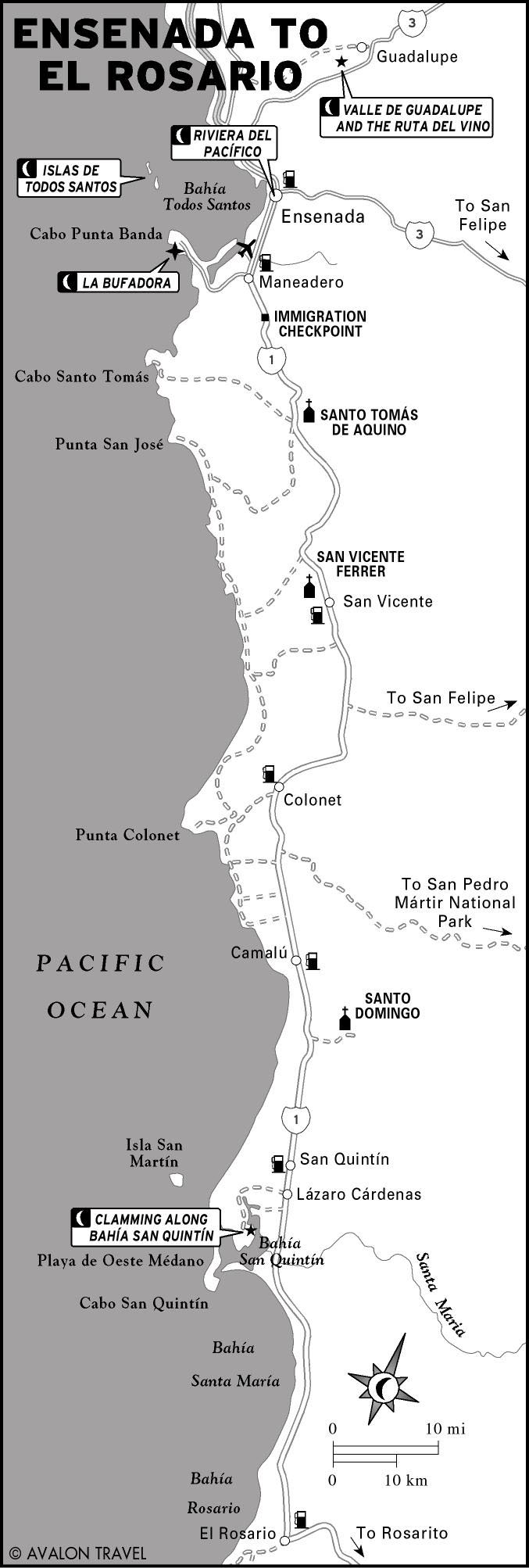
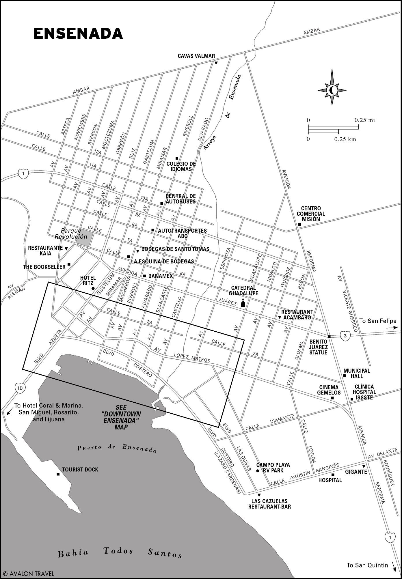
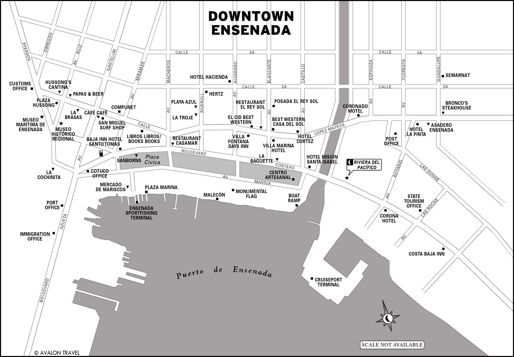
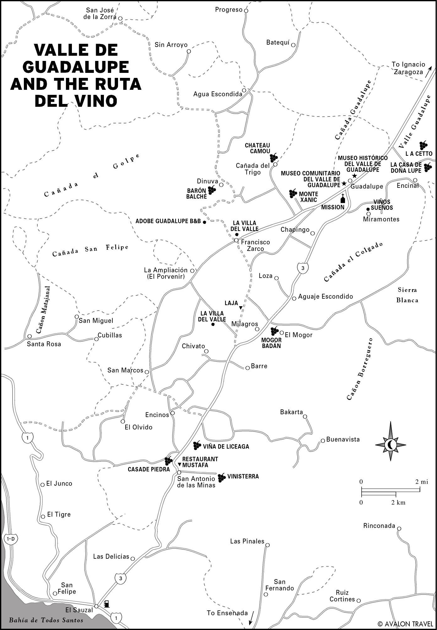
Ensenada to El Rosario
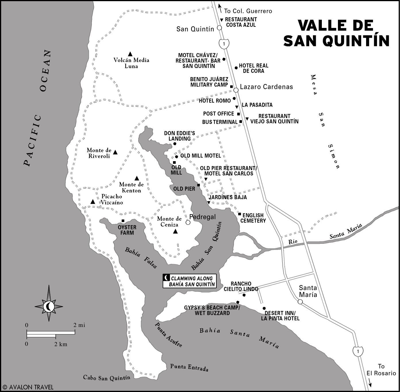
South of the border region, Ensenada has hopping clubs and bars at its north end and a quiet and more upscale malecón (waterfront promenade) downtown. Nearby are boutique wineries and empty beaches along Bahía de San Quintín. El Rosario marks the gateway to the Desierto Central that makes up the peninsula’s interior.
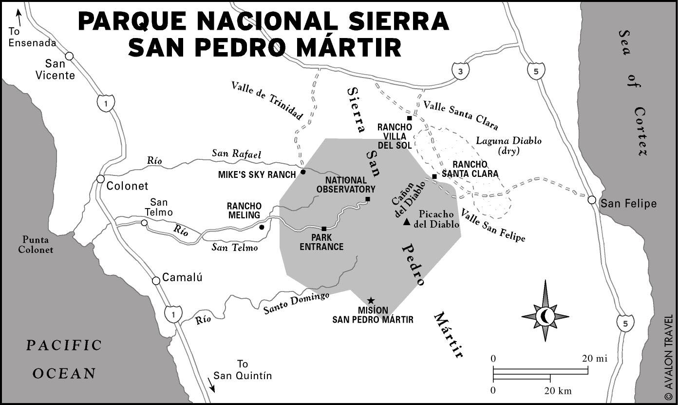
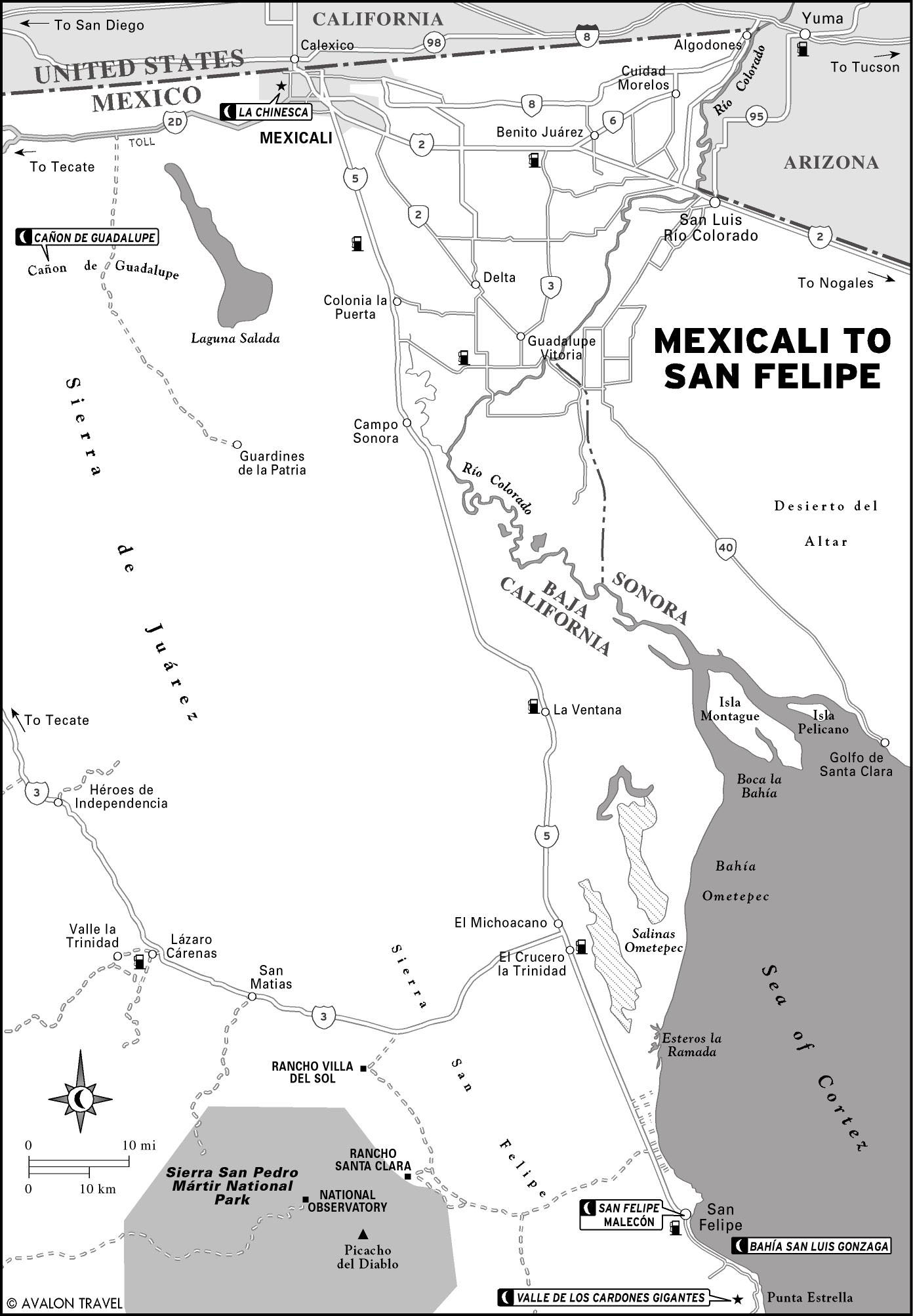
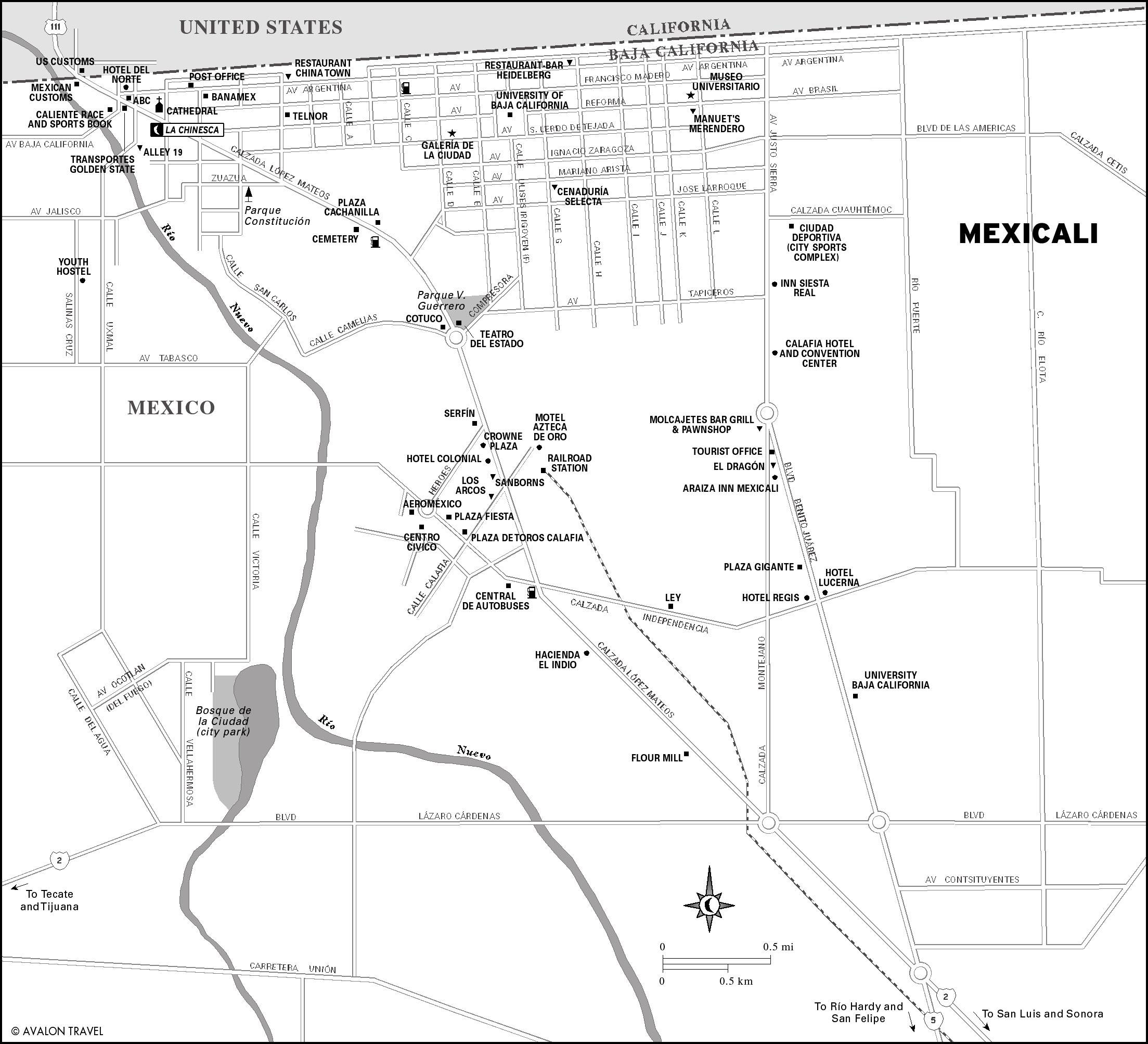
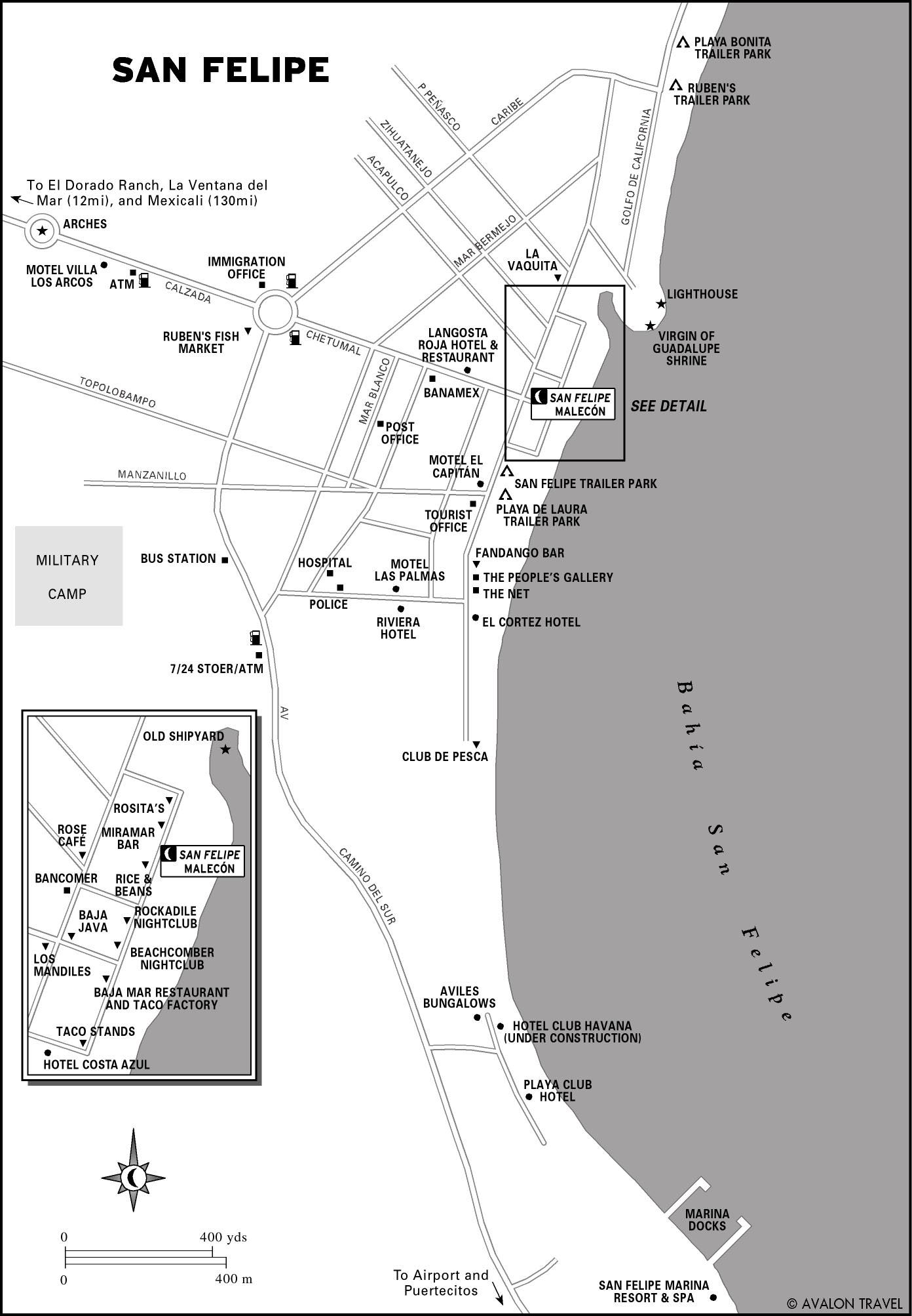
Mexicali to San Felipe
Mexicali is the state capital of Baja California (Norte), a regional center of agricultural commerce, and a supply depot for travelers passing through to points south. Its Chinesca district offers a Mexican twist on Chinese cuisine. Nearby are hot springs in the Cañon de Guadalupe and a sizable expat community in San Felipe on the Sea of Cortez. You can hike among towering cacti in the Valle de los Gigantes or camp on secluded beaches near Puertecitos and Bahía San Luis Gonzaga.
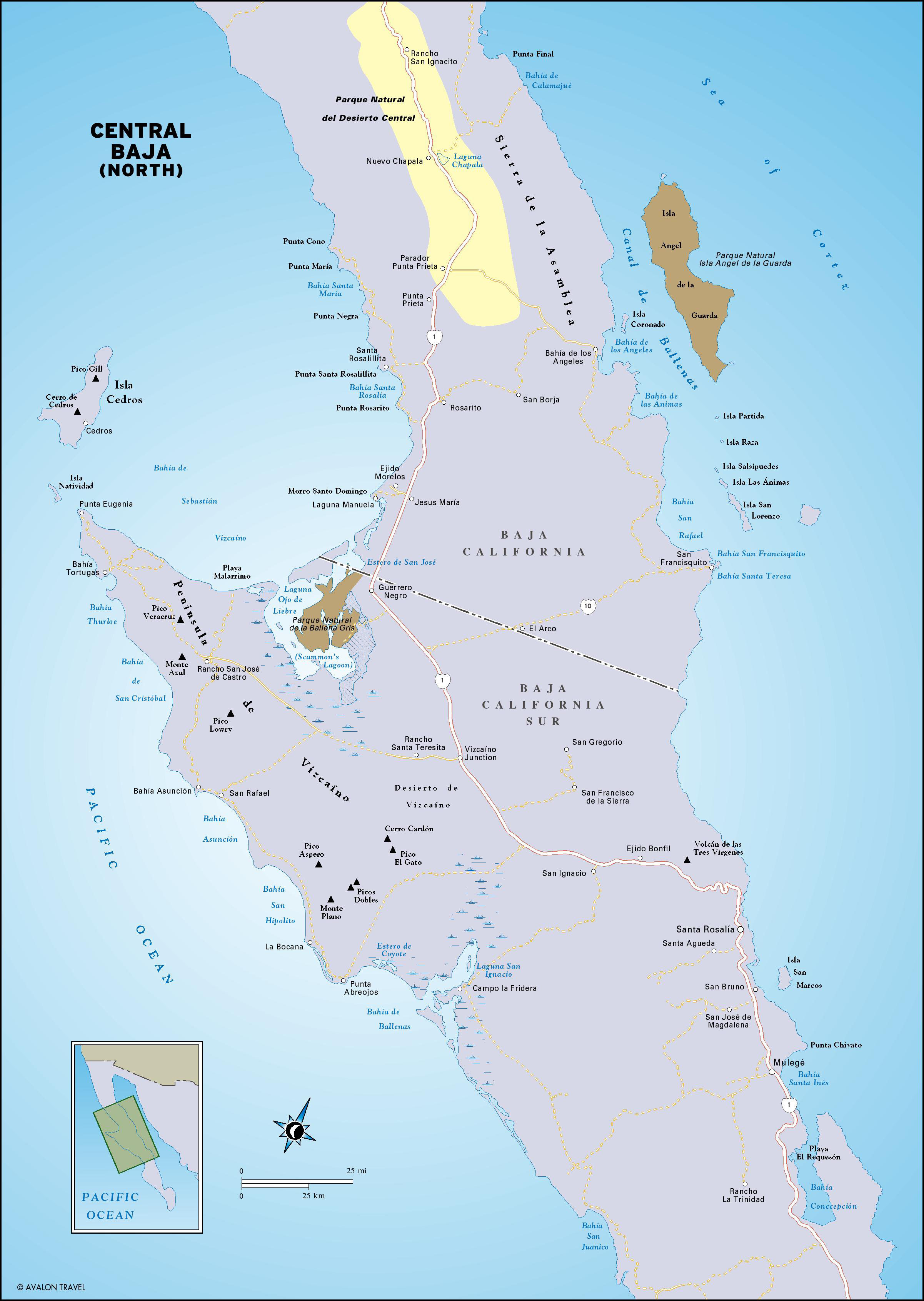
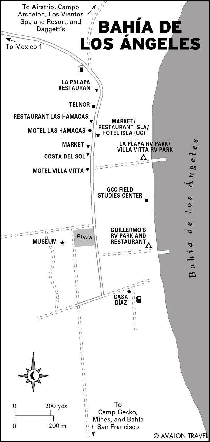
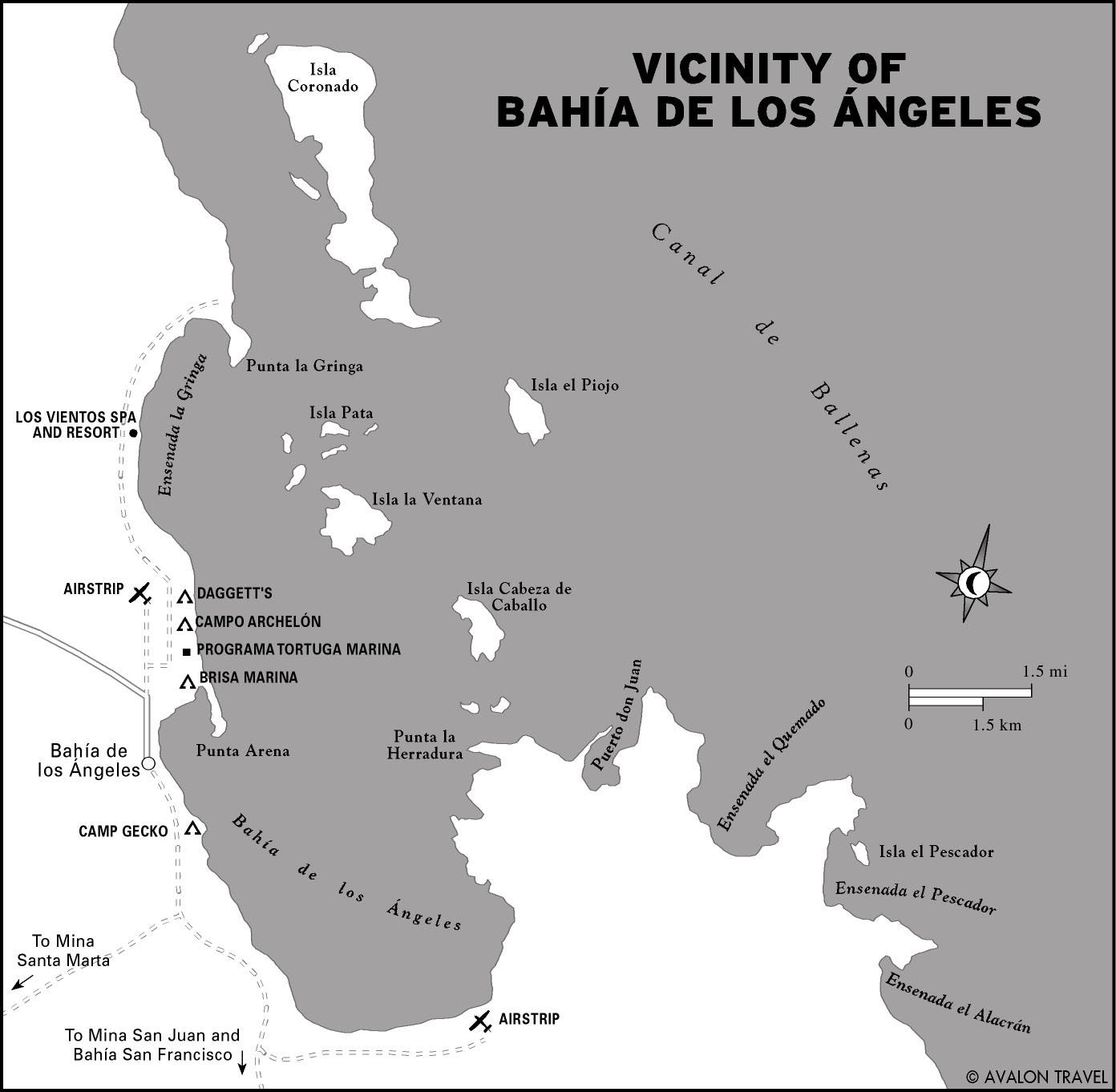
Desierto Central to Bahía de los Angeles
Here begins the quintessential Baja. You’ll drive through miles of undisturbed desert terrain. Stop to stretch your legs in Cataviña and walk among the boulders. Head west to find waves at the Wall or east to explore the timeless fishing outpost of Bahía de los Angeles on the Sea of Cortez.
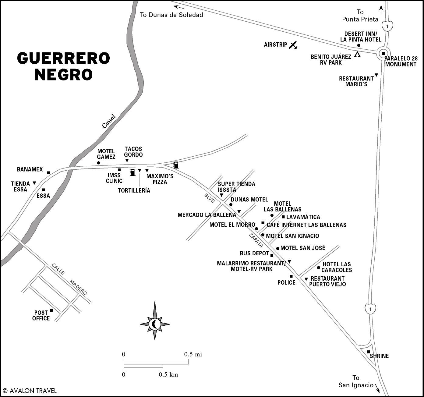
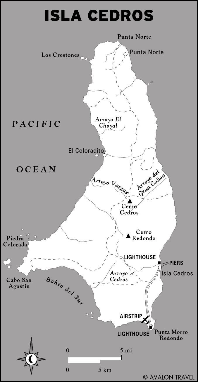
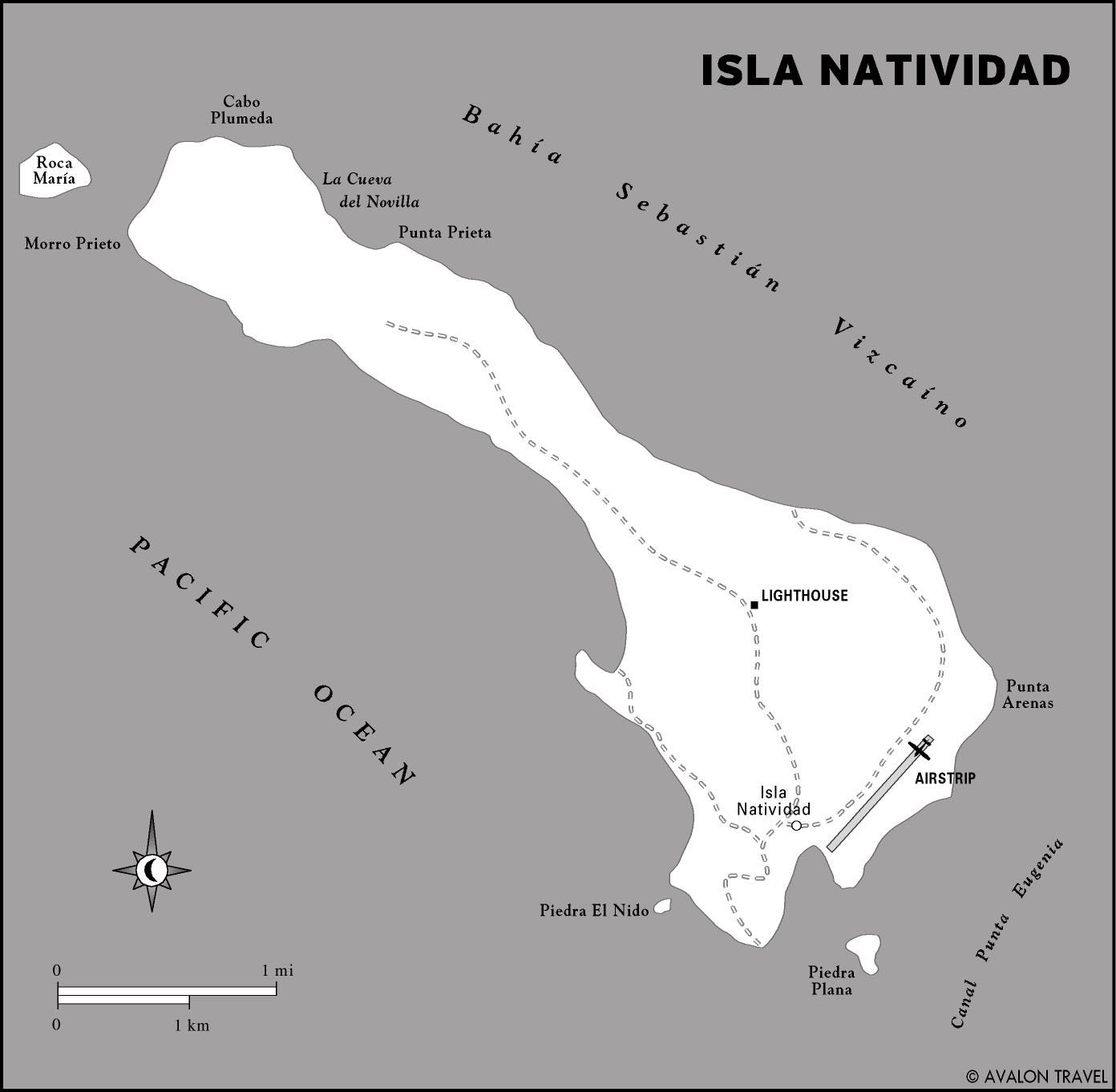
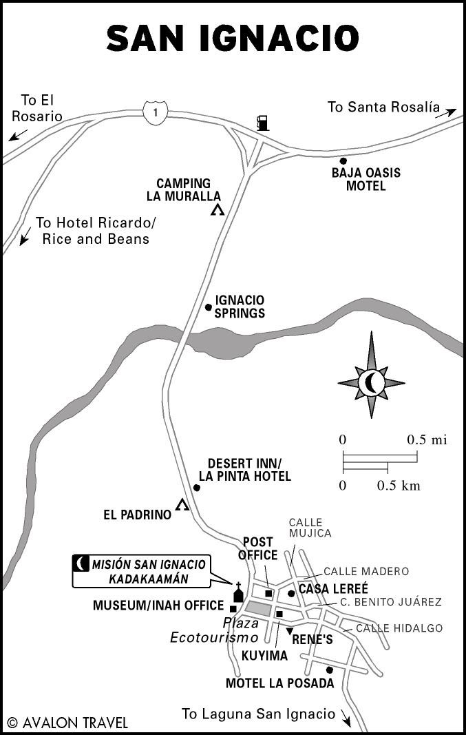
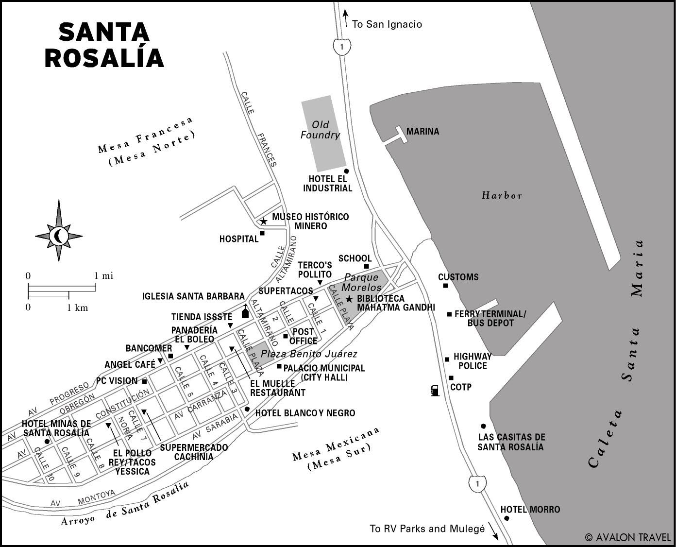
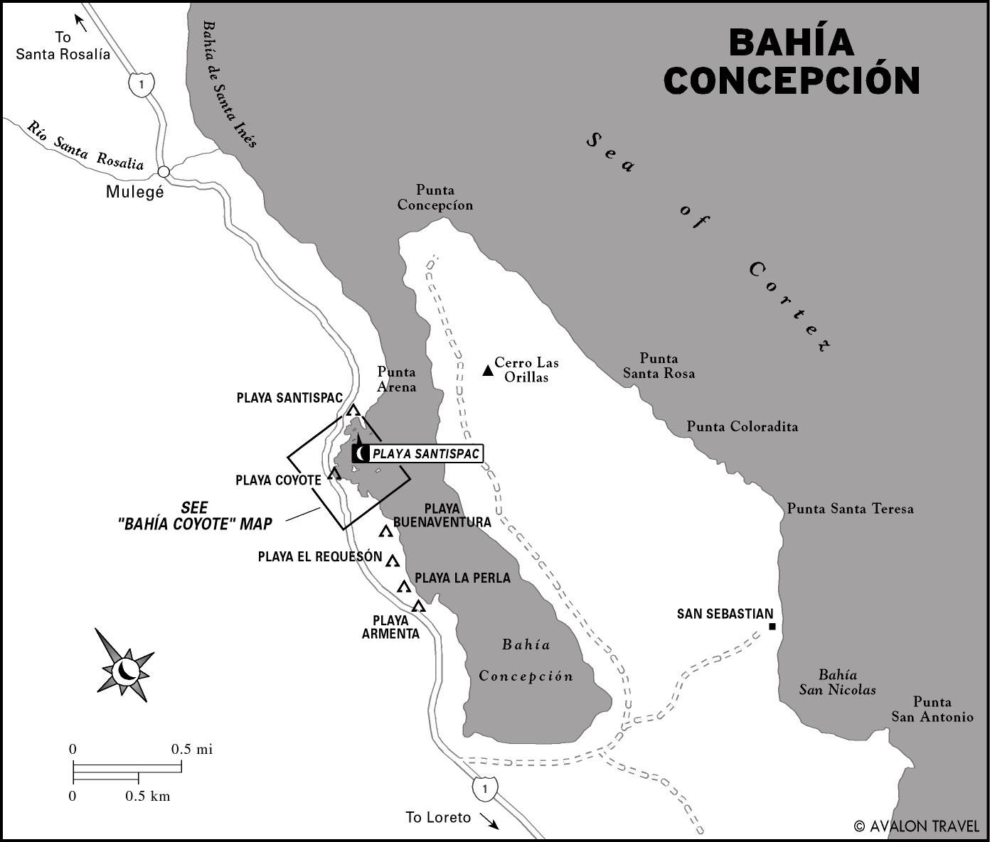
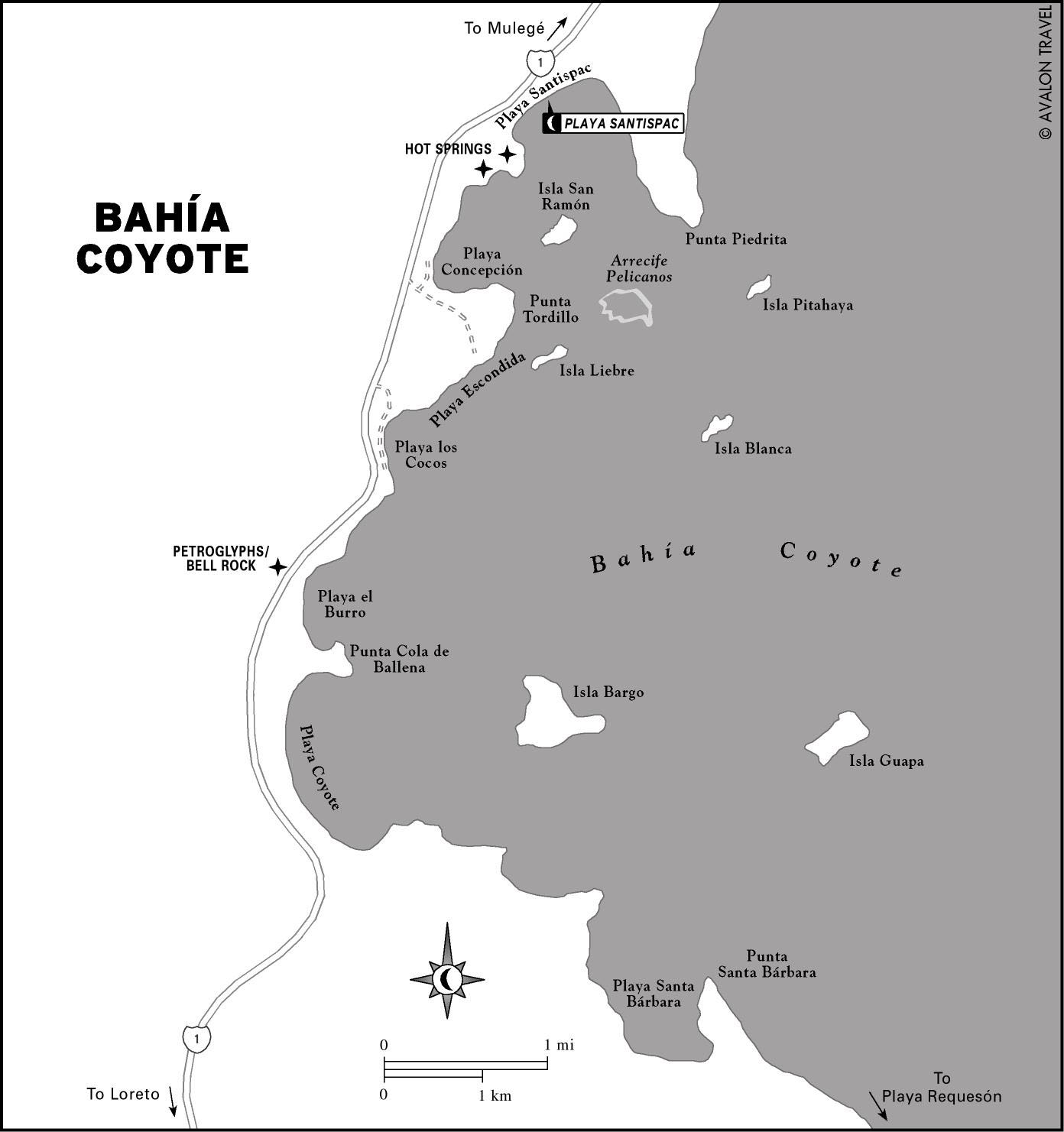
Guerrero Negro to Bahía Concepción
Guerrero Negro marks the state line between Baja California (Norte) and Baja California Sur. From mission towns to mining towns and prehistoric rock art sites, this region is rich with opportunities for cultural exploration. On the Pacific coast are two lagoons where gray whales come to bear their calves. On the Gulf coast, the shallow bays of Bahía Concepción are ideal for paddling, snorkeling, and cruising.
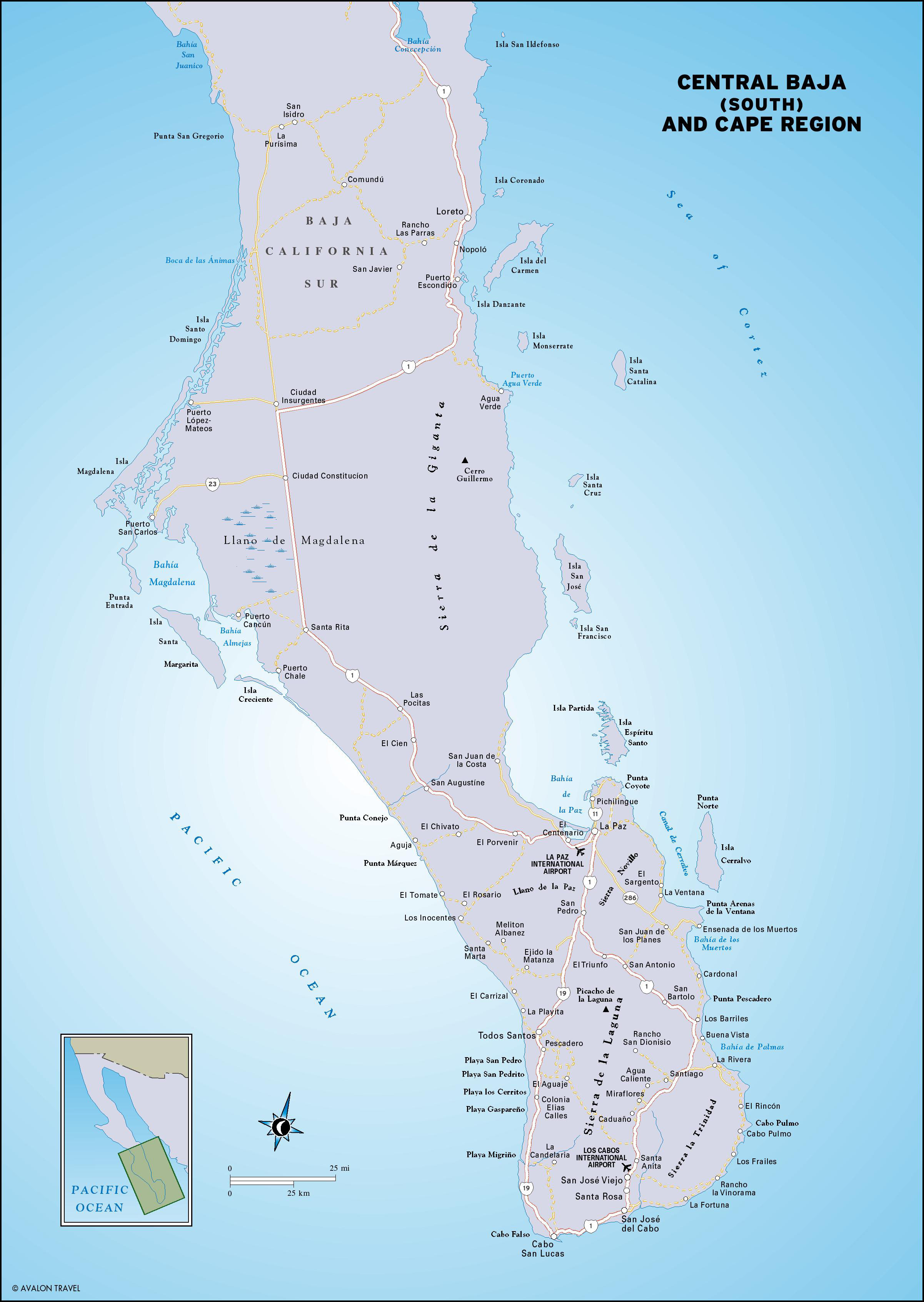
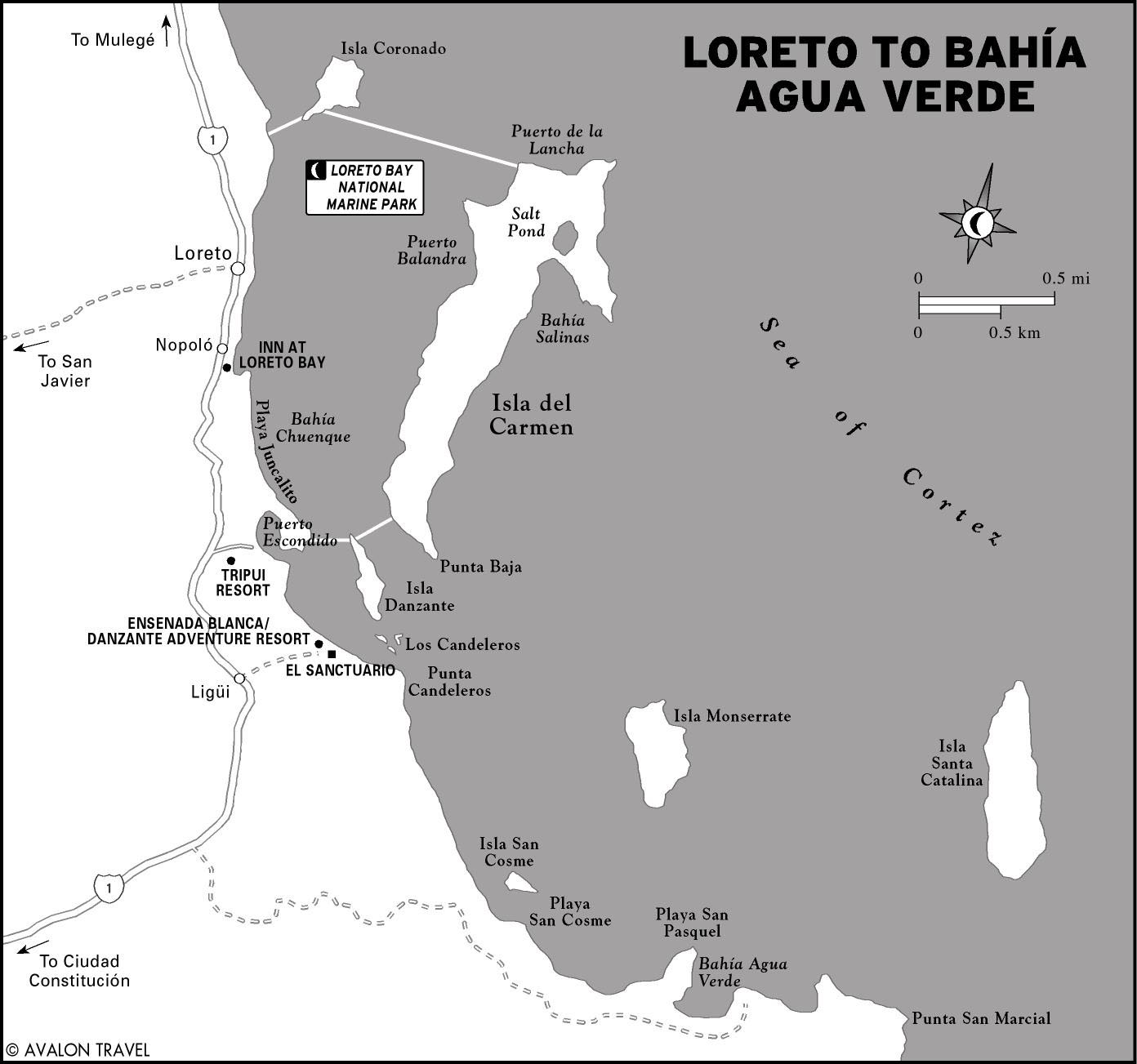
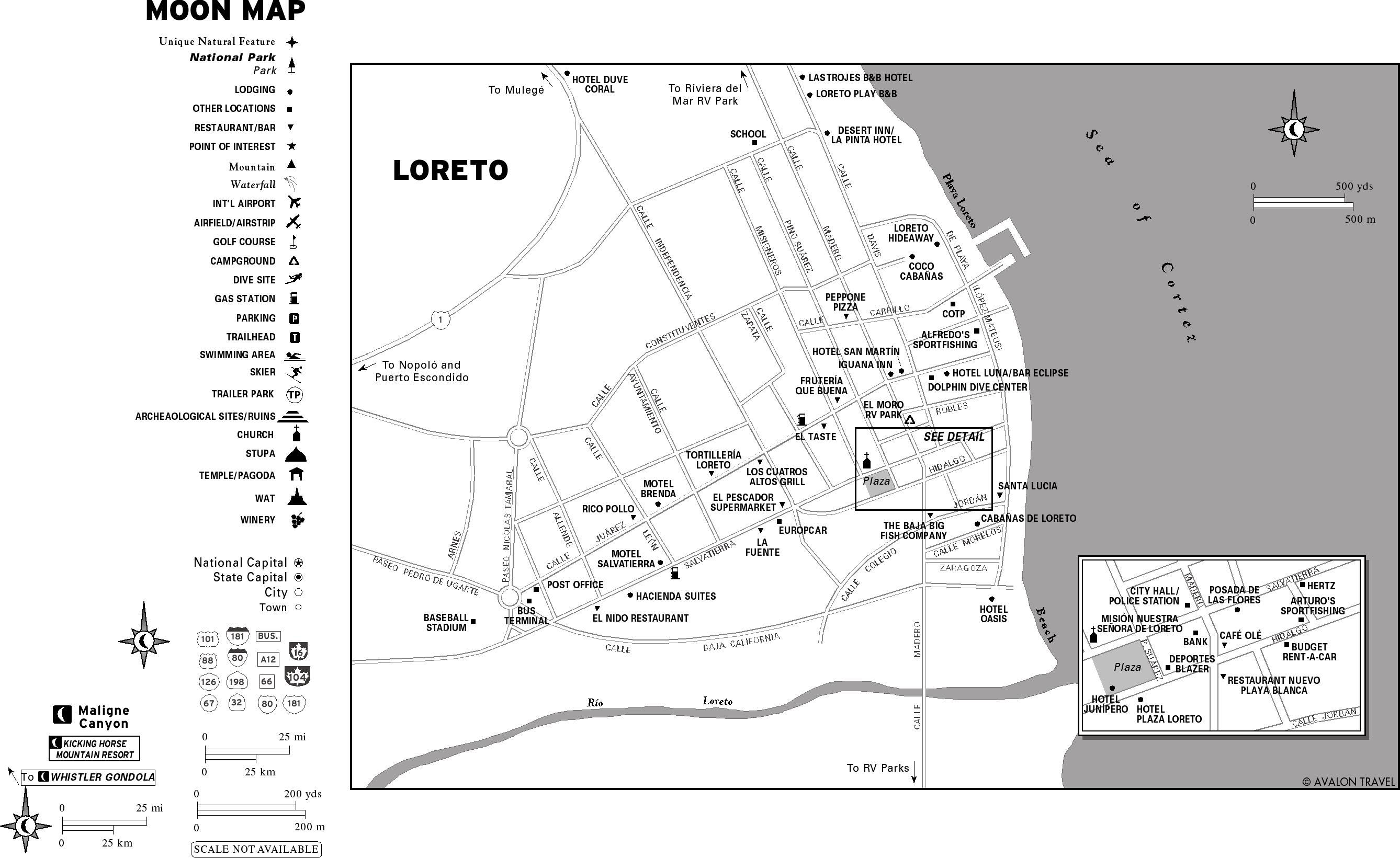
Loreto and Bahía Magdalena
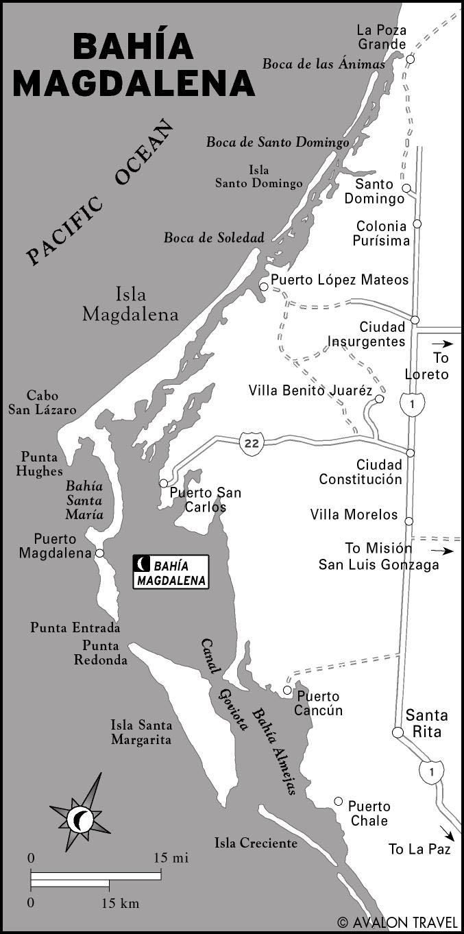
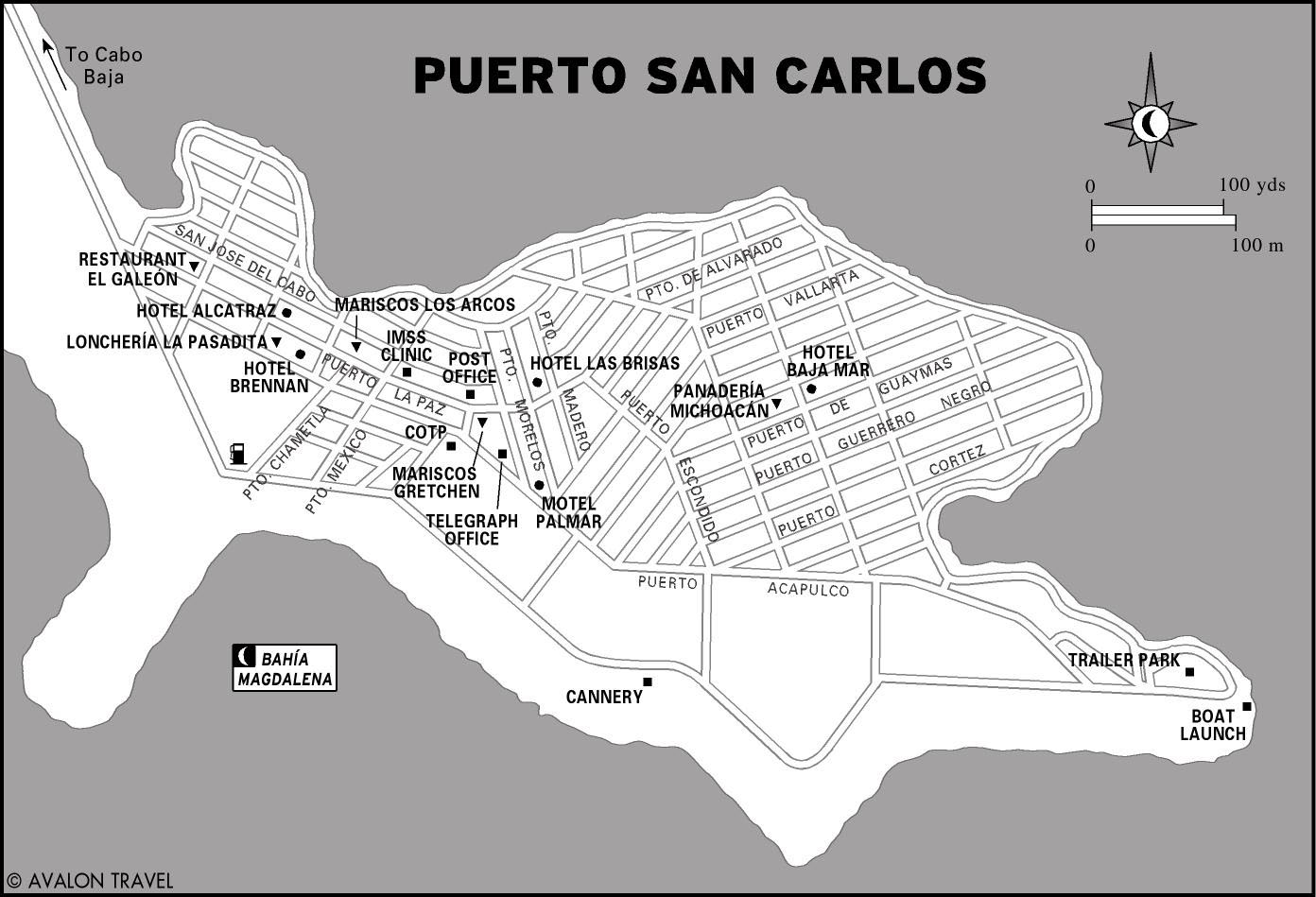
The site of the first permanent Jesuit mission, Loreto has a deep-rooted history. Today it is becoming a government-sponsored tourist corridor that entertains visitors with full-service resorts, sportfishing charters, and a national marine park. Nearby, San Javier gives a taste of life in the isolated interior. Across the peninsula, on the Pacific, gray whales congregate in Bahía Magdalena during the winter months.
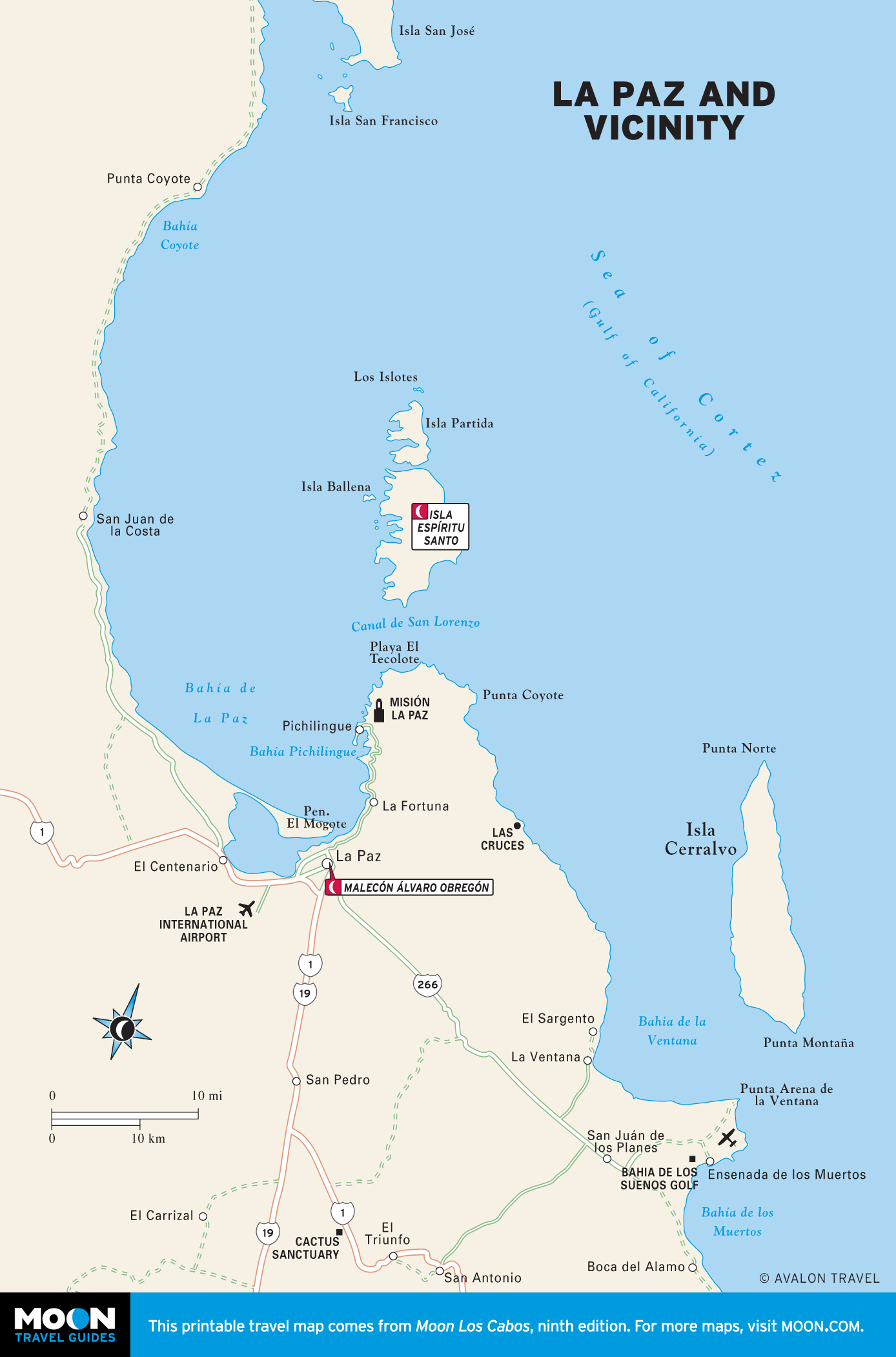
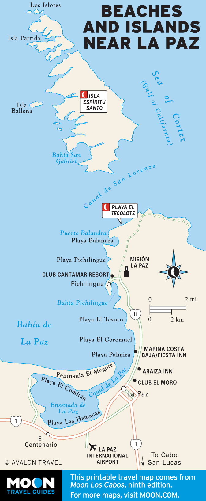
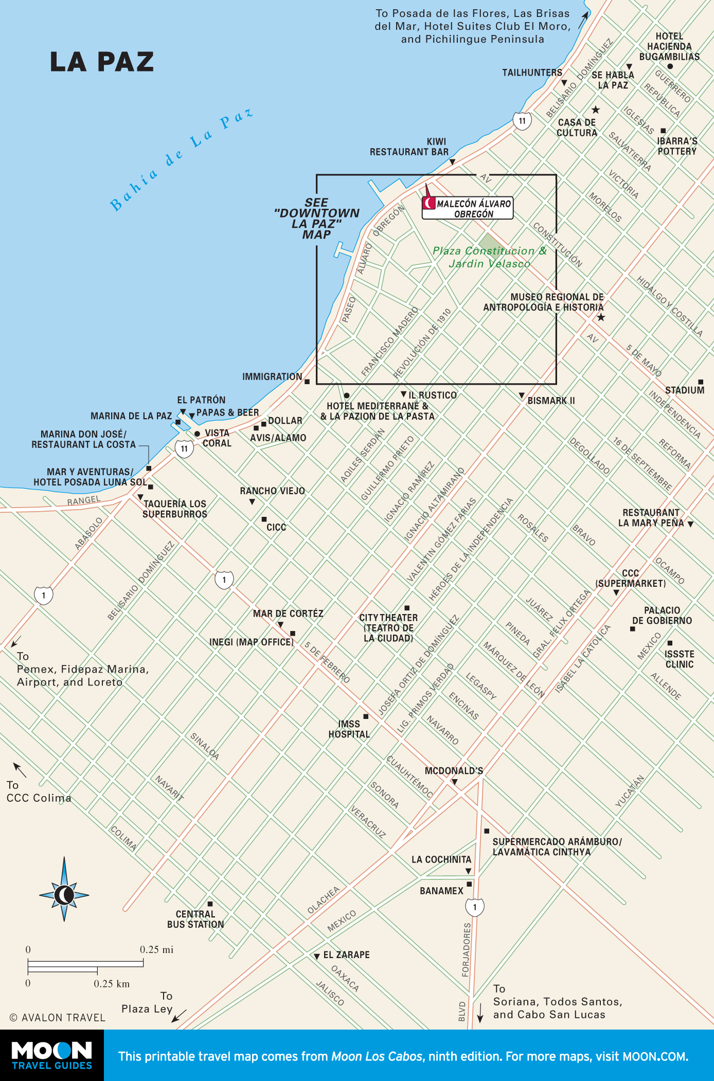
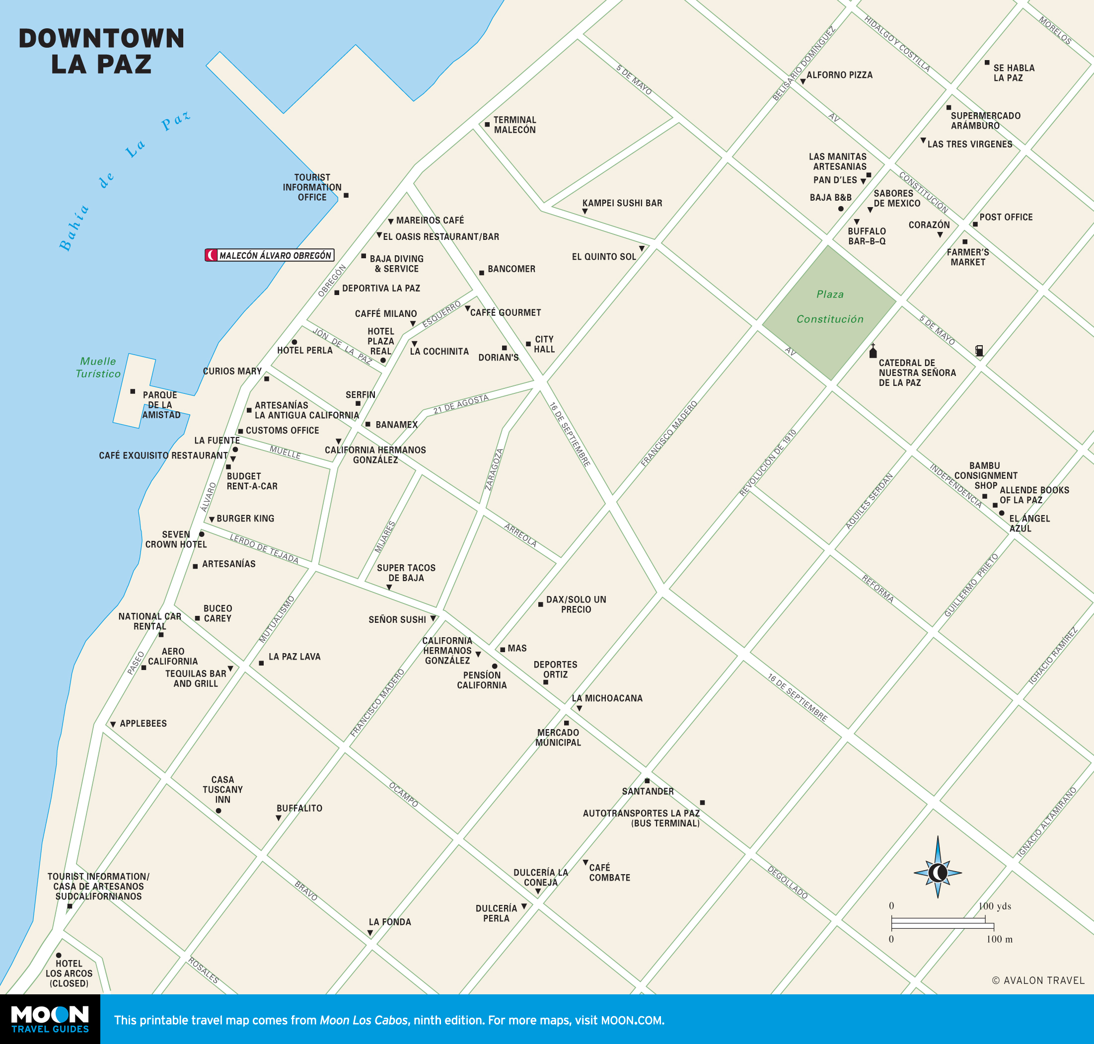
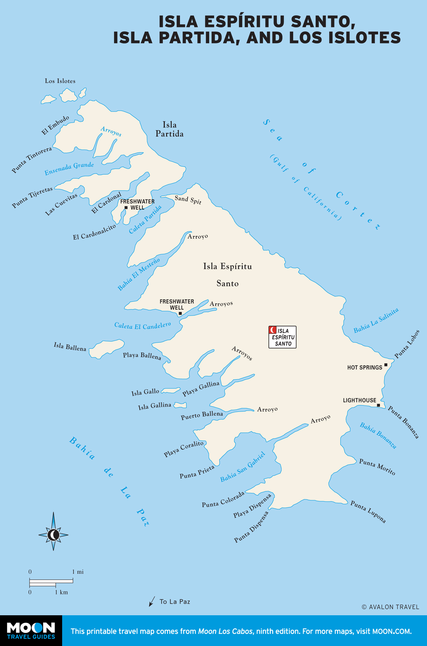
La Paz and Vicinity
Known for its beautiful sunsets and lively malecón scene, La Paz is an authentic Mexican city with a strong mainland influence. White-sand beaches along the Pichilingue Peninsula invite relaxation, while isla Espíritu Santo and other protected islands offshore support a rare and fragile ecosystem.
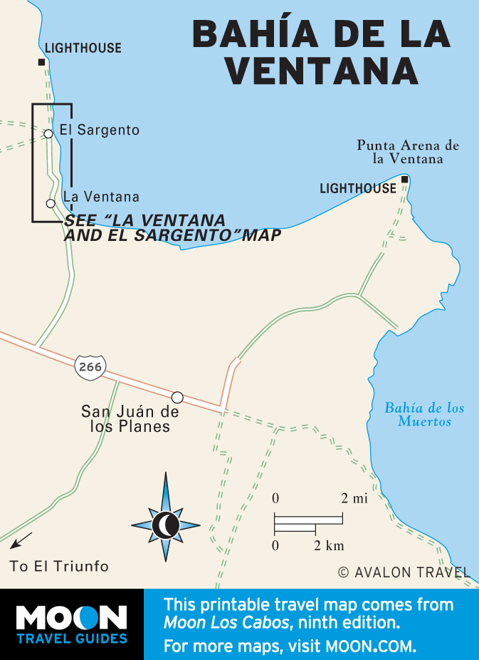
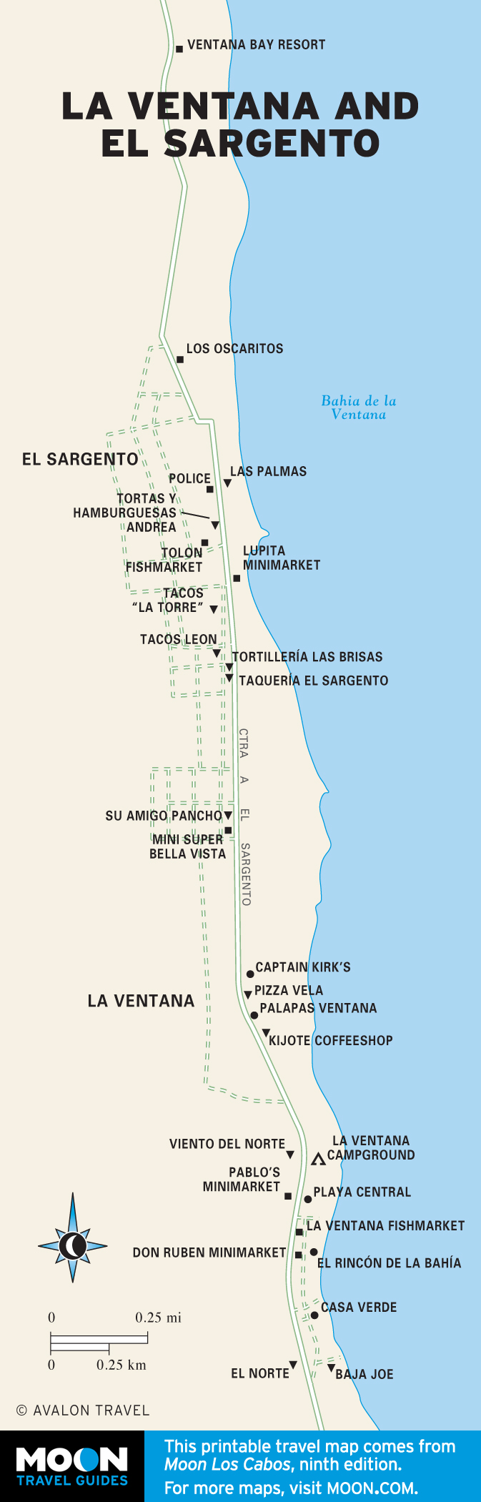
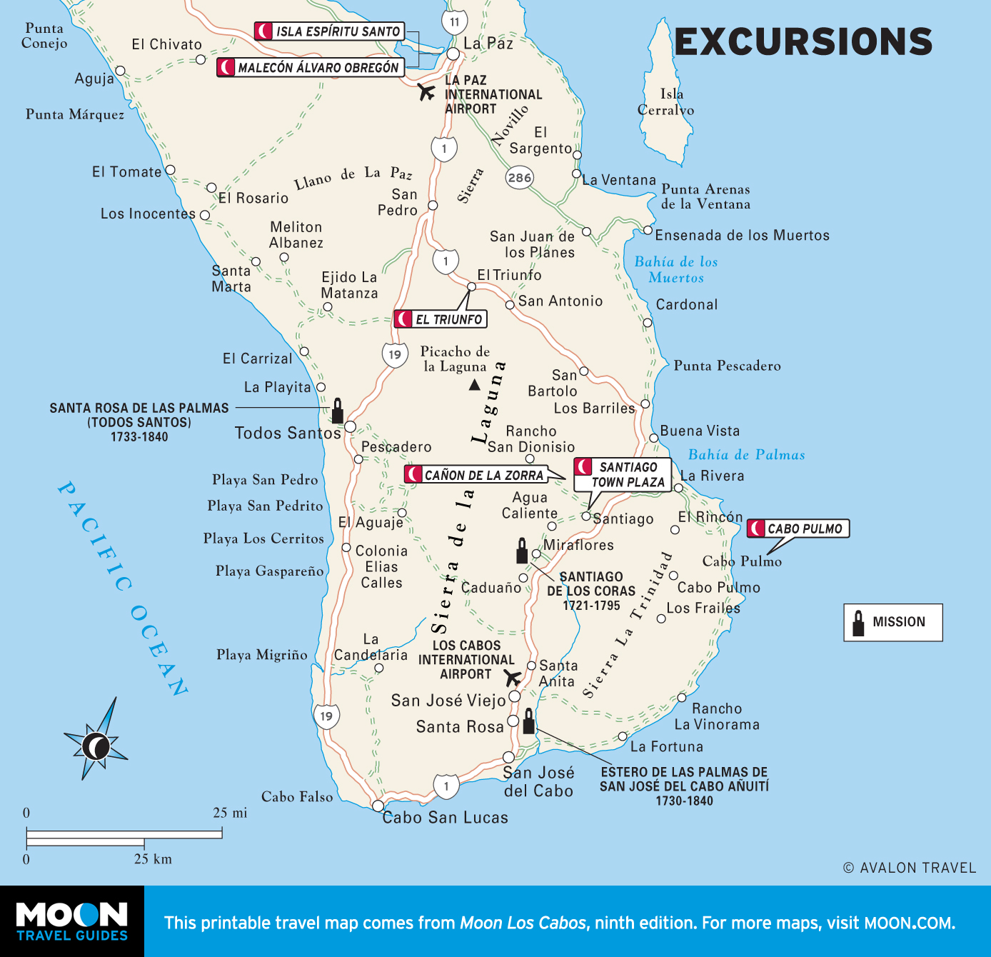
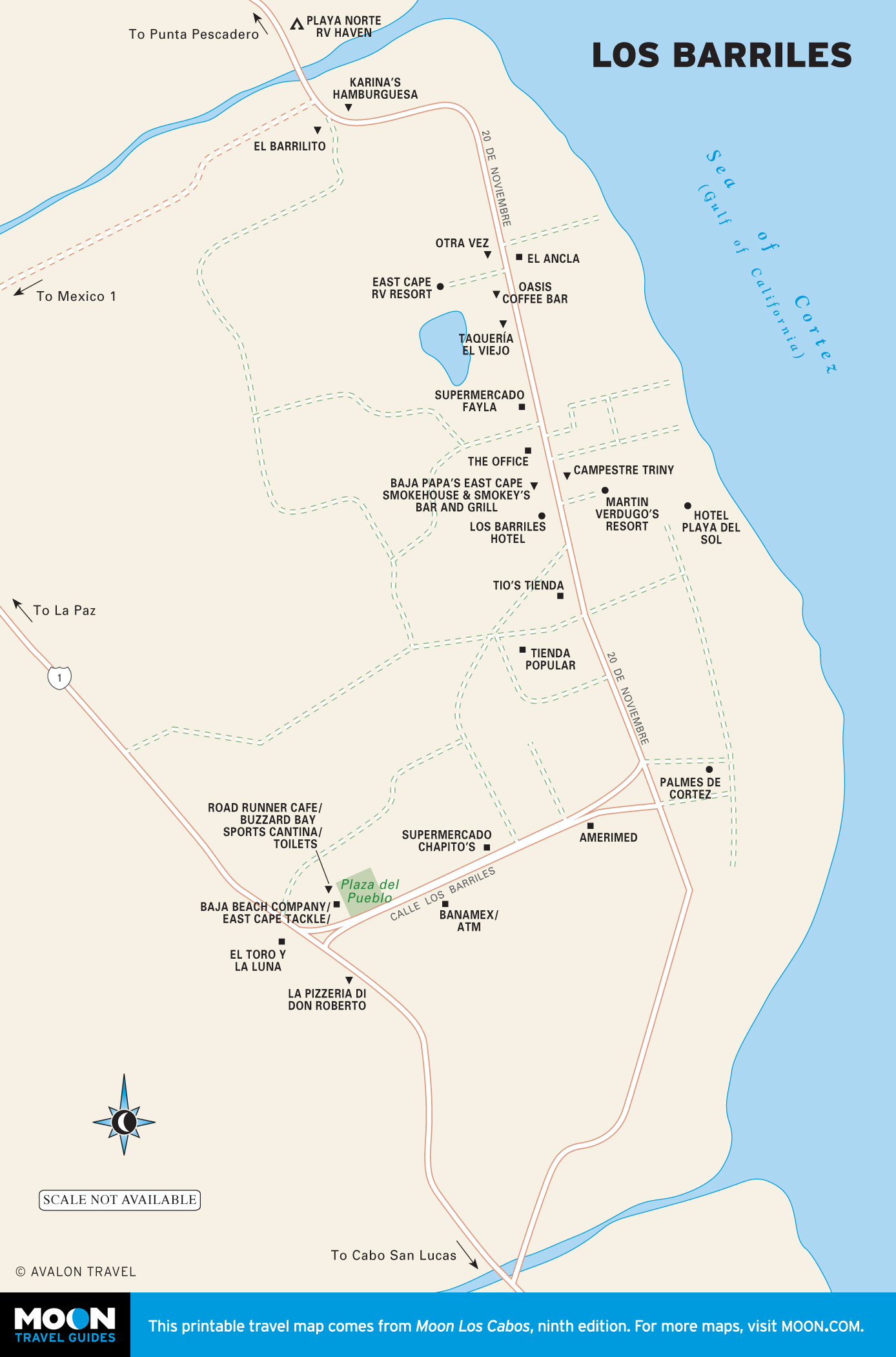
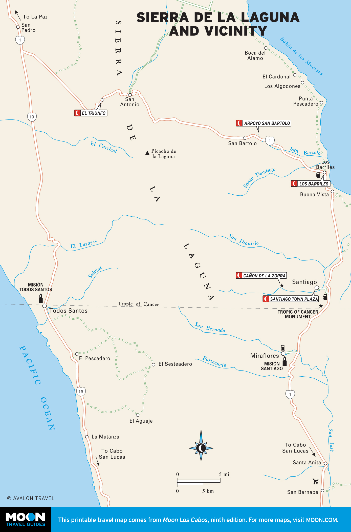
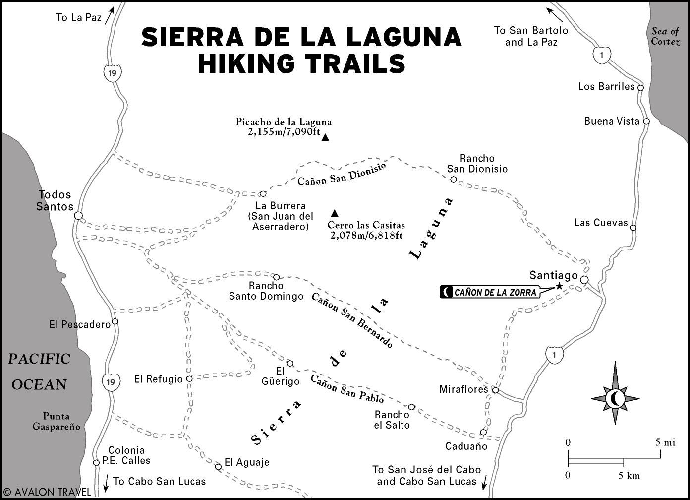
The East Cape and The Sierra de la Laguna
Travelers with a passion for water sports and a willingness to rough it will find paradise along the Gulf coast. This is a place of solar power, dirt roads, panga boats, and palapa restaurants. The Sea of Cortez offers secluded beaches, steady winter winds, abundant game fish, a living coral reef, and 30-meter visibility underwater in summer. Inland, the Sierra de la Laguna attracts hikers and horseback riders with cascading waterfalls and 2,100- meter peaks.

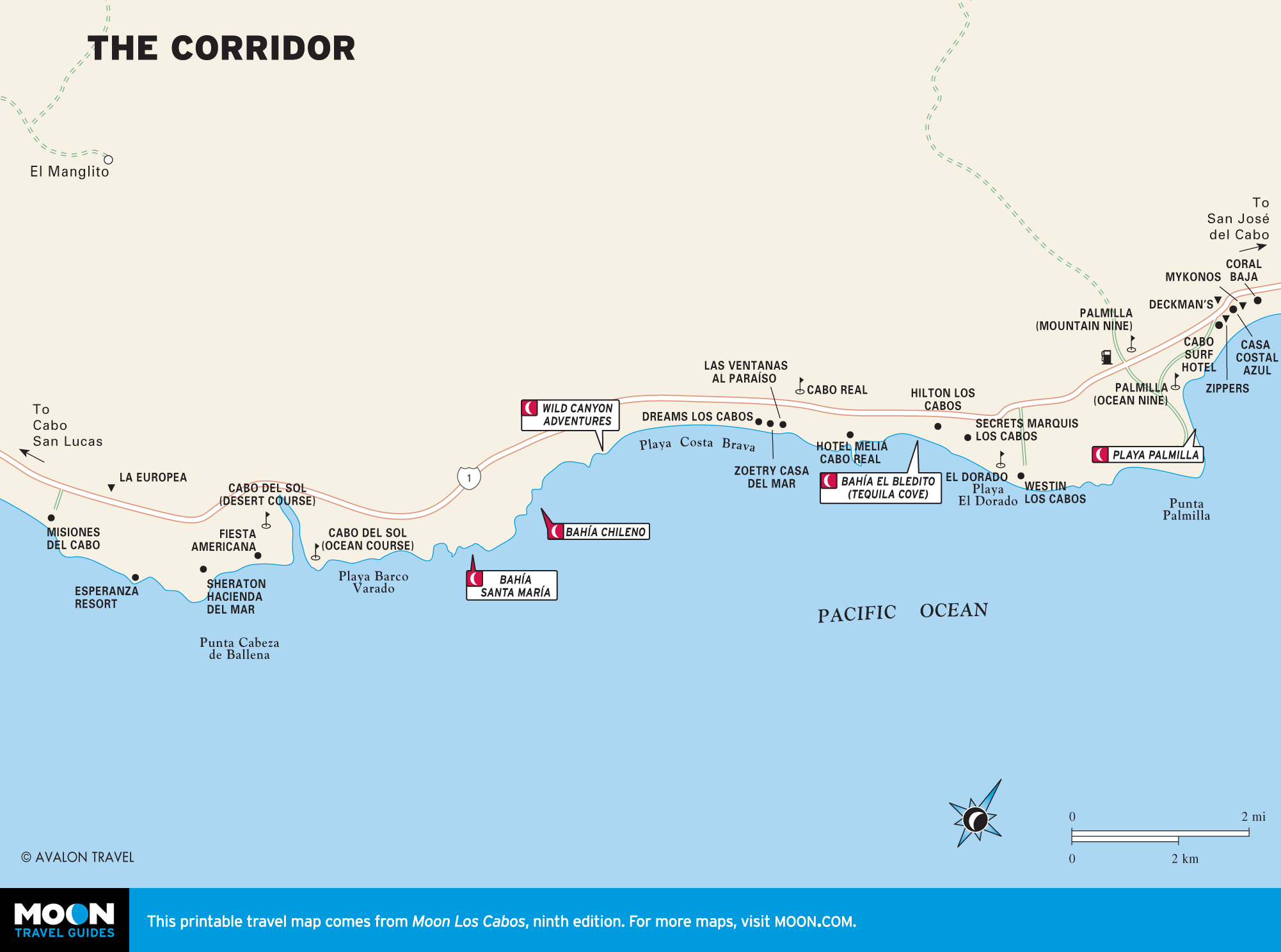
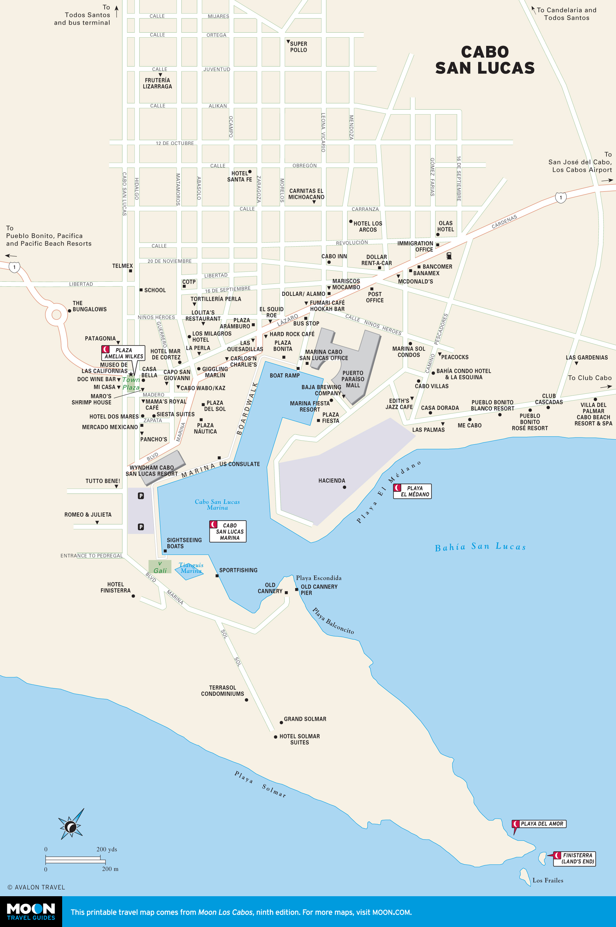
Cabo San Lucas, San José del Cabo, and the Corridor
Once just a quiet fishing village at the tip of Baja California, Los Cabos today encompasses two cape towns and a tourist corridor all wrapped up into one destination.
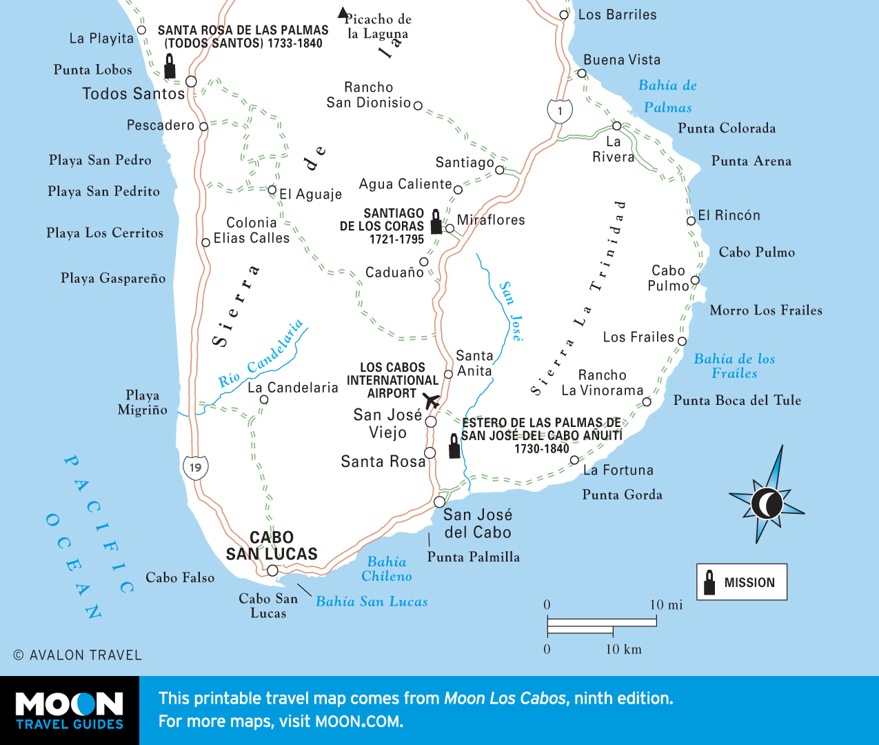
The West Cape and Todos Santos
Along the Pacific coast, a rugged shoreline extends from Cabo San Lucas north to the growing artist community of Todos Santos. The West Cape remains the least-developed stretch of coastline on either side of the peninsula south of La Paz.