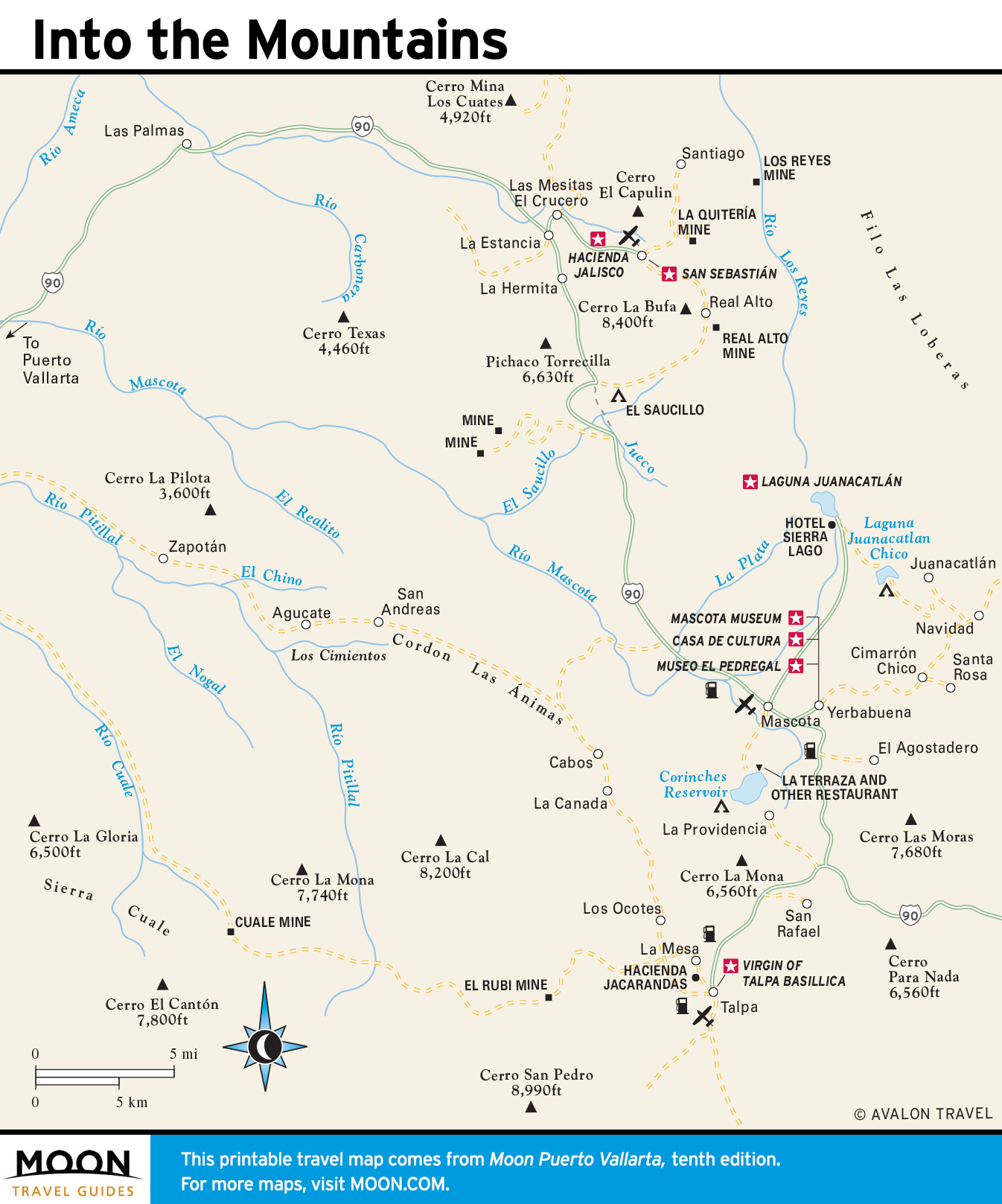
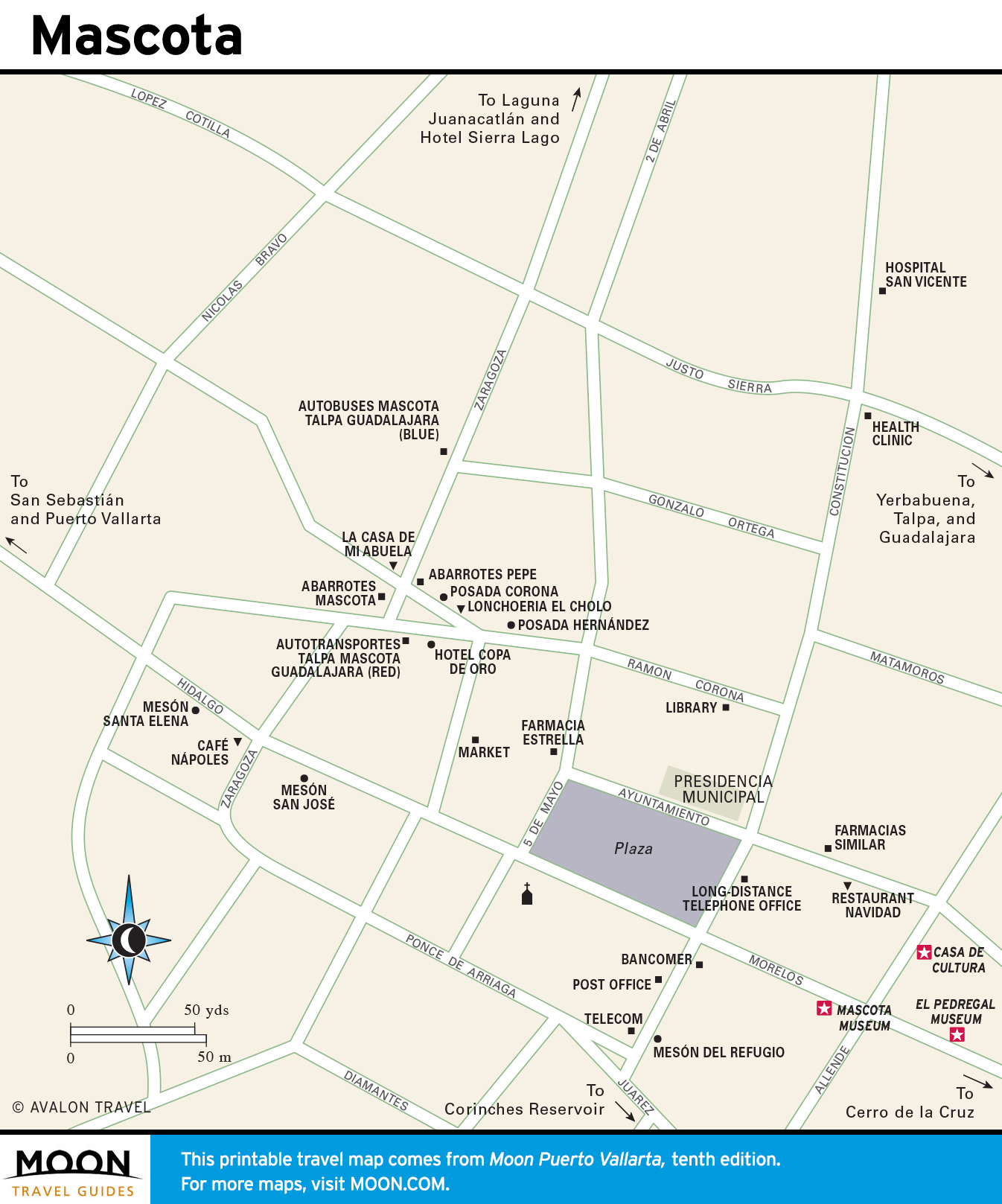
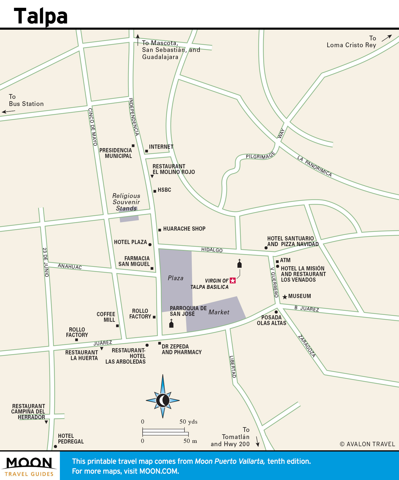
Puerto Vallarta
These free, printable travel maps of Puerto Vallarta are divided into four regions:
- Puerto Vallarta
- Around the Bay of Banderas
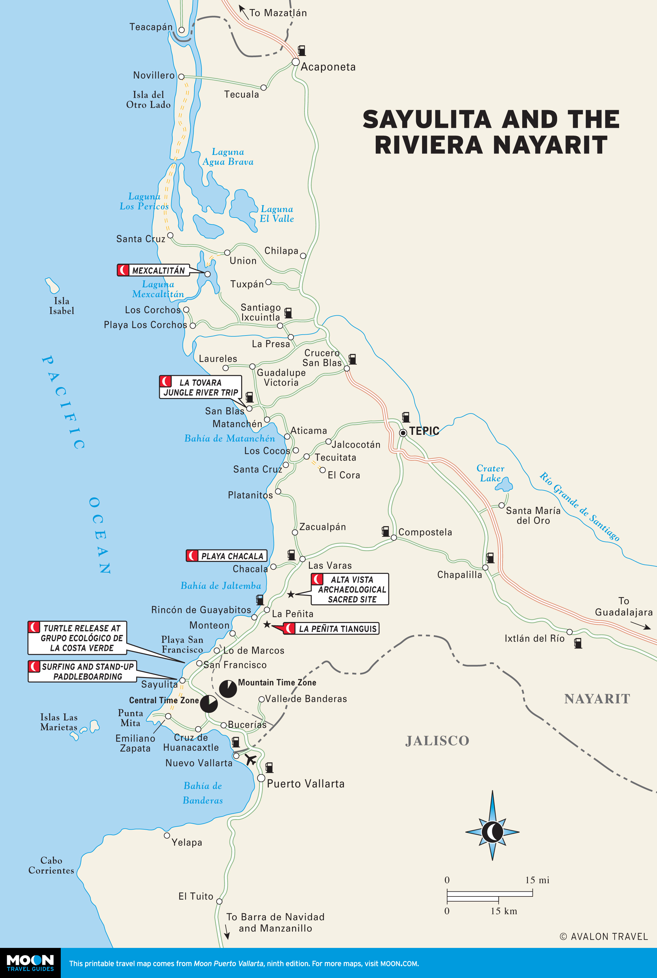
- Sayulita and the Riviera Nayarit
- Barra de Navidad and the Jalisco Coast
Explore Puerto Vallarta with these helpful travel maps. Ensure you have the newest travel maps from Moon by ordering the most recent edition of our travel guide to Puerto Vallarta.
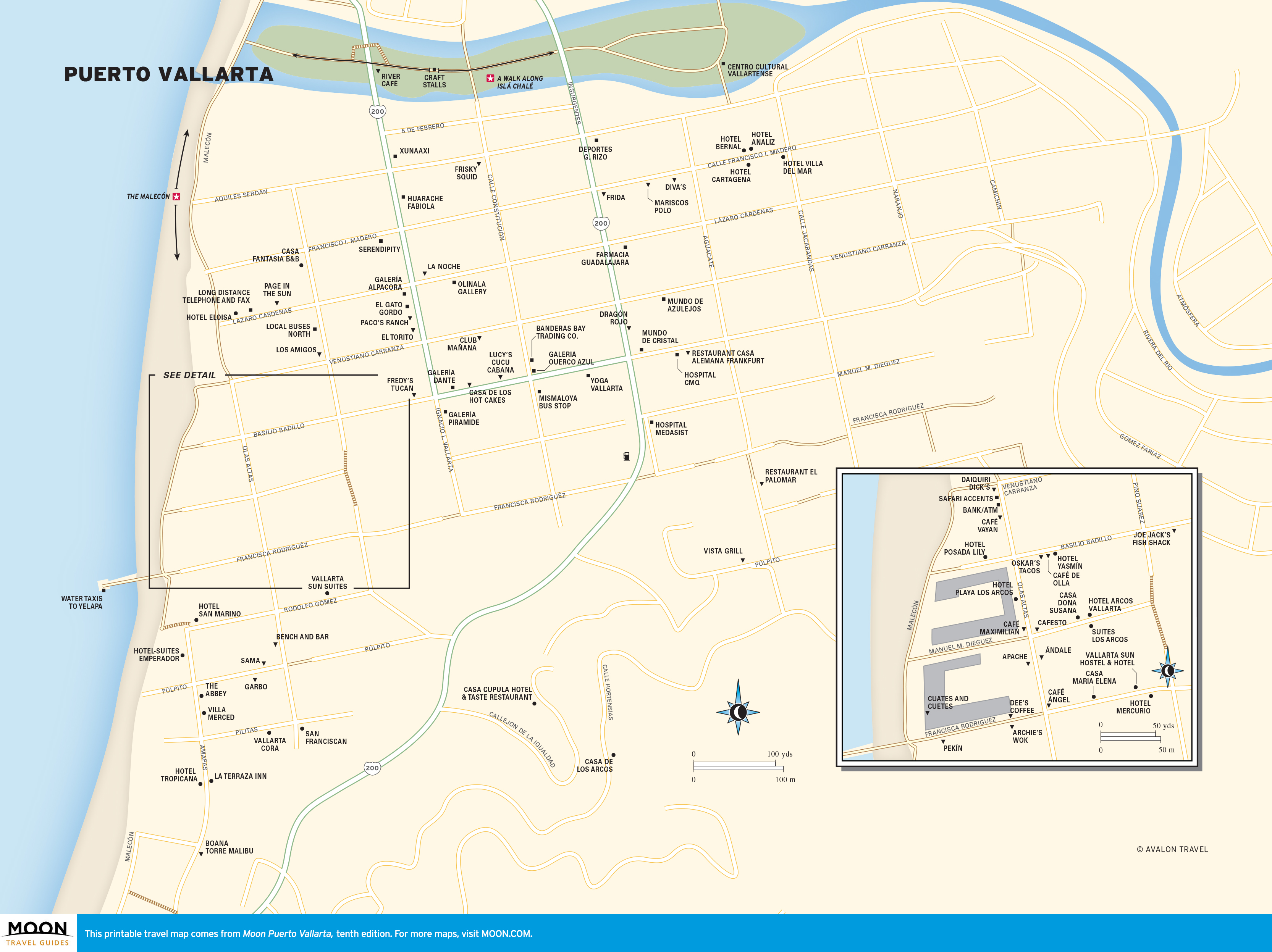
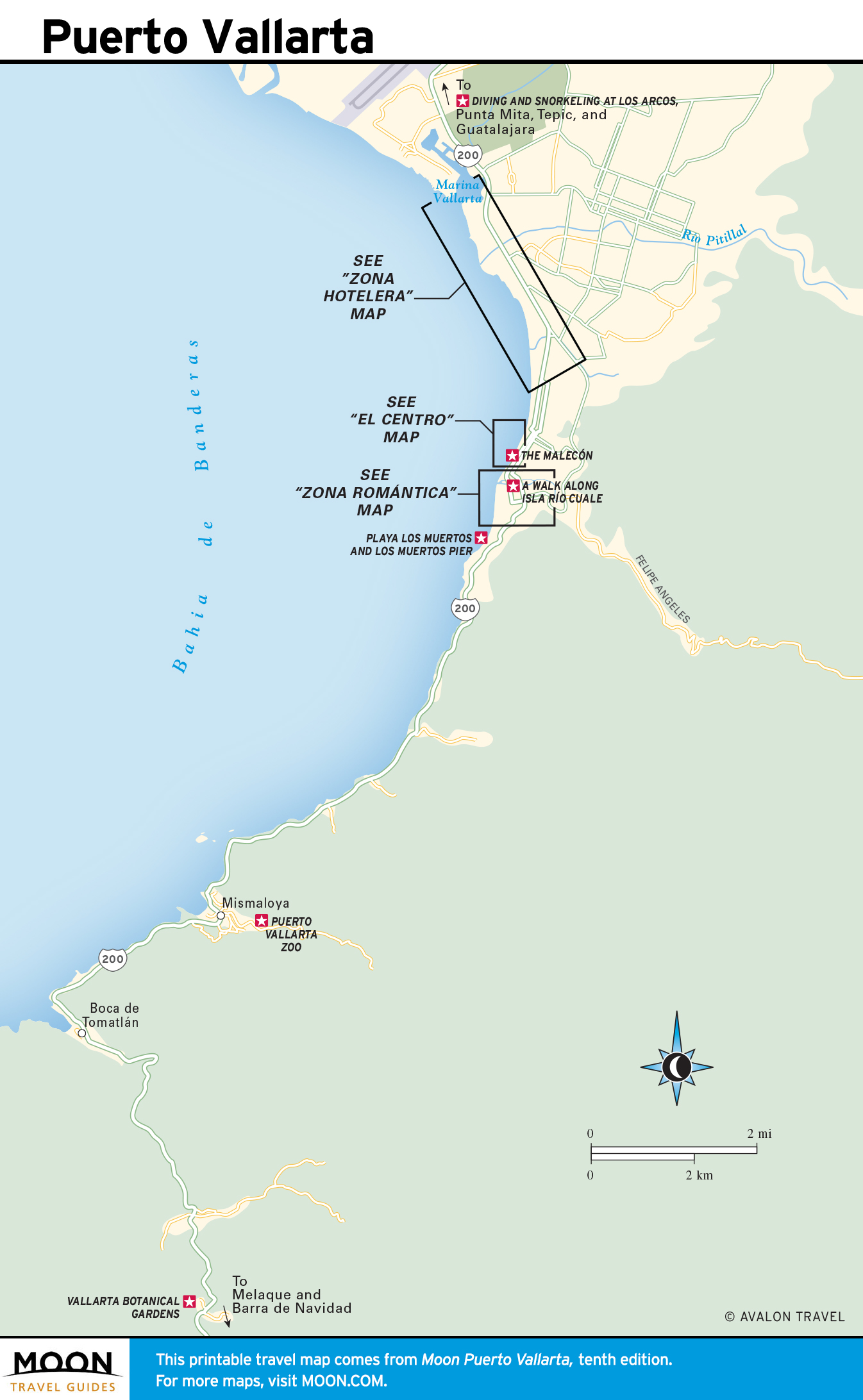
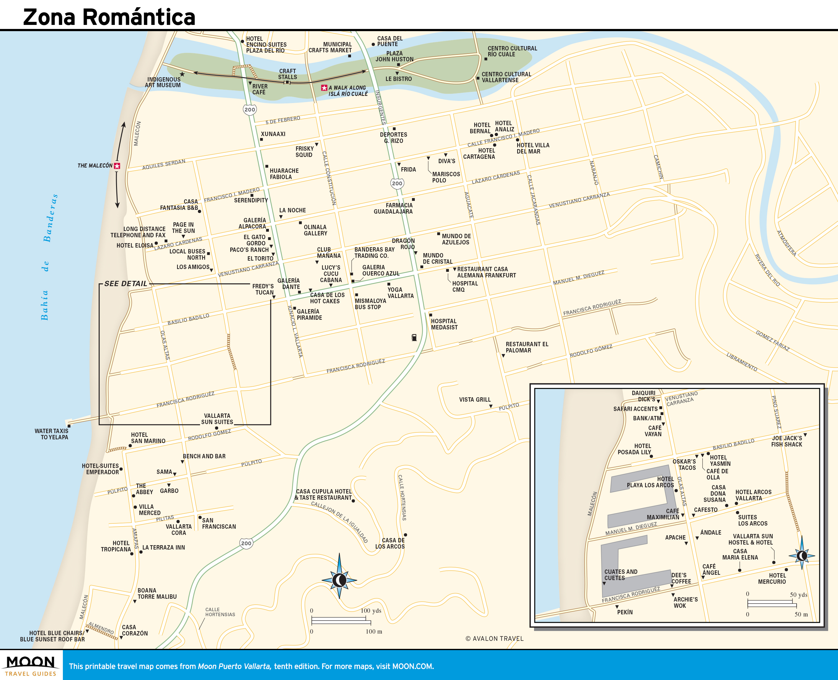
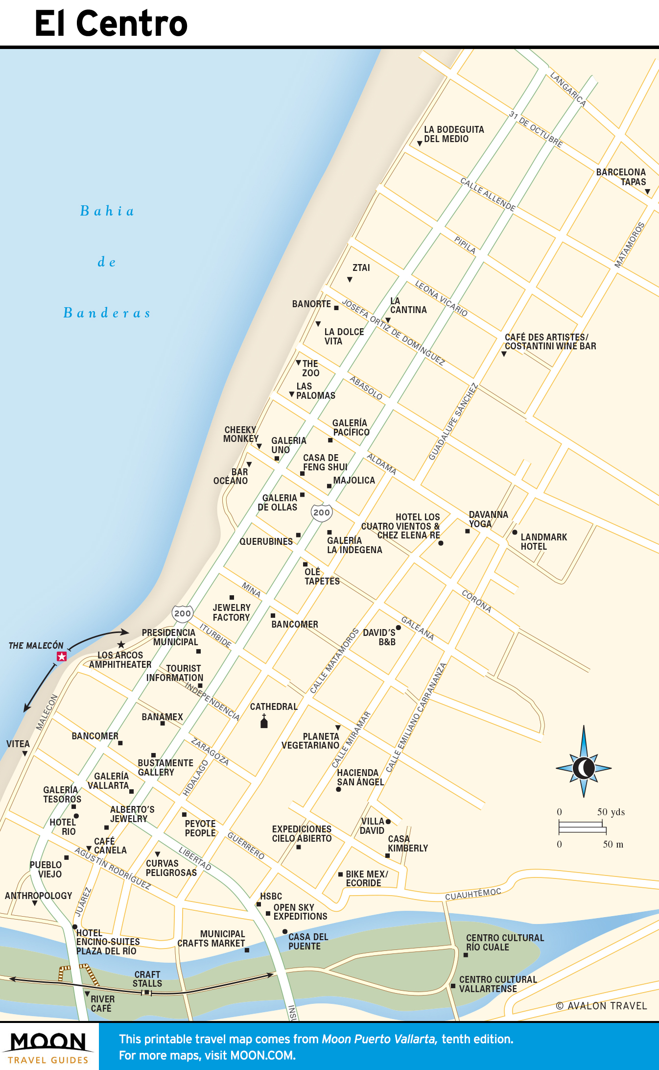
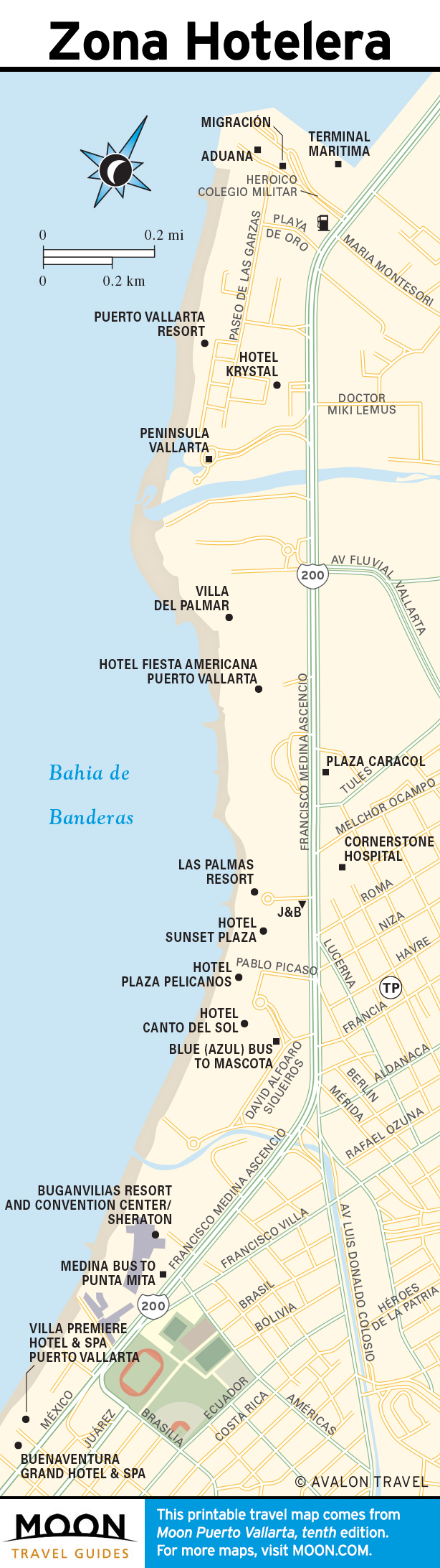
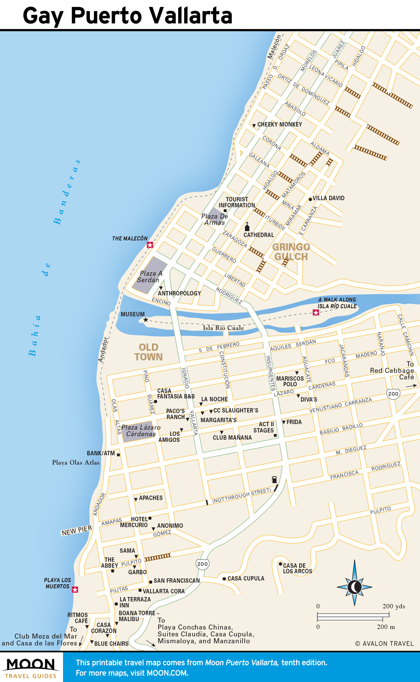
Puerto Vallarta
Puerto Vallarta is divided north and south by the gentle, vine-swathed Río Cuale, rippling down from its foothill canyon. The original town north and south of the river retains much of its charm, especially south of the river in the Old Town or Zona Romántica and the adjacent Playa los Muertos. In spite of a squadron of massively overbuilt hotels and apartment buildings, the appeal continues to the south, along the villa-decorated Conchas Chinas headland, past the village of Mismaloya and the nearby offshore Los Arcos underwater sanctuary, and farther south, to petite Boca de Tomatlán shoreline village.
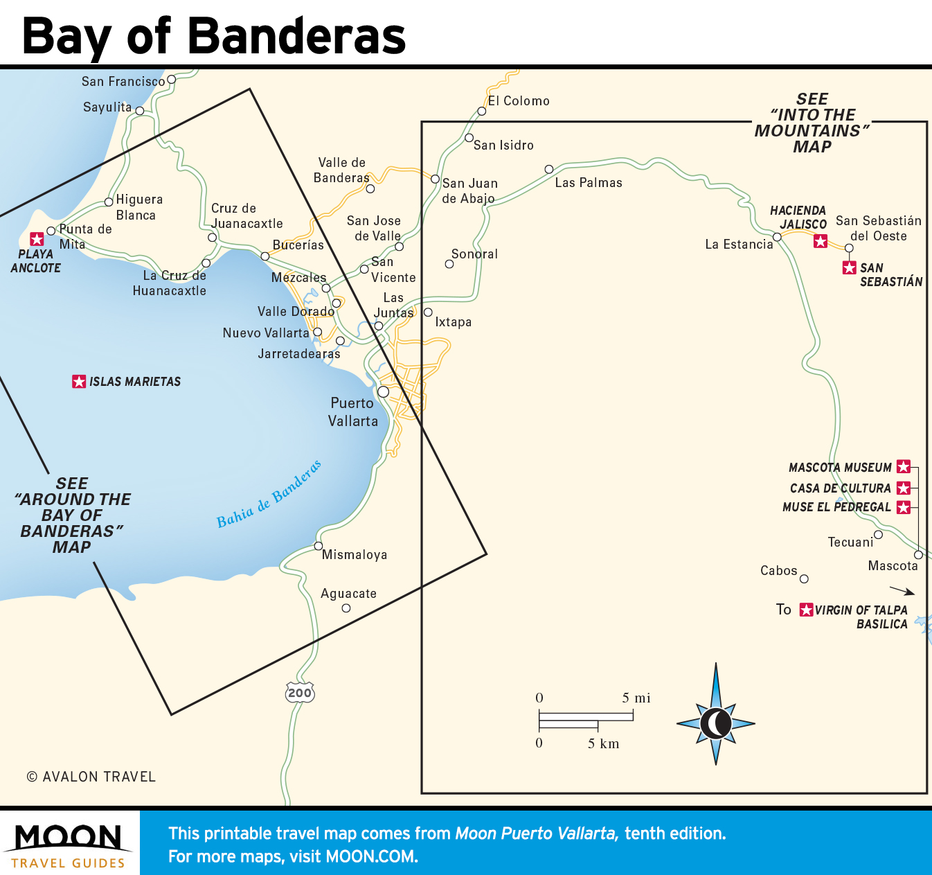
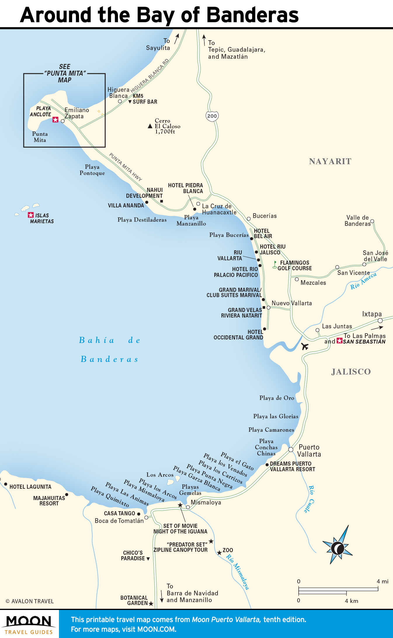
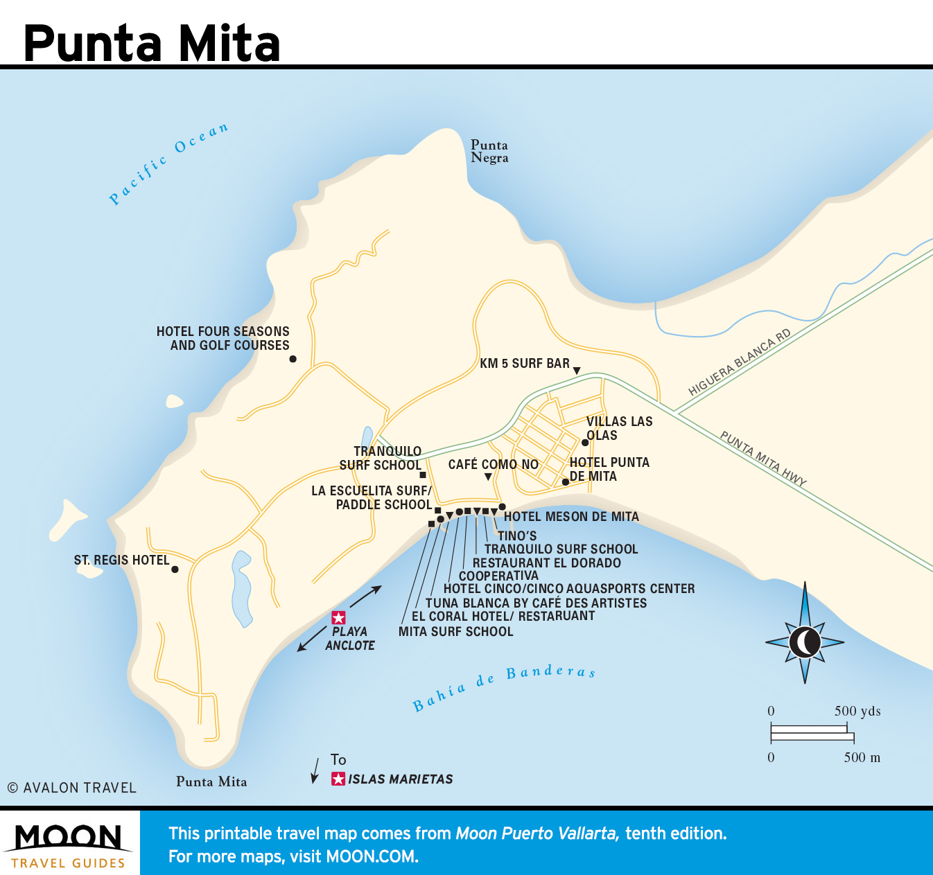
Around the Bay of Banderas
There are many wonderful things to do and see around the Bay of Banderas. Bucerías lies along the northern shoreline, followed by an abundance of lovely beaches climaxing at Punta Mita and coral-strewn Playa Anclote, great places for sunbathing, surfing, and snorkeling. Excursions to wildlife-rich offshore Islas Marietas are a popular adventure as well.
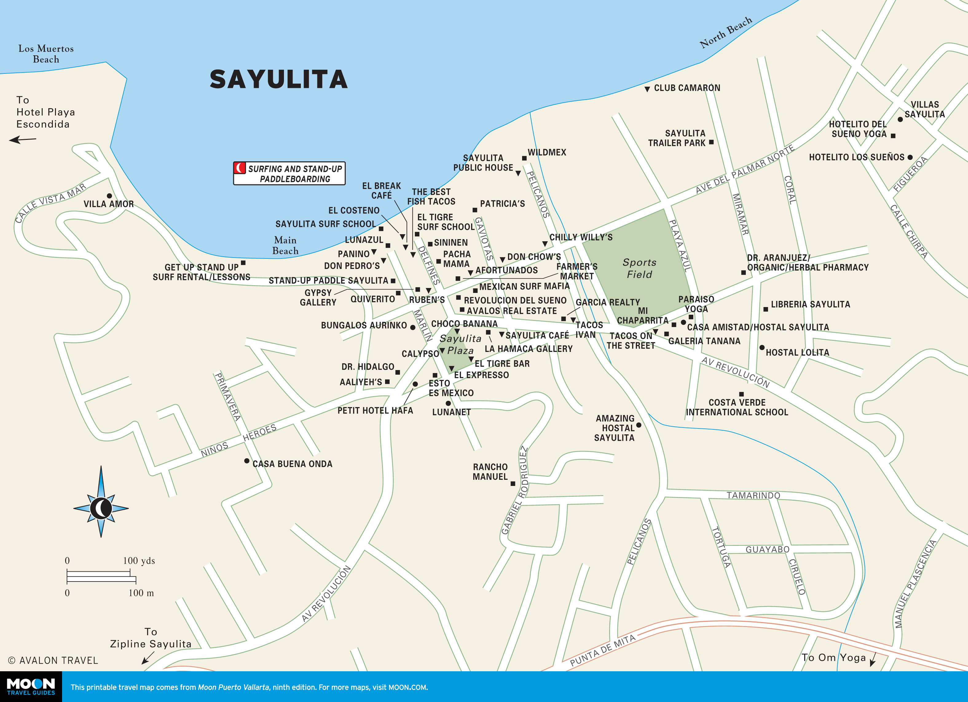
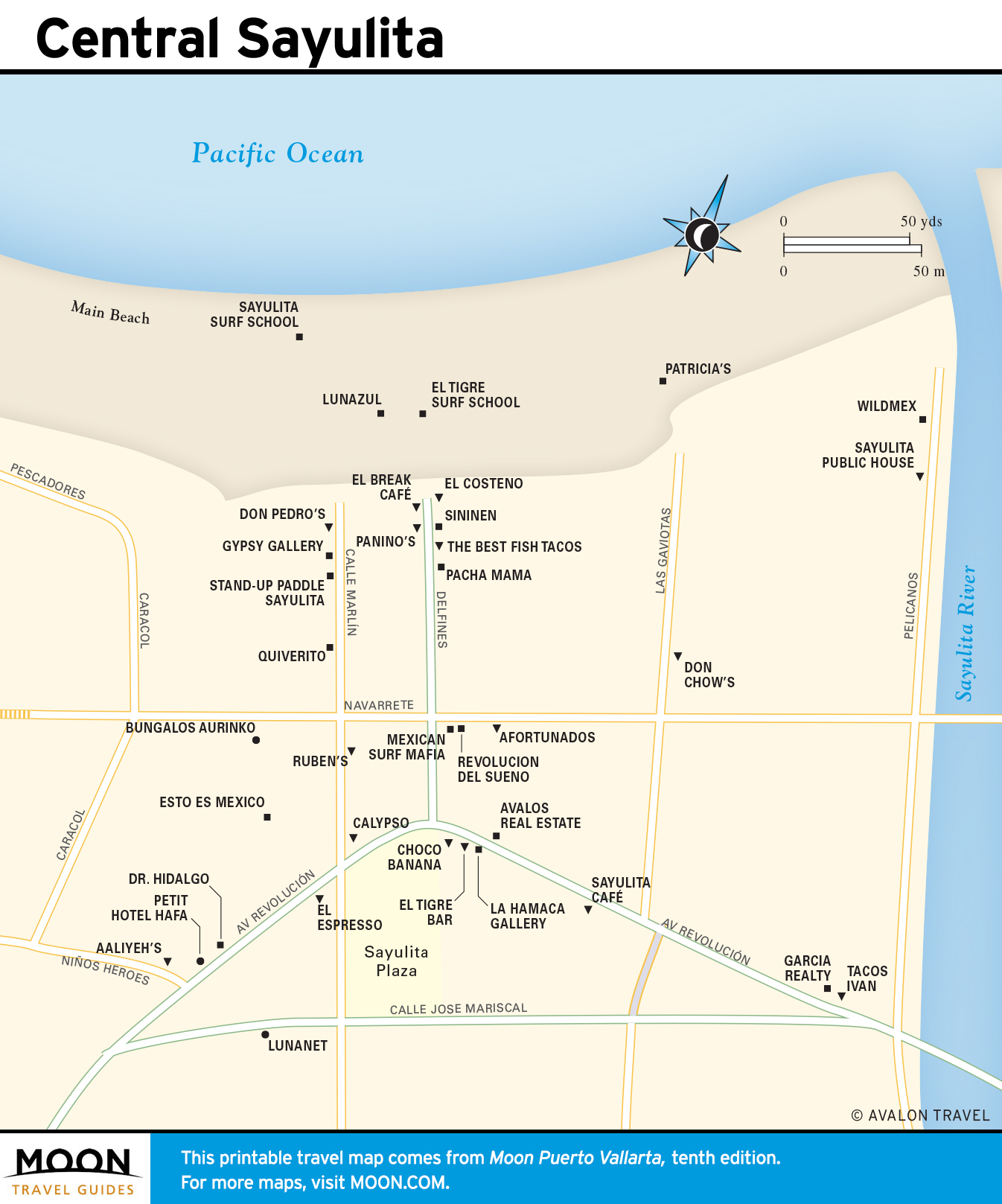
Sayulita and the Riviera Nayarit
For years, the Nayarit Coast was one of Puerto Vallarta’s best-kept secrets, but no longer: Sayulita has emerged as a major destination in Nayarit. Visitors come to enjoy the gorgeous beaches, good surfing, snorkeling, wildlife-watching, and cowboy-country ambience, along with Sayulita’s increasingly sophisticated shopping and dining attractions.
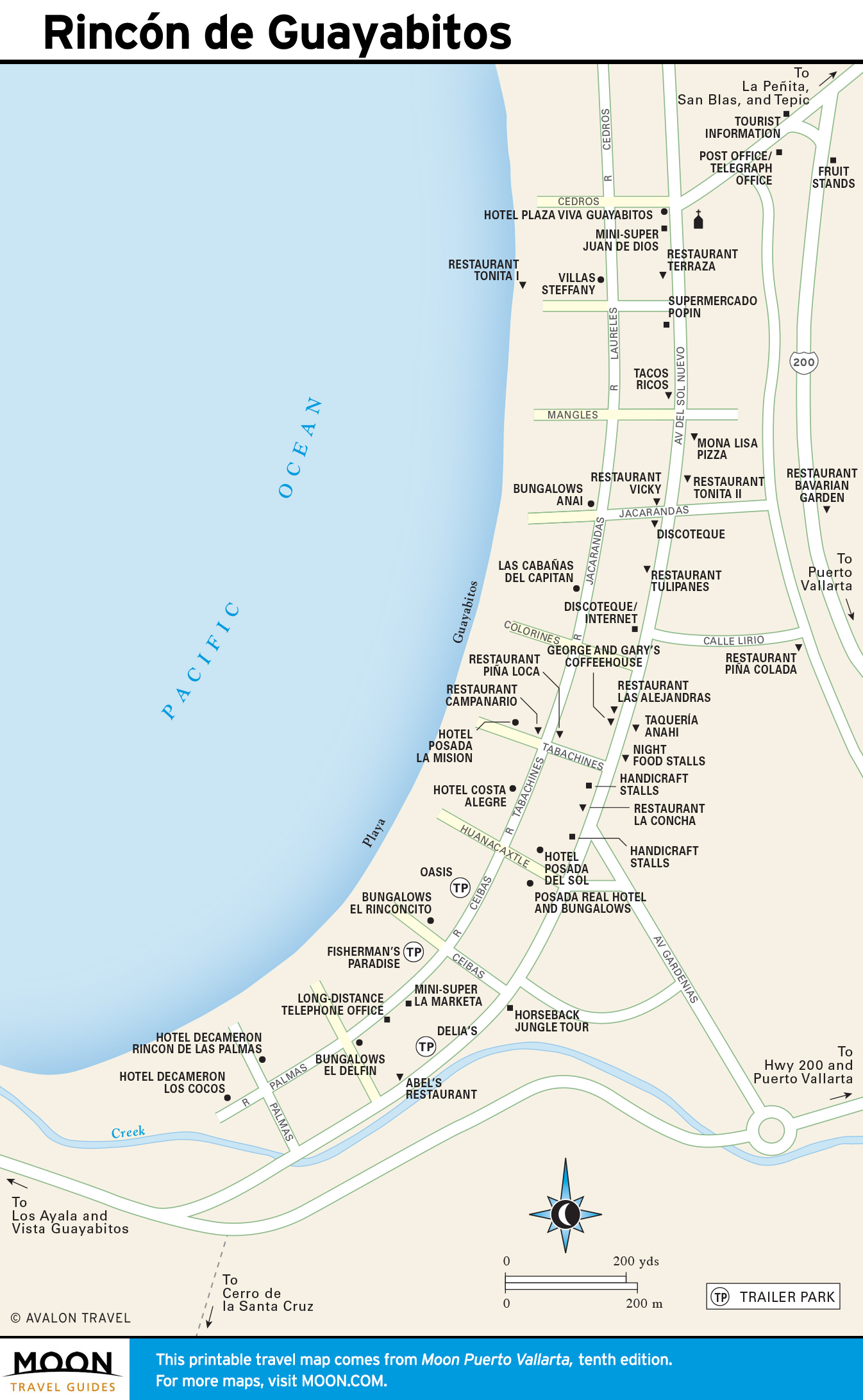
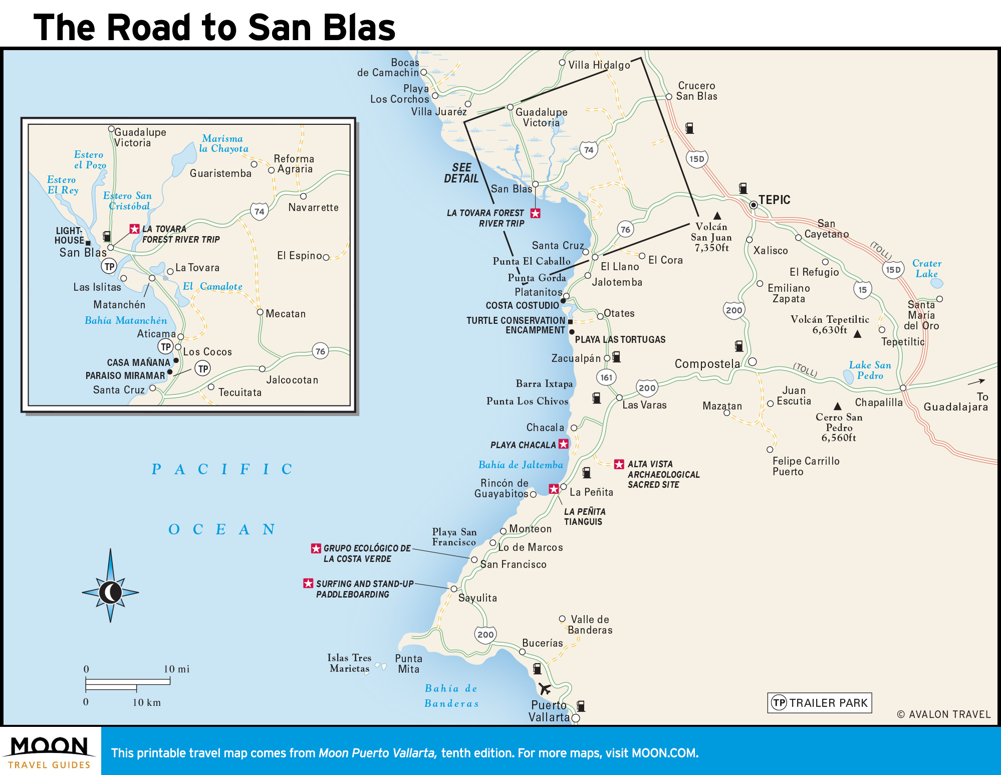
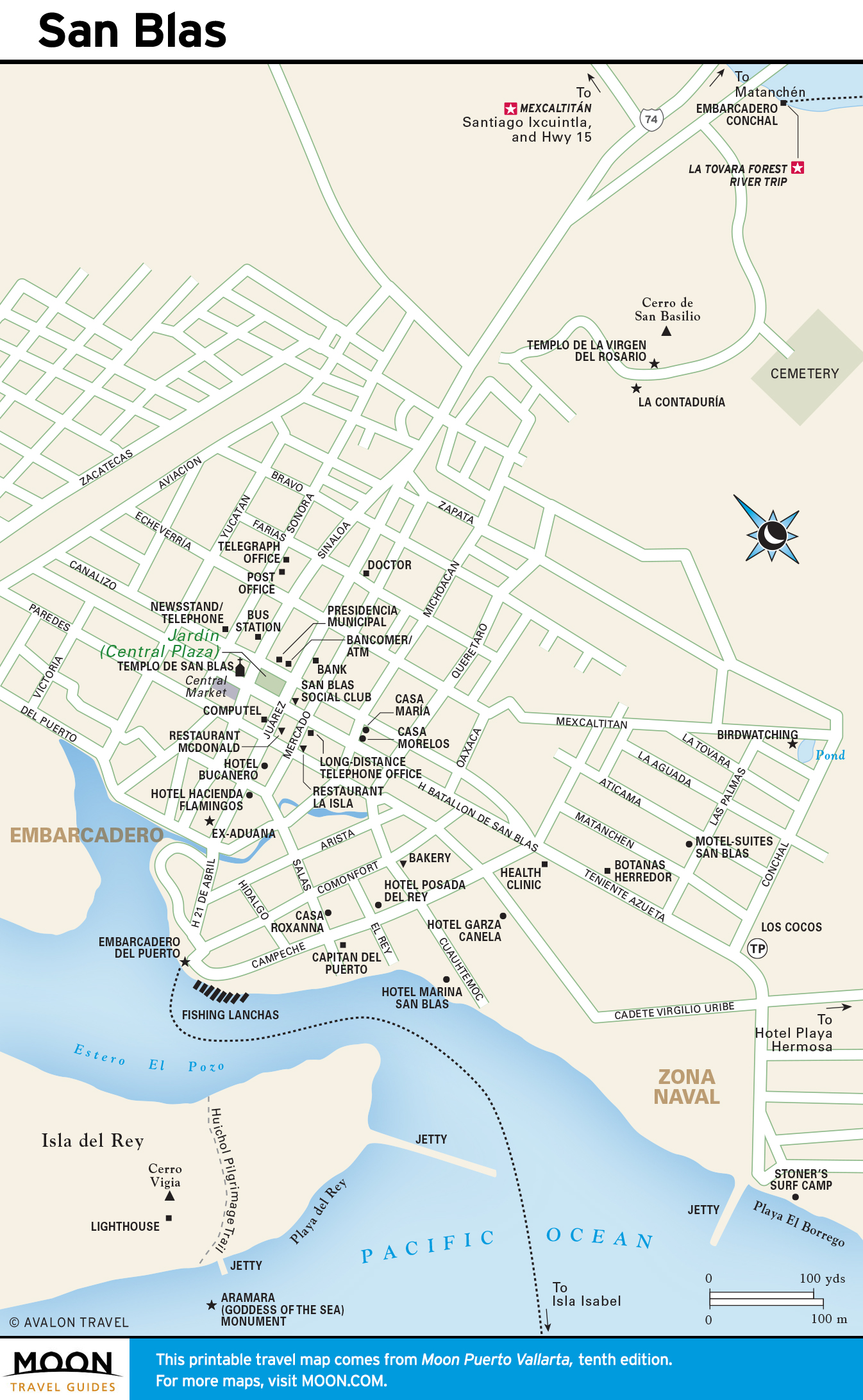
Moving north, the highlights beyond Sayulita include sleepy San Francisco, the still untouristed (by norteamericanos) towns of Lo de Marcos, Guayabitos, La Peñita, and precious Chacala. Finally comes San Blas, famous for bird-watching, wildlife viewing, and occasional world-class surfing. Beyond San Blas is the idyllic automobile-free Mexcaltitán, an island village where an excellent museum tells the island’s fascinating story.
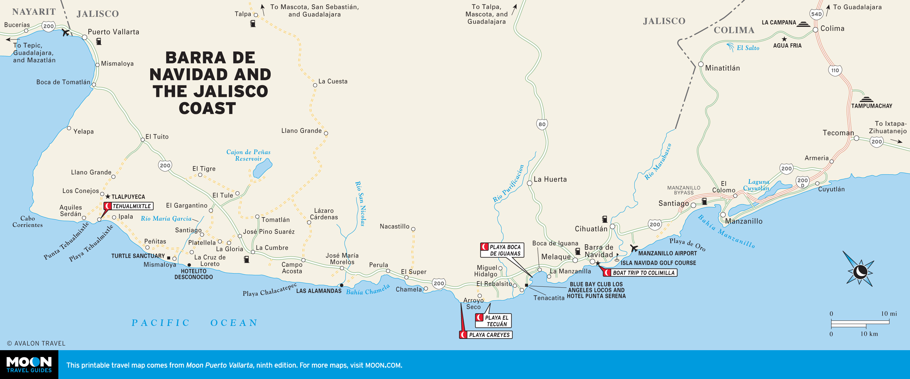
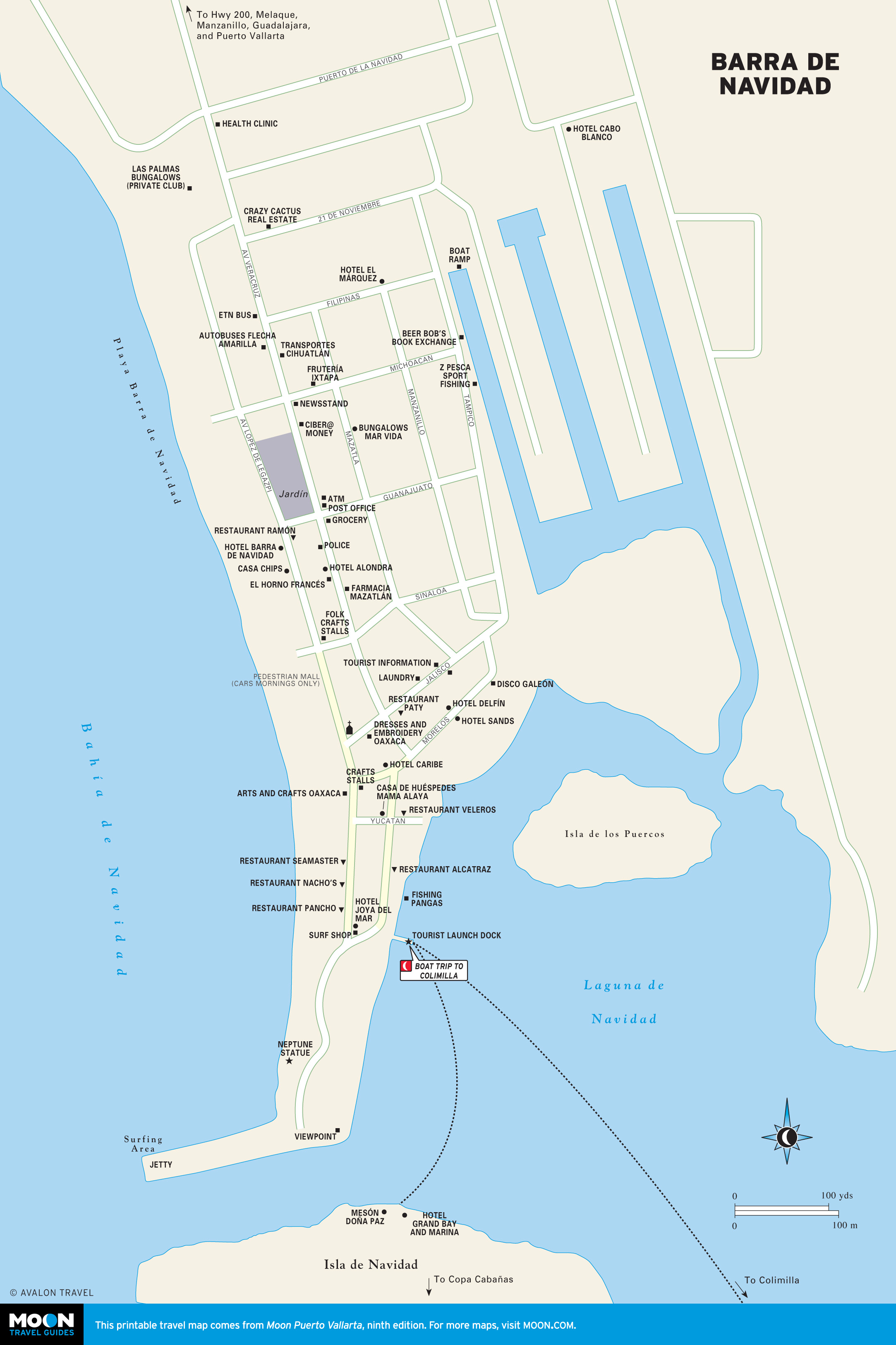
Barra de Navidad and the Jalisco Coast
For travelers yearning to follow the path less traveled, the Jalisco Coast may be just the ticket. From Puerto Vallarta, it stretches more than 100 miles south, traversing pine-tufted mountains, desert-like savanna, lush tropical forest, and seemingly endless pristine golden strands.