Yosemite National Park
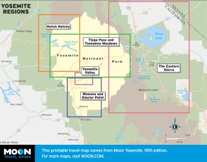
These free, printable travel maps of Yosemite National Park are divided into eight regions:
- Yosemite Valley
- Wawona and Glacier Point
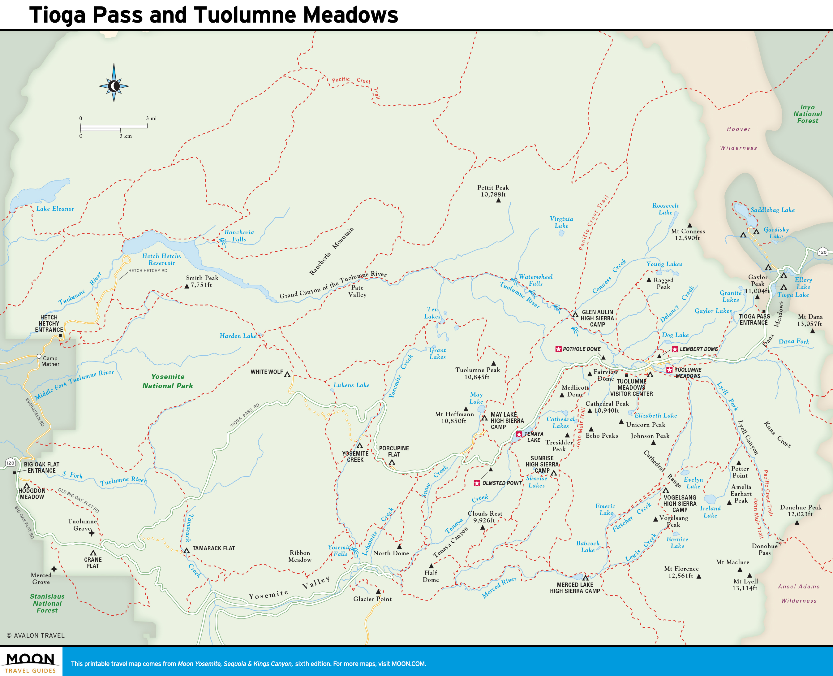
- Tioga Pass and Tuolumne Meadows
- Hetch Hetchy
- The Eastern Sierra
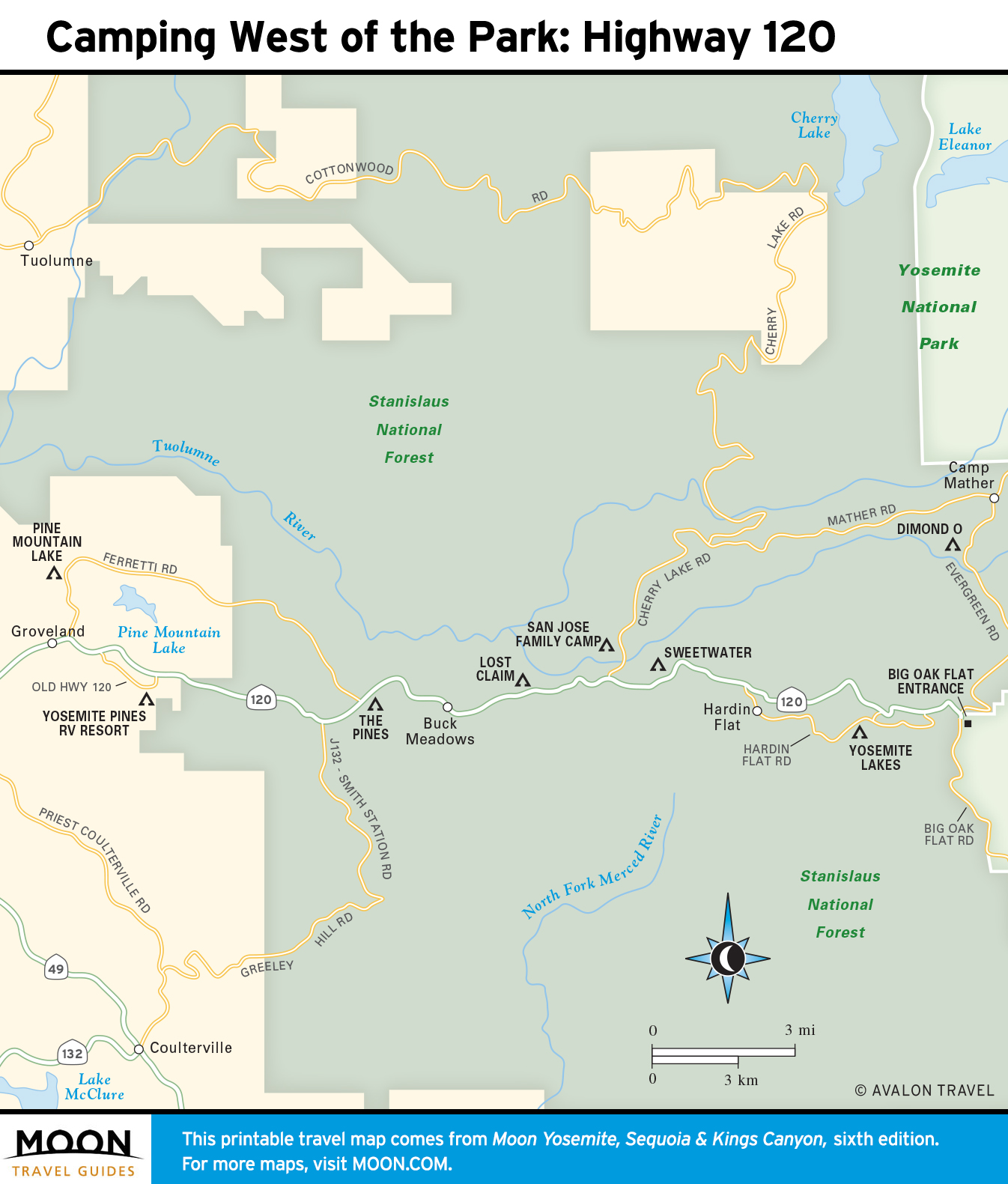
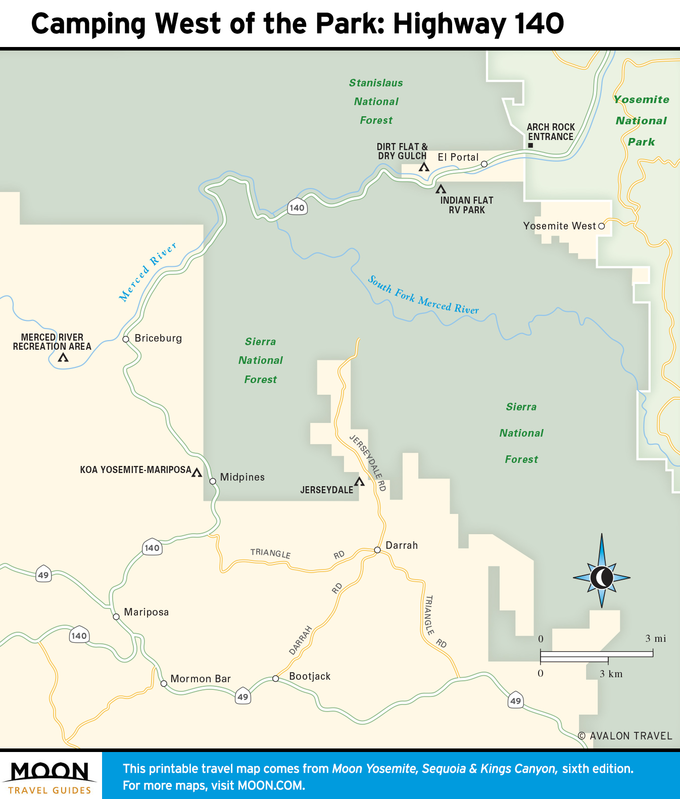
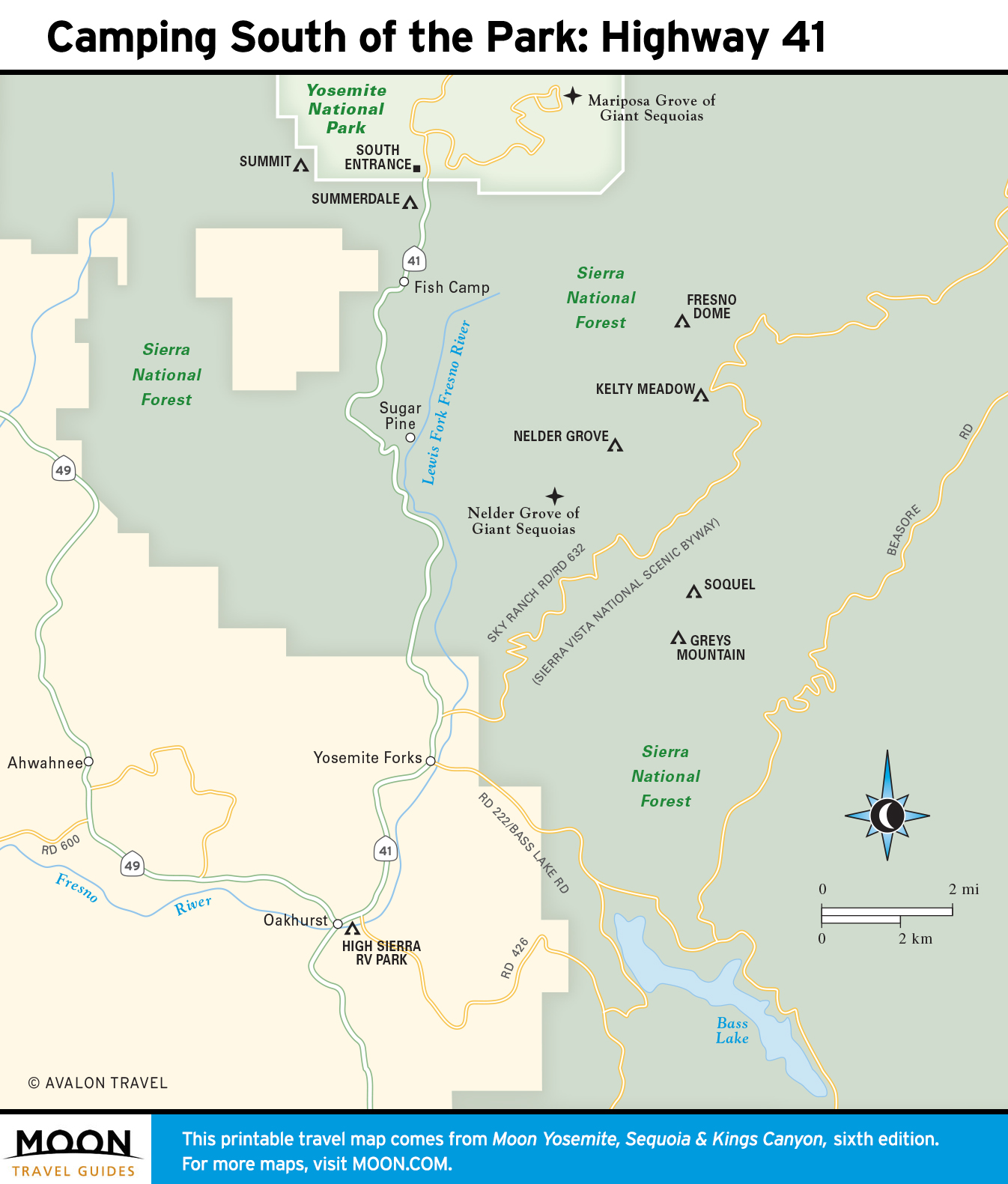
- Yosemite Camping
- Yosemite Lodging
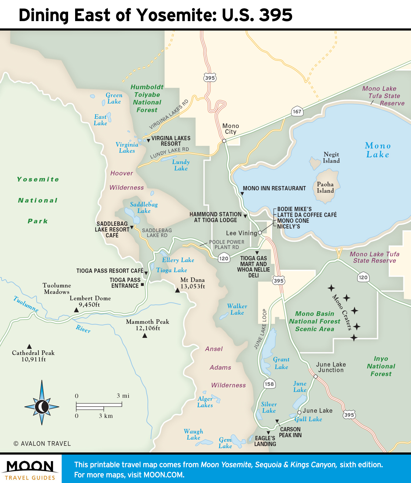
- Yosemite Dining
Explore Yosemite National Park with these helpful travel maps from Moon. Ensure you have the newest travel maps including maps of Sequoia and Kings Canyon National Parks by ordering the most recent edition of our travel guide by local author Ann Marie Brown.
Travel Maps of Yosemite


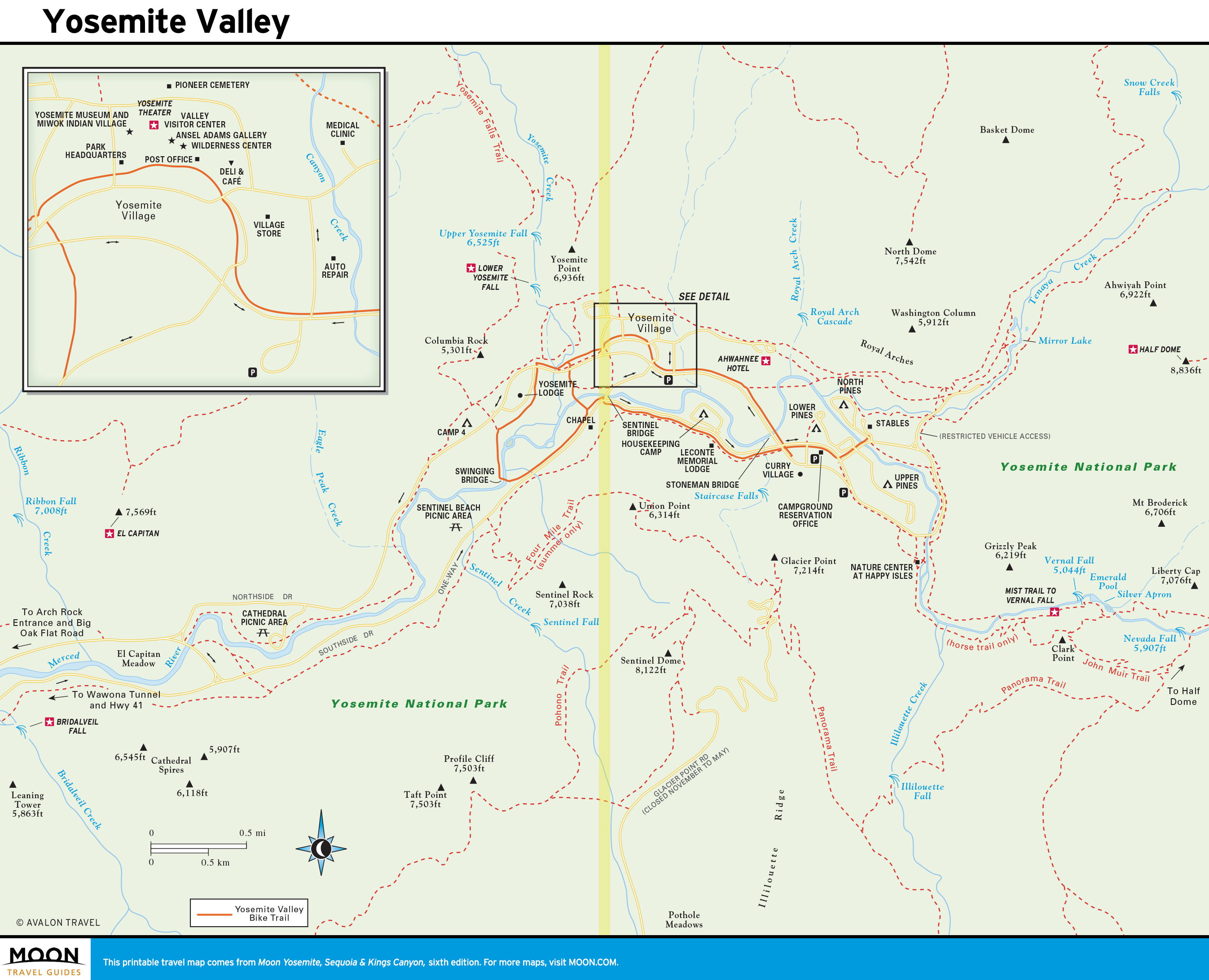
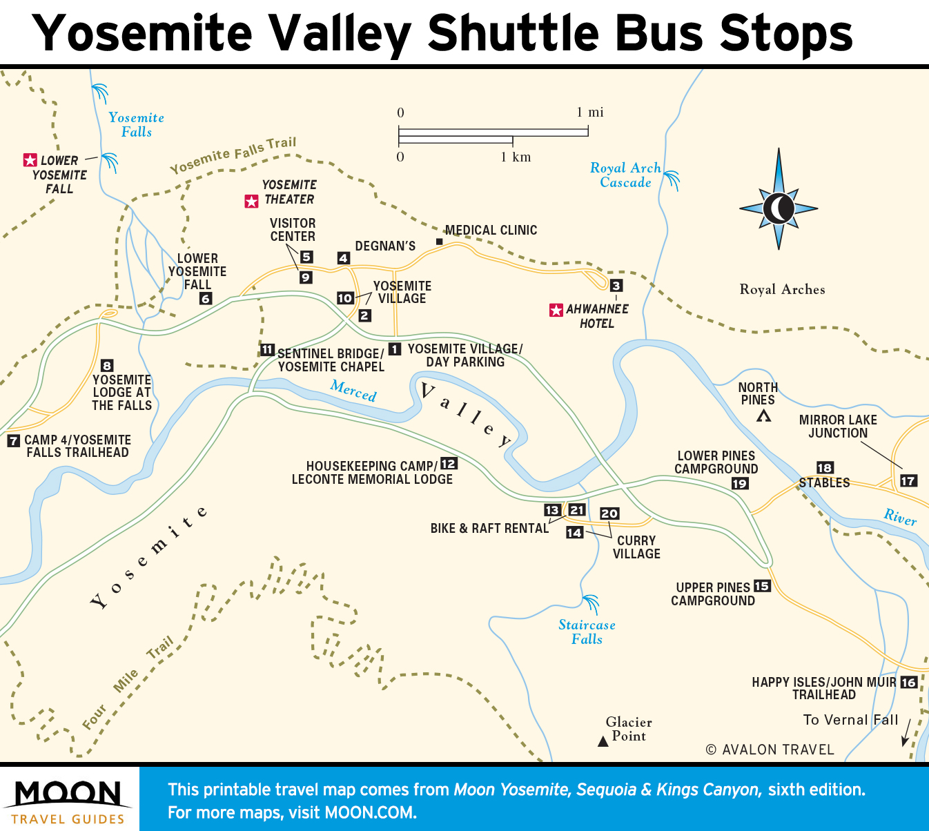
Yosemite Valley
The majority of park visitors spend their time in Yosemite Valley. This is where most of the park’s lodgings and restaurants are located, where most guided tours take place, and where a wealth of organized activities happen daily: ranger walks, biking, art classes, photography seminars, and more.
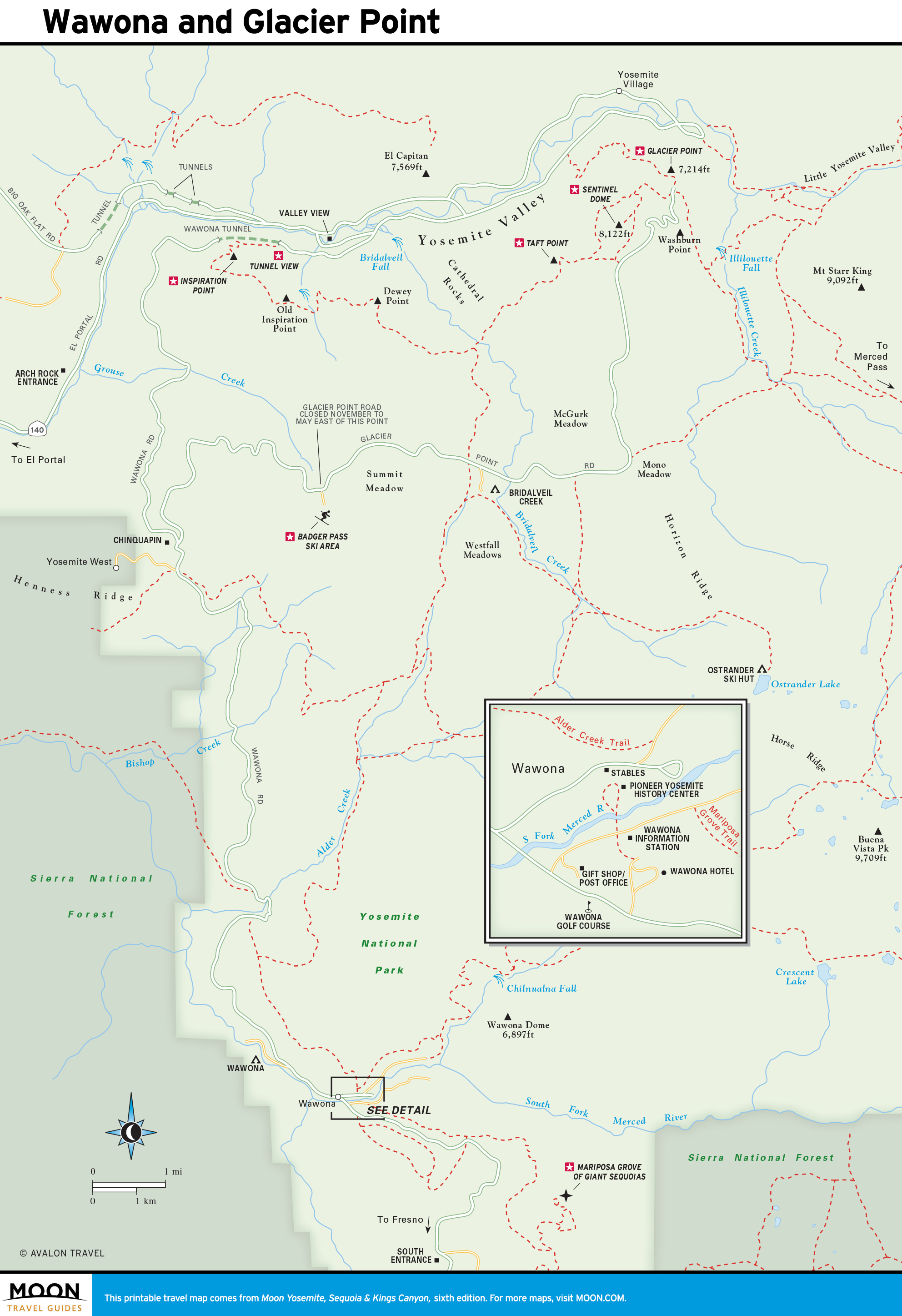
Wawona and Glacier Point
In southern Yosemite, near the hamlet of Wawona, are two of Yosemite’s premier attractions: the Mariposa Grove of Giant Sequoias and Glacier Point. The Mariposa Grove boasts several hundred giant trees. Glacier Point is a drive-to overlook that offers one of the best views in the West. History lovers will enjoy Wawona, with its historic buildings at the Pioneer Yosemite History Center and 19th-century Wawona Hotel.
Tioga Pass and Tuolumne Meadows
The Tuolumne Meadows region is ideal for hikers and backpackers. Trails lead to alpine lakes set below the spires of Cathedral Peak and Unicorn Peak, to roaring waterfalls on the Tuolumne River, and to the summits of lofty granite domes with commanding vistas of the high country.
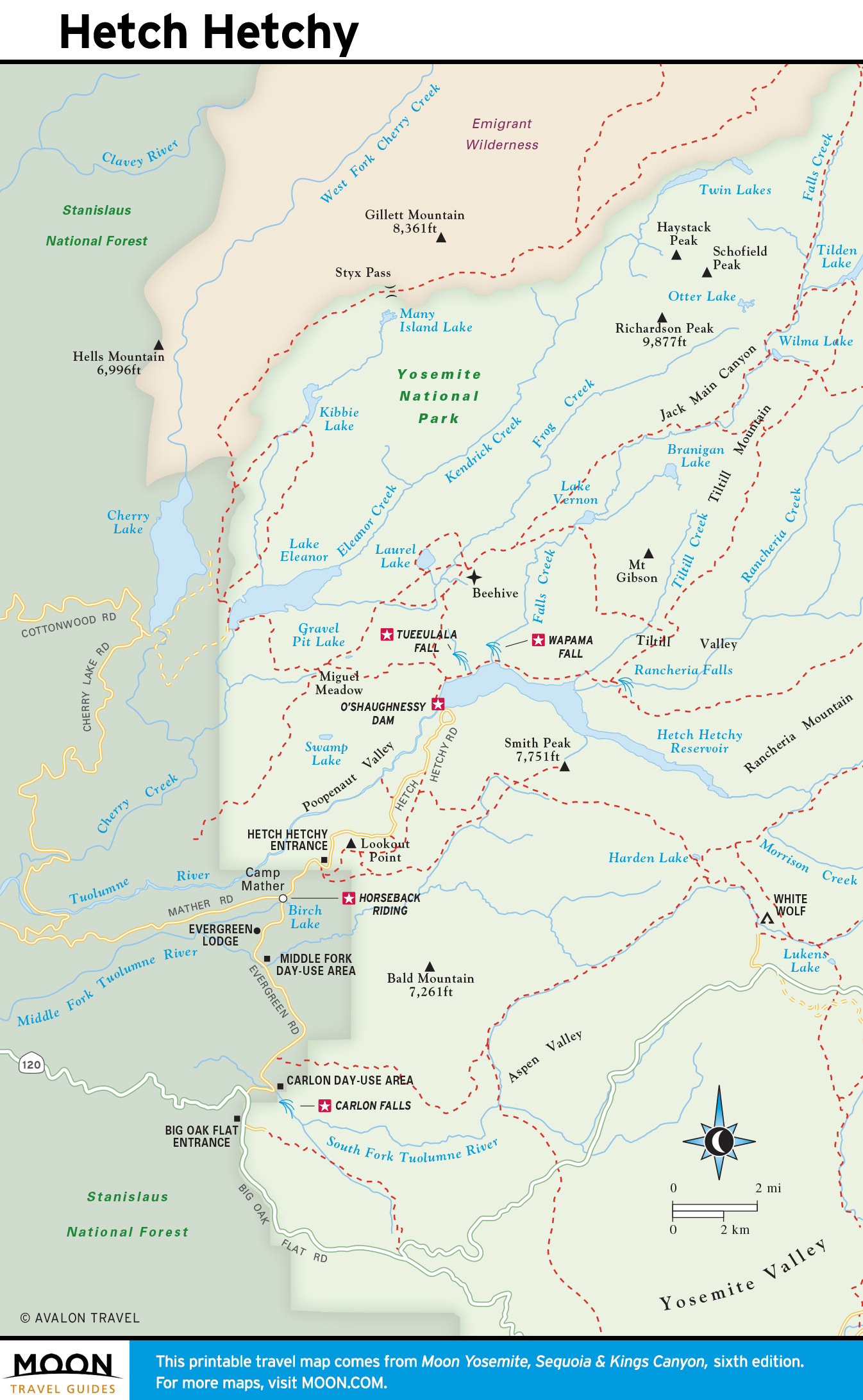
Hetch Hetchy
In the spring, Hetch Hetchy’s waterfalls spill over its massive cliffs. Wildflowers bloom April-June. Visitors make day trips here to admire the enormous O’Shaughnessy Dam or hike along the edges of its reservoir. Backpackers come to Hetch Hetchy for its access to Yosemite’s backcountry and its solitude.
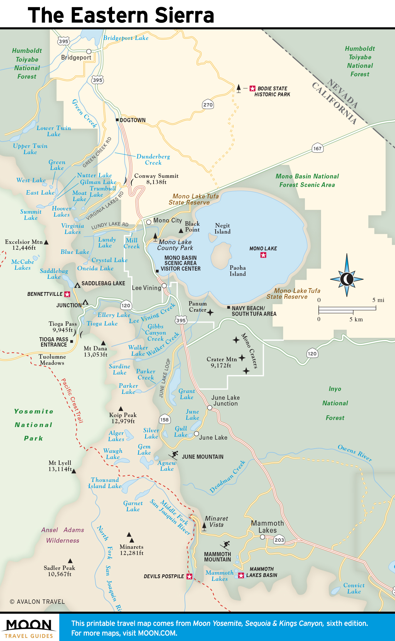
The Eastern Sierra
The Eastern Sierra is an outdoors lover’s playground: skiers and snowboarders swoosh down mountain slopes, hikers and mountain bikers explore miles of trails, anglers cast into crystal-clear streams and rivers, scenery enthusiasts and photographers enjoy alpine lakes backed by granite cliffs. The region hosts two good-sized mountain towns, Mammoth Lakes and June Lake, and worthwhile destinations such as Bodie State Historic Park, a historic gold rush ghost town, and Mono Lake, a 700,000-year-old saline lake.
Camping in and around Yosemite

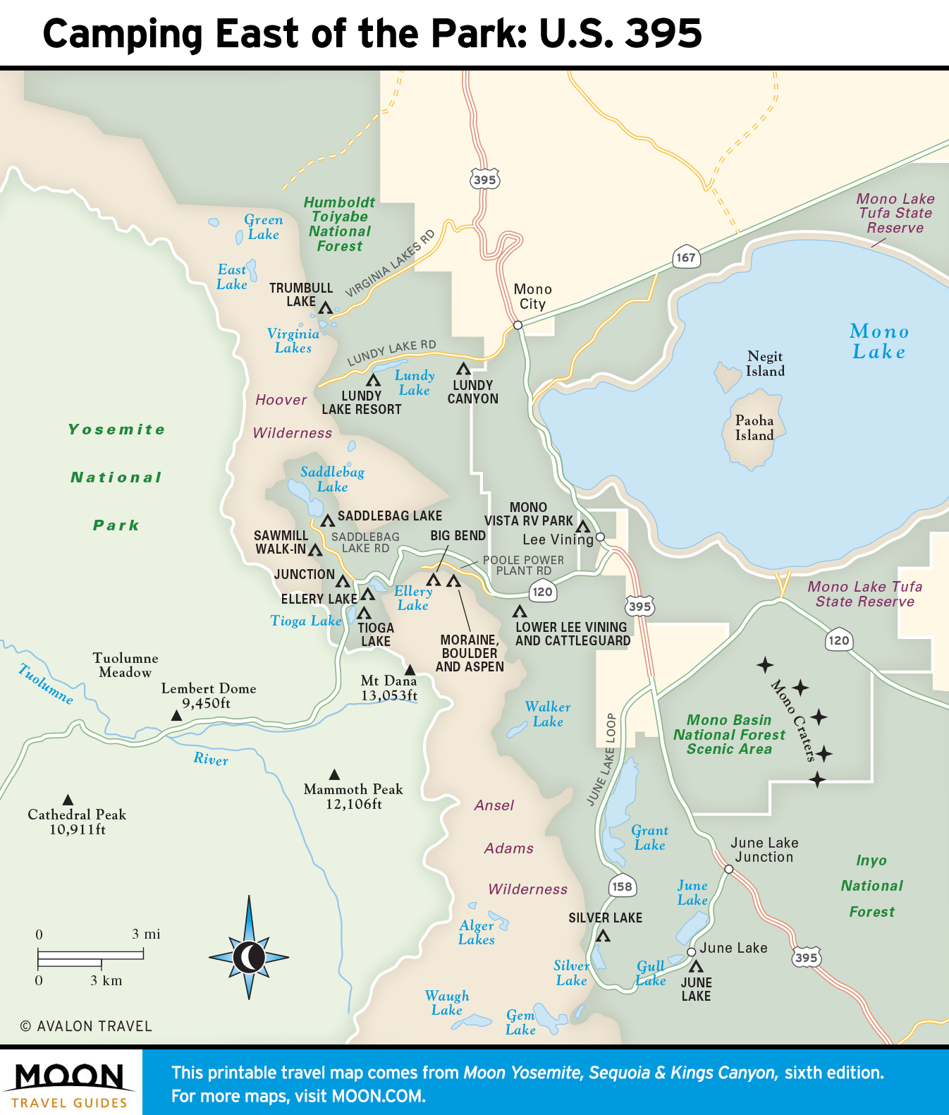
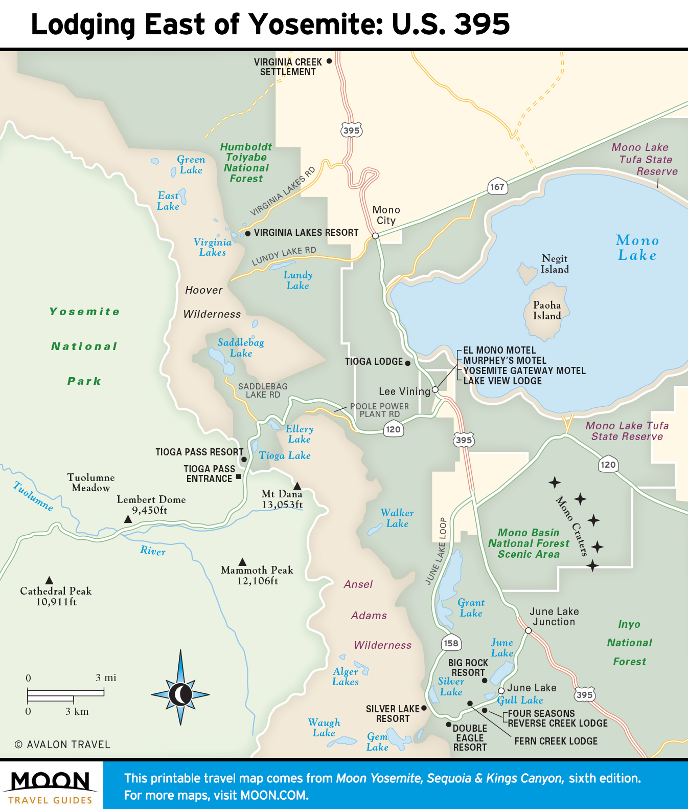
Lodging in and around Yosemite

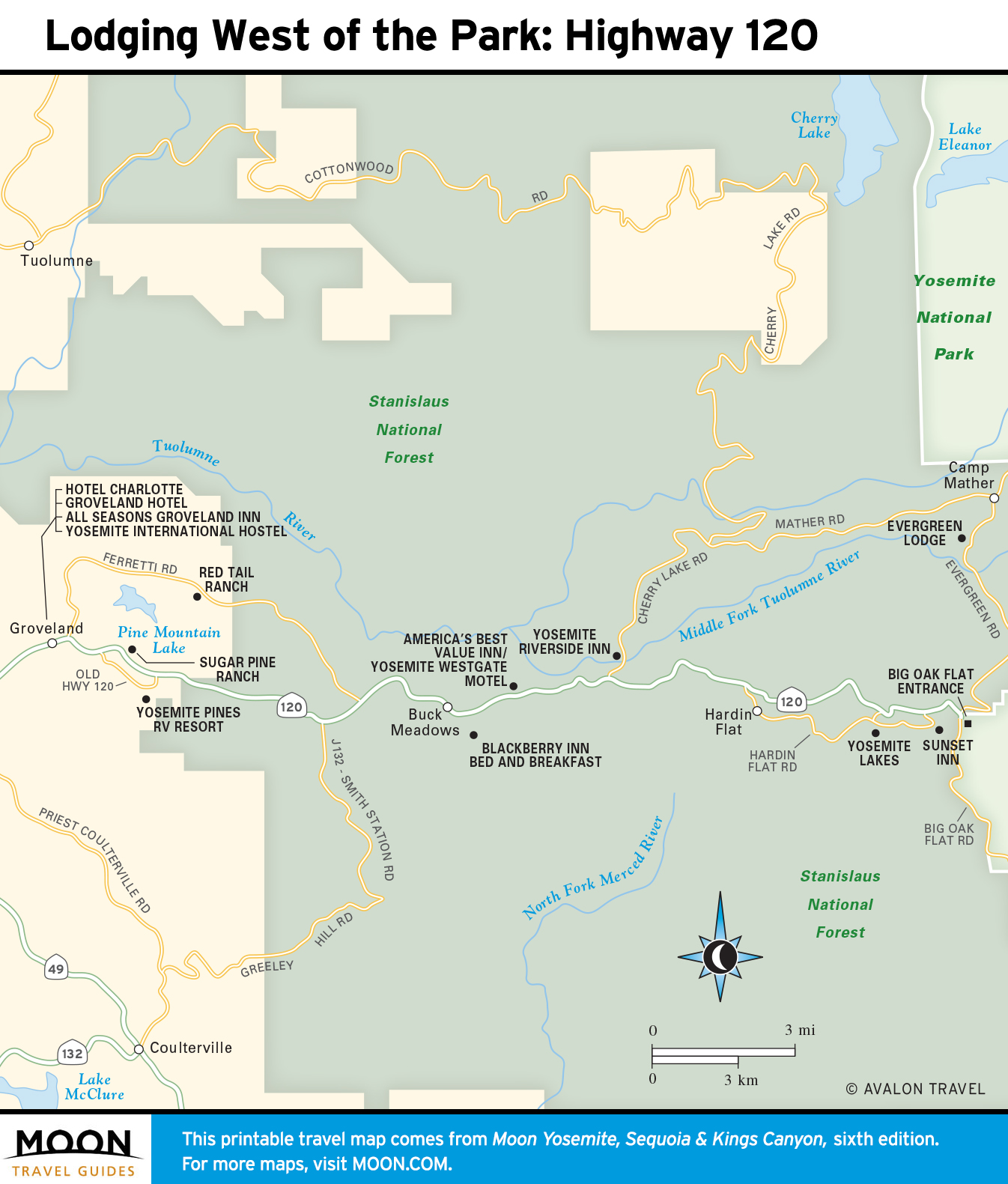
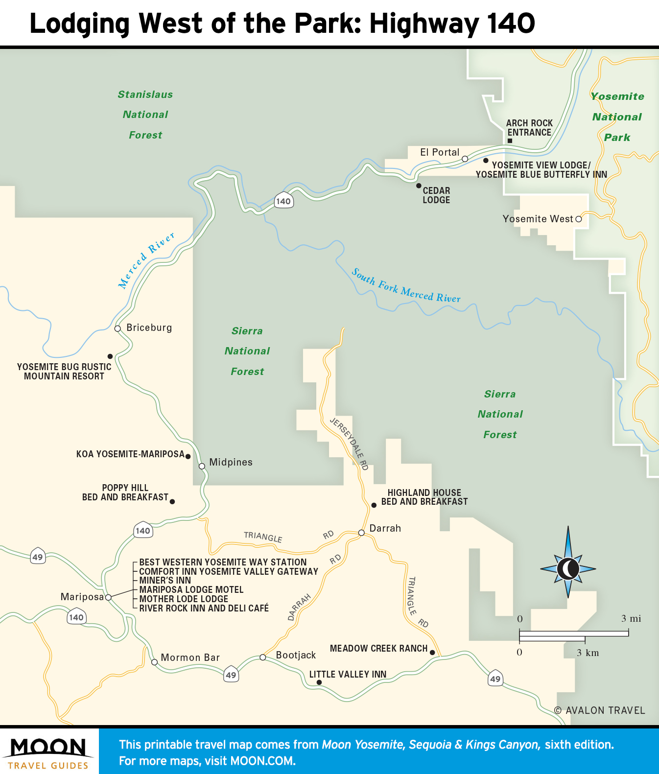
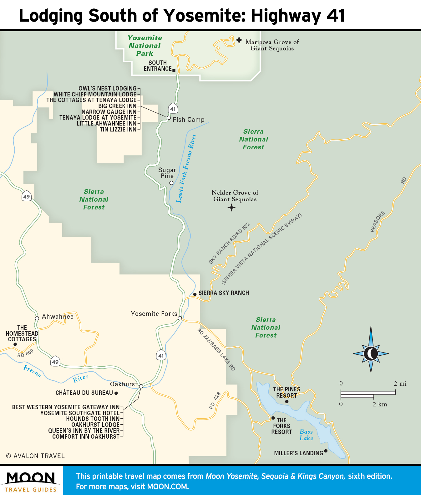
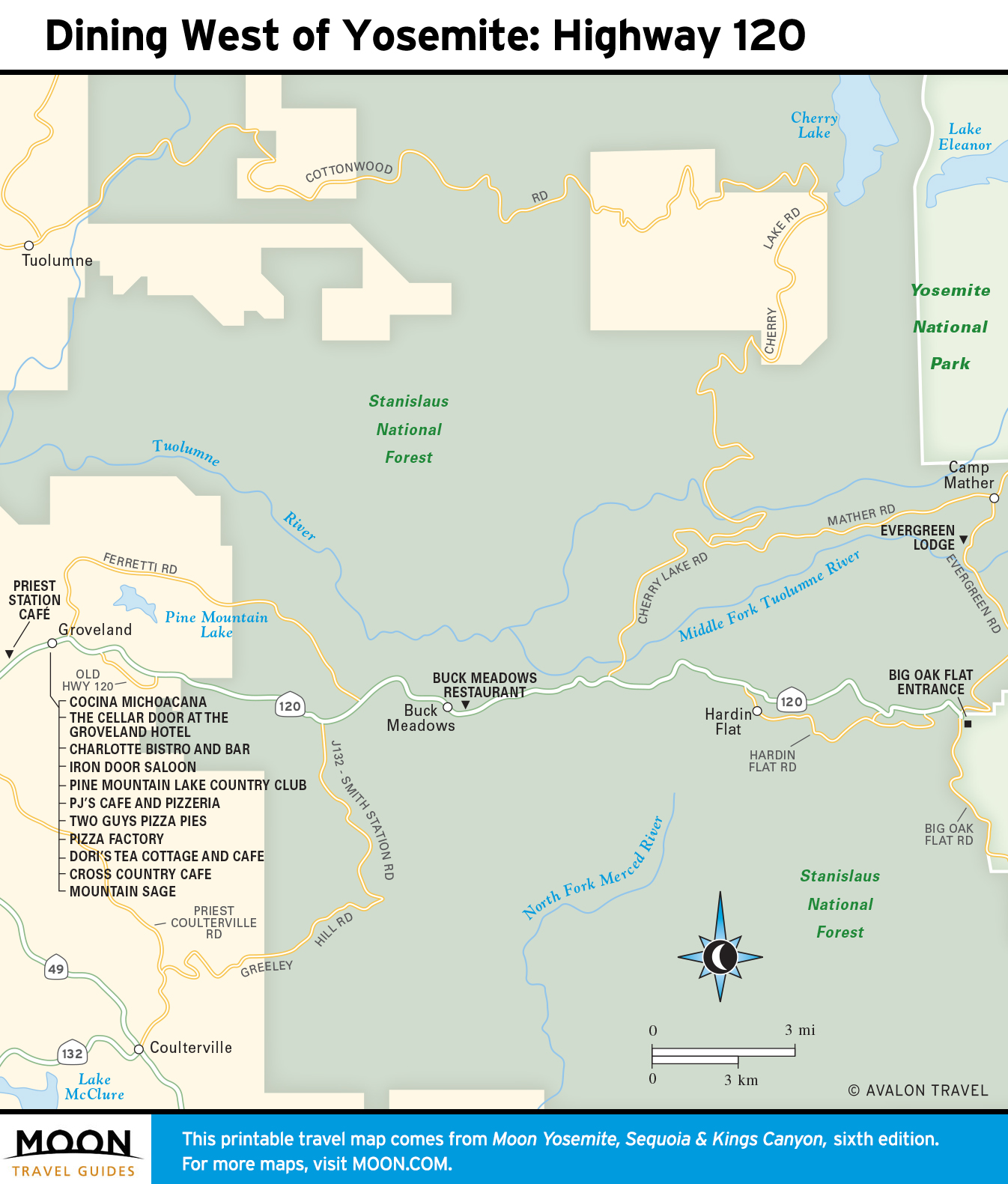
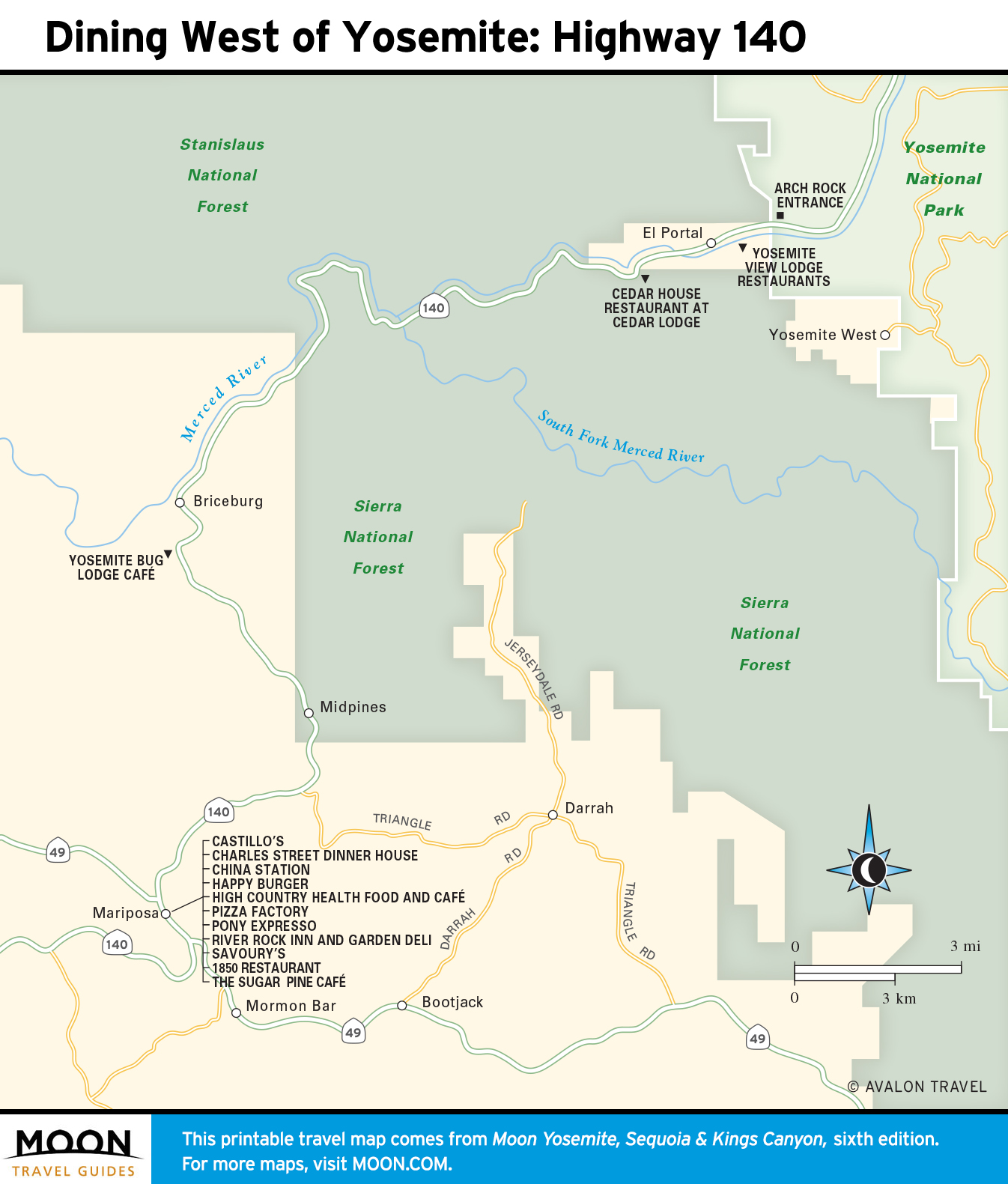
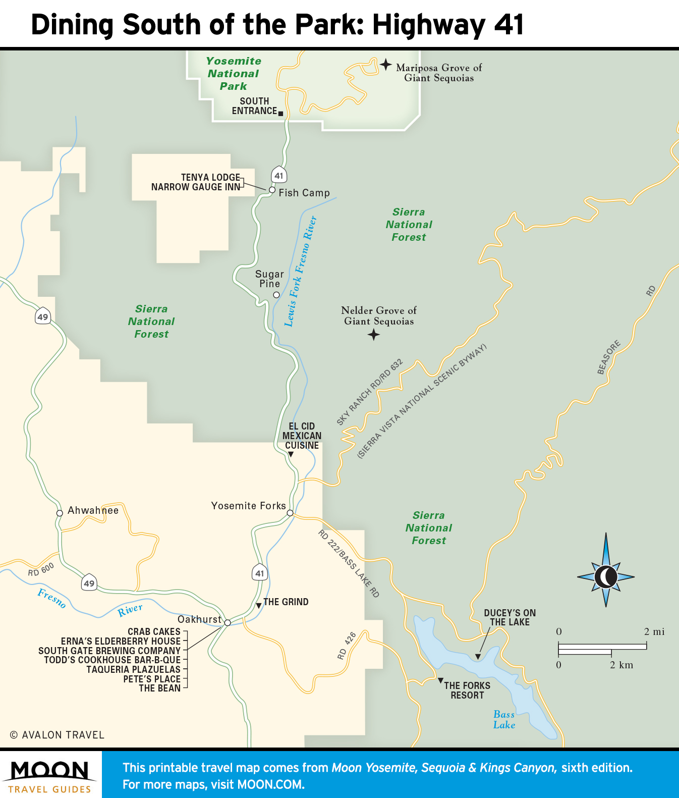
Dining in and around Yosemite

Sequoia & Kings Canyon
Dig in to Yosemite’s less-visited, neighboring parks.
