Michigan

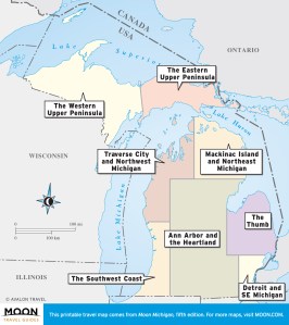
These free, printable travel maps of Michigan are divided into eight regions:
- Detroit and Southeast Michigan
- The Thumb
- Ann Arbor and the Heartland
- The Southwest Coast
- Traverse City and Northwest Michigan
- Mackinac Island and Northeast Michigan
- Eastern Upper Peninsula
- Western Upper Peninsula
Explore Michigan with these printable travel maps. Ensure you have the newest travel maps from Moon by ordering the most recent edition of our travel guides to Michigan.
Travel Maps of Michigan

Detroit and Southeast Michigan
Visitors are often surprised by the cultural attractions that abound in southeastern Michigan, from ethnic enclaves like Hamtramck to impressive museums like The Henry Ford.restaurants, shopping, and hotels.


The Thumb
This region sees fewer crowds than the towns along Lake Michigan. Travelers who appreciate a slower pace and more old-fashioned vibe will enjoy fishing in Lake Huron, touring ancient petroglyphs, strolling through small coastal villages, and visiting historic sites within the region.


Ann Arbor and the Heartland
This is the only part of Michigan not bordered by at least one of the Great Lakes. Still, this vast region contains college sports teams, scenic lakes, unique cultural attractions like Kalamazoo’s Air Zoo, and some of the state’s largest cities.


The Southwest Coast
Michigan’s most compact region, this shoreline is certainly the easiest to visit. Traveling from Harbor Country to the White Lake area requires less than a three-hour drive—but oh, what a drive!


Traverse City and Northwest Michigan
Every summer, tourists flock to Traverse City, the self-proclaimed “Cherry Capital of the World.” The surrounding area is popular among visitors due to the wondrous Sleeping Bear Dunes, the wild rivers of Manistee National Forest, the wineries of the Leelanau Peninsula, and the lovely bays, lakes, and beaches.


Mackinac Island and Northeast Michigan
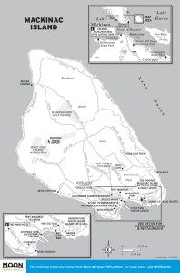
With its pine forests, canoeing rivers, inland lakes, and championship golf courses, Northeast Michigan is an outdoor enthusiast’s paradise. The area’s biggest attraction, the auto-free Mackinac Island, is definitely a step back in time, luring visitors with its quaint shops, carriage rides, and historic hotels.


Eastern Upper Peninsula
Most travelers reach the U.P. by crossing the Mackinac Bridge into St. Ignace. From here, you can explore many cultural attractions, including lighthouses, a shipwreck museum, and the Soo Locks near Sault Ste. Marie.


Western Upper Peninsula
For seekers of solitude, this region promises all that and more. Although the Keweenaw Peninsula boasts a wealth of historic mining sites, and the Ironwood area has a number of popular ski resorts, much of this region consists of vast wilderness areas, including some of the highest mountains in the Midwest. Here, backpackers can lose themselves within expansive forests, kayakers can explore the frigid waters of Lake Superior, and the truly daring can venture to isolated Isle Royale.


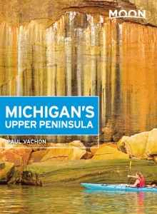
Rugged wilderness, freshwater coastline, and picturesque small towns: explore the best of the "U.P." with Moon Michigan's Upper Peninsula. Inside you'll find:
- Strategic, flexible itineraries, from a weekend on Mackinac Island to a week exploring the eastern or western peninsula, designed for outdoor adventurers, history and culture buffs, foliage seekers, and more
- Unique activities and ideas for every season: Relax in quaint European-style towns, kick back at an outdoor summer concert, and sample local delicacies like Cornish pasties, Swedish meatballs, and Mackinac Island fudge. Hike through maple forests, catch a glimpse of wild moose, red foxes, and white-tailed deer, and camp under the starry sky. Get out on the water and spend the day boating, fishing, and swimming, or try skiing, snowshoeing, or snowmobiling in the winter
- Honest advice on when to go, where to stay, and how to get around from lifelong Michigander Paul Vachon
- Detailed maps and helpful reference photos throughout
- Focused coverage of the Straits of Mackinac, Escanaba and the Lake Michigan shore, the Superior Upland, Keweenaw Peninsula and Isle Royale, Marquette and the Lake Superior shore, Whitefish Bay, and the Lake Huron shore
- Thorough background information on the landscape, climate, wildlife, and local culture
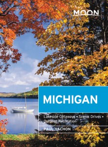
Exploring more of the Mitten State? Try Moon Michigan.

