Wyoming
These free, printable travel maps of Wyoming are divided into five regions:
- Yellowstone National Park
- Grand Teton National Park
- Jackson Hole, Cody, and the Wind Rivers
- Sheridan, Devils Tower, and Northeast Wyoming
- Southern Wyoming
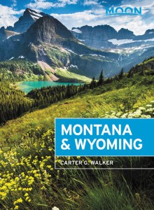
Explore Wyoming and its national parks with these helpful travel maps. Ensure you have the newest travel maps from Moon by ordering the most recent edition of our travel guides to Wyoming and Yellowstone and Grand Teton National Parks.
Travel Maps of Wyoming


Yellowstone National Park
This magnificent park is constantly in motion; nothing here is static. See abundant wildlife, including bison, bears, and wolves; marvel at geothermal features like the legendary Old Faithful; and stay in marvelous historic lodges like the Old Faithful Inn and the rambling Lake Hotel. Perimeter communities, including West Yellowstone, Gardiner, and remote Cooke City, should not be missed.


Grand Teton National Park
Grand Teton packs a punch, particularly when it comes to mountain splendor. Twelve peaks in the Teton Range soar above 12,000 feet. While there are only 100 miles of roads in the park, there are twice as many miles of trails, leaving hikers endless options for adventure.


Jackson Hole, Cody, and the Wind Rivers
Wyoming’s northwest corner is far more than a gateway to Yellowstone and Grand Teton National Parks. Jackson Hole is a destination in and of itself, with glitzy galleries and boutiques, gourmet eateries, luxe accommodations, and a sensational art scene in immediate proximity to world-class ski resorts and white-water rafting. In Cody the cowboy is still king, and the sun rises and sets on the Buffalo Bill Center of the West and its five museums. Farther south, outdoor enthusiasts will find hot springs and mountain meccas.


Sheridan, Devils Tower, and Northeast Wyoming
Where the prairies meet the mountains, cowboy culture comes alive. This is where you’ll find dude ranches and Sheridan, one of the most charming and authentic Western towns in the state.


Southern Wyoming
Southern Wyoming contains everything from sweeping deserts, sand dunes, and wild mustang herds to lush river valleys and green mountains. The southwest corner is noted for fabulous recreational opportunities along the Green River and in the Flaming Gorge National Recreation Area. It’s also home to three of the state’s largest cities: capital Cheyenne, synonymous with its legendary Frontier Days rodeo, college town Laramie, and onetime frontier town Casper.


