North Carolina
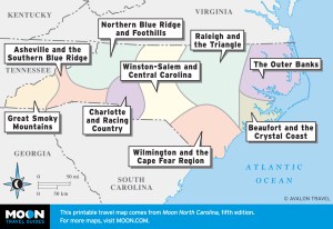 These free, printable travel maps of North Carolina are divided into eight regions:
- The Outer Banks
- Beaufort and the Crystal Coast
- Wilmington and the Cape Fear Region
- Raleigh and the Triangle
- Winston-Salem and Central Carolina
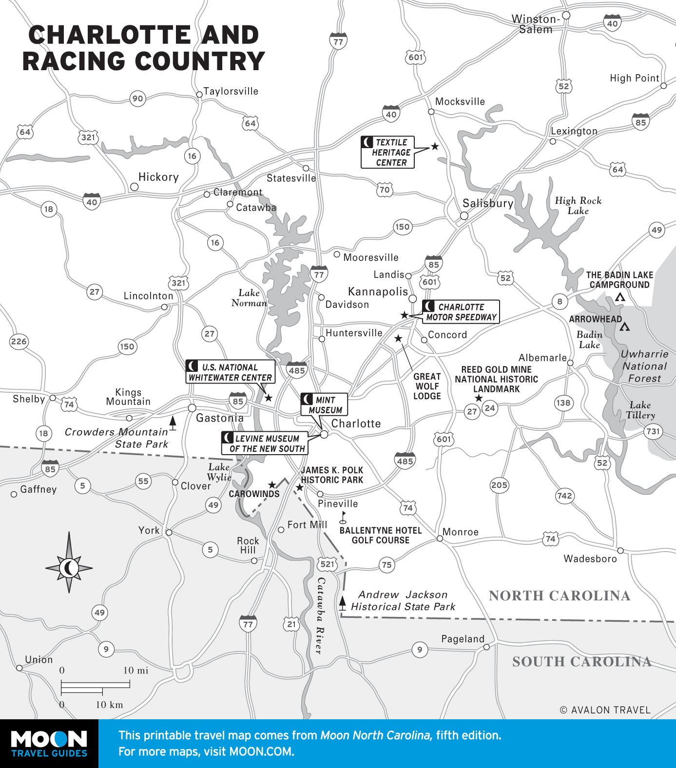
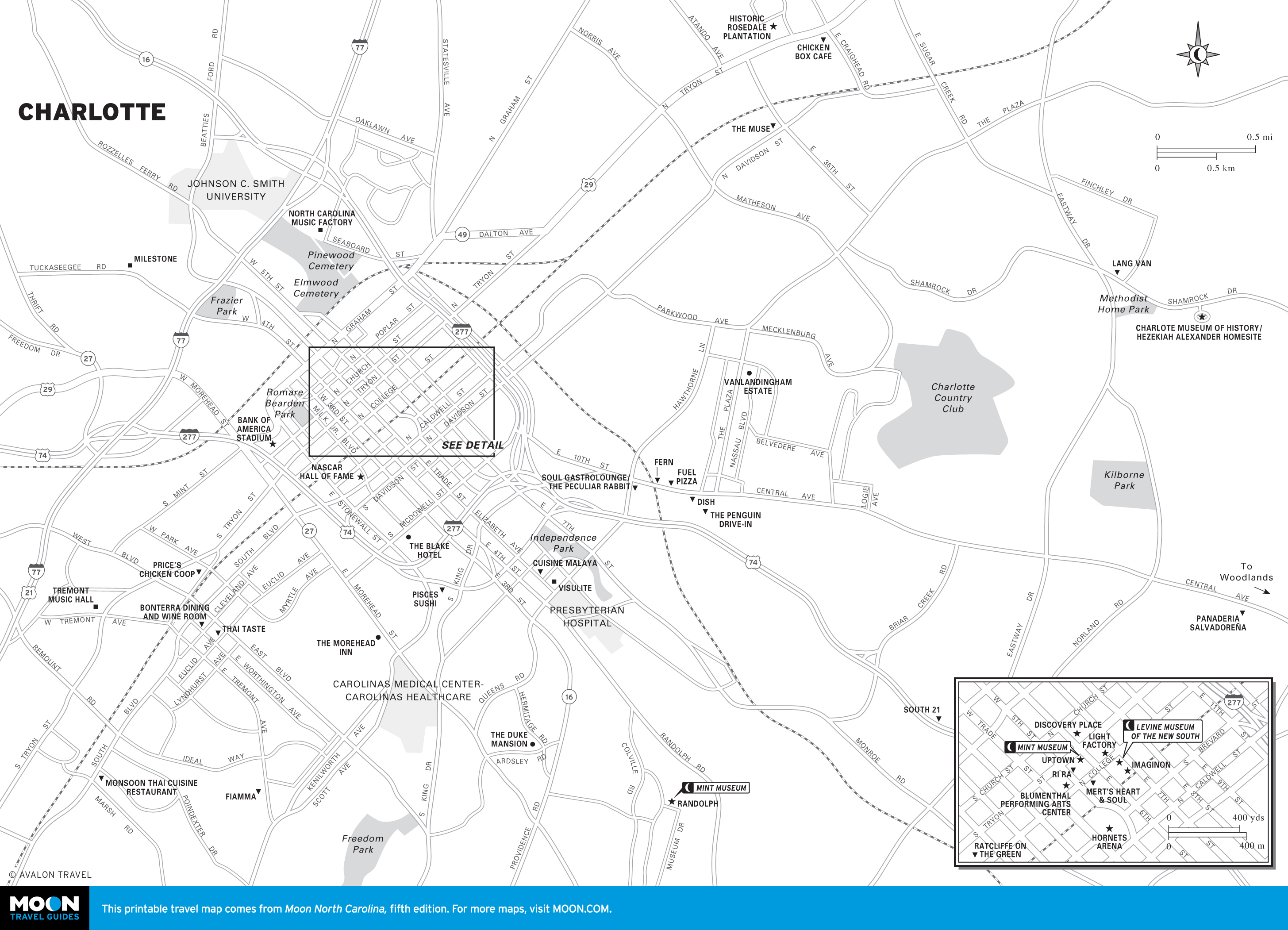
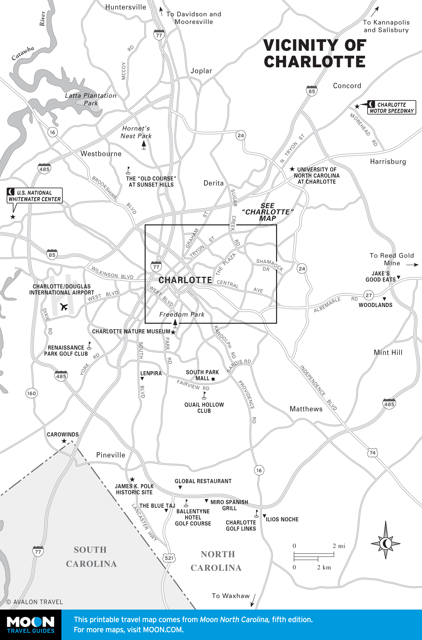
- Charlotte and Racing Country
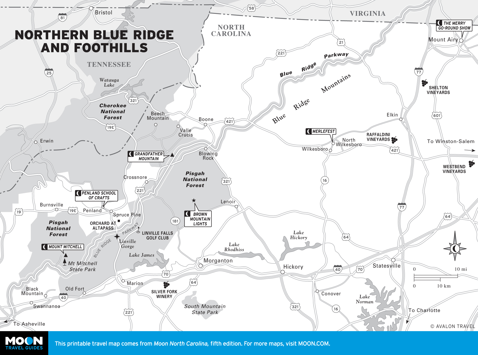
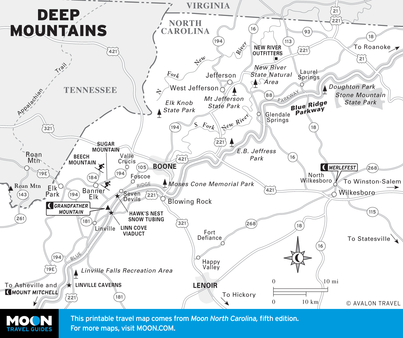
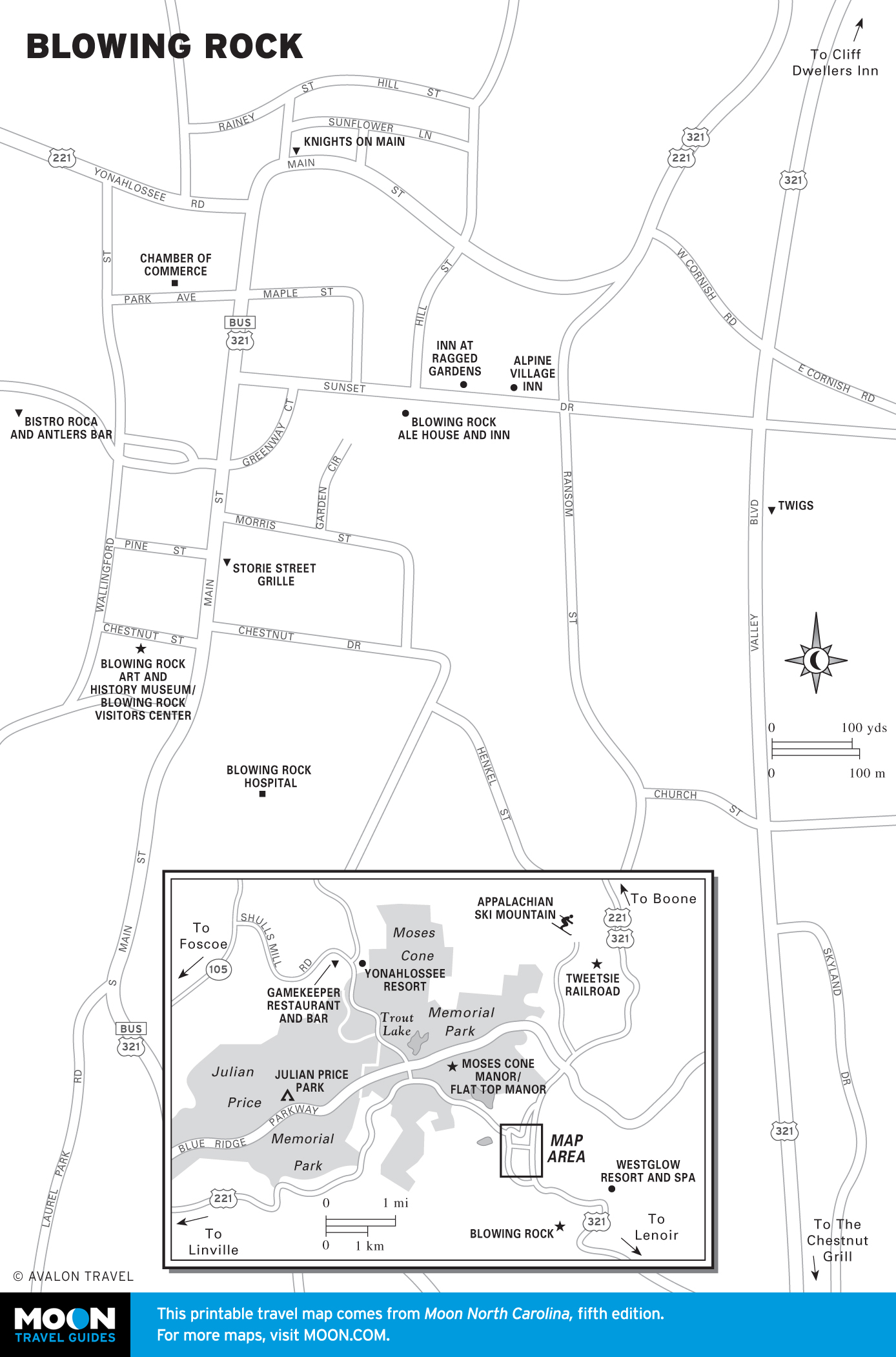
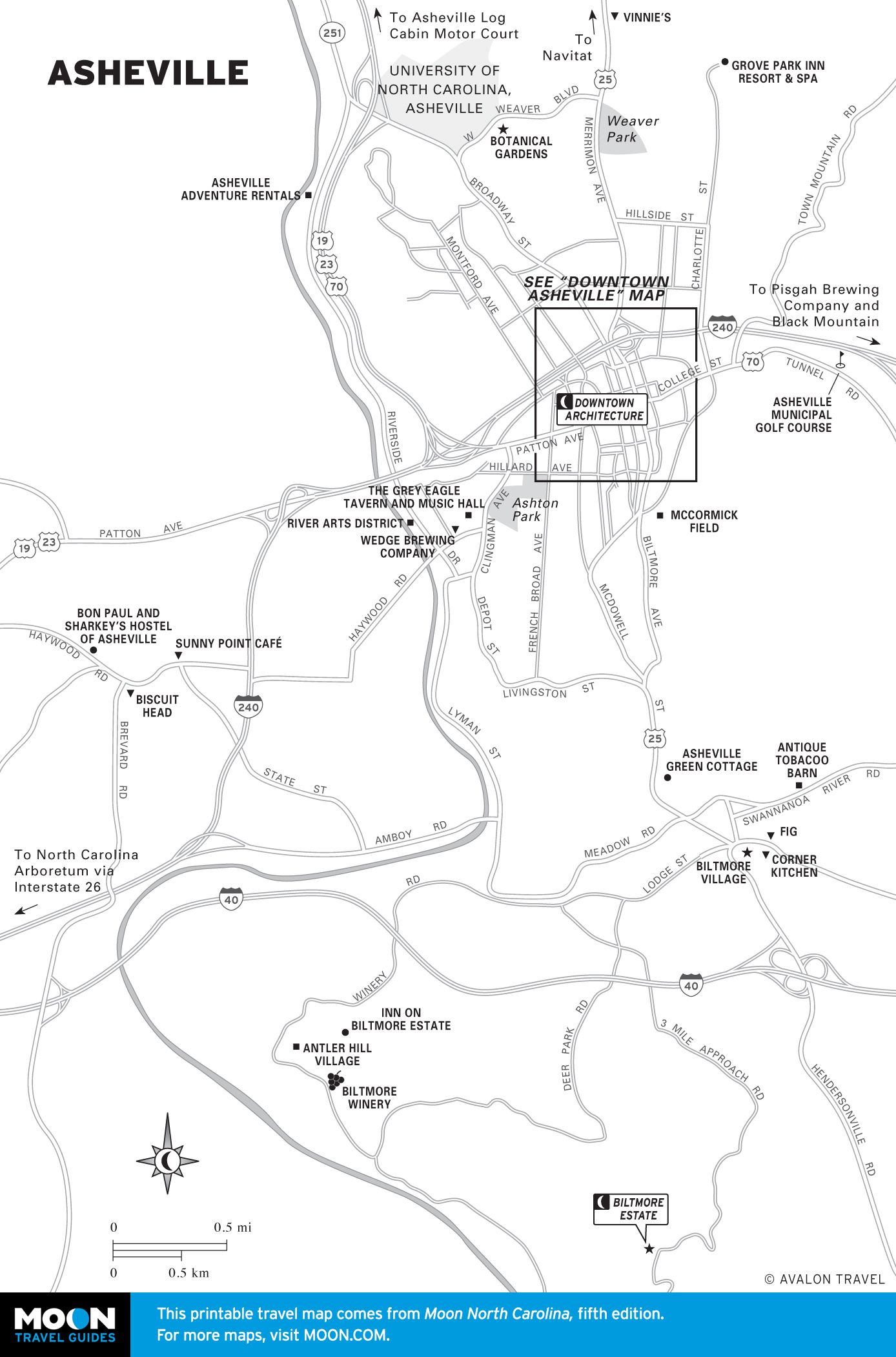
- Asheville and the Blue Ridge
- Great Smoky Mountains
Explore North Carolina with these helpful travel maps. Ensure you have the newest travel maps from Moon by ordering the most recent edition of our travel guides to North Carolina and Great Smoky Mountains National Park.

North Carolina
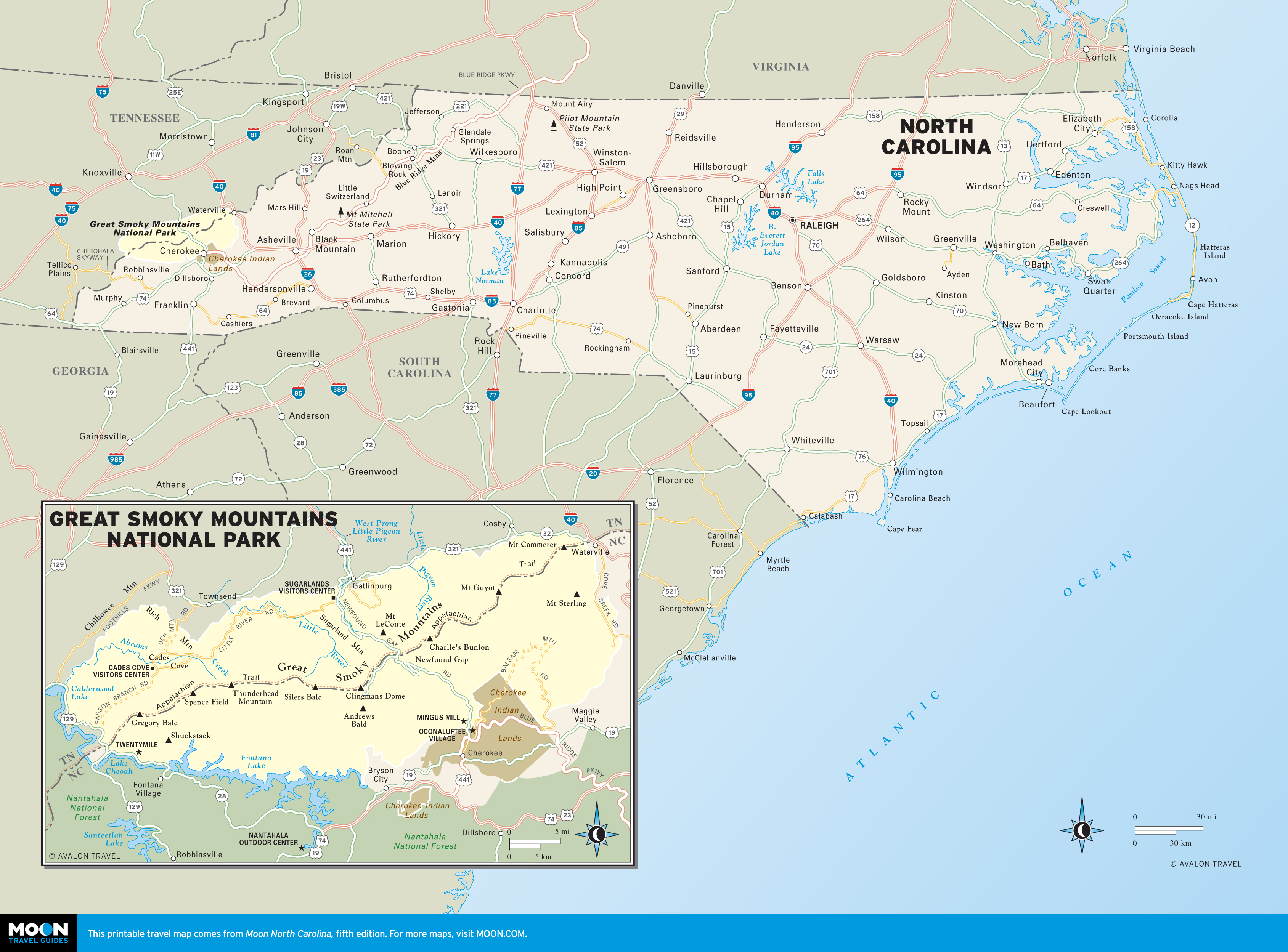
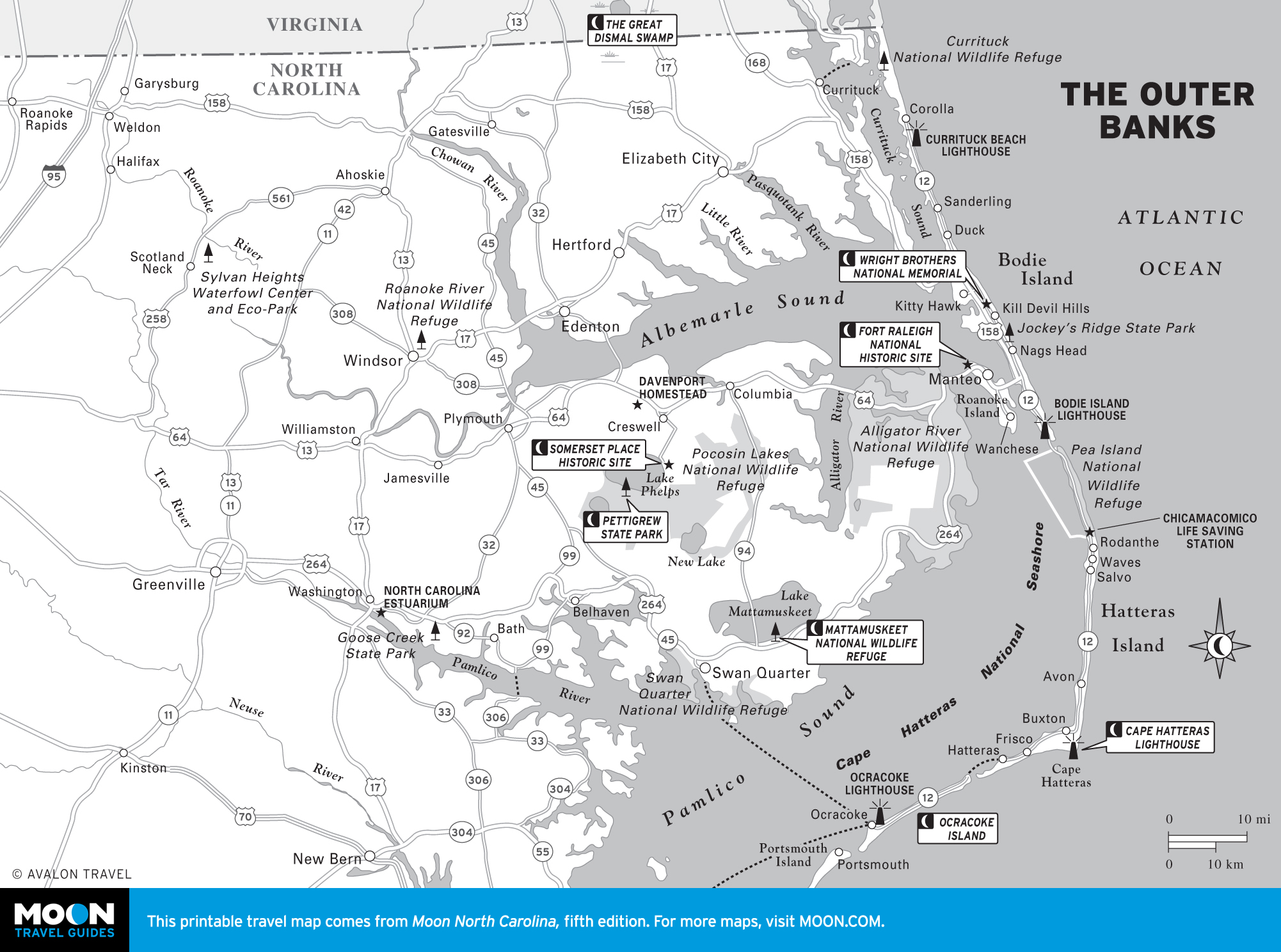
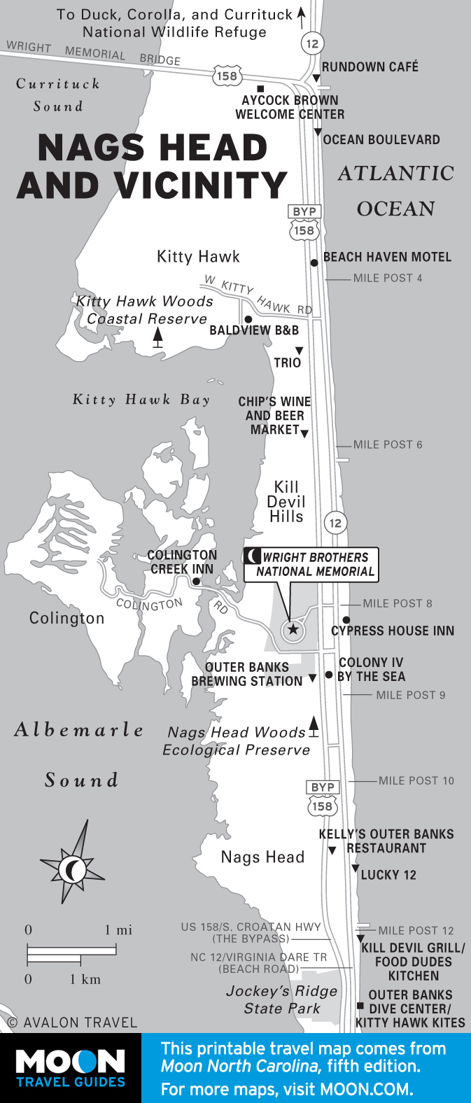
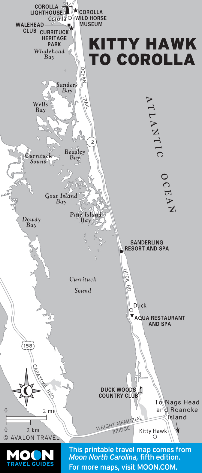
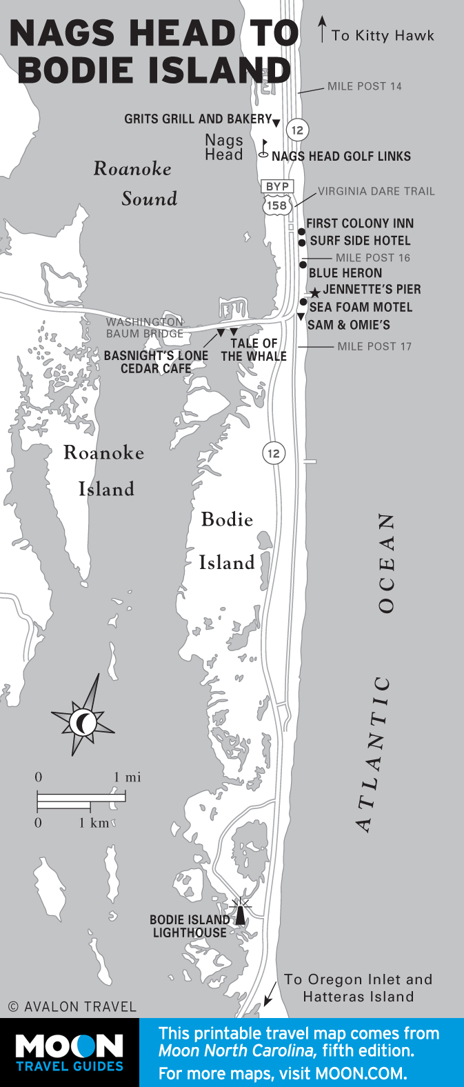
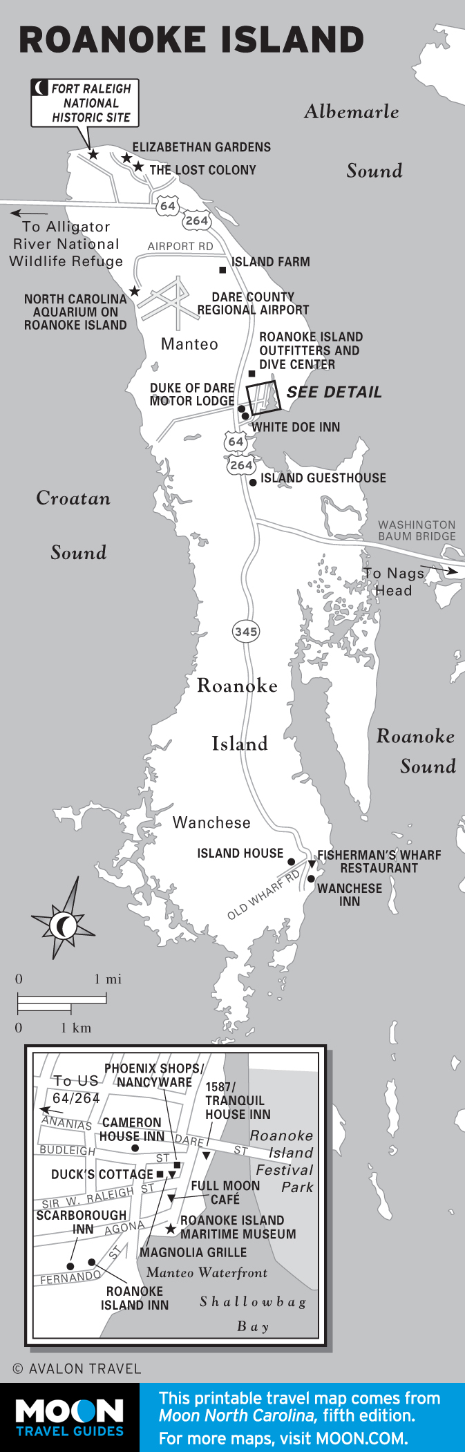
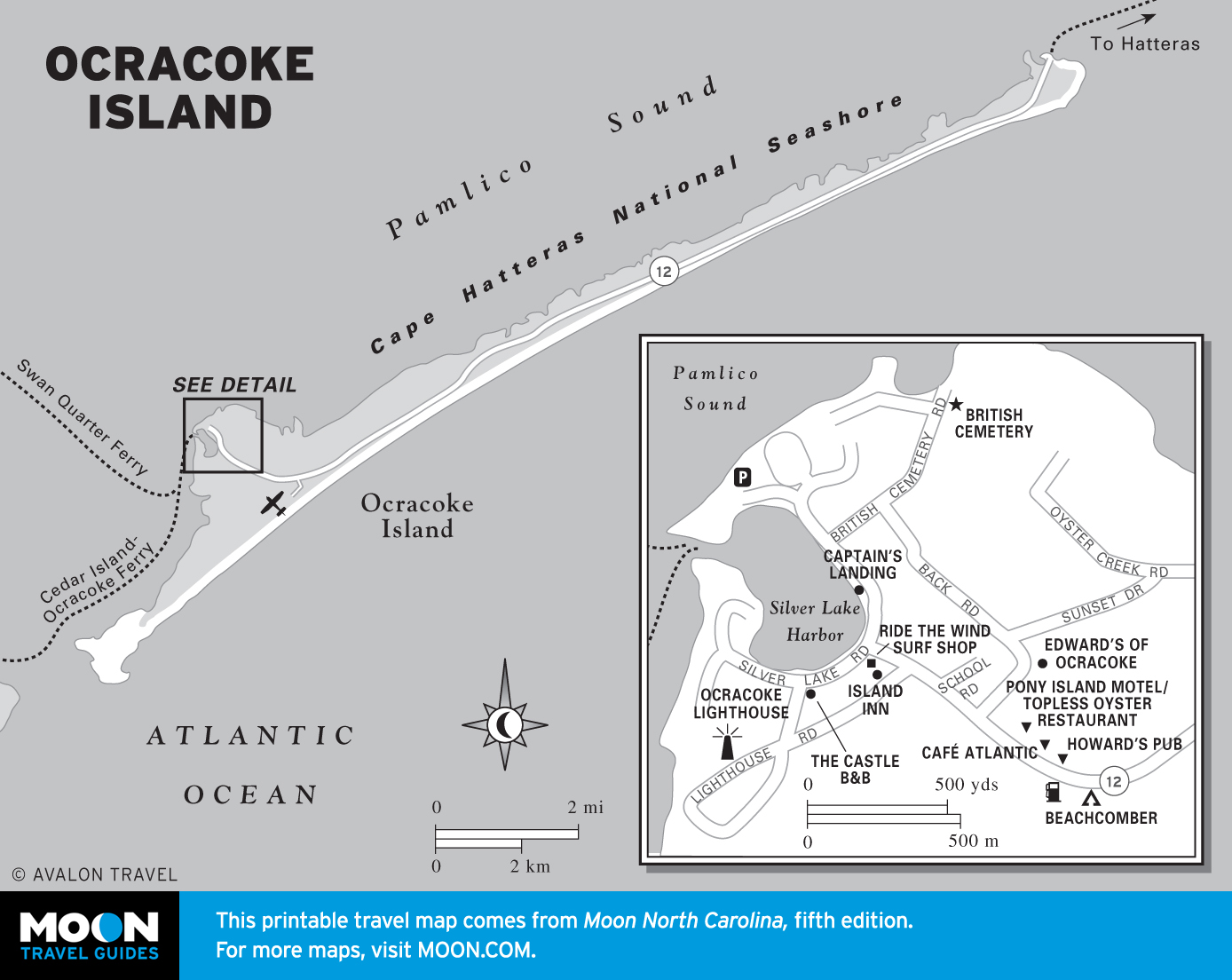
The Outer Banks
This stretch of shoreline is rich with ecological wonders, centuries-old traditions, and historical mysteries. Around Nags Head and the Cape Hatteras National Seashore, surfers and hang gliders ride the wind and waves. One of the first English settlements appeared and then disappeared on Roanoke Island, and Blackbeard roamed these waters before losing his head near Ocracoke. Along the vast Pamlico and Albemarle Sounds, colonial towns and fishing villages stand sentinel along deep, still rivers. The Great Dismal Swamp is an eerie, unforgettable place for kayaking and canoeing.

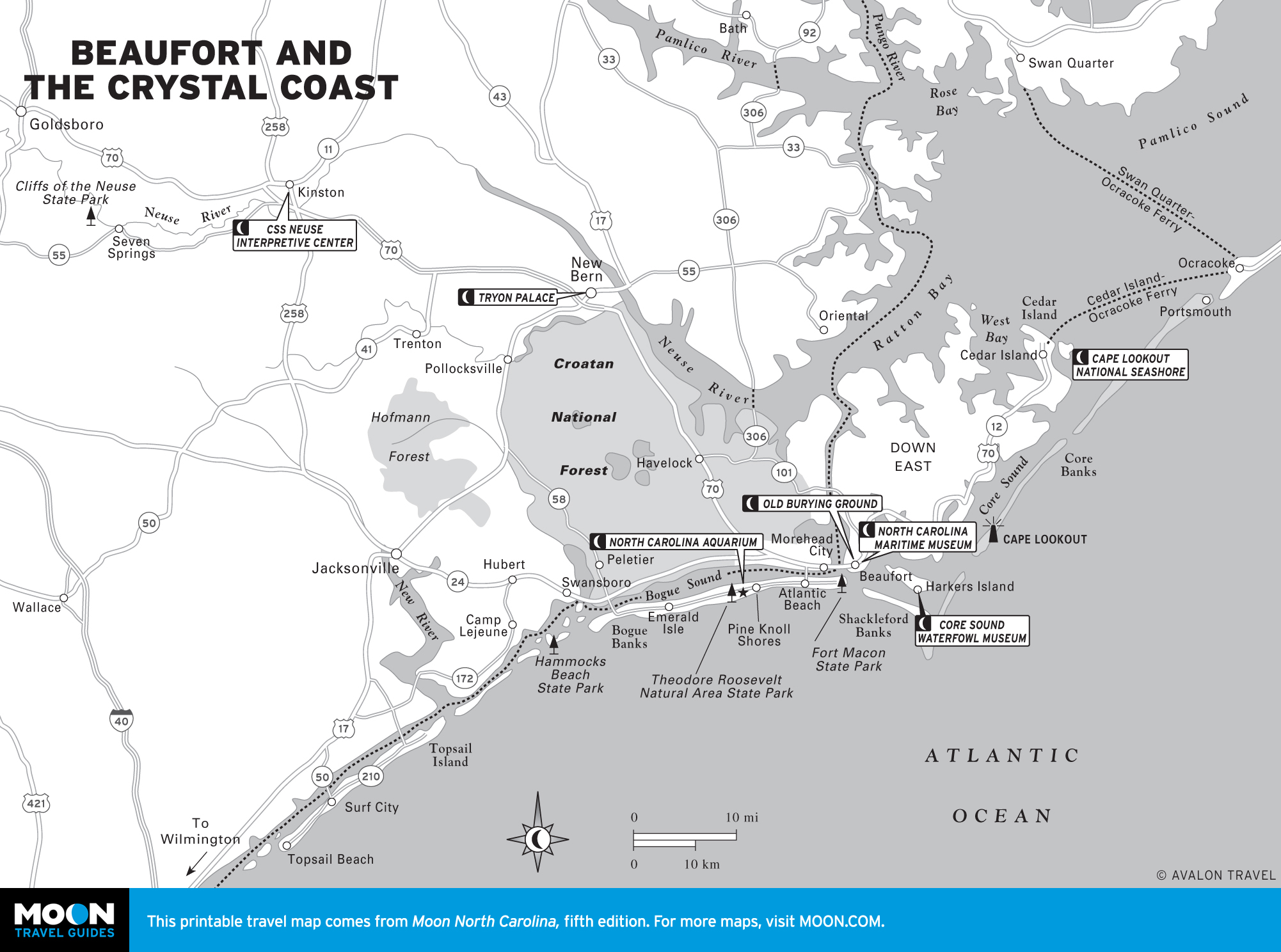
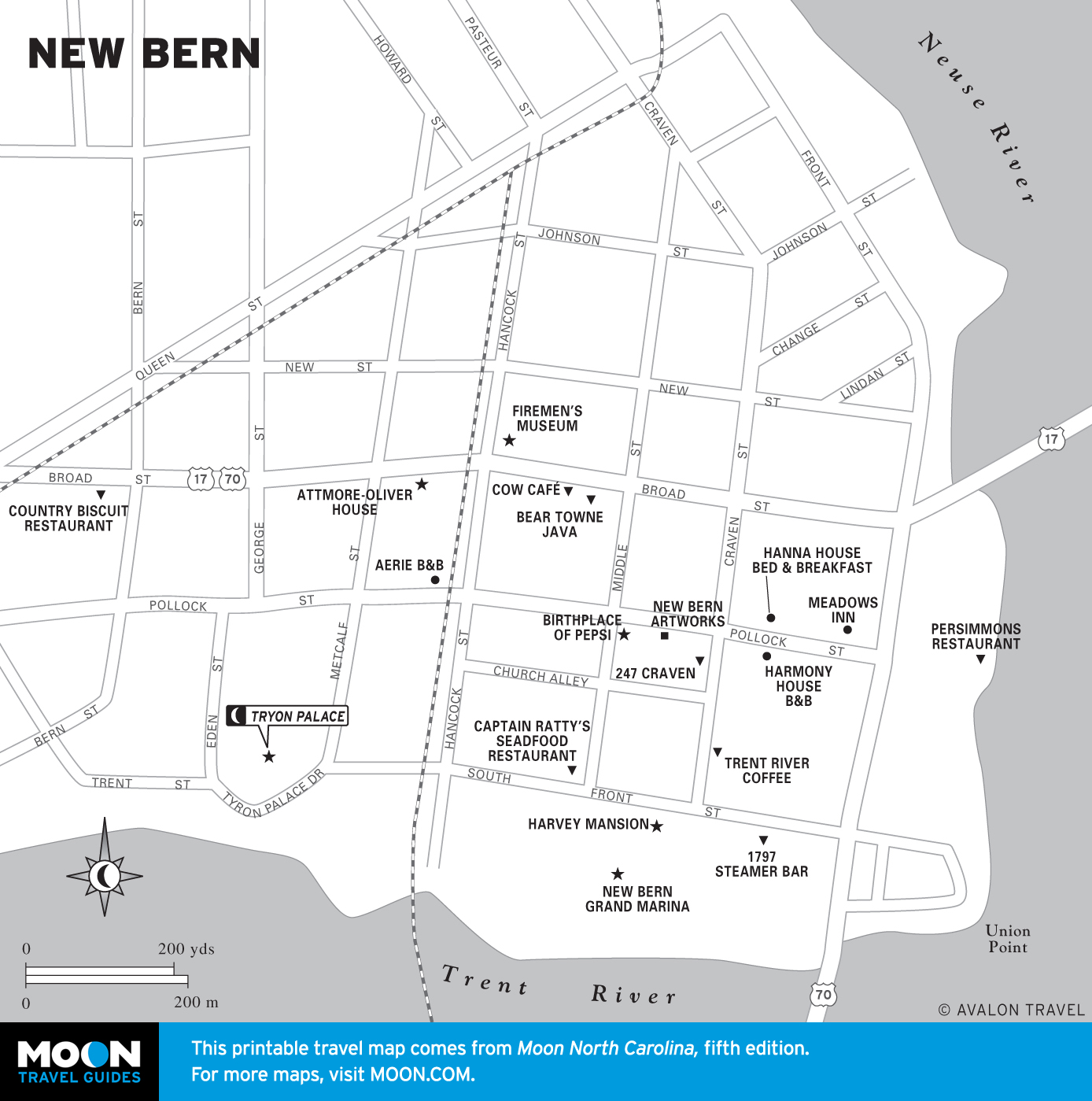
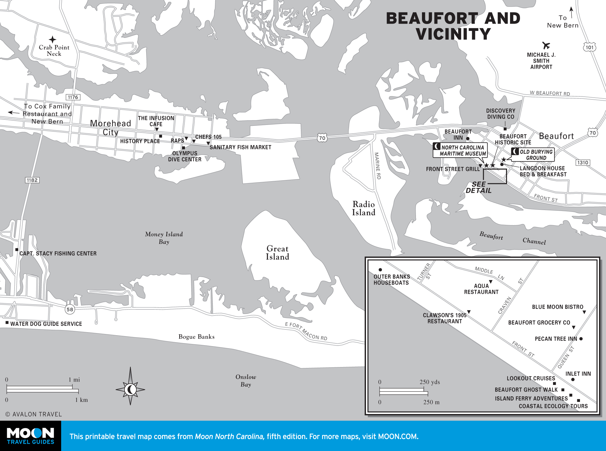
Beaufort and the Crystal Coast
Quiet, comfortable beach towns line the Crystal Coast. Beaufort and New Bern, two of early North Carolina’s most important cities, have some of the most stunning early architecture in the South. Morehead City is a hot spot for scuba diving the offshore wrecks in the Graveyard of Atlantic, and Cape Lookout National Seashore has 56 miles of undeveloped shoreline inhabited only by wild horses and birds.
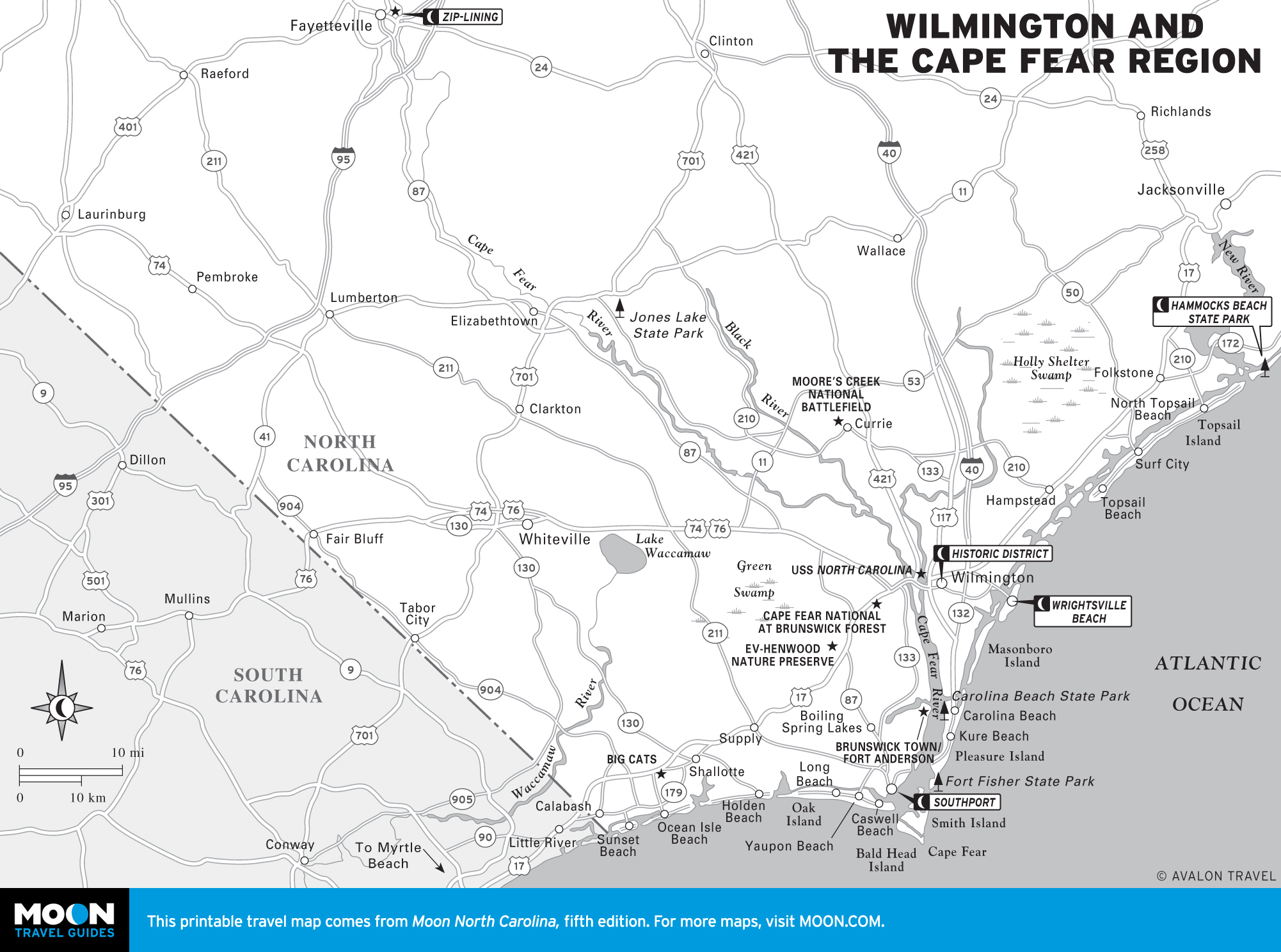
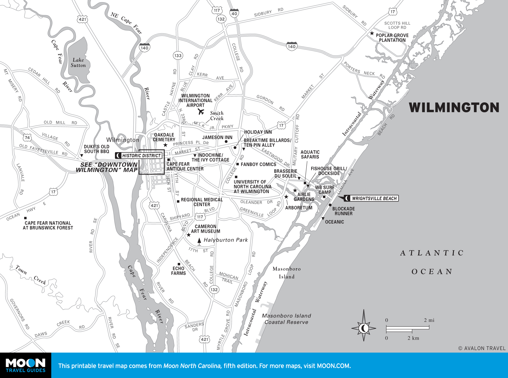
Wilmington and the Cape Fear Region
The towns surrounding the mouth of the Cape Fear River are year-round knockouts. The old port city of Wilmington is known for its antebellum homes and gardens as well as lively shops and restaurants. Topsail Island, Wrightsville Beach, and the Beaches of Brunswick County offer some of the most beautiful stretches of sand in the nation. Inland, the Waccamaw and Lumber Rivers creep through blackwater swamps, while the Cape Fear River leads upstream to Fayetteville, a military hub.

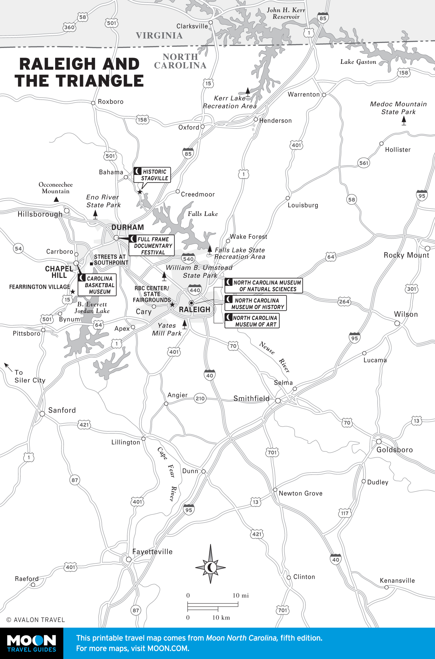
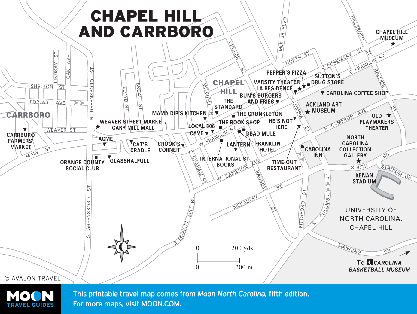
Raleigh and the Triangle
College towns Raleigh, Durham, and Chapel Hill share a creative verve and intellectual vibe. Visitors enjoy rich music and literary scenes and volcanically exciting college sports. Come hungry and thirsty—fantastic restaurants, bars, and breweries await.


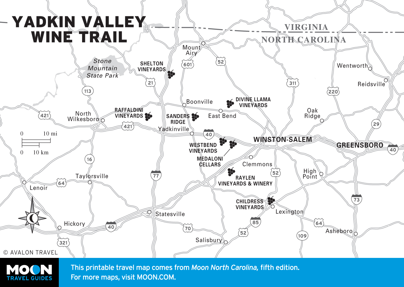
Winston-Salem and Central Carolina
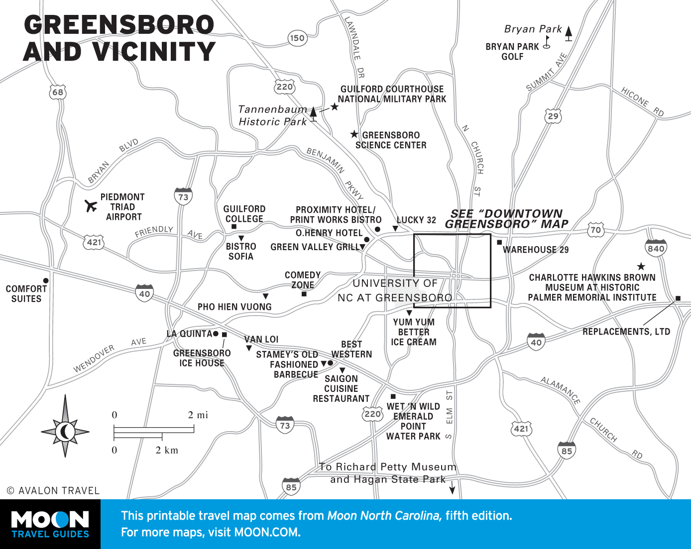
Few visitors experience North Carolina’s Piedmont in all its glory, but more should. At the southeastern edge, the Sandhills are a golfing mecca, with the famed Pinehurst Resort and one of the best-known courses in the world, and the nearby town of Seagrove is renowned for its pottery. The ancient, creepy Uwharrie Mountains shelter deep forests and mountain lakes. Greensboro and Winston-Salem house great galleries, museums, and restaurants. Old Salem preserves the village built by 18th-century religious pilgrims, and the Yadkin Valley, the heart of North Carolina’s wine country, is nearby.


Charlotte and Racing Country
The Old South, New South, and Global South come together to make Charlotte unmatched in its cultural vitality. The diverse restaurants alone show this: you’ll find everything from fried chicken to phô to enchiladas. There’s plenty to do here: south of Charlotte is the amusement park Carrowinds and the US Whitewater Center; north of Charlotte is the epicenter of NASCAR at the Charlotte Motor Speedway. The surrounding towns are filled with fun shops and historic sites.
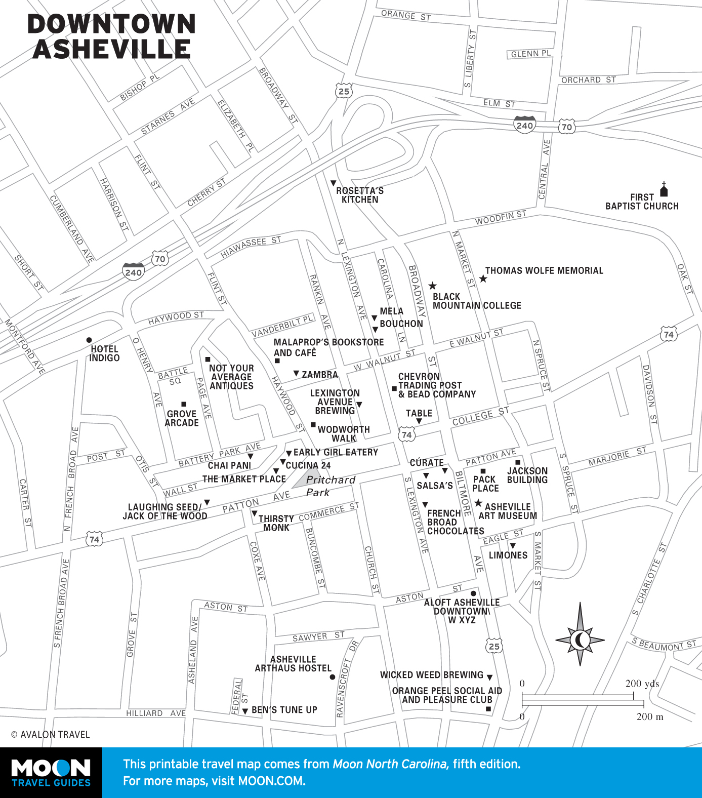
Asheville and the Blue Ridge
Asheville boasts artistic wealth and deep creative passions. A top beer destination and one of the South’s premier food cities, Asheville is filled with galleries, boutiques, and the general weirdness you expect from bigger cities. Its location between the Blue Ridge and Smokies gives easy access to the mountains, especially the Great Smoky Mountains National Park, where recreation opportunities abound.

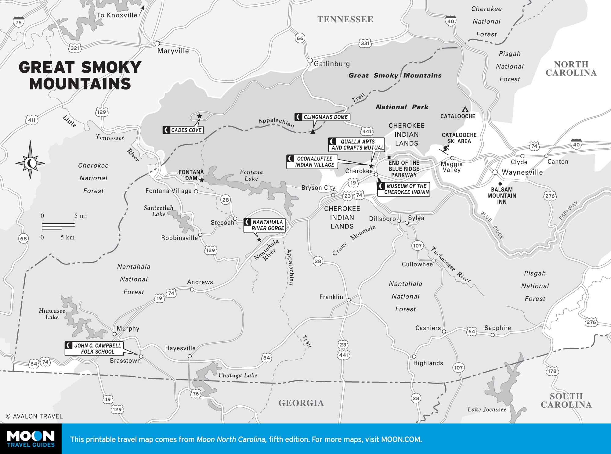
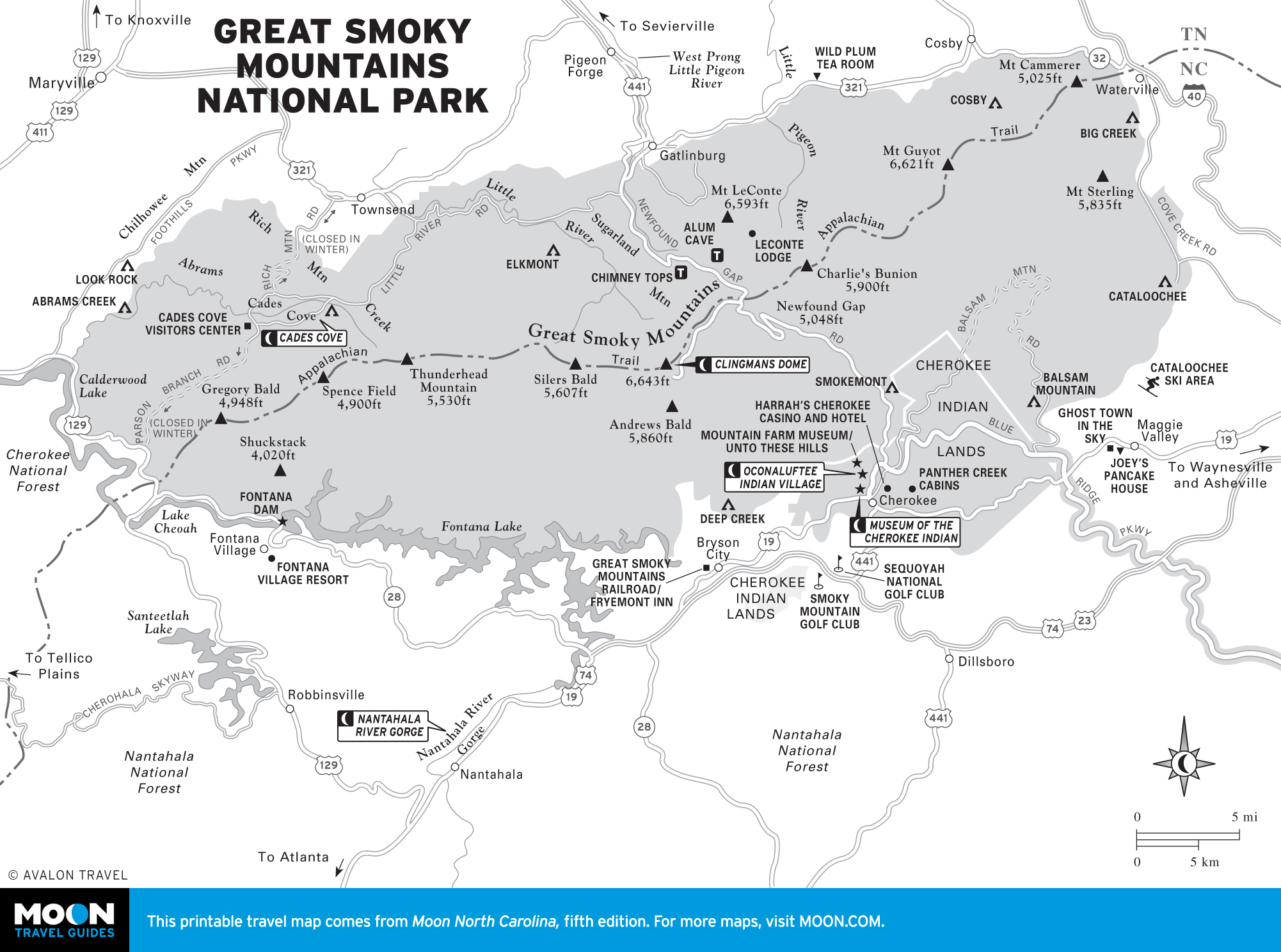
Great Smoky Mountains
Straddling the border with Tennessee, the Great Smoky Mountains National Park is a land of ridges, rocky rivers, virgin forests, and tumbling waterfalls. Visit appealing little towns like Dillsboro, Waynesville, and Sylva, as well as the tribal seat of the Eastern band of the Cherokee, a casino, and the first (and only) fly-fishing trail in the United States.