Capitol Reef’s Best Sights Along Route 24 Scenic Byway
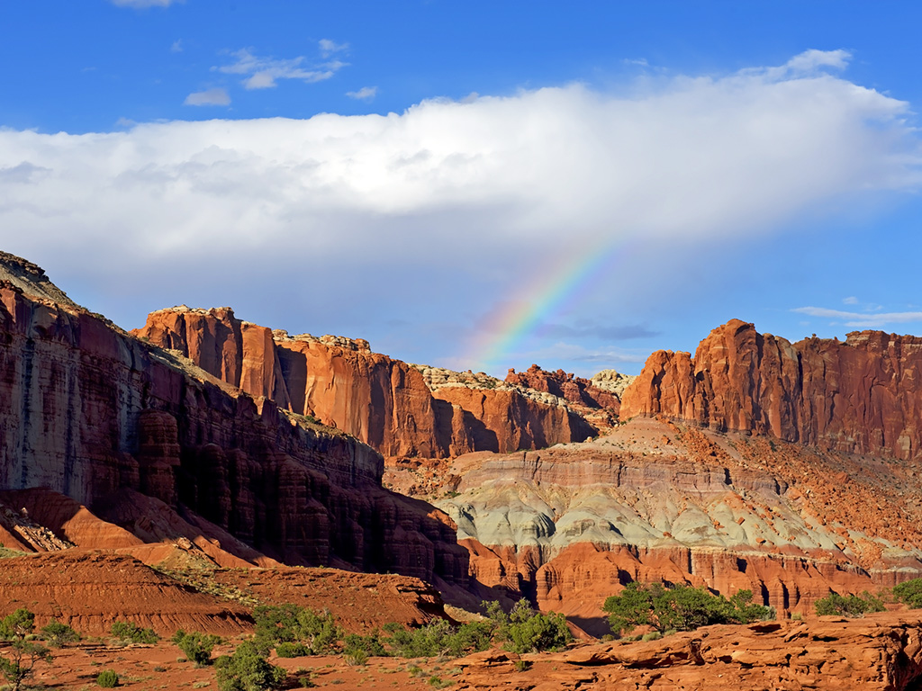
Capitol Reef National Park’s best sights along Route 24 scenic byway are varied. From the west, Highway 24 drops from the broad mountain valley near Torrey onto Sulphur Creek, with dramatic rock formations soaring to the horizon. A huge amphitheater of stone rings the basin, with formations such as Twin Rocks, Chimney Rock, and the Castle glowing in deep red and yellow tones. Ahead, the canyon narrows as the Fremont River slips between the cliffs to carve its chasm through the Waterpocket Fold.
Panorama Point
Take in the incredible view from Panorama Point, 2.5 miles (4 km) west of the visitors center on the south side of Highway 24. Follow signs south for 250 yards to Panorama Point and views of Capitol Reef, the distant Henry Mountains to the east, and looming Boulder Mountain to the west. The large black basalt boulders were swept down from Boulder Mountain to the reef as part of giant debris flows between 8,000 and 200,000 years ago.
Goosenecks Overlook
On a gravel road 1 mile (1.6 km) south of Panorama Point are the Goosenecks of Sulphur Creek. A short trail leads to Goosenecks Overlook (elev. 6,400 ft/1,950 m) on the rim for dizzying views of the creek below. Canyon walls display shades of yellow, green, brown, and red.
Sunset Point
Enjoy panoramic views of the Fremont River gorge, the Capitol Reef cliffs, and the distant Henry Mountains at Sunset Point. Plan your evening around viewing the sunset; it’s worth hanging out for the whole show. From the Goosenecks Overlook parking area, it’s an easy 0.3-mile (0.5-km) hike across the slickrock to Sunset Point. There’s a sign at the trailhead. Bring a flashlight and use caution when hiking back in the dark.
Historic Fruita School
Remnants of the pioneer community of Fruita stretch along the narrow Fremont River Canyon. The Fruita Schoolhouse is just east of the visitors center on the north side of Highway 24. Early settlers completed this one-room log structure, housing grades one through eight, in 1896. Mormon church meetings, dances, town meetings, elections, and other community gatherings took place here. A lack of students caused the school to close in 1941. Although the schoolhouse is locked, you can peer inside the windows and take photos. You can also listen to stories about the Fruita Schoolhouse on audioposts.
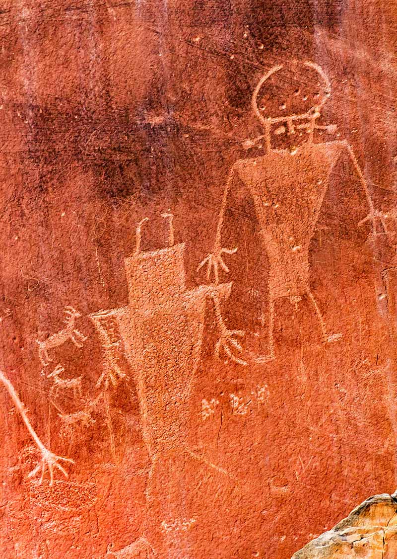
Fremont Petroglyphs
Farther down the canyon, 1.2 miles (1.9 km) east of the visitors center on the north side of Highway 24, are several panels of Fremont petroglyphs; watch for the road signs and parking area. Several mountain sheep and human figures with headdresses decorate the cliff. You can see more petroglyphs by walking to the left and right along the cliff face. Stay on the trail, and do not climb the talus slope. During the summer, rangers give talks about Fremont culture at 3pm daily.
Behunin Cabin
Behunin Cabin is 6.2 miles (10 km) east of the visitors center on the south side of Highway 24. Elijah Cutlar Behunin used blocks of sandstone to build this cabin around 1882. For several years, Behunin, his wife, and 11 of their 13 children shared this sturdy but quite small cabin (the kids slept outside). They moved on when flooding made life too difficult. Small openings allow a look inside the dirt-floored structure, but no furnishings remain.

By clicking ‘Sign Up,’ I acknowledge that I have read and agree to Hachette Book Group’s Privacy Policy and Terms of Use
