The Best Hikes in Monterey and Carmel
The Monterey and Carmel region contains outstanding hiking trails for all levels of hikers. Options include everything from an easy leg-stretching hike to a strenuous multiday backpacking adventure.

Easy Hikes
- The Skyline Trail (0.8 miles round-trip) in Jack’s Peak County Park offers a view of Monterey from the peninsula’s highest point.
- Point Lobos State Natural Reserve has plenty of easy hikes that pay impressive dividends with stunning scenery, abundant wildlife, and unique natural features. The Cypress Grove Trail (0.8 miles round-trip) is one of the best with its twisty cypress trees and vantage points of the sea.
- Most visitors to Big Sur want to view McWay Falls, the 80-foot waterfall that drops precipitously into the ocean. It can be seen from an observation deck by doing the Overlook Trail to McWay Falls Trail (0.66 miles round-trip) in Julia Pfeiffer Burns State Park.
- Andrew Molera State Park occupies a big parcel of Big Sur’s spectacular coastline. At the end of the Trail Camp Beach Trail (two miles round-trip) hikers are rewarded with a wild beach where the Big Sur River spills into the sea.
- Also in Julia Pfeiffer Burns State Park is the Partington Cove Trail (0.8 miles round-trip), which ventures out from the highway, over a bridge, and through a tunnel to a rocky cove.
Intermediate Hikes
- For a view of the Carmel coast from above, take Palo Corona Regional Park’s Inspiration Point Hike (1.3 miles round-trip) to a bench where the shoreline spreads out below. Be sure to first secure a permit to hike in the park.
- Pinnacles National Park has rock formations that seem to be nature’s take on castles and towers. The Juniper Canyon Loop (4.3 miles round-trip) travels up to some fine examples, especially on the steep and narrow portion of the trail.
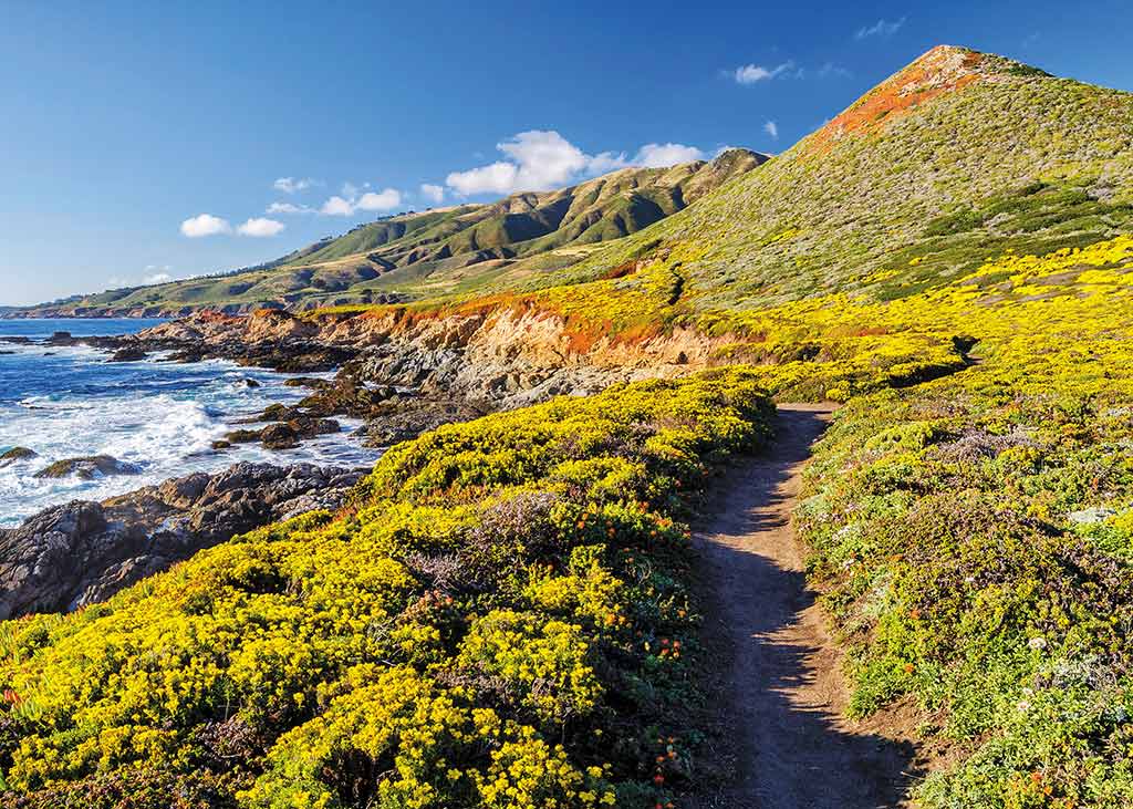
- Take the Ridge Trail and Panorama Trail Loop (eight miles round-trip) in Andrew Molera State Park for views of the Big Sur coast.
- In Julia Pfeiffer Burns State Park, the Ewoldsen Trail (4.5 miles round-trip) combines redwoods and coastal views, two of Big Sur’s best assets, for one of the region’s best day hikes.
- Towering above the south coast of Big Sur, Cone Peak in the Ventana Wilderness is a giant, rocky mountaintop with fantastic 360-degree views. The Cone Peak Trail (five miles round-trip) is a doable day hike to the summit of Big Sur’s second-highest peak.
Backpacking Hikes
- A backpacking trip that goes mostly downhill? That’s the Skyline to Sea Trail (30 miles one-way) in the Santa Cruz Mountains. The hike begins in Castle Rock State Park before heading into Big Basin Redwoods State Park, where it continues past towering trees and scenic waterfalls on the way to Waddell Beach.
- For an overview of Big Sur’s rugged backcountry, consider a multiday backpacking excursion in the Ventana Wilderness on the Pine Ridge Trail from China Camp to Big Sur Station (24 miles one-way). This hike travels along the Big Sur River with a stop at popular Sykes Hot Springs.
By clicking ‘Sign Up,’ I acknowledge that I have read and agree to Hachette Book Group’s Privacy Policy and Terms of Use


