Ecuador’s El Cajas National Park
Less than an hour northwest of Cuenca, the rugged landscapes of the Parque Nacional Cajas are pristine. The 28,000 hectares (69,200 ac) of the park, ranging 3,160-4,450 meters (10,370-14,600 ft) in altitude, are reminiscent of the Scottish Highlands, with rocky green mountains interspersed with crystalline lakes and streams. Most of the vast landscapes are covered in wildflower-strewn páramo (high-altitude moorlands), with some of the only remaining polylepis trees in the country. In stark contrast to the city, the only sounds are running water, the calls of birds, and the wind.
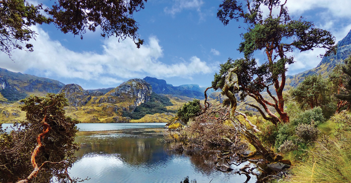
The páramo here acts as a giant sponge, forming 786 bodies of water within the park, 165 of them over a hectare (2.5 ac) in size. Here are born two of the rivers that cross Cuenca and provide its drinking water, the Tomebamba and the Yanuncay. Due to the large number of lagoons, the presence of migratory birds, and the significance of the water sources, Cajas has been recognized as a Wetland of International Importance. Despite this, it is currently threatened by mega-mining.
Visitors stand a good chance of seeing wild horses and the llamas that were reintroduced to the park in the late 1990s. Other mammals in the park include spectacled bear, rabbits, mountain wolves, deer, and pumas. Among the 157 bird species are condors, parrots, Andean toucans, tanagers, and hummingbirds.
El Cajas was used by the Cañaris, who inhabited the area before the Incan invasion, as a passage between the Sierra and the coast. Later, the Incas built a road here, the remains of which can be visited on a guided hike.
Newsletter Signup
By clicking ‘Sign Up,’ I acknowledge that I have read and agree to Hachette Book Group’s Privacy Policy and Terms of Use
Visiting El Cajas National Park
The main route to El Cajas from Cuenca is along the main road to Guayaquil, which climbs to 4,000 meters (13,000 ft) before dropping down dramatically to sea level. Buses to Guayaquil leave from the terminal terrestre every half hour. Ask the driver before boarding to let you off at the national park. To return to Cuenca, flag down a bus on the main road outside the park entrance (they pass every half hour) or stick out a thumb.
Though there are many hikes crossing the park, ranging from three hours to two days in duration, only two are recommended to undertake independently: the trails around Laguna Llaviucu and Laguna Toreadora. The other trails are not well marked, there is no cell phone signal in the park, and the weather can change in minutes, reducing visibility to near zero. It is very easy to get lost, and, with nighttime temperatures below freezing, deaths from exposure have occurred.
Just 18 km (11 mi) from Cuenca is the entrance to Laguna Llaviucu, where a well-marked 1.5-hour trail takes visitors around the lake. This is a more scenic walk than the more popular Laguna Toreadora trail, with good bird-watching. Ask the bus driver to let you out at Llaviucu after around 30 minutes and register to enter the park at the office. Be aware that the office and lake are 2.8 km (1.7 mi) from the highway, from where it’s a three-hour round-trip walk.
The main entrance to the park is 34 km (21 mi) from Cuenca at the Laguna Toreadora visitor center (around an hour on the bus), where there is a well-marked, two-hour trail around the lake and a restaurant serving delicious locro de papa (potato soup), trout, and a set lunch. You can stay overnight at the refuge (tel. 7/237-0126), but there is capacity for only six people, so advance booking is advisable. Camping is also possible. Both the Llaviucu and Toreadora visitor centers close at 4pm, so make sure to arrive in time to complete the walks.
Tour Guides
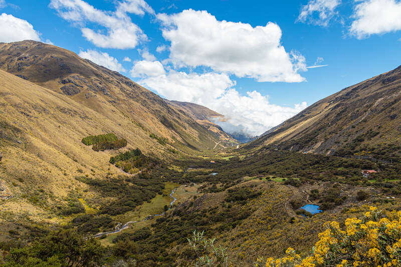
For other hikes within the park, it’s necessary to go with a guide. Wherever you go, stick to the paths. The páramo is covered with fragile, slow-growing vegetation that takes a long time to regenerate. Although it heats up considerably when the sun comes out, it’s generally pretty cold. Even if the sun is blazing when you set out, it can be hailing within minutes. Bring plenty of layers, rain gear, and waterproof hiking boots (waterproof boots are not needed for the trails around Laguna Llaviucu and Laguna Toreadora). It’s especially wet from mid-March through April. Be aware that it is tiring to walk at high elevation, so bring high-energy snacks and plenty of water. If you’re traveling up from the coast, it’s a good idea to spend a day or two acclimatizing in Cuenca before hiking in El Cajas.
All agencies in Cuenca offer daily group tours to the national park for $50-55 per person, including transport, bilingual guide, and lunch. The tours usually last 8am-4pm. The route varies depending on the weather, but all include Laguna Llaviucu. Other hikes can be booked as private tours, including a technical 2.2-km (1.4-mi) climb to the summit of Cerro San Luis (4,264 m/13,990 ft) and a two-day, 18-km (11-mi) trek on the Inca road to a series of lakes.
In addition to the standard Cajas day trip, Andén Tours (Gran Colombia 12-22 y Tarqui, Oficina 201, tel. 99/959-7882) takes visitors walking to a lesser-known part of the park, to three lakes collectively known as Sunincocha, followed by lunch with the local community of Miguir ($65 pp). They also offer horseback riding in the park ($75 pp).
Mateo Coellar (tel. 99/290-6777, coellar94@gmail.com) is a friendly local and a member of a mountaineering club who walks every week in El Cajas. He takes tourists on a stunning three- to four-hour hike that starts at Tres Cruces, the highest part of the highway a few kilometers past the Laguna Toreadora visitor center. From there, the trail descends past a series of lakes before ending on the highway near Laguna Luspa. He can also take visitors to climb the peak at Paragüillas, the location of the highest meteorological radar in the world at 4,450 m (14,600 ft), from where it’s possible to see Chimborazo on a clear day. It’s a fairly steep one-hour ascent and the same time to descend. Mateo, who speaks a little English, charges $35 per person with discounts for groups, including transport in his car. He takes wonderful photos and videos of each excursion and sends them to his hikers after the tour. There is the option of a post-hike meal with canelazo (not included in the price). Reservations should be made with at least 24 hours’ notice.
The Club de Andinismo Sangay (Mariscal Sucre 3-12 y Tomás Ordóñez, tel. 98/793-7205, ) is a local mountaineering club that offers occasional group hikes in El Cajas ($20).
Newsletter Signup
By clicking ‘Sign Up,’ I acknowledge that I have read and agree to Hachette Book Group’s Privacy Policy and Terms of Use
Pin It for Later
