Hiking El Yunque National Forest in Puerto Rico
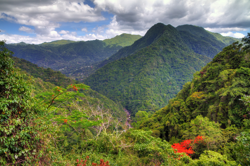
El Yunque National Forest is the crown jewel of Puerto Rico’s natural treasures and a hiker’s paradise. The only tropical rainforest in the United States, it encompasses 29,000 acres and contains some of the only virgin forest remaining on the island. This ecologically diverse wonderland is home to thousands of native plants, including 150 fern species and 240 tree species, and a variety of birds and reptiles.

Some parts of the forest receive up to 240 inches of rain a year, and the average temperature is 73°F (23°C). Spanning the park is the Sierra de Luquillo, a steep and densely forested mountain range. The highest peak is El Toro at 3,526 feet (1,075 m) above sea level; the second-highest peak is El Yunque at 3,461 feet (1,055 m).
Entry and Tickets
The best way to access El Yunque is to visit the well-maintained La Mina Recreation Area, managed by the U.S. Forest Service. La Mina is in the municipality of Río Grande. The national forest actually spans multiple other municipalities, including Canóvanas, Luquillo, Las Piedras, and Naguabo. Efforts are underway to develop access to El Yunque from these municipalities.
Entrance requires a ticket ($2 per vehicle) purchased in advance. Tickets are sold one day at a time, five weeks in advance. It’s a good idea to purchase tickets as early as possible. If your desired day is sold out, check back early the day before, when additional tickets are sometimes released. Tickets are sold for two time slots: 8am-11am and 11am-2pm. Visitors can enter anytime within their time slot and can stay until closing at 5pm.
On PR 191, the road that winds through El Yunque, there’s a checkpoint where a park employee will check your ticket.
If you can’t get a ticket on your own, check with your hotel concierge or book a tour with an independent tour operator; tours start around $50 per person.
Getting There
From San Juan, allow 45 minutes to drive 47 kilometers (29 mi) east to El Yunque via PR 6, then east on PR 66, and east on PR 3. From PR 3, turn south on PR 191, the main thoroughfare through the forest, which travels up into the mountains past the recreational facilities and trailheads for 13 kilometers (8 mi) until it ends about 2 kilometers (1 mi) from the peak.
El Yunque is also home to attractions and hiking trails located outside of the ticketed recreation area. Proceed carefully because the roadways are not always well maintained. It’s best to avoid driving in these areas during rainfall and at night.

Trails
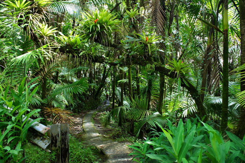
To fully appreciate El Yunque’s beauty and majesty, park the car and hike into the jungle. It doesn’t take more than a couple of dozen steps to become completely enveloped by the dense, lush foliage. Here the aural assault of the 21st century is replaced by a palpable hush and the sounds of water in motion—flowing, dripping, raining—punctuated by birdsong and frog chirps.
El Yunque National Forest has a variety of trails, ranging from easy to very strenuous, that lead to waterfalls, natural pools, and mountain peaks. The longest trail is 6 kilometers (4 mi) one way, but because of the terrain, it takes four hours to traverse it. Some of the trails have steps; most are paved or covered in gravel to keep them passable through the constant rain. Hiking boots with good tread are a necessity. Even paved trails can be slippery and muddy. The warm air and high humidity require frequent hydration, so bring plenty of water. And it rains a lot, naturally, so light rain gear is recommended. Avoid streams during heavy rains, as flash floods can occur. Bug spray and sunscreen are recommended.
Newsletter Signup
By clicking ‘Sign Up,’ I acknowledge that I have read and agree to Hachette Book Group’s Privacy Policy and Terms of Use
The following trails are accessible from El Yunque’s ticketed recreation area, La Mina. All trail lengths and hiking times are approximate.
La Coca Trail
La Coca Trail (3 km/2 mi, 1.5 hours one-way, strenuous, gravel) starts across the street from La Coca Falls. The steep and muddy trail requires navigating over rocks and through streams to access a natural pool suitable for swimming.
El Yunque Trail
El Yunque Trail (4 km/2.5 mi, 2 hours one-way, strenuous, pavement and gravel) is one of the forest’s longest and most strenuous hikes. It starts from Caimitillo Trail (PR 191, km 11.3) and climbs to an altitude of 3,400 feet (1,036 m). Along the way it passes several rain shelters, traverses the cloud forest, and ends at Los Picachos Trail. The upper trail branches left to connect with Mount Britton Trail and right to Los Picachos Trail. The trail to the highest peak of El Yunque is closed.
Caimitillo Trail (0.8 km/0.5 mi, 25 minutes, easy, paved and steps) begins at Sierra Palm Picnic Area (PR 191, km 11.3) and crosses a stream. Along the way you’ll pass a picnic area and structures used by the Puerto Rican parrot recovery program.
Los Picachos Trail (0.4 km/0.25 mi, 25 minutes, strenuous, unpaved and steps) is a steep ascent from El Yunque Trail to Los Picachos, one of three peaks that comprise the summit of El Yunque, marked by a stone observation deck built by the CCC in the 1930s.
Mount Britton Trail

Mount Britton Trail (1.5 km/1 mi, 45 minutes one-way, strenuous, paved) starts at PR 9938, a loop road at the end of PR 191. It is an uphill hike through tabonuco, sierra palm, and cloud forests. The trail crosses two streams and runs along a service road for a short distance—if you’re not sure which way to go, just keep heading straight up. It ends at the Mount Britton Tower, built in the 1930s by the CCC. Mount Britton Spur (1.5 km/1 mi, 30 minutes, moderate, paved) connects Mount Britton Trail to El Yunque Trail.
Trade Winds Trail
Trade Winds Trail (6 km/4 mi, 4 hours one-way, very strenuous, unpaved and unmaintained) is the forest’s longest trail, and it is unpaved, unmaintained, muddy, and overgrown in parts. To reach the trailhead, drive to the end of PR 191 where the road is closed. Park your vehicle without blocking the gate. Walk past the gate to the trailhead. The trail ascends El Toro, the highest peak in the forest, where it connects with El Toro Trail. Landslides are common in some areas, so be prepared to make your own trail. Long sleeves and pants are recommended for protection against brush, some of which can cause skin irritation on contact. There is very little—if any—cellphone service here. Bring lots of water.
Closed Trails
Two trails damaged by Hurricanes Irma and María in 2017 remain closed. La Mina Trail (0.8 km/0.5 mi, 25 minutes, moderate, paved and steps) starts at Palo Colorado Visitors Center and follows La Mina River, ending at La Mina waterfall, where it connects with Big Tree Trail. Big Tree Trail (1.5 km/1 mi, 35 minutes, moderate, paved and steps) is an interpretive trail with signs in Spanish and English. It passes through tabonuco forest, crosses streams, and ends at La Mina waterfall, where it connects to La Mina Trail. The trailhead is by a small parking area at PR 191, km 10.2.
Newsletter Signup
By clicking ‘Sign Up,’ I acknowledge that I have read and agree to Hachette Book Group’s Privacy Policy and Terms of Use
Pin it for Later


