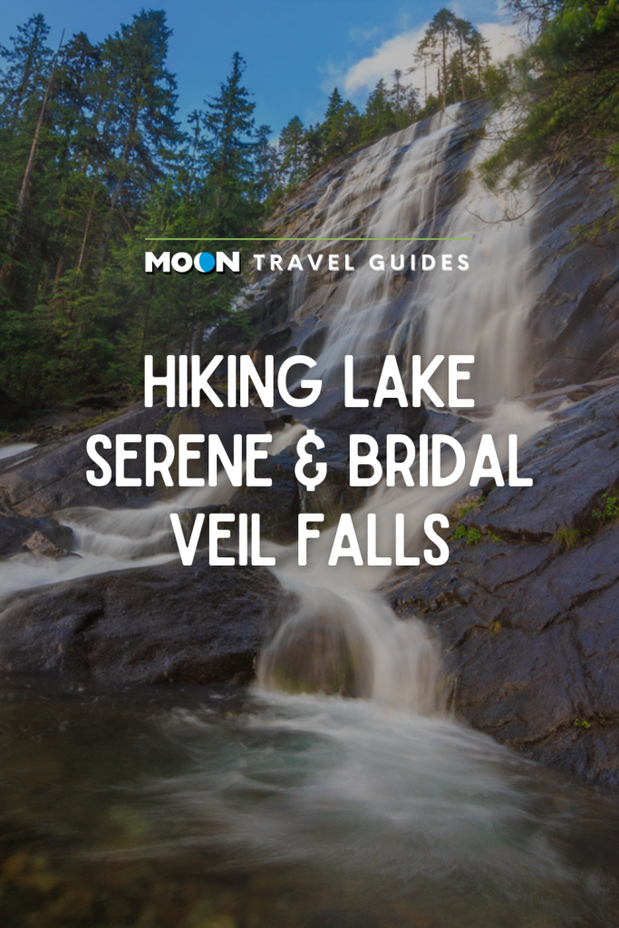
Hiking Lake Serene and Bridal Veil Falls
Relax at the edge of a lake shimmering beneath the rocky slopes of Mount Index after visiting a massive seven-tiered waterfall on this stunning hike in Washington.
Located just south of U.S. 2 and the confluence of the Skykomish River’s north and south forks, this hike is ideal for people who love alpine lakes and giant waterfalls. In fact, one of the beauties of this trip is you don’t have to venture all the way to the lake to be blown away. A round-trip to Bridal Veil Falls is 4.2 mi (6.8 km), a trip to the lake and back is 7.4 mi (11.9 km), and visiting both is 8.2 mi (13.2 km).
Distance: 8.2 miles (13.2 km) round-trip
Duration: 5 hours
Elevation Gain: 2,500 feet (760 m)
Effort: Moderate
Trail: Dirt, steps, slippery rocks
Users: Hikers, leashed dogs
Season: May-November
Passes/Fees: Northwest Forest Pass
Maps: Green Trails Map 142 for Index
Trailhead: Lake Serene & Bridal Veil Falls Trailhead
Facilities: Vault toilets
Contact: Mount Baker-Snoqualmie National Forest, Skykomish Ranger District; 360/677-2414
Start the Hike
Mile 0-2.1: Old Logging Trail to Bridal Veil Falls
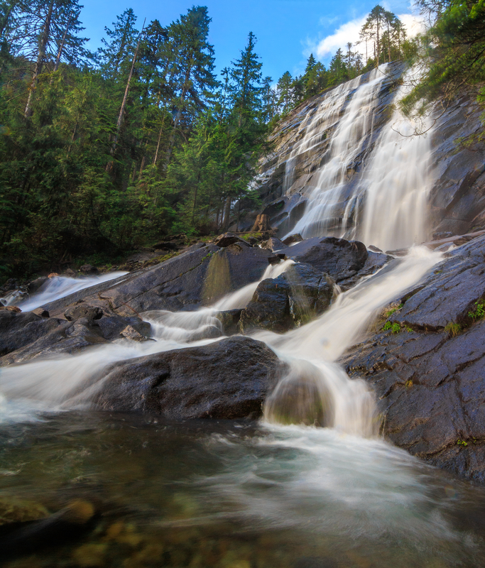
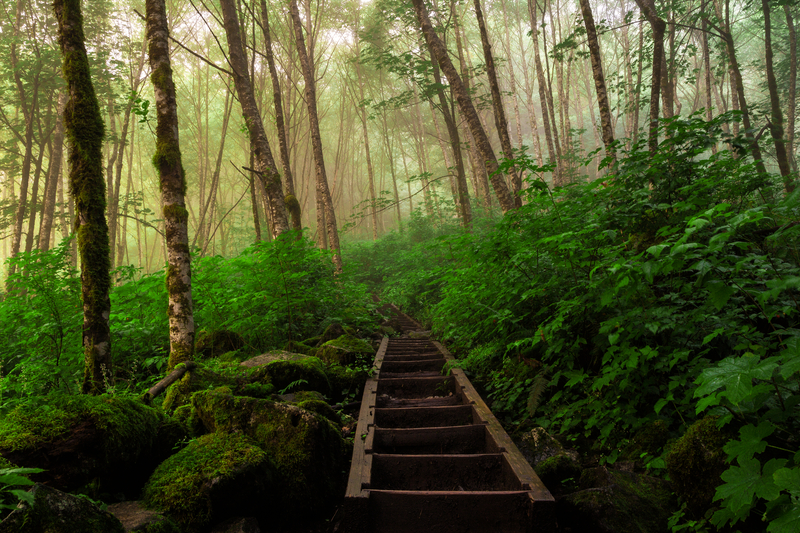
From the parking lot, head south on an old logging trail. Pass alders, maples, Douglas firs, and hemlocks and step over creeks flowing toward the South Fork Skykomish over the next 1.7 mi (2.7 km). After descending some steps, turn right on the spur for Bridal Veil Falls. It’s just 0.4 mi (0.6 km) farther, but the way is steep and includes several sections of stairs. On warm summer days you might appreciate the spray from the falls as you arrive at the viewing areas. Other days, you might wish you packed a raincoat. Bridal Veil Creek fans out on the cliffs as it splashes down from Lake Serene. The falls drop nearly 1,300 ft (400 m) over seven tiers. The entirety of the falls is too much to take in from any one spot, but you’ll have no problem finding an impressive vantage point. Just be careful on the slippery rocks.
Mile 2.1-4.5: Bridal Veil Falls to Bridal Veil Falls Bridge and Lake Serene
When you’re finished marveling at the force of nature, descend 0.4 mi (0.6 km) back to the junction. Turn right and, after 0.2 mi (0.3 km), cross the Bridal Veil Falls bridge to continue to Lake Serene. The most significant bit of climbing sits between the bridge and the lake. Spend 1.8 mi (2.9 km) climbing switchbacks up 1,500 ft (460 m) until the lake’s jaw-dropping beauty finally comes into view.
Mile 4.5-8.2: Lake Serene to Parking Lot
Lake Serene mirrors Mount Index’s sheer rock walls and invites you to stay and relax. Early in the season, when snow and ice still cling to the imposing cliffs of Mount Index, it’s not uncommon for serenity to be interrupted by a loud crack as avalanches rumble down the slopes on the other side of the lake.
Despite this occasional drama, Lake Serene lives up to its name, even when it draws a crowd. Find room to sit on a shoreline boulder and do your own reflecting at the north end of the lake, where the path leads over the lake’s outlet and passes a short spur trail leading to a view of the valley. When you’ve had your fill of serenity, ready your knees for the downhill return via the same trail.
Directions
From Monroe, drive east for 20 mi (32 km) on U.S. 2 and turn right on Mount Index Road just before a steel bridge crossing the South Fork Skykomish River. Drive 0.3 mi (0.5 km) and turn right to access the parking lot.
GPS Coordinates: 47.809189, -121.573693 / N47° 48.5513’ W121° 34.4216’
Best Nearby Bites and Brews
You’ll want to work up a serious appetite before stopping at Gold Bar’s Mountain View Diner. Not only is the extensive menu loaded with options ranging from seafood to the 3/4-pound Big Foot Burger, but the restaurant, open since 1994, might be best known for desserts such as its pies, chocolate peanut butter mousse, and chocolate chip cheesecake. From the trailhead, the diner is a 7-mi (11.3-km) drive (11 minutes) west on U.S. 2.
Newsletter Signup
By clicking ‘Sign Up,’ I acknowledge that I have read and agree to Hachette Book Group’s Privacy Policy and Terms of Use


Pin It for Later