Nevada’s Valley of Fire State Park
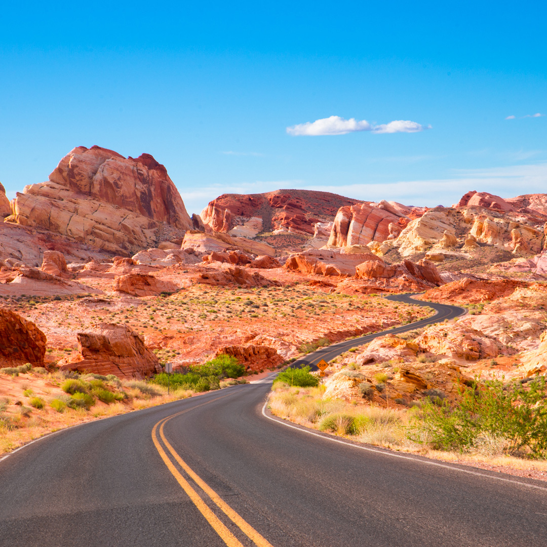
Working with a palette of red-tinged rock for 150 million years, the sun, wind, and rain created the masterpiece that is Valley of Fire State Park (29450 Valley of Fire Hwy., 702/397-2088). Like Red Rock Canyon, this valley, six miles long and 3-4 miles wide, gets its distinctive color from the oxidizing metals in its Mesozoic-era sandstone. It is part of the Navajo Formation, a rocky block that stretches from southern Colorado through New Mexico, Arizona, Utah, and Nevada, and its monuments—arches and protruding jagged walls in brilliant vermilion, magenta, and gold—epitomize the Southwest.
The highest and youngest formations in the park are mountains of sand deposited by desert winds 140 million years ago. These dunes petrified, oxidized, and were chiseled into psychedelic shapes and colors. Underneath them is a 5,000-foot-deep layer dating back at least 250 million years, when brown mud was uplifted to displace the inland sea. The gray limestone below represents another 200 million years of deposits from the Paleozoic marine environment 550 million years ago.
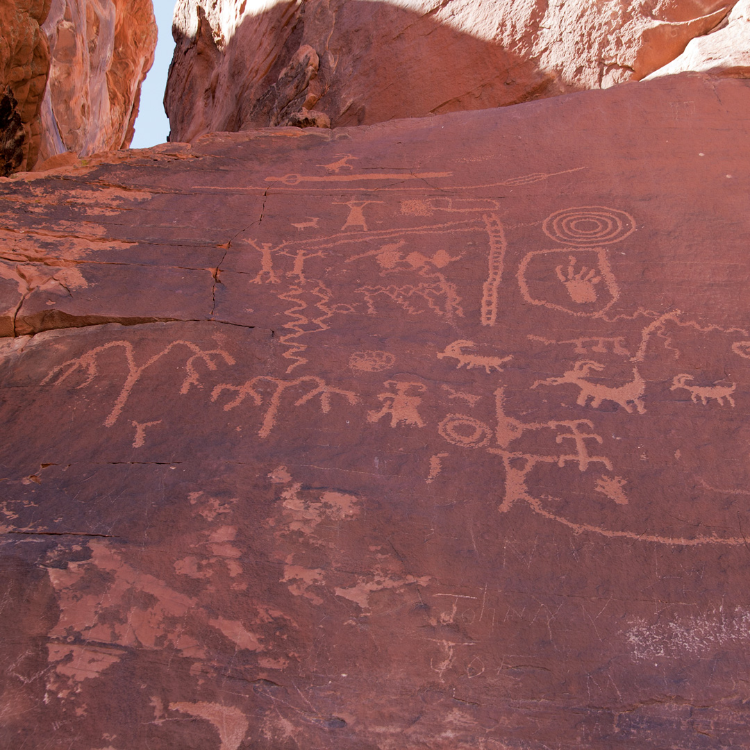
This stunning valley was venerated by Native Americans, as seen in numerous petroglyphs in the soft rock, and it was part of the old Arrowhead Highway auto trail through southern Nevada.

Exploring Valley of Fire State Park
A turnout near the entrance to the park has a self-service fee station: $10 entry, $20 for camping. An information shelter offers a description of Elephant Rock, one of the best and most photographed examples of eroded sandstone in the park; a short trail leads to it from the sign. Continue west past signs for the Arrowhead Trail and petrified logs to the cabins, built for travelers out of sandstone bricks by the Civilian Conservation Corps in 1935. Farther in, the Seven Sisters are stunning sentinels along the road.
The visitors center (8:30am-4:30pm daily) has a truly spectacular setting under a mountain of fire. Outside is a demonstration garden, and inside is the finest set of exhibits at any Nevada state park. Signboards by the front window describe the complex geological history of the landscape. You can spend another hour reading all the displays on the history, ecology, archaeology, and recreation of the park as well as browsing the changing exhibit gallery and the bookshelf near the information desk. There is a colorful interpretive signboard describing the most popular features in the Valley of Fire. Don’t forget to pick up a map of the park.
From the visitors center, take the spur road to Petroglyph Canyon Trail and dig your feet into some red sand. Mouse’s Tank is a basin that fills with water after a rain. A fugitive Native American named Mouse hid here in the late 1890s. The spur road continues through the towering canyon and peaks at Rainbow Vista, which has a parking area and a spectacular overlook.
The road continues four miles to Silica Dome, where you can park and gape at the walls, pillars, and peaks of sparkling white rock.

Head back toward the visitors center and take the through road, NV 169. Driving west, you come to a 0.25-mile loop trail to fenced-in petrified wood, the most common local fossil. On the other side of the highway, another spur road leads to the campgrounds and the high staircase up to sheer Atlatl Rock, which is inscribed with petroglyphs. This is the tallest outdoor staircase in the state, more than 100 steps up to the face of the rock; you’ll wonder how the petroglyphs’ creators got up here.
Atlatl Rock is between the two campgrounds. Together they total 51 campsites for tents or self-contained motor homes up to 30 feet. Both have piped drinking water, picnic tables under ramadas, grills, and fire rings.
The loop road continues back to the highway. Take a right and continue west to the Beehives, which are worth a look. From here you can turn around, return to the east entrance, and take a left on NV 169 toward Overton, or you can head to the west end of the park and back to Las Vegas (55 miles).
Related Travel Guide
Pin For Later

