The Waterfalls of Michigan’s Upper Peninsula
Scattered around the U.P. are no less than 300 sites of cascading water that punctuate its vast network of rivers and streams. Most require at least a short walk to reach, but the beauty that awaits you will make the effort worthwhile. While their sizes vary in terms of width and drop (the vertical height), virtually all of the falls are in idyllic tree-lined settings.
Spring is when the flow of water tends to be the strongest, as the runoff from the winter’s snow and ice swells the rivers, allowing gravity to work its magic. In summer, trees that are in full bloom combined with the warm temperatures can make waterfall viewing an ideal daylong activity. But autumn is without question the most satisfying time to see waterfalls—taking in the cascading stream amidst patches of yellow, orange, and crimson is endlessly engaging. Winter is for the more intrepid visitor, but you’ll be rewarded with solitude and unique beauty.
Be sure not to miss these beauties:
Bond Falls, Paulding
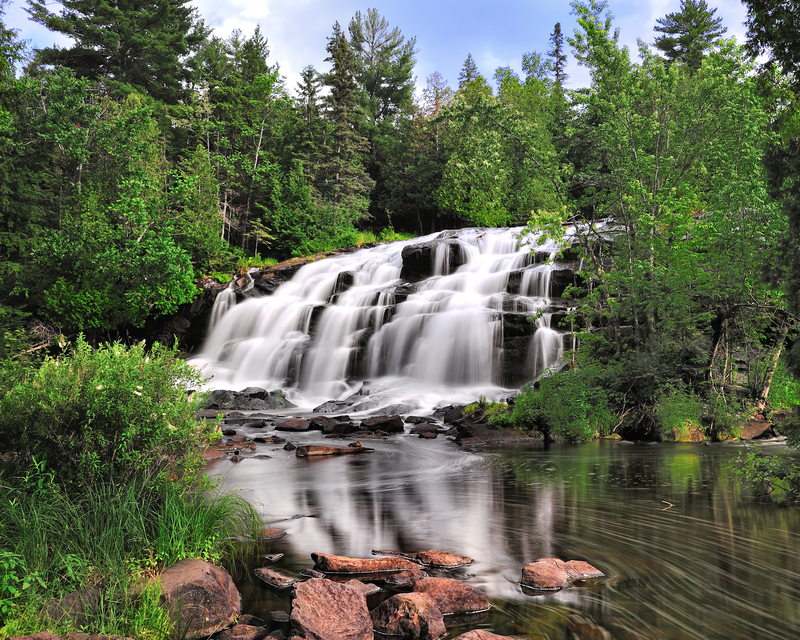
Bond Falls is one of the most spectacular falls in the Upper Peninsula, despite being over-developed with walkways and viewing platforms. Bond Falls is located near Paulding off US 45 in Ontonagon County, 3 miles (4.8 km) east on Bond Falls Road, and is well-marked by signs. Though virtually surrounded by national forest land, the falls themselves sit on power company property, just below a dam that forms the adjacent Bond Falls Flowage, a popular area for fishing, swimming, and camping. To view the falls, follow the trail down the west side of the river. Ignore the spillway, cement retaining wall, and other power company additions. Once you begin descending the stairs, the falls come into view on the right, close enough to touch. Continue down the path to a footbridge that spans the base of the falls for an up-close view. Water gushes down a 50-foot (15-meter) face of chiseled rocks, so dramatic it almost looks artificial.
Presque Isle Falls, Porcupine Mountains Wilderness State Park
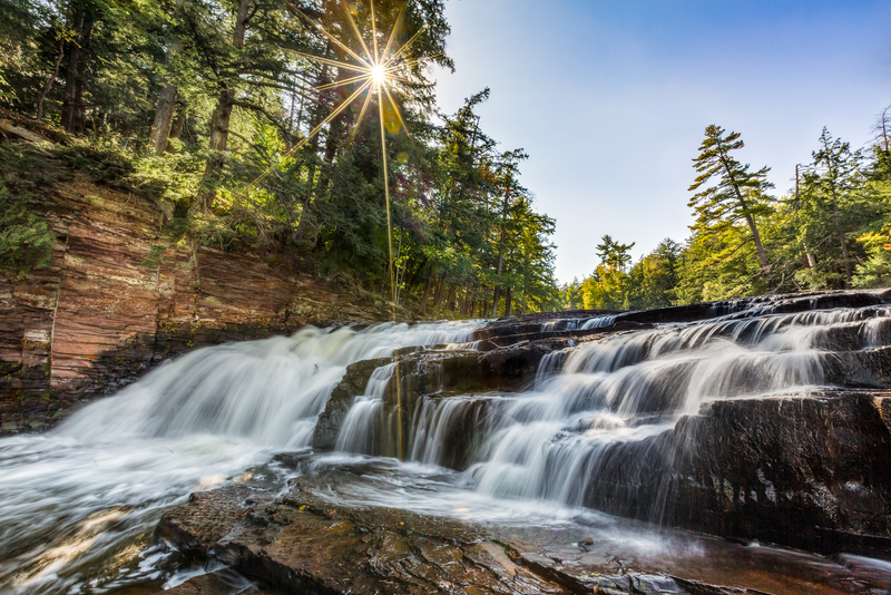
The Porcupine Mountains’ more than 60 waterfalls can seem a bit overwhelming, but despite the many choices, some stand out. Make the brief trek to Presque Isle Falls in the western portion of the park. Presque Isle Falls is actually a chain of three falls— Manabezho, Manido, and Nawadaha. The first two are accessible from the nearby parking areas. Manabezho has a fairly low drop, with rocky points punctuating the water. Manido occupies a wide spot on the river and resembles a stairway with a gentle, undulating flow. Nawadaha is the uppermost of the falls and requires a short but slightly rugged hike along the West River Trail. The swift current provides a power and roar seldom seen.
Newsletter Signup
By clicking ‘Sign Up,’ I acknowledge that I have read and agree to Hachette Book Group’s Privacy Policy and Terms of Use
Tahquamenon Falls, Paradise
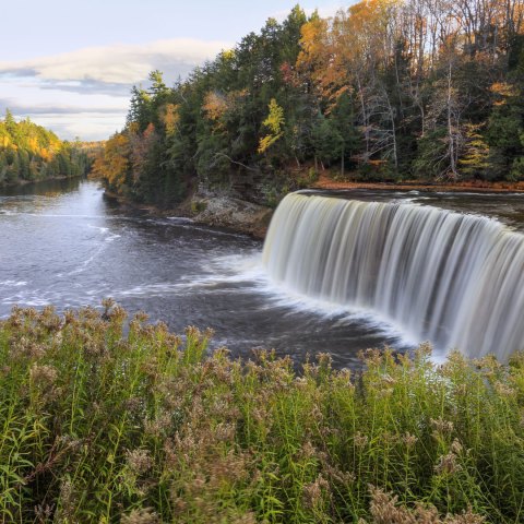
West of Newberry, the headwaters of the Tahquamenon River bubble up from underground and begin a gentle roll through stands of pine and vast wetlands. Rambling and twisting northeast through Luce County, the river grows wider and more majestic by the time it enters Tahquamenon Falls State Park (41382 M‐123, 906/492‐3415). Then, with the roar of a freight train and the power of a fire hose, it suddenly plummets over a 50‐foot (15‐meter) drop, creating a golden fountain of water 200 feet (60 meters) wide.
As many as 50,000 gallons of water per second gush over the Upper Tahquamenon, making it the second‐largest waterfall by volume east of the Mississippi, eclipsed only by Niagara. Adding to Tahquamenon’s majesty are its distinctive colors: bronze headwaters from the tannic acid of decaying cedars and hemlocks that line its banks, and bright white foam from the water’s high salt content.
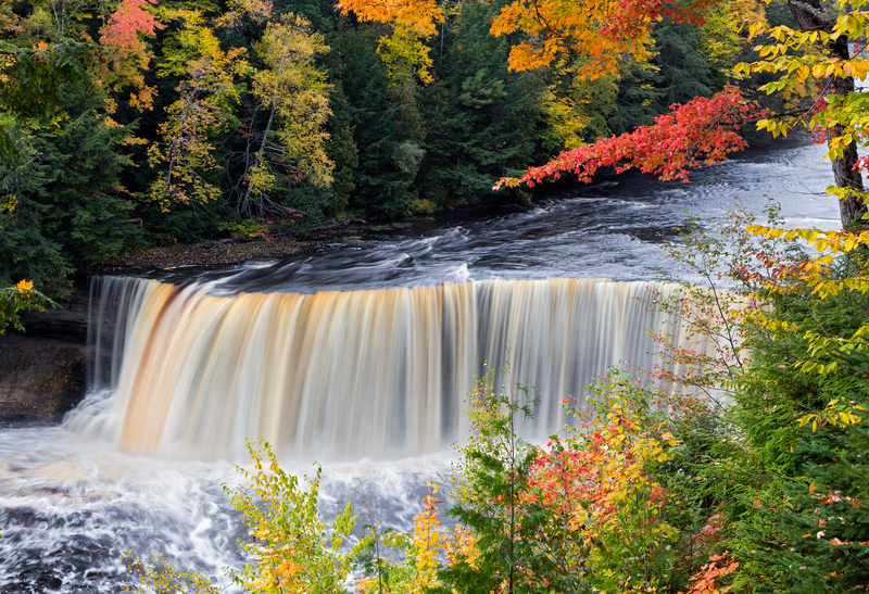
Accessing Tahquamenon Falls is easy, since both the Upper Falls and Lower Falls lie within Tahquamenon Falls State Park, which provides short, well‐marked paths to prime viewing sites. At Upper Tahquamenon Falls, follow the trail to the right and down the 74 steps to an observation deck, which will bring you so close you’ll feel the falls’ thundering power and its cool mist on your face, which on a hot summer day is wonderfully refreshing. The deck offers a stunning view of both the placid waters above and the furious frothing below.
Four miles (6.4 km) downstream, Lower Tahquamenon Falls consists of a series of cascades. The best vantage point is from a small island in mid‐river. A state park concessionaire rents out canoes and rowboats to make the short crossing.
In recent years, moose have been seen more frequently within the park. They generally stay near water, so your best chance to see one will be the Tahquamenon River Trail that links the Upper and Lower Falls and follows the path of the river.
Explore More of Michigan
Pin It for Later
