Plan a Visit to San Juan Bautista, California
To touch a piece of early California’s past, visit romantic San Juan Bautista. With less than 2,000 residents, the small town has one of the best historic parks in the state and a charming independent main street, and it’s surrounded by the fertile fields and bucolic rolling hills that were once a part of San Justo Rancho, a 34,000-acre 1839 Mexican land grant.
San Juan Bautista is in eastern Monterey County, twenty miles east of the sparkling waters of Monterey Bay. Monterey County is always hard at work, growing the lettuce for our salads, the strawberries for our ice cream, and tomatoes for our pasta sauce. Nicknamed the “Salad Bowl of the World,” the region, with its wide open spaces, fertile soil, and mild climate, was also the site of thriving Californio (Spanish-Californians) communities during the Mexican period. Today the towns are small, mostly agricultural, and are home to large Latino populations.

Sights in San Juan Bautista
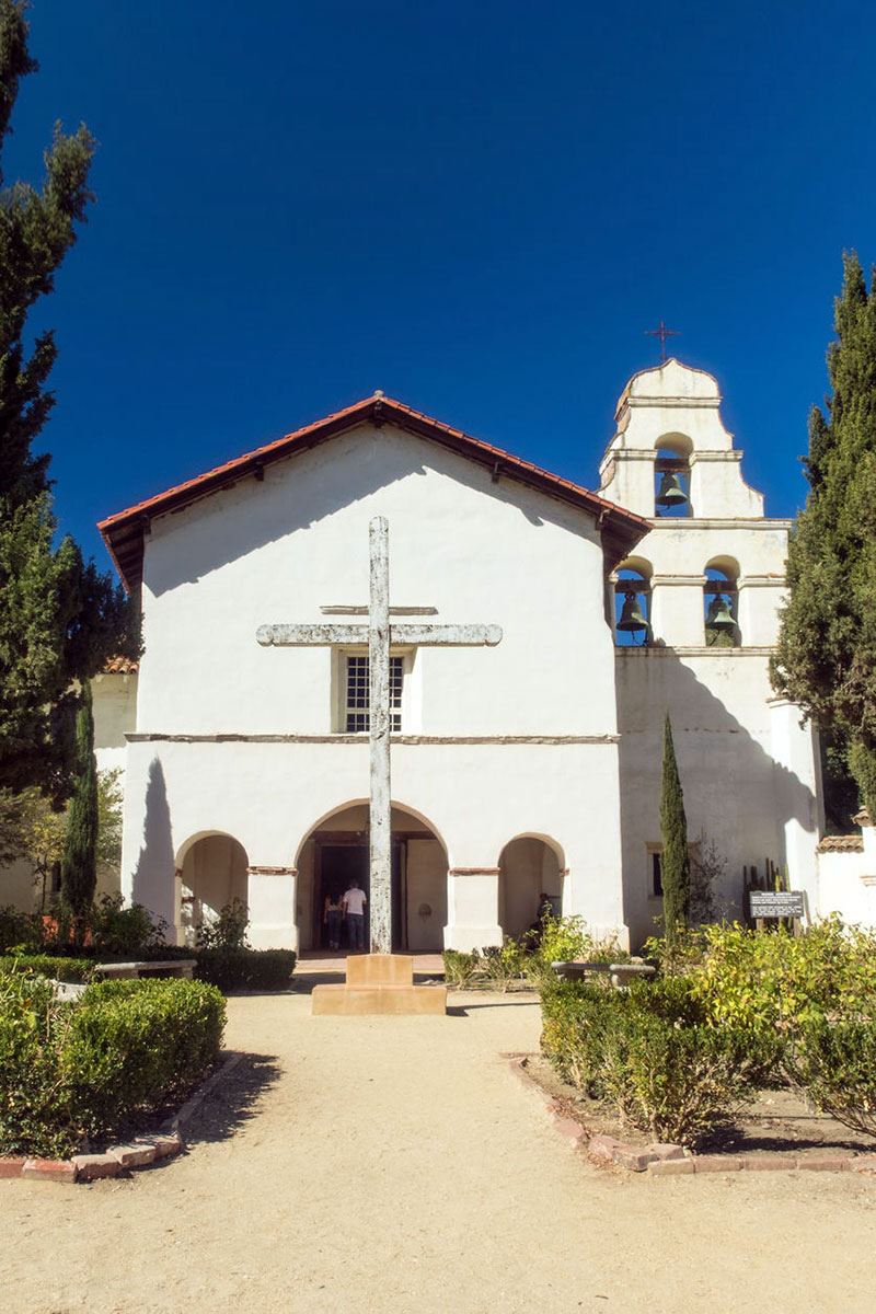
Mission San Juan Bautista
Founded in 1797, the Mission San Juan Bautista (406 2nd St., 831/623-4528, 9:30am-4:30pm daily) was the 15th in the chain, and one of California’s richest missions. It also has the dubious distinction of having one of the largest Native American populations, which at one point reached 1,200 people. Taken and held largely by force, this mix of Mutsun and Yokut people suffered under the yoke of hard labor and succumbed to many waves of disease. A mass graveyard beside the mission is where an estimated 4,000-5,000 souls are buried.
The mission holds mass at 8am Monday-Friday, 5pm Saturday, and 8:30am and 10am on Sunday. Visitors are welcome to stroll the grounds and explore many of the buildings. There is a small museum and gift shop, as well as daily tours (adults $4, seniors $3, children 5 and over $2, under 5 free).
San Juan Bautista State Historic Park
Adjoining the mission is the wonderful San Juan Bautista State Historic Park (2nd St. at Washington and Mariposa Sts., 831/623-4881, 10am-4:30pm daily). Centered around the large plaza, the park is home to many of the original 19th-century wood and adobe buildings that made up the once-largest town in Central California. Poke your head into a fashionable period parlor at the Plaza Hall-Zanetta House. Explore the grounds around the 1841 Castro-Breen Adobe. Learn more about San Juan Bautista’s history in the museum located in the adobe Plaza Hotel. The best exhibit is found at the Plaza Stables and Blacksmith Shop, a perfectly preserved blacksmith shop complete with a full set of tools. Stagecoaches, a fire wagon, and carriages are also on display.
Try to time your visit during one of the Living History Days (11am-4pm first Sat. of every month), when docents dress in period costumes, giving a taste what life was like in this Californio (Spanish-Californian) town. A more unusual look at the park can be had at Vertigo Day at the Park (tour $15, dinner $35, check website for dates). You’ll get a tour of the film’s shooting locations, dinner catered by a local Mexican restaurant, and an outdoor showing of Vertigo, Hitchcock’s classic 1957 film about a woman who could not escape her Californio past.

Fremont Peak State Park
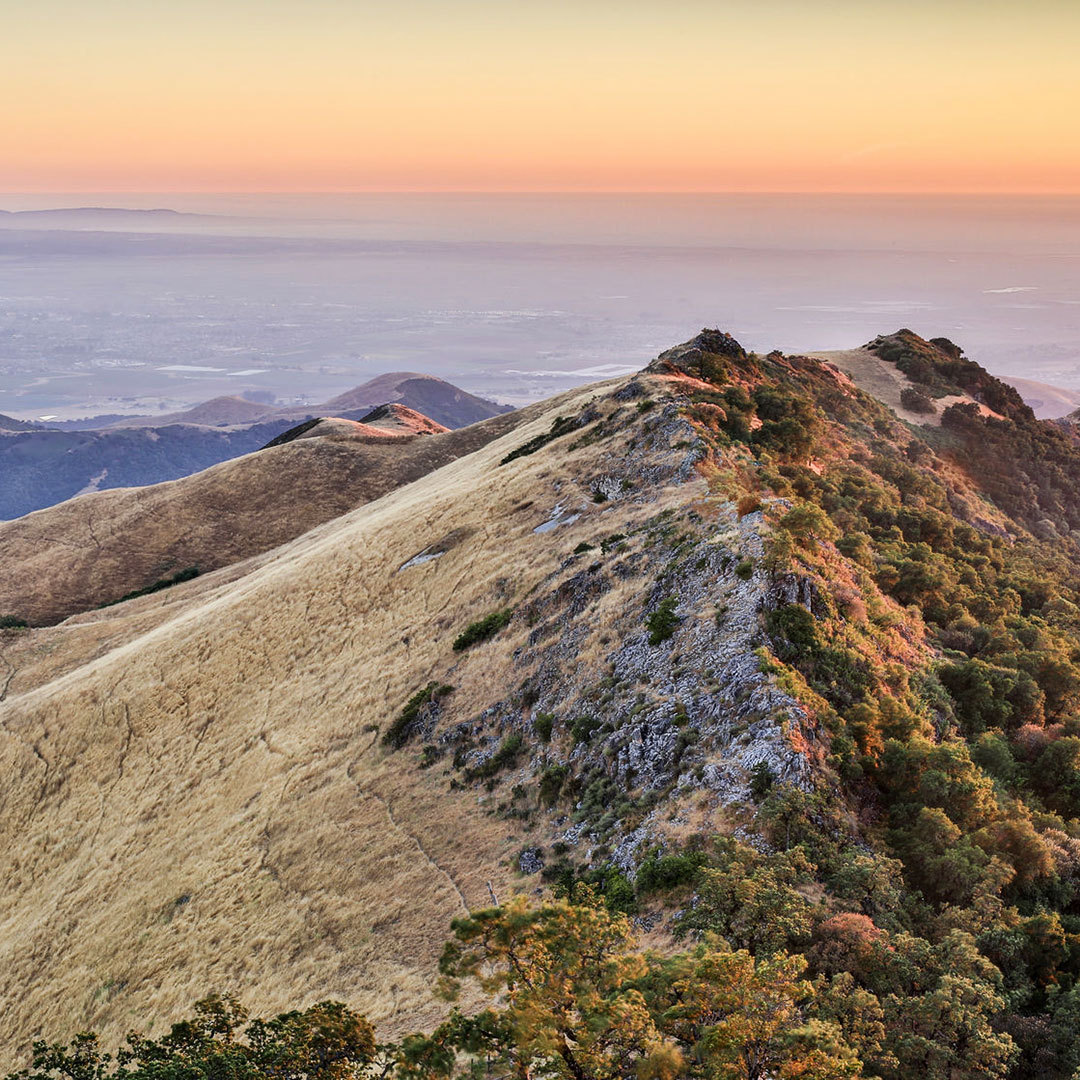
History was also made at the top of Fremont Peak State Park (end of San Juan Canyon Rd., 831/623-4526, 8am-sunset daily), as the U.S. Army captain John C. Fremont first hoisted the American flag over the bustling town of San Juan Bautista in 1846. Fremont picked the perfect place to escalate tensions between the United States and Mexico, as Fremont Peak, at 3,169 feet, is one of the tallest mountains around. From it, on a clear day, you can see Monterey Bay, Salinas Valley, the three nearby mountain ranges, and, if you’re lucky, the snow-capped Sierra Nevada. From the parking lot, the peak is accessible by the relatively easy one-mile Fremont Peak Trail.
The views at night are not bad, either. The height and isolation of Fremont Peak gives viewers a perfect view of the solar system without the light pollution of urban centers. To make the most of it, the Fremont Peak Observatory (831/623-2465, 8pm-midnight Sat. Apr.-Oct.) hosts viewings of the night sky through its 30-inch diameter telescope. The program starts with a 30-minute talk, followed by viewings, plus plenty of discussion. It’s a casual affair and reservations are not required. Visit their website for a schedule, which includes rare solar viewings.
Where to Eat in San Juan Bautista
The ideal lunch spot in San Juan Bautista is Jardines de San Juan (115 3rd St., 831/623-4466, 11:30am-9pm Sun.-Thurs., 11:30am-10pm Fri.-Sat., $7-16). The northern Mexican restaurant serves classic comfort dishes in a flower-filled courtyard and charming historic dining room. With an excellent beer, wine, and cocktail menu, which includes margaritas, mojitos, and sangria, it’s easy to spend the whole afternoon here, lounging in the San Juan Bautista sun.
Although San Juan Bautista is not known for its Basque community, the food and atmosphere at Basque Matxian Etxea Restaurant (206 4th St., 831/623-4472, 4pm-9pm Wed.-Thurs., noon-9pm Fri.-Sat., 1pm-9pm Sun., $14-22) fits right in. Traditional tapas and entrées like oxtail stew, bacalao, and paella fill the menu, while the ambience is homey and casual.
Getting to San Juan Bautista
San Juan Bautista is located off Highway 156, three miles east of the intersection with U.S. 101. From San Francisco, the 93-mile trip takes 1.5 hours. From Monterey, 33 miles away, it takes 40 minutes. Once you reach San Juan Bautista, turn left at the light onto the Alameda. It will take you directly to the historic downtown.

