Visiting Ecuador’s Cotopaxi National Park
Spanning the provinces of Cotopaxi, Napo, and Pichincha, Ecuador’s top mainland national park is second only to the Galápagos in the annual number of visitors, and it’s easy to see why. Just 50 km (31 mi) south of Quito, 32,255 ha (79,700 ac) of páramo enclose one of the most beautiful volcanoes in the Americas, with its picture-perfect cone and permanent mantle of snow. Llamas graze and wild horses gallop on grasslands strewn with wildflowers, including clouds of purple lupines. Higher up, the landscape is barren and lunar, a stark canvas from which to marvel at the colossus that is Volcán Cotopaxi, whose name means “Neck of the Moon.”

At 5,897 m (19,347 ft), this is Ecuador’s second-tallest peak after Chimborazo, and
one of the world’s highest active volcanoes. It’s often shrouded in cloud, but the weather is ever-shifting and, when Cotopaxi does choose to show her face, it’s an awe-inspiring sight. July to September tends to be the clearest time of year to visit but can be windy.
Between 1532 and 1880, Cotopaxi presented five major eruptive periods before rumbling into life once again in April 2015 by emitting a 10-km (6.2-mi) ash plume. An August 2015 eruption caused earth tremors in the nearby towns and covered the surrounding countryside with thousands of tons of ash. In October 2022, Cotopaxi began a new eruptive period, albeit much less significant than in 2015, emitting plumes of steam and ash until July 2023. The volcano is under constant monitoring and there is an alert system to prevent any risk to visitors. See www.igepn.edu.ec and the park’s website for up-to-date information.
There are several ways to explore Cotopaxi National Park (tel. 3/305-3596, free). Entrance is permitted 8am-3pm daily, although visitors can remain within the park until 5pm. ID is required to enter. If you have your own four-wheel-drive vehicle, you can drive around the signposted tracks that lead to the various attractions. From the main entrance (Control Sur), the road through the park curves in a semicircle north around Volcán Cotopaxi. As it heads northeast, 10 km (6.2 mi) from the entrance is a small visitor center (8am-3pm daily, free) with an exhibition on the geology, history, flora, and fauna of the park.

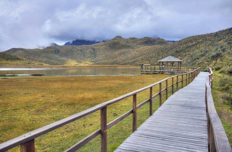
Just beyond the museum, a path leads to Laguna Limpiopungo, a shallow lake at 3,800 m (12,470 ft) elevation whose reeds provide a habitat for several species of birds. The volcano is sometimes spectacularly reflected in the lake’s surface. From the lake there is a signposted 6-km (3.7-mi), 90-minute hike past a natural spring and a viewing point to the Control Norte, as well as two circular cycle routes, one to a natural spring (3 hours), the other to the Santo Domingo Lake (4-5 hours). A trail leads around the lake to the northwest for access to Rumiñahui.
Shortly beyond that trail, another track heads 9 km (5.6 mi) south to the parking lot for the José Ribas Refuge (tel. 3/223-3129 or 98/790-8704) at 4,800 m (15,750 ft), which is open to climbers and non-climbers alike. Although the walk from the parking lot to the refuge is only 1 km (0.6 mi), it takes most people 45 minutes to an hour, due to the altitude and level of difficulty. It’s a steep walk on rocky paths surrounded by snow. If conditions are good, it’s possible to walk beyond the refuge for another hour to the glaciers at 5,000 m (16,400 ft). If you’re planning on doing the walk, bring water, snacks, sunglasses, warm clothes, and sunblock. Built in 1971, the refuge is warm and welcoming, with hot drinks and food available.
On the eastern edge of the park, 15 km (9.3 mi) beyond the lake, are the oval ruins of El Salitre, formerly an Inca pucará (fortress), abandoned soon after the arrival of the Spanish.
Tours and Guides
Those without their own transport can take a tour with the local guides who wait with trucks by the two main access points to the park. The standard three-hour tour ($50 for 1 person, may be negotiable to $40; $25 pp for 2 people; and $20 pp for 3 people) includes three stops: the museum; the refuge parking lot (your guide might accompany you while you walk to the refuge or glacier and back, or may wait with the car); and the Limpiopungo Lake. Just driving around the park is an experience, and the guides are happy to stop for you to take photos.
For a tour that includes transport to and from the park, or additional activities such as downhill mountain biking or horseback riding, go with an organized tour. From Machachi, the best option is Casa Sakiwa (tel. 99/266-8619).
In Latacunga Greivag Turismo (tel. 98/731-1822) offers the standard tour with transport and lunch ($100 for 1 person, $60 pp for 2 people, $55 pp for three people).
Climbing Volcán Cotopaxi
Cotopaxi is Ecuador’s most popular high-altitude climb because of its relative simplicity. Crevasses are usually large and obvious, making it mostly an uphill slog. However, less than half of those who attempt the summit actually reach it. You need to be in good physical condition, be fully acclimatized, be accompanied by an accredited guide, and have a certain amount of luck with the conditions. Technical equipment is necessary: ice axes, crampons, ropes, marker wands, and crevasse rescue gear.
Due to an eruptive period that started in October 2022 and ended in July 2023, the national park temporarily closed access to climbers, but it was reopened in February 2024.
As with any peak over 5,000 m (16,400 ft), acclimatization is essential. If you’ve been staying in Quito at 2,850 m (9,350 ft), this is unlikely to be sufficient preparation. Ideally you should trek and sleep at around 4,000 m (13,000 ft) for a couple of days, or, even better, do a practice climb of a smaller peak such as Iliniza Norte or Rumiñahui before attempting Cotopaxi. All mountaineering tour agencies offer acclimatization climbs.
Although Cotopaxi can be climbed year-round, the best months are usually December and January. The February-April period is often clear and dry as well. August and September are also good but windy.

Most climbers make their bid for the summit from the José Ribas Refuge (tel. 3/223-3129 or 98/790-8704, $33.60 pp, including breakfast and dinner). The refuge has bunk beds, toilets, running water, a fireplace, a café, and lockers for your gear while you climb. A night’s stay is usually included in the price of a tour booked with an agency. Camping outside the refuge is not permitted, and neither is use of the kitchen. Lunch is available for $7.
Catch a few hours of sleep before starting to climb around midnight or 1am. It takes 6-10 hours to reach the summit from the refuge, and the route contains smoking fumaroles reeking of sulfur. The views over the neighboring volcanoes are spectacular. The summit is actually the northern rim of the crater, which is rounded and measures approximately 480 m (1,575 ft) wide. The descent takes 3-6 hours.
The park has issued the following requirements for those wishing to summit Cotopaxi. A reservation is required at one of the three accommodation options within the park: the José Ribas Refuge, the Hostería Tambopaxi Lodge, or La Rinconada Camping Area. Climbers must be accompanied by an accredited, specialized guide and be registered in the Biodiversity Information System (SIB). Any reputable tour operator will make these arrangements, so make sure that yours has. Members of mountaineering clubs and qualified individuals must apply for permission to enter the protected area at least 15 days in advance by emailing gregorio.nunez@ambiente.gob.ec. Entry to the park for climbers is permitted 8am-5pm daily.
Ecuador Eco Adventure (tel. 99/831- 1282) in Riobamba offers a four-day Cotopaxi climb including acclimatization hikes ($495 for 1 person, $375 pp for 2 people), as well as a combined Cotopaxi and Chimborazo climbing tour (8 days, $1,750 for 1 person, $1,350 pp for 2 people). Prices include a night at the Chimborazo Base Camp near Riobamba the night before departure, all equipment, permits, accommodations, and most meals. In El Chaupi, Cotopaxi Travel (tel. 98/133-3483,) offers the climb for $325 per person for a group of two. Certified guides can also be found on the Members page of the Ecuadorian Association of Mountain Guides, which includes guides that speak English, German, French, and Italian.
Climbing Volcán Rumiñahui

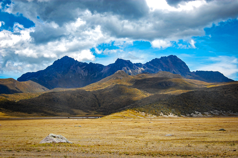
This peak, 13 km (8 mi) northwest of Cotopaxi, was named after Atahualpa’s bravest general, who famously hid the huge Inca ransom after Atahualpa’s death and refused to give up its whereabouts when tortured by the Spanish. Rumiñahui (4,712 m/15,459 ft), officially dormant but most probably extinct, has three peaks. It’s a relatively straightforward climb, combining an uphill hike with a bit of scrambling, but a rope and climbing protection are recommended for the more exposed stretches. While it is not compulsory to climb with an accredited guide, it is highly recommended. Contact the same agencies as for the Cotopaxi climb. In El Chaupi, Cotopaxi Travel (tel. 98/133-3483) offers the climb for $75 per person for a group of two.
The east side of Rumiñahui is reached through Cotopaxi National Park along tracks that skirt Laguna Limpiopungo to the north or south. A path toward the central peak is clearly visible along a well-defined ridge. From the lake to the base is about a two-hour hike, and it’s possible to camp along the way. The south peak involves some moderately technical rock climbing (class 5.5). The IGM Machachi and Sincholagua 1:50,000 maps cover this area.
Food and Accommodations
Between the visitor center and Laguna Limpiopungo, La Rinconada Chagra Huasi (tel. 99/895-0059) offers camping spaces for those with their own tents ($3 pp), camping spaces with tents for rent ($23 pp), and a dormitory in a log cabin ($25 pp). Firewood is on sale for $5. Meals are available at the cafeteria.
Located 6 km (3.7 mi) from the main park entrance, Cuello de Luna (El Chasqui, Panamericana Sur km 44, tel. 3/330-53898 or 99/970-0330, WhatsApp +41 77/457-1144, $54-80 s, $75-95 d, including breakfast) has rooms with private bathrooms, electric blankets, and fireplaces or wood burning stoves. Half- and full-board packages are available for those staying two nights or more. The hotel can arrange transport, tours, and horseback riding. Mountain bikes are available to rent.
The only hotel within the national park, with great views of Cotopaxi, is Tambopaxi (tel. 2/600-0365 or 96/224-4500, $18 pp camping, $38 dorm, $107-122 s, $137-150 d, including breakfast). Rooms have wood-burning stoves, and there is a good restaurant using organic ingredients with vegetarian options ($19 lunch or dinner). Horseback riding and hiking tours are available. The hotel is certified by Smart Voyager, a UNESCO-recognized program for environmental sustainability.
Four kilometers (2.5 mi) from the northern entrance of the park is Hacienda El Porvenir (tel. 2/600-9533 or 99/498-0115, $60-218 s/d, including breakfast). Accommodation ranges from thatched huts with shared bathrooms to suites. Activities include tours on foot, mountain bike, and horseback, as well as cooking and lasso classes. The spa has a sauna, Jacuzzi, and massage service. The hacienda was a finalist for Ecuador’s Leading Green Hotel in the 2017 World Travel Awards.
Off the beaten path is Secret Garden Cotopaxi, (tel. 99/198-0027, $42.50 camping, $55 dorm, $94-120 s, $125-160 d), sister hotel of the backpacker favorite in Quito. This eco-lodge is set in the foothills of Pasochoa, near the village of Pedregal, overlooking the national park. Rooms range from mixed dorms to hobbit houses and private cabins, many with spectacular views of Cotopaxi in the mornings. Rates include three meals, snacks, drinks, a tour to a waterfall, and use of the Jacuzzi. Daily shuttles ($5) are available from Quito (2 hours) and Machachi (1 hour), as are treks and trips to the nearby peaks.
Getting There and Around
There are two ways to enter the park. The South Entrance or Control Sur is the main gate, located 25 minutes south of Machachi along the Panamericana. The North Entrance or Control Norte, accessed via the village of El Pedregal to the north of the park, is lesser used, but the route is more scenic. Those planning on arranging a tour with a local guide upon arrival at the park are advised to use the main entrance, especially if hoping to meet fellow travelers to share the cost.
To get to the South Entrance from Quito, take a bus from the Quitumbe terminal heading to Latacunga (or any destination south of the park along the Panamericana) and ask the driver to let you off at the park, after about a 90-minute drive. From any destination south of the park, ask locally for the location of the nearest bus stop along the Panamericana, take a bus heading to Quito, and ask the driver to let you off.
To get to the South Entrance from Machachi, head to the bus stop on the Panamericana at El Timbo, where Av. Amazonas meets the highway, 1.2 km (0.7 mi) from the town center ($1.50 by taxi). Take any bus heading south and ask to be let out at the park ($0.50).
Local guides with camionetas wait at the Panamericana offering tours of the park and transport to the South Entrance, which is another 10 minutes’ drive.
To get to the North Entrance, first take a bus to Machachi. In Machachi, take a bus to El Pedregal with Transportes Machachenas. Buses leave from outside the Escuela Luis Felipe Borja on the Central Park at 5am, 6am, 7am, 10am, 1pm, and 7pm (45 minutes, $0.80). Coming back from El Pedregal, buses to Machachi leave at 6am, 8am, 11am, 3:30pm, and 8pm. Alternatively, take a camioneta from Machachi to El Pedregal ($15) or onward into the park. Guides wait in El Pedregal to offer tours of the park and transport to the entrance, which is another 25 minutes’ drive.
Newsletter Signup
By clicking ‘Sign Up,’ I acknowledge that I have read and agree to Hachette Book Group’s Privacy Policy and Terms of Use
Pin It for Later


